
Artist's impression of Chicxulub imact.. NASA
The table of contents may be found here.
Artist's impression of Chicxulub imact.. NASA
The age of the dinosaurs ended in global catastrophe. Traces of
this event are found in New Mexico, though not in the Jemez, where
the relevant beds were eroded away during the Laramide Orogeny.
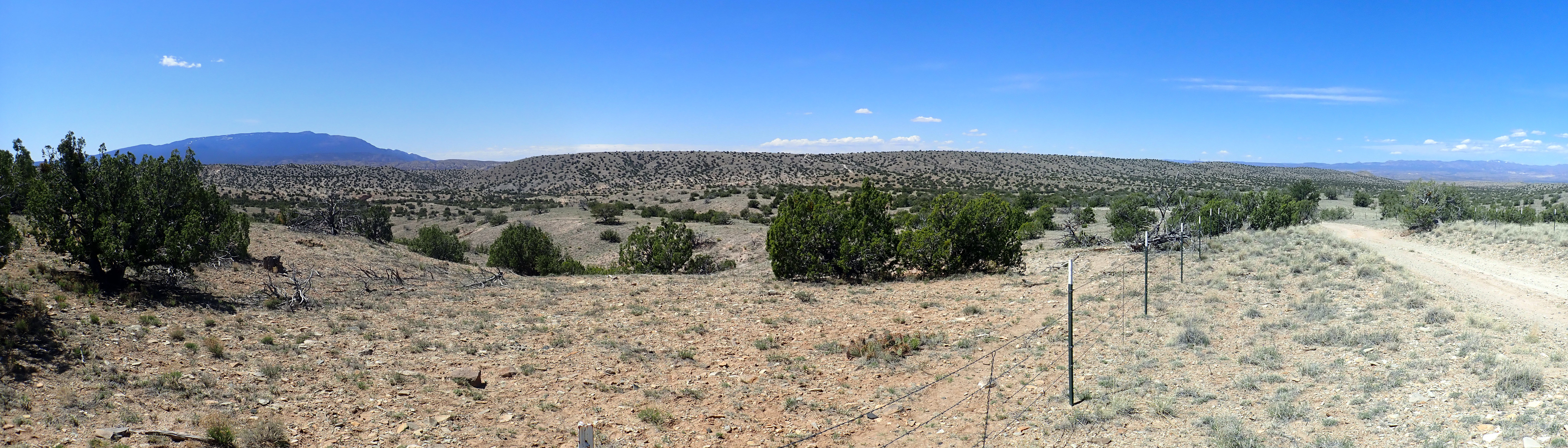
In this chapter, we will look at the Jemez area during the early Tertiary Period.
The Mesozoic Era ends, and the Cenozoic Era begins, with a mass
extinction, albeit one less catastrophic than the Great Dying at
the end of the Permian. However, what it lacked in destructiveness
was made up in drama and knowledge: We know a lot more about this
much more recent extinction. Unfortunately, no record of this is
preserved in the immediate Jemez area.
You have almost certainly heard that the age of the dinosaurs
ended with a catastrophic asteroid impact near what is now the
northern shore of the Yucatan Peninsula. This Chicxulub event has
been popularized to the point where there is even a Pixar
children's movie depicting it. The global consequences of this
impact included the destruction of most of the dinosaurs and many
other families of life. Only those dinosaur families whose
descendants became modern birds survived the impact. Enough
reptiles and mammals survived that they, too, became part of the
fauna of the Tertiary. In fact, conditions became suitable for
mammals to become the dominant form of land animal, leading
ultimately to the ascent of Man.
The Cretaceous-Tertiary boundary is marked in many places in the world by a thin layer of clay that is enriched with traces of the noble metal, iridium. Iridium is extremely scarce in the universe, but even more so in the Earth's crust, since most of the small amount with which the Earth formed settled into the Earth's core along with iron and other heavy elements. Iridium is much more abundant (if still very scarce) in meteorites, which have over 500 times the iridium abundance of average crust rock. This was the first clue that an asteroid impact was the main trigger for the mass extinction. Eventually the deeply buried traces of the impact crater were discovered, mostly by petroleum geologists, and there is now a broad consensus that the asteroid impact was the major cause of the extinction. (There is still a vigorous debate about what other factors may have contributed.)
Although the Cretaceous-Tertiary boundary is not found in the
Jemez, it is well exposed near Raton,
at the K-T Boundary Trail.
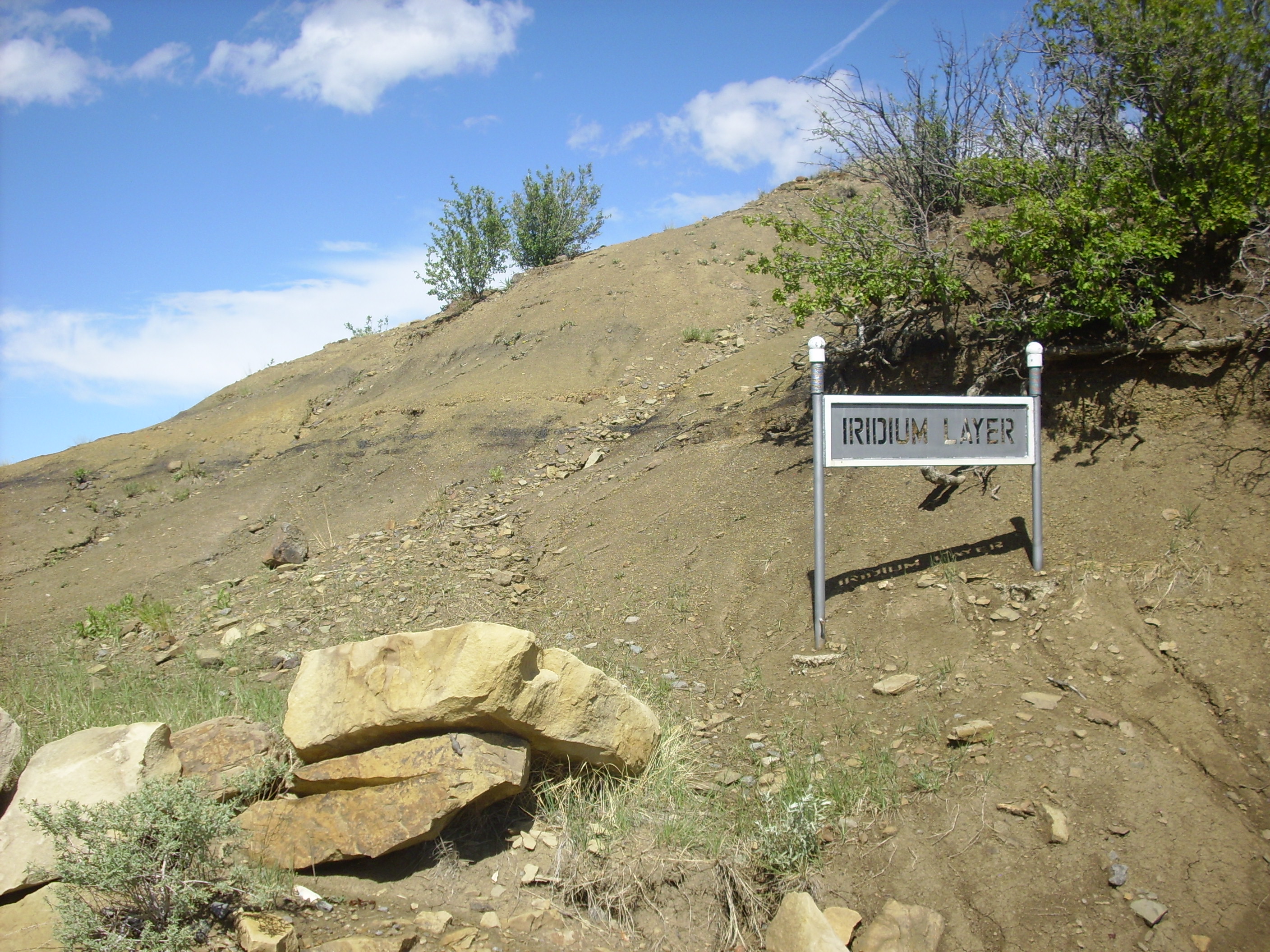
K-T Boundary Trail. 36
54.198N 104 27.077W
The hill is underlain by the Raton Formation, which is mostly shale with interbedded coal.
Here's a close up of the boundary layer.
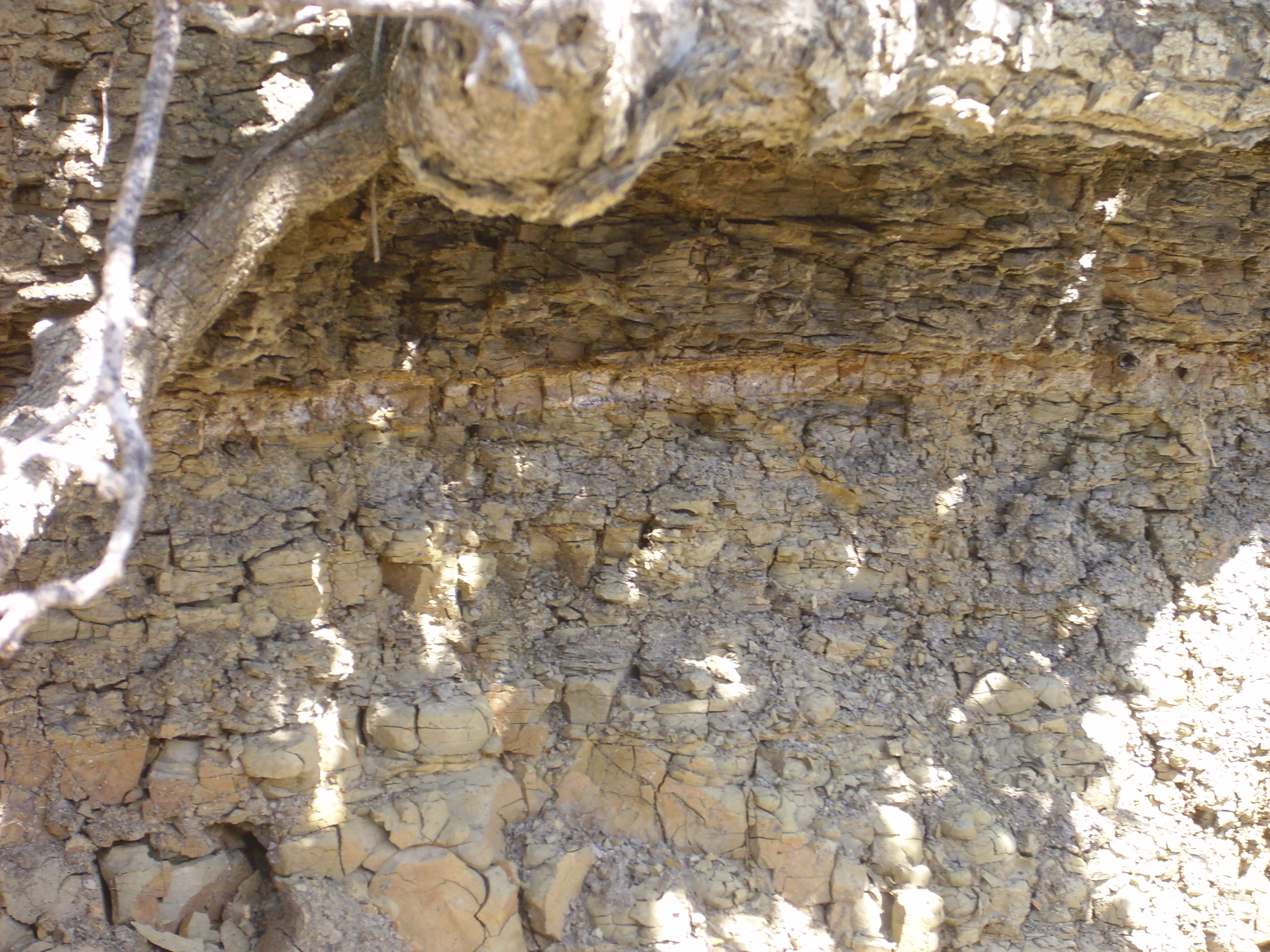
K-T Boundary Trail. 36
54.198N 104 27.077W
The boundary is the thin light layer separating lighter shale
beneath from darker shale above.
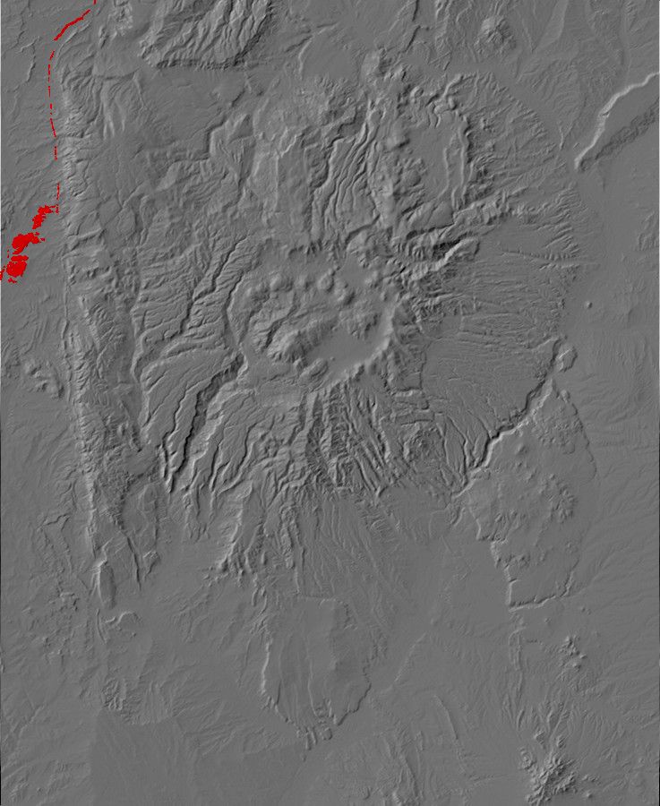
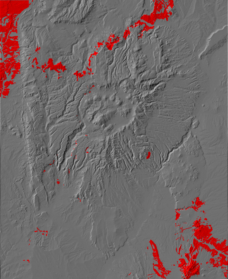
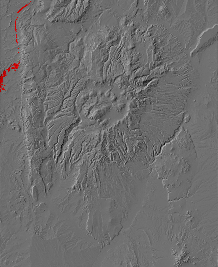
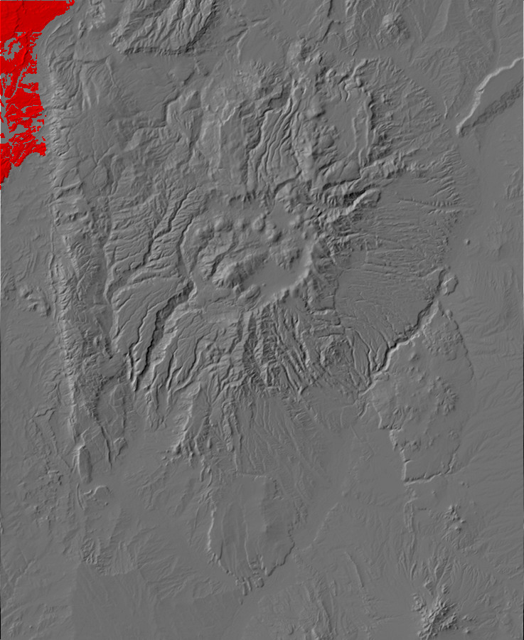
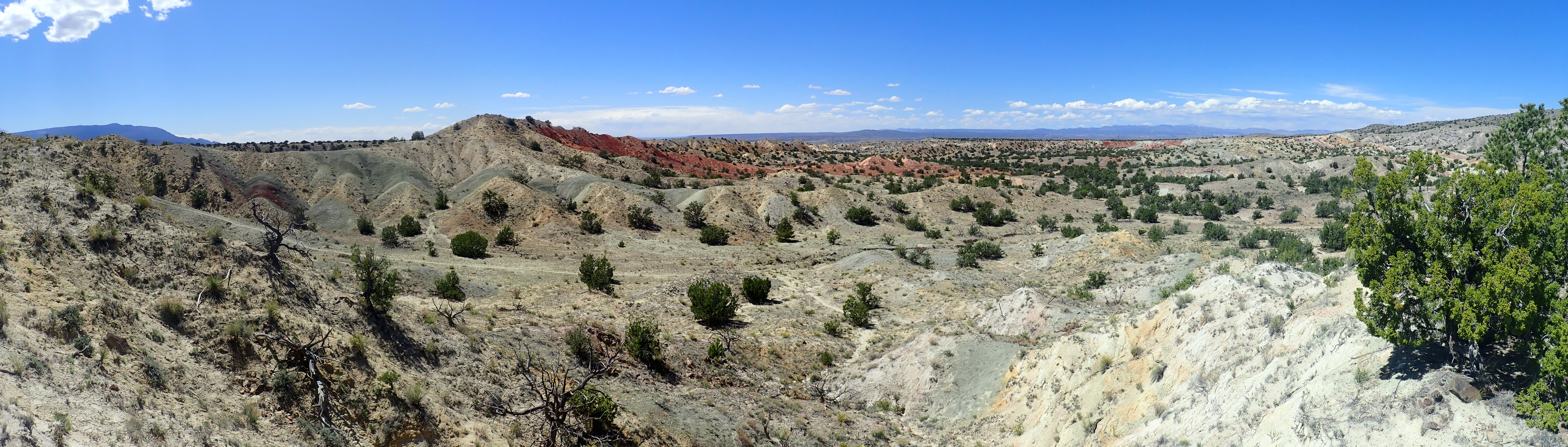
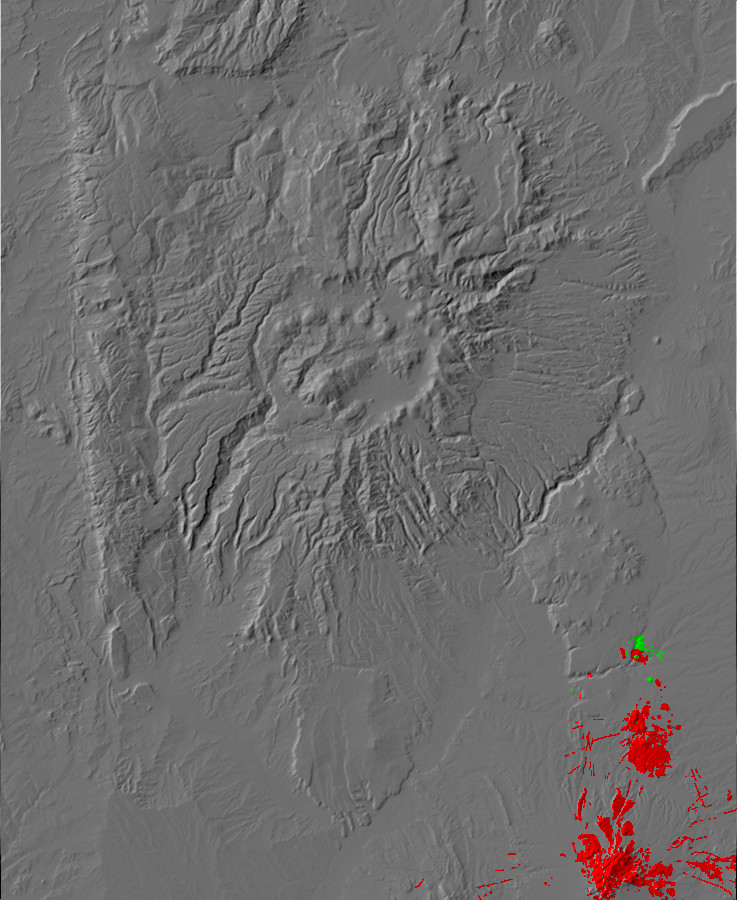
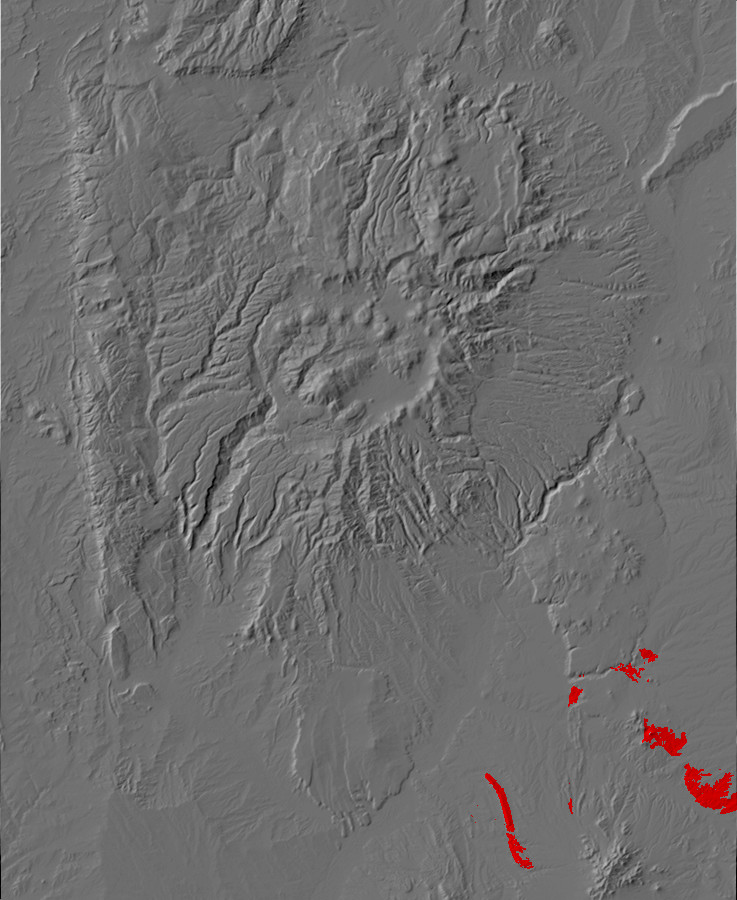
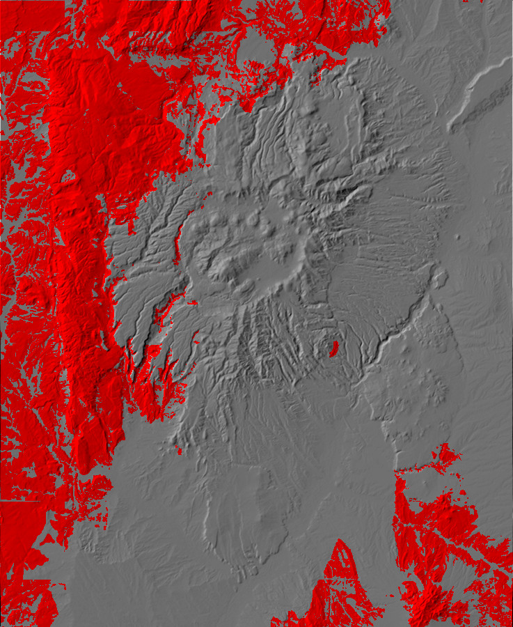
Relief map of the Jemez with Ojo Alamo Formation
outcroppings highlighted in red.
By the end of the Cretaceous, the Laramide Orogeny was in full
swing. Buckling and faulting of the crust had first become severe
in Wyoming and Montana but began to spread south. By the beginning
of the Tertiary, a large area was beginning to be thrown up in
southern Colorado and northern New Mexico very close to the
location of the ancient Uncompaghre Uplift. This is known as the
Brazos-Sangre de Cristo Geanticline. A geanticline is a
large-scale upwarp in the Earth's crust, and this uplift included
the entire area from the present-day Tusas Mountains to the
present-day Sangre de Cristo Mountains. This uplift began shedding
sediments into the surrounding basins.
West of the Sierra Nacimiento, there are exposures of the Ojo
Alamo Formation, whose exact age has been much debated. The
current consensus seems to be that it straddles the
Cretaceous-Tertiary boundary, with dinosaur fossils in its lowest
beds and early Eocene fossils further up. There are several small
discontinuities in the formation, and, unfortunately, the exact
Cretaceous-Tertiary boundary is missing in one of these
discontinuities.
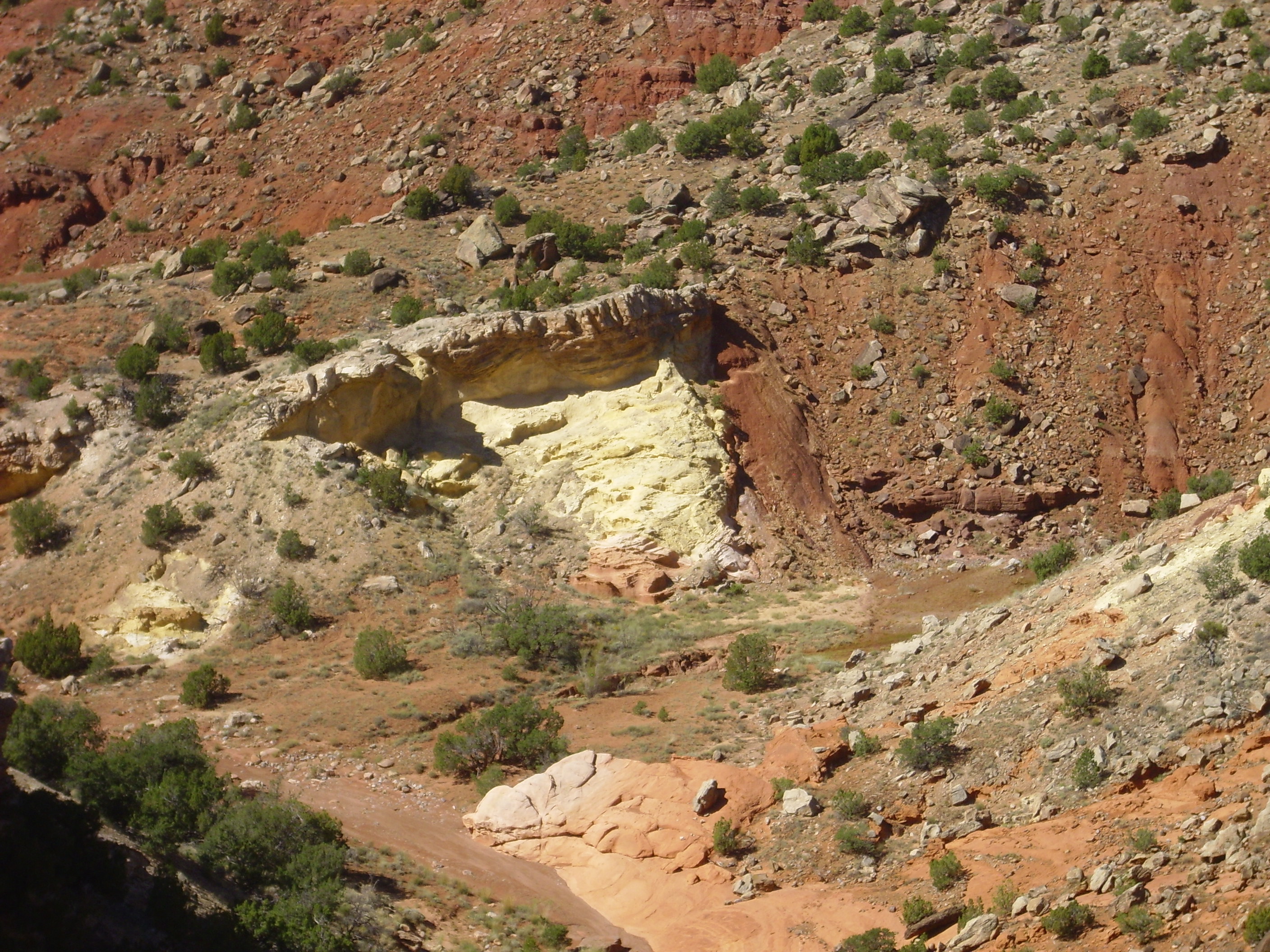
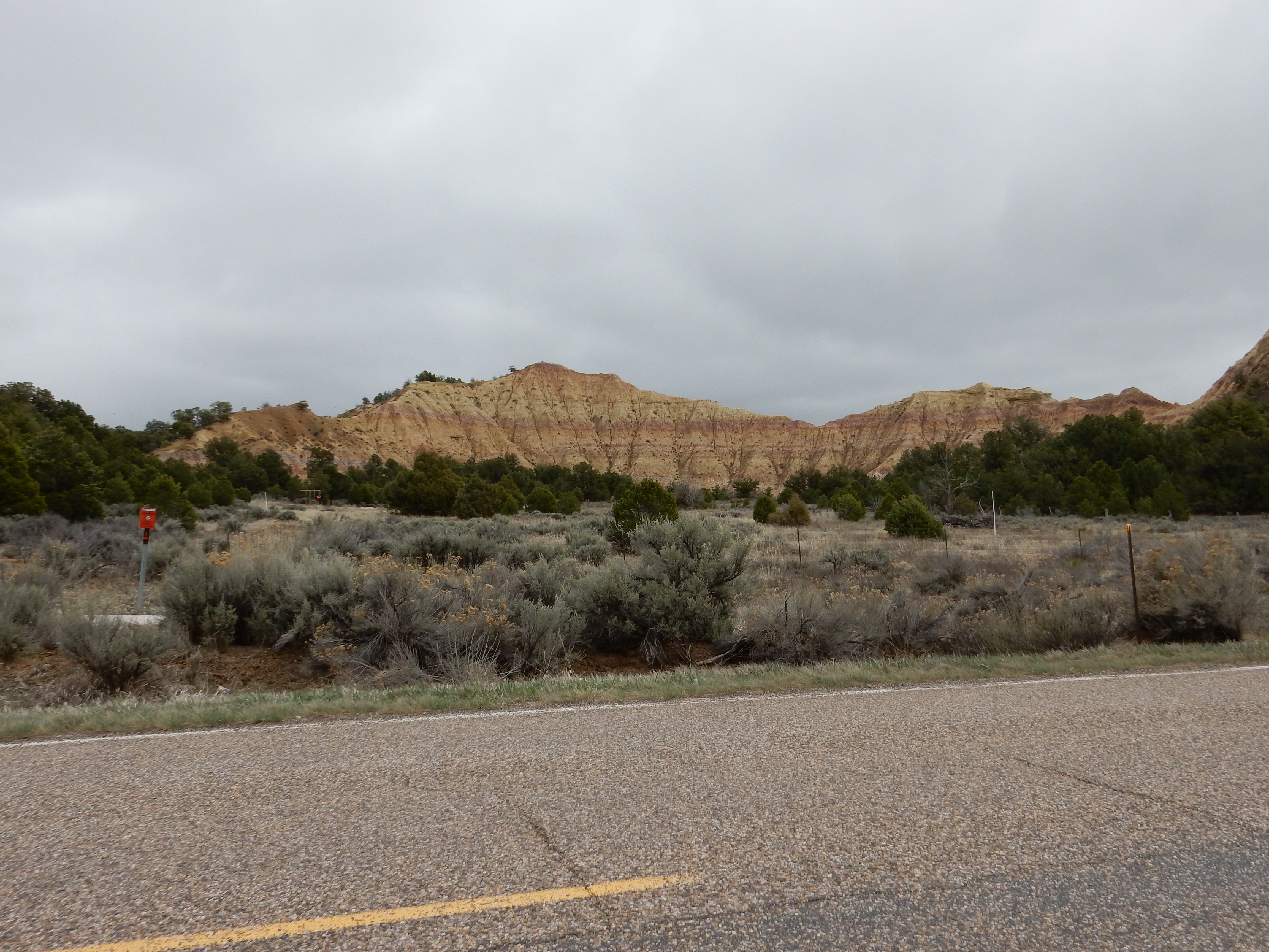
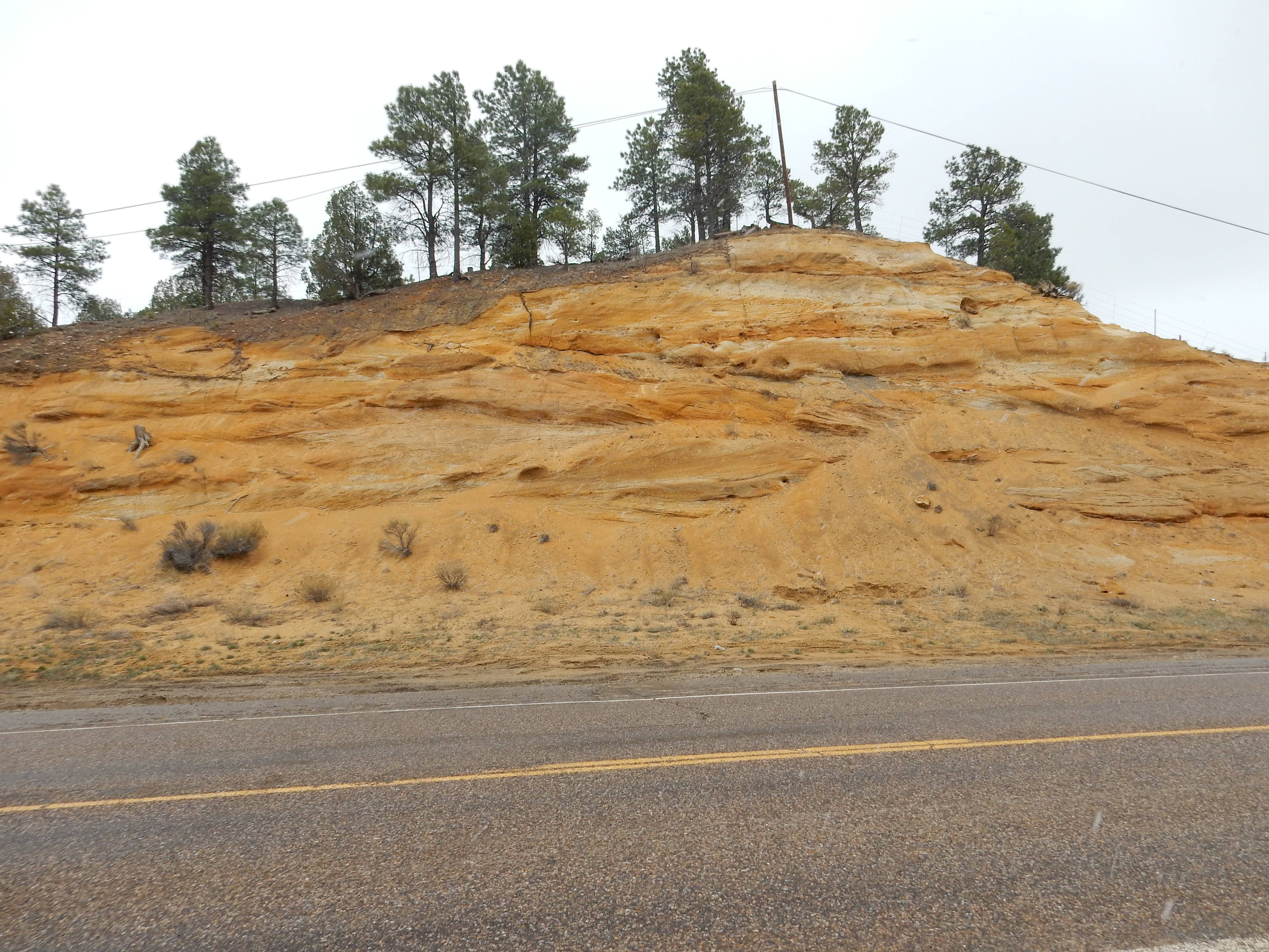
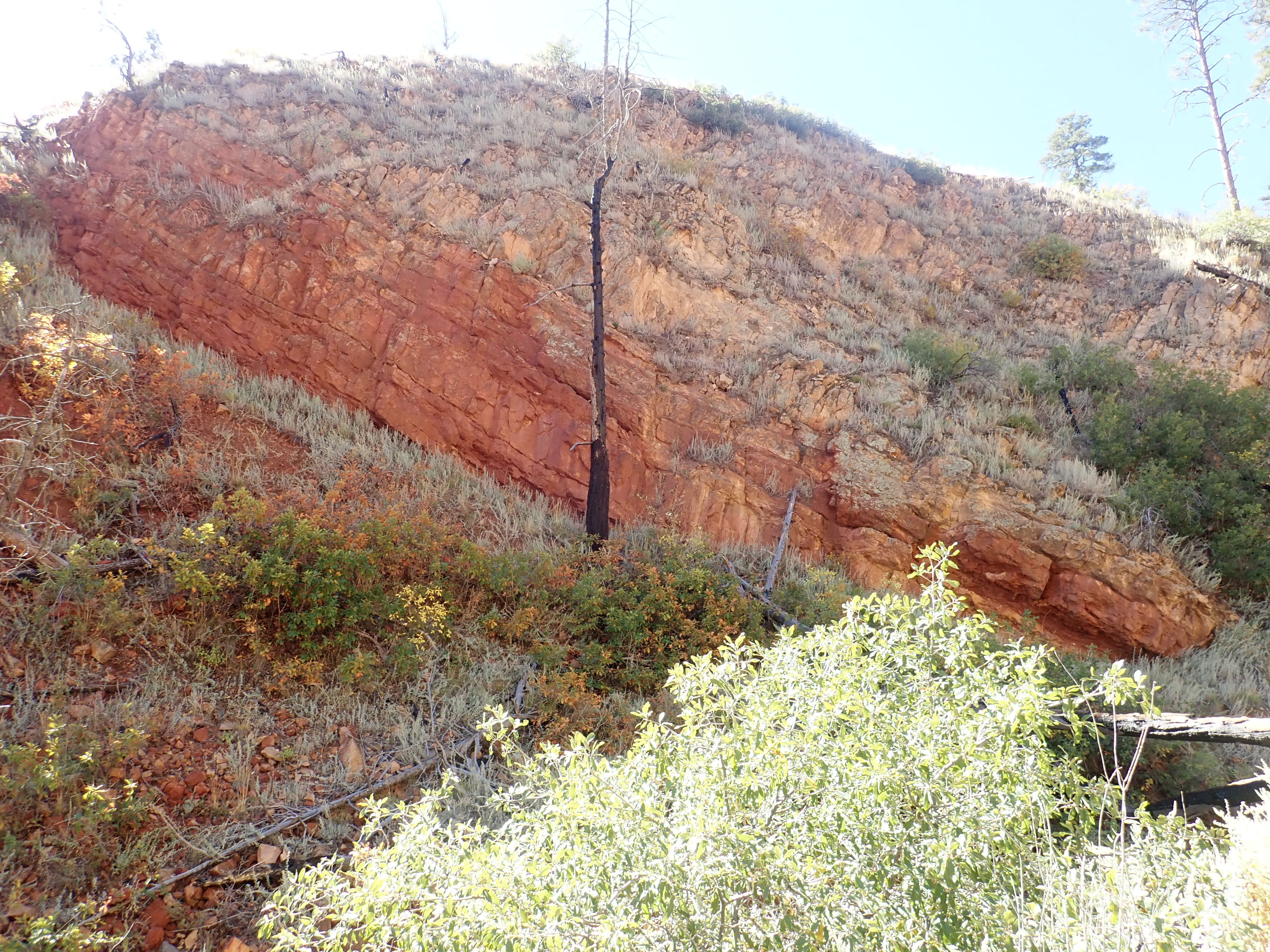
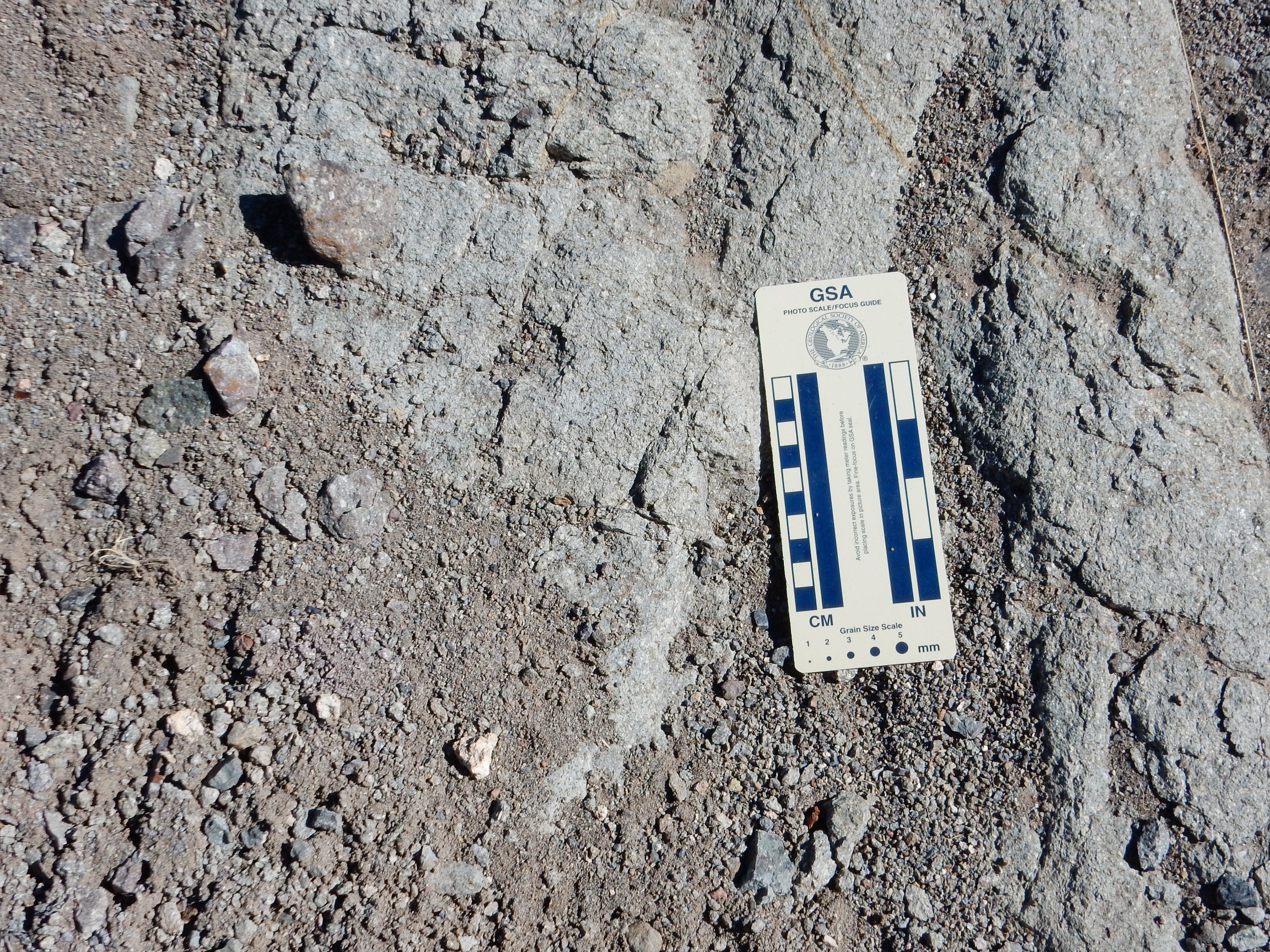
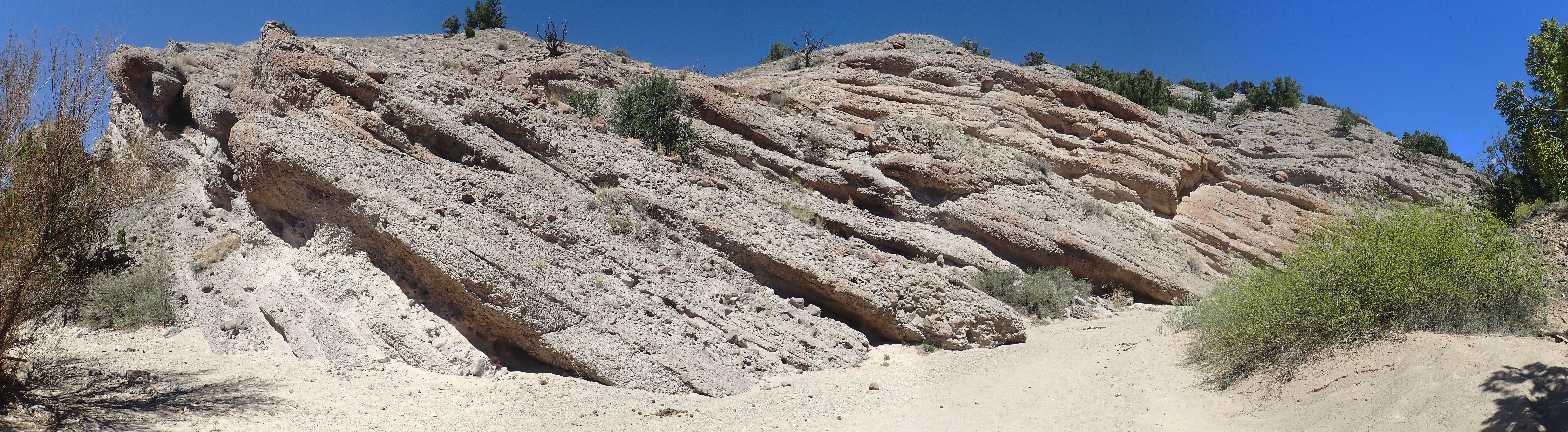
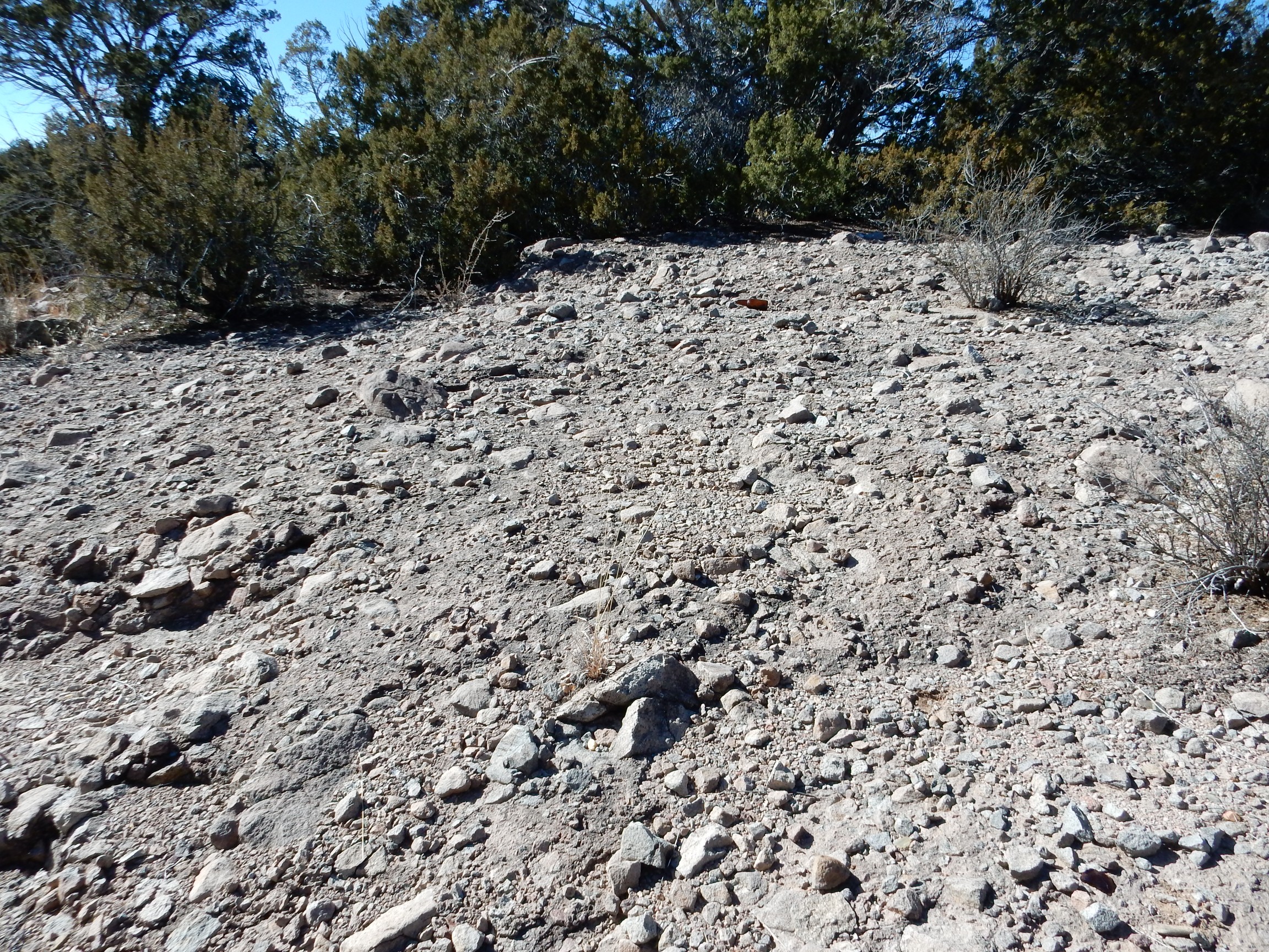
Ojo Alamo Formation south of Cuba. 35
57.865N 106 59.446W
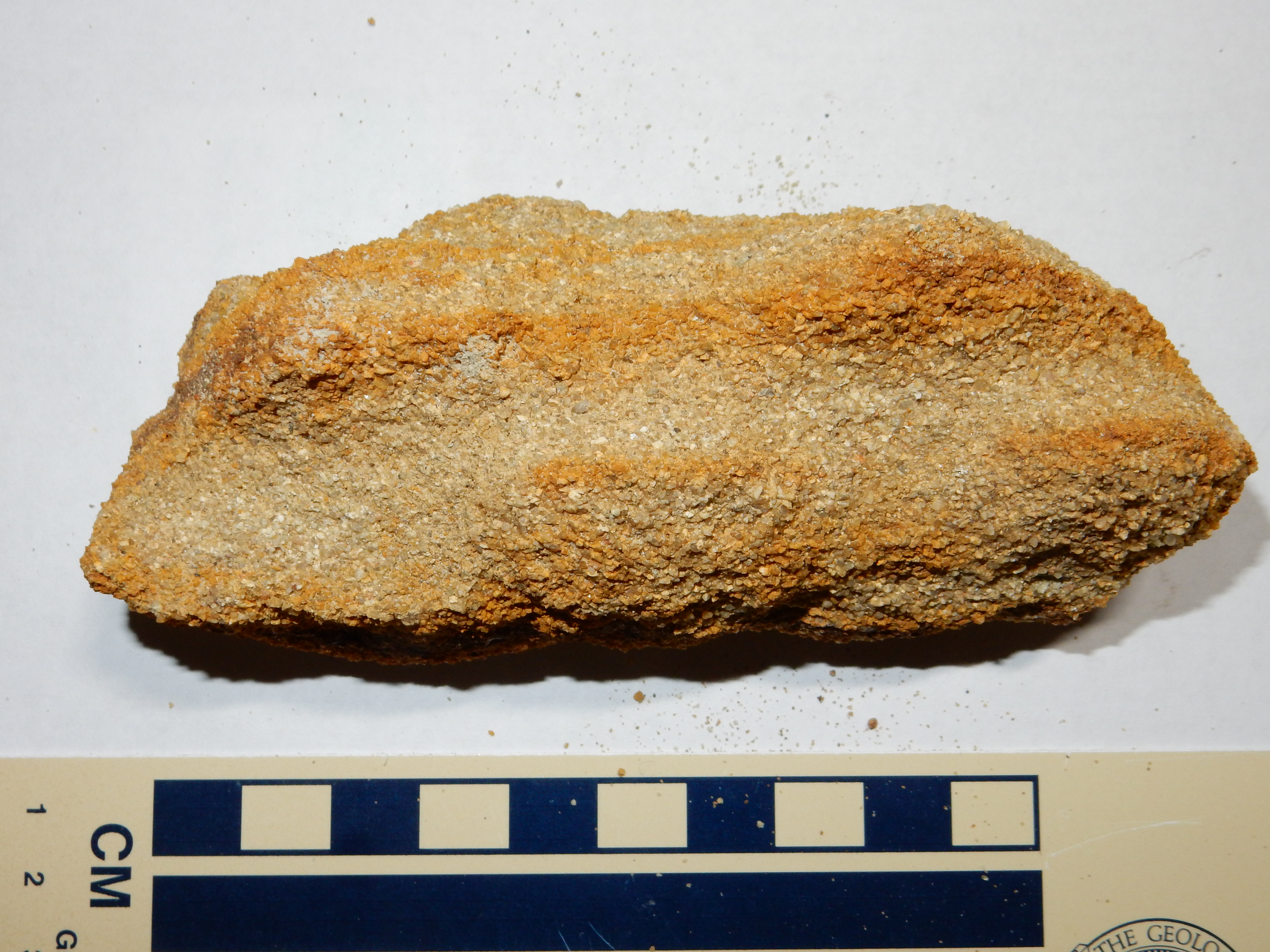
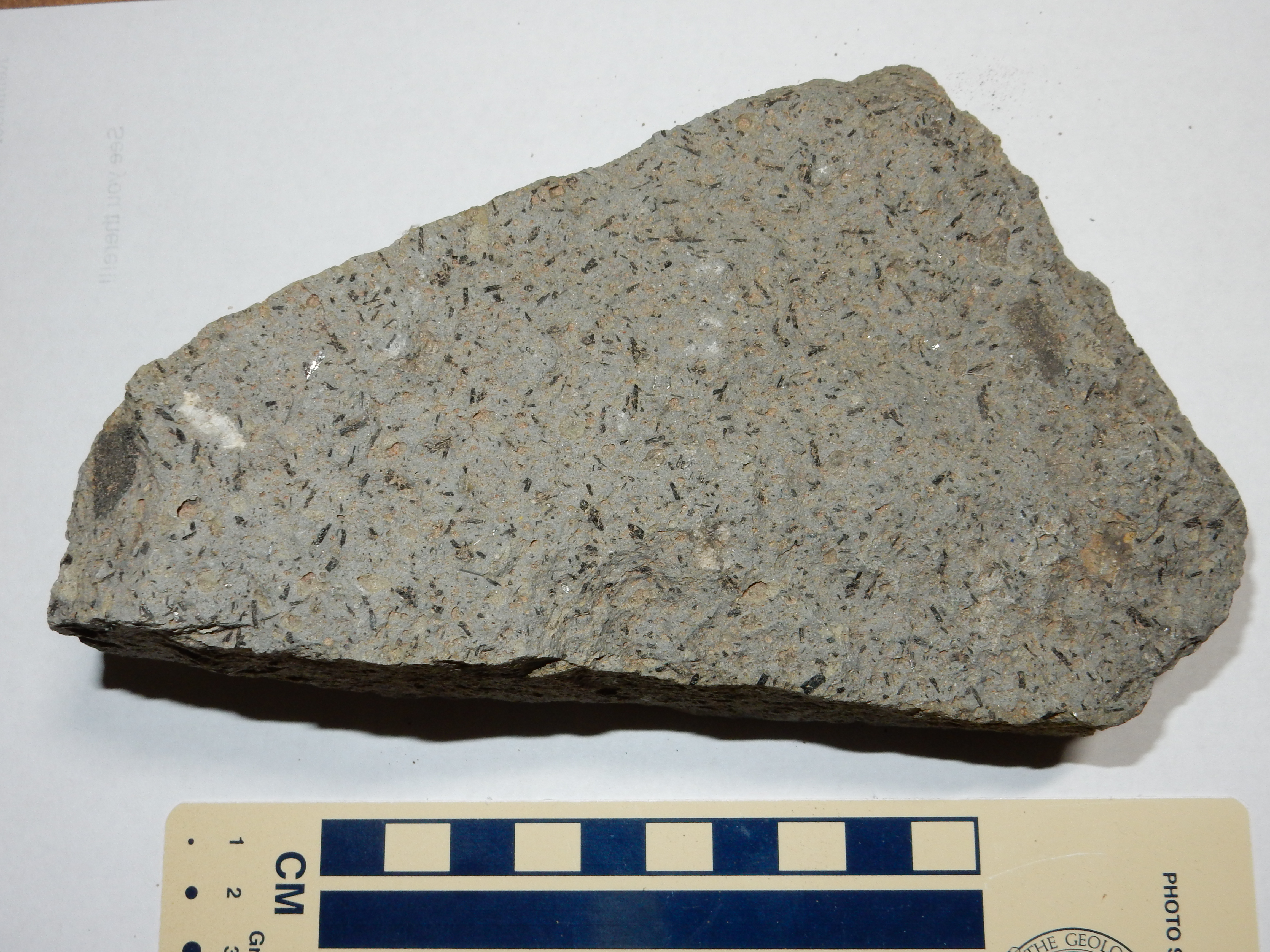
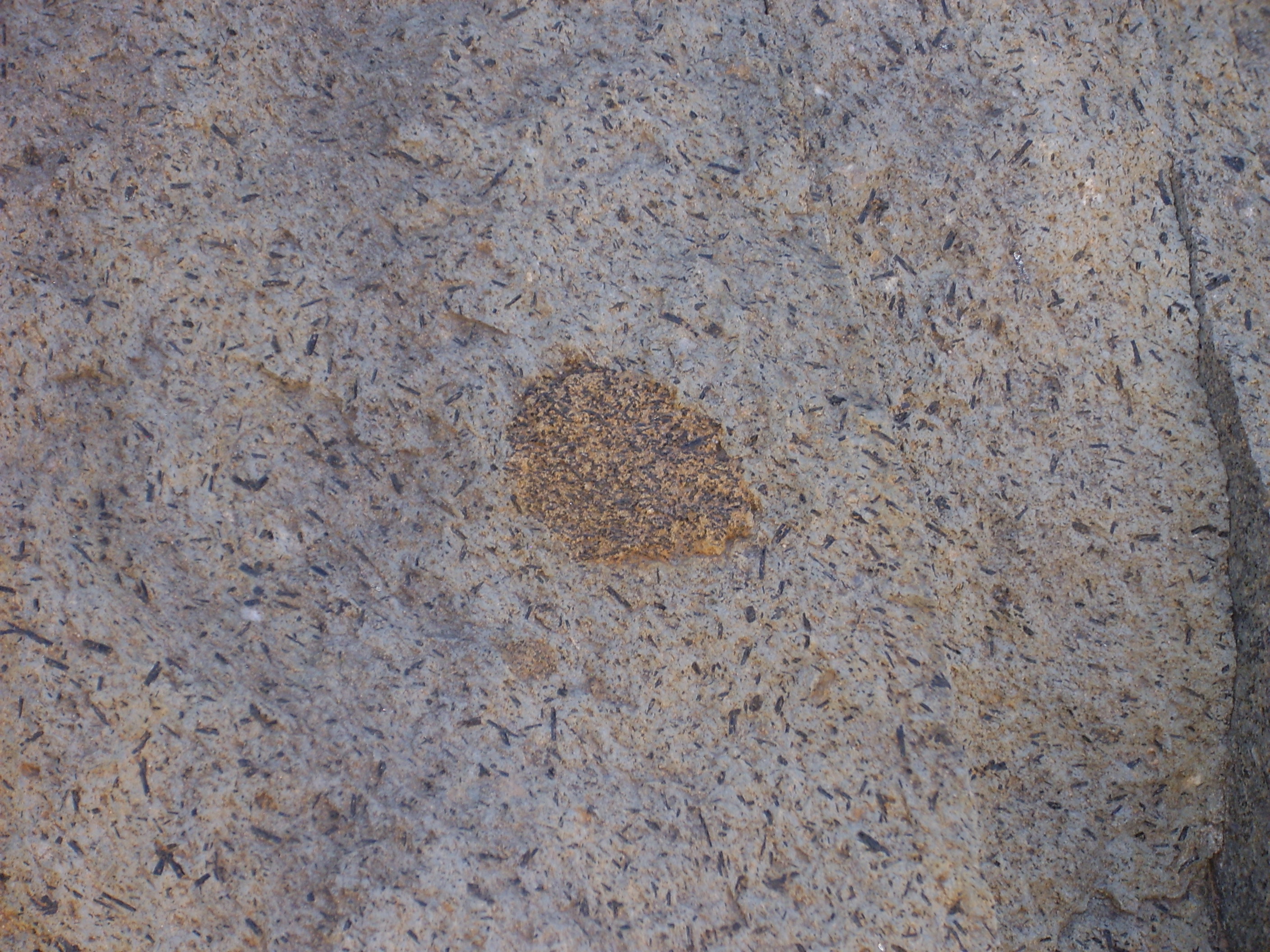
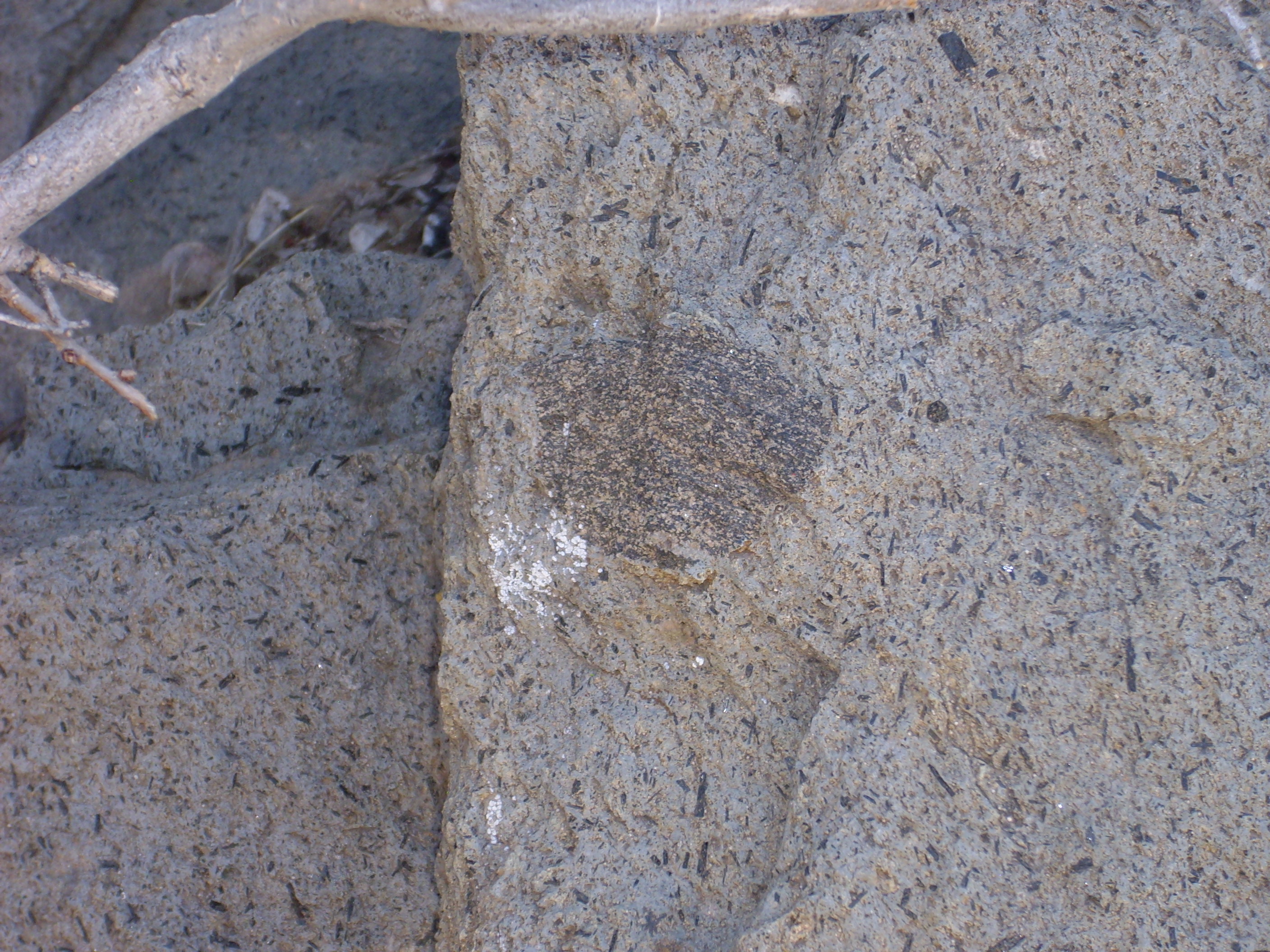
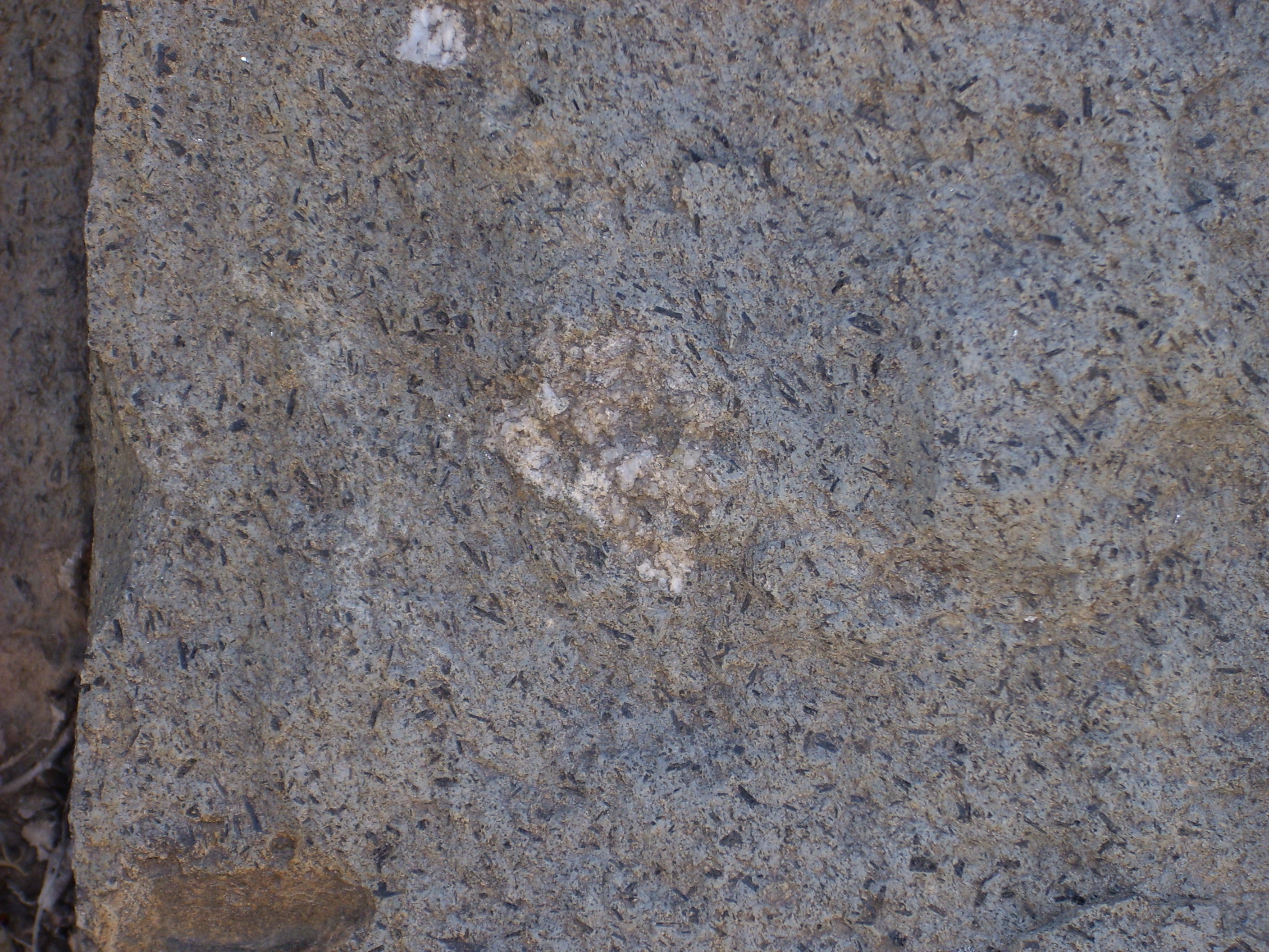
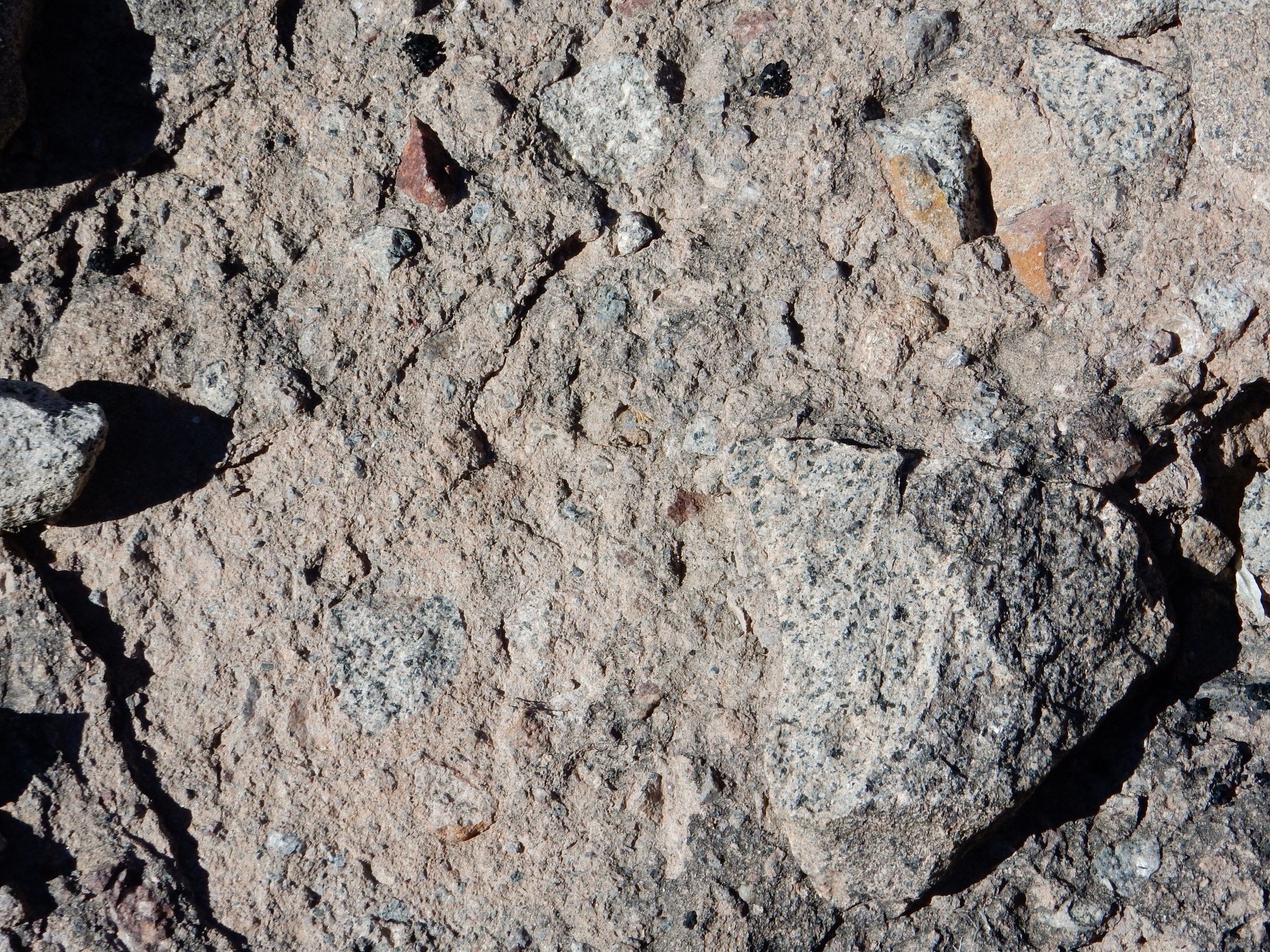
The Ojo Alamo shows a coarsening upwards sequence. The lower beds tend to be shale and mudstone, while the upper beds are increasingly coarse sandstone. This likely reflects the progression in the erosion of the source uplifts. The first beds exposed by uplift would include thick sequences of Lewis and Mancos Shale, providing ample clay and silt for shale and mudstone. As erosion progressed, the exposure of sandstone and basement rock would provide more coarse sediment. The accessible beds south of Cuba consist of a fairly “dirty” sandstone, of coarse, angular grains that include a fair amount of clay particles that are likely weathered feldspar grains eroded from the exposed basement rock.
Ojo Alamo Formation south of Cuba. 35
57.865N 106 59.446W
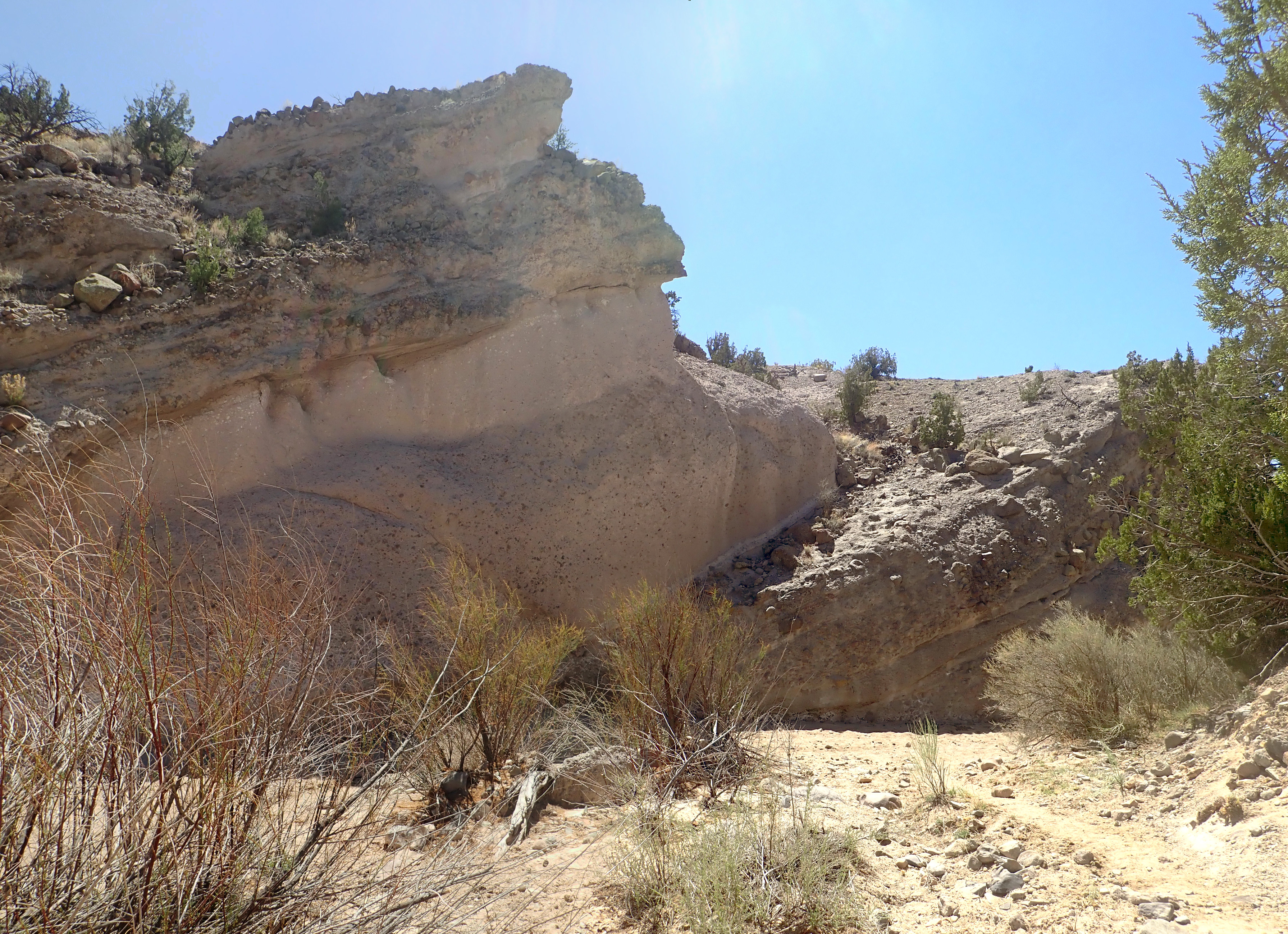
The upper beds of the Ojo Alamo are themselves resistant to erosion and form the cap of Portales Mesa, as we saw in the previous chapter. The formation is also exposed as a hogback in the Regina area in the far northwest of the Jemez region.
Although the period of time from 65 million to about 2.6 million years ago is still widely called the Tertiary in geologic literature, the name is no longer formally recognized. This period of time is divided into the Paleogene (65 to 23 million years ago) and the Neogene (23 to 2.58 million years ago.)
During the Paleogene, India collided with Asia and Antarctica moved towards the South Pole. This caused the hot, moist climate of the Cretaceous to give way to a cooler, drier climate. The rise of the Himalayas exposed great masses of silicate rock that absorbed carbon dioxide from the atmosphere, reducing greenhouse warming of the Earth. The rifting of Australia away from Antarctica allowed the Southern Ocean Current to became established around Antarctica, which also contributed to cooling. The ocean basins increased in volume and the seas receded off the continents. The world was beginning to take the form familiar today, although South America was not yet joined to North America and the Atlantic was narrower.
The Laramide Orogeny continued to affect northern New Mexico into the mid-Paleogene, raising uplifts along fault lines that often coincided with Paleozoic faulting and which remain active today. The Paleogene in New Mexico began with the crust beginning to crumple into mountains and basins as the crust was compressed; it ended with the crust beginning to tear apart down the center of the state as it was pulled back apart.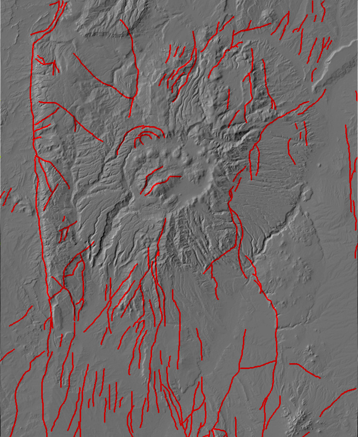
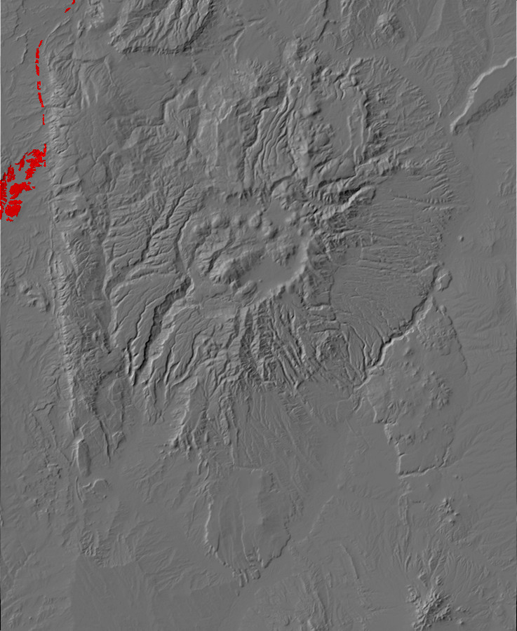
Relief map of the Jemez with major faults highlighted in
red.
The map of major faults in the Jemez region shows that faults are not rare features. In addition to the major faults shown on the map, there are numerous minor faults crossing the entire area, most of which are relatively short and not particularly active. There are some patterns evident in this map. Faults in the Jemez region are more likely to run north to south than east to west. The faults also are not evenly distributed. There are particularly prominent chains of faults running along the west face of the Sierra Nacimiento (the Nacimiento Fault); along the eastern edge of the map (the Tusas-Picuris Fault); and from Black Mesa past the foothills of the the Sierra de los Valles and on south (the Pajarito and La Bajada Faults). These are all associated with the Laramide Orogeny. There is also a swarm of north-south faults across the southern part of the map, associated with the opening of the Rio Grande Rift.
Faults are characterized by the angle of dip, which is the angle the fault plane makes with the vertical. Thus a high-angle fault, with an angle of dip close to 90 degrees, plunges nearly straight into the ground. The side beneath the fault is called the footwall and the side above the fault is called the hanging wall, from terminology used by miners (who often mine minerals deposited along a fault.) The footwall would be under the miner's feet, while he would hang his lamp on the hanging wall, which hung over his head. The fault trace is the path where the fault intersects the surface of the earth.

Almost all the faults in the Jemez area are normal faults,
in which the hanging wall is displaced downwards relative to the
footwall. If a normal fault is active enough, the footwall will
form an escarpment above the fault trace. This will be eroded away
if the fault is inactive for a long period of time.
Normal faults are characteristic of settings where tectonic
forces are stretching the crust, such as in the Rio Grande Rift.
Where the crust is being compressed, as it was in the Jemez area
during the Laramide, one sees reverse faults where the
hanging wall is displaced upwards relative to the footwall.
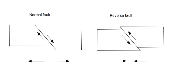
A reverse fault with a shallow dip (less than 45 degrees) is
called a thrust fault. Active reverse faults of any kind
are uncommon in the Jemez area today, with the Nacimiento Fault
being the only major thrust fault in the area. However, reverse
faults were more common during the Laramide.
Both normal and reverse faults (including thrust faults) are
known as dip-slip faults. Whether normal or reverse, the
side of the fault that is displaced downwards relative to the
other side is described as the downthrown side of the
fault. A fault can also be displaced laterally; such strike-slip
faults are less common, but include such famous faults as
the San Andreas Fault in California. The Embudo Fault along the
south flank of Black Mesa is displaced both laterally and
vertically and is described as an oblique-slip faults.
Strike-slip faults are further described as right lateral or left
lateral faults. If you stand on one side of a strike-slip fault
and look across at the other side, the direction of displacement
of the far side determines which kind of strike-slip fault it is.
Thus, if the far side is displaced to the right, it is a right
lateral fault. You should be able to satisfy yourself that this is
true no matter which side of the fault you are standing on, by
picturing the geometry in your head.
Major faults tend not to occur as single isolated fractures.
Instead, there are several parallel strands making up a fault
zone. A strand can fork off the main fault and rejoin it
further along the fault zone. Major faults may also end in a set
of fault splays that branch off to spread the displacement
over a broad area, almost like forks of a river delta.
Once a fault forms, it continues to be a zone of weakness in the crust for a very long time. If the deformation of the lower crust continues, as it typically does, there will be repeated earthquakes and repeated displacements along the fault. If new rock beds are being deposited on top of the fault, either by volcanic activity or by continued sedimentary activity, the older beds will be displaced by a greater amount than the younger beds. This permits geologists to learn something about the history of activity along the fault. The fault itself will be marked by a zone of finely crushed rock called fault gouge. If the fault ceases to be active, the fault gouge is sometimes cemented into hard rock by minerals carried by fluids moving along the old fault.
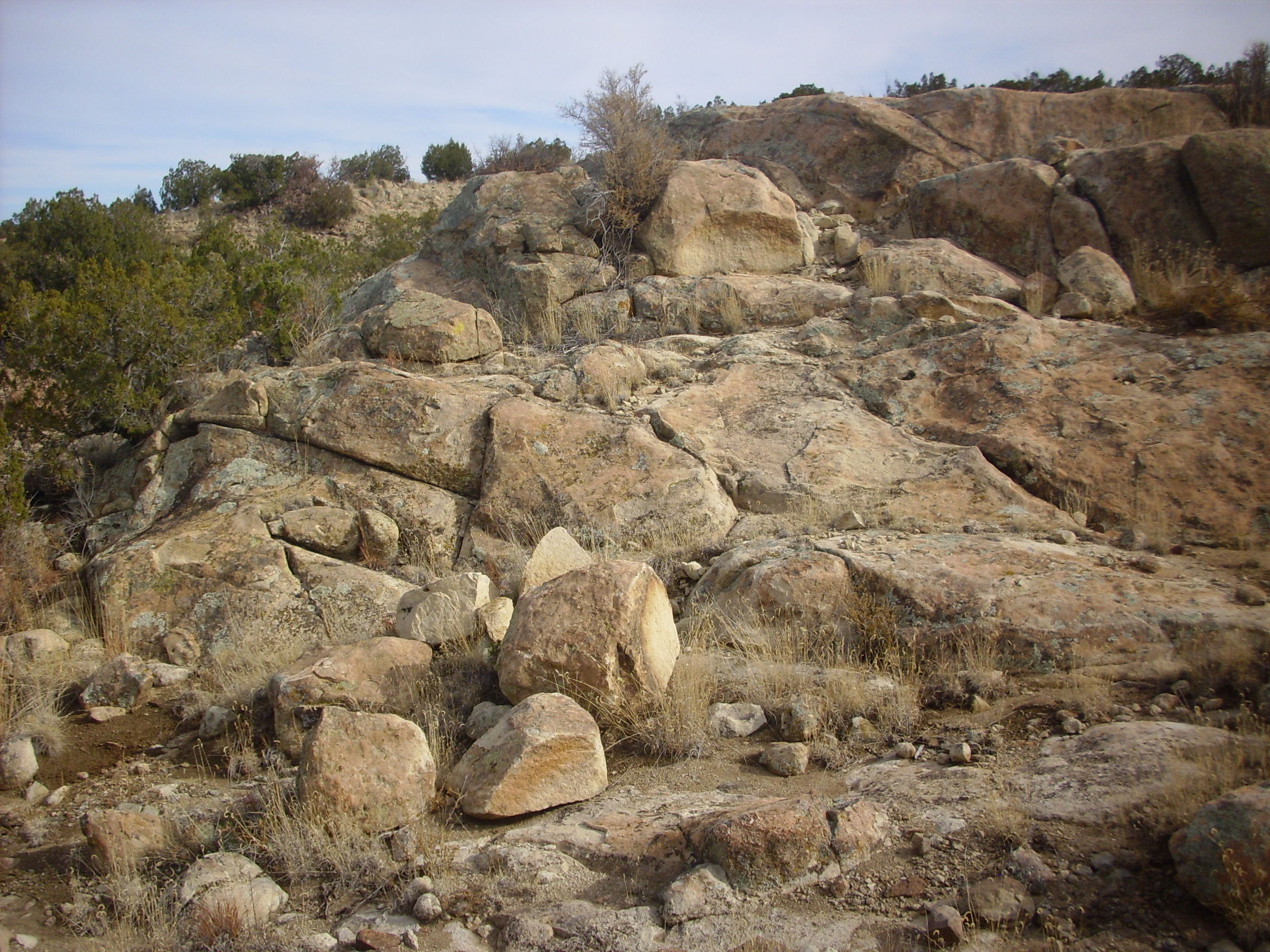
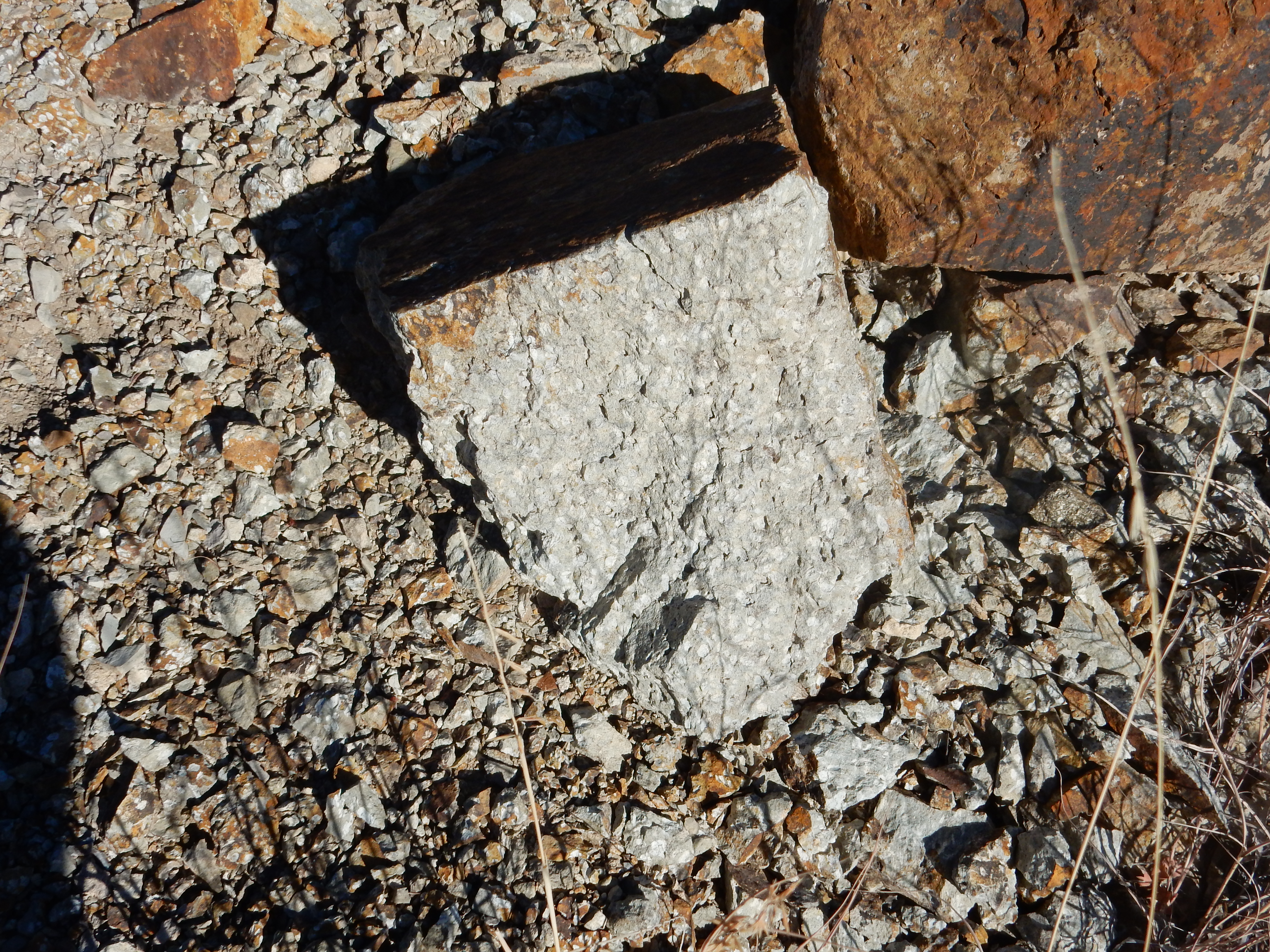
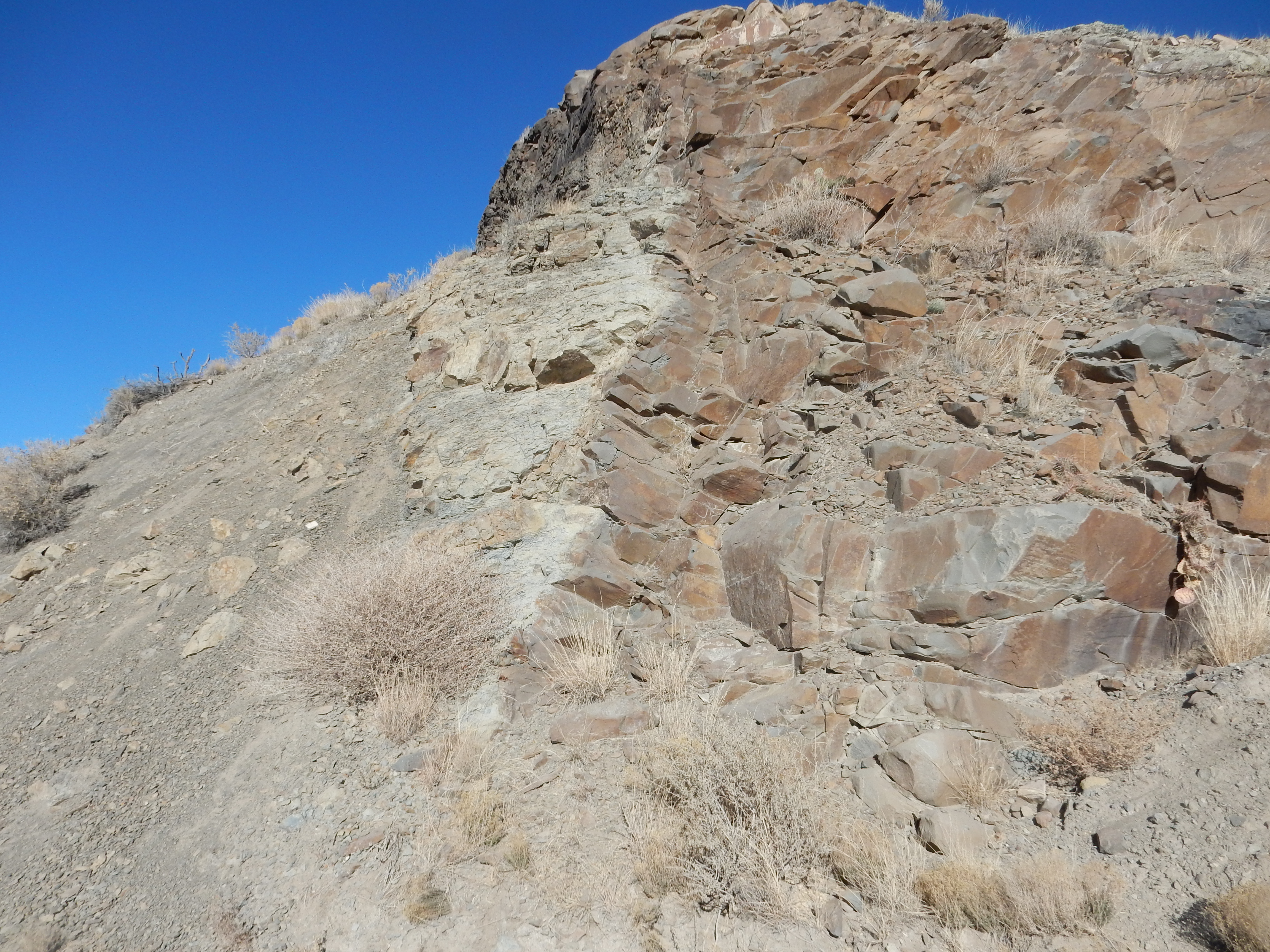
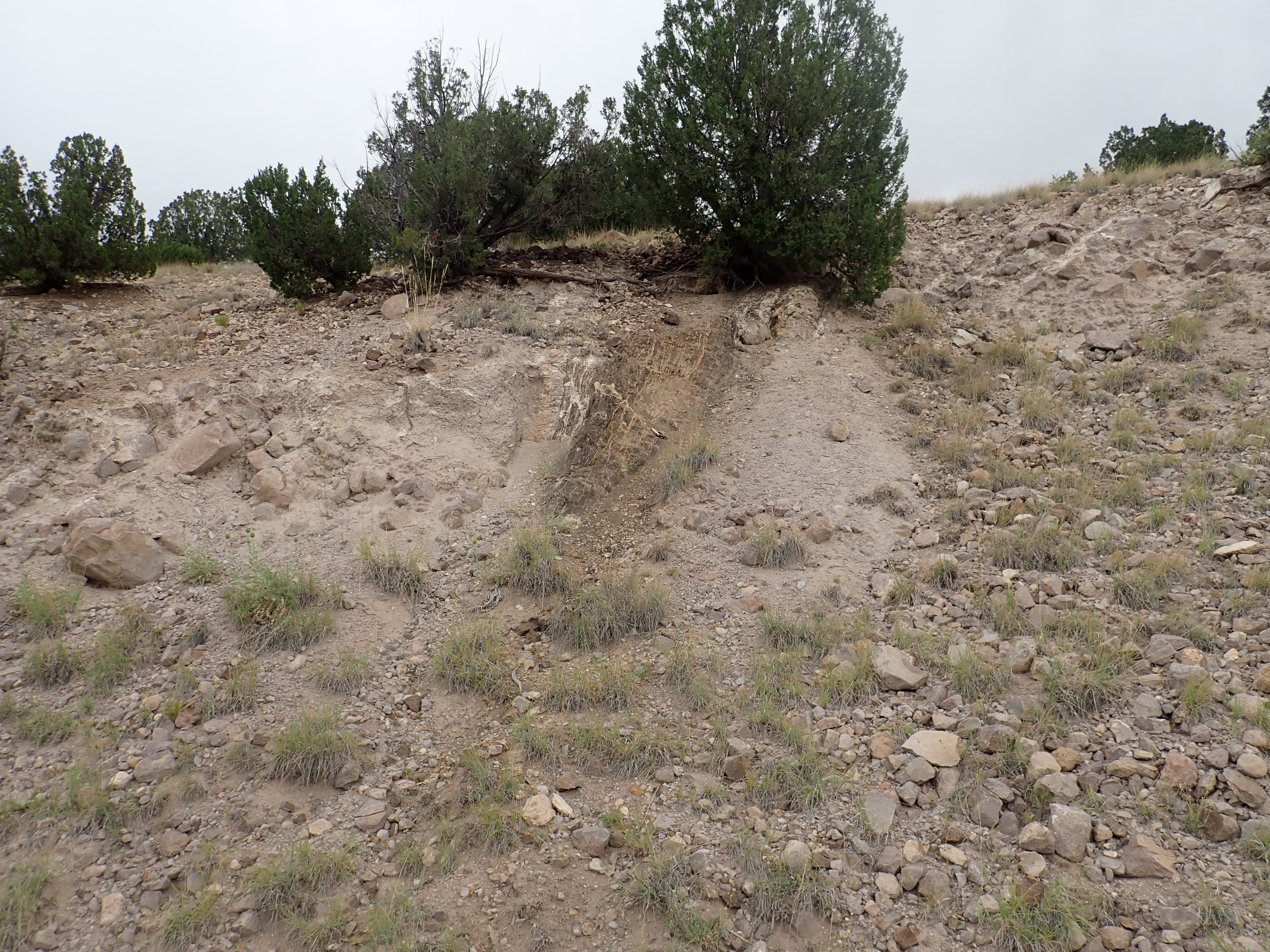
Some faults, particularly in sedimentary rock, display a
phenomenon called fault drag. In the following photograph,
the sedimentary beds forming the rocky outcrop, which are from a
formation that actually dips to the west across the arroyo, curve
over and dip steeply into a fault trace that is partially
concealed by soil and vegetation just to the right of center.
Small fault strand east of San Miguel Mountains. 35.747753N
106.3419584W
The relatively ductile sedimentary beds have been deformed by
slow motion, being (in effect) dragged along the direction of
displacement. The less ductile igneous beds at right show a much
smaller degree of fault drag.
One fault zone established during the Paleogene in the Jemez
region is the Canones Fault Zone, located west of Abiquiu. The
fault zone crosses the floor of Arroyo del Cobre and the highway
to the south.
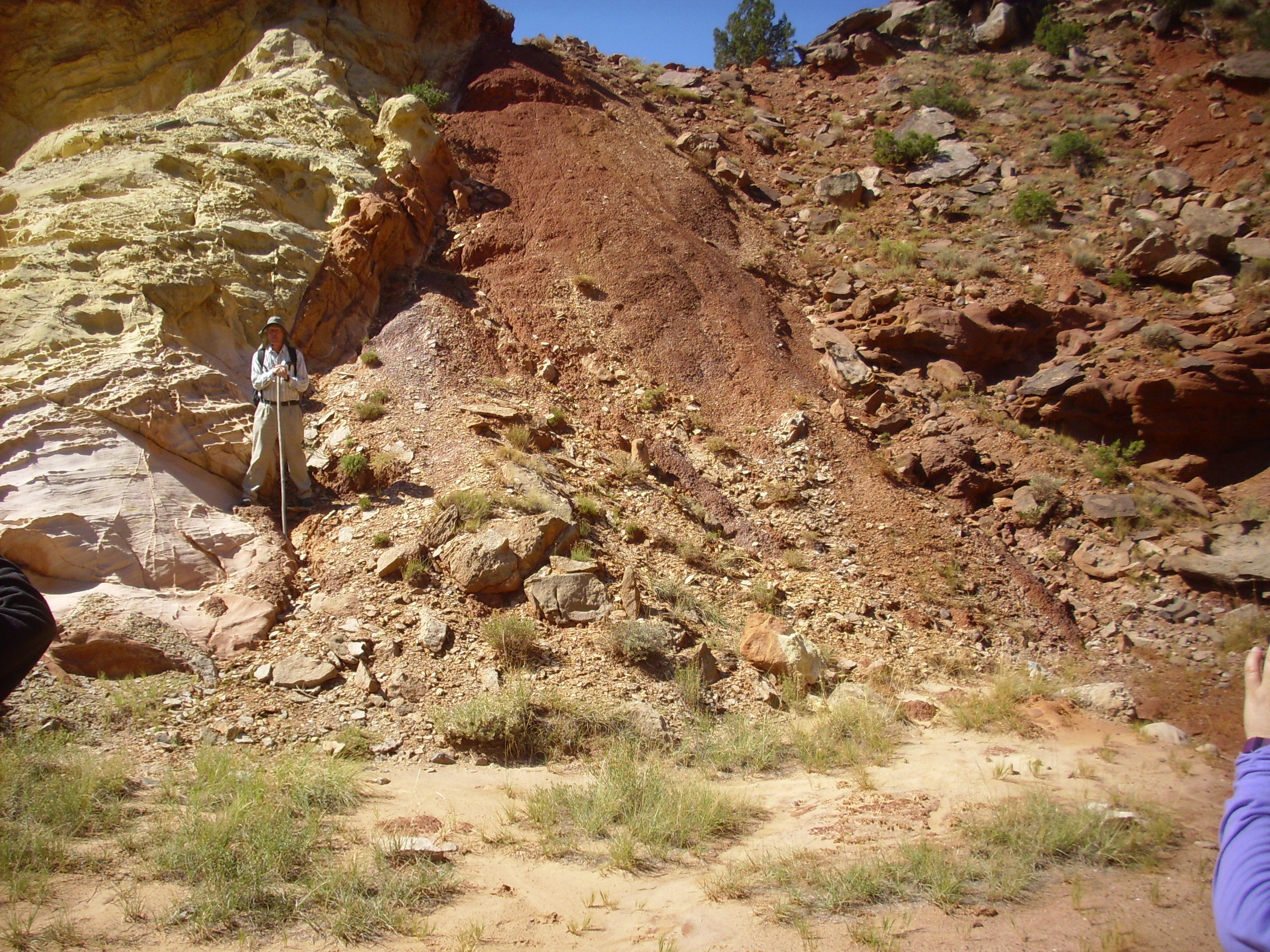
Arroyo del Cobre. 36
14.740N 106 22.057W
The main strand of the Canones Fault Zone runs across the floor of the canyon from left to right. This fault zone is generally taken to mark the boundary between the Rio Grande Rift (on the near side) and the Colorado Plateau (on the far side), two major tectonic provinces. The rock beds on the near side of the fault zone are thrown down a considerable distance, so that the Jurassic rocks forming most of the rim we’re standing on are considerably younger than the Triassic rocks forming the far rim. Just how great the displacement is is demonstrated by the presence of the white beds in the center of the valley floor. The main strand of the fault zone runs just beyond them, and they are the same formation (Poleo Sandstone) as the far canyon rim on the other side of the fault.
The cliffs in the left foreground are Jurassic Entrada Sandstone, with a thin covering of younger Tertiary El Rito Formation and Ritito Conglomerate. There was once a bed of Jurassic Toldilto Formation above the Entrada Sandstone, as shown by the yellowish color; this is characteristic of the uppermost Entrada Sandstone, just beneath the Todilto Formation. A few weathered remnants of the Todilto Formation lie between the Entrada Sandstone and the El Rito Formation, and on the far side of the cliffs the Todilto Formation is much better preserved.
The far canyon wall is underlain by dark red Arroyo del Agua Formation, the upper formation of the Permian Cutler Group. The lower formation, the Canon del Cobre Formation, is exposed in the valley floor and in the Canon del Cobre further north. These are capped by the tan beds of the Poleo Sandstone of the Triassic Chinle Group, with a significant discontinuity between them.
The fault trace is spectacular where it crosses a local saddle.
Fault trace of main strand of Canones
Fault. Looking soutwest from near
36
14.787N 106 22.471W
The fault trace is directly to the right of the yellowish outcrop
of Entrada Sandstone capped with Todilto Formation. These Jurassic
formations have been thrown down until they are in contact with
Permian Arroyo del Agua red beds.
Trace of main strand of Canones Fault
Zone. 36
14.744N 106 22.573W
The zone of fine red material is the fault trace itself, which is
filled with fault gouge apparently dominated by the soft red bed
sediments of the Permian side of the fault. You are looking here
at the closest thing to the exact boundary between two major
tectonic provinces, the Rio Grande Rift province (to the left) and
the Colorado Plateau (to the right).
There is a spring arising almost exactly on the fault trace (behind us as we’re facing here) that produces very brackish water. It must flow through the Todilto Formation, or some other formation rich in partially soluble minerals, at some point. Because the water is brackish, it does not support a local flourishing of vegetation; the spring is dominated by sparse salt grass instead.
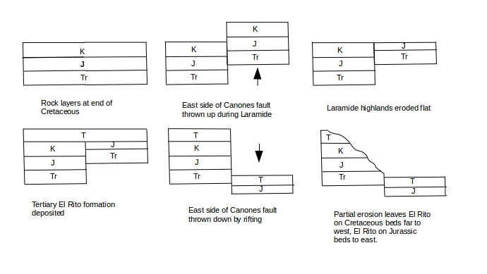
In previous chapters, we visited the area just to the south where the main strand of the fault crosses the highway. You may recall that the fault has thrown down the contact between the Morrison Formation and the El Rito Formation. The Morrison Formation is of Jurassic age, about 150 million years old. Here it takes the form of fluvial sandstone, deposited in a river valley. All the rocks above the Morrison Formation were eroded away at this location, then buried again under the El Rito Formation some 50 to 30 million years ago.

The contact is clearly visible towards the top of the cliff,
where the beds in the two formations lie at an angle to each
other. This is a good example of what geologists call an angular
unconformity. The contact is important for another reason: Whereas
here the Tertiary El Rito Formation lies directly on Jurassic
Morrison Formation rocks, we find that further west, across the
Canones fault, the El Rito lies on top of younger sedimentary beds
of Cretaceous age. This tells us that the Canones Fault existed at
least thirty million years ago, and that at that time it was the west
side of the fault that was thrown down. Geologists believe the
Canones Fault was part of the Laramide orogeny, and has been
reactivated by the opening of the Rio Grande Rift, this time with
the east side being thrown down. Such fault reversal has been
common across the western United States, with some of the best
examples in the Precambrian basement exposed in the Grand Canyon.
The surprising conclusion is that the San Luis Valley and Espanola Basin were part of a highland area, the San Luis Uplift, during the Paleogene. The portion between Santa Fe and Los Alamos is called the Pajarito Uplift. These areas are now deep basins of the Rio Grande Rift.
This is illustrated in the following diagram.
Here is a close up of the point of contact, where it comes close to the road level.
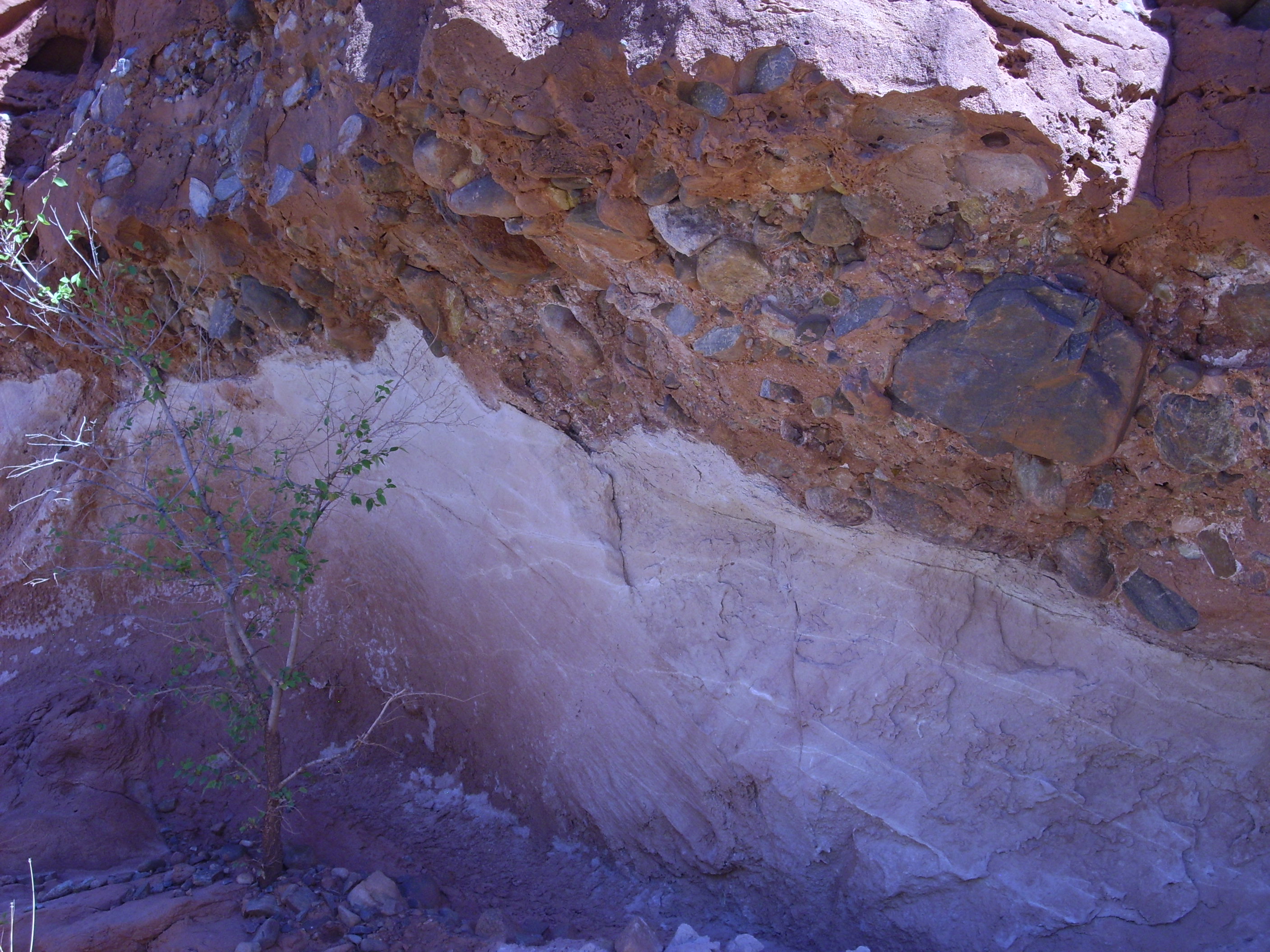
This contact represents a gap in the geological record of at
least 100 million years.
The Canones Fault Zone has been mostly inactive for the last three million years, since it does not displace volcanic rocks younger than that age.
Fission-track dating is a form of radiometric dating useful for certain minerals containing radioactive isotopes. It has mostly been applied to apatite, which contains radioactive thorium and uranium, and which is common in intrusive igneous rocks. It has special characteristics that make it useful for timing some of the events of the Laramide Orogeny.
A long-lived uranium or thorium nucleus usually decays by emitting an alpha particle. However, a few out of a trillion decays of U235 will take place through spontaneous fission, where the nucleus breaks into two halves plus a few neutrons. The two halves of the nucleus, which are still highly charged and relatively massive, penetrate a short distance into the surrounding mineral grain and leave a track of damaged crystal that can be brought out by polishing the mineral grain, then etching it with acid. Because these events are so rare, an apatite grain a few tens of millions of years old will have few enough of these fission tracks that it is possible to make out individual tracks under a microscope, count their density, and determine how long the grain has been accumulating radioactive damage.
Fission tracks are erased by relatively mild heating. Apatite has a particularly low closure temperature of about 70 to 110 C (160 to 230 F) and it is particularly rich in heavy radioisotopes. This means that the fission track age for a rock outcropping will be the age since the rock last experienced any kind of heating event.
Geologist Shari Kelley and her collaborators have collected fission track ages for many of the mountains around the Rio Grande Rift. The highest peaks of the Sangre de Cristo and San Pedro Mountains have fission track ages of around 65 million years, showing that these rocks were brought close to the surface by the Laramide Orogeny no earlier than the start of the Cenozoic. Locations further down the flanks of the mountains show progressively younger fission track ages, of about 35 million years at the feet of the mountains. This indicates continual uplift from 65 million to 35 million years ago, and it is possible to estimate the uplift rate at 0.072 mm per year (a little over a quarter of an inch per century.) Sandia Crest is relatively young, with fission track ages of around 20 million years or less. No fission track ages have been published yet for the Tusas Mountains, but the dating work is continuing.
We'll see stratigraphic evidence later in this chapter that is
broadly consistent with these timings.
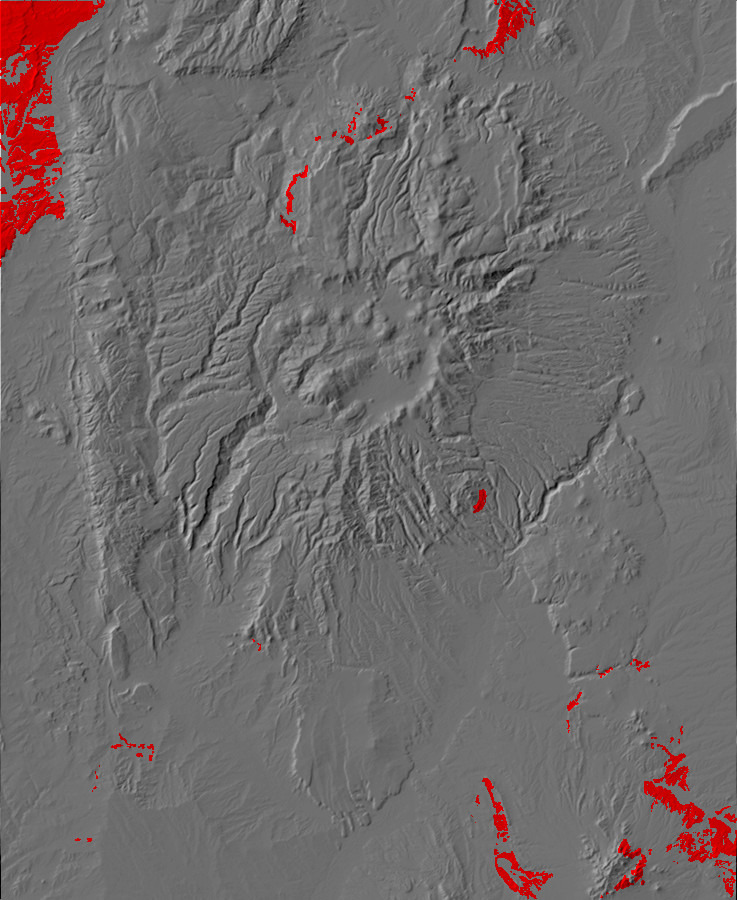
Relief map of the Jemez with Paleocene outcroppings
highlighted in red.
65 milllion years ago, northern New Mexico was beginning to look
something like it does today. The Western Interior Seaway was no
more. The San Juan Basin to the west was accumulating sediments
eroded off the newly uplifted San Luis and Pajarito Uplifts to the
east. The climate was hot and moist, as it was across almost the
entire globe. Far to the west, Europe was just beginning to
separate from Greenland and Greenland from North America, and
there was an intermittent land bridge between Asia and North
America, which would continue to open and close until almost the
present day. South America had pulled away from Africa but was
still separated from North America by a tropical sea, while Africa
was separated from Europe by the Tethys Ocean. India was still
well south of Asia but moving north. Australia was just beginning
to pull away from Antarctica, and its bulk diverted southern ocean
currents to ensure that warmth from the tropics was well mixed
across the entire ocean area of the Earth.
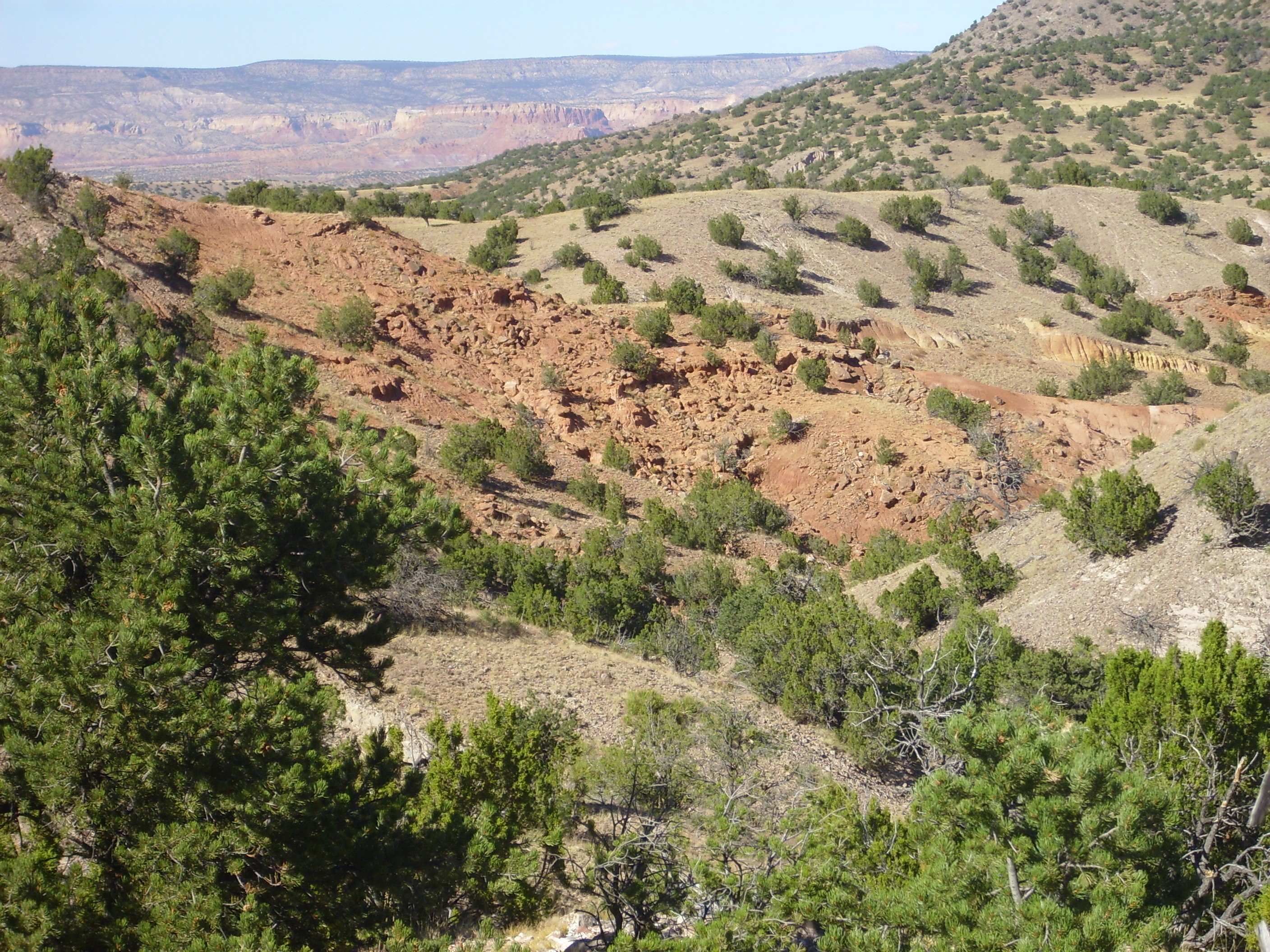
This earliest epoch of the Paleogene has been named the Paleocene ("old recent"), and lasted from about 65 million years ago to 56 million years ago. This epoch left little trace in the Jemez proper, but Paleocene beds of the Nacimiento Formation are found west of the Sierra Nacimiento in the San Juan Basin.
Relief map of the Jemez with Nacimiento Formation
outcroppings highlighted in red.
During the early Paleogene, the San Juan Basin west of the Sierra
Nacimiento was a lush, well-watered intermontane basin, and
fossils of recognizable families of modern plants typical of
semitropical climates are found in the Nacimiento Formation, along
with numerous mammals. These included examples of the first true
rodents and primates, which branched off from a common ancestor in
the Cretaceous, 80 million years ago. That's right: Of all the
common household pets, rats, mice, hamsters, and gerbils are our
closest kin. The dog, man's best friend, is man's cousin 100
million years removed.
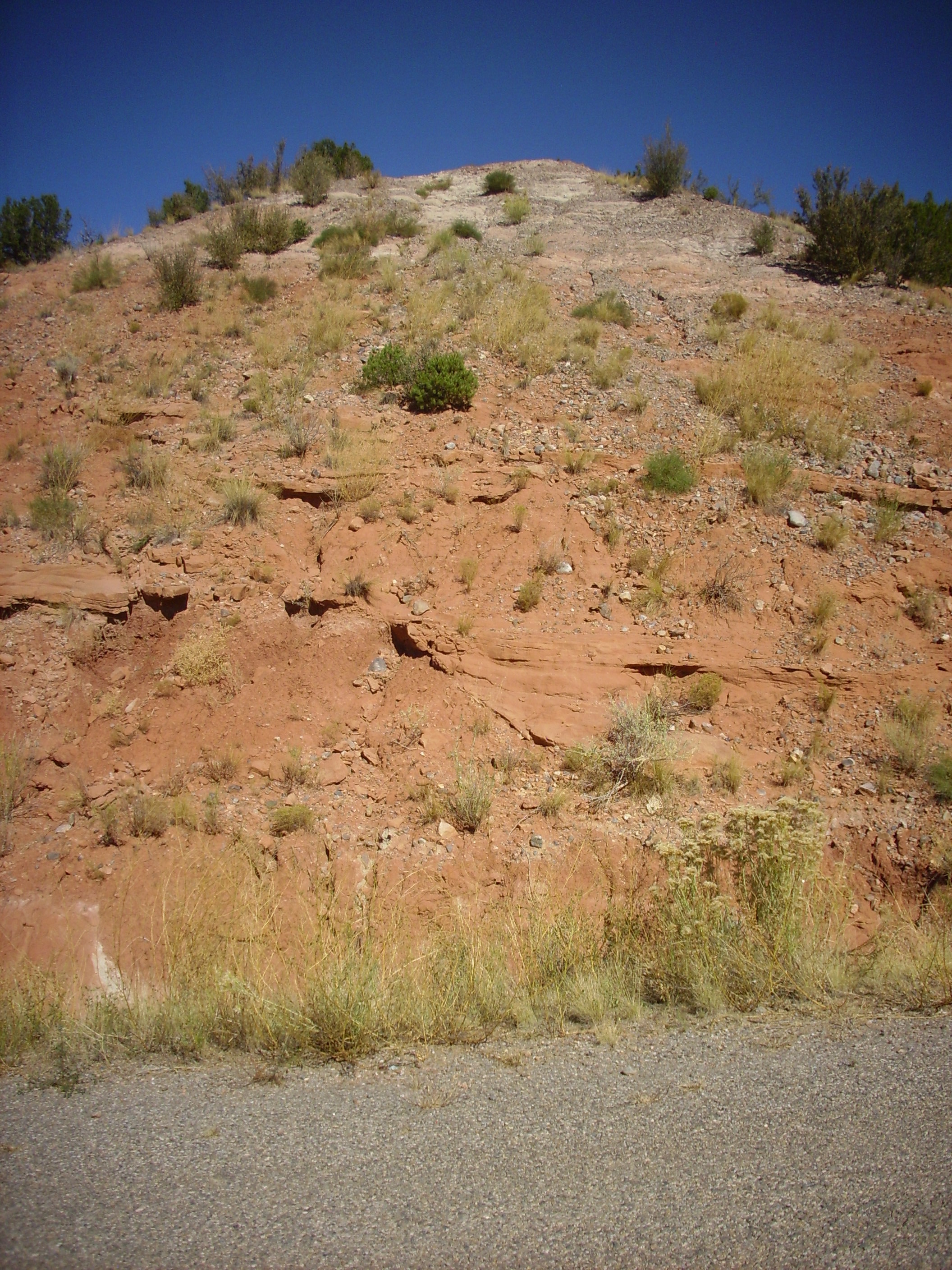
There are excellent exposures of the Nacimiento Formation throughout this area, generally forming slopes under cap rock of the San Jose Formation. Mesa de Cuba is an example.
The mesa is underlain by San Jose Formation sandstones and
conglomerates forming a cap over softer shales of the Nacimiento
Formation.
This sequence may be examined more closely along the main highway just northwest of Cuba.
The San Jose Formation is the sandstone cliffs, while the slope-forming sedimentary beds beneath the cliffs are Nacimiento Formation.
The Paleocene marks the end of the long period of tectonic quiescence in the Jemez, and with it the paleotopographic map again becomes interesting.

Paleocene paleotopography map
Only the San Juan Basin to the northwest was accumulating
sediments during the Paleocene. The remainder of the Jemez region
was high ground. However, this map should be taken with some
skepticism. The beds identified as Eocene beds resting directly on
Cretaceous beds have unusually poor age control, and may be older
than they appear.
The Hayden Expedition of 1869 was not exclusively concerned with
locating coal supplies for a transcontinental railroad. Hayden was
a well-trained and careful geologist and his observations
established the first basic framework for the stratigraphy of the
Santa Fe area. He took note of the sandstone beds of the Galisteo
area, which he found dipped at angles from 5 to 50 degrees and
displayed a wonderful variety of colors from almost white to a
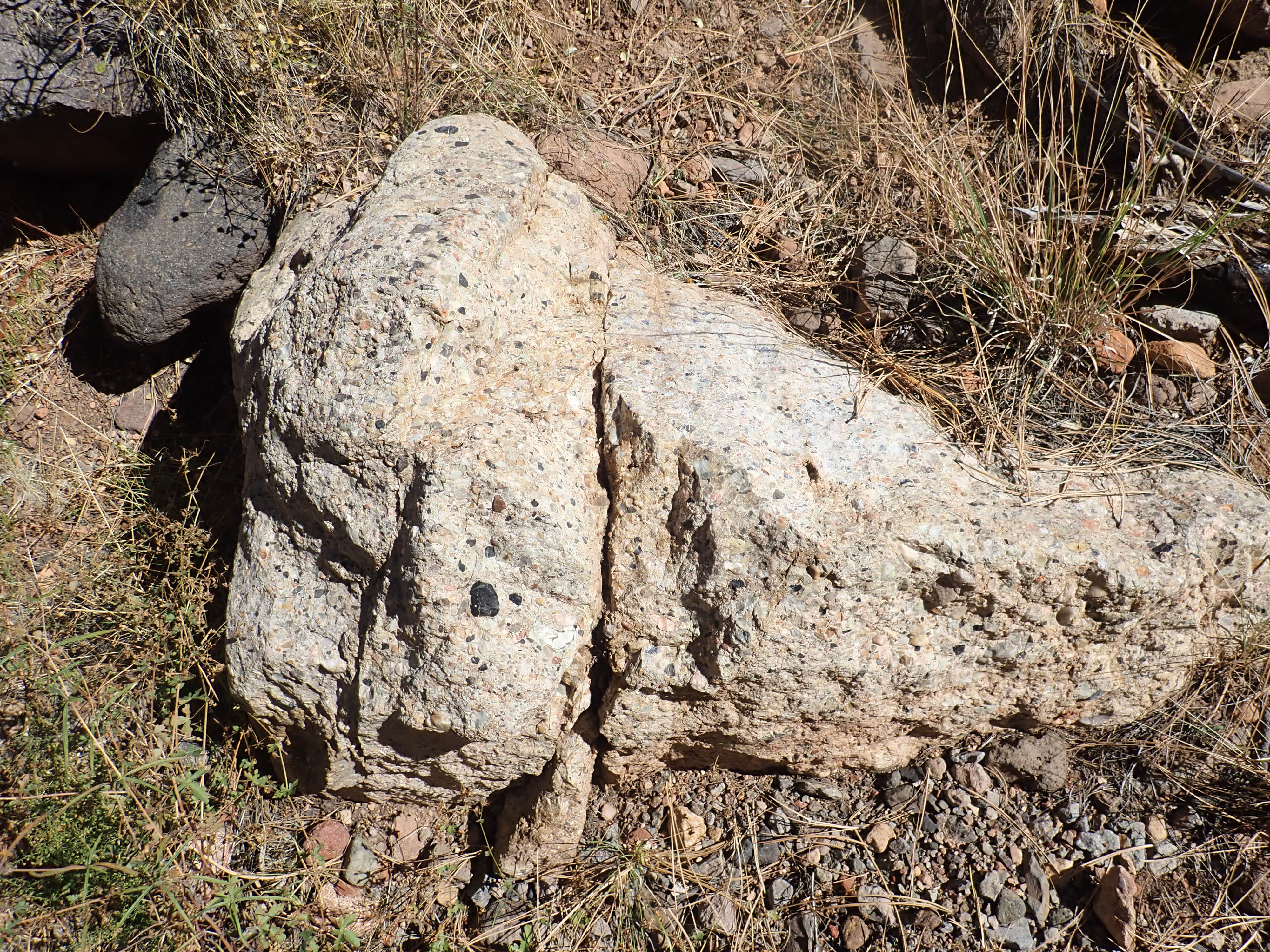
deep brick red. He was disappointed to find no fossils in the beds
other than enormous petrified logs, including one remarkably well
preserved log with a cavity 10" (25cm) in diameter running through
it. He named these beds the Galisteo sand group, and the name has
remained with some of the beds to the present day.
Relief map of the Jemez with Eocene outcroppings
highlighted in red.
The Eocene, which lasted from about 56 million years ago to 38
million years ago, was the warmest epoch of the Cenozoic Era.
Ocean temperatures were at least 5 degrees Centigrade (9 degrees
Fahrenheit) warmer than today. However, global temperatures began
to decline in the middle of the epoch and plunged dramatically
towards its end.
The start of the Eocene in the Jemez was marked by uplift of the Sierra Nacimiento to the west and further uplift of the Brazos-Sangre de Cristo geanticline to the north and east. A broad river valley lay between the Sierra Nacimiento and the Pajarito Uplift, where the Jemez Mountains are located today.
The tectonic compression of the Laramide Orogeny came to a close
towards the end of the Eocene, and the uplifts began to erode down
to fill the surrounding basins with sediments. The remnants of the
Farallon Plate began to sink into the mantle, and hot
aesthenosphere rose to take their place. This caused volcanism to
break out in the Yellowstone area, and crustal extension began to
take the place of compression, beginning in what is now western
Montana.
During the period between 1877 and 1892, the two leading
paleontologists in the United States, Edward Drinker Cope of the
Academy of Natural Sciences in Philadelphia and Othniel Charles
Marsh of the Peabody Museum of Natural History at Yale, engaged in
a bitter rivalry that become known as the Bone Wars. Cope had
first come out to the fossil beds of the West as an unpaid member
of the Hayden Survey, and he soon developed a reputation for
ignoring instructions from Hayden and collecting fossils where he
liked.
In late 1874, Cope ignored orders from Wheeler to proceed north
from the Chama River to Colorado, and headed south to explore the
area north of the San Pedro Mountains, where fossils had been
reported. North of Regina,
he found early Eocene fossils in the badlands and spent about
seven weeks collecting fishes, reptiles, and what was then the
oldest known mammal fossils in North America. He also collected
the fossil of a giant flightless bird. This proved to be one of
the most important fossil finds for life in the early Eocene in
North America, which Cope wrote to his father was
"the most important find in geology I have ever made". However,
Cope was unable to find anything but a few bits of petrified wood
in the underlying beds of the Nacimiento Formation, which he named
the Puerco Marls.
Relief map of the Jemez with San Jose Formation
outcroppings highlighted in red.
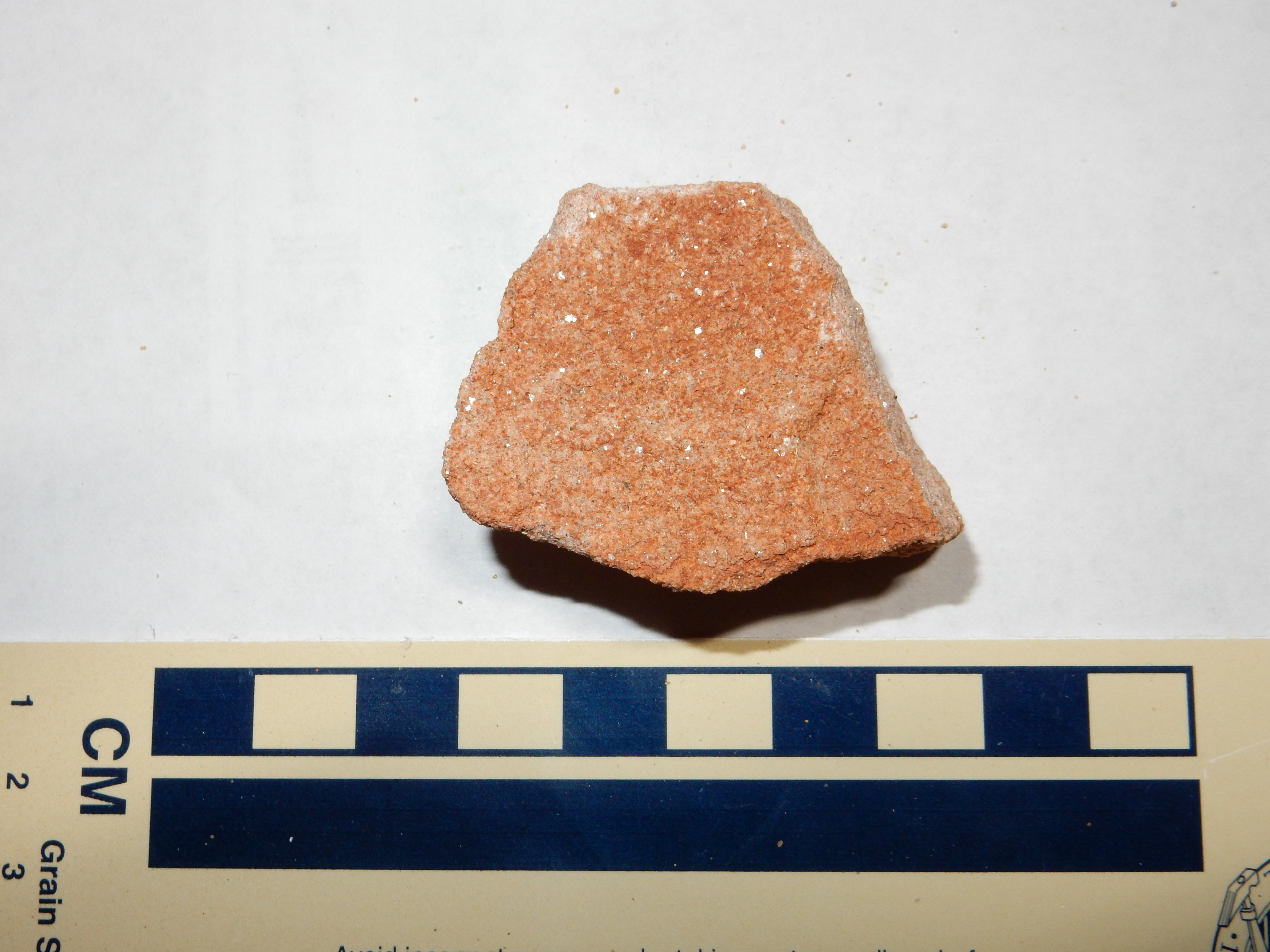
The San Jose Formation is separated by a definite discontinuity from the underlying Paleocene Nacimiento Formation. It dominates the area northwest of Cuba, where it tops mesas and other hills. It can also be a beautiful formation:
Here is a gorgeous exposure in a road cut. This exposure is
heavily cross-bedded and strongly indurated.
A fairly coarse, angular, and feldspar-rich sandstone, with some organic debris. Other exposures are quite dirty. In general, this formation is a relatively immature sandstone near Cuba, reflecting its origin as sediments off of the nearby Sierra Nacimiento and Brazos-Sangre de Cristo geanticline.
Locations near Cuba have fossils of the giant carnivorous bird, Diatryma.
And if "giant carnivorous bird" seems indistinguishable from
"dinosaur", I doubt many paleontologists would argue with you.
The formation shows internal discontinuities that suggest the
lowest beds formed in the subsiding San Juan Basin, but later beds
formed during discrete intervals of folding along the Nacimiento
Fault that produced accommodation space for sediments. In
other words, episodes of folding dropped the rock beds to the west
so that there was room for sediments to accumulate on them.
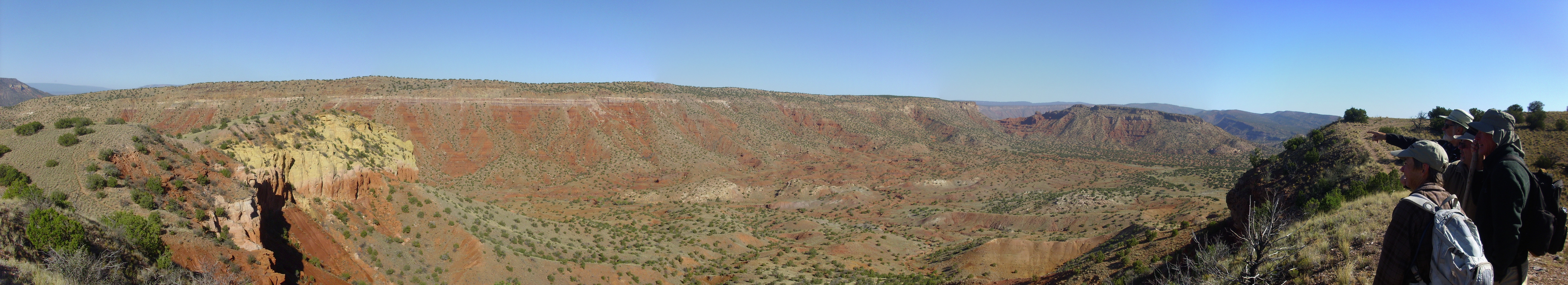
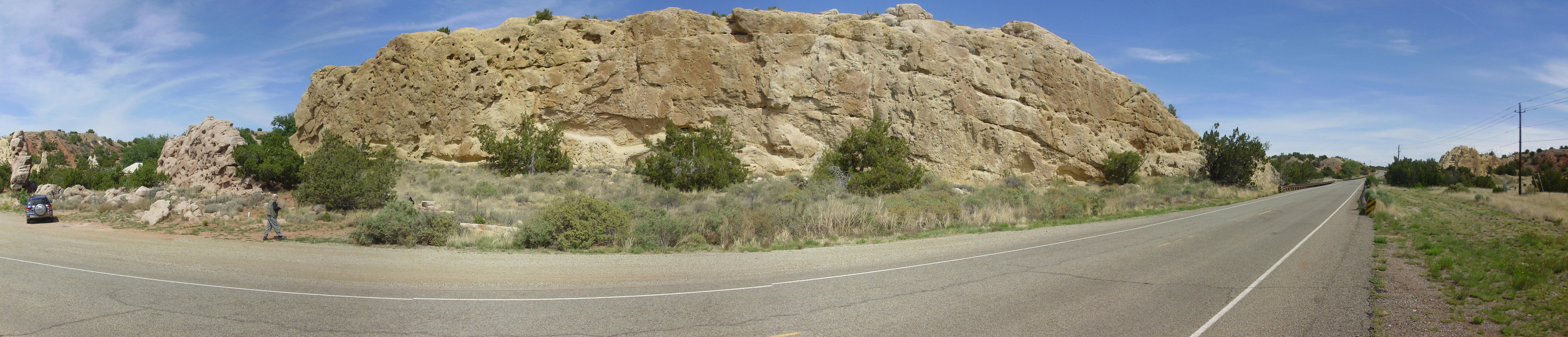
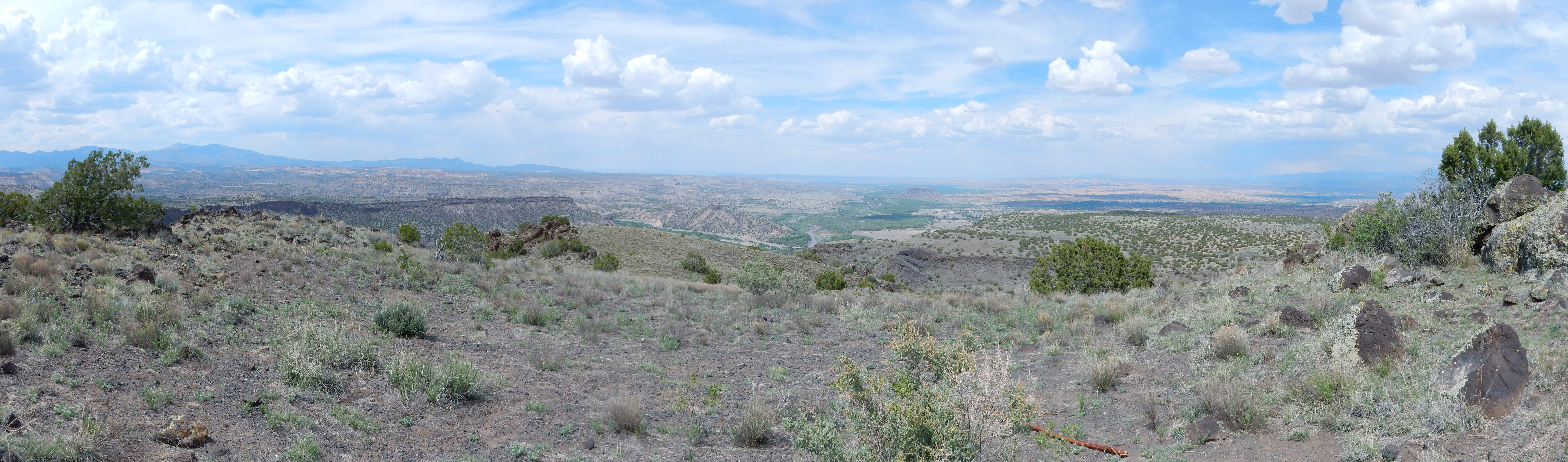
The San Juan Basin west of the Sierra Nacimiento dips very gently to the north. As a result, successive resistant beds form nearly level mesa tops, with the youngest beds exposed on mesa tops to the north and the oldest to the south. This panorama shows the sequence of beds.
Panorama of the eastern San Juan Basin. Looking
west to southwest from 36
04.289N 106 59.026W
At left in the far distance is the Mount Taylor volcanic field.
The northeastern part of the field includes several volcanic
plugs, of which Cabezon Peak is the largest.
Just visible in front of the plugs is San Luis Mesa, which is
topped by Lookout Point sandstone. The mesas at far left, which
are labeled La Ventana Mesa North and La Ventana Mesa South on the
geologic map, are topped by the next resistant formation, the
Cliff House Formation (La Ventana Member) underlain by less
resistant Menefee Formation.
The next four formations, the Lewis Shale, Cliff House Sandstone, and Fruitland and Kirtland Formations, are less resistant, while the Ojo Alamo Formation forms the resistant cap of Mesa Portales near the center of the panorama.
At right is Cuba Mesa, capped with resistant San Jose Sandstone over less resistant Nacimiento Formation.
In the middle distance in the center and right of the panorama is
a hogback ridge formed by steeply dipping beds of the Mesaverde
Group (Lookout Point, Menefee, and Cliff House Formations) that
were exposed by the uplift of the Sierra Nacimiento. The flat
ground to their east is underlain by Mancos Formation (here poorly
exposed) while everything in the foreground is Dakota Formation or
older.
Relief map of the Jemez with El Rito, Gallisteo, and
Diamond Tail Formation outcroppings highlighted in green, red,
and yellow, respectively.
The El Rito Formation extends from north of the Valles caldera to the Chama area in northernmost New Mexico. It is somewhat difficult to precisely date, having very few fossils, but is probably in the ballpark of 40 million years old. The formation is mostly interbedded red mudstone and sandstone, tending to form slopes.
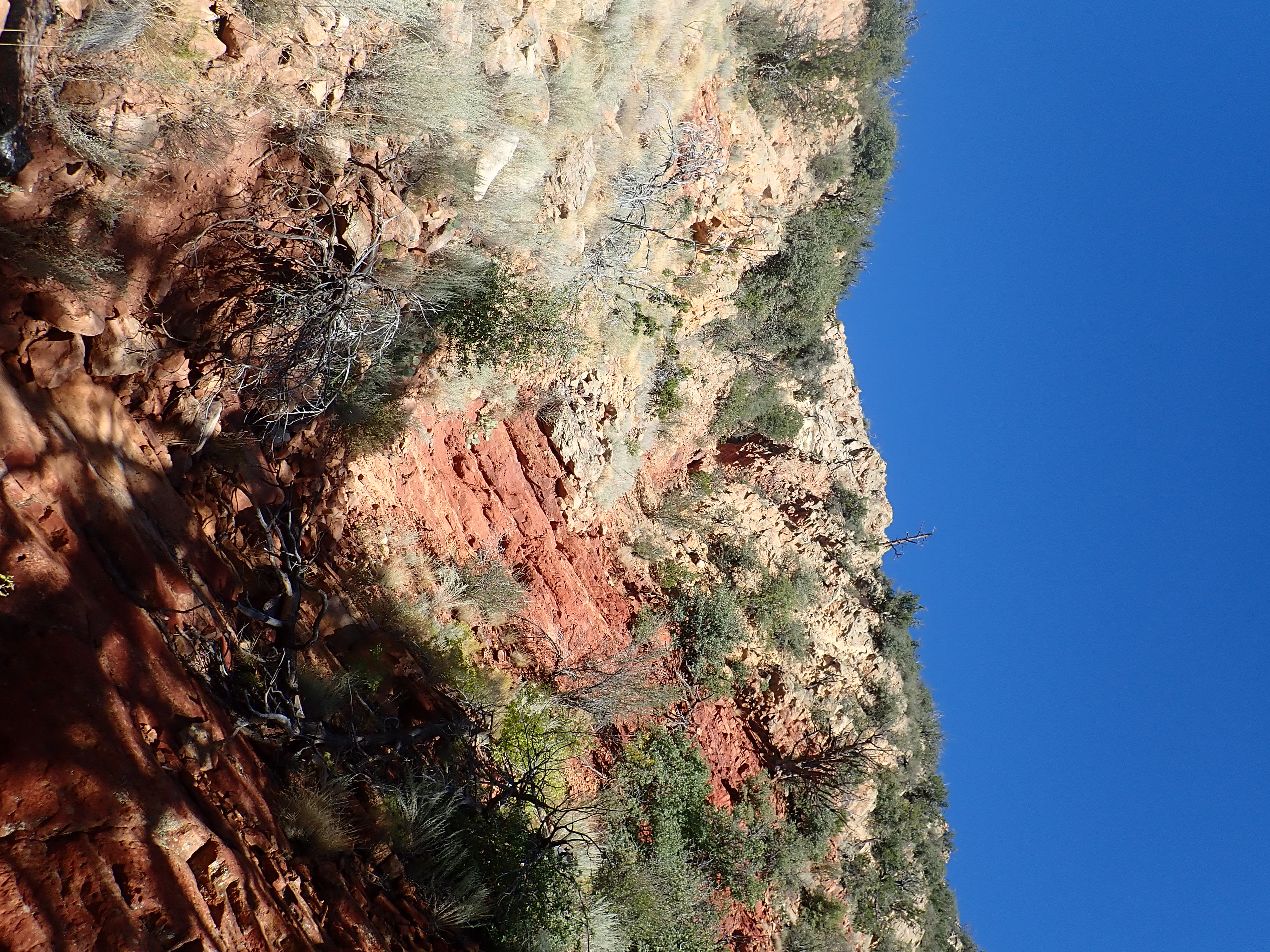
The lowest bed of the El Rito Formation is very coarse conglomerate with ample sandy matrix, as shown in the earlier photograph of the contact between the El Rito Formation and the Morrison Formation near the Canones Fault. This is even more evident in the Red Wash Canyon area.

Basal conglomerate of El Rito Formation.
36
14.428N 106 22.484W5
The clasts are mostly quartzite, of the type found in the Tusas
Mountains to the north. This suggests that there was already
a Tusas Range 40 million years ago, part of the San Luis Uplift,
and geologists interpret the El Rito Formation as alluvial fans
eroded off the early Tusas Mountains to the south and west. The
lack of fossils and other characteristics of the formation suggest
it was deposited under semiarid conditions.
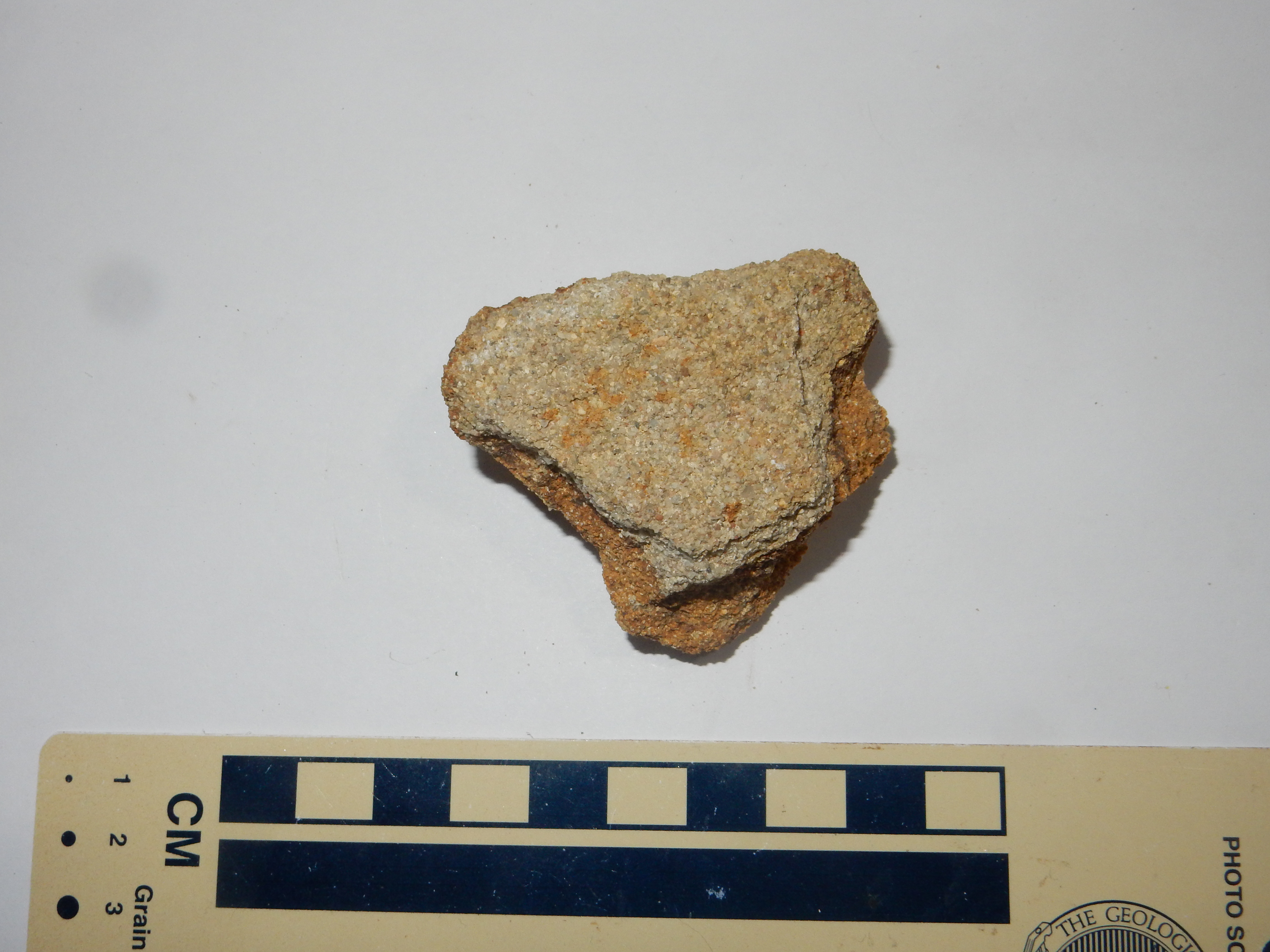
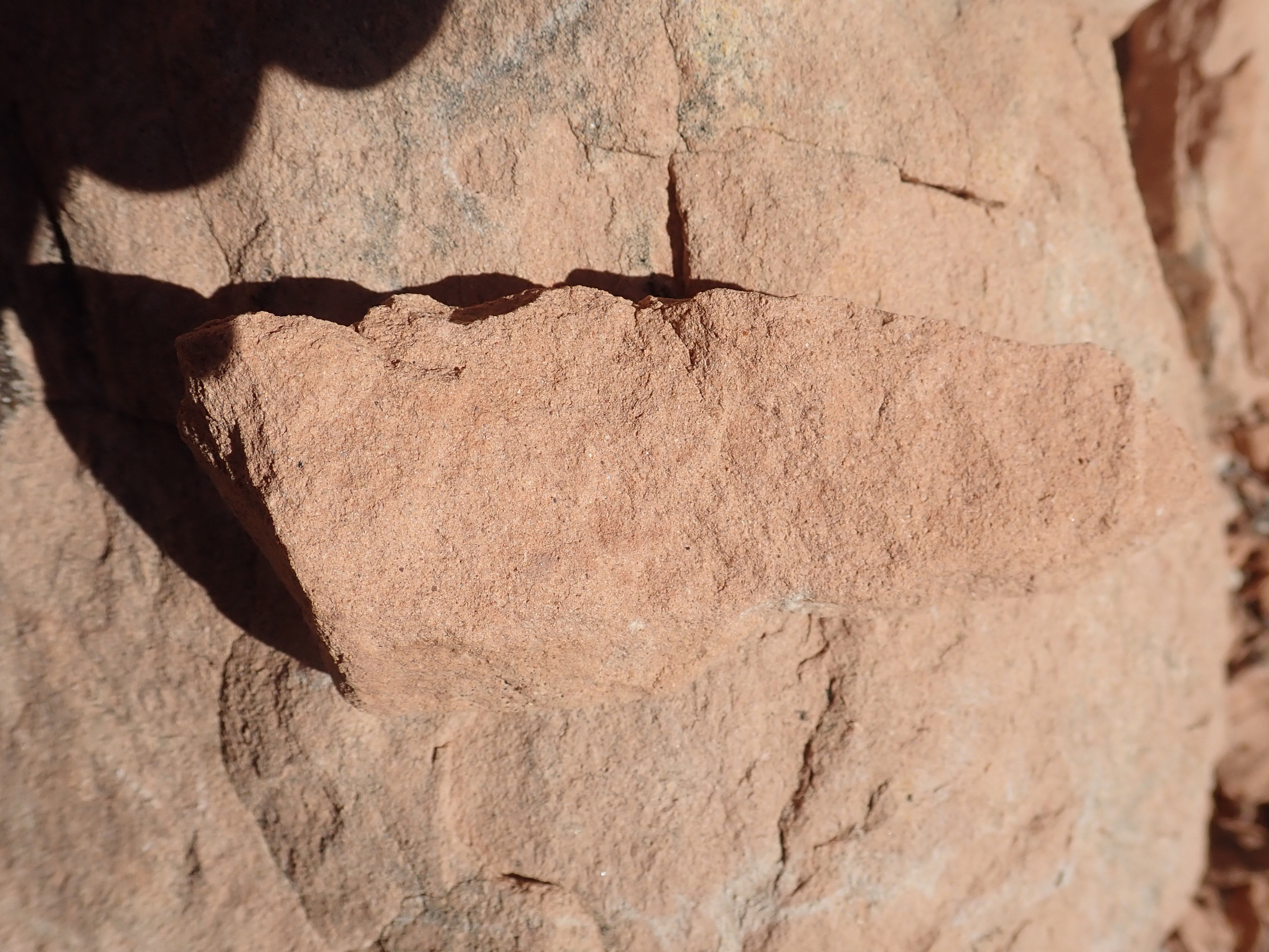
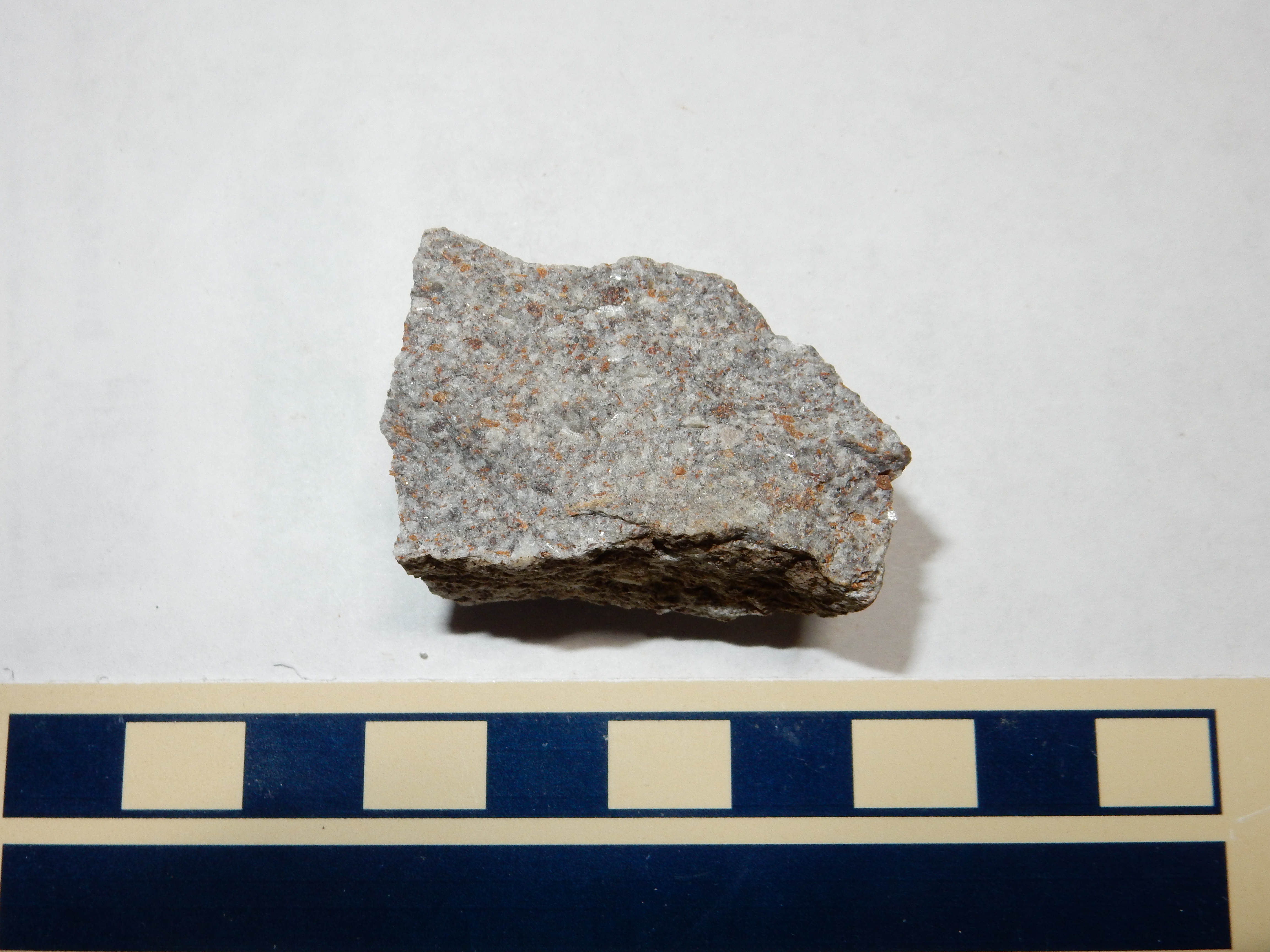
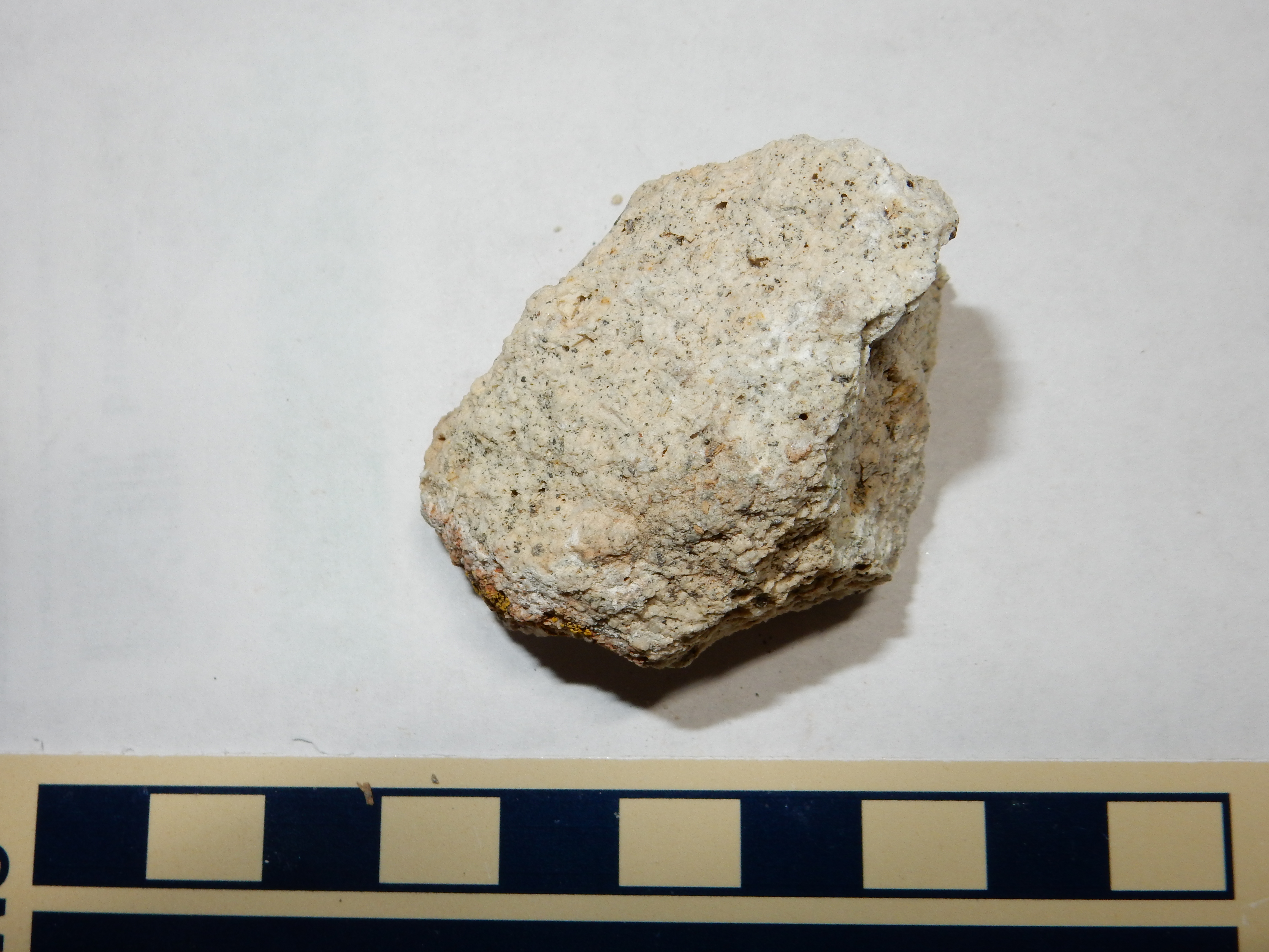
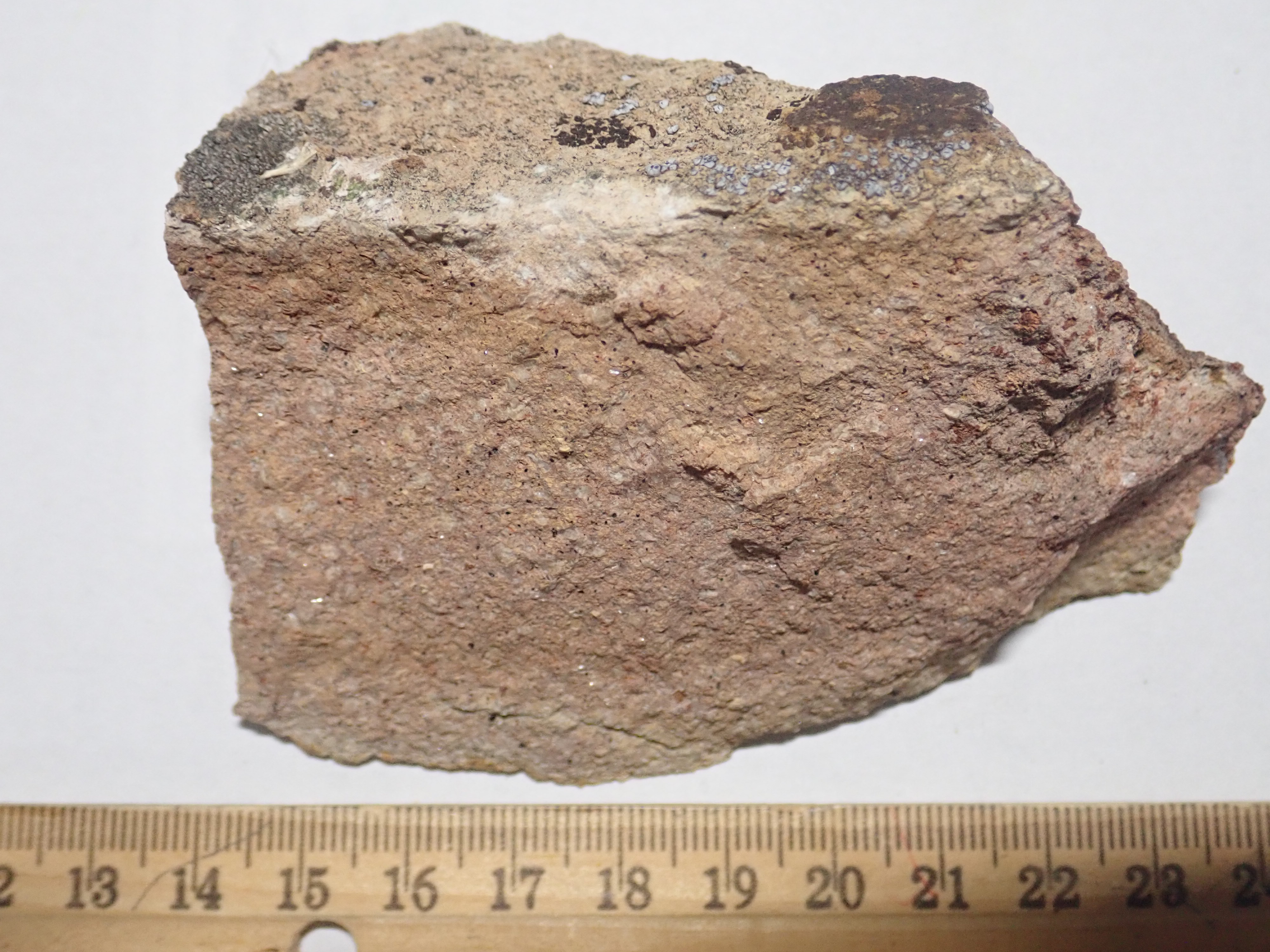
Here is a sample of the El Rito Formation from its lowest bed.

Notice that there is a quartzite pebble embedded in this sample.
This was taken from near the bottom of the bed. The sandstone
consists of somewhat rounded but poorly sorted clasts of quartz
with considerable feldspar and lithic clasts, and much cement in
the pore spaces — all consistent with an immature sandstone formed
close to its source rock. Because of the proximity of the Canones
Fault, which forms a path for ground water, this exposure is
unusually well cemented.
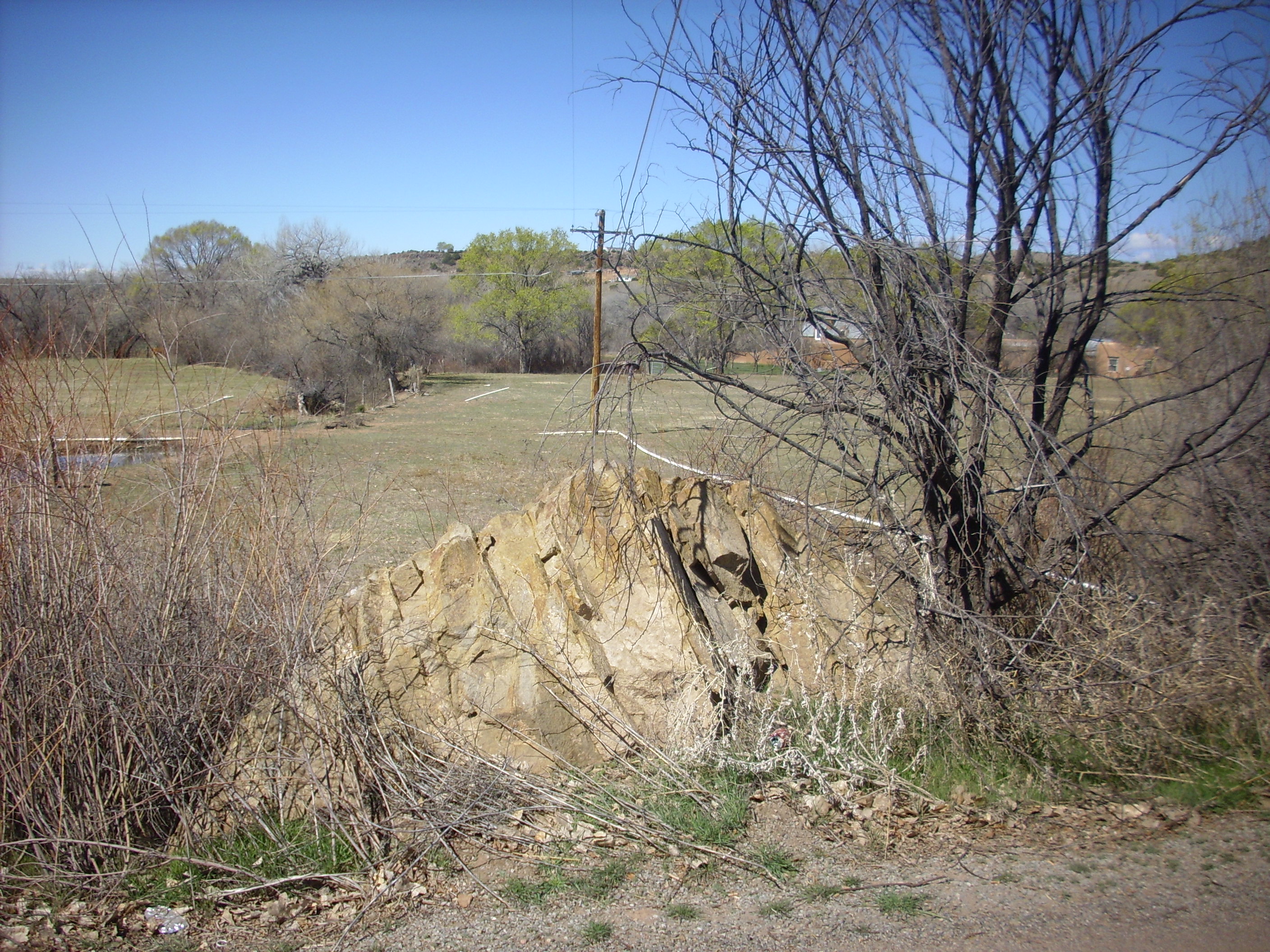
El Rito Formation forms the south rim of Arroyo del Cobre.
El Rito Formation on south rim of Arroyo
del Cobre. 36
14.754N 106 22.123W
In this area, the El Rito Formation rests unconformably on Jurassic beds.
This photograph nicely contrasts a conformable contact with an
unconformable contact. At left, Todilto Formation limestone beds
lie atop massive yellow beds of Entrada Formation standstone. The
two formations are bedded at the same angle. At top center and
right, red beds of the El Rito Formation lie atop the same massive
beds of Entrada Formation, but the beds lie at a different angle
with respect to each other. The contact at right represents an
erosional surface across which around 130 million years of
geologic history are missing.
There are also some good exposures north of the village of Canones.
El Rito Formation. Looking north
from 36
11.271N 106 26.738W
A particularly accessible exposure is found in a road cut along
the old road into Canones.
El Rito Formation. 36
11.463N 106 26.989W
Towards the top, the El Rito Formation gives way to the
light-colored Ritito Conglomerate, which we'll describe shortly.
Here's a sample of the El Rito Formation from this location.
El Rito Formation. 36
11.463N 106 26.989W
This sample is a medium sandstone of well-rounded but
poorly-sorted quartz grains with some feldspar and a few lithics
and a fair amount of reddish cement in the pore spaces. Note the
distinctive muscovite flakes, generally aligned with the bedding
planes of the sandstone. Mica is not usually abundant in
sandstones and so serves as a distinguishing feature of the El
Rito Formation. Its presence hints at an origin in the mica-rich
pegmatites of the Tusas.
The El Rito Formation is not typically well exposed in the Jemez proper, but along Forest Road 100 in the north Jemez, the El Rito Formation is hinted at by reddish discoloration in road cuts just below outcrops of the younger Ritito Conglomerate. One can sometimes find clasts of El Rito sandstone resembling those from the Canones Area.

El Rito Formation. 36
08.616N 106 31.070W
Similar poor exposures continue west and south as far as upper Coyote
Canyon. These exposures are significant because they are
located northwest of the Canones fault zone, and suggest that this
had not yet been reactivated by El Rito time.
Another pair of formations in the Jemez area from about this same
time are the Diamond Tail and Galisteo Formations. These crop out
in only a few locations between the northern Sandia
Mountains and the southern Sangre
de Cristo Mountains, because they are mostly buried under
younger sediments. However, there is an outcropping of Galisteo
Formation along I-25 where the highway descends from the Cerros
del Rio, at La Bajada. The outcropping shows up clearly on Google
Maps as a red patch around the highway and to the northeast.

The resemblance of the red beds of the Galisteo Formation to the Abo Formation is not accidental. Like the Abo, the Galisteo formed in an arid fluvial environment, where rivers descending from the Pajarito Uplift and Sierra Nacimiento meandered south across a level valley. Similar environments produce similar rocks.
Galisteo Formation is prominent at Garden of the Gods.
Here the beds have been tilted nearly vertical by the nearby intrusion of the Cerrillos Hills. We'll have more to say about the Cerrillos Hills shortly.
The most complete section of the Galisteo Formation is found in the Hagen Basin, located south and east of I-25 and north of the Sandia Mountains. The Hagen Basin is a large block of crust bounded by the La Bajada Fault to the east, the Budaghers Fault to the north, the San Francisco Fault to the west, and to the south by the South Montezuma Thrust Fault and zone of severe deformation to its east along the northern edge of the Sandia Mountains. This block of crust was uplifted to the west, tilting its beds, and erosion subsequently exposed a splendid sequence of formations dating from the Jurassic in the west to the Santa Fe Group to the east, with the particularly resistant beds of Espinaso Ridge forming a hogback. The Galisteo Formation is exposed just west of Espinaso Ridge.
Galisteo Formation underlies everything out to the middle ground.
We see that it is a sequence of white, gray, and brick red
sandstone and siltstone beds.
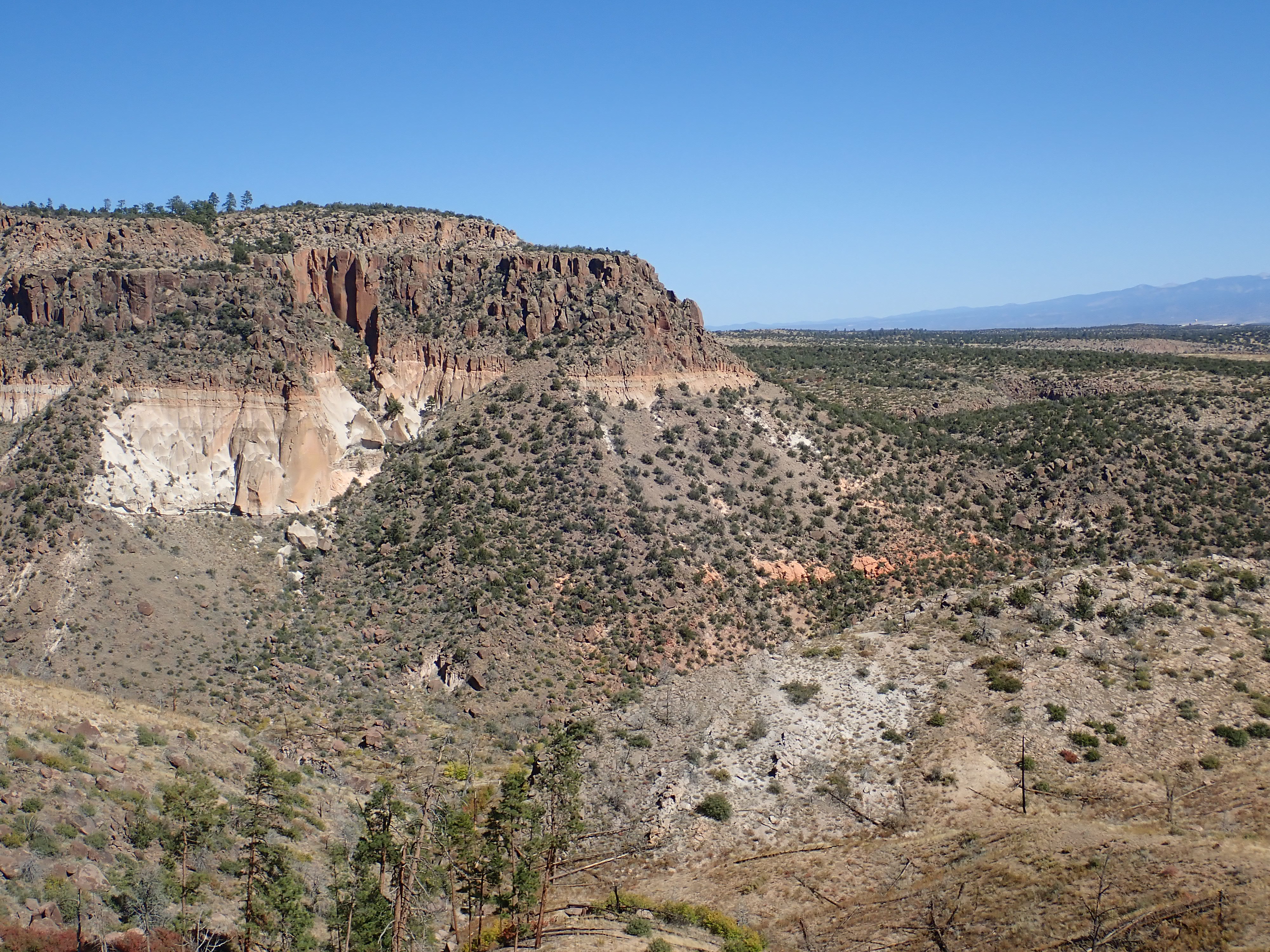
The formation also crops out on the east slopes of the San Miguel Mountains in the southeast Jemez, where it has been exposed by deep faulting along the Pajarito Fault Zone.
Galisteo Formation east of St. Peter's Dome. Looking
west from 35
45.441N 106 22.135W
The block west of the fault zone has been tilted to the west. The
tilting is discernible even in the relatively young volcanic beds
atop St. Peter's Dome, but is greatest for the oldest beds, which
show a dip of around 27 degrees. The increase in dip with age
shows that the block has been slowly tilting over the last 40
million years. This tilted block forms a striking island of old
rock among the much younger rocks of the Rio Grande Rift and Jemez
volcanic field.
Galisteo Formation east of St. Peter's Dome. 35.748755N
106.3475267W
The beds here vary from deep red to yellowish-white in color, with the lower beds being the deeper red.
Galisteo Formation east of St. Peter's Dome. 35.749173N
106.3479167W
The red beds are a fairly fine-grained sandstone, though not well
sorted and with abundant matrix and feldspar grains. This is
typical of an immature sandstone.
Galisteo Formation red sandstone. 35.7485094N
106.3420798W
The higher beds include some coarser conglomerate beds.
Galisteo Formation conglomerate east of St. Peter's
Dome. 35.749173N
106.3479167W
The clasts are well-rounded pebbles, mostly Precambrian quartzite but with some volcanic rock, in a white, very well-cemented, matrix. There is sufficient matrix that the pebbles barely touch, putting this on the boundary between a matrix-supported and a clast-supported conglomerate. Coarse sediments like these are more common in these northernmost Galisteo Formation beds than than in the exposures further south. This supports the conclusion that the sediments came from highlands to the north, with the coarser sediments found closer to the source rock and the finer sediments found further away.
This bed is so thoroughly cemented that it resembles a lithic
tuff, of which we'll learn more in the next few chapters. However,
the rounded form and character of the clasts show that it is a
conglomerate, though the abundant cement may have come from
overlying volcanic ash beds.
The northernmost exposures of Galisteo Formation include outcrops
in Capulin Canyon.
Galisteo Formation in Capulin Canyon. Looking northeast
from 35.754263N
106.3360017W
The outcrops are the reddish beds at the base of the mesa. Here the main strand of the Pajarito Fault Zone throws down the area to the east, with the Galisteo beds marking the limit of pre-rift rock on the west side of the rift.
The Galisteo Formation was originally defined to include older
beds that are extensively exposed south of the villages of Cerrillos
and Galisteo
and northeast of the ghost town of Hagen.
Geologists later recognized that there was a significant
discontinuity separating the two sets of beds, and the lower beds
were split off into their own formation, the Diamond Tail
Formation. This formation is exposed mostly at the southern limits
of the Jemez region.
Diamond Tail Formation south of Los Cerrillos. 35
24.865N 106 08.435W
As with the Permian Cutler Group and Abo Formations, the question
arises whether the El Rito Formation and the Galisteo Formation
are really distinct formations. They appear to be the same age and
are similar in their characteristics. It is likely that they were
deposited on opposite ends of a river valley running south between
the Brazos-Sangre de Cristo geanticline and the Sierra Nacimiento
whose middle section is now buried under the volcanic rocks of the
Jemez. They also appear to correlate with the San Jose Formation
west of the Sierra Nacimiento.
The Galisteo and Diamond Tail Formations contains numerous petrified logs in the Cerrillos area, mostly conifers, oak, and beech. Fossil pollen includes palm pollen, suggesting a subtropical forest giving way to a mixed pine-oak forest at higher elevations. The elevation of the Cerrillos area was probably around 550 m (1800') with a climate that was frost-free throughout the year. Cerrillos presently has an elevation near 1800 m (6000'), which is an indication of how much regional uplift has taken place in the last 50 million years.
The timing and cause of this uplift remain somewhat
controversial. There are reasonably good time constraints for the
integration of the modern Colorado River, suggesting it took its
present form between 6.0 and 4.4 million years ago. This suggests
relatively recent uplift. The cause is also imprecisely
known, though it seems likely it is related in some way to the
approach of North America to the East Pacific Rise. One hypothesis
is that the long history of subsidence of the Colorado Plateau was
the result of slow conversion of garnet granulite in the
underlying mantle to denser eclogite, and the recent uplift is the
result of rapid conversion of eclogite back to lighter garnet
granulite. There is some evidence supporting this hypothesis from
xenoliths erupted across the Colorado Plateau, which change
from eclogite to granulite around 25 million years ago.
The sediments of the Diamond Tail Formation appear to have come mostly from the northeast, where the Brazos-Sangre de Cristo geanticline provided a rich source of sediments. The Sierra Nacimiento became an additional source of sediments in Galisteo time, supporting the conclusion that the Sierra Nacimiento was not uplifted until the Eocene. There appears to be no contribution from the south, in the area of the present-day Sandia Mountains, suggesting that these were not uplifted until after the Eocene.
Fossils are not abundant in the Galisteo and Diamond Tail Formation. Curiously, the lowest beds contain Paleozoic brachiopods and Cretaceous shark teeth, eroded from underlying formations and redeposited as reworked fossils. You can imagine how these might have thrown off initial dating of the beds! However, two locations in these formations have some beds containing bone fragments, mostly mammals. A site in the Diamond Tail Formation in the Cerrillos Hills produces fossils belonging to the Wasatchean Stage, which extended from about 55.4 to 50.3 million years ago. These include freshwater fish scales, fragments of turtle shells and vertebra, tapir teeth, Coryphodon teeth, a Hyopsodus jaw, and Hyracotherium teeth. Coryphodon was one of the earliest really large grazing mammals, roughly the size of a horse; Hyposodus was a primitive mammal resembling a shrew but more closely related to modern horses; and Hyracotherium was a dog-sized ancestor of both horses and rhinoceroses.
The other fossil site is in the Galisteo Formation at Arroyo del Tuerto, and contains numerous fossil remains of titanotheres, very large mammals related to horses and rhinos. These date to the Duchesnean Stage, about 42 to 38 million years ago. The Stearns quarry where the mammal fossils were found is a protected area, but nearby are impressive exposures of petrified wood.
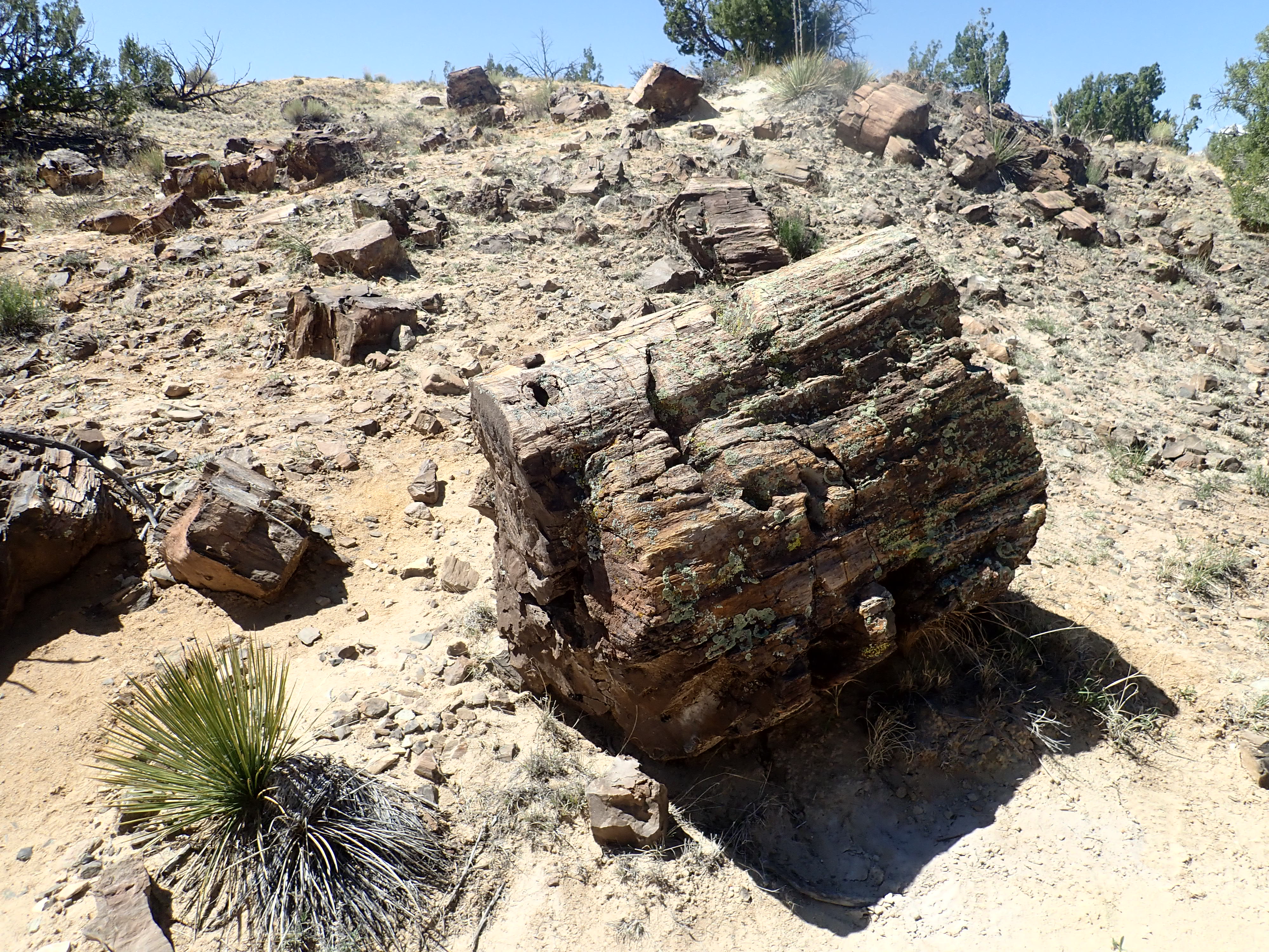
Petrified wood in uppermost Galisteo Formation beds.
35.3812714N
106.3181237W
Towards the end of the Eocene, volcanic activity picked up in
what is now the San Juan Mountains of Colorado. Ash and basalt
flows from the San Juan field reached into northern New Mexico,
though not as far as the Jemez region. This activity would peak in
the Oligocene with the formation of at least 15 calderas, and the
activity would not remain confined to southern Colorado.
34 million years ago, northern New Mexico was rocked by a series
of volcanic eruptions along a belt extending south from the
Pajarito Uplift. Magma from the upper mantle had forced its way to
near the surface, doming up the overlying sedimentary beds almost
like blisters in the Earth's skin. In some places the magma broke
through, forming volcanoes that deposited debris in a broad apron
around the volcanic belt and choked the river valleys that had
formerly run south through the area. This marked the beginning of
the Oligocene Epoch in New Mexico.
The Oligocene Epoch lasted from 34 to 23 million years ago. It
was a period of severe global cooling, caused by the rifting of
Australia and South America away from Antarctica. This created the
Southern Ocean and established the Antarctic Circumpolar Current,
which isolated Antarctica from warmer ocean water to the north and
turned the continent into an icebox. The earth has not returned to
pre-Oligocene temperatures, leading some geologists to regard the
Oligocene as the start of a Cenezoic Ice Age of which the
Quaternary Ice Age (which we'll discuss later on) is only the
latest episode. The drop in sea level accompanying the global
cooling sharply increased continental weathering rates, with the 87Sr/86Sr
of marine carbonates beginning a steep rise that continued almost
to the present day.
The Oligocene was a period of volcanic upheaval in much of New
Mexico. There were some truly spectacular eruptions in the area west
of Socorro, along the southeast margin of the Colorado
Plateau. These are distant enough from the Jemez that they will
not come into our story further. Oligocene volcanism also included
the Ortiz
Mountains southeast of the Jemez. The Ortiz Mountains are
part of the Ortiz Porphyritic Belt, a chain of volcanoes extending
from South
Mountain north to La
Cienega. The bulk of the eruption was of monzonite and
latite, which are intrusive and extrusive rocks formed from
alkaline magma that is moderately rich in silica. This particular
composition yields a rock composed mostly of plagioclase and
alkaline feldspar, with traces of iron minerals and small amounts
of quartz.
It is not clear how much of the eruption actually reached the surface. The igneous rocks in this area are primarily intrusive monzonite, coarsely crystallized and interbedded with older sedimentary rocks. Most of the extrusive latite has long since eroded away. However, there are beds of volcanic debris and ash atop the Galisteo Formation along Espinaso Ridge and west of Galisteo, named (logically enough) the Espinaso Formation. These are though to have come from the pulse of volcanism that produced the Ortiz Mountains.
It seems likely that the Ortiz Porphyritic Belt was a substantial
volcanic field at its peak, comparable in size with the Jemez
volcanic field we see today. It formed just as the Rio Grande Rift
began to open, but its connection with the rift is unclear.
However, the earliest stages of Ortiz volcanism, when laccoliths
formed, was probably still a time of compression. Laccoliths are
bodies of magma that pushed up the overlying rocks but did not
quite break through to the surface, so that the magma cooled
underground into visibly crystalline rock. Regional compression of
the crust favors formation of laccoliths. The later stages, when
dikes became more common, marks the transition to extension. The
volcanic belt has since been deeply eroded, exposing the plumbing
below the volcanoes.
As the eruptions died down, the crystallizing monzonite sweated
fluids rich in incompatible elements, which are
chemical elements that do not easily fit into the crystal
structure of the common silicate minerals that form from magma.
Gold and tungsten are incompatible elements, and both were mined
in the Ortiz Mountains, with the last gold mine closing in 1986.
Hayden visited the Ortiz Mine during his 1867 expedition and
noted that both the Ortiz Mountains (which he knew as the Placiere
Mountains) and the Cerrillos Hills to their north were composed of
masses of intrusive rock and associated dikes. He naturally (but
incorrectly) assumed that the dikes were the source of the nearby
Cerros del Rio basalt and noted that one dike extended for a great
distance east of the Cerillos Hills. This is El Crestón, which
forms a striking landmark in the otherwise flat country
surrounding the town of Galisteo.
Relief map of the Jemez with Ortiz Belt and Cienegujilla
basanite outcroppings highlighted in red and green
respectively.
Southwest of Santa Fe, near where Cienega Creek joins the Santa Fe River, lies the village of La Cienega. In the language of the Spanish Southwest, a cienega is a wetlands in an otherwise arid region, characterized by permanent saturation of the soil by alkaline water. During the early Spanish period, the cienega southwest of Santa Fe supplied water to nearby El Rancho de las Golondrinas, "Ranch of the Swallows", which is preserved today as a living museum. El Rancho del las Golondrinas was the final paraje, rest stop, on the Camino Real, the Royal Road, joining Mexico City to Santa Fe. Here travelers could replenish supplies and rest for the night. The relatively abundant water and fertile soil made La Cienega the breadbasket of old Santa Fe.
La Cienega has escaped most of the gentrification that has
affected many historic villages in the Santa Fe area. Its
population remains small at about 3000 persons, and 70% of these
identify as Hispanic. The village is set in a shallow valley
surrounded by red exposures of Galisteo Formation, overlain in
places by young sediments of the Ancha Formation that we'll
examine later in the book.
Of immediate interest is the terrain north of La Cienega, which
is low hills underlain with Ortiz monzonite and Espinaso
brecciated latite. Ortiz monzonite is exposed south of the gravel
road to Cañon.
Though fine grained, this rock is visibly crystalline under the loupe. In a few spots, the rock is quite coarsely crystalline and its makeup is clear.
The rock is a mixture of translucent dark microcline, with obvious cleavage faces that are resistant to scratching by a metal probe (which rules out the remote chance that it is calcite), and opaque white plagioclase. Dark grains of augite with a few flakes of biotite are also present. The mixture of microcline and plagioclase without noticeable quartz is by definition a monzonite.
There is some variability in the Ortiz monzonite even in the La
Cienega area, suggesting it was emplaced as multiple intrusions.
Here's a sample from a few hundred yards south.
Ortiz monzonite. 35
34.591N 106 07.893W
This sample is slightly lavender on fresh surfaces under sunlight, with a beautiful pattern of interlocking crystals. Again, these appear to be two different varieties of feldspar. There are also some large rusty grains that are probably weathered augite.
Still further south are rounded outcrops of yet another variety
of monzonite.
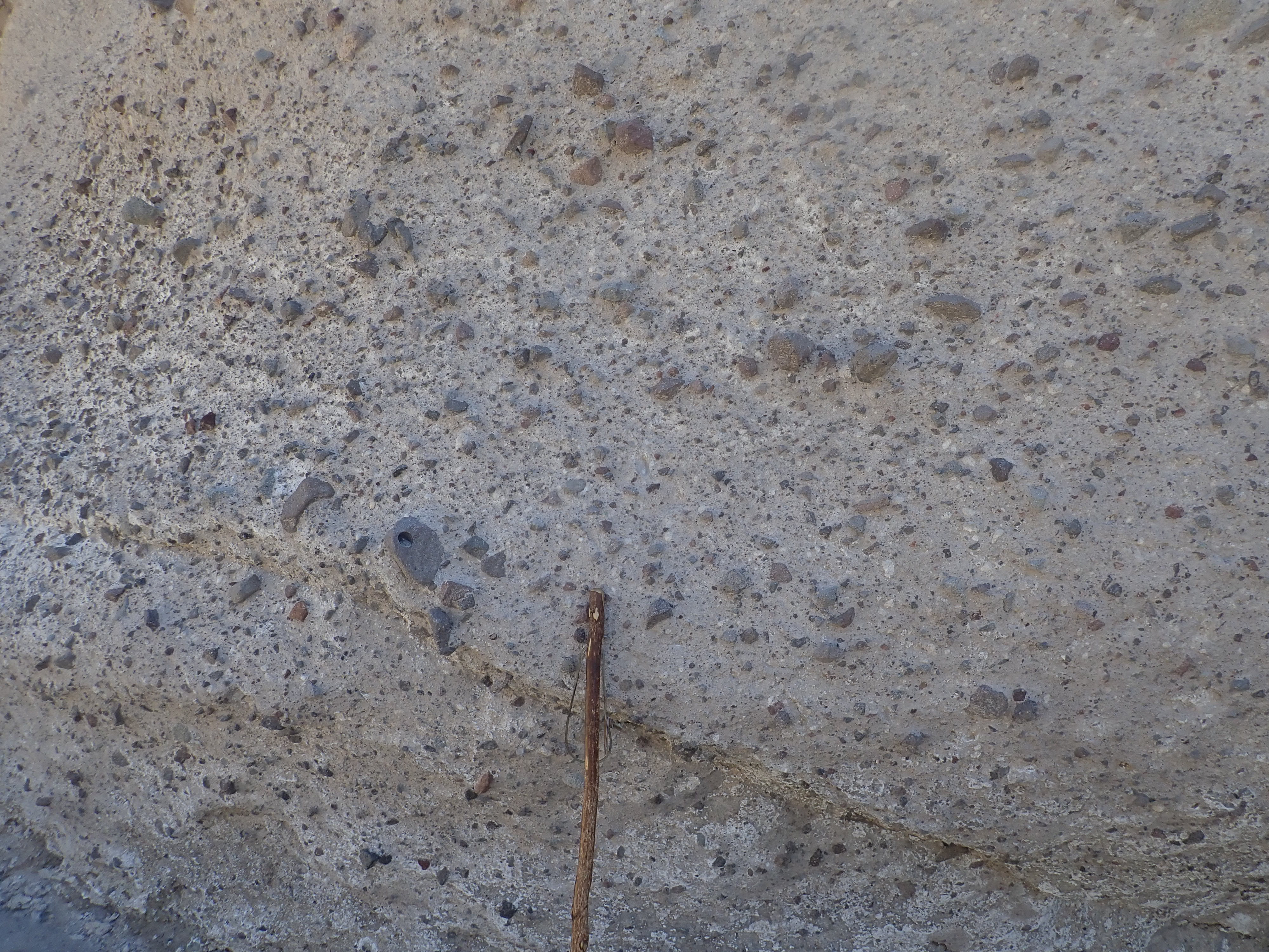
I've placed my walking stick for scale on the photograph below.
The stuff weathers a bit like granite, unsurprising considering that it's mostly feldspar and it's mostly feldspar that makes granite weather the way granite weathers. Here’s a sample.
This rock is much lighter in color and gives the impression of being porous, almost like a sandstone. However, under the loupe, one sees that it consists almost entirely of small feldspar grains with numerous small flecks of biotite and hornblende. No quartz is visible.
The unusual character of this rock may indicate that it has been
weathered or hydrothermally altered. The rock comes from a ridge
that looks suspiciously like a dike or fault trace, and an actual
dike crops out along the road to Canon that is roughly aligned
with this ridge.
This outcropping is located in the middle of La Cienega, is not mapped, but could be either Ortiz monzonite or Espinaso Formation.
Ortiz Monzonite? 35.562N
106.126W
Under the geologist’s loupe, one sees smaller gray crystals, probably alkali feldspar, with larger white crystals, probably plagioclase, and lots of oxidized iron that was probably once hornblende or another iron-rich mineral. The presence of both alkali and plagioclase feldspar is characteristic of monzonite, and the absence of visible quartz keeps this from being classified as a quartz monzonite.
The Ortiz porphyry belt continue south through the Cerrillos
Hills and the Ortiz Mountains.
Like most of the Ortiz Porphyry Belt, the Cerrillos Hills are a cluster of laccoliths. The highest point is Cerro Bonanza, also known as Santa Rosa Mountain, 7088′ tall. It is underlain by augite biotite monzonite, so called because it contains some biotite and lesser amounts of augite.
It's a popular belief that you can rid your body of toxins by
making yourself sweat. This turns out not to be the case, unless
you mean the modest quantities of urea and salt found in human
sweat. But bodies of magma cooling underground really do “sweat”
certain trace elements, dissolved in hydrothermal fluids, which
penetrate the surrounding rock to deposit valuable metal ores. The
second phase of Ortiz volcanism, when the crust had transitioned
from compression to extension and numerous dikes formed, was also
the phase of greatest mineralization. The dikes formed natural
pathways for circulation of hydrothermal fluids.
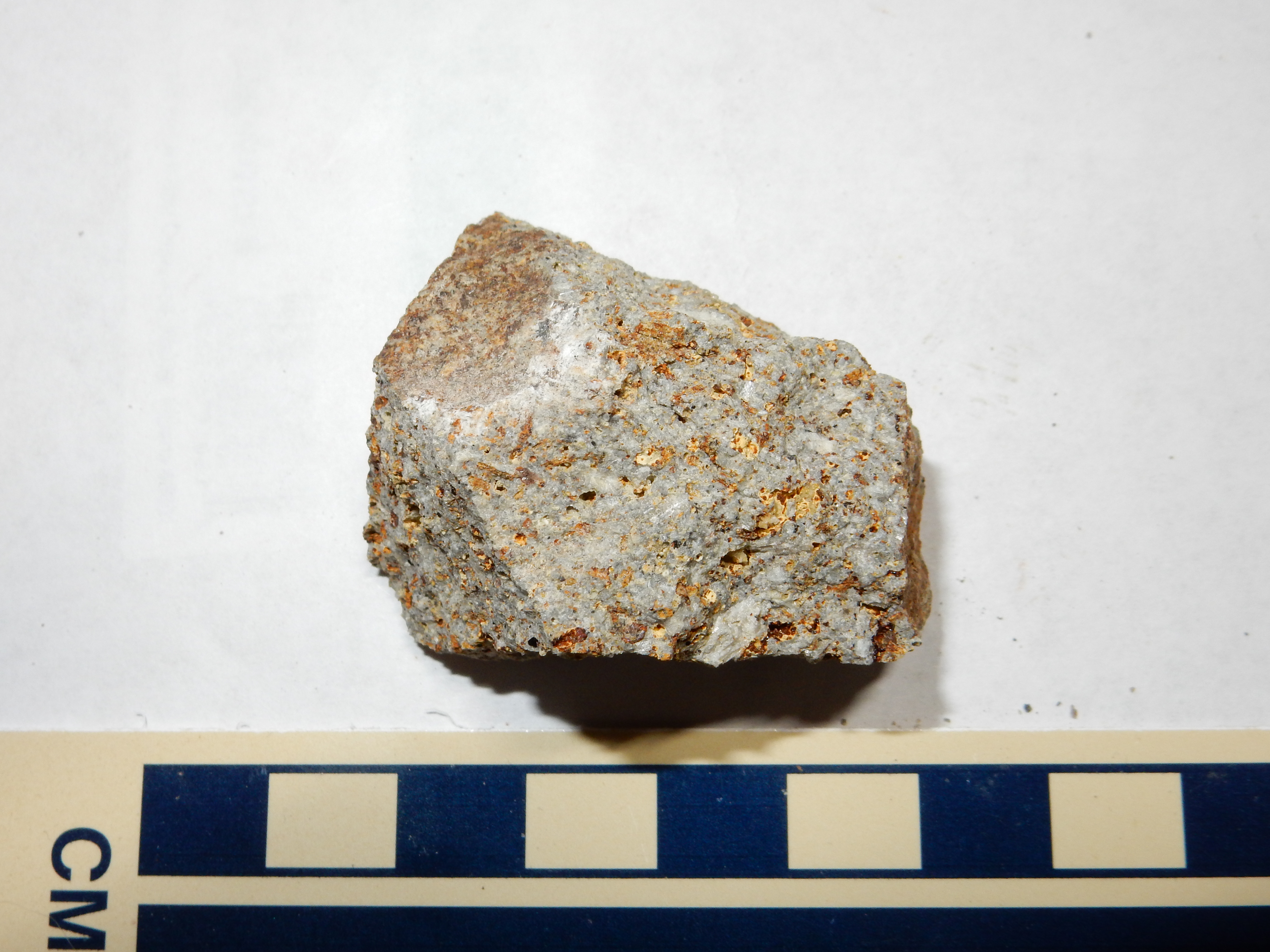
The Ortiz porphyry belt has numerous old mines and mining claims, and gold was being mined here as recently as the 1980s. But the mineral that has been mined the longest in the Cerrillos Hills is turquoise.
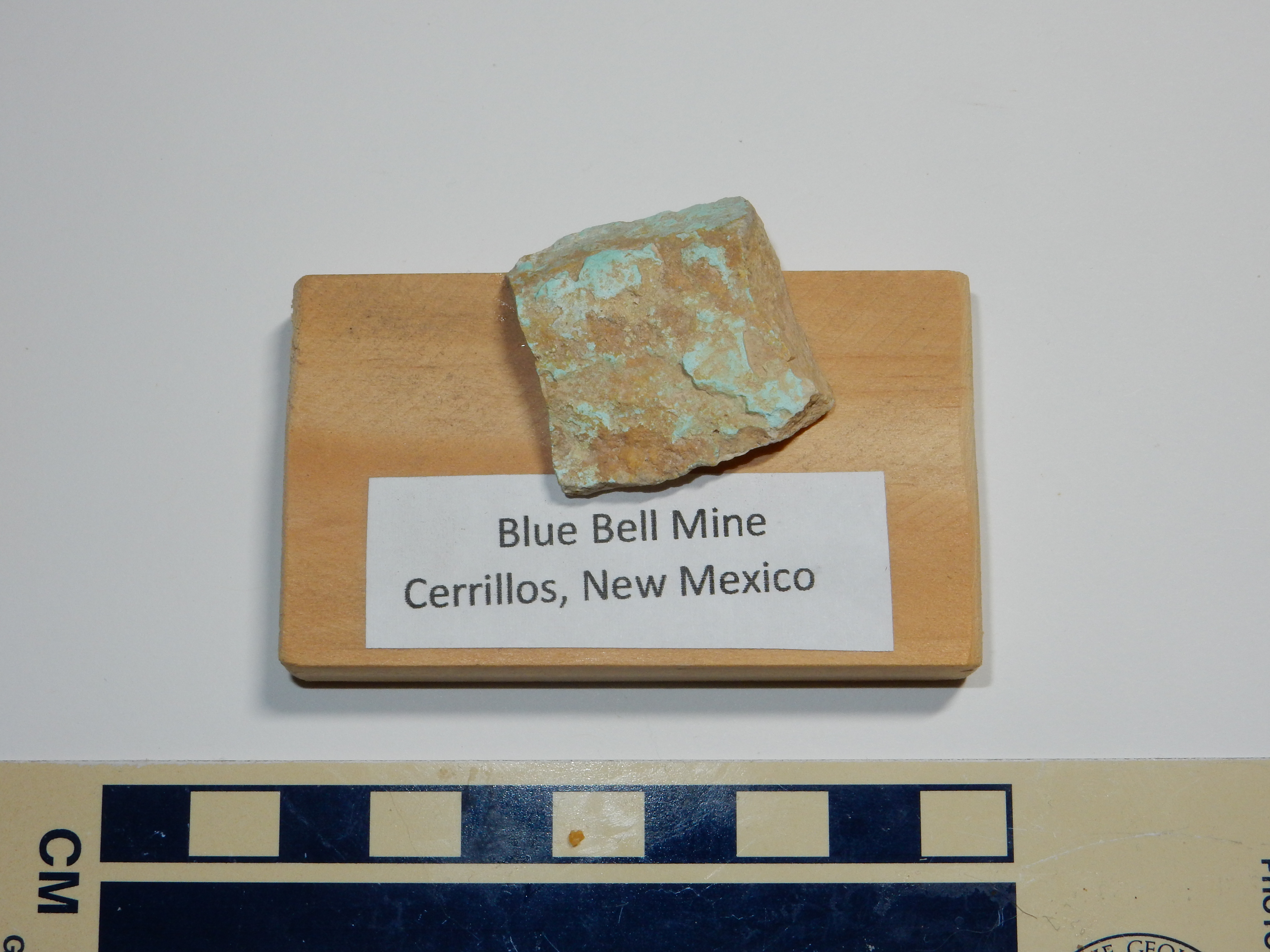
Turquoise from Blue Bell Mine. Near
35
28.219N 106 6.751W
Turquoise is a form of
hydrated copper aluminum phosphate, CuAl6(PO4)4(OH)8·4H2O,
and it is the gemstone most closely associated with native
American jewelry of the Southwest. It is not found in the original
hydrothermal ore deposits of the Cerrillos Hills, but is a
secondary or supergene mineral formed by weathering of the
underlying ore veins. Meteoric water (rainwater or melted
snow) carrying dissolved oxygen infiltrates the ore veins, where
it oxidizes the copper sulfides to more soluble copper sulfates.
The acidic, metal-bearing water then reacts with aluminum- and
phosphorus-bearing minerals (such as feldspars and apatite) to
deposit turquoise in veins and joints in the overlying rock.
Turquoise has been mined in the Cerrillos Hills since at least 700 A.D., the date of an archaeological site near Mexico City where turquoise has been found that has the chemical fingerprint of Cerrillos Hills turquoise. Mount Chalchihuitl in the Cerrillos Hills was the largest open pit mine of any kind in North American when the Spanish arrived in 1535. The native Americans may have mined the deposit by building large bonfires over the ore beds, then dousing the fires with cold water to fracture the rock by heat stress. The rest was done with stone tools. The Spanish subsequently mined small quantities of silver, but the big boom was between 1879 and and 1885 or so.
The boom was fueled mostly by speculators, with just enough mineral resources in the claims to keep the speculation going. Many investors bought rights to claims with less thought of profiting from the actual mineral extraction than from reselling the rights to someone else at a profit. This was not at the level of the famous tulip mania in Holland, but the same speculative mindset was involved.
The boom, and its collapse, were influenced by the laws for
staking and developing mining claims. The laws governing such
claims were derived from the economic theories of the Scottish
Enlightenment, which strongly influenced the American founders.
Under these theories, a person rightfully established ownership of
previously unclaimed land by mixing his labor with the land. This
could be done by clearing and tilling it for agriculture or
excavating it for valuable mineral resources. This philosophy was
reflected in the Homestead Act, which allowed settlers to take
possession of public land they successfully cultivated for long
enough, and in mining claim law. In most American jurisdictions,
you could file a claim at the nearest county seat asserting that
there were valuable mineral ores on a section of public land. You
then marked your claim with "monuments", such as actual wooden or
metal stakes, inscribed with the number of your claim. You then
had exclusive rights to develop the claim and mine the ores. For
the claim to remain valid, you had to do a minimum amount of
development within a prescribed time frame. Eventually, if you
developed the claim sufficiently, you could purchase title to the
land from the government at a bargain price per acre. This was
known as patenting the claim.
Mine claims were governed by state and local law previous to the
Mining Law of 1872, which formally legalized mine claims on
federal land. The law was enacted by Congress under the
encouragement of the western states and against the objections of
some Easterners who regarded miners as squatters stealing national
resources. The Mining Law of 1872 was amended in 1920 to remove
oil, gas, and coal from the claim process, and again in 1947 to
allow sand, stone, gravel, and pumice to be mined without a claim.
Subsequent amendments have added remediation requirements, but the
basic provisions of the law remained in effect until 1 October
1994, when Congress ended the filing of new claims through the
expedient of refusing appropriations to process the paperwork.
The claim boom in the Cerrillos Hills was fueled in part by relatively lax development requirements. You had a full year to dig just ten feet of tunnel. When this changed to a more stringent requirement — three months to dig ten feet of tunnel — the boom collapsed. The speculators weren’t interested in actually digging; they wanted to try to make money by trading the mineral rights.
This does not mean that there were not actually any valuable minerals in the Cerrillos Hills. In addition to turquoise, the Spanish mined considerable silver and lead, and iron and manganese were also produced in significant quantities. Manganese is still used in steel manufacture today. It is a powerful deoxidizer and desulfuring agent and is almost indispensable for making high-quality steel from low-grade ore
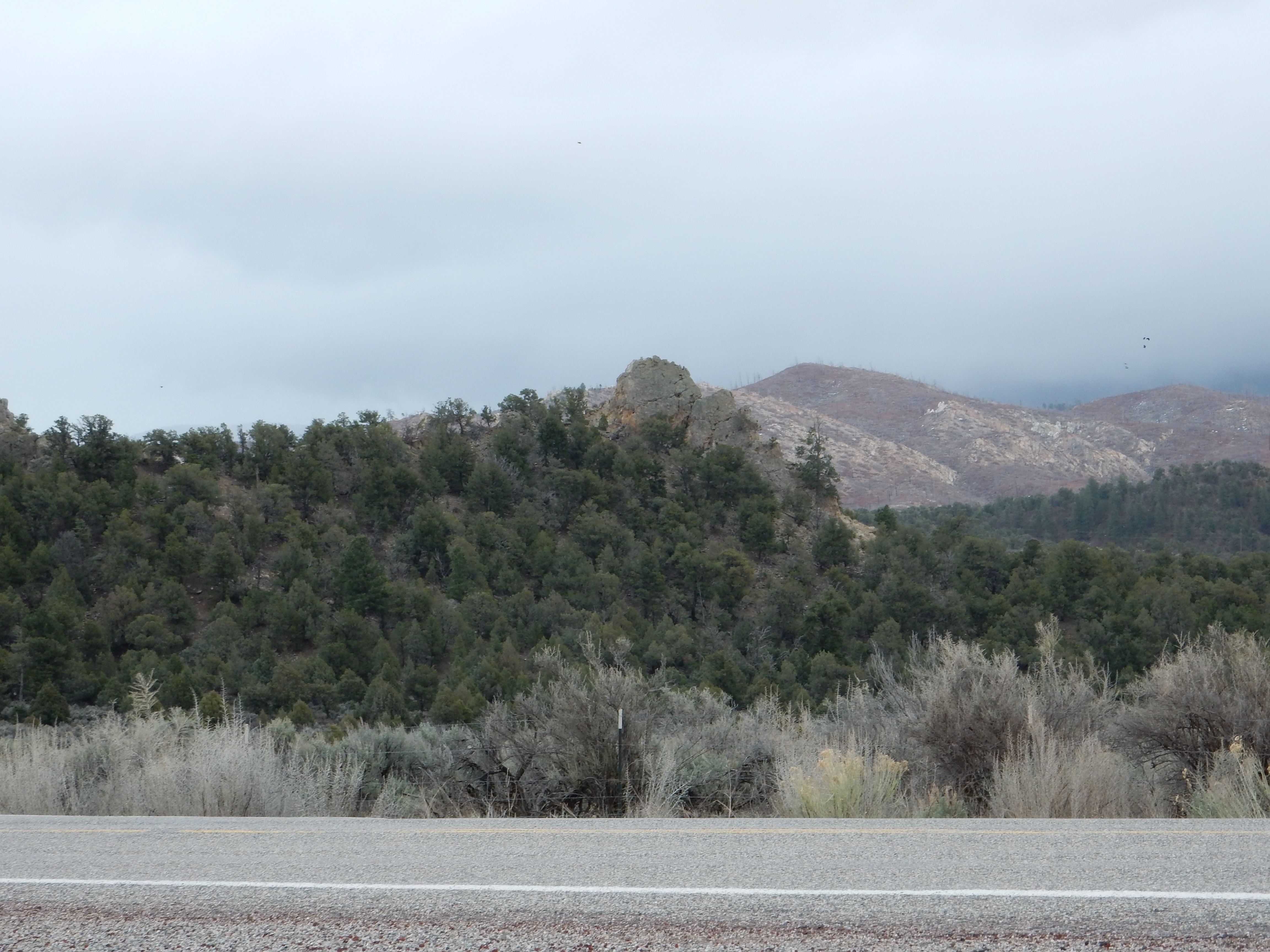
Picture Rock, also known as Lone Bluff, is a particularly picturesque isolated laccolith of the Cerrillos Hills.
The monzonite is readily accessible next to the road as it passes Picture Rock.
Notice the resemblance to the outcrop of monzonite at La Cienega. Another local landmark is The Devil's Throne, just northeast of Los Cerrillos.
The geologic map for this area duly notes that one team of investigators classified the rock making up the Devil's Throne as hornblende quartz latite porphry and another as hornblende monzonite porphyry. The difference is subtle: Quartz latite is fine-grained rock with slightly more quartz than coarse-grained monzonite. A good petrological laboratory could settle the issue, but then it’s entirely possible the composition varies slightly from location to location. The geologic map chooses to map most of the rock underlying the Cerrillos Hills simply as porphyritic andesite. Here's a sample from further west, along the Jane Calvin Sanchez Trail at Cerrillos Hills State Park.

The porphyritic andesite of the Cerrillos Hills is itself intruded by dikes that must have formed shortly after the main body of andesite cooled. These radiate away from the hills for great distances in all directions, Many are composed of a distinctive trachytic latite porphyry -- a rock moderate in silica and rich in potassium that contains large feldspar phenocrysts. One such dike is located along the Jane Calvin Sanchez Trail.
A dike composed of similar rock extends well west of the Cerrillos Hills.
The rock here is reddish rather than gray in color, but such color differences are often among the least useful for distinguishing rocks.
Not all the dikes radiating from the Ortiz porphyry belts are
porphyritic. Some are composed of what appears to be a uniform
fine-grained basalt. One example is the El Creston dike, which
forms the core of an impressive ridge extending for miles east of
the Cerrillos Hills.
This suggests two systems of dikes from two eruptive pulses in the Cerrillos Hills. A third system of basalt dikes located west of the Cerrillos Hills running in a north-south direction are likely younger dikes associated with the opening of the Rio Grande RIft.
A similar dike west of the Cerrillos Hills shows hornfelsization.
The dike is the dark gray rock with redish patina on the right. The whitish zone immediately to the left of the dike is hornfels, produced by the heat of the magma baking the Niobrara Member shale into which it intruded. Close to the dike, the shale layers have more or less fused together, while further out, the hornfels gradually transitions into unaltered shale.
The Ortiz Mountains are another cluster of laccoliths of the Ortiz monzonite.

The Ortiz Mountains are gold mining country. Early mining exploited placer deposits, where gold that erodes out of bedrock accumulates deep in stream beds because of its high density. More recently, the bedrock ores themselves have been exploited.
This photograph shows part of the tailings pile for the Cunningham Hill mine, which was first opened in 1828. The host rock containing the ore is the breccia filling a volcanic pipe through which much of the Espinaso Formation is thought to have been erupted. The content of gold in the ore is quite low, a few grams per ton, but this can still be profitably extracted using cyanide. Though extremely toxic, cyanide is one of the few chemicals that can pull gold into solution, so it is used to leach the gold out of the crushed ore. The gold-bearing solution is then treated with powdered zinc, which replaces the gold in solution. The result is a mixture of remaining zinc powder and metallic gold, from which the zinc can be removed by treatment with sulfuric acid.
The Cunningham Hill mine was most recently operated by Consolidated Gold Fields, which began open pit mining in 1973. Some 7 metric tons of gold (250,000 ounces), with a value of about $300 million at March 2017 prices, was extracted before the mine was closed again in 1986. Subsequent attempts to reopen the mine have foundered over environmental regulations and the fluctuating price of gold.
The northwest Ortiz Mountains include the Cerro Chato laccolith, where magma intruded into the relatively ductile beds of the Menefee Formation. The resulting rock has the same mixture of plagioclase and alkali feldspar as other Ortiz Monzonite outcrops, but with abundant hornblende needles.
It is striking that rock of such similar silica and alkali
content and emplaced at about the same time in a similar manner
can show such variety in its gross appearance.
Relief map of the Jemez with Espinaso Formation
outcroppings highlighted in red.
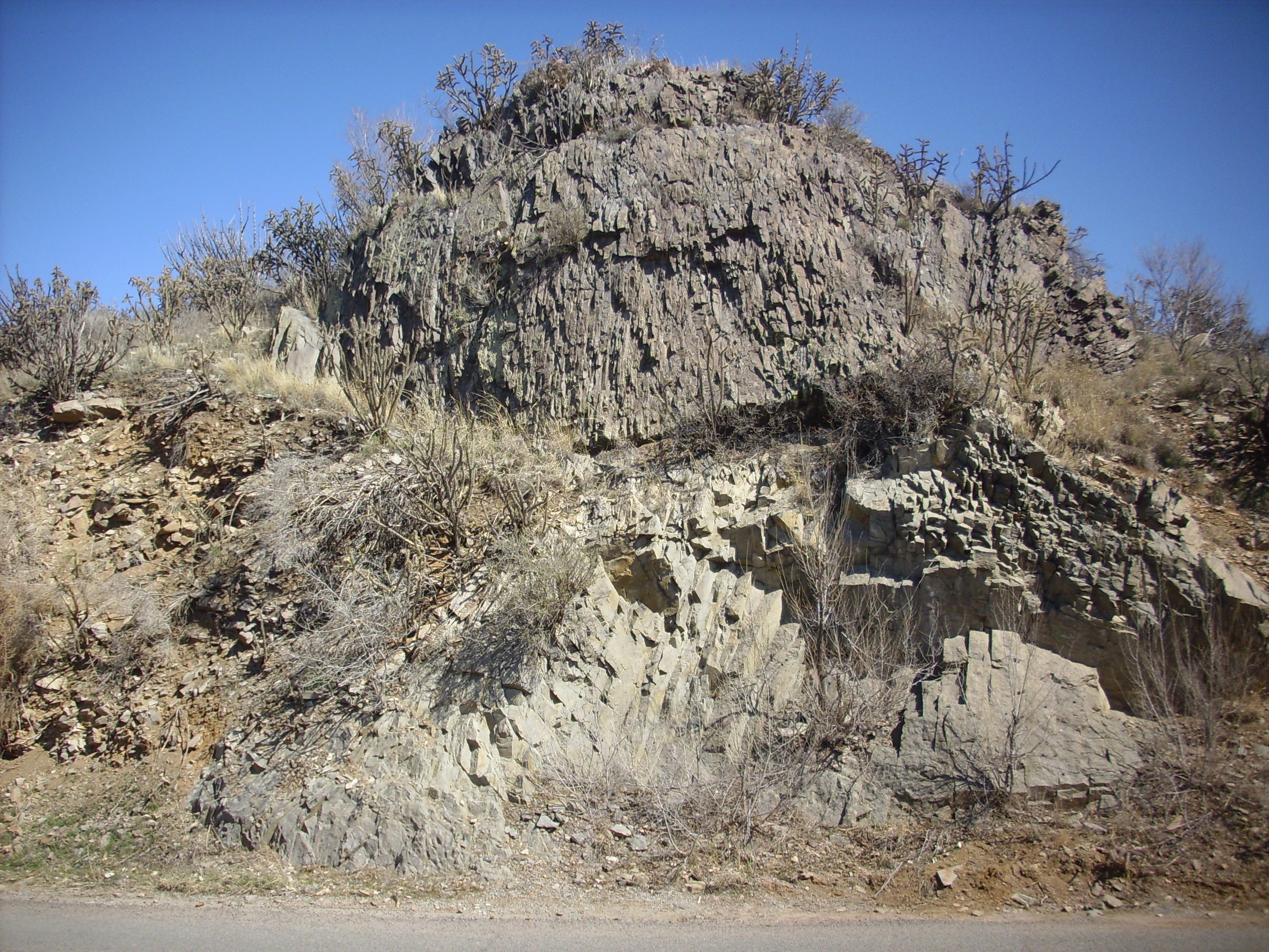
The Espinaso Formation is slightly younger than the Ortiz Monzonite and is thought to be volcaniclastics from the portion of the Ortiz eruptions that made it to the surface. Volcaniclastics are beds of broken rock fragments produced by volcanic activity and subsequent erosion. The type section is at Espinaso Ridge itself.
Espinaso Ridge. Looking west from near
35.3897724N
106.2962957W
Here some 120 m (400') of volcaniclastics are exposed along
Arroyo del Tuerto.
Lower Espinaso Formation in Arroyo del Tuerto.
35.3821764N
106.3141617W
Much of the Espinaso Formation consists of beds made up mostly of
large clasts rather than clay and silt. These are classified as debris
flows. Debris flows form when loose shattered rock, of which
there was an abundance in the Ortiz volcanic field, is lubricated
by rainfall and begins moving downhill under the force of gravity.
The beds in the previous photograph are dominated by clasts up to
a few inches across. As we will see shortly, It is not
unusual for a debris flow to contain very large clasts.
It may be difficult to imagine how such a unit could once have flowed like a fluid, but debris flows have been captured on videotape:
Video of debris flow in Clear Creek Country, Colorado.
The destructive power of a debris flow is not hard to imagine.
There are some tuff beds interbedded with the debris flows of the
Espinaso Formation.
Tuff beds in Espinaso Formation in Arroyo del Tuerto.
35.3816194N
106.3103107W
Tuff beds are formed of consolidated ash. There are appear to be two beds, with the lower bed rich in fragments of solid rock.
Lithic tuff in Espinaso Formation in Arroyo del Tuerto. 35.3816194N
106.3103107W
The mixture of dark fragments of volcanic rock and light volcanic ash is completely unsorted. This is very unlikely to happen in any sedimentary process. This was likely a pyroclastic flow, of which we'll learn much more later in the book.
Here is a thin tuff bed over a very coarse debris flow.
Espinaso Formation in Arroyo del Tuerto.
35.38184N
106.3089167W
Unfortunately, while Espinaso Ridge is located mainly on public lands, the road access is poor. More accessible exposures are found at La Cienega and along Galisteo Creek. This outcropping of Espinaso Formation breccia conglomerate is located north of La Cienega. It is formed mostly of broken fragments of andesite.
Espinaso breccia. 35.570N 106.127W
A dike runs through the center of La Cienega that has been dated at about 20 million years in age. This is mapped as part of the Espinaso Formation.
Espinaso dike. 35.564N 106.127W
The dike is composed of a very pretty hornblende trachyandesite. Trachyandesite is a rock formed from lava with an intermediate silica content, similar to andesite, but with an unusually high content of sodium and potassium. This trachyandesite contains numerous phenocrysts of hornblende.
Hornblende trachyandesite.. 35.564N
106.127W
The long needlelike hornblende crystals are obvious. The clump of crystals at the left end of the sample is either a clot (the crystals forming around some nucleus as the lava cooled underground before being erupted) or a xenolith.
Closer examination of the outcrop itself shows numerous xenoliths.
Xenoliths get geologists’ attention because they sample the rocks deep below the surface, including the lower crust and upper mantle. This dike has apparently gotten a lot of geologists’ attention, because there are drill holes all over it, presumably where geologists have taken samples of the xenoliths.
The Espinaso Formation is strikingly exposed northeast of Los Cerrillos.
The outcrop consists of numerous angular fragments of coarsely
crystalline rock in a fine-grained matrix. This is almost
certainly an example of a debris flow that has been preserved as
conglomerate. The original flow was a mass of rock and mud that
flowed off the slopes of the nearby volcanoes to produce the beds
here. These were later cemented into hard rock.
Not all the Espinazo Formation is well cemented. In the Cañon area, there are beds of coarse conglomerate resembling river gravel that look deceptively young.
The matrix between the clasts easily crumbles to the touch. However, two clues indicate these beds are much older than they appear. The first is that the clasts are entirely Ortiz Monzonite; there are no clasts from the younger Cieneguilla Basanite even though this formation is abundantly exposed just up the slope and as fresh fall on the road bed below. The second is the presence of a dike intruding the beds that cannot be geologically young.
The dike consists of a dark rock thoroughly infiltrated with
light veins. The rock could be an altered basanite, making this a
source dike for the Cieneguilla Basanite, or it could be an
unusual rock type such as a carbonatite. Laboratory tests will be
be required to be sure. The veins are not calcite; they do not
bubble in acid. They may be some form of zeolite. Regardless, this
dike cannot be much younger than the Cienegilla Basanite (25
million years) and so proves the beds here are in the age range of
the Espinaso Formation.
Further up the hillside, the Espinazo Formation is capped with what looks like a thin, crystal-rich tuff.
The bed is only a few feet thick. Above it are flows of the
Cieneguilla Basanite, which I'll discuss shortly. It is
possible that this is actually a soil surface that was fused by
the heat of the Cieneguilla Basanite lava, which was likely an
unusually hot lava.
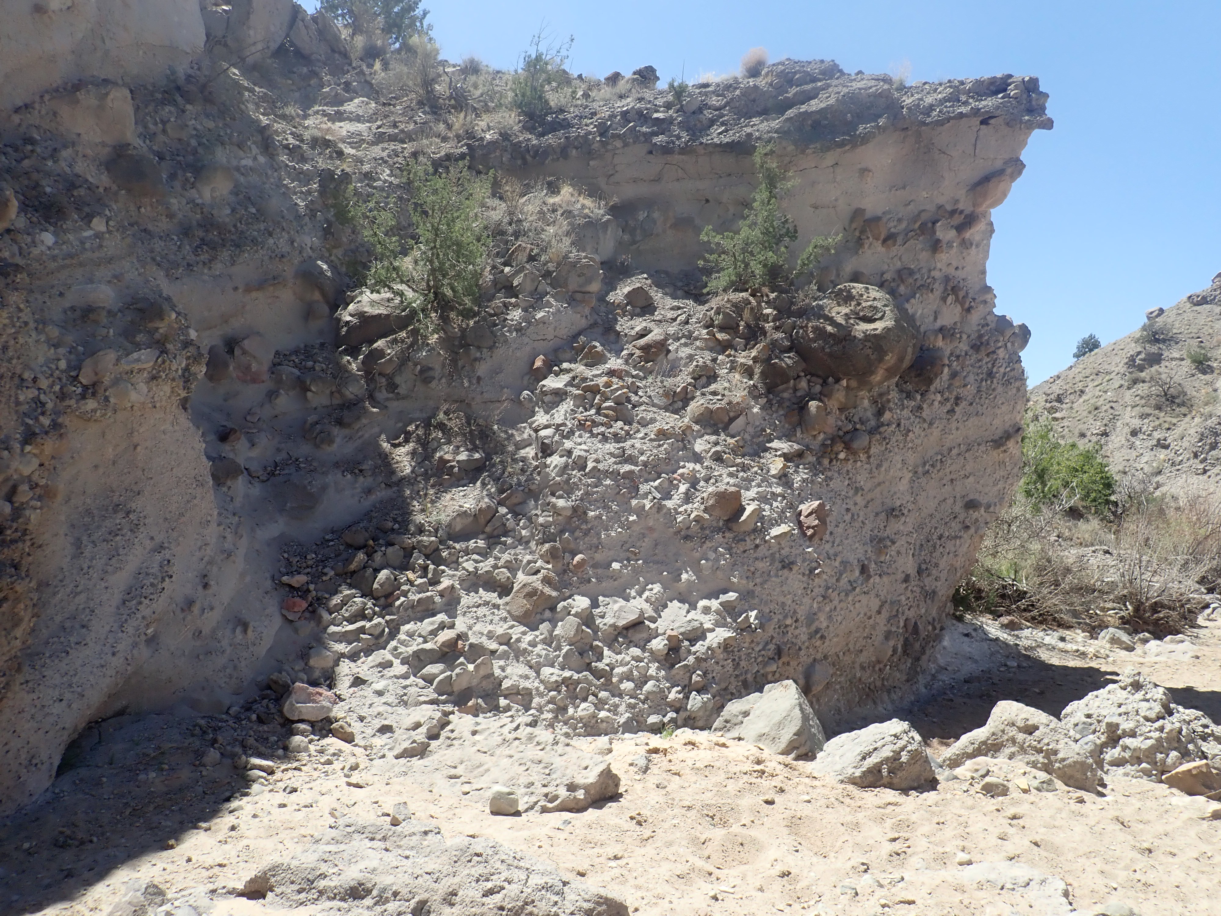
There are few exposures of sedimentary rocks of Oligocene age in New Mexico, and fewer fossils, but the end of the epoch marked an important milestone in the geologic history of the Jemez.
... the Rio Grande appears to follow a great fault zone along the foot of ranges which from Socorro northward face the east, while southward from that point they face the west. The relations of the larger structural valleys are too complex ... to permit an adequate description. The average width of this great structural trough is nearly 20 miles.
— W. Lindgren, L.C. Graton, and C.H. Gordon, 1910
The depression is a great rift belt... [and the] late Tertiary tectonic pattern is specialized and distinct enough to warrant the application of the term Rio Grande Rift Belt ...
— V.C. Kelley, 1952
In the last section, we saw that the rock beds at Espinaso Ridge
and throughout the Hagan Basin dip to the east. However, when
originally laid down, the beds were nearly level, showing that
Hagen Basin is a block of crust that has been uplifted to the
west. This deformation records the birth of the dominant tectonic
feature of New Mexico, the Rio Grande Rift.
Around 30 million years ago there was a major shift in the tectonics of the western United States. The compression produced by the subducting Farallon Plate along the west coast was replaced by tension and uplift as North American drifted onto the northern East Pacific Rise, a mid-ocean ridge. Precisely what began to take place under the western United States is still debated by geologists, but it seems likely that the remnants of the Farallon Plate began to sink deep into the mantle and hot mantle rock rose to the level of the asthenosphere to take its place. As a result, for the last 30 million years, the western United States has been simultaneously uplifted and pulled apart, producing the Basin and Range Province so distinctive in topographic maps today. And the eastern boundary of that province runs right down the middle of New Mexico.
The Basin and Range Province is characterized by a series of
north-trending ranges separated by valleys. The heart of this
province is in Nevada and western Utah, but portions extend
through Arizona into southwest New Mexico. The Colorado Plateau
seems to be a block of particularly cold, rigid crust that has
held together even as it has been pushed up by the rise of hot
mantle beneath, but it has begun to split off the rest of North
America along the valley of the Rio Grande. This is the Rio Grande
Rift, which extends from near Leadville
in central Colorado down at least as far as the area west of El
Paso, where it blends into the surrounding basin and range
geology. Seismological evidence shows that the crust has thinned
significantly in the Rift, from a thickness of 50 km (30 miles)
east and west of the Rift to 30 km (20 miles) under the Rift.
There is also greater heat flow from deep in the earth through the
Rift than in the surrounding crust.
The direction in which the Rift is pulling apart is not directly
east-west. Instead, the separation is more west-southwest to
east-northeast. This means that there is some left-lateral
movement along the major faults bounding the rift. In the northern
part of the Rift, this is consistent with the Colorado Plateau
rotating slightly clockwise.
This map shows all exposures of rocks of Oligocene age or older
in the Jemez region.
Relief map of the Jemez with pre-Neogene outcroppings
highlighted in red.
These older rocks are useful for tracing the outline of the Rio Grande Rift, since they all formed before rifting began. Although the young volcanic rocks of the Jemez Mountains obscure part of the western margin of the Rift, one can see that this margin runs almost directly under the Jemez. The isolated exposure of Gallisteo Formation in the San Miguel Mountains, to the right of the center of the map, is an anomaly that suggests the western margin of the Rift is not sharply defined at the latitude of the southern Jemez. This is an accommodation zone in which the Rift shifts abruptly to the east as one moves north from the Albuquerque Basin to the Espanola Basin.
Espanola Basin. Looking north from 35
51.251N 106 08.896W
The Espanola Basin began to form late in the Oligocene as a broad, shallow basin, typical of ductile extension. The crust in north central New Mexico had been heated by the burst of volcanism in the early Oligocene, and it deformed relatively smoothly as it came under tension. At this time, the western boundary of the basin was located along the Sierrita Fault, just east of the southern Sierra Nacimiento. Similar basins had formed along the entire length of the Rio Grande Rift by 26 million years ago.
South of the accomodation zone, the displacement shifts west into the Santo Domingo Basin, sometimes regarded as a northern extension of the Albuquerque Basin.

Santo Domingo Basin. Looking north from 35
18.883N 106 27.122W
North of the Jemez area, the displacement shifts east into the
San Luis Basin.
About 25 million years ago, silica-poor magma from the upper
mantle reached the surface near La
Cienega as a series of low-volume eruptions. This ultramafic
magma was also rich in alkali metal oxides. Such alkaline
magmas are thought to form from relatively undepleted
mantle that has produced little magma in the past and so has
retained most of its original alkali metal content. When
undepleted mantle experiences a low degree of partial melting, so
that only the most alkali-rich fraction of the mantle rock
contributes to the magma, the magma is greatly enriched in alkali
oxides.
Low-silica alkaline magma forms an uncommon kind of igneous rock
called basanite. The excess sodium converts much of the
feldspar that would otherwise have crystallized from the magma to
nepheline, Na3KAl4Si4O16.
Other common minerals in basanite are olivine, magnetite, and a
calcium-rich pyroxene called clinopyroxene.
Cerro Seguro is the most prominent eruptive center for the basanite flows of the Cieneguilla Basanite.
Cerro Seguro. Looking southwest from
35.5733543N
106.1329967W
Here a plug of basanite has intruded the underlying Ortiz
Monzonite. The top of the hill is dark basanite while the lower
slopes are light monzonite. The lower
slopes are covered with numerous small clasts of basanite.
The view from the top
shows many features associated with the Rio Grande Rift.
The panorama begins with a view to the southwest, towards Sandia
Crest. At extreme left are the nearer Ortiz Mountains. Mesa
de Juanita is in the middle distance in front of Sandia
Crest, just north of a bend in Interstate 25. It is underlain by
relatively young Cerros del Rio Basalt with a cluster of small
cinder cones atop the mesa.
The canyon
that dominates much of the panorama, coming down from the north
(right) and turning west to disappear into the horizon, is the
canyon of the Santa Fe River. Northwest of the Santa Fe River
canyon is Tsinat Mesa, also underlain by Cerros del Rio Basalt.
The hills
just beyond the canyon are underlain by Ortiz monzonite, which
rises like islands out of the much younger Cerros del Rio Basalt.
Such islands of older rock completely surrounded by younger lava
flows are described as kipukas, a Hawaiian term adopted by
geologists.
The peak behind and to the right of these hills is Tetilla Peak, New Mexico's etymological counterpart to Grand Teton in Wyoming, and on the far size of the Santa Fe River canyon to the right you see exposures of highly weathered monzonite. North of these are darker hills of Cieneguilla Basanite flanking the canyon. The basanite hill on the west side of the canyon is marked with a white cross just visible in this panorama. This area is accessible via the road to the tiny settlement of Canon.
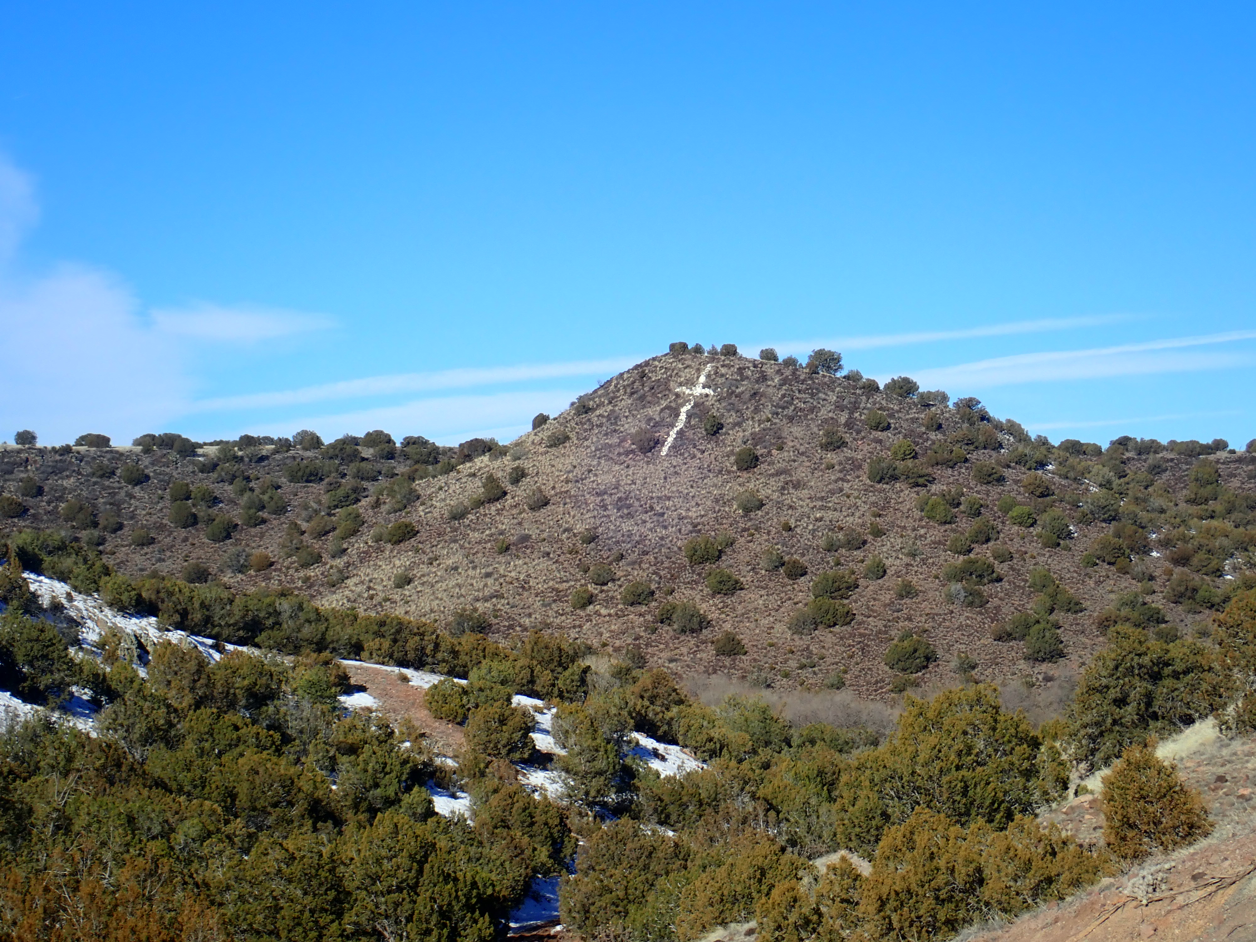
Cieneguilla Basanite knoll opposite Canon.
35.5784063N
106.1351187W
The basanite at the top of Cerro Seguro is described as agglomerated
in a recent geological paper on this area, which confirms we are
near the vent location. Rock with agglomerated texture is formed
when blobs of semimolten lava are thrown out of the vent and pile
up around it.
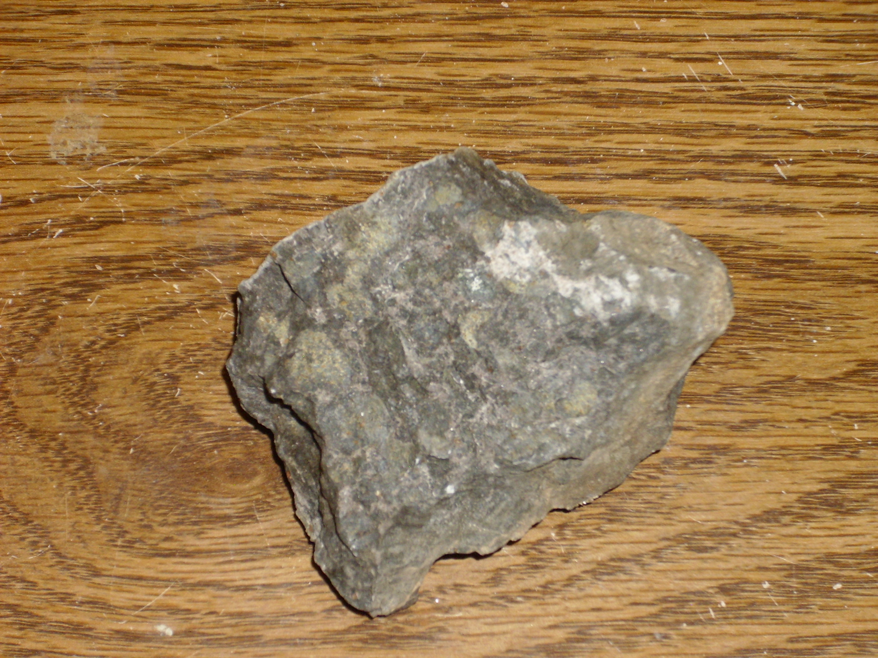
The rock does indeed look like individual blogs of magma tightly welded together. The rock is very black, very dense, and very fine-grained, but even with a loupe I doubt I would have recognized it as different from very dark basalt. It takes laboratory analysis to confirm the presence of nepheline and the low (44%) silica fraction.
Further down the hill, a pile of basanite boulders shown a distinctive red weathering.
The magnetite in the basanite slowly oxidizes to red hematite when exposed to atmospheric oxygen. Basalt sometimes contains magnetite and gets a reddish patina, so this is not necessarily diagnostic for basanite, but there is a difference in degree. A sample from basanite here is more massive than the rock from the top of the cone.
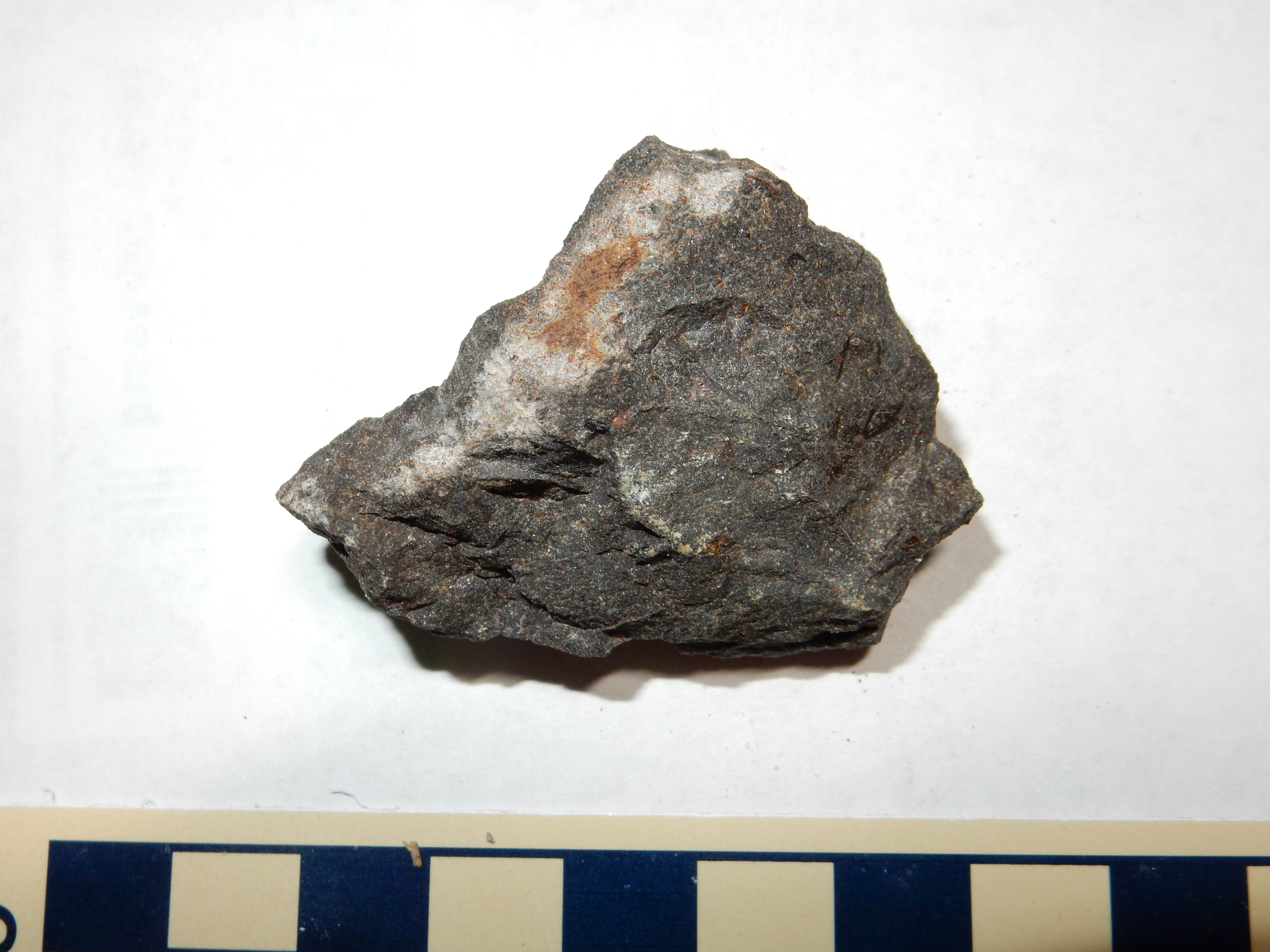
The gravel road to the settlement of Canon also passes readily accessible outcrops of the Cieneguilla Basanite. Here the basanite directly overlies conglomerate beds of the Espinaso Formation. A sample of the basanite from this area shows it to be a very uniform, dark, fine-grained rock.
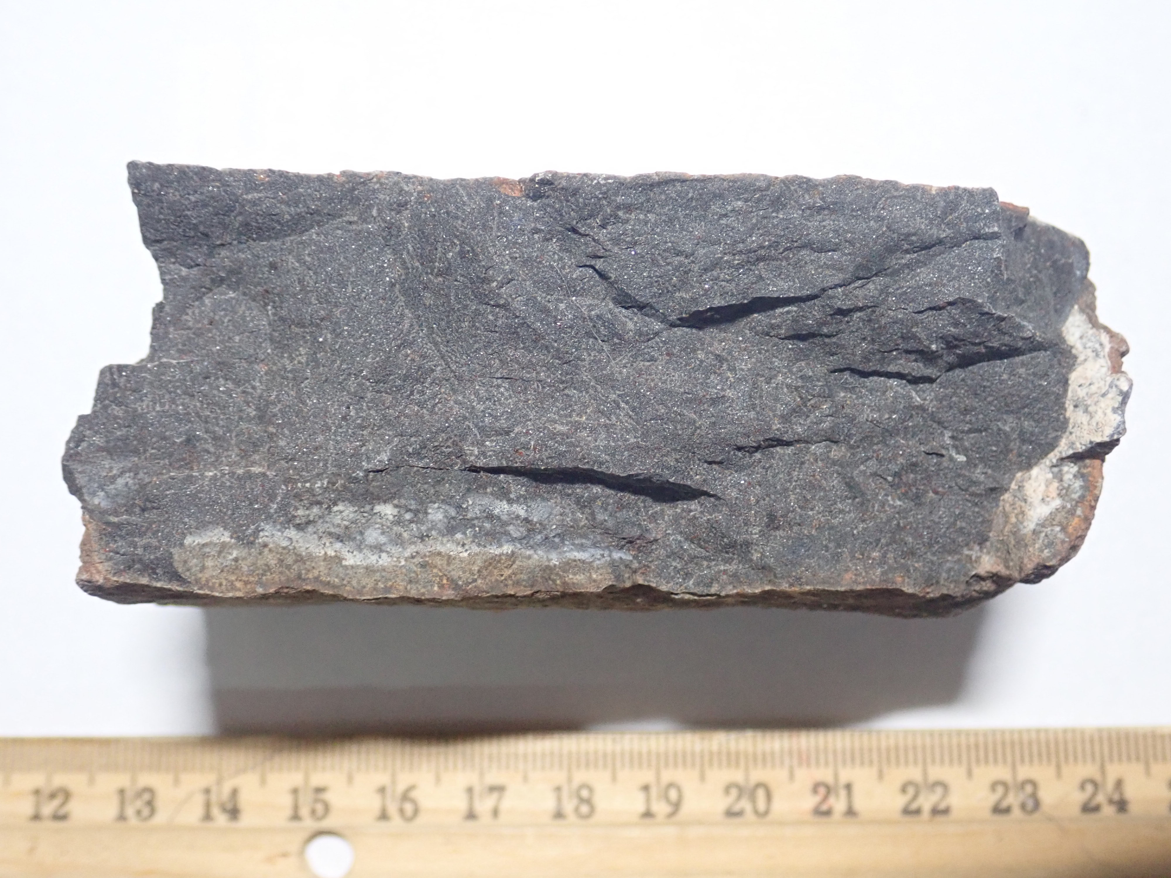
Basanite from Canon. 35.57864N
106.1325372W
Nepheline, Na3KAl4Si4O16,
is an example of a feldspathoid. Like feldspars,
feldspathoids are tektosilicates. Each silica or aluminum
tetrahedron is joined to four neighbors at its corners to form a
three-dimensional network. However, feldspathoids contain less
silica than feldspars, and the framework of silica-alumina
tetrahedra is more open. This makes room for the additional alkali
metal atoms needed to supply the electrons to compensate for the
added aluminum.
Feldspathoids generally crystallize only from magma that is
enriched in alkali oxides relative to its silica content. In
particular, feldspathoid is almost never found in the same rock as
quartz, since any excess silica that might have formed quartz
would have gone into converting feldspathoid into feldspar
instead. Minerals that do not normally coexist with quartz are
described as silica-undersaturated. A rock that contains
such minerals is itself described as silica-undersaturated. A rock
containing neither quartz nor silica-undersaturated minerals is
described as silica-saturated. If the rock contains
quartz, it is described as silica-oversaturated.
Those silica-undersaturated rocks which contain feldspathoids are
described as alkaline, by contrast with the subalkaline
tholeiitic and calc-alkaline suites discussed in the second
chapter of this book. Alkaline magma is a product of a low degree
of partial melting, because minerals bearing potassium and sodium
are some of the first to melt under mantle conditions. Only if
melting proceeds further will the magma become subalkaline.
Alkaline magmas are typical of continental rifts like the Rio
Grande Rift. Here the crust is pulling apart relatively slowly,
less than 2mm per year, versus centimeters per year for the
mid-ocean ridges. In addition, the mantle under the continents is
relatively undisturbed, making it more likely to be undepleted.
The slow melting of undepleted crust can produce highly alkaline
magmas. These are also more likely to penetrate the crust than
subalkaline magmas, since alkaline magmas are more than 0.1 g/cc
less dense than tholeiitic magmas.
The rocks of the Jemez volcanic field straddle the composition
boundary between subalkaline and alkaline rocks. The older rocks
tend to be alkaline, as do flows near the periphery of the field.
Younger rocks near the center of the field tend to be subalkaline,
suggesting than enough magma has been generated here to begin
depleting the underlying mantle.
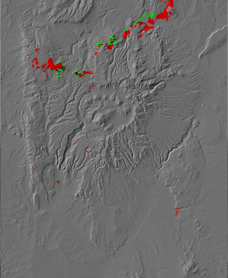
Relief map of the Jemez with Abiquiu and Ritito
Formation outcroppings highlighted in red and green,
respectively.
North of the Jemez Mountains, in the valley of the Rio Chama, lies the village of Abiquiu. This was originally founded as a community of genizaros during the Spanish era, in the mid-18th century. The Spanish word genízaro has the same roots as the English janissary, used to describe slaves (usually Christian boys) under the Ottoman Empire, who gained some measure of freedom and considerable social status by converting to Islam and becoming elite soldiers of the Turkish Army. The genízaros of Spanish New Mexico were native American boys (mostly Navajo) enslaved by the Comanche and sold to the Spanish as household servants or shepherds. They were indoctrinated in Catholicism by their Spanish masters, gained some measure of freedom, and eventually formed communities of their own, in which there was extensive intermarriage among tribes and with the Spanish. At Abiquiu, the genízaro community was awarded its own land grant or merced by the Spanish governor. The Merced del Pueblo de Abiquiu grant, originally awarded around 1750, is still a recognized legal entity today. The Abiquiu merced owns the northern part of Mesa Alta, which I have found is very well maintained, even in comparison with the adjacent National Forest lands. And, yes, they still raise some sheep, though cattle is more common now.
The village later became the eastern terminus of the Old Spanish
Trail, whose western terminus was Los Angeles. The trail was first
successfully traveled in 1829-1830 by Antonio Armijo, whose
caravan took 142 days to make the round trip. Bode's
General Merchandise, founded in 1890 as Grants Mercantile
and purchased by Martin Bode in 1919, is a fixture of the modern
community, which has now become somewhat gentrified. Artist
Georgia O'Keefe settled permanently in the village in 1946 and
produced several paintings of "The White Place", Plaza Blanca
Canyon, which is underlain by dramatic white beds of ash-rich
sediments now assigned to the Abiquiu Formation. This is one of
the most distinctive formations of the northern Jemez.
The La Cienega eruptions were contemporaneous with the formation of the Latir volcanic field north of Taos. This included a giant caldera eruption from the Questa caldera. The first Latir eruptions occurred 30 million years ago as the rift opened, while the Questa eruption occurred five million years later. The Questa caldera has subsequently been uplifted by tectonic activity and deeply eroded, exposing valuable deposits of ores of molybdenum and other metals.
The Latir field produced extensive ash falls, while the Questa caldera produced voluminous pyroclastic flows. The pyroclastic flows formed the Amalia Tuff, which crops out as far to the southwest of Questa as the southern Tusas Mountains.
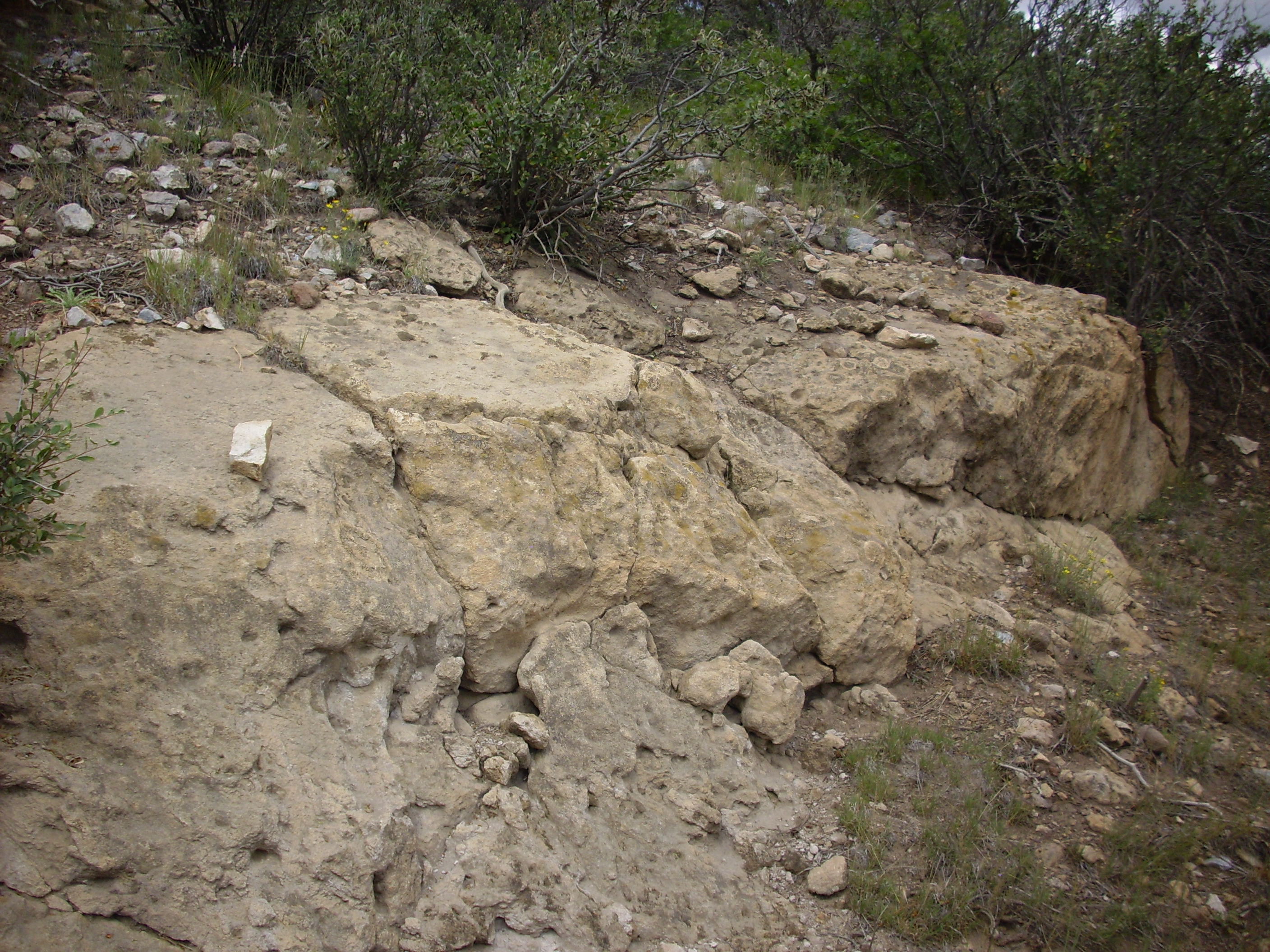
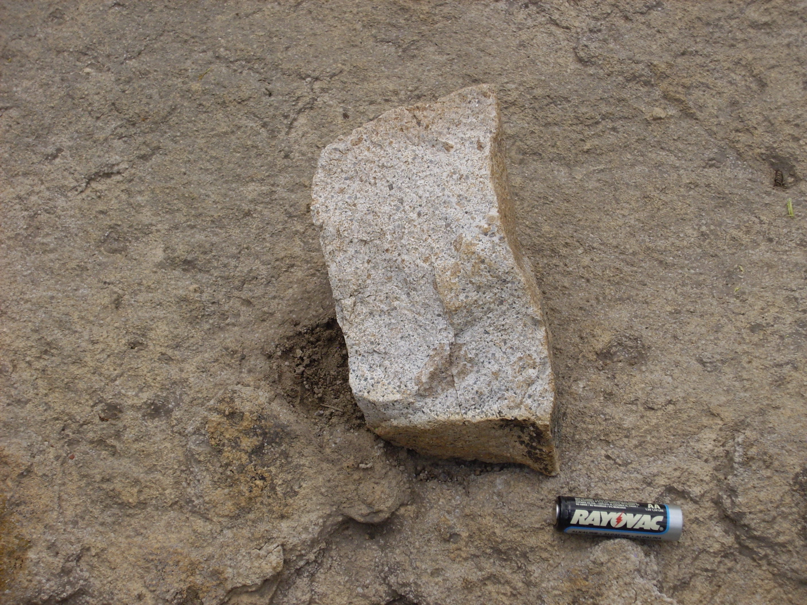
Quite a pretty tuff, full of quartz and sanidine phenocrysts.
Such crystalline tuff is also found in Yellowstone area
and in the San Juan Mountains.
A pyroclastic flow is a kind of avalanche of red hot particles of
rock carried along by hot gases from the volcano. Because the hot
particles are buoyed up by the hot gas, the avalanche can travel
great distances (this outcrop is about 25 miles from the Questa
caldera) and destroy everything in its path. The hot rock then
settles out on the ground. I will have much more to say about
tuffs and pyroclastic flows later in this book.
The ash from the Latir field is an important component of the
Abiquiu Formation, which crops out throughout much of the northern
Jemez. This formation originally included three members: a lower
member of somewhat unremarkable, poorly consolidated light tan
sandstone and conglomerate beds; a thin layer of limestone and
chert (the Pedernal Chert); and the white upper layers, which are
rich with volcanic ash and clasts of Amalia Tuff. This division
and assignment has recently undergone revision. The lower Abiquiu
Tuff turns out to correlate with the Ritito Conglomerate, which
was originally described to the north of Abiquiu, and newer maps
and papers of this area now assign exposures that were formerly
described as lower Abiquiu Tuff to the Ritito Formation. Only the
distinctive white upper beds are now assigned to the Abiquiu
Formation, while the Pedernal Chert remains an informal unit name.
This sort of thing is neither terribly uncommon nor particularly
unhealthy in geology. Formation designations change as further
study improves our understanding.
The white beds of the Abiquiu Formation can be traced far to the west and south, cropping out in the Jemez as far to the southwest as lower Canon de San Diego. For the traveler approach Abiquiu from the south, the first dramatic exposures of the formation are visible on the southwest flank of Sierra Negra.
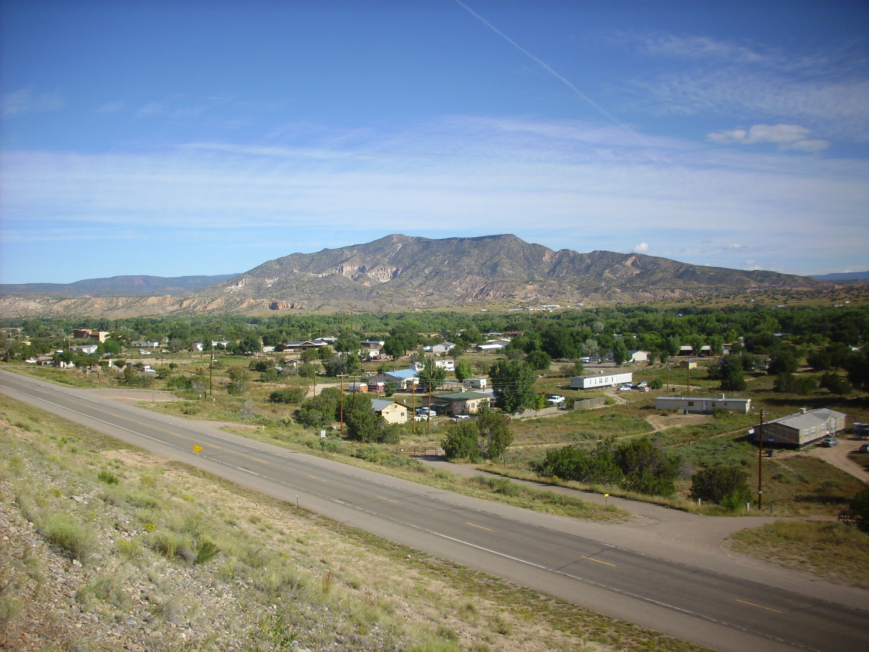
Sierra Negra. Looking north from 36
11.809N 106 14.396W
The white cliffs halfway down the left side of the mountain are
Abiquiu Formation. There is a fault cutting right through the
mountain, at about the location of the right side of the Abiquiu
outcrop. To the east (right) are younger beds of the Santa Fe
Group, and the top of the mountain east of the fault is capped by
a small basalt lava flow that had been dated to about 4.8 million
years old.
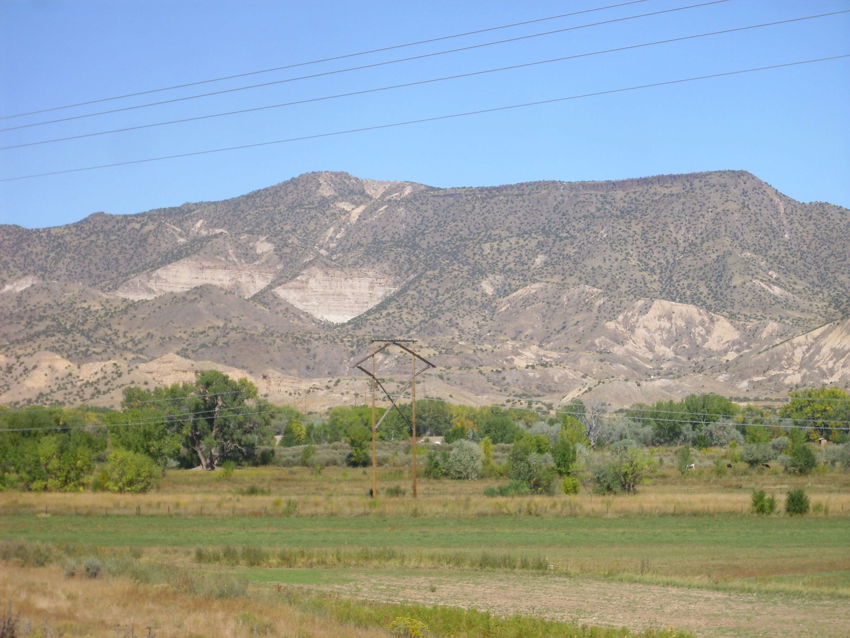
Sierra Negra. Looking north from 36
12.231N 106 14.805W
The fault is part of the western edge of the Rio Grande Rift. It
displaces the basalt flow by just a a few meters, showing that
activity has been limited on this fault in the last four million
years.
The Abiquiu Formation is particularly well exposed in Plaza Blanca Canyon, Georgia O'Keefe's "White Place", north of Abiquiu.
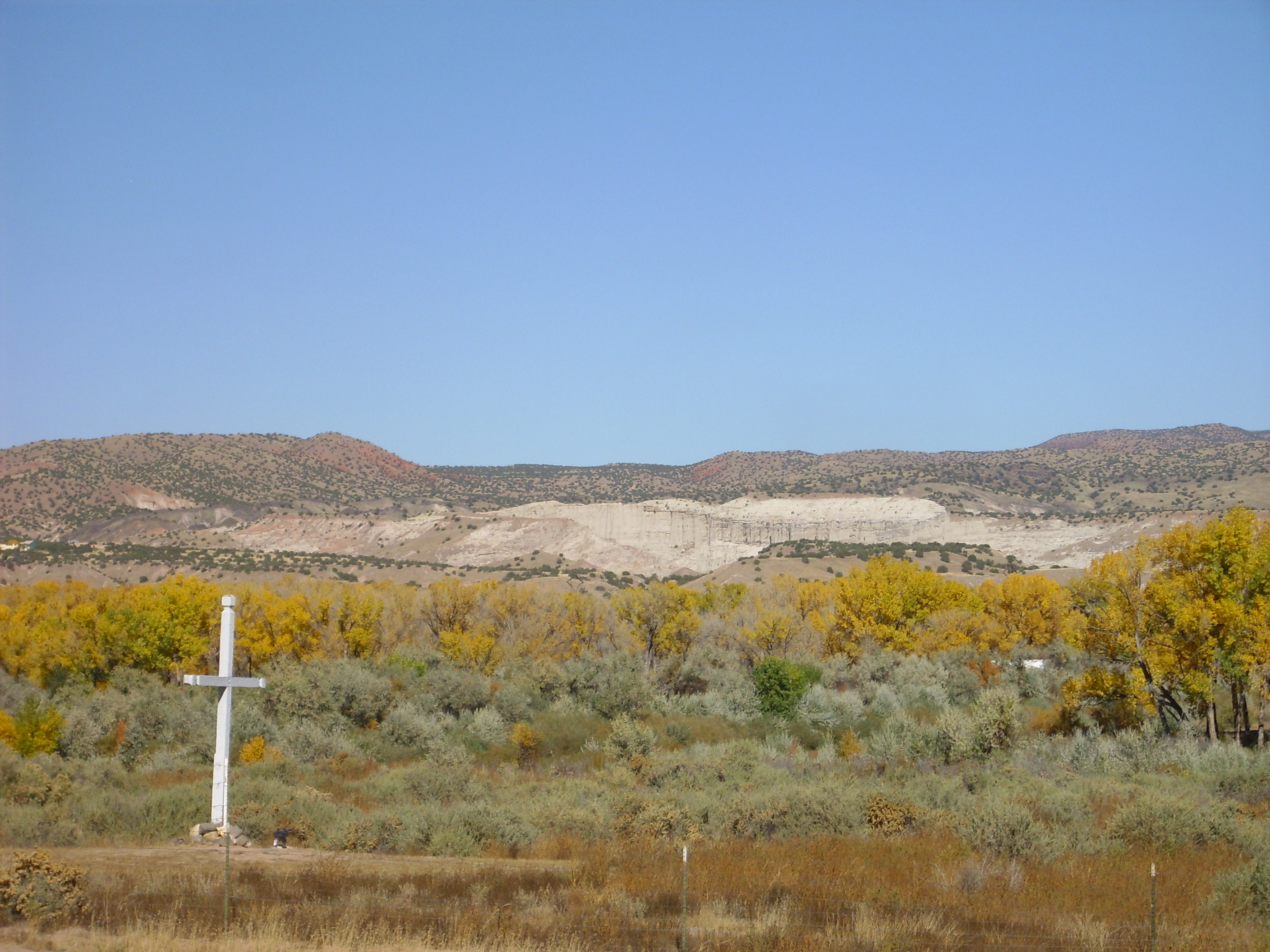
The canyon is presently owned by Dar al Islam Mosque, but is open
to the public.

Abiquiu Formation at Plaza Blanca Canyon. 36
14.048N 106 18.180W
The darker bed in the cliffs in the center of the panorama contains numerous clasts and may mark an ancient stream bed or a debris flow. Here's a closer view.
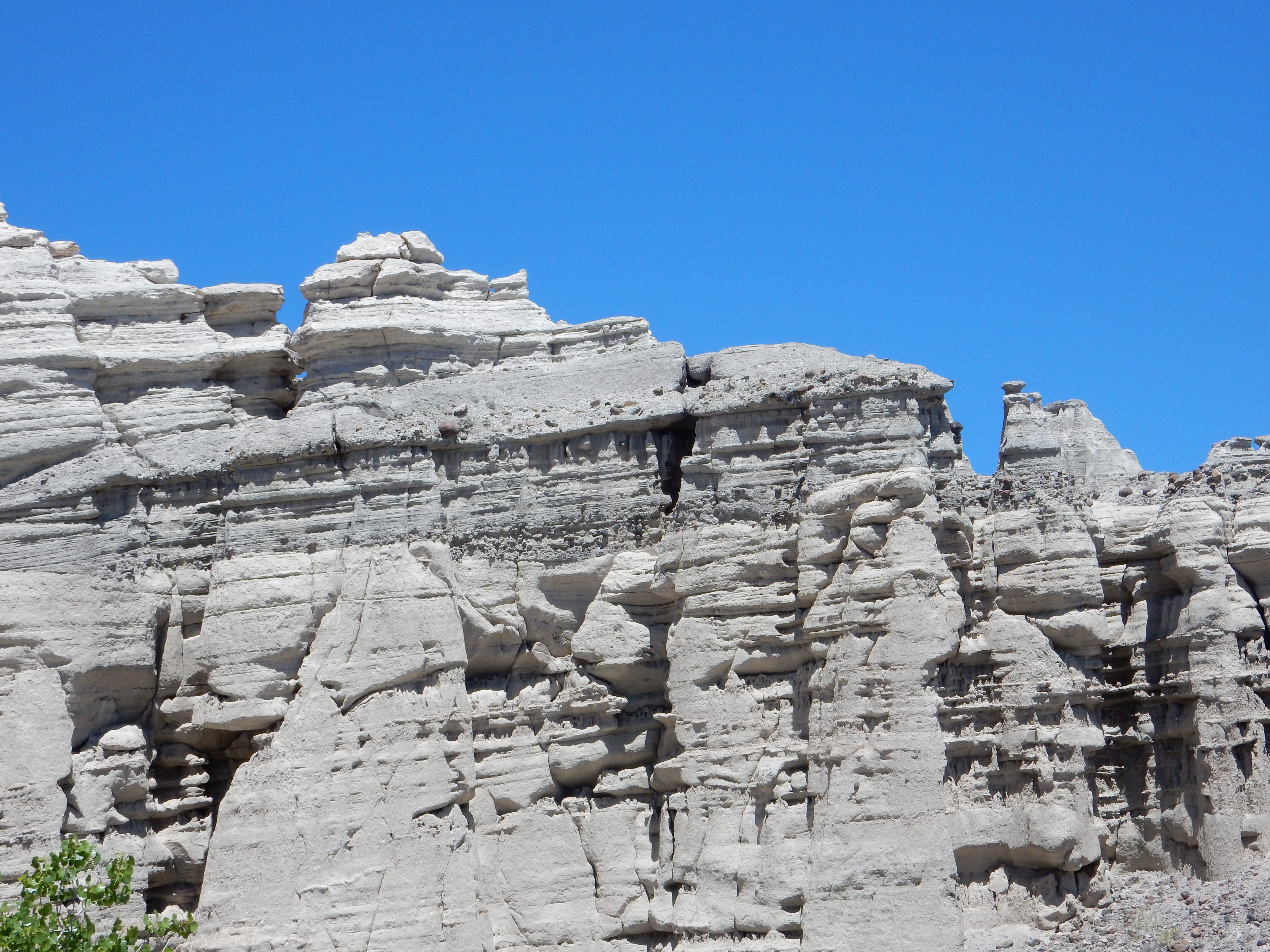
Possible debris flow in Abiquiu Formation at Plaza
Blanca Canyon. 36
14.048N 106 18.180W
The ridge here lies along the trace of the Plaza Colorado fault. The fault plane itself is dramatically exposed.
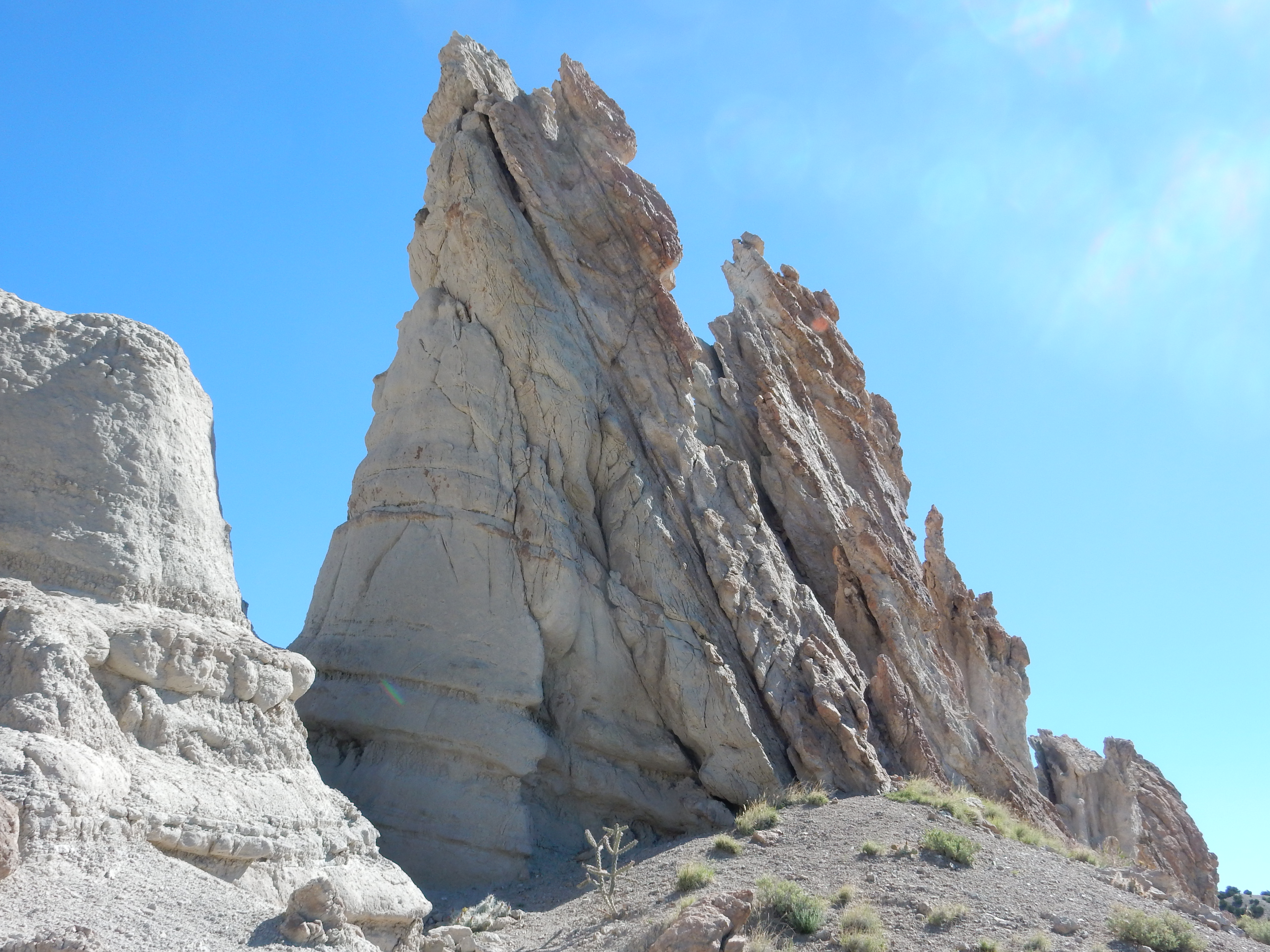
Fault plane of Plaza Colorado Fault. 36
14.073N 106 18.235W
Slickenside is present along the fault plane.
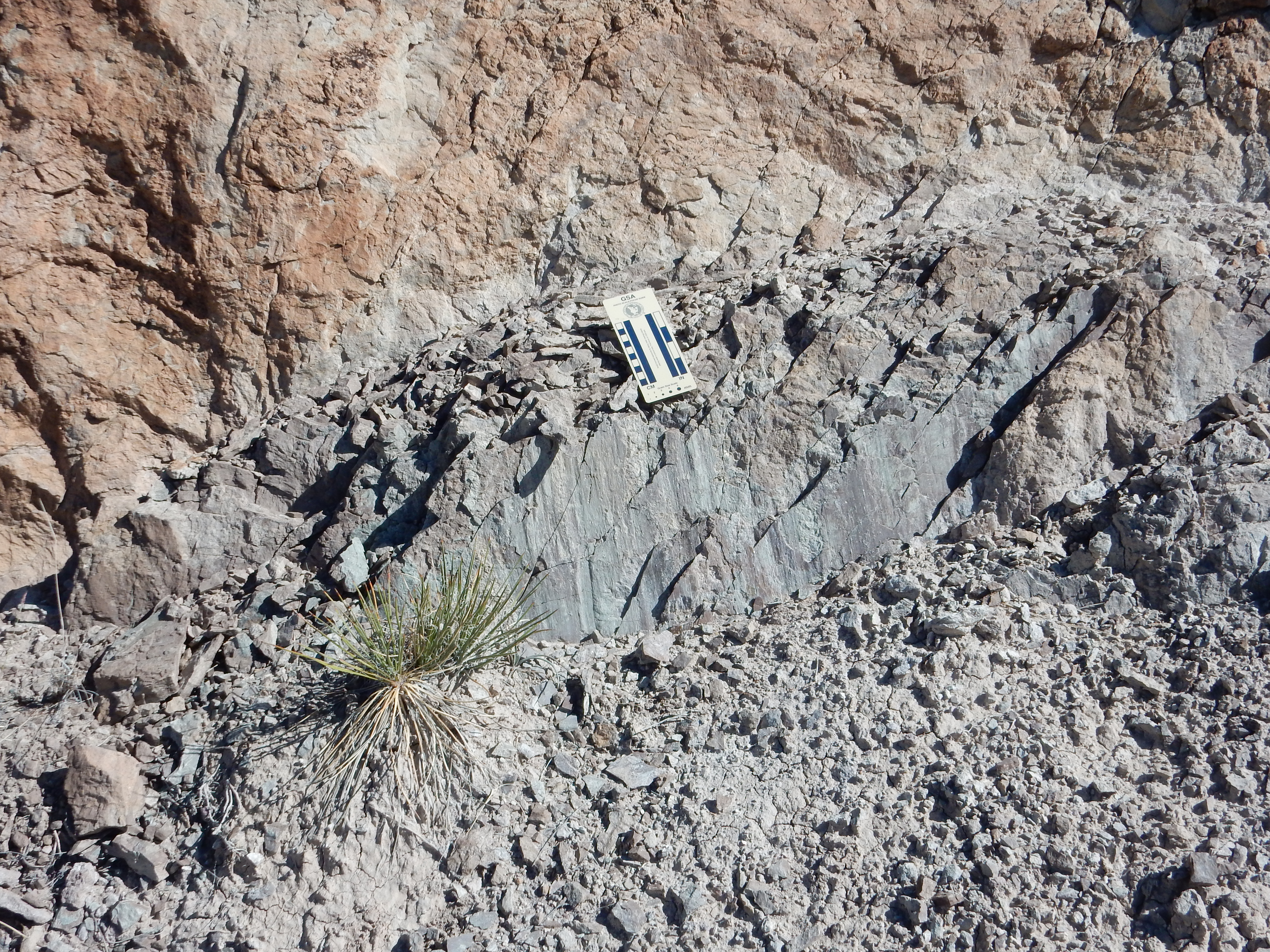
Slickenside at Plaza Colorado Fault. 36
14.073N 106 18.235W
Slickenside is a distinctively polished rock surface on the plane
of a fault, caused by the motion of the rock faces past each
other. The striations here are consistent with this being a normal
fault, with primarily up/down motion.
A peculiar feature of some of the Abiquiu Formation beds at Plaza Blanca is the presence of well-developed conjugate jointing.
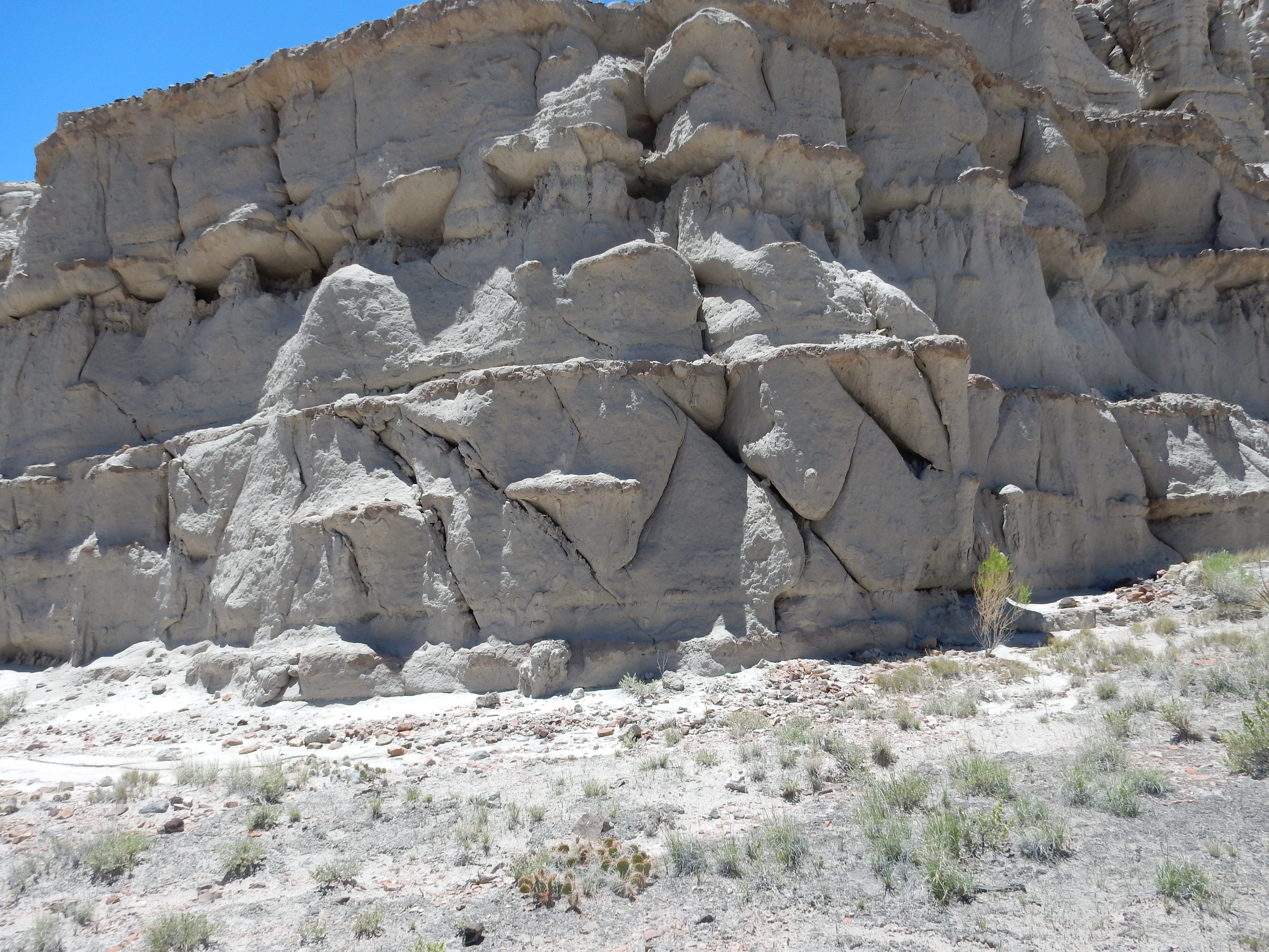
Conjugate jointing in Abiquiu Formation at Plaza Blanca
Canyon. 36
14.117N 106 18.416W
It is not uncommon for rock to have joints (fissures) that meet at right angles, with one of the angles commonly being the bedding angle. Joints that do not meet at right angles are described as conjugate joints. They're something of a geological curiosity, for which I've not come across a good explanation.
Some surfaces show well-developed manganese dendrites.

Manganese dendrites at Plaza Blanca Canyon. 36
14.294N 106 18.388W
The black patterns are manganese oxides formed by weathering of
the rock.
In the area west of Abiquiu, geologists have carefully studied
the sediments making up the Abiquiu Formation, and find a
transition from sediments derived mostly from the San Juan
volcanic field to the northwest to sediments derived mostly from
the Latir volcanic field to the northeast. The former is
relatively poor in quartz while the latter is rich in quartz. The
feldspar composition also shifts, from mostly plagioclase to
mostly sanidine. The transition from one to the other suggests
changes in drainage patterns associated with the very earliest
opening of the Rio Grande Rift in the Taos area.
Further west, past the ridge of Cerrito
Blanco, the Abiquiu Formation is visible just north of the
road.
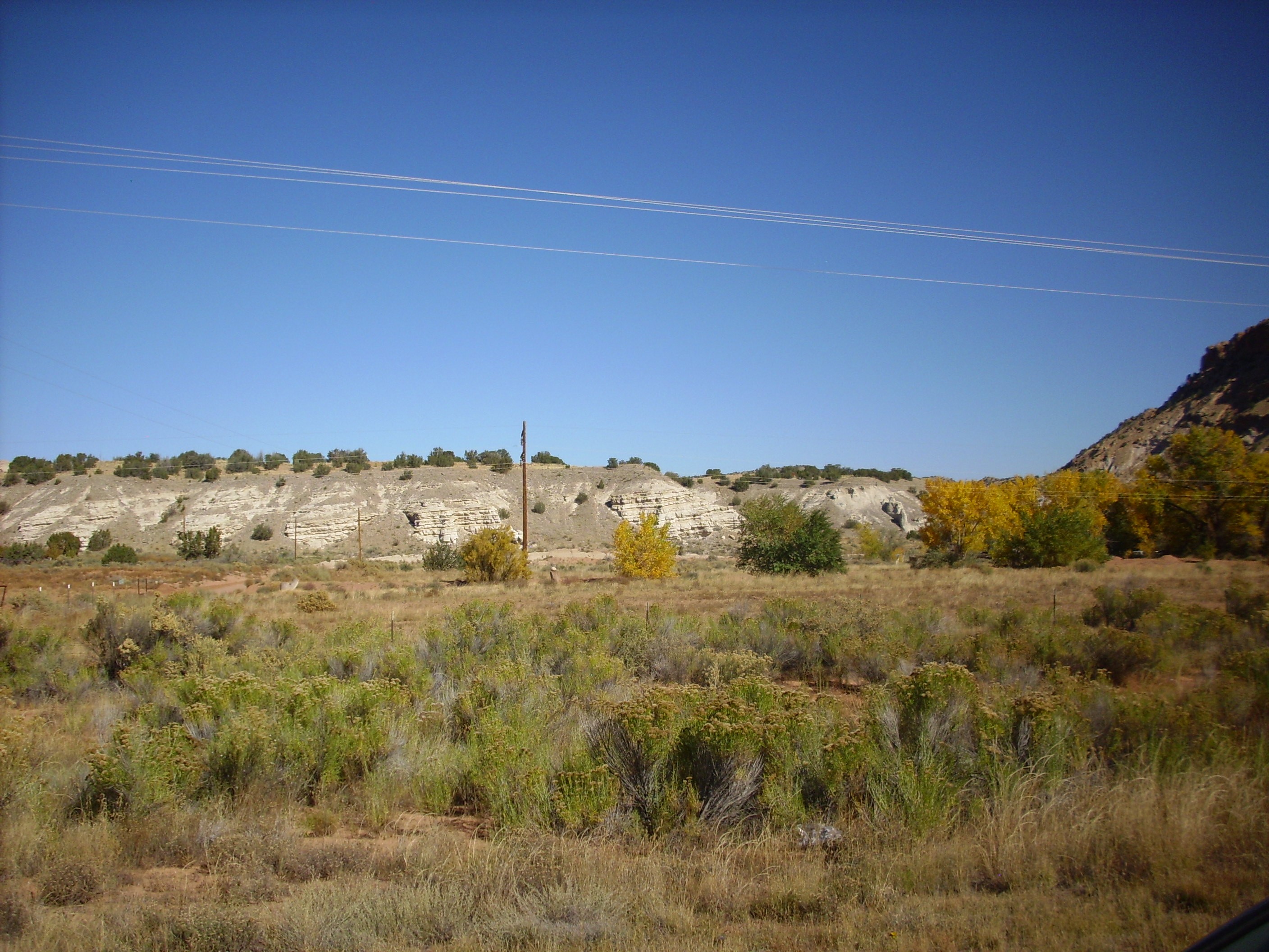
West side of Cerrito Blanco showing fault offset of
Tesuque and Abiquiu Formations.
Just west of here, across a fault boundary that is thrown down to the east, the Ritito Conglomerate is well exposed.
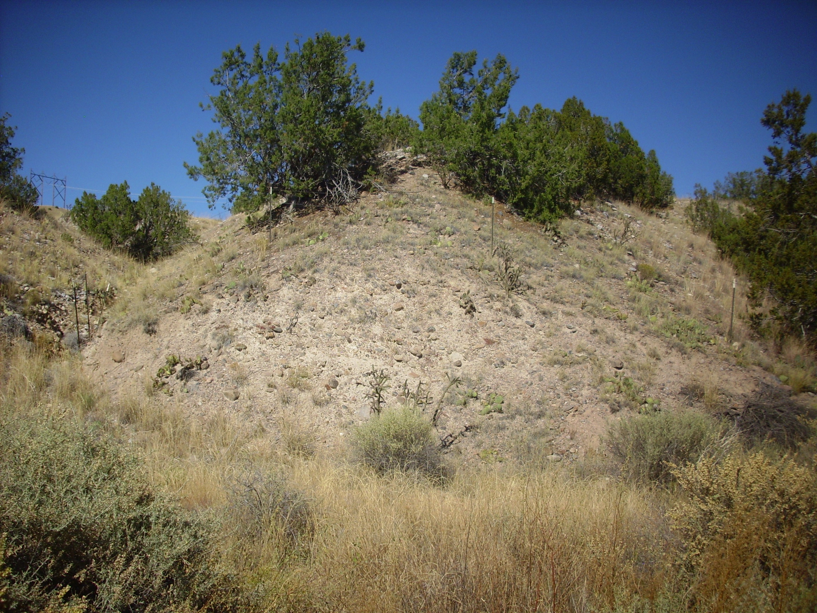
Ritito Conglomerate in road cut west of Abiquiu. 36
13.855N 106 22.846W
The Ritito Conglomerate contains an abundance of rock clasts,
embedded in a light ash-rich sandy matrix. This is rarely very
well cemented, except just below the Pedernal Chert at the top of
the formation. Areas underlain by the Ritito Conglomerate thus
tend to form gentle slopes and rounded hills, like this one. The
clasts are dominated by quartzite and granitoid rocks of
Precambrian age, likely weathered off the Tusas Mountains to the
north.
Superb exposures of the Ritito Conglomerate are found along Red Wash Canyon.
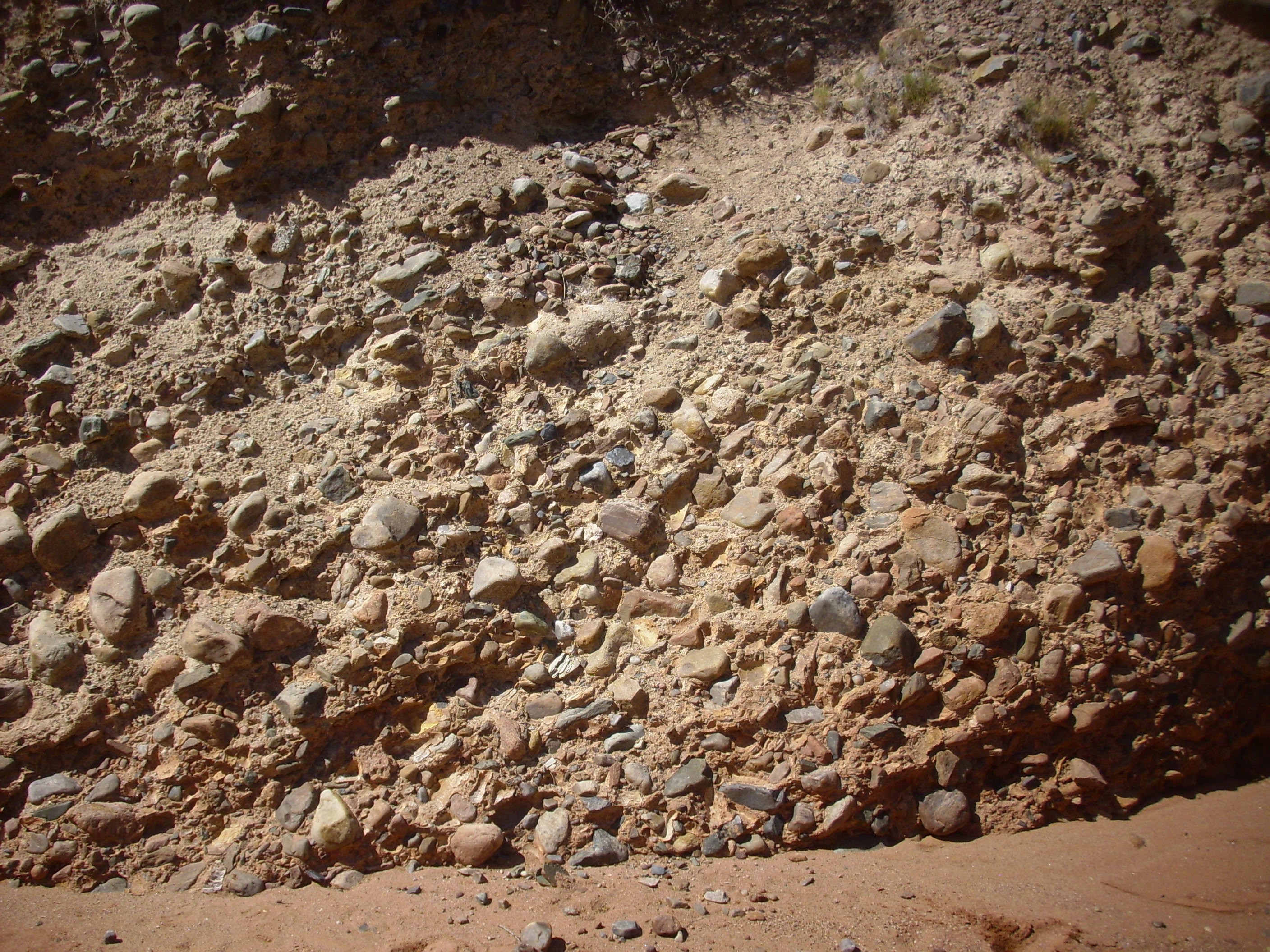
Ritito Conglomerate along Red Wash
Canyon. 36
14.354N 106 22.532W
The area also features a slot canyon.
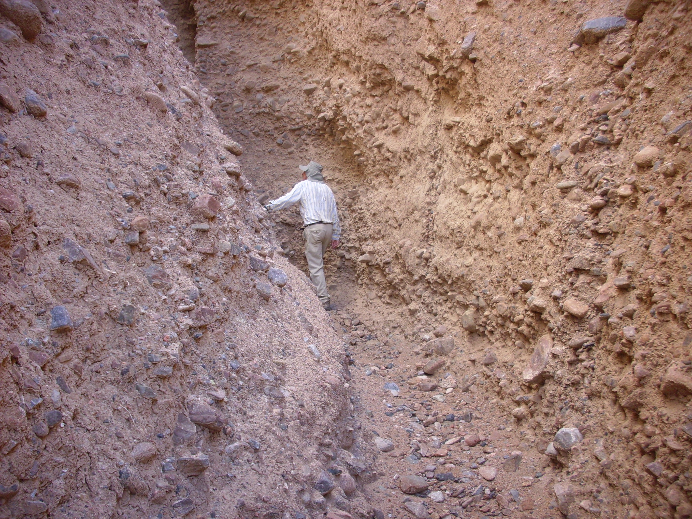
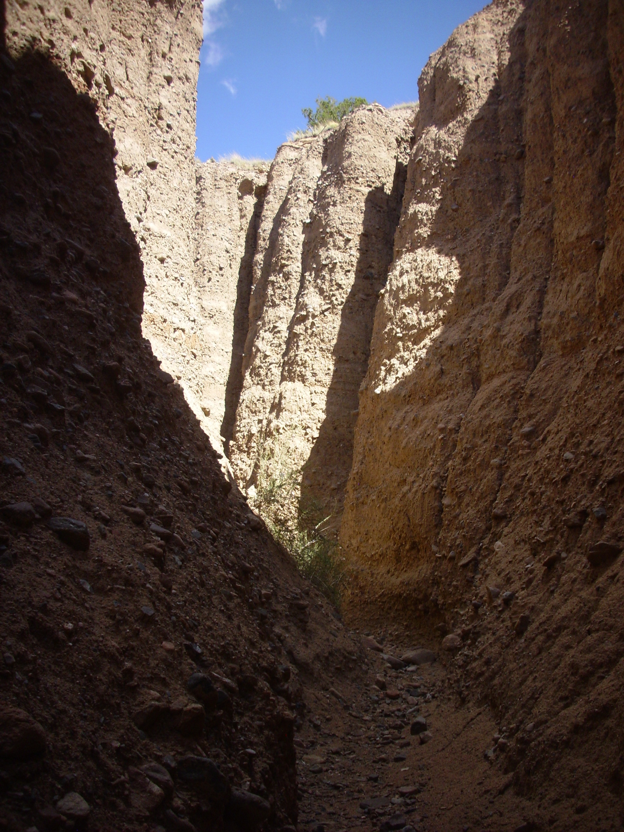
Slot canyon in Ritito Conglomerate. 36
14.103N 106 22.562W
The clasts in the conglomerate here are varied and interesting,
including epidote and garnet-bearing metamorphic rocks. These very
thick deposits of very coarse conglomerate indicate that the
source rock was very close to this location.
The Abiquiu Formation can be traced west to Canones Mesa
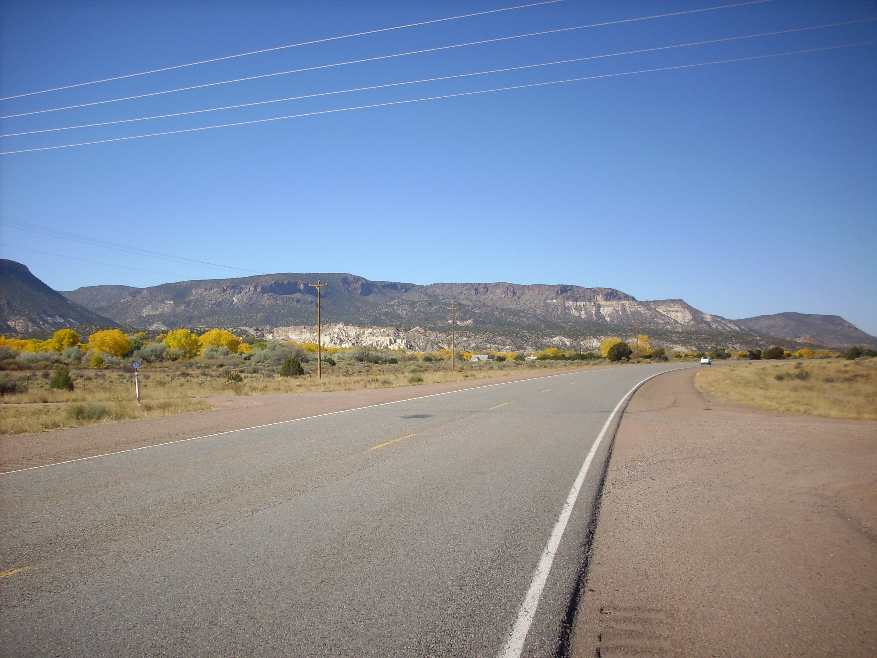
and the Ritito Conglomerate is beautifully exposed north of the village of Canones, where it lies atop El Rito Formation.
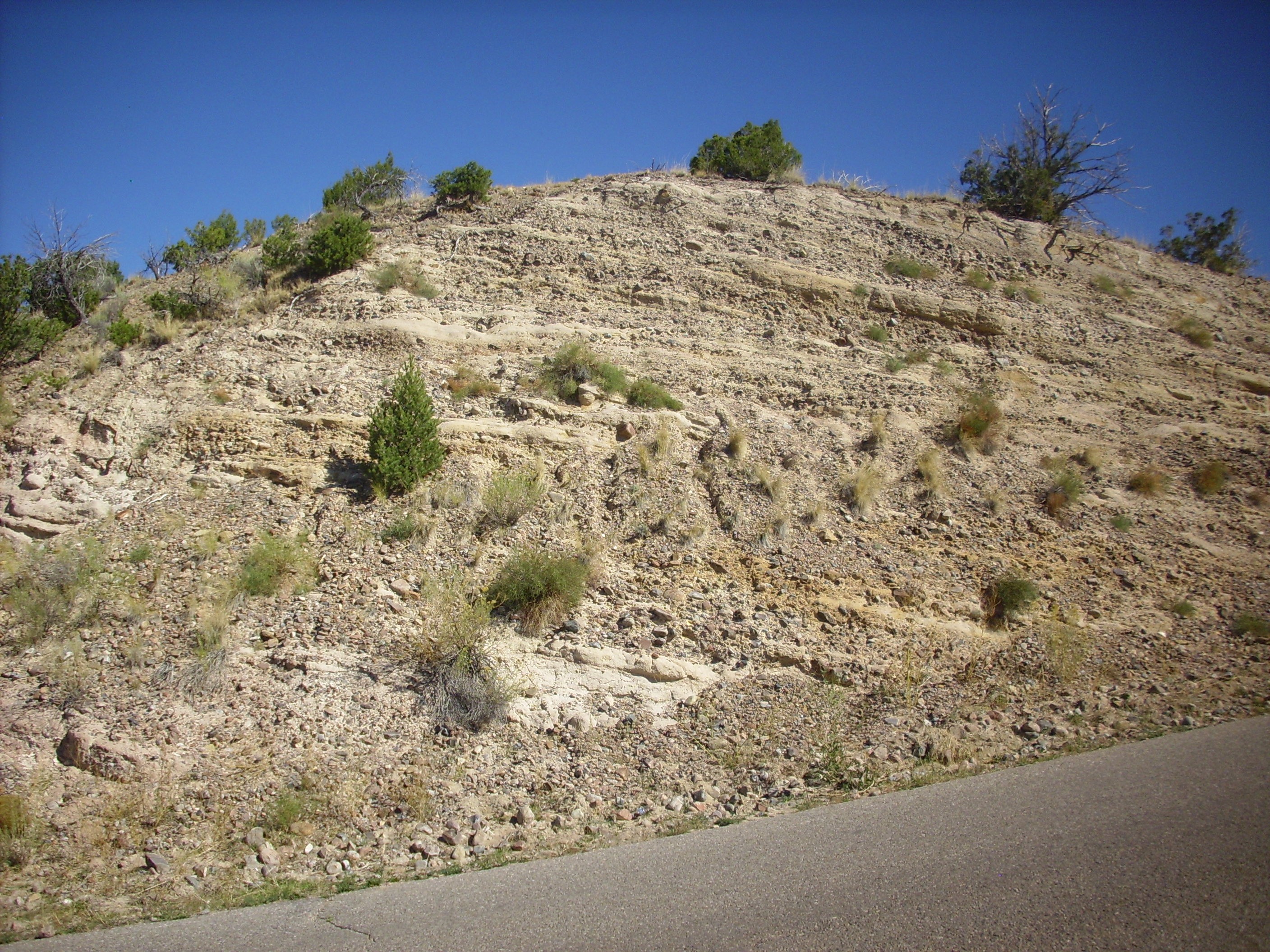
Ritito Conglomerate north of Canones. 36
11.369N 106 26.796W
Exposures occur on the lower slopes of Cerro Pedernal. Cliffs
of Abiquiu Formation are prominent along Forest Road 100 in the
valley of the Rio Encino as it climbs towards the La
Grulla Plateau, southwest of Cerro Pedernal.
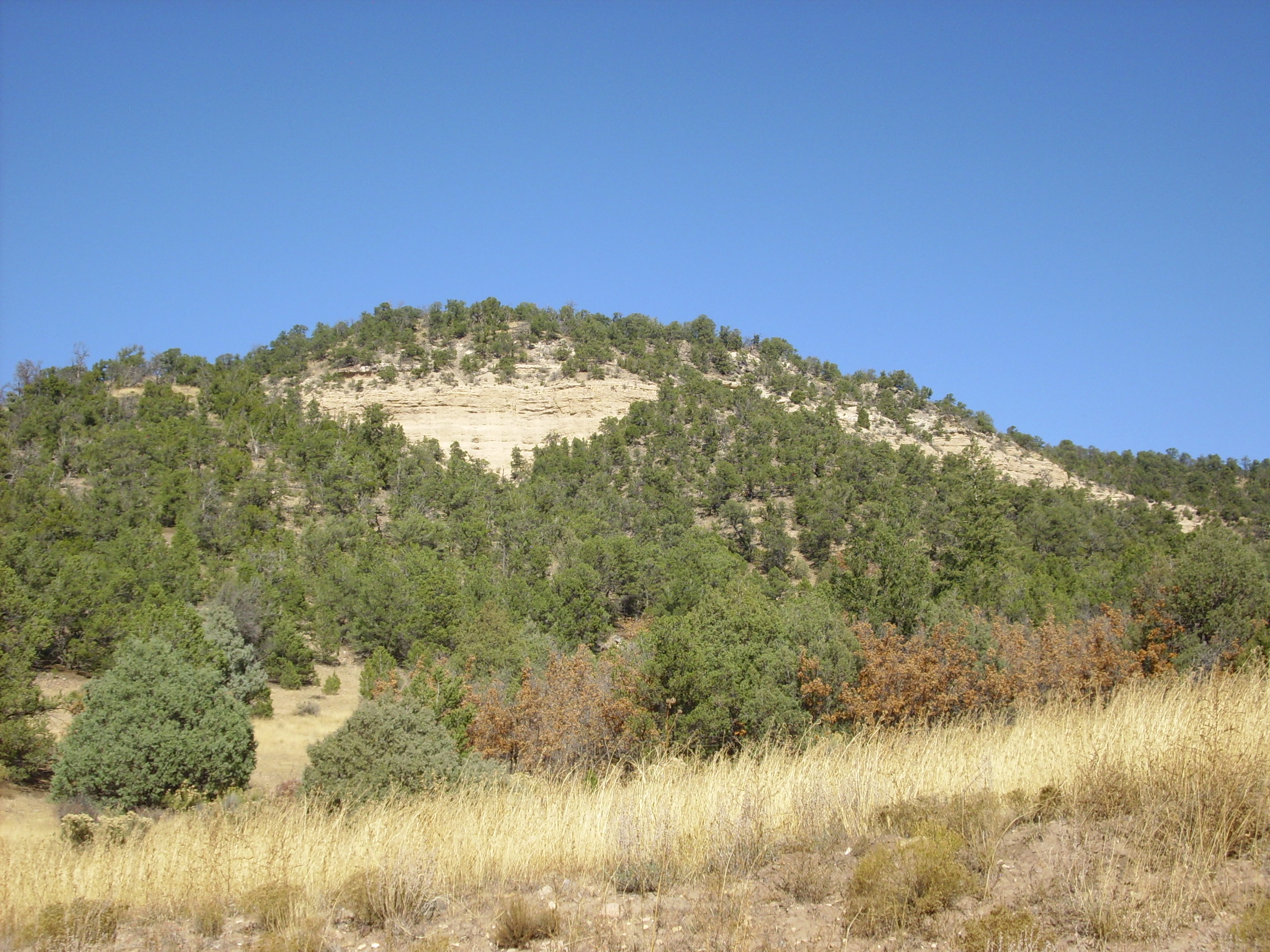
Nearby, the Ritito Conglomerate is well exposed in the road cut.
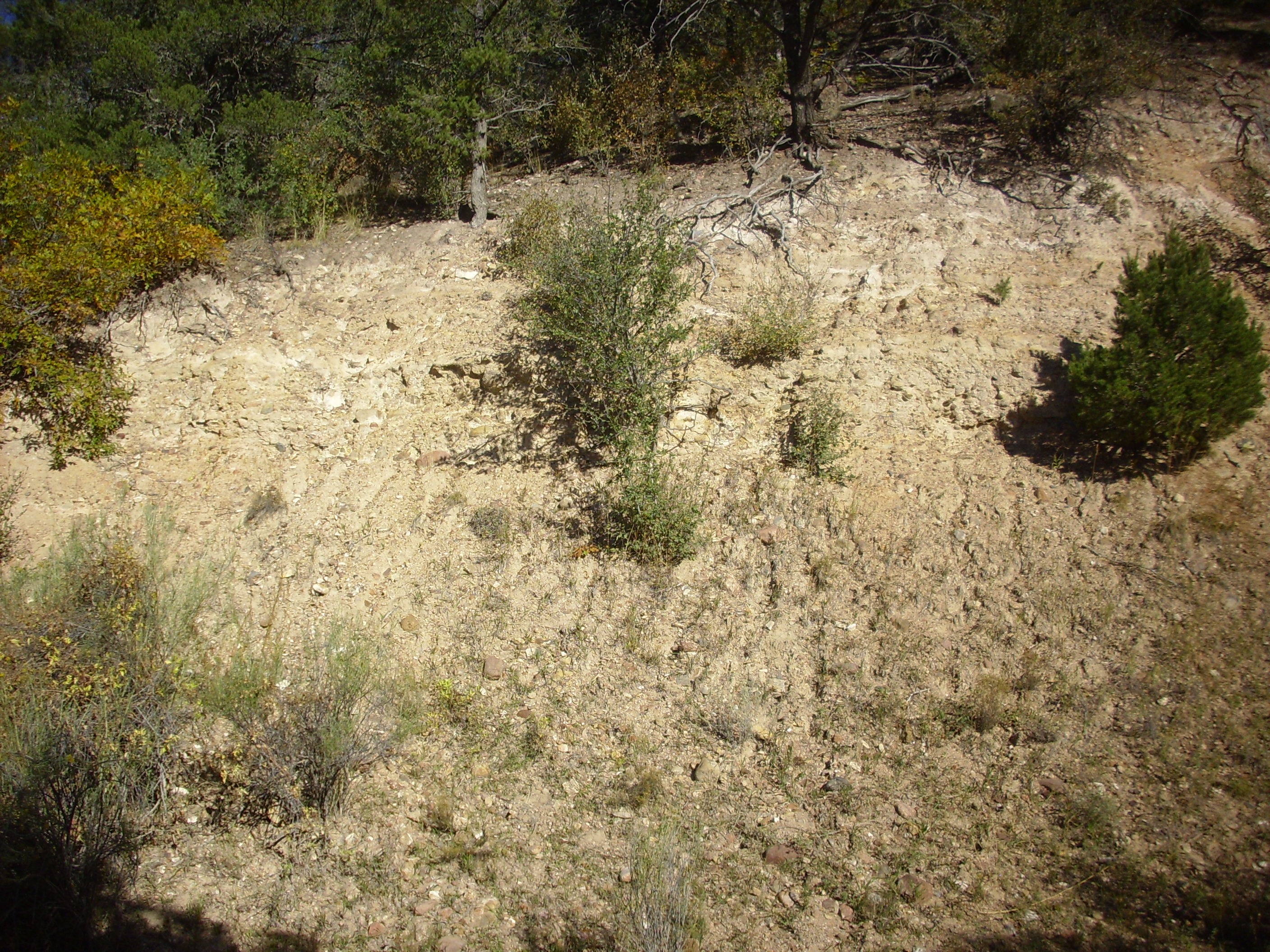
Ritito Formation. 36
08.342N 106 30.784W
Some exposures of the Ritito Conglomerate in this area contain
large clasts of Amalia Tuff at the top of the formation, but I
found none here. The clasts were all quartzite, gneiss, and other
Precambrian rocks likely weathered from the Tusas Mountains.
The Pedernal Chert is particularly well exposed here, forming a
prominent ledge separating the Ritito Conglomerate and Abiquiu
Formation:
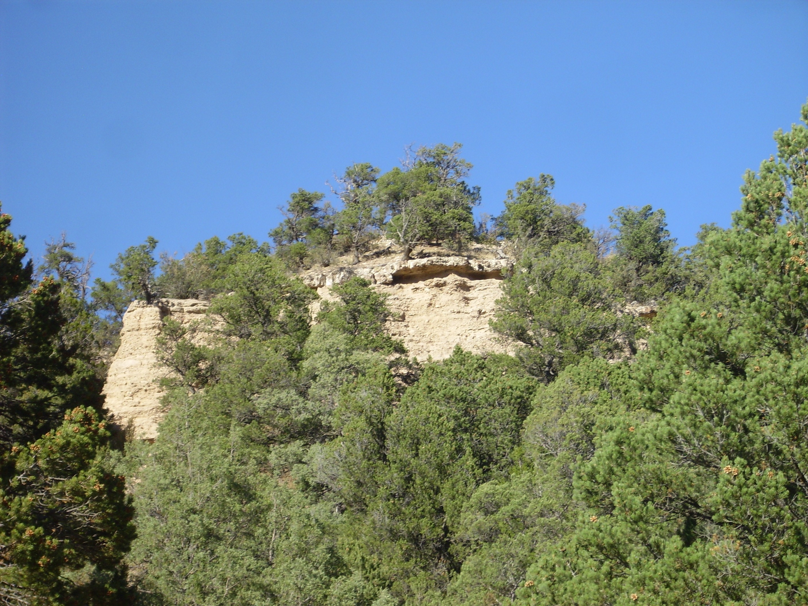
Pedernal Chert forming the prominent ledge.
Looking north from 36
08.418N 106 30.630W
It's a bit of a scramble to reach the ledge, beneath which are
unusually well cemented beds of Ritito Conglomerate. Here's the
chert layer close up.
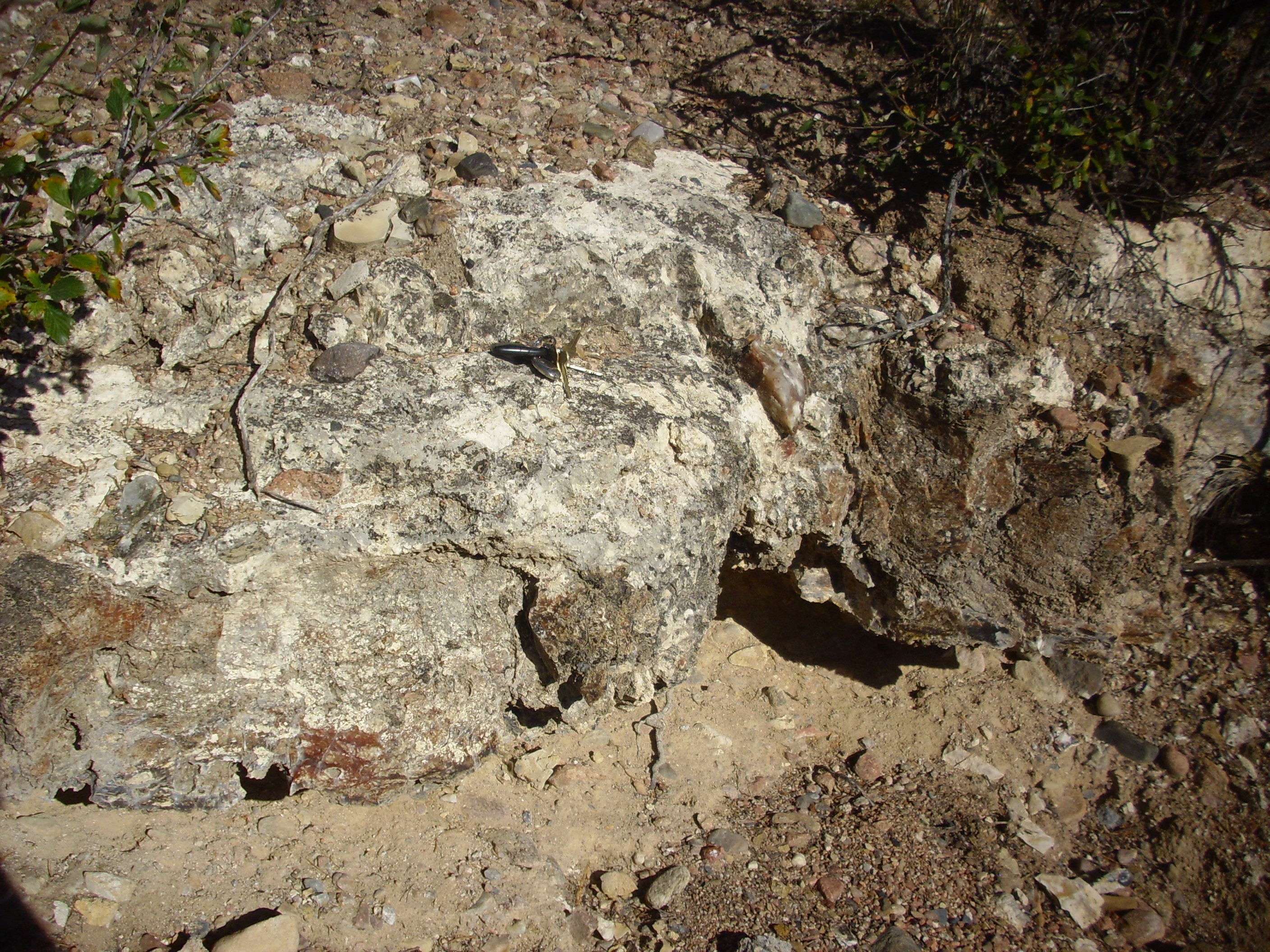
Pedernal Chert. Car keys for scale. 36
08.486N 106 30.622W
The Pedernal Chert is a bed of amorphous silica and limestone. The limestone probably formed as a calcium-rich soil atop the Ritito Conglomerate under arid conditions. Later, the Abiquiu Formation was deposited on top of the limestone layer, and groundwater circulating through the ash-rich Abiquiu Formation picked up silica that was redeposited in the limestone layer. Deposition of amorphous silica in limestone beds is very common, though the chemistry seem not to be fully understood. The chert varies in color from milky white to reddish brown to pitch black.

Pedernal Chert. 36
08.486N 106 30.622W
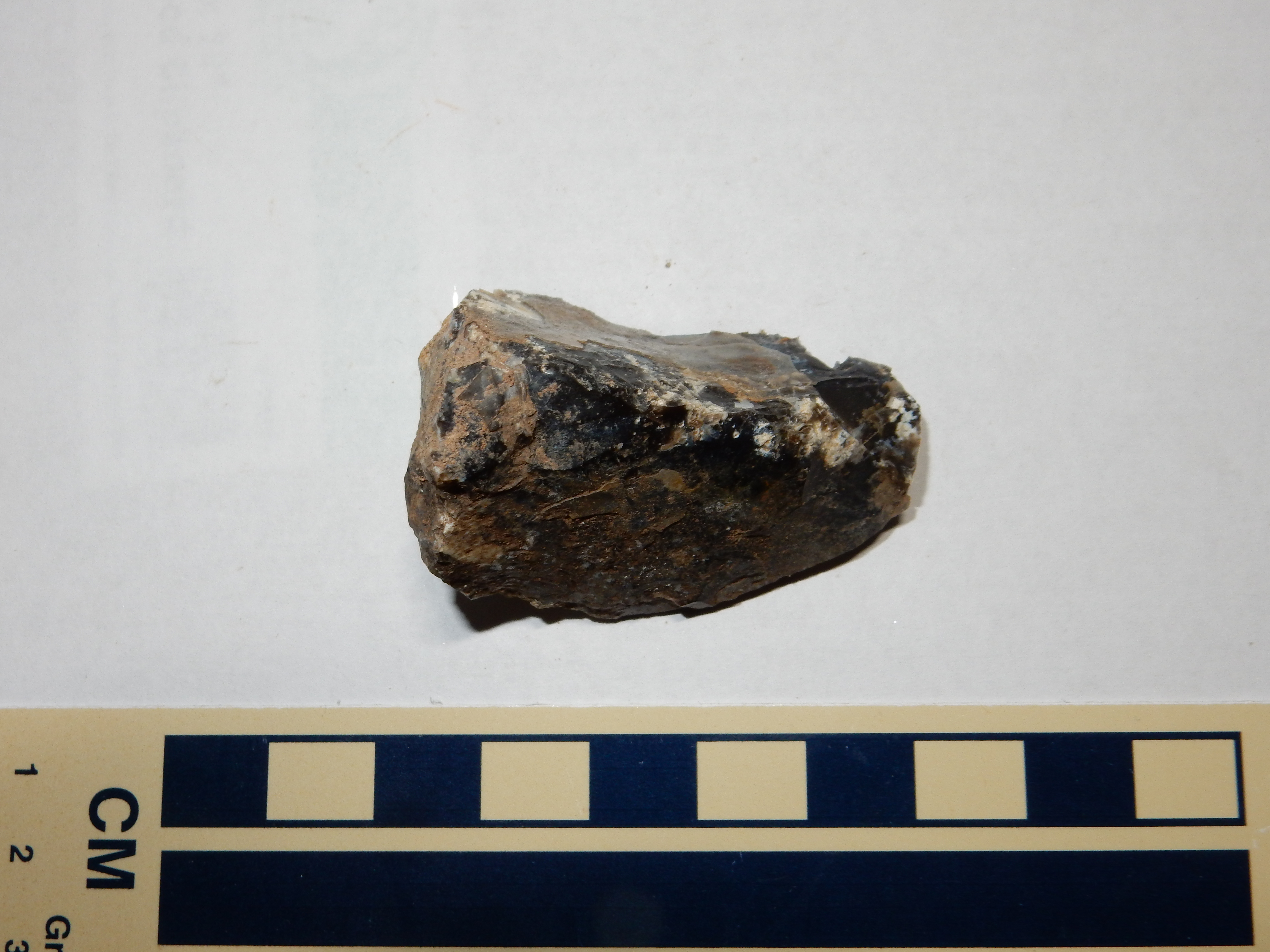
Pedernal Chert. 36
08.486N 106 30.622W
Large clasts of chert can be found around the base of Cerro Pedernal, where it was exploited by early native Americans for tool making. Pedernal Chert artifacts have been found as far east as the eastern slopes of the Sangre de Cristo Mountains, and Spanish archives mention chert quarries in the mid-18th century.
Another possibility for the origin of the Pedernal Chert is that
it formed in an alkaline lake that covered this region. Chert is
forming by this mechanism today in parts of the East African Rift
Valley. This could be tested by searching for traces of rare
sodium silicate minerals in the chert, but to my knowledge, this
has not been done.
Further south along Forest Road 100, the ascending road cuts through Abiquiu Formation.

The higher elevation at which the Abiquiu Formation is exposed in
the northern Jemez, compared with the exposures in the Abiquiu
area to the northeast, reflects the displacement along the Canones
Fault Zone, which lies between the two areas.
There are deeply weathered but extensive outcrops of Pedernal Chert in the San Pedro Mountains.
More Abiquiu Formation. 36
07.850N 106 30.746W
These outcrops are particularly significant because they provide
strong evidence that the San Pedro Mountains were uplifted less
than 25 million years ago. These beds are 240 m (800') higher than
corresponding beds east of Jarosa.
The Ritito Formation is exposed again in the northwest wall of Valles Caldera, in Valle San Antonio, which can be reached by passenger vehicle with a back country permit from Valles Caldera National Preserve. Viewing the exposure requires hiking some distance along San Antonio Creek.
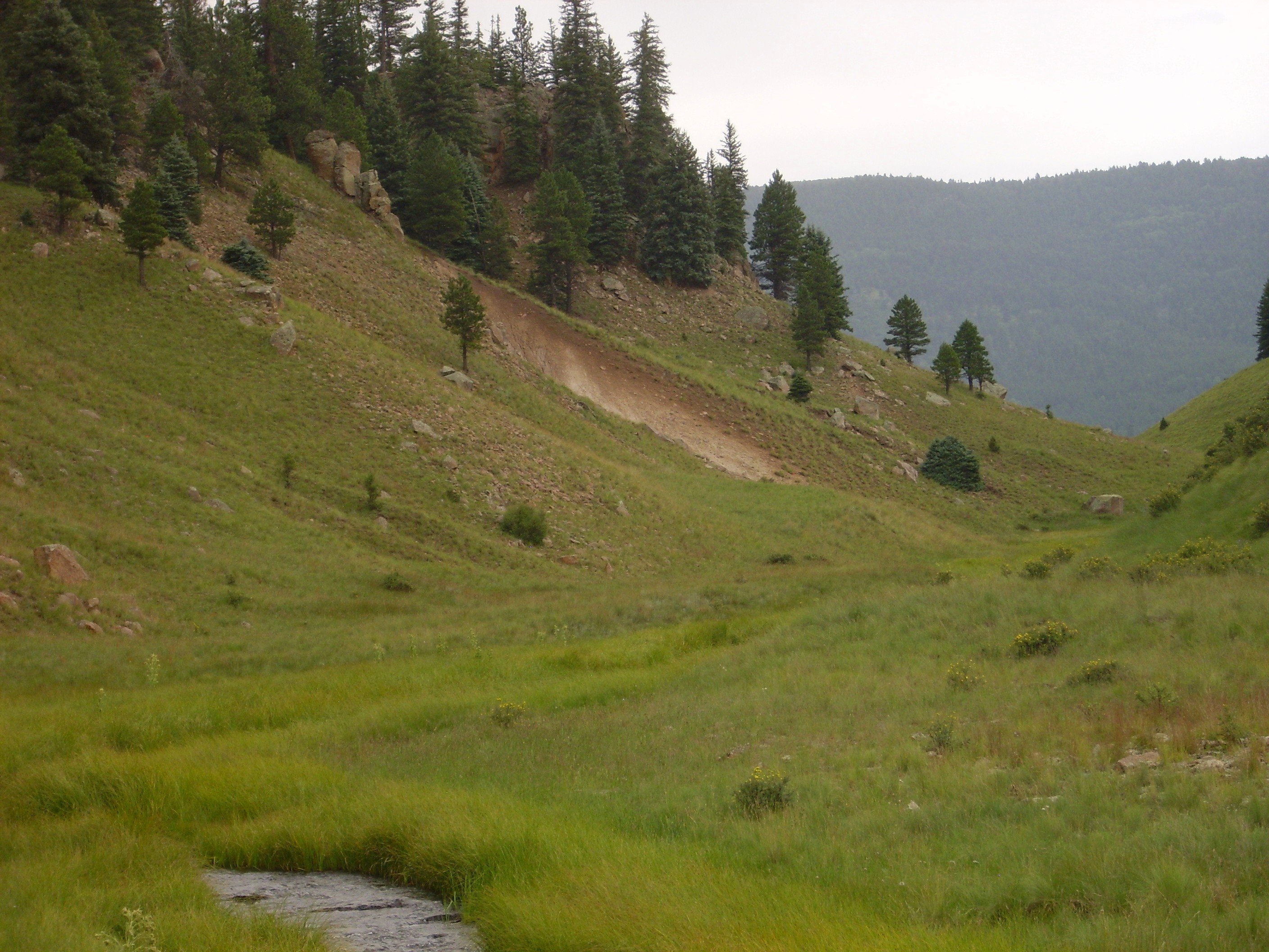
Ritito Formation in northwest caldera
rim. 35
58.102N 106 36.742W
The exposure here is somewhat poor, and easily confused with nearby lacustrine beds and Bandelier Tuff. However, it establishes that the base of the topographic rim of the caldera is located here.
Further south along the caldera rim, in upper San Antonio Canyon, are some better exposures.

These definitely appear to be the ash-rich beds of the Abiquiu Formation proper rather than the Ritito Conglomerate. Spotty exposures of the Abiquiu Formation continue south along the caldera rim, of which the most accessible is in a road cut along State Road 126.
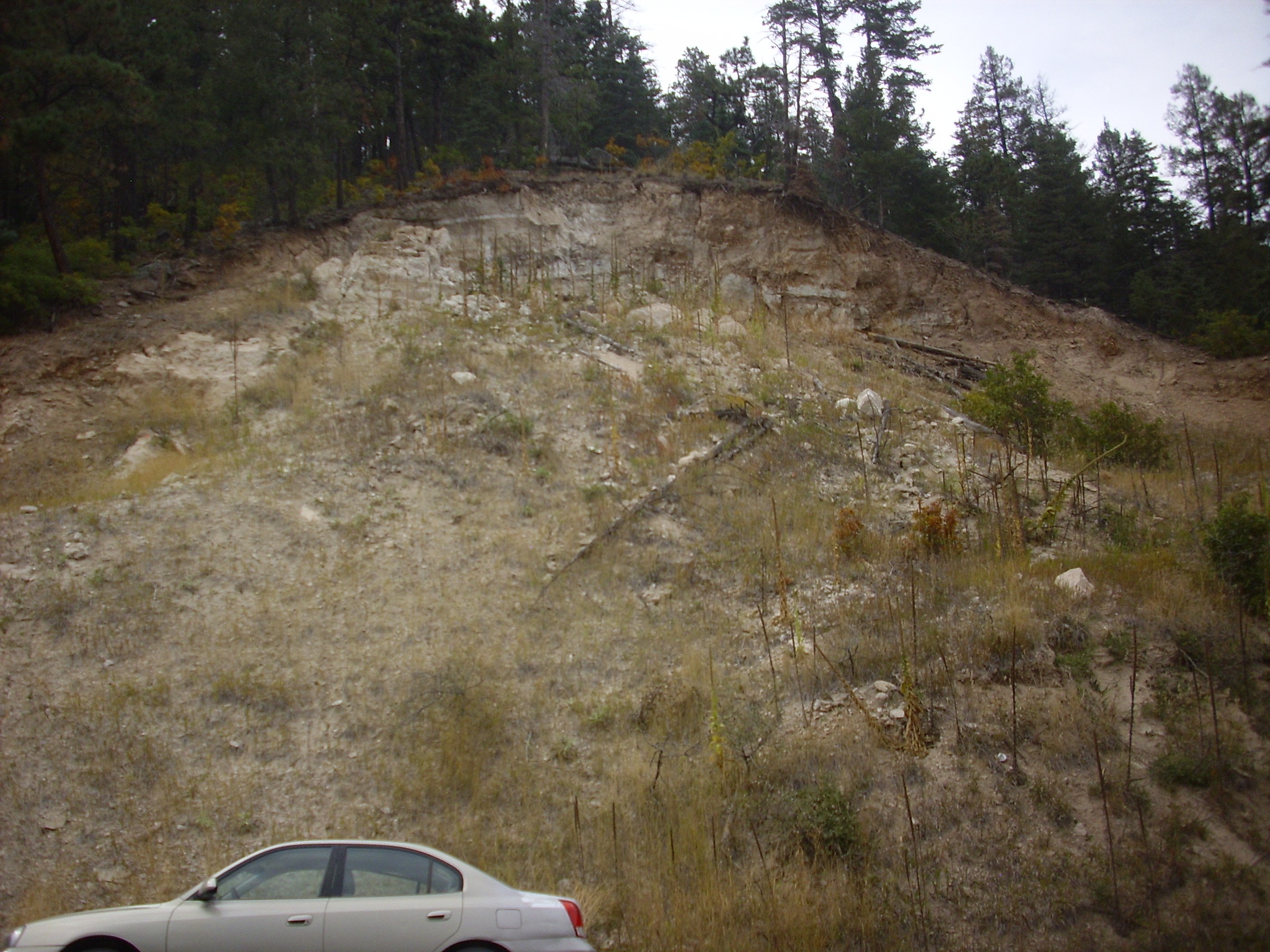
More Abiquiu Formation. 35
53.056N 106 39.781W
The Abiquiu Formation is also present in the southern Jemez, in
upper San Juan Canyon. The easiest exposures for the casual
visitor to reach are in landslide deposits along the road.
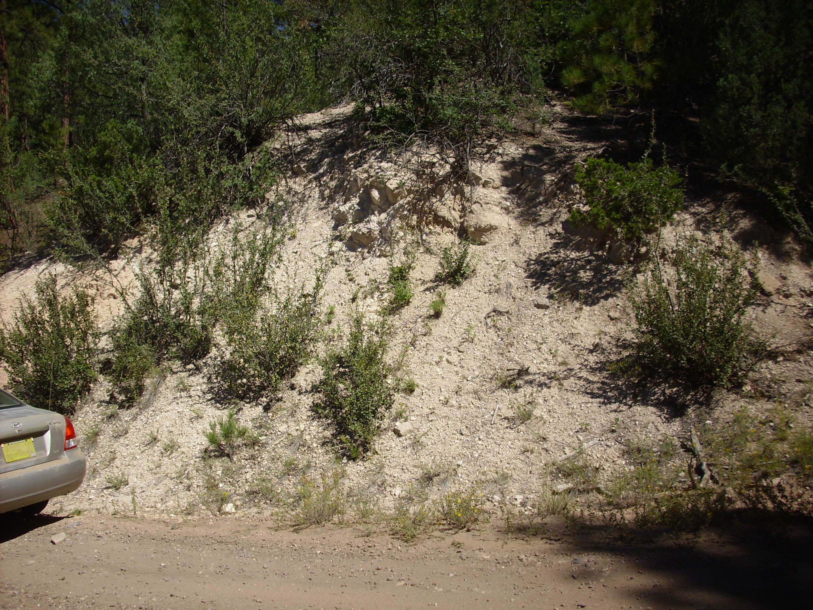
This is located at about the same elevation as in the northern Jemez. Under the loupe, this looks like a mass of small quartz grains with considerable lithic fragments and abundant white cement. This makes the rock a lithic wacke, rather than a lithic arenite.
More pristine exposures on the east side of San Juan Canyon can
be reached by a short but strenuous hike from Forest Road 10.

Abiquiu Formation on east side of San Juan Canyon. 35
45.293N 106 37.256W
The exposures here are quite thick, with a particularly spectacular exposure in a drainage into the east side of the canyon.
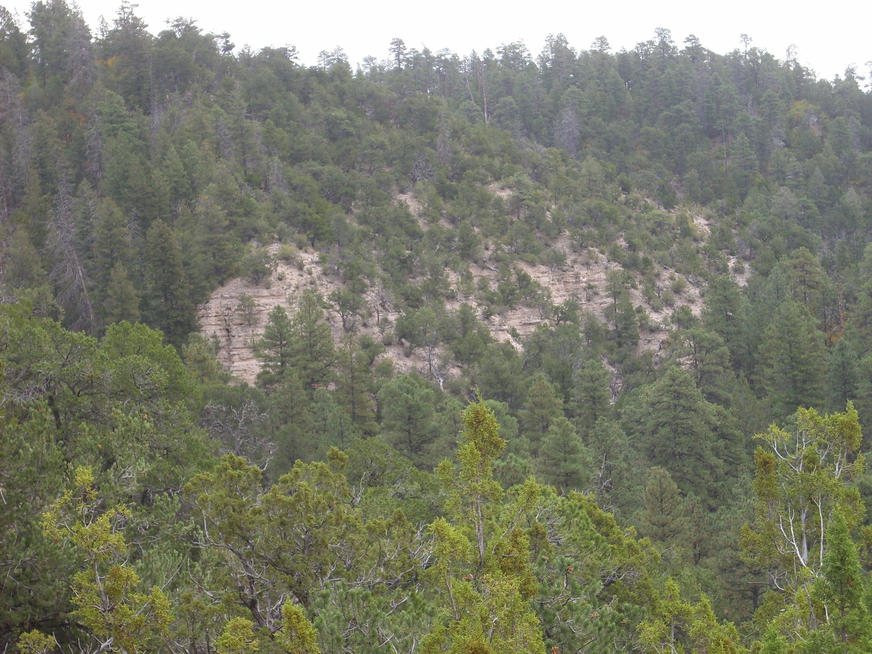
Abiquiu Formation on east side of San Juan Canyon.
Looking east from 35
45.293N 106 37.256W
There are also exposures on the west side of the canyon, which can be reached by a less strenuous but longer hike down the canyon along an abandoned forest road branching off of Forest Road 10.
The southernmost exposures of Abiquiu Formation in the Jemez are
in southern Canon de San Diego, occurring in two isolated
erosional remnants just south of Red Rocks and in more substantial
exposures across the Jemez River on tribal lands.
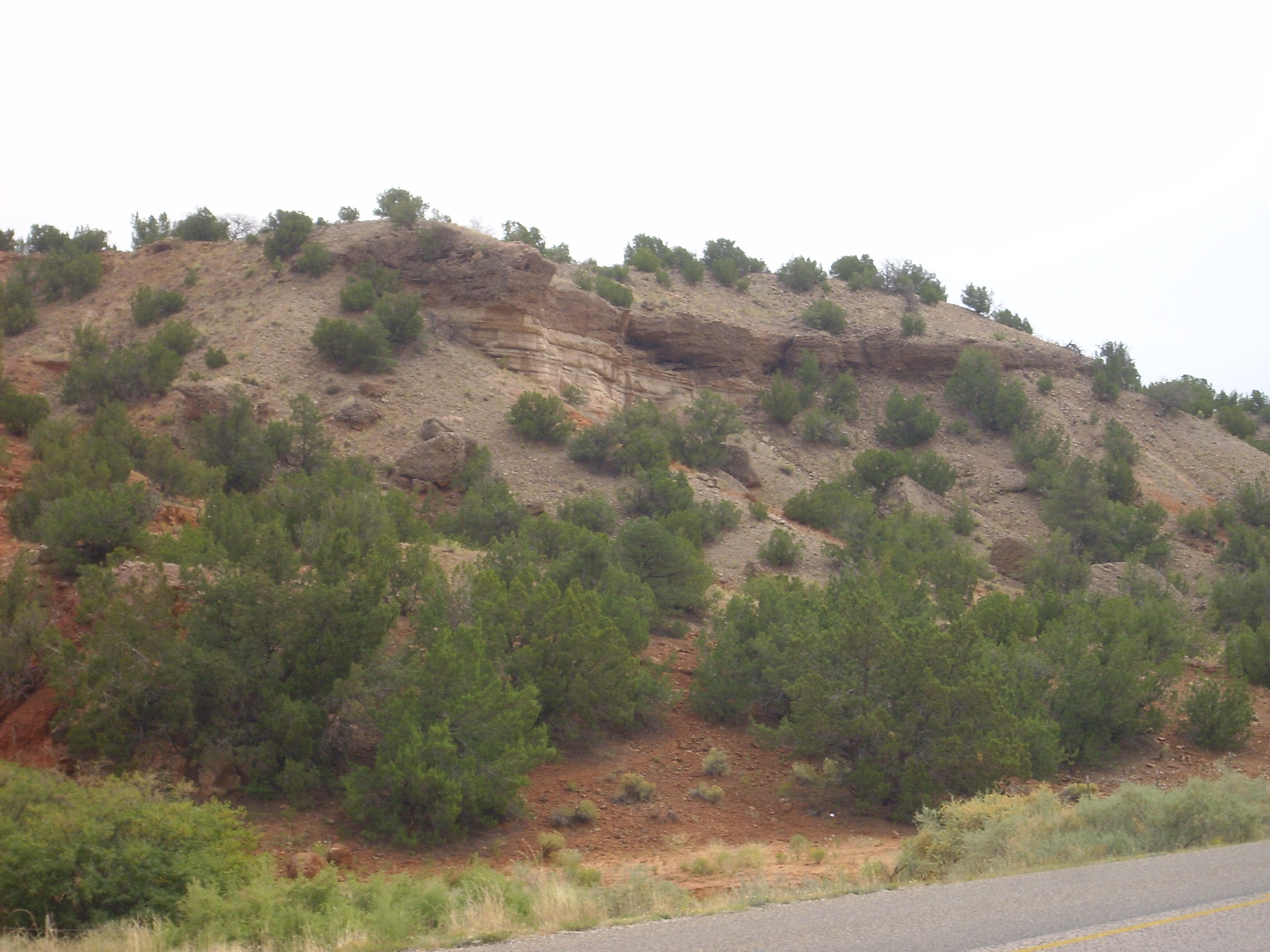
Abiquiu Formation remnants near Red Rocks. 35
38.251N 106 43.429W
The exposure here is the thin layered white beds, sandwiched between red Abo Formation on which the Abiquiu was deposited in this area and dark beds of much younger terrace gravels laid down by the Jemez River before it cut down to its current level.
Also present in the southwestern Jemez is the Gilman Conglomerate. The type section is prominent in the cliffs west of the former logging camp of Gilman.
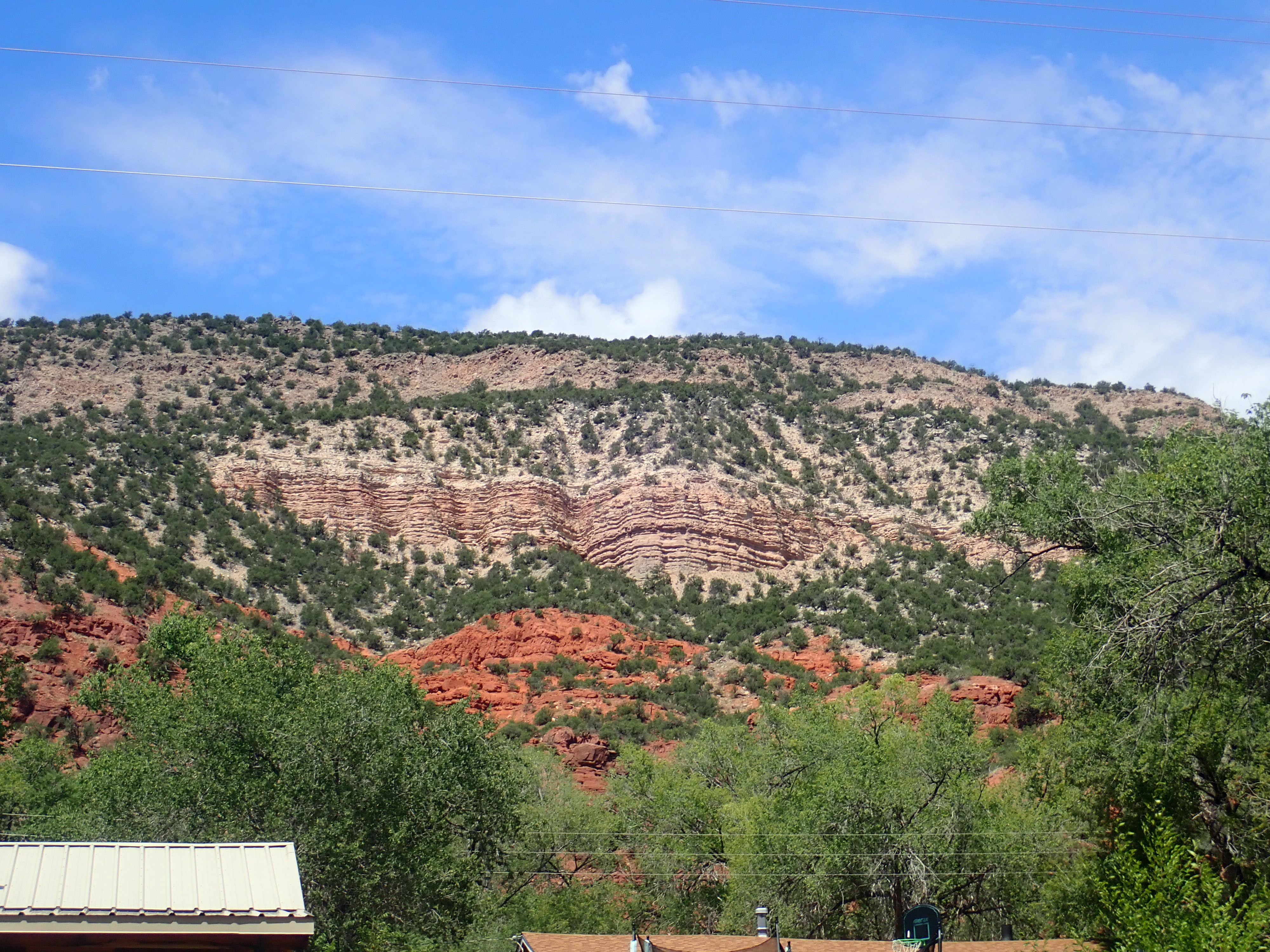
Gilman Conglomerate type section. Looking west from 35
42.977N 106 45.568W
At bottom are red beds of the Permian Abo Formation, some 300
million years old. Above are the beds of the Gilman Conglomerate.
Above those are younger gravel beds, then a mesa of Tsherige
Member, Bandelier Tuff. We know that the gravels must be older
than 1.25 million years, since that’s the age of the Tsherige
Member lying above them, but it’s very hard to date gravels. The
individual clasts in the gravel are Paleozoic but that just tells
you how old the rocks they eroded from are; it doesn’t tell you
when the beds formed.The same is true for the Gilman
Conglomerate, though it’s clearly older than the gravels. It has
the look of volcaniclastics, and is mapped as such in the
quadrangle map for this area. The clasts in its uppermost beds
have a minimum age of 25 million years, similar to the Ritito
Conglomerate. Some geologists now believe that the Gilman
Conglomerate correlates with the Ritito Formation and should
probably be regarded as a member of the Ritito Formation. Others
note that, while it is roughly the same age as the Ritito
Conglomerate, it must be derived from an Oligocene volcanic field
that is now buried under the southern Jemez. I have included it in
the map at the start of this section as part of the Ritito
Formation.
I've devoted a lot of space to the Abiquiu Formation, because its distinctive white beds nicely trace the approximate boundary of the west side of the Rio Grande Rift through the Jemez area. Further east, the Abiquiu Formation was either never deposited, was eroded off the Pajarito Uplift before the Rio Grande Rift opened, or is now buried under younger rift fill sediments of the Santa Fe Group. There is one prominent exception: an exposure along La Bajada.
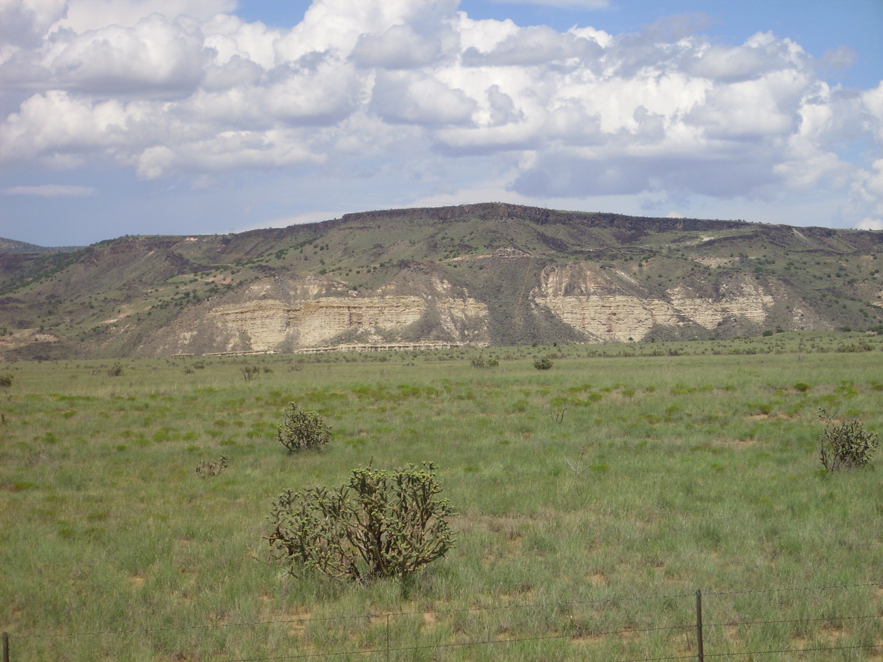
Abiquiu Formation on La Bajada. 35
32.898N 106 13.971W
This is not only the finest exposure of this formation south of the Jemez; it's very nearly the only exposure south of the Jemez. The reasons why the formation is so well preserved here are unclear, but may be related to its location along the La Bajada Fault, which is thrown down to the west. This is the area where the Rio Grande Rift jumps to the west, and so this exposure marks the east edge of the Rift at this latitude.
Or it's possible this is not Abiquiu Formation at all, but is
Espinaso Formation that has been misidentified. The ages and
character are similar. They could be distinguished by careful
clast analysis and charting of paleocurrent directions, but to my
knowledge this has not yet been done.
The Ritito Formation is intruded by the Cerrito de la Ventana
dike system. One dike is crossed by the highway west of Abiquiu.

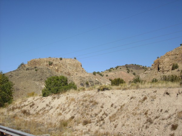

The basalt in the dike ihas most recently been dated at 18.9 million years old, making it part of an episode of volcanic activity predating the current Jemez volcanic field. It also helps us put a lower limit on the age of the Ritito Formation, which is poor enough in fossils that its age has been hard to pin down. You can see a band of the surrounding Ritito Formation baked red by the heat of the dike though, curiously, only on one side of one part of the dike.
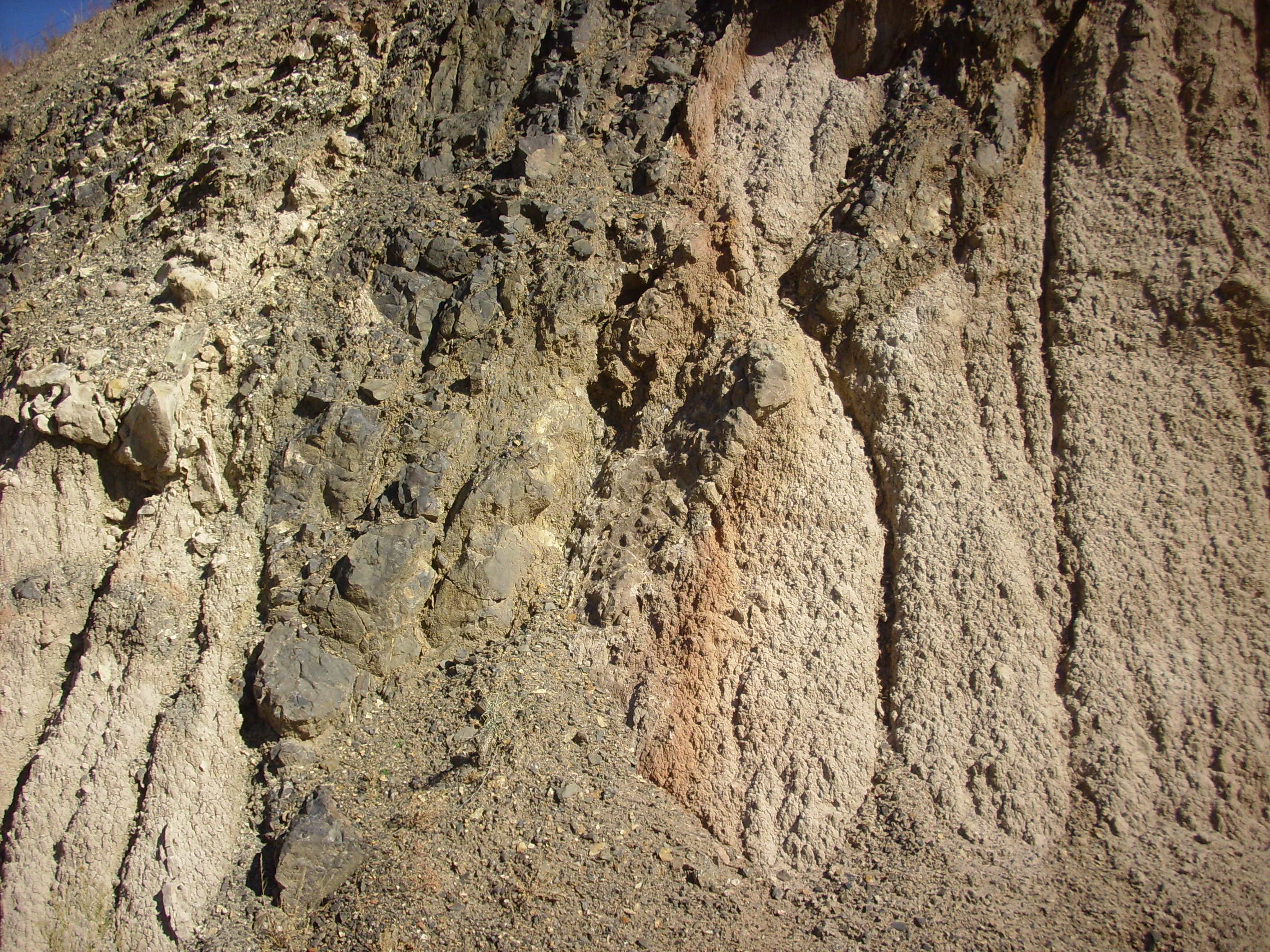
The basalt is a dense black rock with occasional veins of almost
pure quartz that indicate the dike has undergone some hydrothermal
alteration.
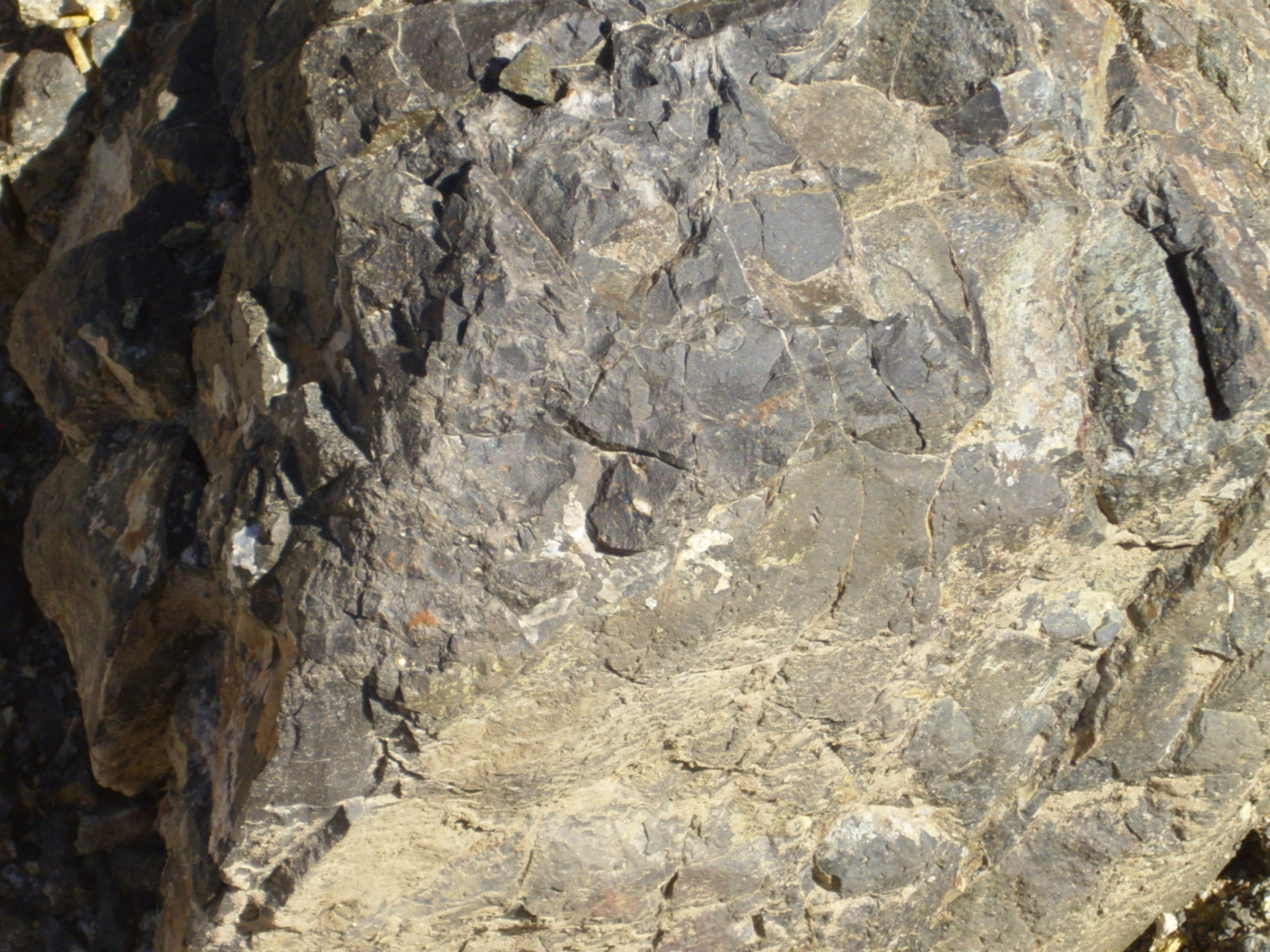
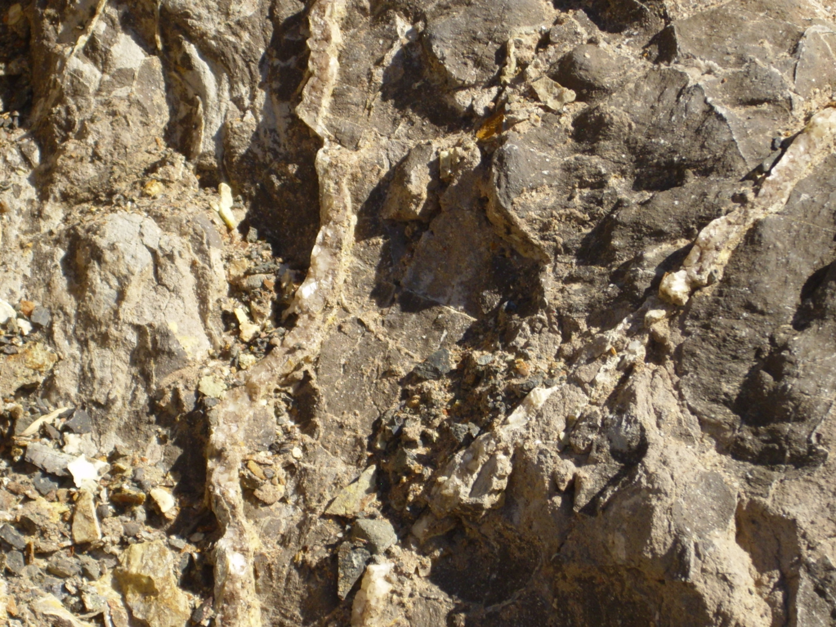
Basalt is quite low in silica, while quartz is more or less pure silica. The quartz must have been injected long after the basalt cooled, probably as a solution in water formed in the very last part of the underlying magma chamber to cool.
This dike continues north past the western end of Plaza Blanca, where it splits into multiple strands.
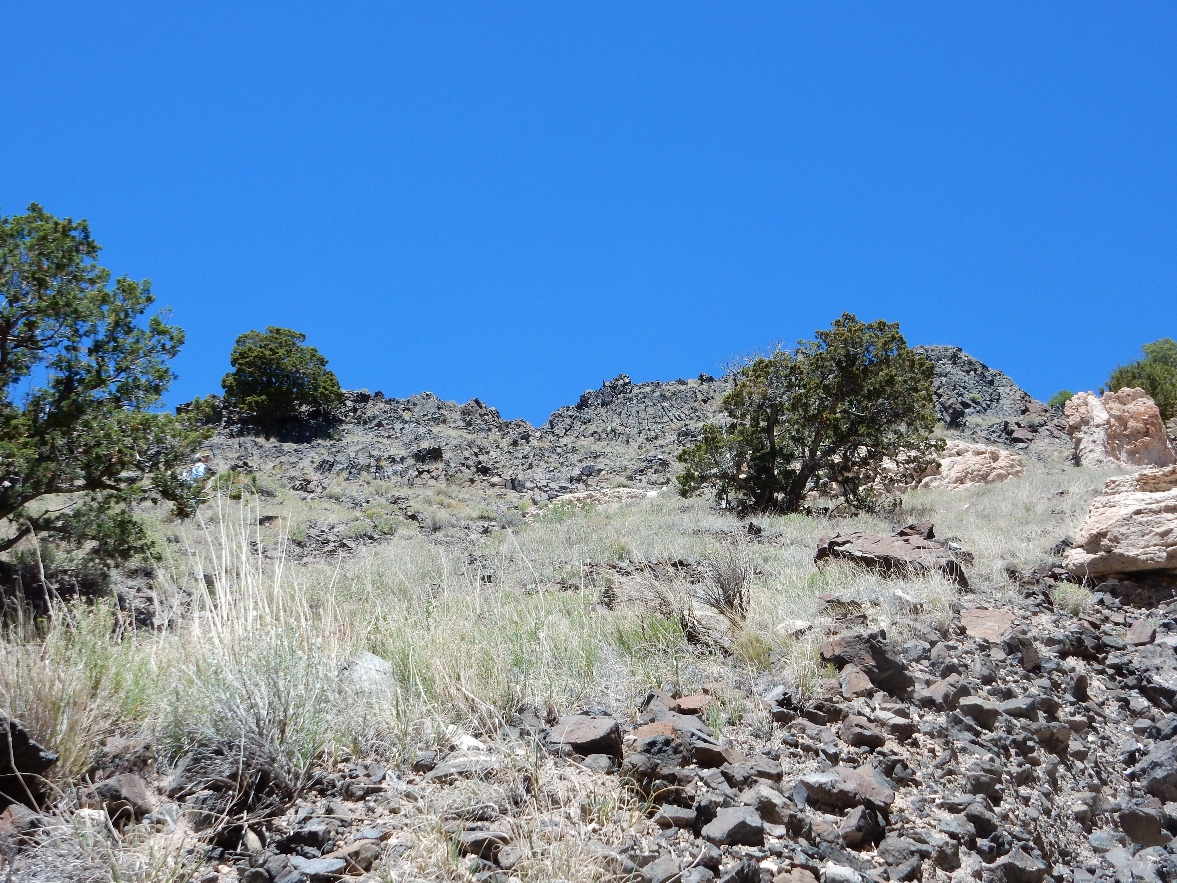
Cerrito de la Ventana dike west of Plaza Blanca. Looking
west from 36
14.178N 106 18.680W
This is but one (particularly prominent and accessible) dike of the Cerrito de la Ventana system. An example of a smaller dike is found near Red Wash Canyon.
Small dike of Cerrito de la Ventana
system. 36
14.097N 106 22.257W
Another dike, or perhaps this same one in a different exposure, is found in the west wall of Arroyo del Cobre.
Here is the paleomap for the Abiquiu Formation.
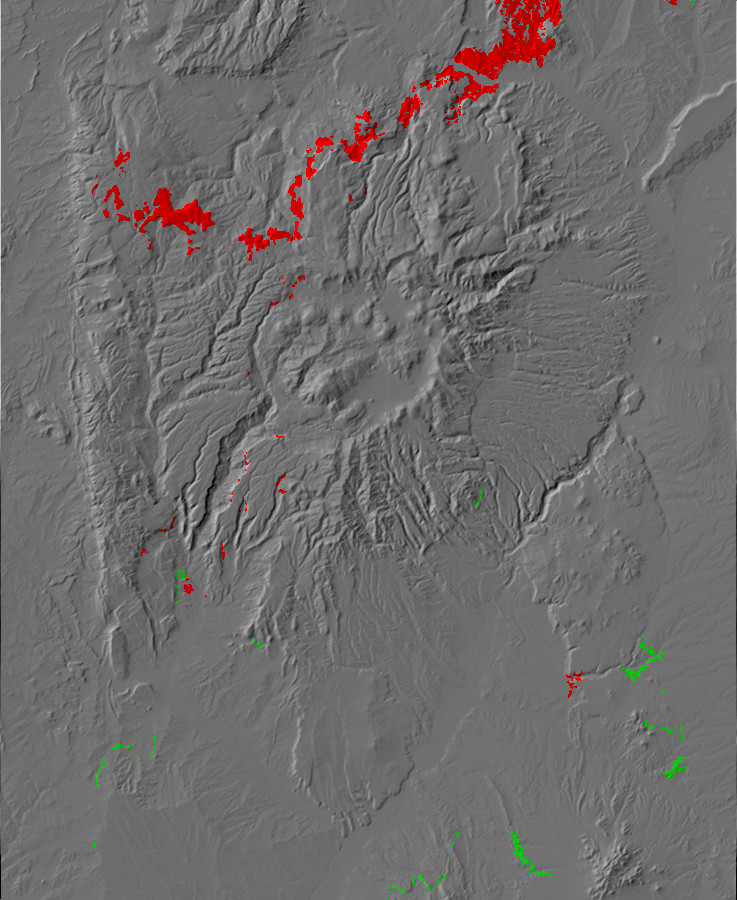
Paleotopographic map
of the Abiquiu Formation
The map shows the limits of the Abiquiu depositional basin
reasonably well. This reached to about the latitude of the Santa
Fe River canyon, although the Abiquiu Formation is notably absent
between the Santa Fe Group and Galisteo beds near the San Miguel
Mountains. However, the Santa Fe River beds may not actually be
Abiquiu Formation.
And this will be the last of the paleotopographic maps in this
book. As we approach the present day, formations begin to overlap
in time in a way that makes such maps decreasingly useful.
During his 1867 expedition, Hayden noted that Santa Fe was surrounded by badlands -- he likened them to the "Mauvais Terres" of the Dakotas -- likely of Tertiary age. These consisted of sandstones and "marls" (unconsolidated limy clay) with some conglomerates, and he named them the Santa Fe Marls. This was the first formal name assigned to a geologic unit in New Mexico. He found that the Santa Fe Marls extended north to Black Mesa, that they dipped gently to the west, and that they were of enormous thickness -- at least 1500' (500m). He reported that the marls formed mesas on the west side of the Rio Grande, with two distinct levels. In this he was mistaken; likely he did not actually cross the river to the Pajarito Plateau, else he would have discovered that the upper level was not sedimentary rock but tuff. Then again, he would not have been the last visitor to the Pajarito Plateau to mistake the pink finger mesas of the Bandelier Tuff for sandstone.
As with the Galisteo Sands, the name Hayden gave to the Santa Fe
Marls has remained attached to these beds to the present day.
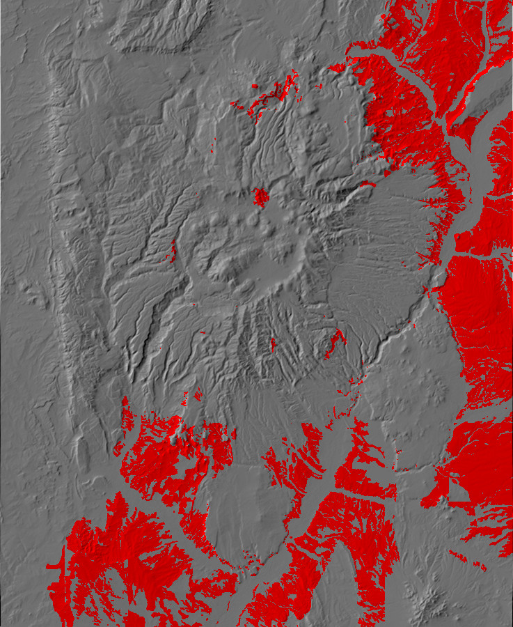
23 million years ago, the world was beginning to look very much like it does today, although Iraq and New Guinea were still under water and Central America was not yet a continuous ribbon of land. In the western United States, the compression of the Laramide orogeny had reversed itself, and instead of the crust being compressed, it began to be pulled apart. At the same time, the asthenosphere under the western United States became hot enough to lift the entire region as the western United States drifted onto the northernmost part of the East Pacific Rise. This was the period when rifting along the Rio Grande Rift really began to get going.
Geologists have chosen this moment in time as the start of the
Neogene. The Neogene is further divided into the Miocene and
Pliocene Epochs. During the Miocene, the severe global cooling at
the end of the Oligocene moderated somewhat, but cooling resumed
by 15 million years ago and temperatures plunged at the end of the
Miocene, about 5.33 million years ago.
Only a small part of the crustal thinning in the Rift is accounted for by lower surface elevations along the Rift. The rest is due to the mantle rising into the rift. The rift is bounded by deep faults on one or both sides, and the combination of deep faulting, a shallow, hot mantle, and the zone of fertile rock along the Jemez Lineament creates conditions for sustained volcanic activity.
The faults bounding the rift are not single large faults, but numerous parallel faults forming one or more fault zones. East of Santa Fe the Pecos-Picuris Fault Zone marks the west face of the Sangre de Cristo Mountains and plunges to the west. To the west, which is the deeper side of the Rift in the Jemez area, there are three systems of faults. These are the Pajarito Fault Zone, the Canada de Cochiti Fault Zone, and the Jemez Fault Zone. Further north, the Pajarito Fault Zone turns east to join the Embudo Fault Zone, while the Jemez and Cochiti Fault Zones disappears under the Jemez Mountains before possibly joining with the Canones Fault Zone.
The Jemez Fault Zone runs roughly along Cañon de San Diego. It is difficult to trace over much of its length, but one strand (the Sierrita Fault) is fairly obvious at Guadalupe Box.
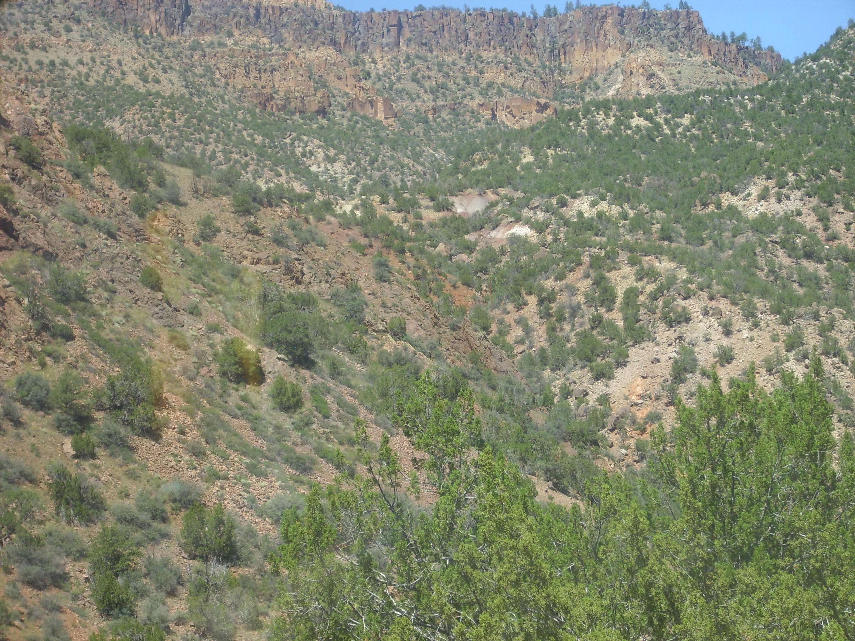
Fault scarp at Guadalupe Box. Looking northeast from
near 35
43.882N 106 45.754W
The darker rock to the left is weathered Precambrian hornblende-biotite quartz monzonitic gneiss ("granite" is close enough for most purposes.) To the right are Permian sedimentary beds. The local topography suggests, and geological mapping confirms, that this is actually a large fault. The younger beds have been thrown down by the fault a considerable distance, bringing them into contact with the Precambrian rocks.
The Canada de Cochiti Fault Zone is largely located on tribal lands in some of the less accessible areas of the southern Jemez, but one of the major strands of the fault, the Camada Fault, passes just west of the Veterans Memorial Overlook at Kashe-Katuwe Tent Rocks.
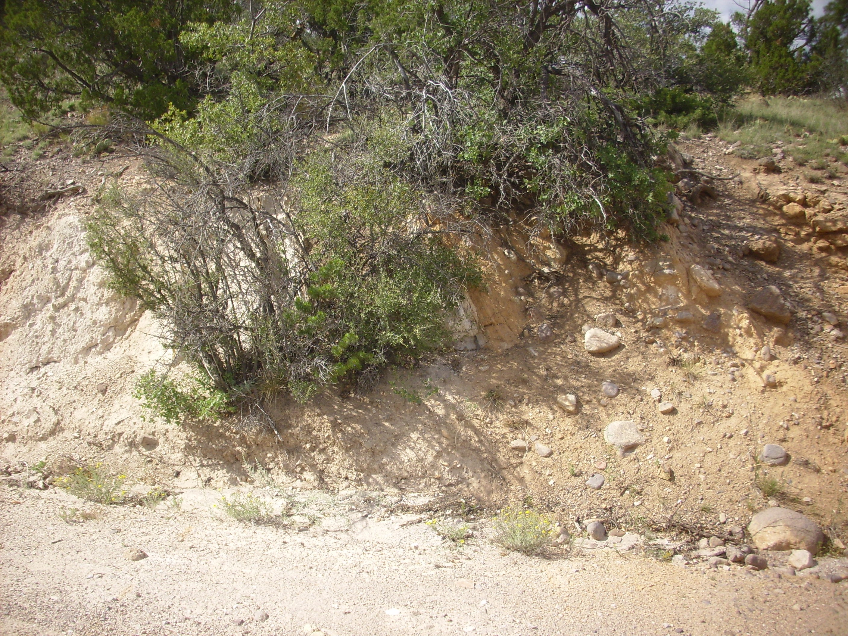
Trace of Camada Fault, Canada de Cochiti Fault Zone. 35
40.330N 106 27.430W
The white beds to the left are Peralta Tuff, while the reddish
beds to right are thin surge beds of the Tsherige Member,
Bandelier Tuff. The right side is thrown down by the fault.
Neither the Jemez nor the Canada de Cochiti fault zones have been
very active in the recent past, as shown by the lack of much
displacement of Bandelier Tuff beds overlying the faults.
The Pajarito Fault Zone is much easier to trace, probably because it is now taking up most of the extension in this part of the Rift and has been significantly displaced since the Tsherige Member of the Bandelier Tuff was erupted, 1.2 million years ago. This fault zone joins the La Bajada Fault Zone to the south and the Embudo Fault Zone to the north. The Pajarito Fault Zone is most obvious southwest of Los Alamos, along the foothills of the Sierra de los Valles, where it forms a prominent escarpment that shows up well on topographic maps:
The Pajarito Escarpment is quite obvious as one approaches it
from the east along State Road 4.
Pajarito Escarpment. 35
50.030N 106 21.351W
You can see that the highway winds up the face of the escarpment. Looking north and south from one of the hairpin turns in the road, we get an excellent view of the Pajarito Escarpment in both directions.

Pajarito Escarpment south of hairpin at 35
49.991N 106 21.804W
The view to the south shows the Pajarito Fault dividing into two strands, one forming the escarpment at the center of the picture, and a second strand to the east (left) forming a smaller escarpment.
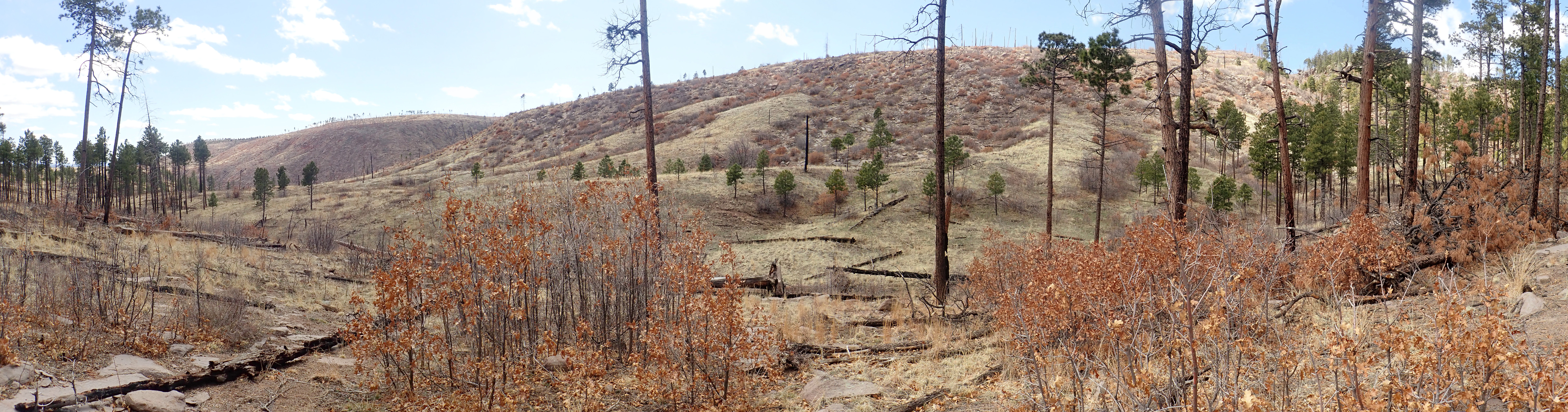
Pajarito Escarpment along Ponderosa Trail. 35.8213873N
106.3613967W
The fault zone is exposed at Upper Crossing in Frijoles Canyon.
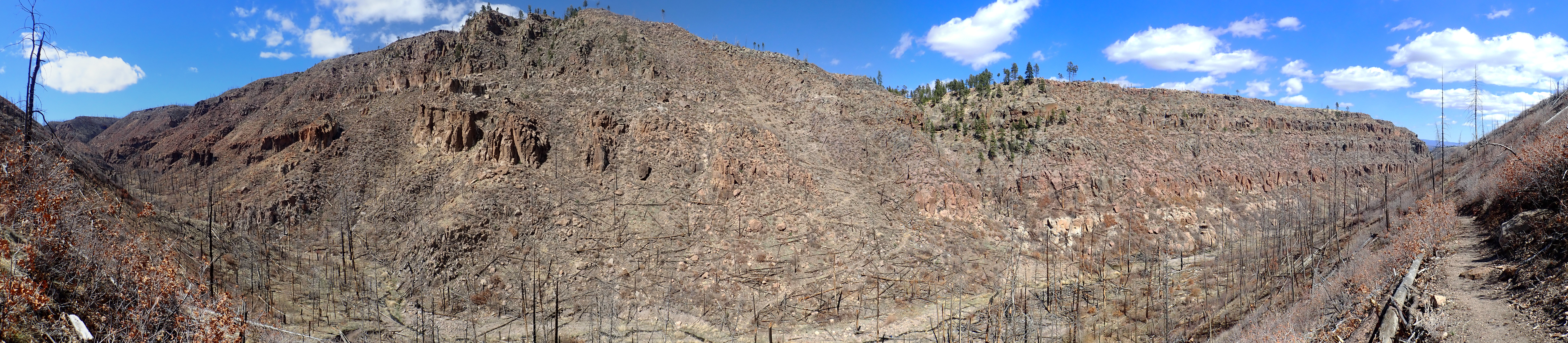
Upper Crossing. Lookin north from 35.8143423N
106.3630143W
The main strand of the fault cuts the canyon right of center,
where the switchback trail is just visible left of a forested
area. A second, probably much older, strand cuts from the notch
just left of the peak of the canyon rim down to the left on the
far side of the irregular darker rock mass. This is an outcrop of
Tschicoma Formation dacite. Two small strands correspond with the
two small notches to the right of the rim peak, and slightly
displace the Bandelier Tuff beds beneath.
Further south, the Pajarito Escarpment also cuts through the San Miguel Mountains, a small outlying range of the Jemez. The fault scarp forms the east slope of St. Peter's Dome and exposes older rocks down to the Galisteo Formation.
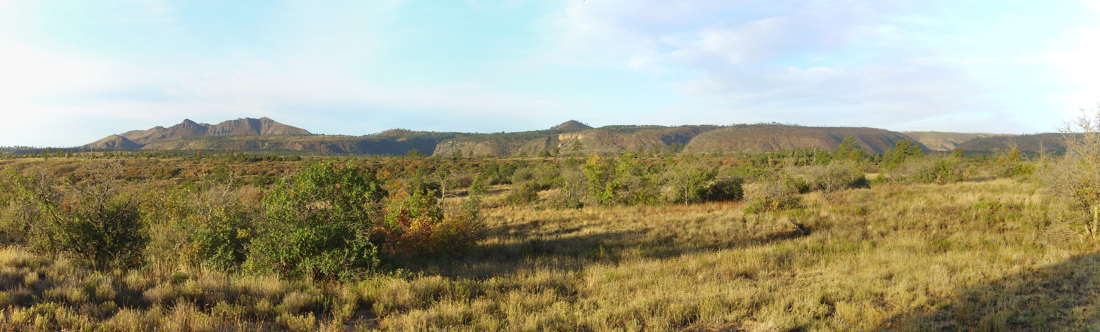
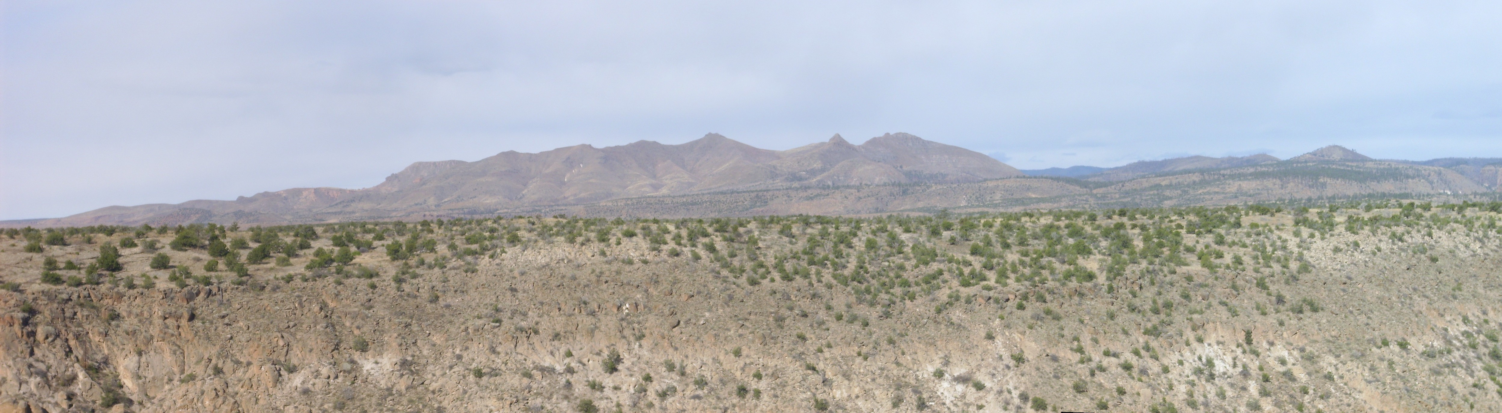
One of the strands of the fault enters Capulin Canyon not far from the Stone Lions shrine.
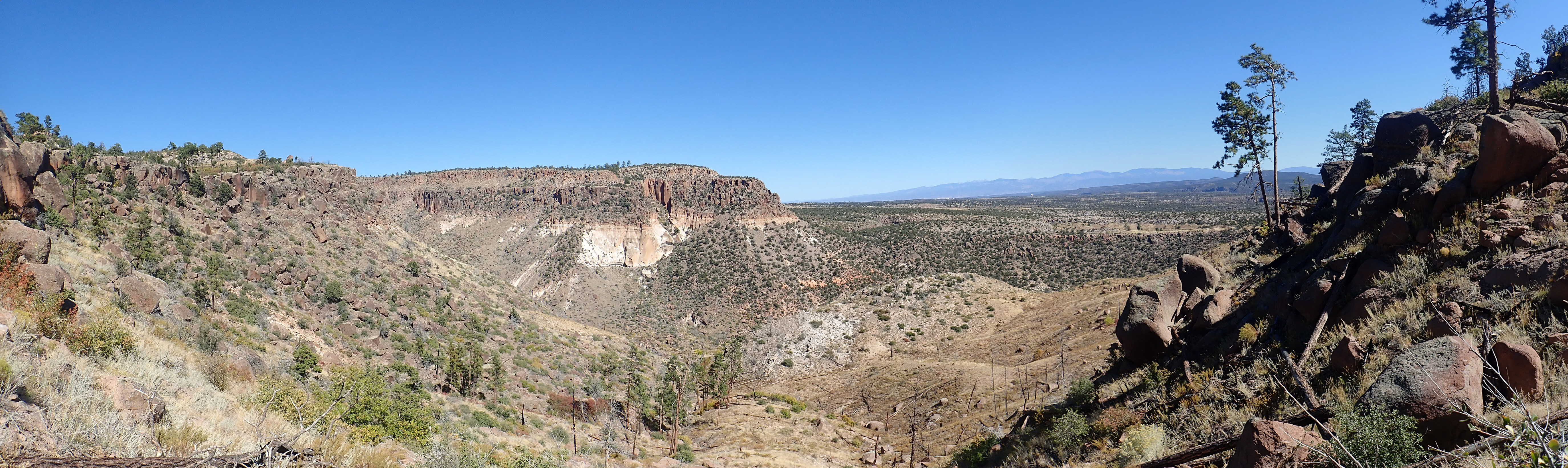
Pajarito Fault strand in Capulin Canyon. 35
46.385N 106 15.714W
The fault runs along the far side of the mesa at center and enters the canyon to its right. The displacement here is about 300 feet (100 meters) since the Tsherige Member forming the mesa cap was emplaced 1.25 million years ago. A much smaller antithetic fault runs to the west of the main fault and visibly displaces the white beds of Otowi Member in the side of the mesa. (We'll revisit the Tsherige and Otowi Members of the Bandelier Tuff in due course.) The displacement is down to the west, opposite of the main fault, which is what makes it an antithetic fault. A small fault associated with a larger fault that is downthrown on the same side is called a synthetic fault. Antithetic faults are not uncommon near major faults.
A smaller strand occurs to the west and displaces the Tsherige Member by a few tens of feet:
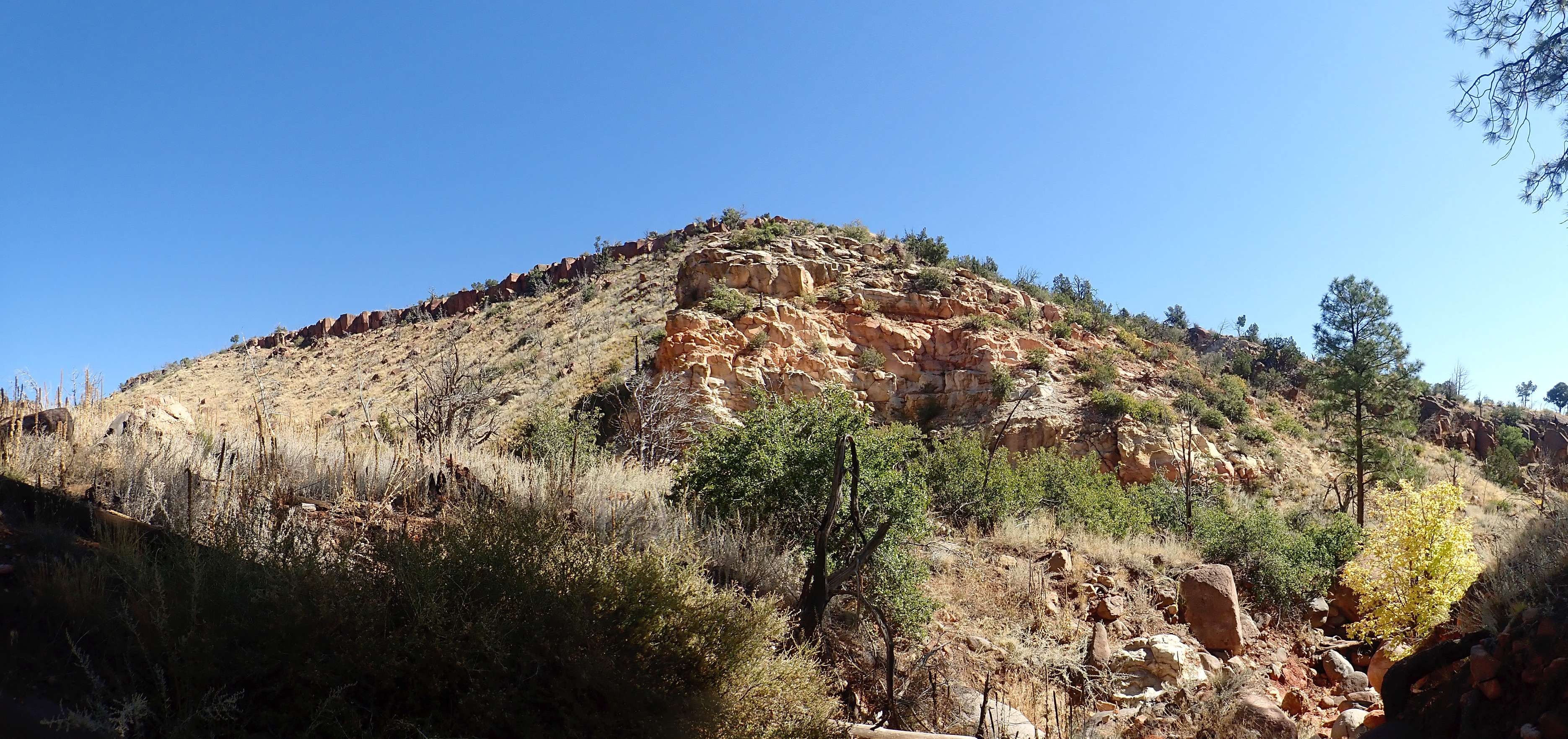
Small fault strand east of San Miguel Mountains. 35.7483163N
106.3434158W
Although the panorama slightly distorts the image, one can see
that the rim of Bandelier Tuff is significantly higher left of the
rocky outcrop of Galisteo Formation than to its right. The fault
trace is just to the right of the rocky outcrop. (We will learn
more about the Bandelier Tuff later in the book.)
The Pajarito Fault splits south of the San Miguel Mountains before both splays pass south out of the Jemez area. The east splay forms the La Bajada Fault, which marks the western boundary of the Cerros del Rio. This fault is thrown down to the west, unlike the main Pajarito Fault, and it marks the point where the Rio Grand Rift is displaced to the west. The fault runs roughly along the base of the La Bajada escarpment, and the exact trace is exposed in the hills west of the Galisteo dam:
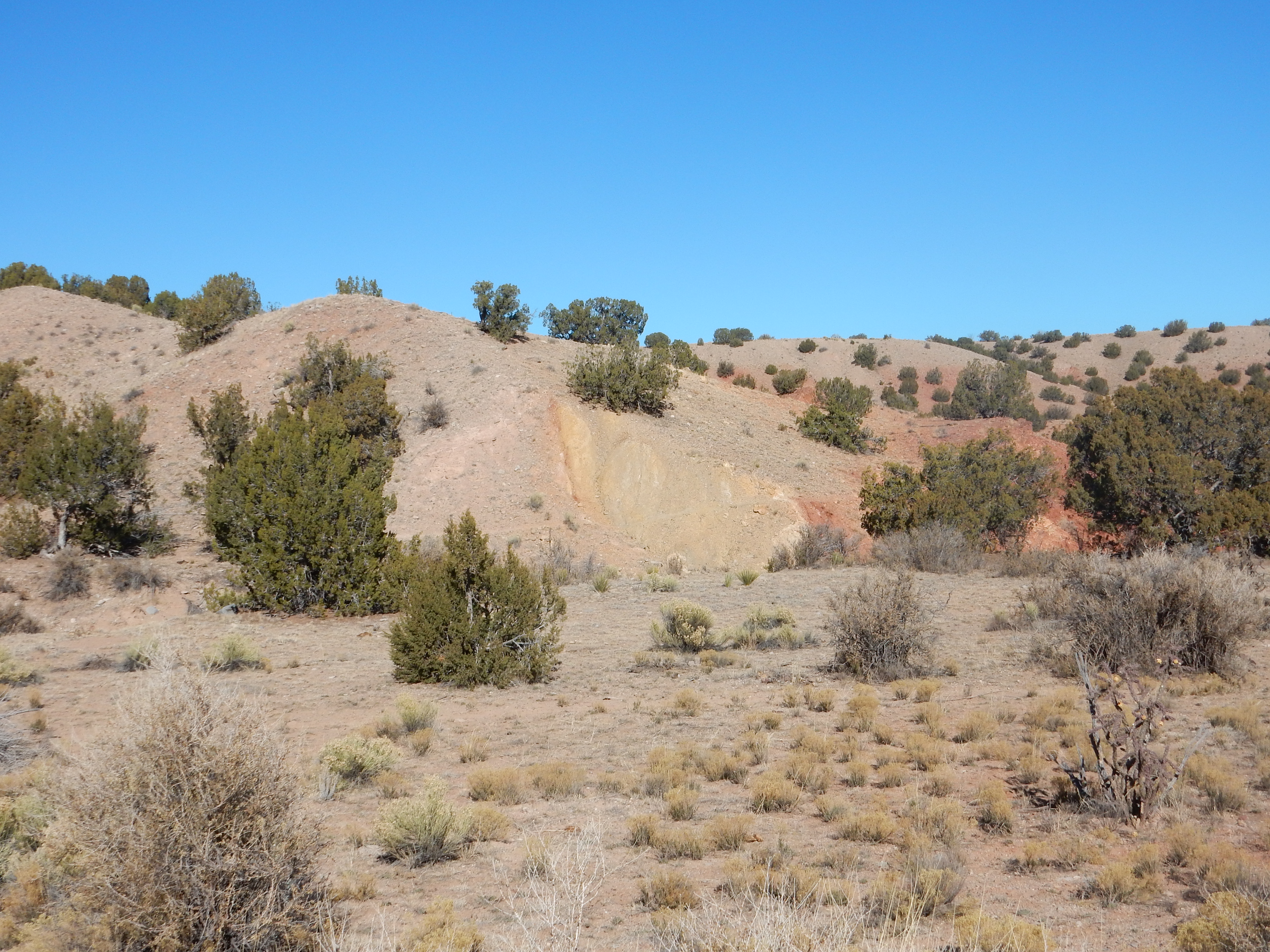
Trace of La Bajada Fault west of Galisteo dam. 35
27.780N 106 14.241W
The reddish, nearly vertical, thin line on the side of the hill is the precise trace of the La Bajada Fault. The fault runs nearly at the foot of the La Bajada escarpment to the north and south, but in this area, Galisteo Creek has eroded the escarpment back so that the fault runs some distance west of it.
The pinkish beds to the left, on the downthrown side, are young Rio Grande Valley alluvium deposits. The reddish beds to the right are much older Chinle Group beds. The yellowish beds immediately to the right (east) of the fault, between the fault trace and the Chinle beds, may be a sliver of Entrada Formation. Or they may be fault gouge, the pulverized rock formed by motion along the fault, which has since been cemented by minerals brought in by groundwater flowing in the fault zone. The geologic map shows Entrada Formation at nearby locations immediately east of the fault trace.
There is a strand of the La Bajada Fault that branches from the
main fault just south of the Cochiti exit from I-25.

La Bajada fault strand. 35.5151689N 106.2284233W
The smaller eastern strand of the fault turns northwest and runs along the base of the cliffs to the right. The yellowish tan beds forming the edge of the cliff are the Salt Wash Member of the Morrison Formation, composed mostly of sandstone laid down by a river system. These cliffs end on the skyline just left of center. The gray cliffs peeking over the Salt Wash Member at the center of the panorama are much young basalt of the Cerros del Rio, with an age close to three million years.
The red beds north (left in the photo) of the fault belong to the
Galisteo Formation. Their presence next to the much older Salt
Wash Member shows that the beds to the left have been thrown down
a considerable distance by the fault. Also, if you look closely at
the beds at the left, you will see that they are tilted upwards.
The beds have been deformed by fault drag, but become more or less
level further north. The motion along the fault is not
strictly up and down; there was some left lateral slip on the
fault.
After the fault passes over the skyline, just left of center in the photograph (where the red soil gives way to tan soil), it begins to curve around more towards the north, but continues separating young Eocene and Oligocene beds from older Jurassic beds. The fault then passes under the lava flows of the Cerros del Rio and becomes untraceable a few miles further north. These flows unhappily (for geologists) conceal much of the accomodation zone where the eastern boundary of the Rio Grande Rift takes a jog to the east.
The main Pajarito Fault, to the west of La Bajada, cuts through Eagle Canyon just west of the old Dixon apple orchard.
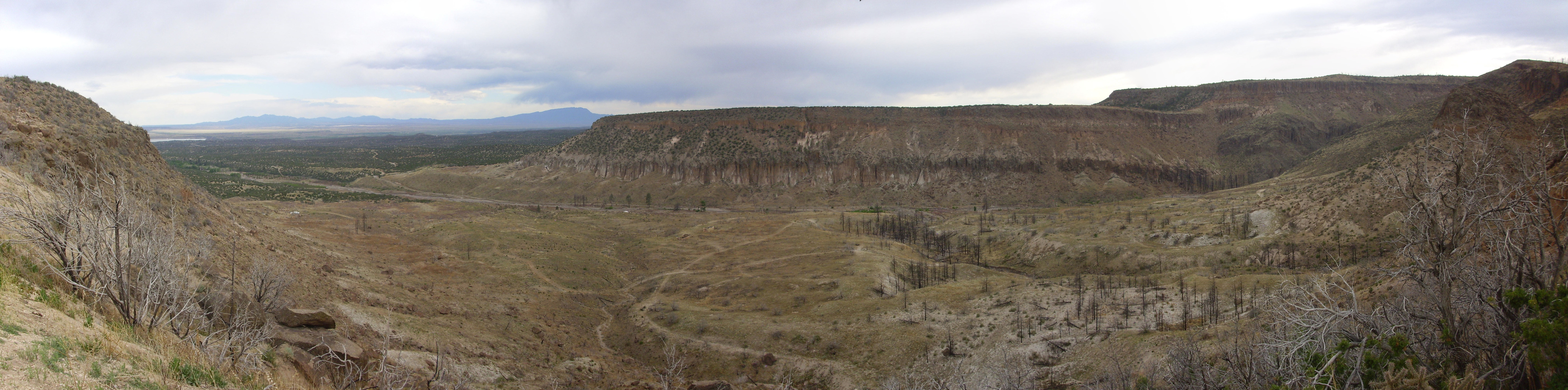
Eagle Canyon from north rim overlook.
35
42.491N 106 23.080W
The escarpment at right marks the trace of the Pajarito Fault.
(Click for a full resolution version.) The fault trace is well
exposed in the canyon wall -- in fact, this is the most dramatic
exposure of the Pajarito Fault I've seen. To the left (east) is
Bandelier Tuff, while to the west is an exposure of dark andesite
of the Paliza Canyon Formation capped by Bandelier Tuff. Note that
the Bandelier Tuff is significantly thicker on the left side of
the fault; there was already an escarpment 1.25 million years ago
and the pyroclastic flow that produced the tuff ponded on the east
side along the escarpment. This shows that the fault was already
active before 1.61 million years ago, when the Otowi Member of the
Bandelier Tuff was emplaced. The displacement in the Bandelier
Tuff shows that the fault has been active in the 1.25 million
years since the emplacement of the Tscherige Member of the
Bandelier Tuff.
One of the findings of geologists that most surprises me is how
long-lived deep fault zones like the Pajarito Fault Zone and the
Jemez Fault Zone are. The area around the Sierra Nacimiento
Mountains has been repeatedly uplifted since at least the time of
the Ancestral Rocky Mountains, 300 million years ago. The
Pecos-Picuris Fault Zone has been in existence nearly as long. The
Pajarito Fault Zone was active during the Laramide Orogeny fifty
million years ago; what's more, until the Rio Grande Rift opened,
the Pajarito Fault Zone worked in reverse of how we see it today,
with the current location of the Jemez Mountains forming a low
area between the Sierra Nacimiento and a high area, the Pajarito
Uplift, between the Pajarito Fault Zone and the Pecos-Picuris
Fault Zone. The Pajarito Uplift is now the Espanola Basin of the
Rio Grande Rift. Similar basins opened up the length of the Rio
Grande Rift, including the San
Luis Basin to the north and the Albuquerque
Basin to the south. Between each basin, the Rift takes a
sharp jog to the right.
We'll return now to that hairpin turn on State Road Four where it
climbs the escarpment, and this time we'll look north.

Pajarito Escarpment north of hairpin at 35
49.991N 106 21.804W
Here the escarpment runs along the eastern foot of the Sierra de
los Valles until it joins the Santa
Clara Canyon Fault north of Los Alamos.
North of the Jemez, there is extensive rift faulting associated
with the opening of the Rio Grande Rift centered around the
village of Canones.
Deformation along this fault zone has been traced as far west as
Coyote and extends east to where the zone merges with the Embudo
Fault Zone. The main strand of the Canones Fault forms an
impressive escarpment just north of the highway where it begins to
climb up to Abiquiu Reservoir.
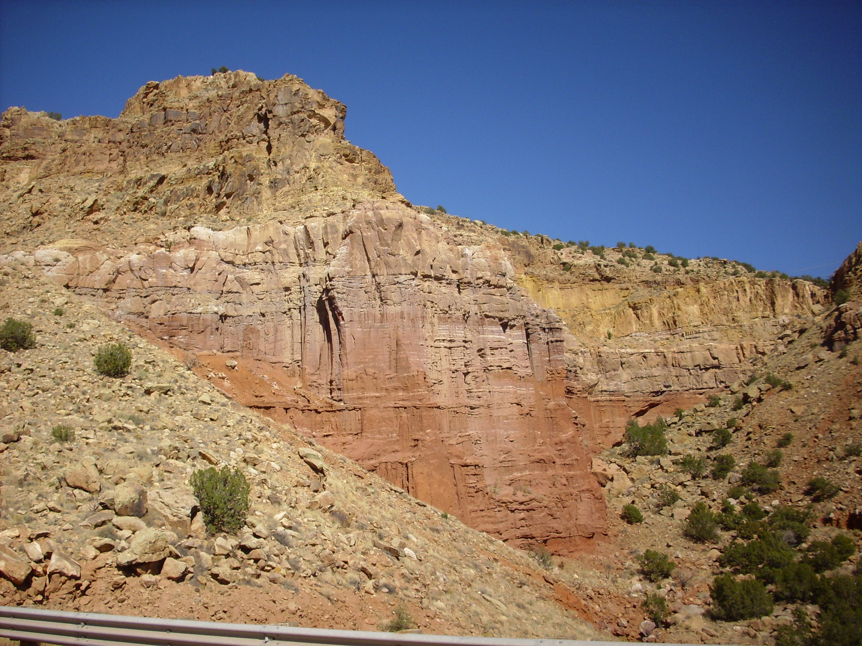
Canones Fault scarp. Looking northwest from 36
14.015N 106 23.294W
This is generally taken to mark the boundary between the Rio
Grande Rift and the Colorado Plateau to the northwest.
Another strand of the fault dramatically offsets exposures of the Jurassic Entrada and Todilto Formations on the north end of Canones Mesa.
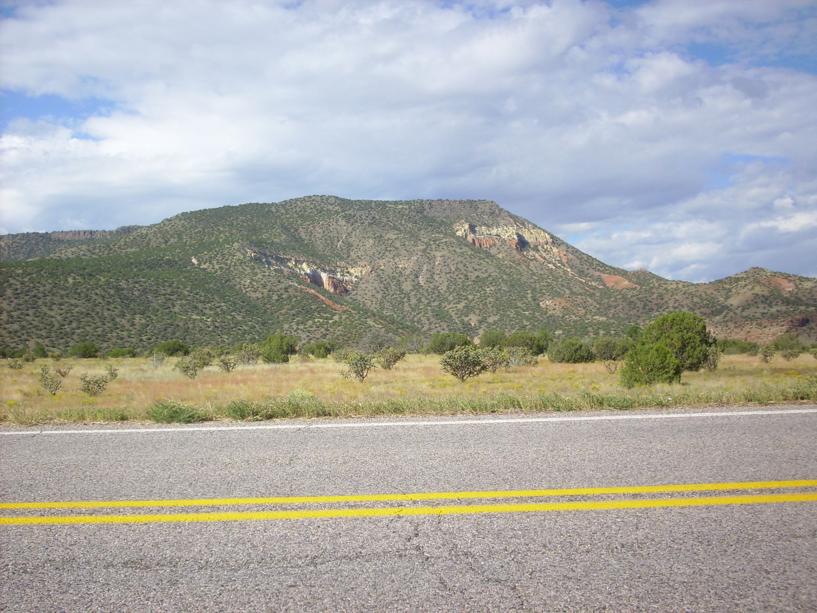
Entrada and Todilto Formation offset by fault through
Canones Mesa. Looking southwest from 36
14.149N 106 24.029W
Red and white beds of the Entrada Formation, capped with a thin
bed of Todilto Formation, crop out on either side of a landslide
down the north face of the mesa. On the east (left) the beds are
thrown down about 70 meters (200 feet) by the fault passing
between the two outcrops. This fault does not displace the lava on
top of the mesa, showing that this particular strand of the
Canones Fault Zone has not been active in at least three million
years.
As our story comes closer to the present, where more geological
evidence is preserved, the growing cast of characters will tend to
break down any telling as a regular progression in time. We will
find ourselves following one story line, then backtracking to
catch up on another. The story of the Santa Fe Group extends from
the beginning of the Neogene almost to the present day, and we
will tell much of it here before returning to the middle Neogene
and picking up the story of the Jemez volcanic field.
As the rift opened, the Pajarito Uplift subsided to become the
Espanola Basin. It is estimated that the basement rock beneath
Espanola is now about 4600 meters (15,000') lower than
corresponding basement in the Sangre de Cristo Mountains to the
east. However, there is not today a yawning chasm four kilometers
deep in this area. As the Pajarito Uplift dropped to become the
Espanola Basin, the basin began to fill with sediments eroded off
the nearby highlands.
These sediments formed beds that are, in some places, thousands of meters thick. Similar thick beds of sediments accumulated in the other basins forming the Rio Grande Rift. These rift sediments are known collectively as the Santa Fe Group. For the most part, the Santa Fe Group consists of weakly consolidated muddy sandstone, though some beds are locally well indurated and the clast size varies from mudstone to coarse conglomerate. Some of the formations making up the Santa Fe Group were deposited by the ancestral Rio Grande River and its tributaries, while others were deposited by wind. Continuing regional uplift caused by the hot asthenosphere under the western United States has resulted in erosion of these thick beds of sediments, which form spectacular badlands throughout the Santa Fe and Espanola area.
The nomenclature for the Santa Fe Group is unusually complicated. This is in part because the individual formations are not always easy to distinguish in the field, and in part because there were multiple sources of sediments. A sedimentary rock formation normally represents a correlated interval in time, but the the sediments laid down in a particular time interval may vary systematically from place to place because they came from a different source. A further complication is that many named members of the group are found to interfinger with each other.
The Santa Fe Group is divided into lower and upper sections. The
lower Santa Fe Group are formations deposited in closed basins,
called bolsons (Spanish bolsón, "purse"), that
often had a central playa or intermittent saline lake,
surrounded by piedmont deposits from the surrounding high ground.
The upper Santa Fe Group are formations deposited in open basins
integrated into an axial river system, either the ancestral Rio
Grande or one of its major tributaries.
There has been much disagreeement on which formations to include in the Santa Fe Group. The oldest formation that is sometimes assigned to the Santa Fe Group is the Abiquiu Formation, which partially filled the rift in its earliest stages of formation. The slightly younger Zia Formation of the southwest Jemez is also assigned to the Santa Fe Group by some geologists but not by others. The oldest rift fill sediments generally accepted as part of the Santa Fe Group belong to the Tanos Formation.
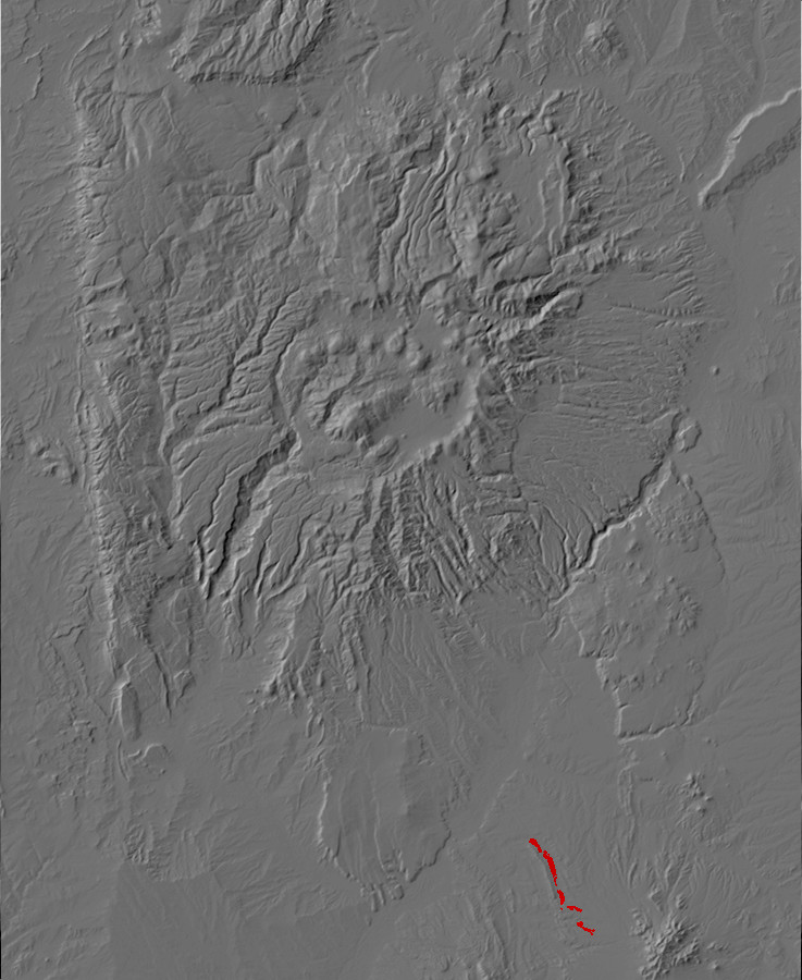
Relief map of the Jemez with Tanos Formation
outcroppings highlighted in red.
The Tanos Formation was named relatively recently, to designate what had previously been mapped simply as basin floor sediments of the undivided Santa Fe Group. It crops out only in the Hagen Basin, where erosion of a tilted block of crust on the margin of the Rio Grande Rift has exposed the very oldest beds of the Santa Fe Group where they rest on the Espinaso Formation.
The base of the formation is a coarse conglomerate.
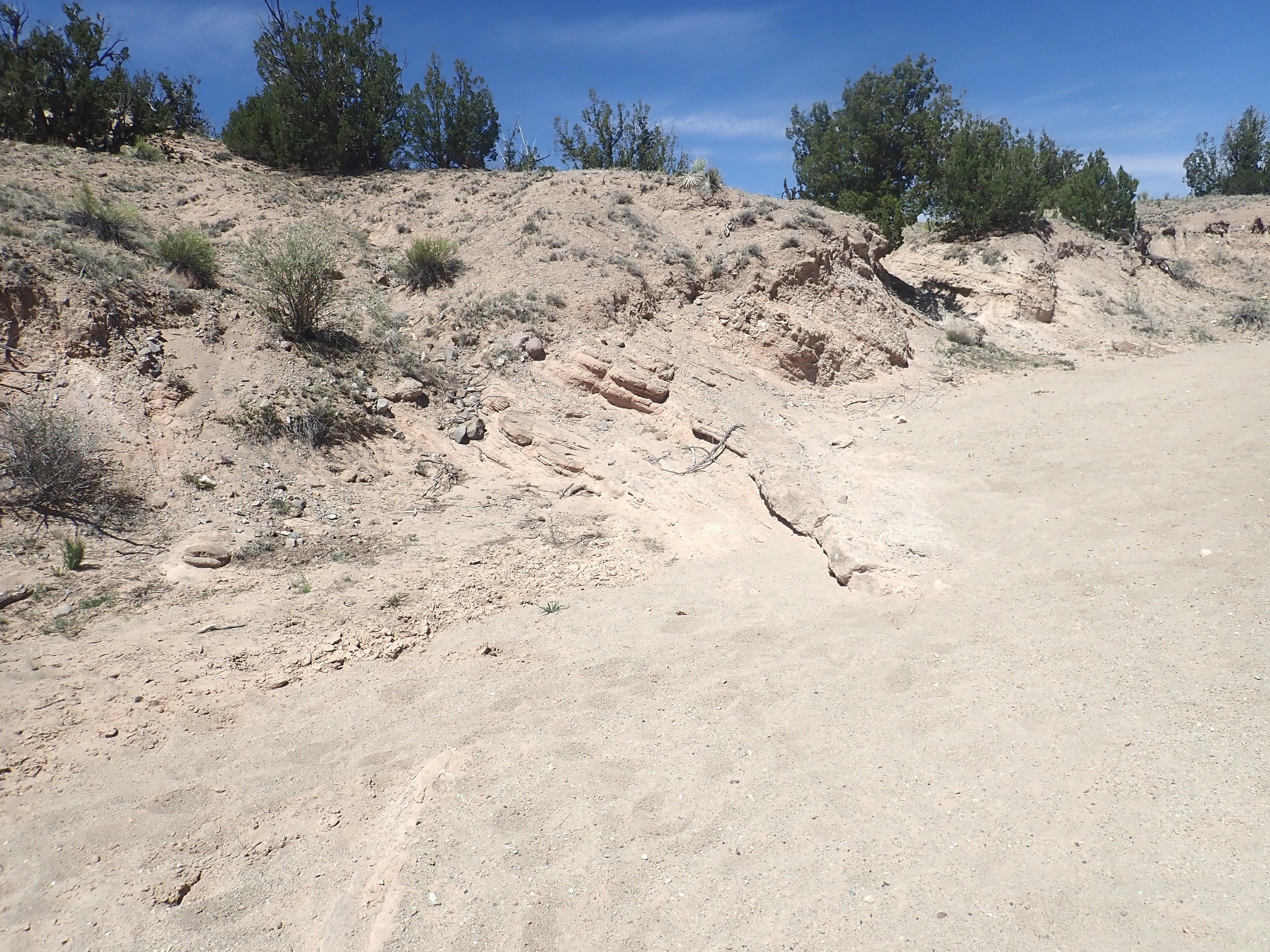
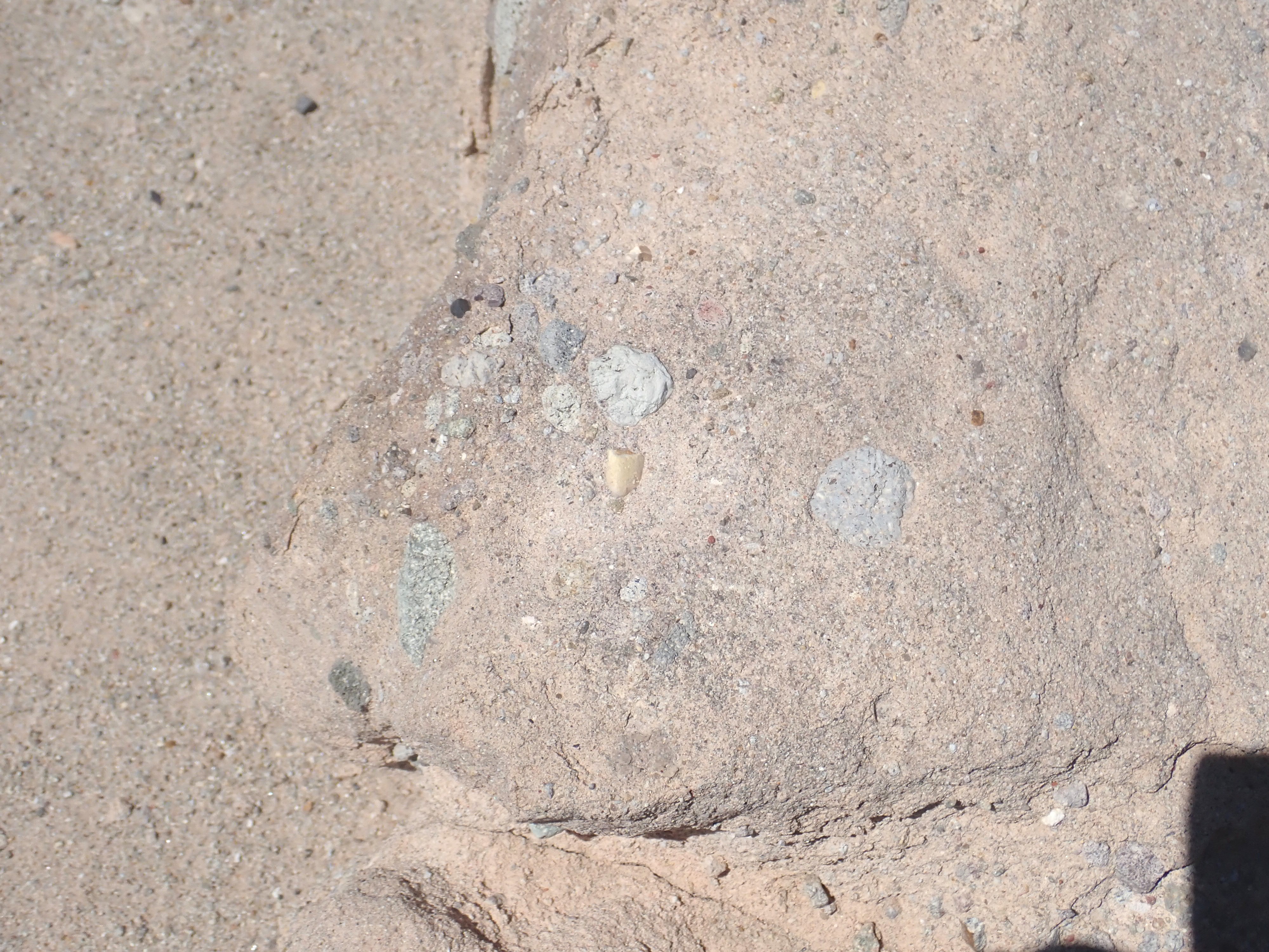
Tanos Formation. 35.384915N
106.3055342W
This is overlain by sandstone and siltstone.
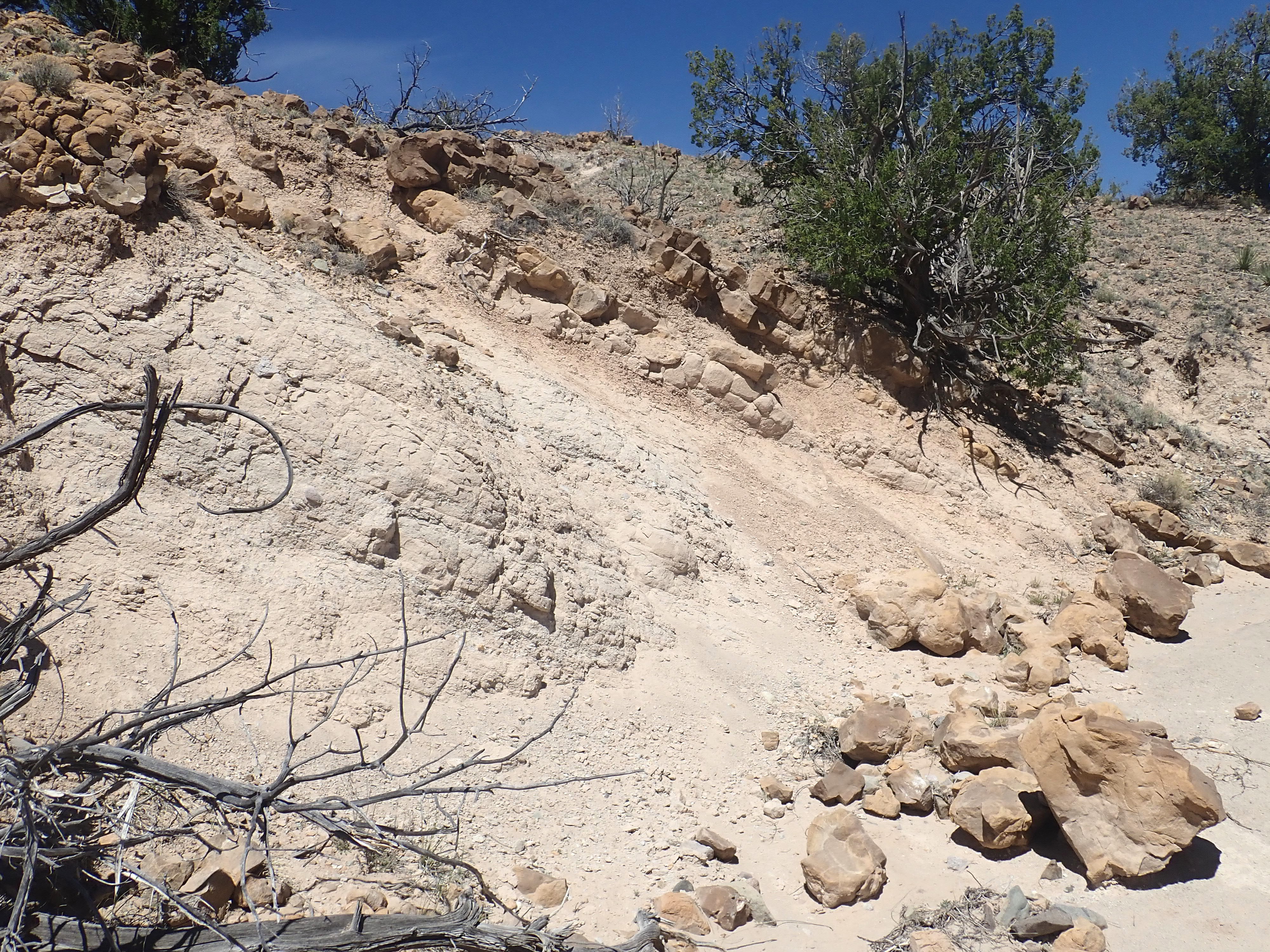
Tanos Formation. 35.385717N
106.3064624
Under the loupe, the sandstone is found to be a poorly sorted,
dirty sandstone.
The Tanos Formation is interpreted as being deposited in a closed
basin produced by very early rifting, with occasional thin
limestone beds from ponds and other indications of poorly
established drainage to the north. A basalt flow interbedded with
the lower sediments has been radiometrically dated as 25 million
years old. The tilting of these beds indicates that they were laid
down before the Hagan Basin itself was tilted, likely by the rise
of the Sandia Mountains.
In July of 1859, on the eve of the Civil War, Captain John N. Macomb led a topographical engineer party on a expedition looking for a practical route from Santa Fe to the Great Basin. Much of the expedition followed the poorly charted Spanish Trail. While the expedition failed to find a practical route across the steep canyons of the Green and Colorado Rivers, the expedition included geologist John S. Newberry, who produced the first good geologic report on the heart of the Colorado Plateau. Alas, the outbreak of war delayed publication for a full sixteen years.
During the return to Santa Fe, Newberry visited Cañon de San Diego and the Valle Grande, becoming the first trained geologist to examine the Valles caldera. Near Jemez Pueblo, he noted "a number of buttes of white tufaceous rock ... undoubtedly Tertiary, [which] belong to the great series of freshwater deposits of Miocene and Pliocene age." Though his estimate of the age was slightly off — the beds were entirely Miocene in age — he was otherwise correct about their age and character.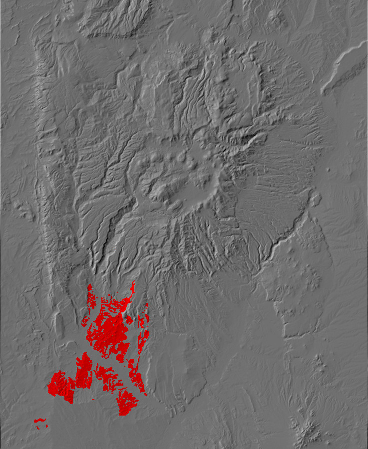
Relief map of the Jemez with Zia Formation outcroppings
highlighted in red.
The Zia Formation is from 25 to 12 million years old, coinciding
with the earliest period of rifting along the Rio Grande Rift. It
is exposed in the southwest Jemez, in some places forming spectacular
badlands. Some of the most prominent are in lower Canon de
San Diego.
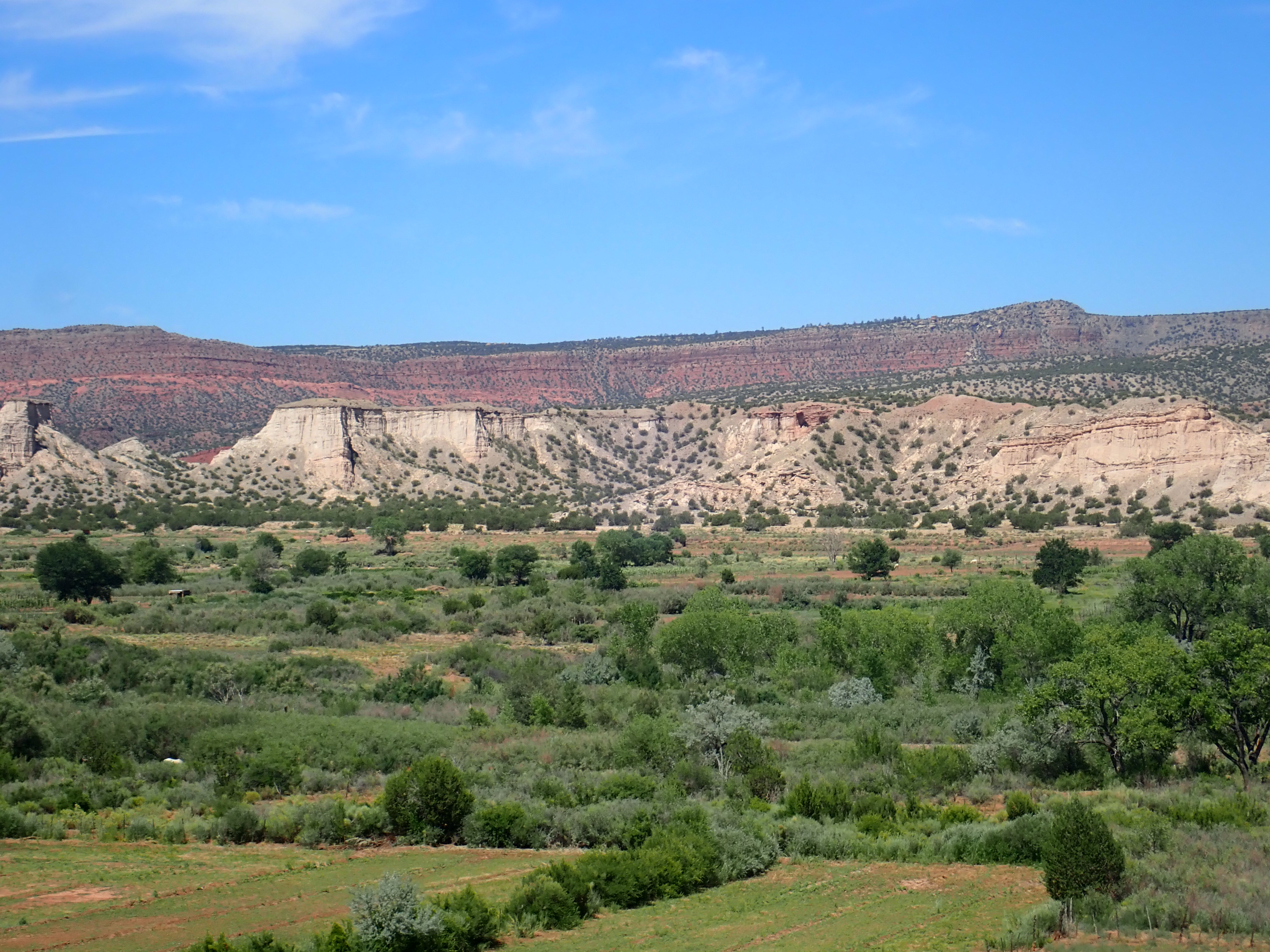
The Zia Formation here consists of very soft sandstone of nearly pure quartz, probably deposited as sand dunes about 13 to 20 million years ago. In this photograph, it is capped with younger gravels cemented with travertine and, as is usually the case when softer beds underlie more resistant beds, the softer Zia Formation forms cliffs and towers capped by the harder overlying sediments. Because the Zia Formation is so poorly cemented, its earliest name in the geologic literature was the Zia Sand.
Based on sedimentary structures in the formation, it is thought
to have been deposited as sediments that were first transported
south along the ancestral Jemez River, then carried east by the
prevailing winds.
The Zia Formation can be traced further east, cropping out in the banks of Vallecitos Creek southwest of the village of Ponderosa.
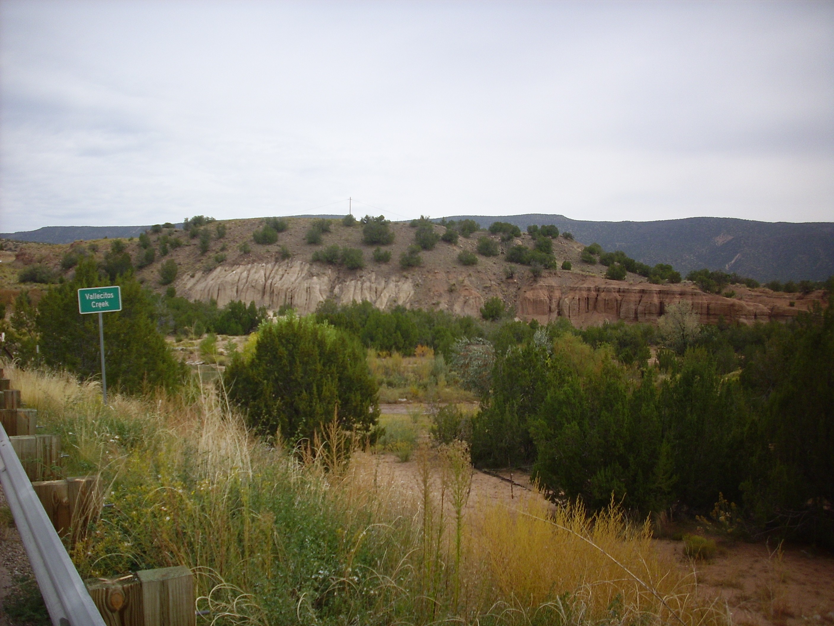
Zia Formation. Looking east from 35
37.693N 106 42.095W
The Zia Formation is the white area to the left. The contrasting tan beds to the right are much younger terrace deposits of Vallecitos Creek, enriched with reddish sediments from the Paleozoic beds upstream. Zia Formation also crops out in the western slopes of Borrego Mesa.
Zia Formation. Looking east from 35
37.693N 106 42.095W
The Zia Formation disappears in the area west of Cochiti Pueblo,
buried under younger deposits of the Cochiti Formation. This
reflects the migration of the active western margin of the Rio
Grande Rift to the east.
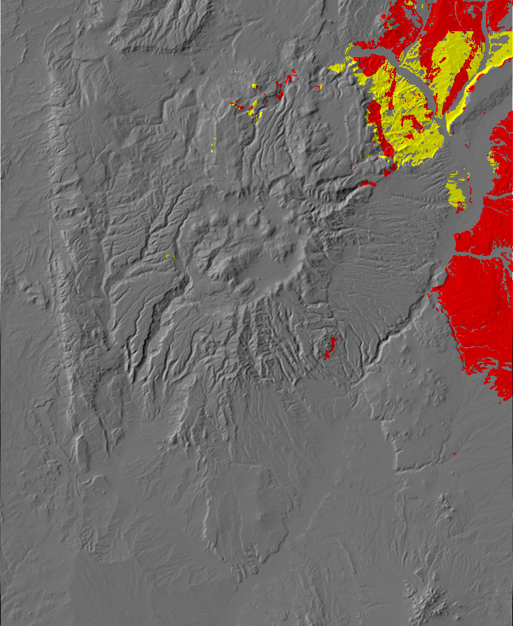
Relief map of the Jemez with Tesuque Formation
outcroppings highlighted in yellow (Ojo Caliente Member) or
red (all other members.)
The Tesuque Formation is the chief Santa Fe Group formation in
the Espanola Basin. It lies atop the Abiquiu Formation and its age
is between about 26 million and 11 million years old, making it
contemporary with the Zia Formation. In places it is more than
3000 meters (10,000 feet) thick. Because of its great thickness,
it was originally divided into five members, which (from oldest to
youngest) are the Nambe Member, the Skull Ridge Member, the
Pojoaque Member, the Chama-El Rito Member, and the Ojo Caliente
Sandstone. More recent classifications have added the Cejita and
Cuartales Members, both younger than the Pojoaque Member.
There is also overlap in age. It was recognized from the start
that, while the Nambe, Skull Ridge, and Pojoaque Members form a
fairly straightforward age sequence, the Chama-El Rito Member,
with an age of about 17 to 11 million years, overlaps the Pojoaque
Member and part of the Skull Ridge Member in time. It is
identified as a distinct member because its sediments originate
from the San Juan volcanic field to the north and northwest rather
than the Sangre de Cristo Mountains to the east. The Ojo Caliente
is mostly younger than the other members, but there is some
overlap of the oldest Ojo Caliente beds with the earliest Pojoaque
and Chama-El Rito beds.
To further complicate matters, the Tesuque Formation is also
divided into Lithosome A and Lithosome B, and this division cuts
across the more traditional division into members. The two
lithosomes represent two distinct source regions for the sediments
originally thought to originate in the Sangre de Cristo Mountains.
Lithosome A is thought to be sediments eroded from the Sangre de
Cristo Mountains to the east, and it consists of distinctly
pinkish sediments rich in feldspar grains (arkose) and granite
clasts deposited by a broad network of small streams flowing to
the west. Lithosome B is thought to be sediments carried by larger
rivers from the north and northeast, and it consists of tan
sediments that contain singificant clay and a wide variety of
different clasts. Thus, geological maps distinguish, for example,
the Pojoaque Member of Lithosome A from the Pojoaque Member of
Lithosome B.
The Santa Fe Group has proven to be a good fossil hunting ground.
G.K. Gilbert visited San Ildefonso with the Hayden Survey in 1873
and found fossil mammal bones dating to the Pliocene. Some of
these were sent to the great paleontologist Othniel Marsh, but his
bitter rival E.D. Cope arrived at San Ildefonso the next year to
collect a number of Miocene repile, bird, and mammal fossils. The
American Museum of Natural History sponsored fossil digs from 1942
to 1965 that produced a vast collection of around 10,000 fossil
fragments. Prehistoric mammals ranging from dire wolves (extinct
relatives of gray wolves) and horses to camels, primitive
elephants, and primitive hippopotamuses have been found in the
various members of the Tesuque Formation. This forms much of the
basis for its division into members.

Commercial camel fossil from Santa Fe area
Camel footprints were discovered in an ash bed just west of Santa
Fe Airport in the 1960s.
The Tesuque Formation is particular rich in fossils east and west
of the highway from Santa Fe to Espanola. Palm fossils north of
Santa Fe suggest that the elevation was still only 700m (2300') in
the middle Miocene, much less than the current elevation of 1800m
(6000').
The Nambe Member crops out close to the Sangre de Cristo Mountains, well east of the Jemez area, and we will not have much to say about it. It is mostly soft, pink sediments that weather to low hills.
Nambe Member. Looking north from 35
54.851N 105 58.130W
Closer to the mountains, the Nambe Member starts to contain more coarse conglomerate beds.
Nambe Member. Looking north from 35
57.217N 105 55.367W
This is a very common pattern in sedimentary beds. The coarser material is found nearer the source rocks and the finer material further away. This can be a very useful clue when reconstructing paleotopography for more ancient periods in the earth’s history, where sedimentary beds are all that are left of the original landscape. Thus, the tendency for beds of the Triassic (between 200 and 250 million years ago) to be coarser north of the Jemez than south of the Jemez is a clue that the sediments originated in a highlands near the Colorado border.
The Skull Ridge Member crops out as far west as the
Pojoaque-Espanola highway and is notable for its large number of
ash beds. These date to around 15 million years old, two million
years older than the oldest known ash-producing eruptions in the
Jemez region. Either the ash came from further afield, or it came
from vents in the Jemez that are now buried under flows from later
eruptions. The base of the Skull Ridge Member is defined in much
of the region by a particularly distinctive ash bed.
A prominent feature of the Skull Ridge Member is the Red Wall, so named by paleontologists digging for fossils in the area.
The Red Wall. Looking west from 35
55.194N 105 57.965W
The Skull Ridge Member tends to form cliffs like these, probably because its numerous ash beds provide cementing silica. Similar cliffs are impressive and readily accessible in the Camel Rock area along the main highway from Santa Fe to Espanola.
Skull Ridge Member in Camel Rock area. Looking east from
35
50.019N 105 59.048W
Numerous fossils have been collected from the Skull Ridge Member,
and these help define the Barstovian faunal stage. A
faunal stage is a distinctive combination of animal fossils found
in beds of a fairly narrow range of age, not more than a few
million years. The presence of ash beds that can be
radiometrically dated has allowed paleontologists to fix the time
frame of the Barstovian stage as from about 16.3 to 13.6 million
years ago.
The Tesuque Formation is prominent in the Espanola Valley east of the Rio Grande, where it forms the spectacular badlands of Los Barrancos:

Los Barrancos. Looking north from near 35
52.897N 106 04.045W
Note that the beds tilt to the west (left). Geophysical data shows that the Rio Grande Rift in the Espanola area (the Espanola Basin ) is deepest to the west. These beds are mapped mostly as Lithosome A with Cuartales Member on top underlain by Pojoaque Member. To the west, the beds transition to Lithosome B, primarily of the Pojoaque Member. Numerous north-south faults cut across the beds, further complicating the geological picture.
Both of these members are exposed in road cuts along the highway from Pojoaque to Totavi.
Pojoaque Member, Lithosome A. 35
52.906N 106 06.958W
This is a thick siltstone interbedded with thin gravel layers.

Cejita Member, Lithosome B. 35
53.114N 106 06.417W
You can see the slightly redder color of Lithosome A versus the
more tan color of Lithosome B.
The contrast between lithosomes within a single member is visible in the hills along the road from Otowi to Pojoaque.
Contact between Lithosome A and LIthosome B in Pojoaque
Member. 35
53.172N 106 05.896W
Notice that the top of the hill is distinctly redder than the lower slopes. The geologic map confirms that this is the contact between Lithosome A (on top) and Lithosome B (at bottom) of the Pojoaque Member.
One of the best exposures of the Tesuque Formation for close
examination is found in a road cut along Highway 285 southeast of
Espanola.
Road cut in Pojoaque Member, Lithosome
A, Tesuque Formation. 35.984N
106.053W
The best location for appreciating the great thickness of the Tesuque Formation, though located just east of the Jemez region, is probably the south rim of the Santa Cruz river valley.
Almost the entire thickness of the cliffs north of the river is underlain by Lithosome A of the Tesuque Formation. The geologic map for this area does not divide this into members.
Along the western margin of the Rio Grande Rift, the Chama-El Rito Member makes up the bulk of the lower Tesuque Formation. It is prominent in the badlands north of the Santa Clara Mountains.

Chili Badlands. Looking north from 36.035674N
106.24034W
The Canada del Almagre Fault runs roughly along the arroyo
running north-northwest at the center of the panorama. Chama-El
Rito Member is exposed west (left) of the fault at the foot of
Lobato Mesa.
Chama-El Rito Member. Looking north from 36.035674N
106.24034W
To the right of the fault, on the downthrown side, the Chama-El Rito Member is overlain by Ojo Caliente Member. The Chama-El Rito Member reappears further east near the Chama River.
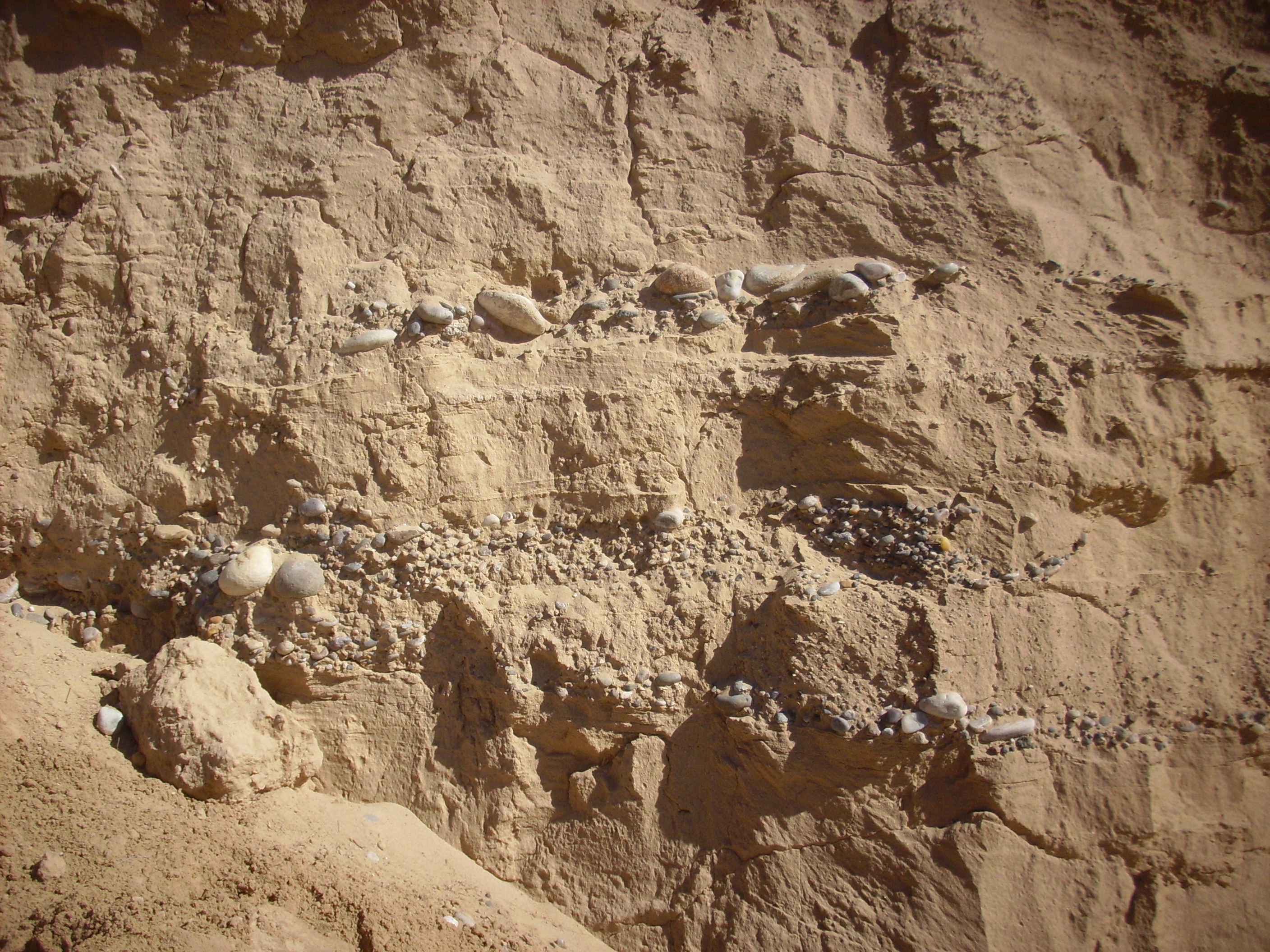
Chama-El Rito Member near the Chama River. 36.1269438N
106.1670207W
The lenses of rounded clasts derived from the mountains to the
north and northwest are characteristic of the Chama-El Rito Member
and distinguish it from the Ojo Caliente Member, which is almost
devoid of gravel.
The beds are covered further south by basalt of the the Santa Clara eruptive center, but reappear on the south flank of the Santa Clara Mountains.

Chama-El Rito Member. 36.030121N
106.2341054W
At Sierra Negra northeast of Abiquiu, the Chama-El Rito Member is
exposed on the flanks of the mountain. Here a major fault has
displaced the Chama-El Rito Member downwards on the right side of
the fault, placing it alongside older Abiquiu Formation beds. We
saw this picture earlier in the chapter.
Sierra Negra. Looking north from 36
12.231N 106 14.805W
The Chama-El RIto Member is the reddish beds to the right. Further west, thick beds of the Chama-El Rito Member are exposed on the flanks of Abiquiu Mesa.
North of Abiquiu, there are tuff beds interpreted as remnants of an old tuff ring formed by localized volcanic activity within the Chama-El Rito Member. The tuff ring has not been dated.

Remnants of tuff ring. Looking northeast from 36
13.361N 106 17.845W
The tuff ring remnants are the greenish-tan beds at left and right center in the photograph. Another set of tuff rings are found further to the east, on the road to El Rito.
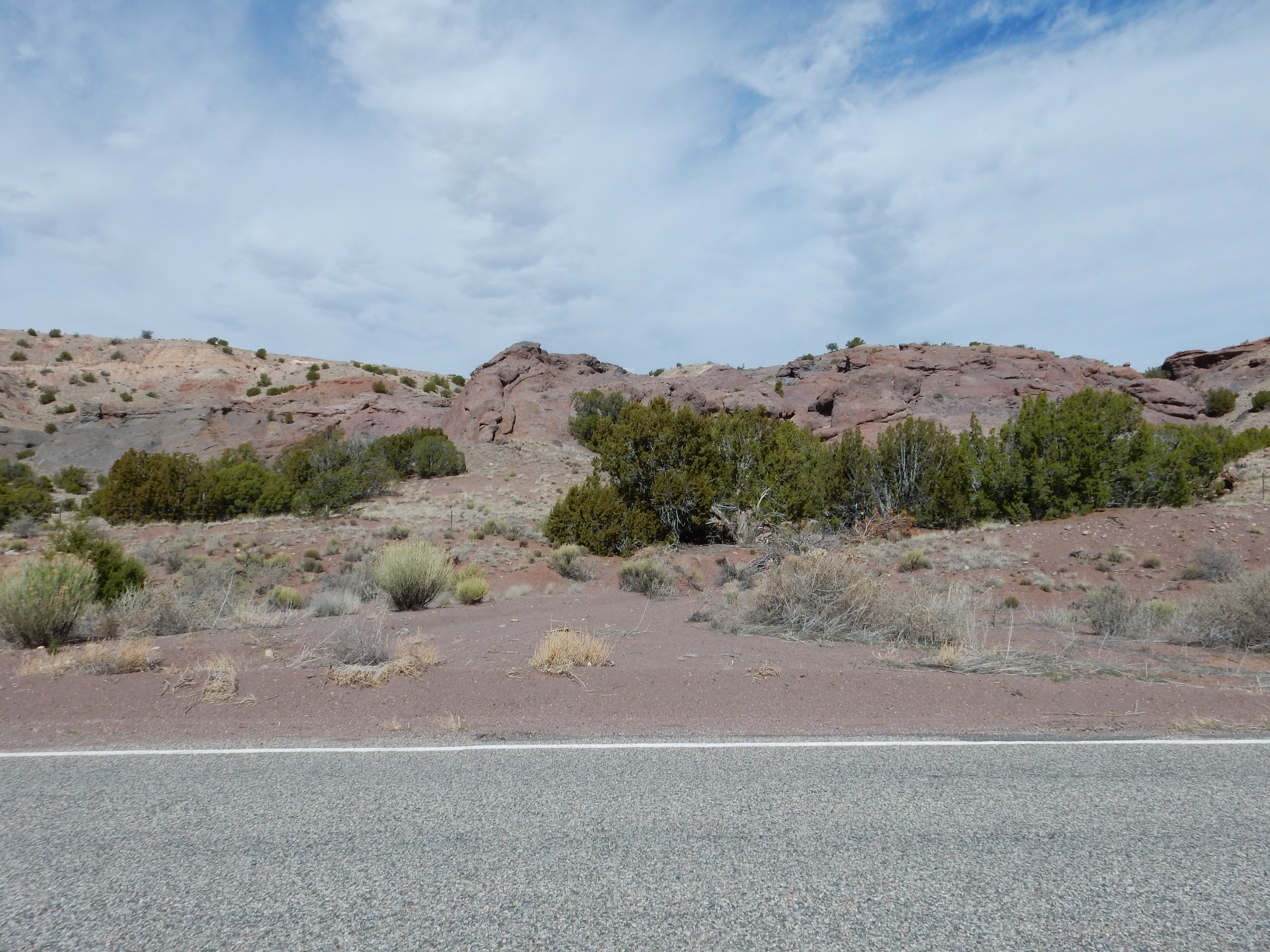
Remnants of tuff ring. Looking west from 36
14.288N 106 11.537W
The darker rock is a basaltic tuff, formed from bits of silica-poor lava thrown out by an eruption. Basaltic tuffs do not form the vast outflow sheets you see with rhyolitic tuff, such as the Bandelier Formation. The silica-poor lava does not hold onto its gas content long enough to move far from the vent as suspended particles. This particular tuff was erupted in a small eruption some 15.3 years ago, based on potassium-argon dating of a basalt bomb embedded in the tuff.
Here's a closer look.
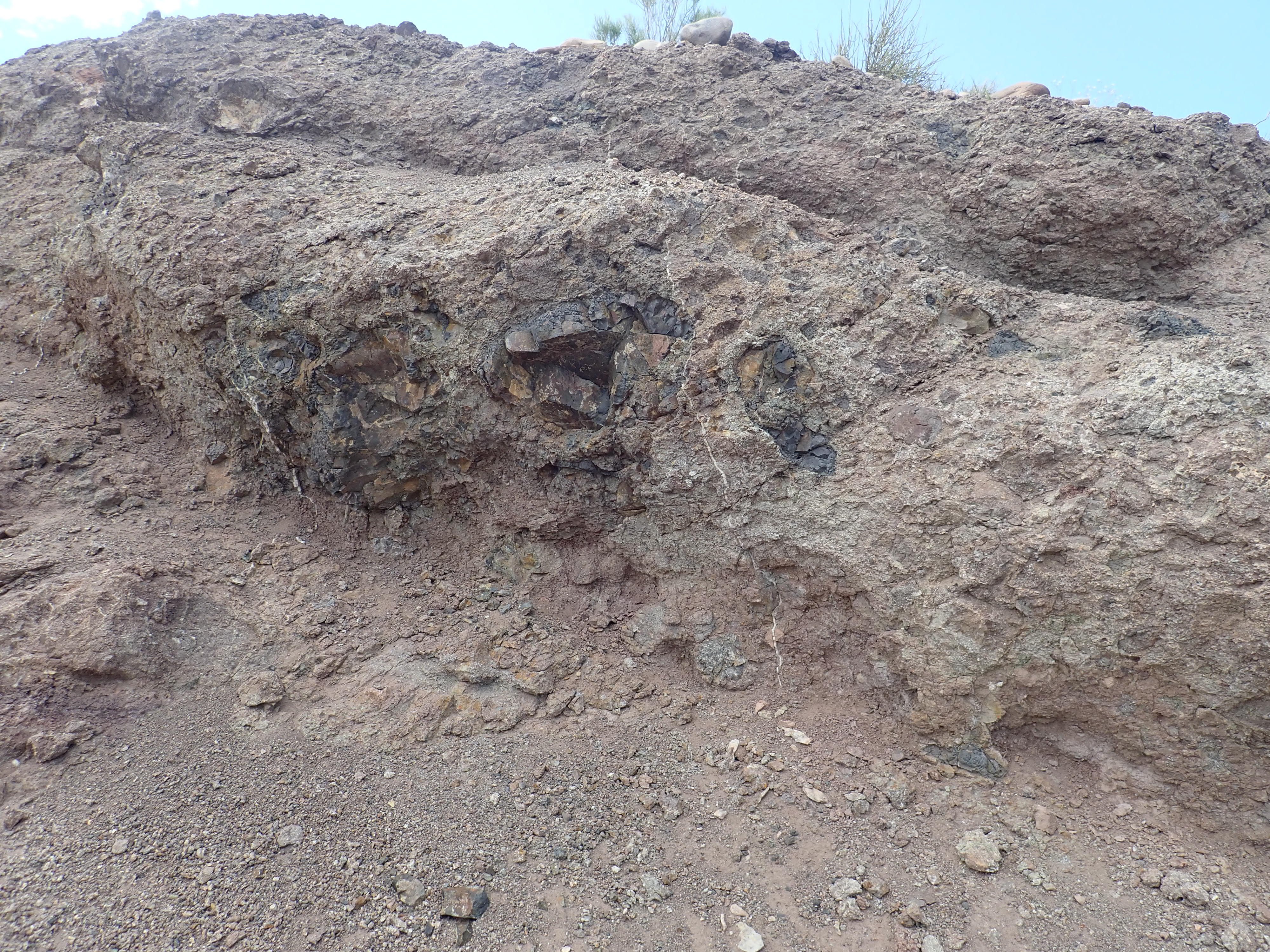
Mafic tuff. 36.2403711N
106.1922591W
This portion of the ring is composed of basaltic cinder and ash cementing together large broken fragments of basalt.
Other beds are much better sorted.

Mafic tuff. 36.2418693N
106.195026W
The color shift is fairly abrupt, perhaps representing the point
where hydromagmatic explosions gave way to pure cinder.
An arroyo cuts through the tuff ring, exposing veins of fluorite and barite.

Mineral vein. 36.2424011N
106.1910985W
Fluorite, CaF2, and barite, BaSO4, are the
principal ores of fluorine and barium respectively, as well as
having minor uses in their raw form. Both elements are
incompatible elements, and the veins here were deposited by
hydrothermal fluids, possibly associated with a nearby fault.
Fourteen million years ago, the climate of the Rio Grande Rift to
began to cool. The many small streams that had brought sediments
into the Rift started drying up and a field of dunes began to
creep across the Rift. This dune field is preserved in the rock
record as the Ojo Caliente Member of the Tesuque Formation.
I've mentioned that most of the members of the Tesuque Formation
are difficult for a non-expert to distinguish in the field.
However, the Ojo Caliente Sandstone stands out from the rest of
the Santa Fe Formation as being even less likely to be well
cemented and in being composed of relatively clean quartz grains.
It is a difficult unit to accurately date; there are no ash beds
for radiometric dating, and it is almost devoid of fossils.
However, it is thought to be between about 10 and 13.5 million
years old.
The formation is exposed throughout the Medanales area.
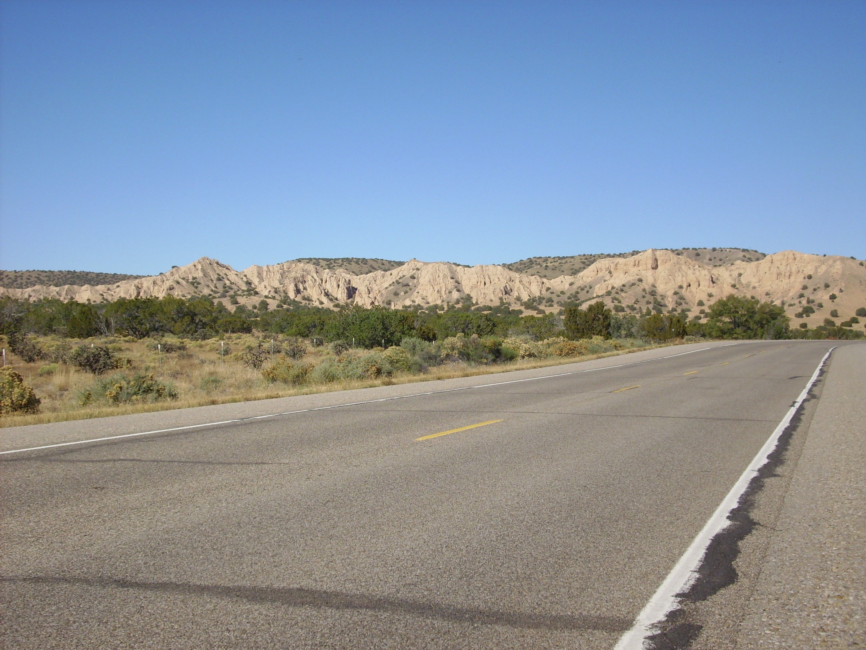
In a number of locations, the Ojo Caliente Sandstone has been
unusually well cemented along faults that allowed mineral-rich
groundwater to circulate through the sandstone. The hardened
sandstone stands out in stark relief when the surrounding softer
sediments are eroded away. Cerrito
Blanco, west of Abiquiu, is a an excellent example of such a
sedimentary dike.
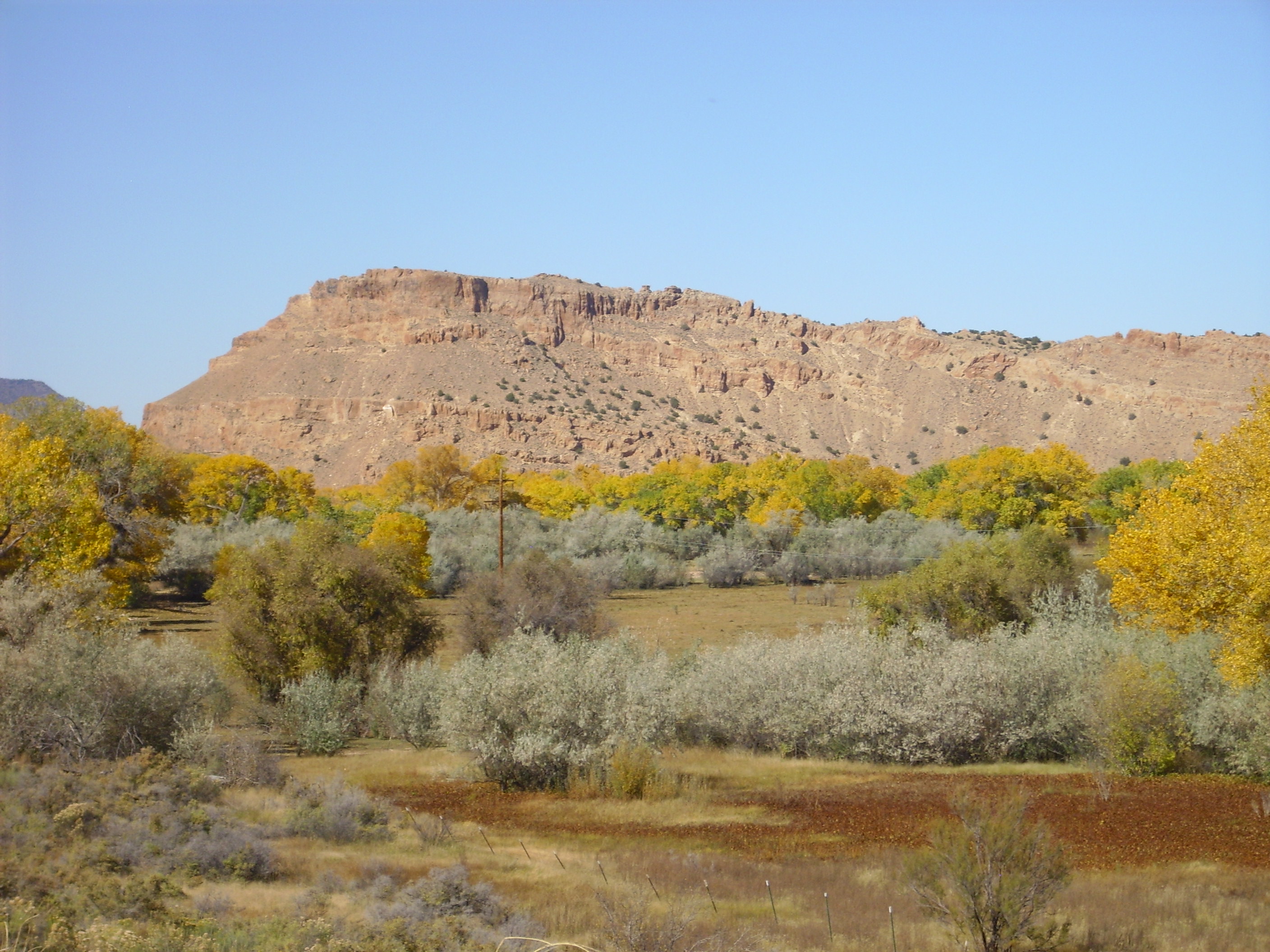
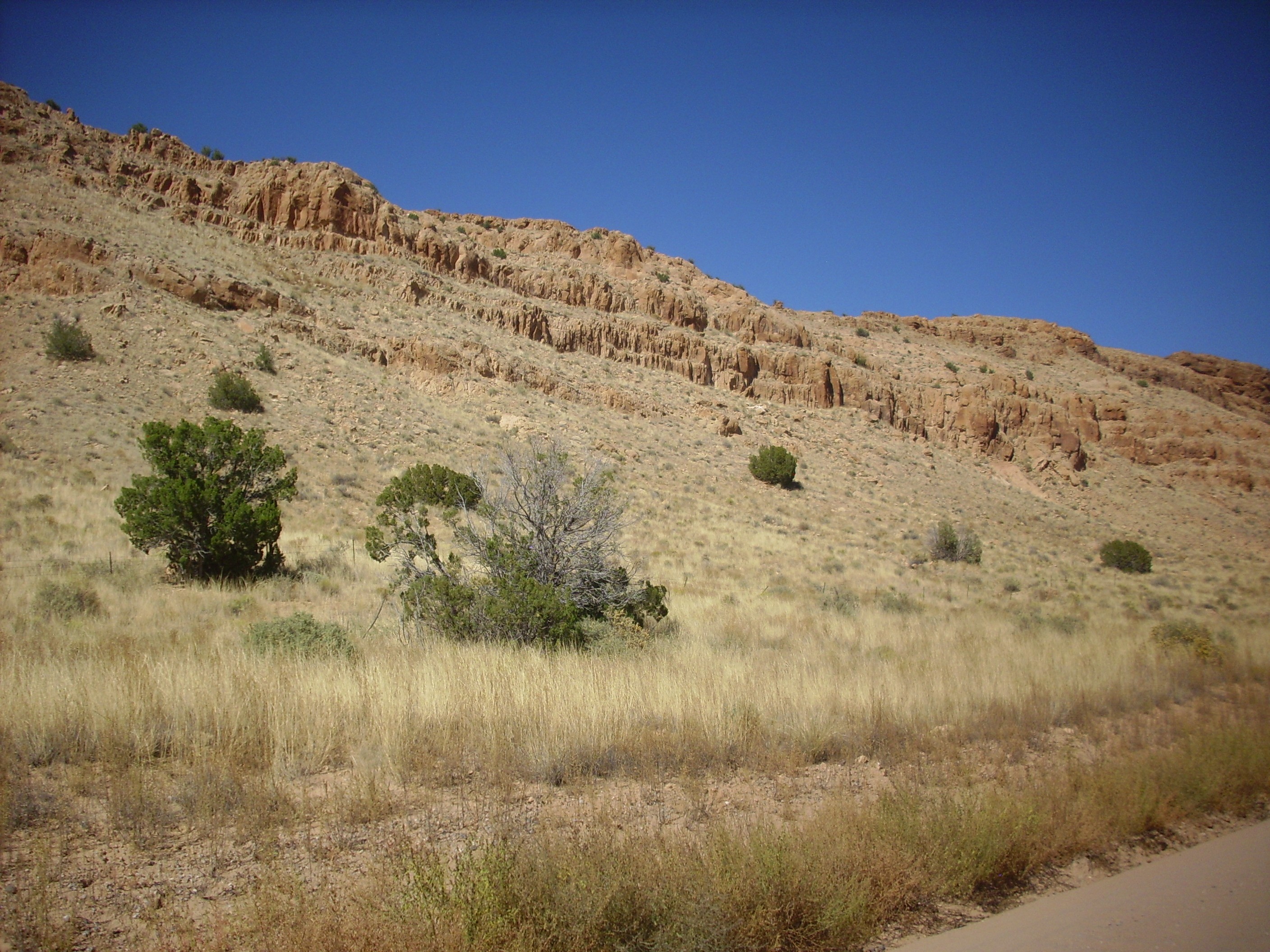
Cerrito Blanco. 36
12.988N 106 19.368W
Hills of Ojo Caliente Member are prominent east of Lobato Mesa
and west of the Rio Chama.
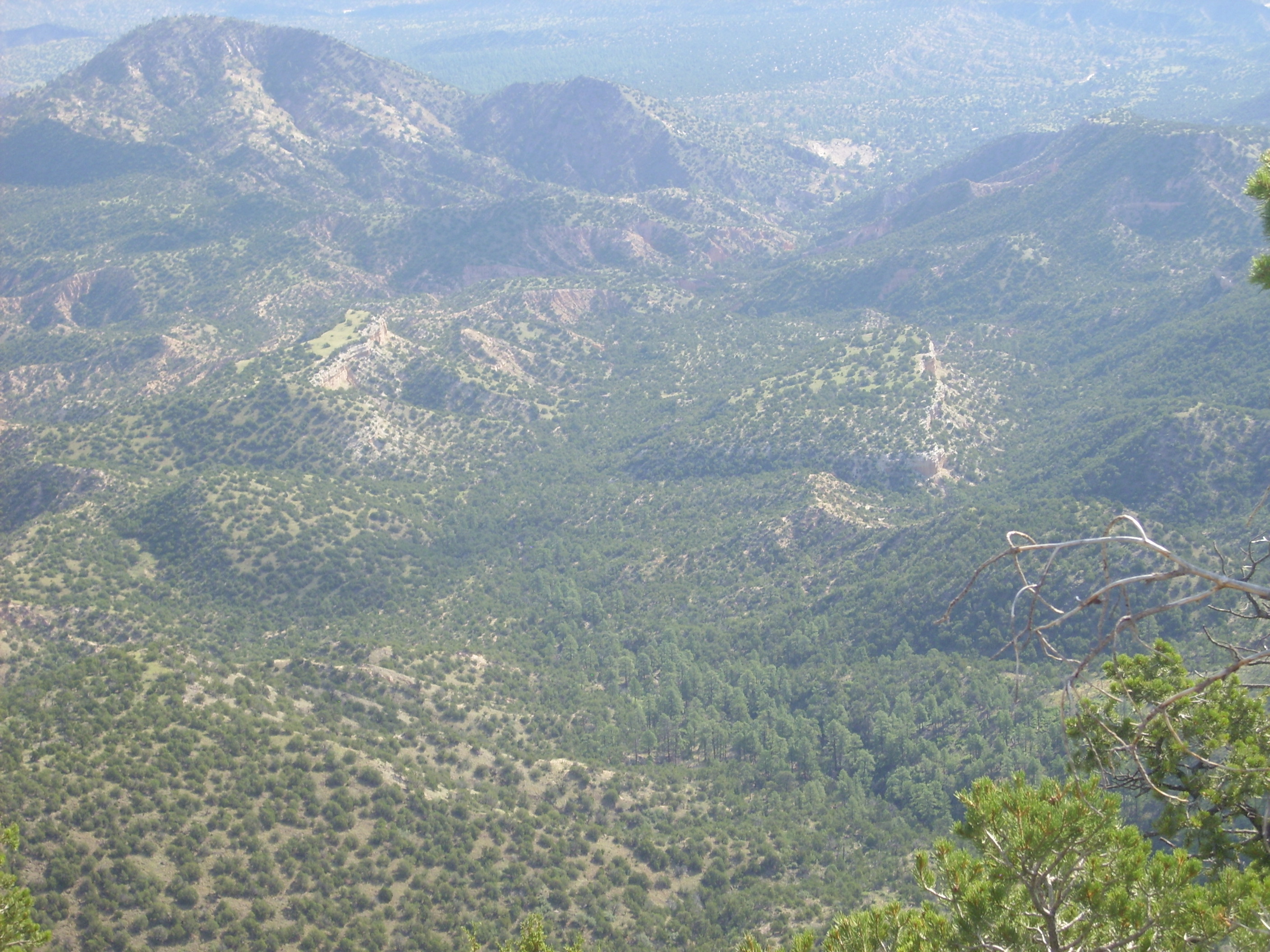
The foreground terrain is underlain by Chama-El Rito member. A
fault runs along the west side of the hills and may account for
the hills being better cemented than most Ojo Caliente Member.
Ash beds are visible at the southern edges of the small hills right and left of center. These are marked on the geologic map for the area, but not further identified or described.
The Ojo Caliente extends from here to the Rio Chama and beyond.
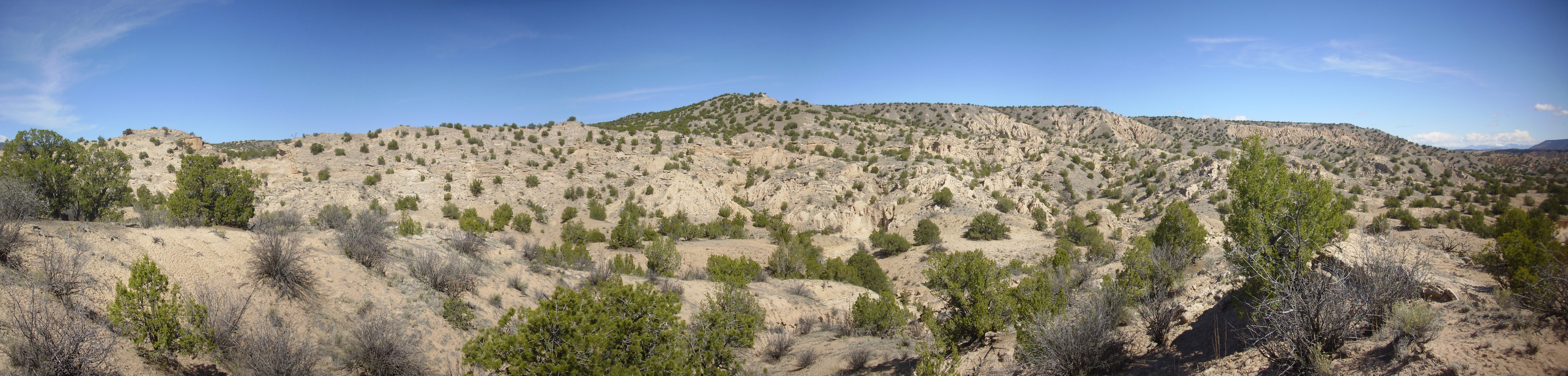
Ojo Caliente along Lemitas Trail. 36.121871N
106.1845773
The Ojo Caliente in this area is often well cemented, forming resistant beds.
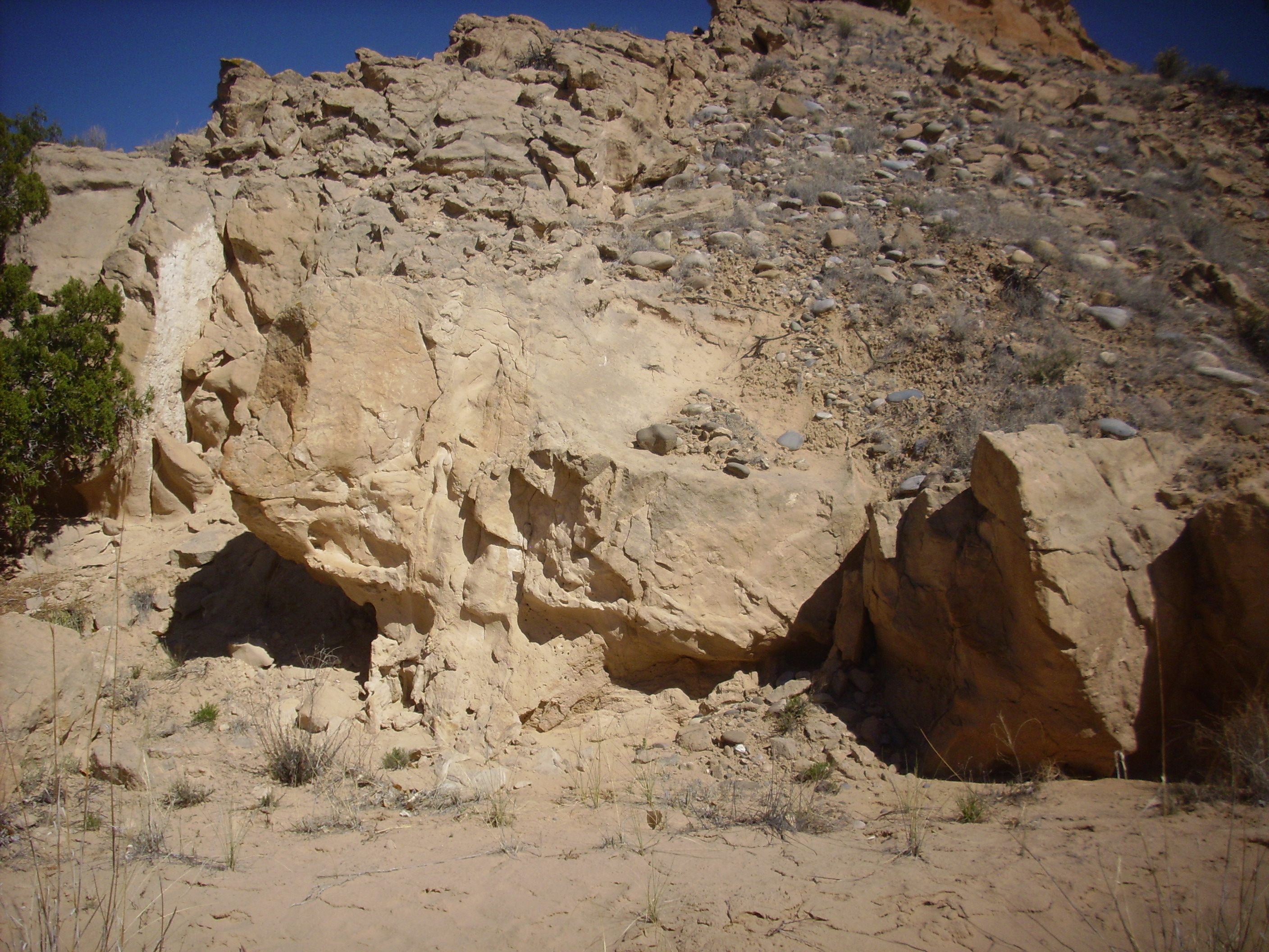
Ojo Caliente along Lemitas Trail. 36.1255376N
106.1742324W
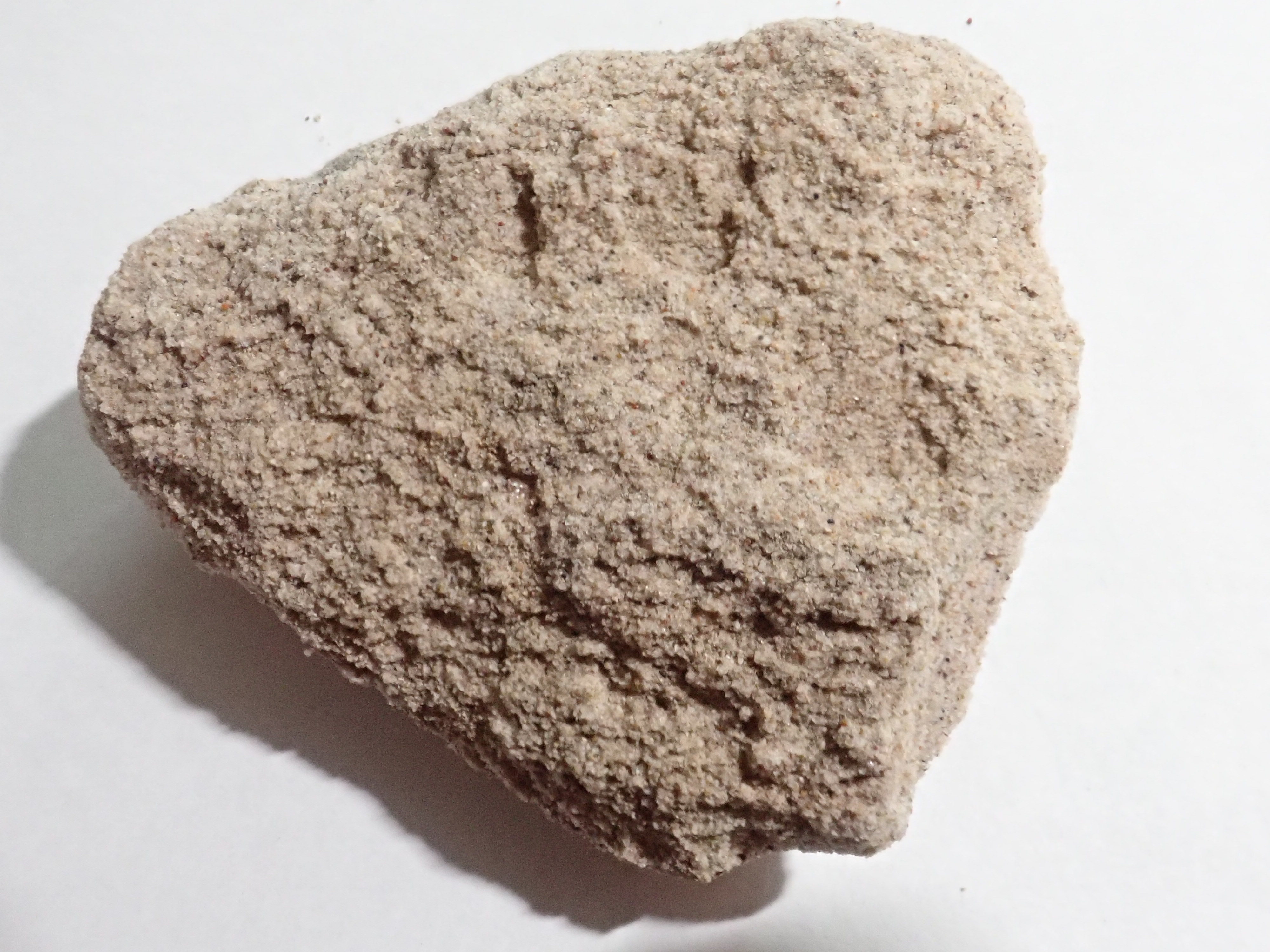
Ojo Caliente along Lemitas Trail. 36.1255376N
106.1742324W
This area also has some interesting sedimentary structures, such as this "pillow" structure.
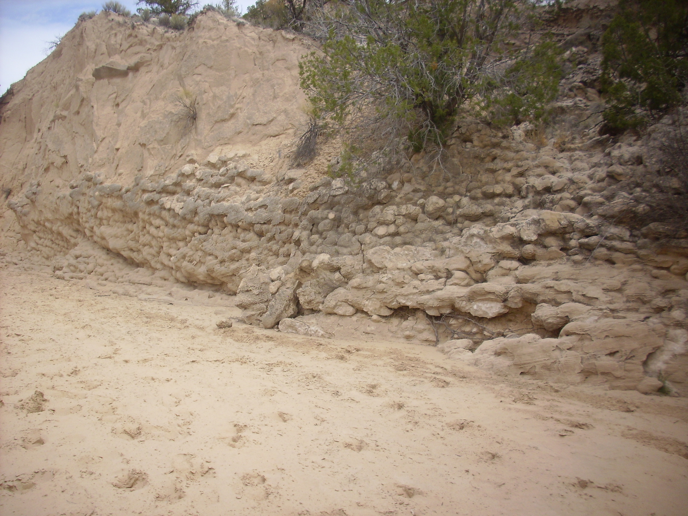
"Pillow" stuctures in Ojo Caliente along Lemitas Trail.
36.1227921N
106.1798249W
Or these nests of concretions.
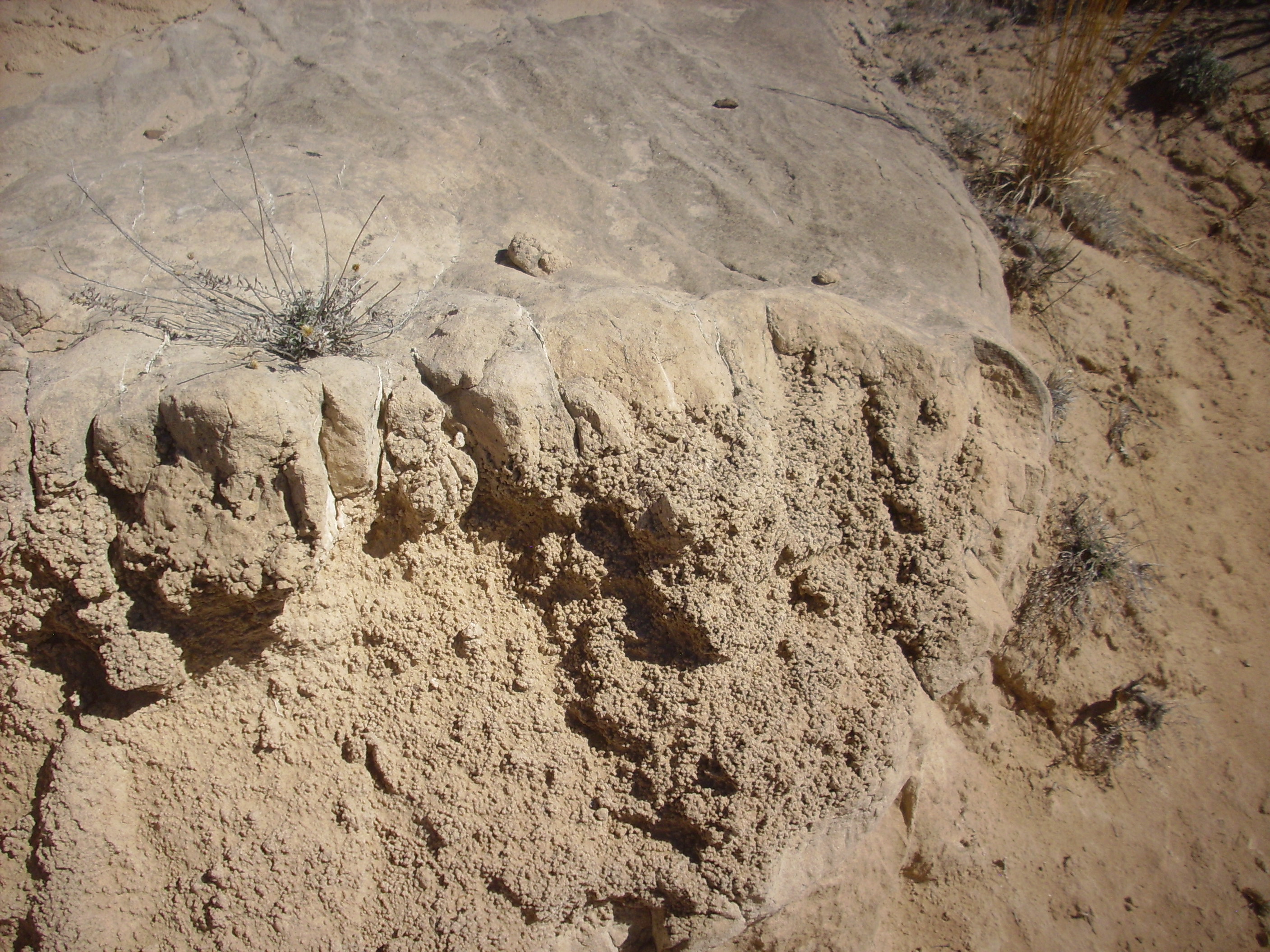
Concretions in Ojo Caliente along Lemitas Trail. 36.121871N
106.1845773
There are numerous "fins" of harder rock within the softer bed, all striking north to north-northeast.
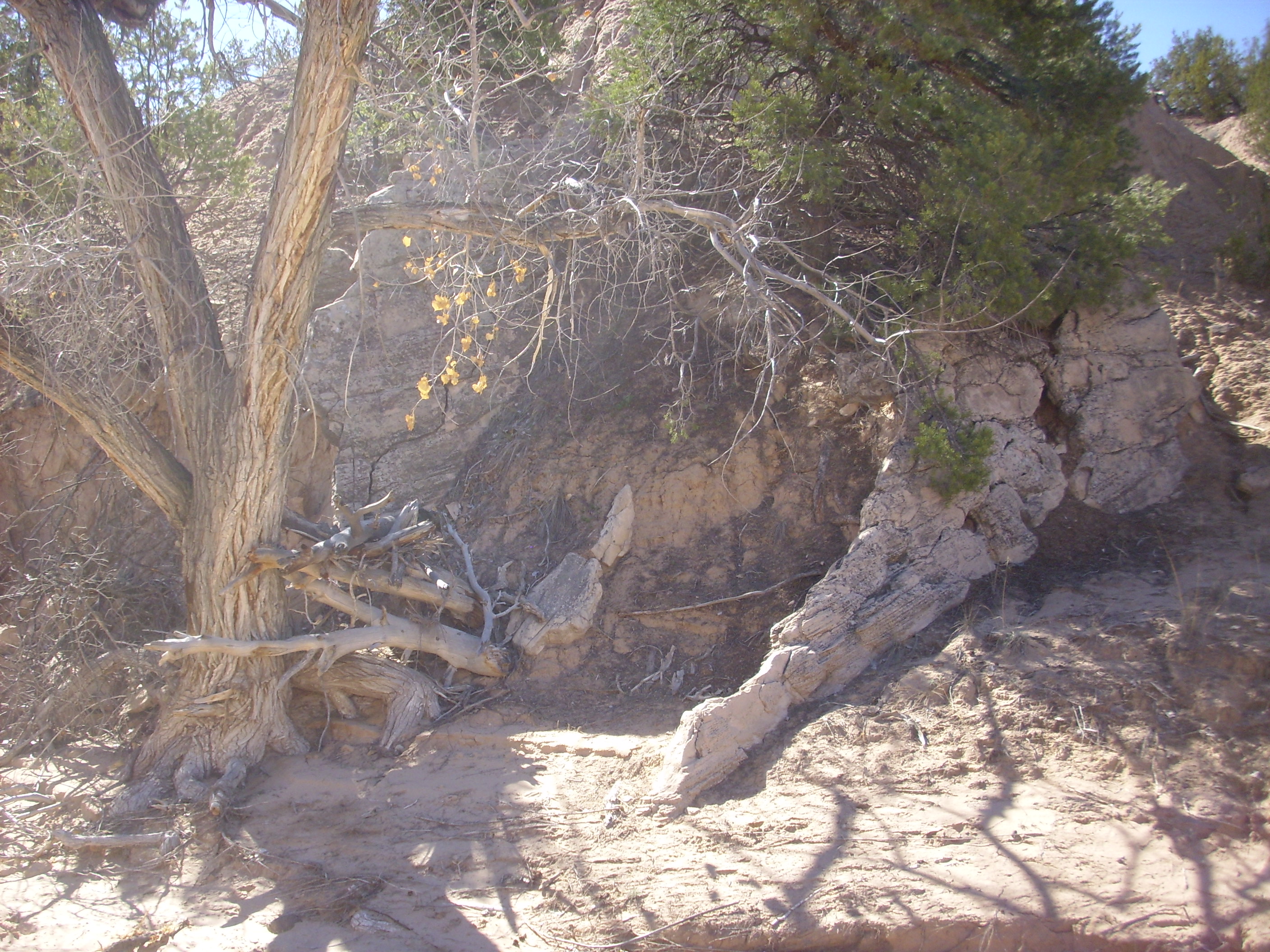
Ojo Caliente "fin" along Lemitas Trail. 36.1228178N
106.1804238W
Ojo Caliente Sandstone also underlies much of the northwestern slopes of Black Mesa.
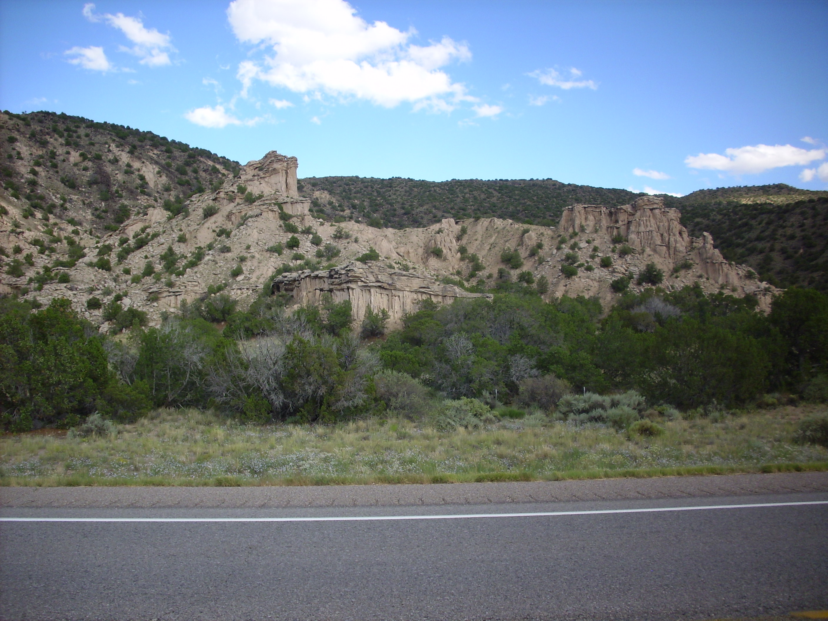
Here the soft nature of the beds is clear. This looks a lot like the Zia Formation, doesn't it? Similar environments produce similar rocks; but the Zia Formation appears to be significantly older than the Ojo Caliente Sandstone.
Nearby is yet another sedimentary dike.
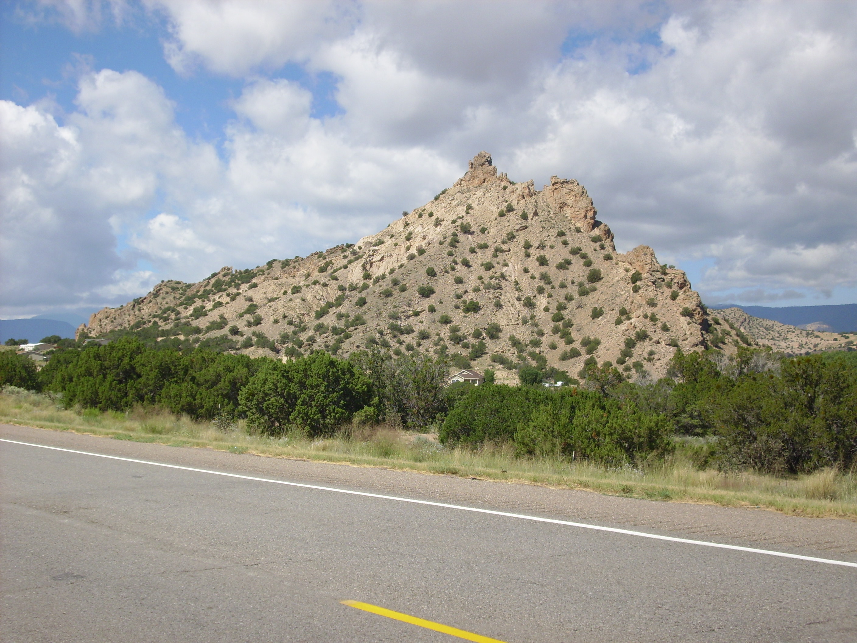
Cerrito de la Baca, a sedimentary dike
north of Black Mesa. 36
7.146N 106 7.594W
There are excellent exposures of Ojo Caliente Member in Abiquiu
Canyon. One such exposure is where the road turns to ascend El
Alto.
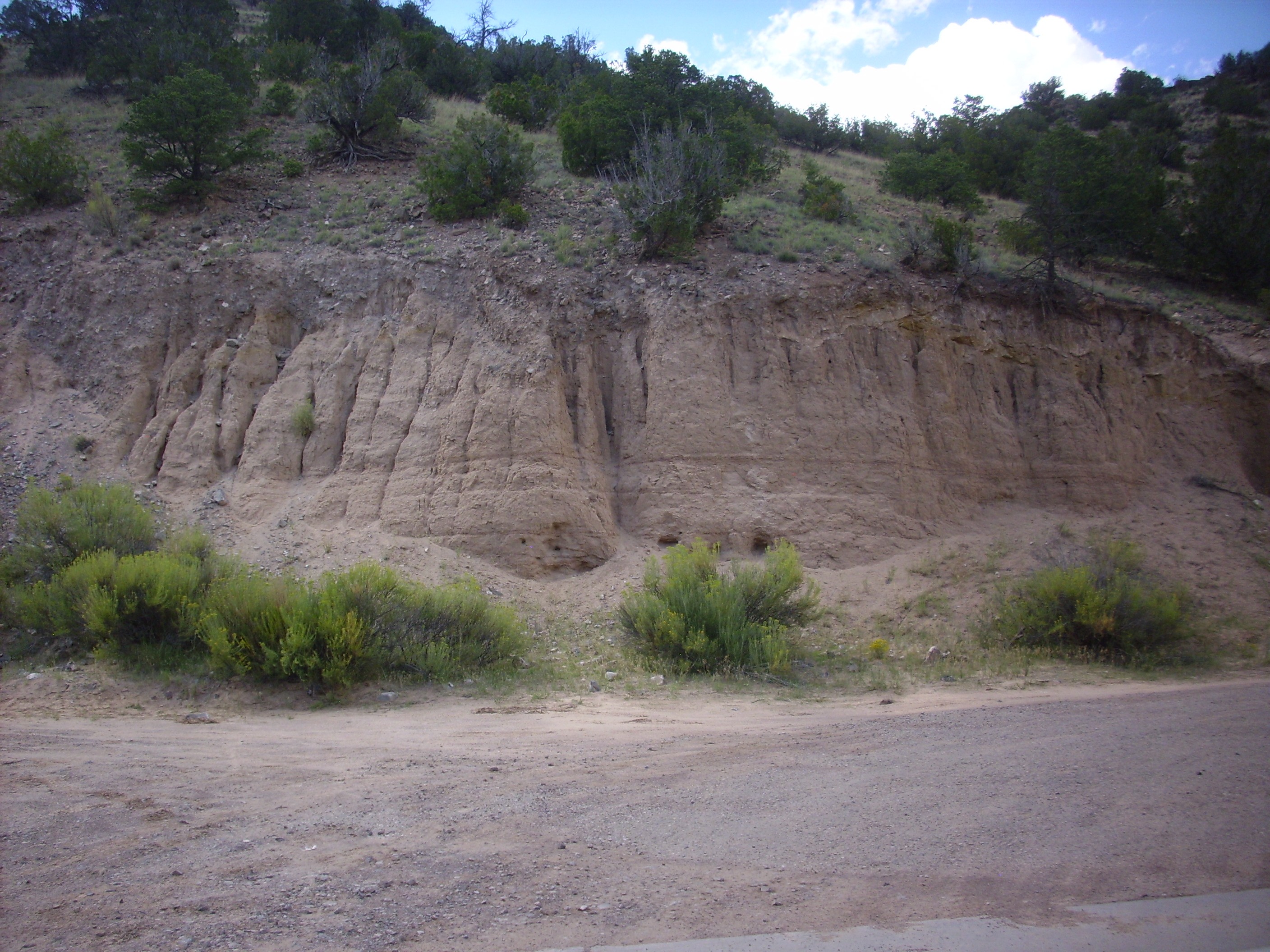
Ojo Caliente Member in Abiquiu Canyon. 36
09.992N 106 21.486W
This must be admired from a distance, as the entire canyon is
private property and visitors are restricted to the roadway.
Further down the canyon, there is another exposure of the Ojo Caliente Member, with impressive cross bedding.

Ojo Caliente Member in Abiquiu Canyon. 36
10.485N 106 20.713W
This exposure just screams eolian. Judging from the
satellite photo, this may be a borrow pit, from which sand was
extracted for road building or construction work.
Local exposures of Ojo Caliente Member are also found in the west
rim of the Valles caldera, atop Abiquiu Formation and beneath the
oldest volcanic rocks. These are the westernmost exposures of the
unit.
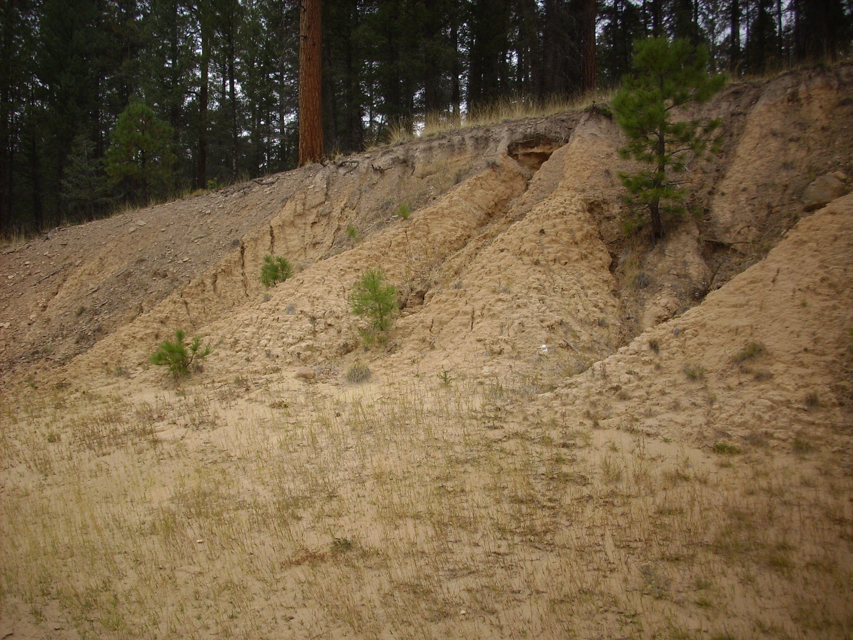
Ojo Caliente Member. 35
53.578N 106 40.262W
You can see in the photograph how deeply eroded this small outcrop is. The exposure is poorly consolidated and uncemented, with loose sand everywhere. A more substantial exposure is found further west along State Road 126 towards Fenton Lake.
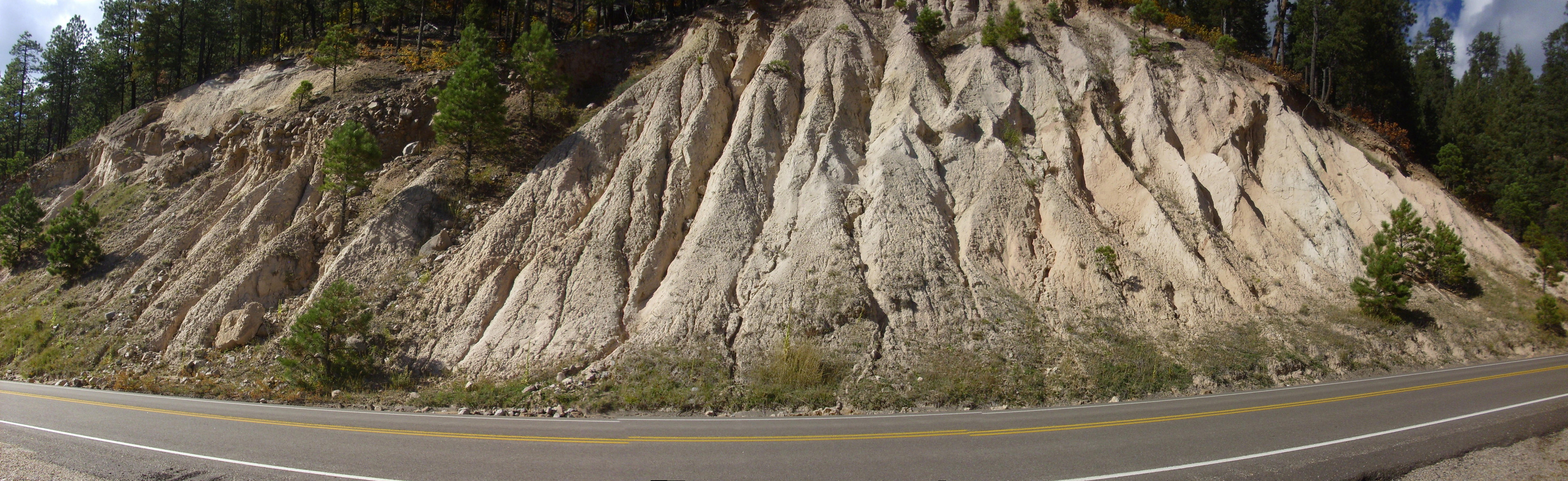
Ojo Caliente Member. 35
53.074N 106 41.019W
The bulk of this road cut is light sandy sediments of the Ojo
Caliente Member. The area at upper left exposes younger formations
that we will revisit later in this book.
Similar exposures are found in many places in the caldera west rim. Some are difficult to assign to particular units of the Santa Fe Group, and are mapped simply as undivided Tertiary sediments. The "undivided" means that the Tertiary beds have not been divided into separate units on the map. An example crops out along Forest Road 376 to San Antonio Springs.
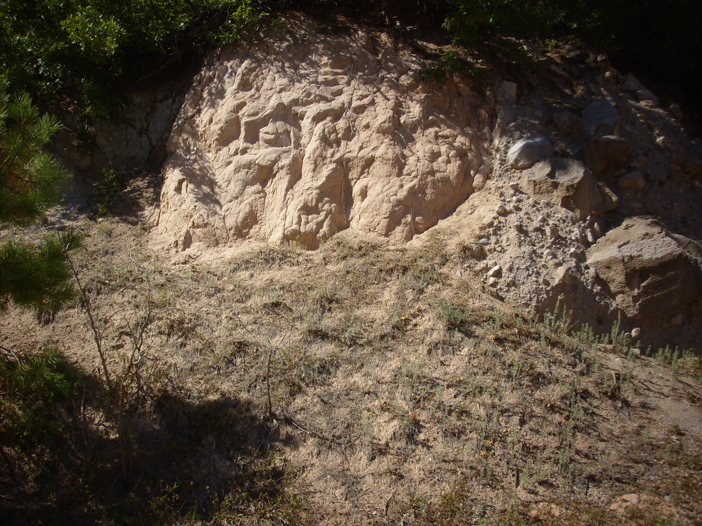
Undivided Tertiary sediments in caldera
west rim. 35
53.757N 106 39.860W
Such sediment beds make up a fair part of the west caldera wall,
and this outcrop must be at least five million years old. By
appearance, it could be either Ojo Caliente Member or Zia
Formation.
The study of otherwise nondescript formations, such as the Tesuque Formation, is made easier by the presence of marker beds. These are beds in the formation that stand out in some way, so that they can be traced over long distances. We've seen an example of a marker bed already: the thin limestone bed near the top of the De Chelly Sandstone, near its gradation into the Glorieta Formation. Several marker beds are found in the Tesuque Formation.
Many of these are ash beds, such as the 285 Road Ash of the Skull Ridge Member.

285 Road Ash of the Skull Ridge Member. 35.937N 106.022W
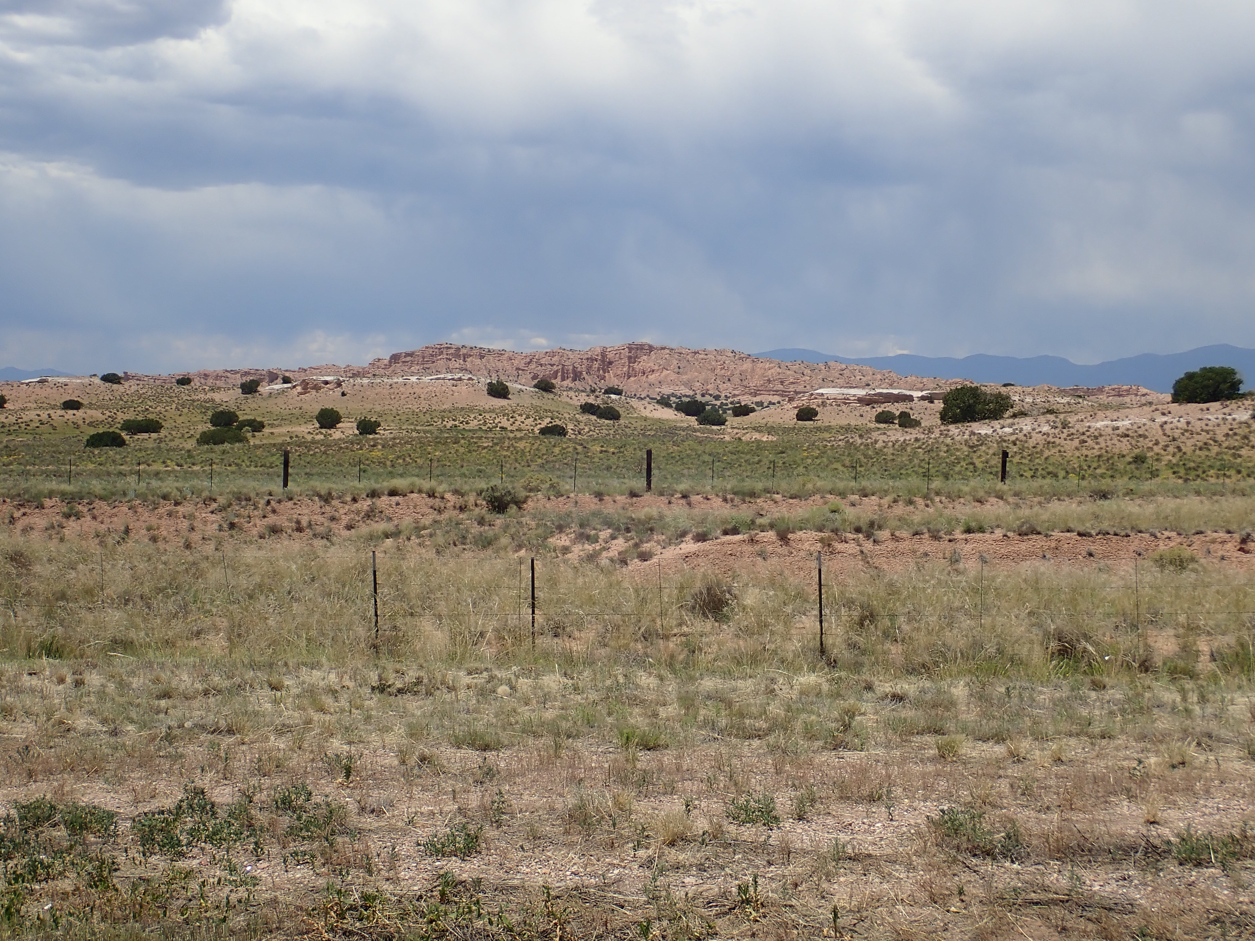
The ash bed is the white layer at the top of the cliff in the first photo and the near hills in the second. It’s a bed rich in volcanic ash, which gives it its light color. The volcanic ash contains potassium feldspar crystals which have been radiologically dated to 15.1 million years old. This is older than the Jemez volcanic field, and the precise source of the ash is unknown, though it is suggestive that its age is close to that of the earliest giant caldera eruptions of the Yellowstone hot spot. Most of the ash beds of the Skull Ridge Member are thought to have originated either from the Yellowstone hot spot or from a cluster of calderas in southern Nevada. The 285 Road Ash is not the most prominent ash bed in the Skull Ridge Member, but it is probably the most accessible, being right off a major highway.
Another kind of marker bed is found between the Tesuque Formation and overlying terrace gravels throughout the area west and north of Espanola. (Terrace gravels are deposits left by a river when it cuts a deeper channel; we'll have more to say about them later in the book.) This marker bed, which is particularly well exposed at Arroyo Largo, consists of quartzite gravel.
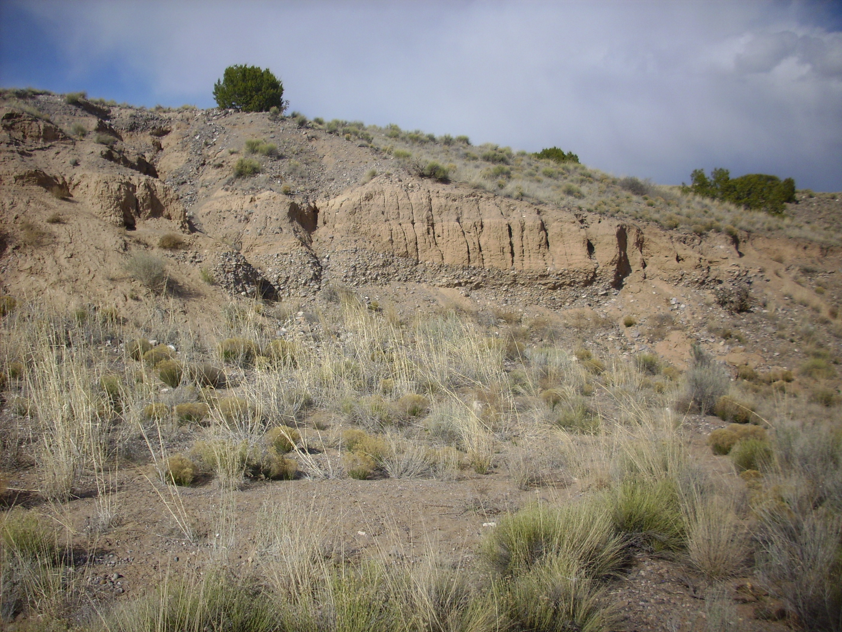
Quartzite gravel marker bed. 36
01.457N 106 05.527W
This bed is very distinctive, consisting of well rounded clasts of quartzite typical of the Tusas Mountains to the north. It mark a geologically brief interval sometime in the last two million years when the ancestral Rio Grande and its tributaries in the Espanola area carried a heavy load of gravel from the mountains to the north. Similar beds are found as far north as Abiquiu and as far south as Cochiti and may be correlated.
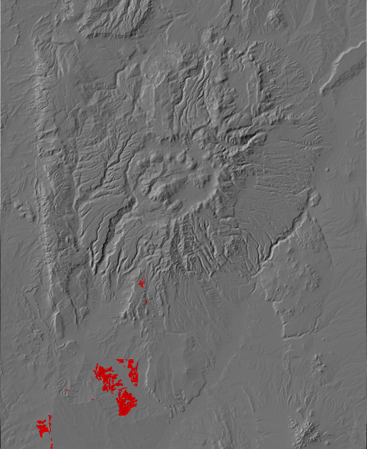
Relief map of the Jemez with Cerro Conejo Formation
outcroppings highlighted in red.
The upper beds of the Zia Formation, as originally defined, were
assigned to the Cerro Conejo Member. However, there turns out to
be a significant hiatus at the base of the Cerro Conejo, amounting
to perhaps as much as 1.6 million years of missing beds. This led
geologists to promote the Cerro Conejo to formation rank.
The Cerro Conejo is about 14.6 to 9.5 million years old and represents a time of transition in the western Santo Domingo Basin. The eolian deposits of the Zia Formation were beginning to give way to fluvial deposits from streams descending off the Colorado Plateau. For this reason, some geologists assign the Cerro Conejo Formation to the middle Santa Fe Group, as transitional between playa deposition and river deposition.
The formation is exposed mostly on tribal lands, but there is a good exposure in a highway roadcut between Bernalillo and San Ysidro.
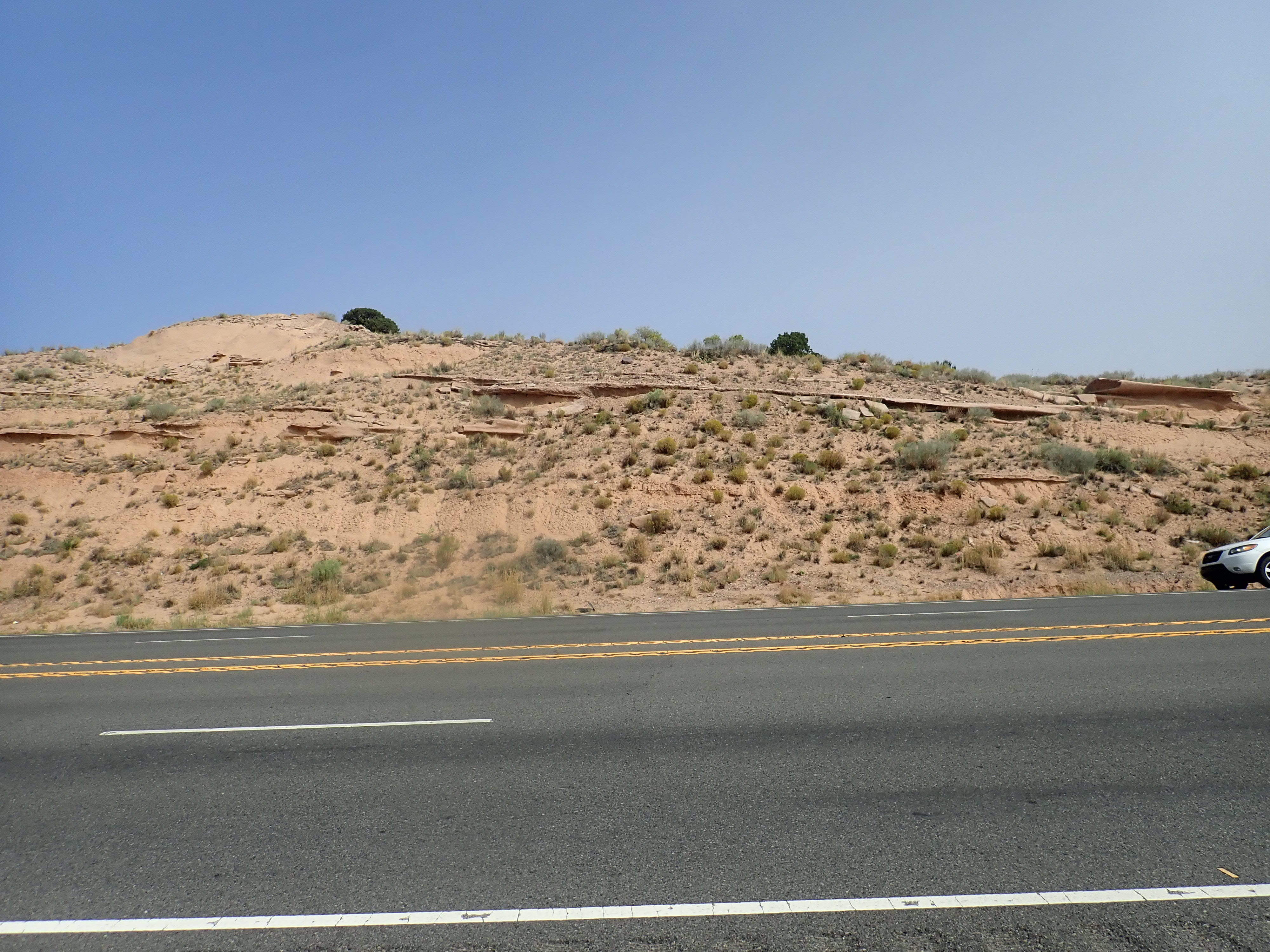
Cerro Conejo Formation. 35.3974N 106.6396W
A number of younger formations assigned to the Santa Fe Group represent beds deposited as the Rio Grande became established as a through-running river. We'll examine these upper Santa Fe Group formations later in the book.
Next page: And, finally, we get to the birth of the Jemez volcanic field
Copyright ©2014 Kent G. Budge. All rights reserved.
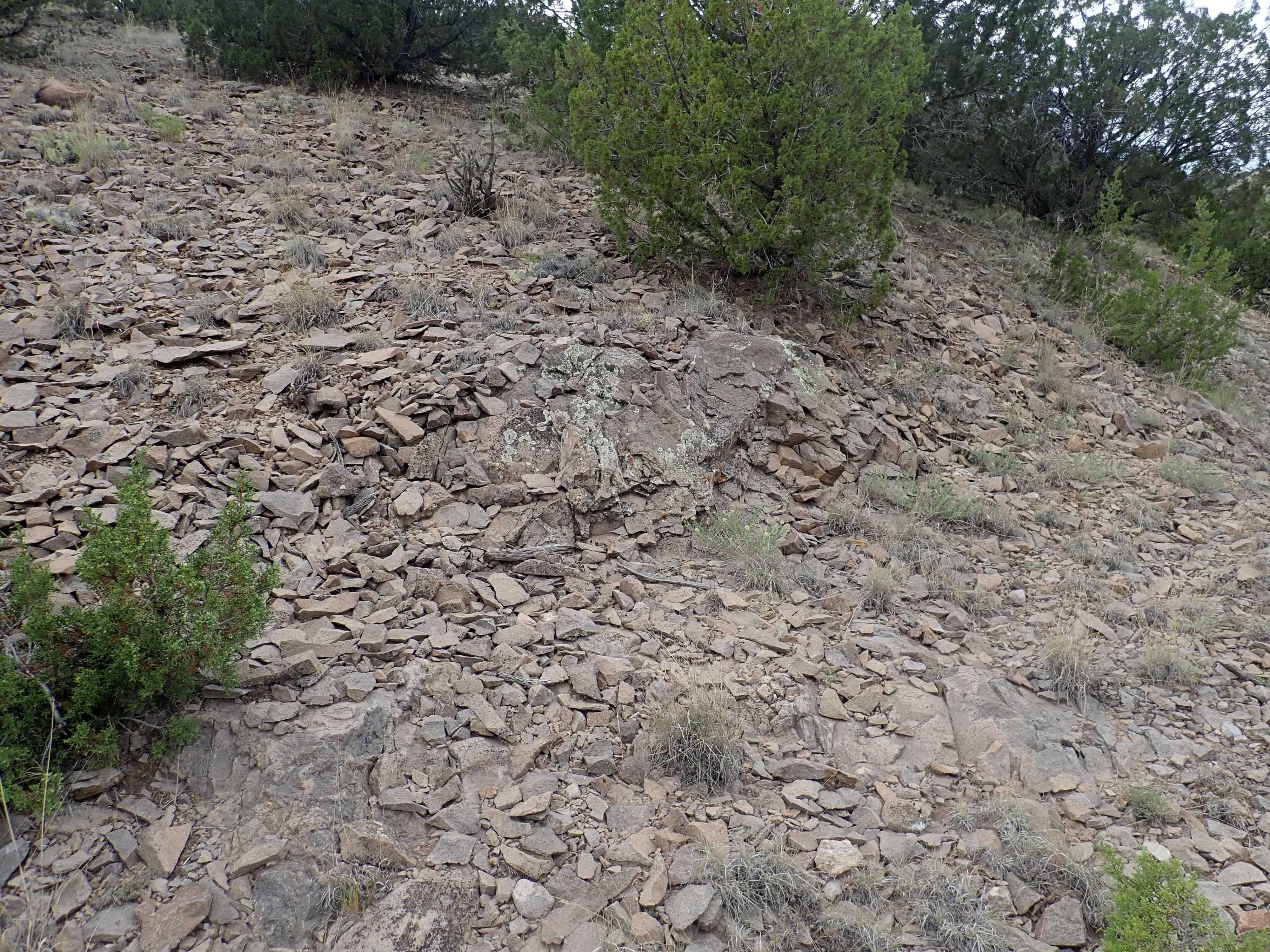