The table of contents may be found here.
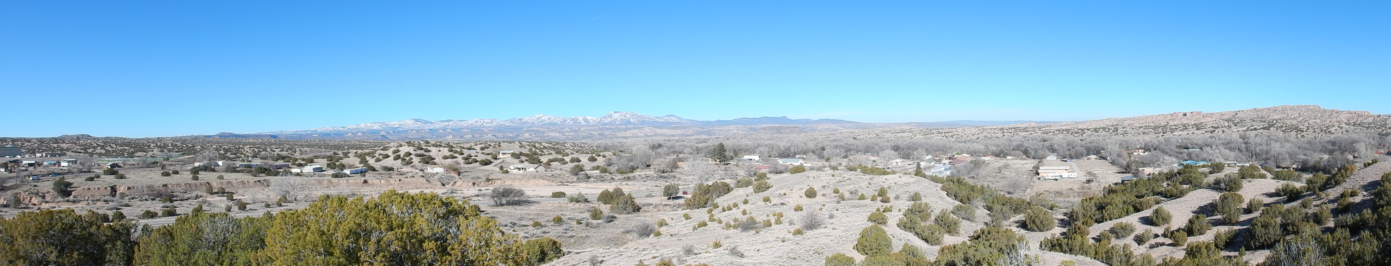
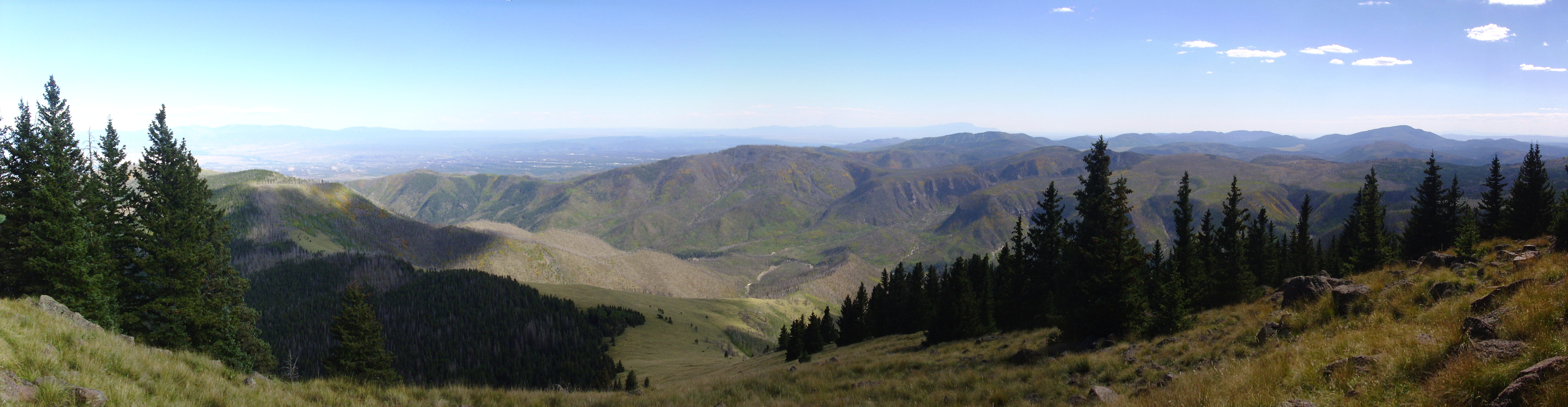
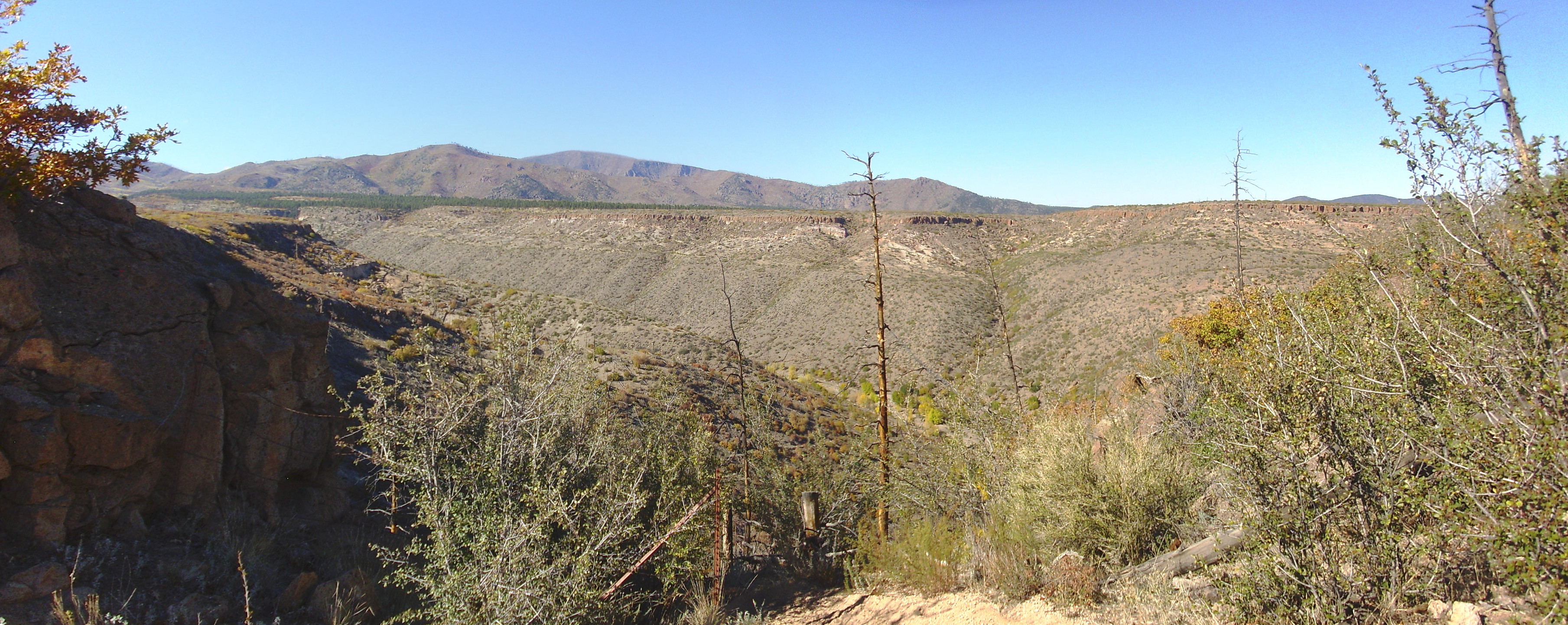
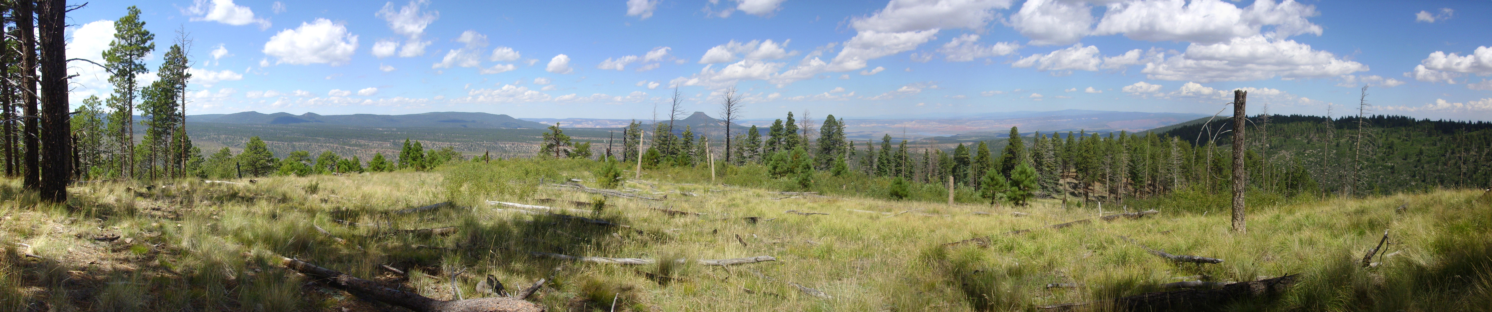
Panorama of the Jemez Mountains as seen from the southeast. 35 52.975N 106 03.660W
Following the eruption of the Bearhead Rhyolite, volcanism in the Jemez slowed to a crawl, with only sporadic small eruptions of dacite between 6.5 and 5 million years ago. Volcanism resumed around 5 million years ago, as large volumes of dacite began to to erupted in the Jemez volcanic field. These flows formed the high mountains of the Sierra de los Valles and extended as far west as the present western caldera rim.
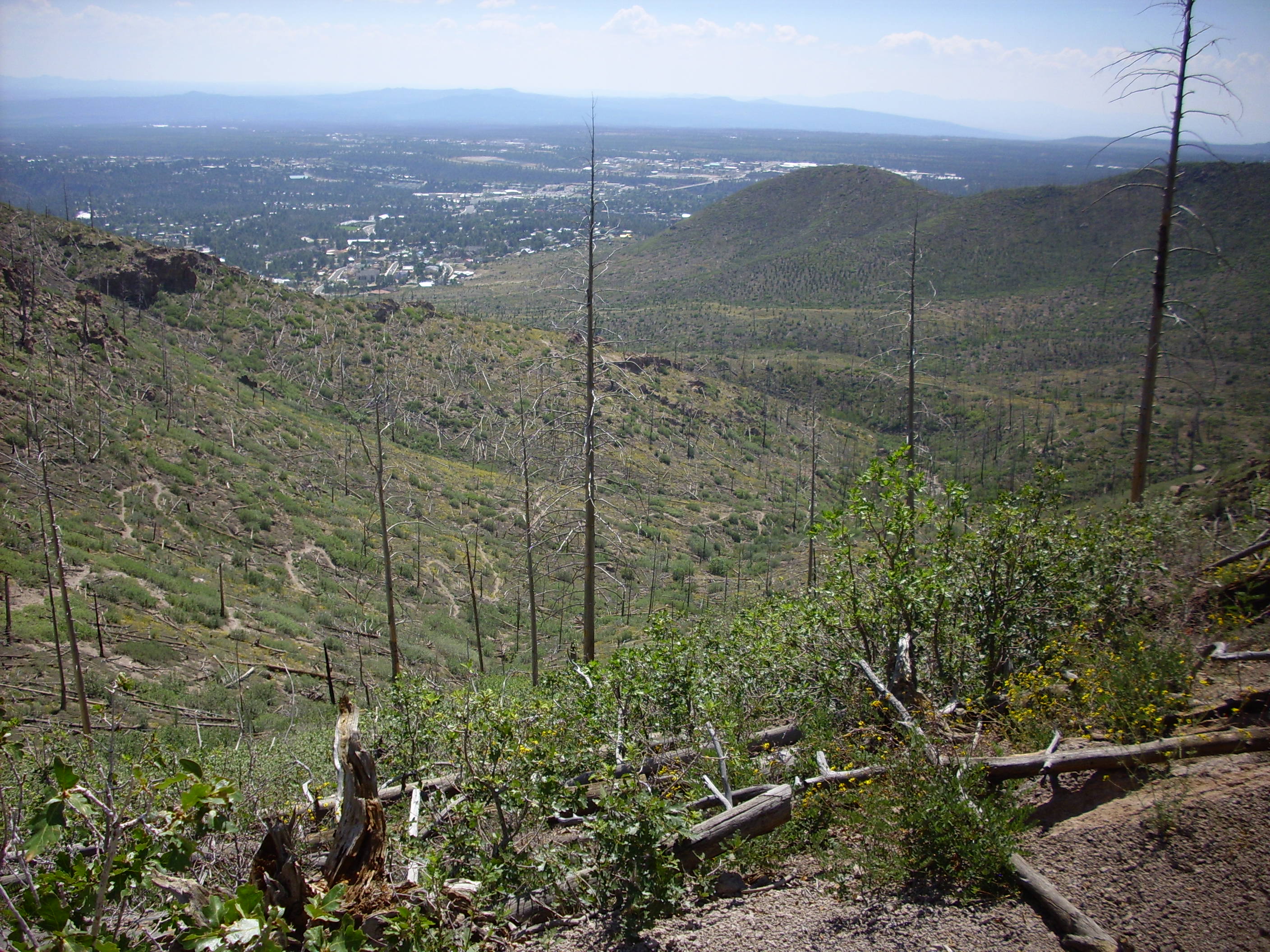
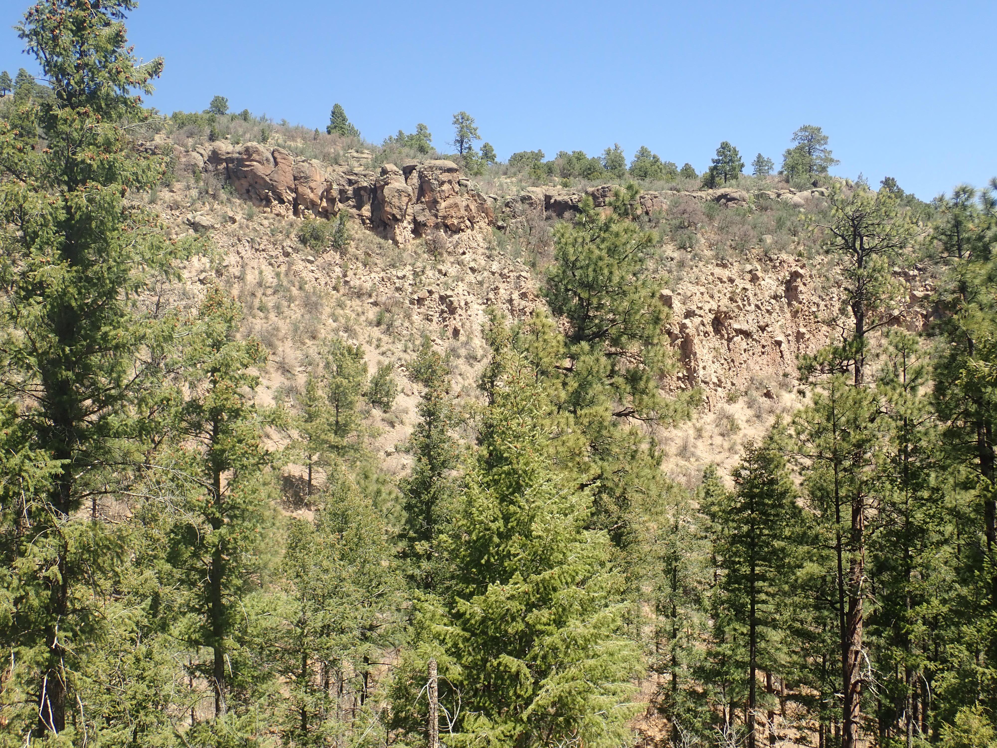
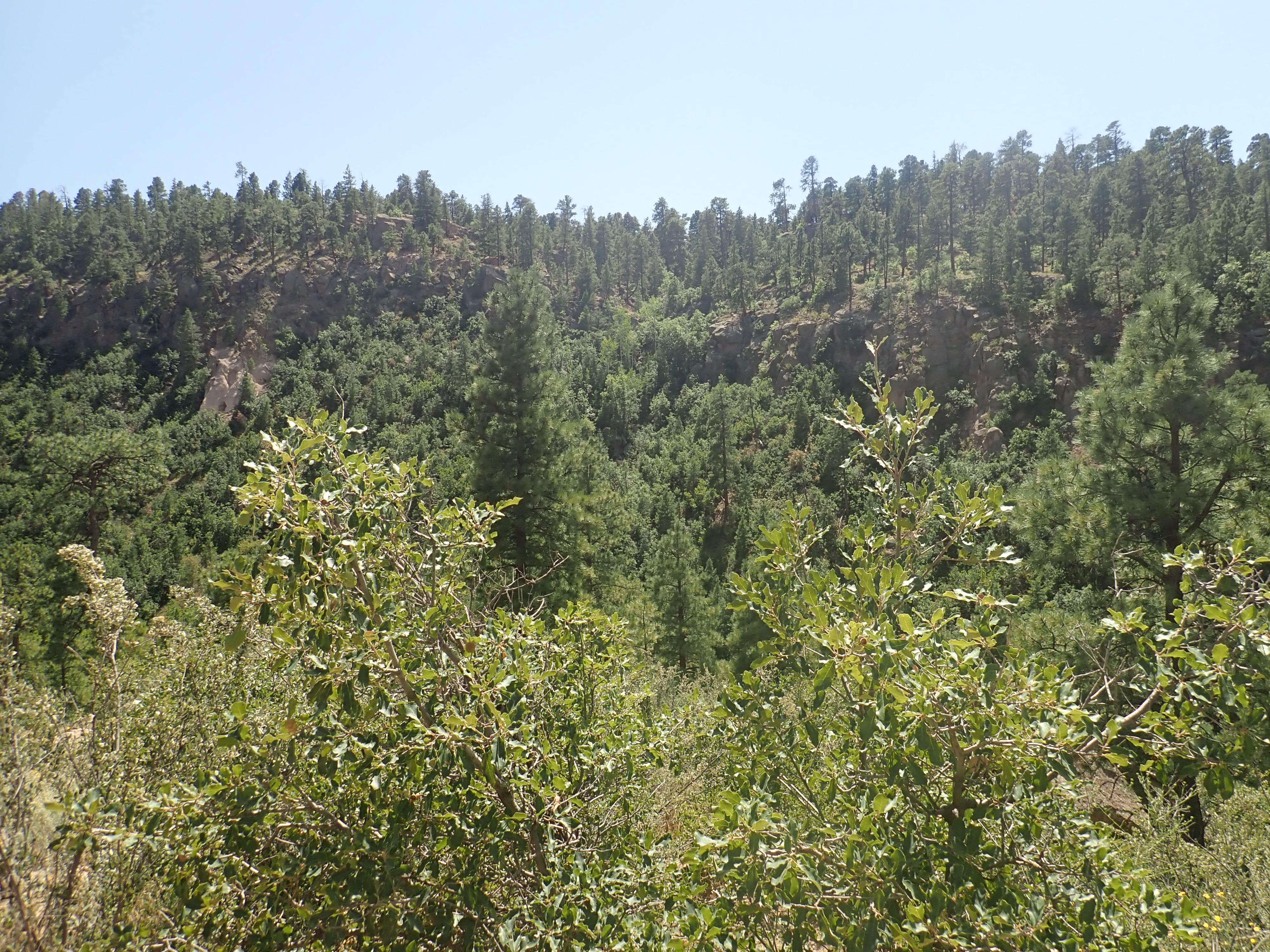
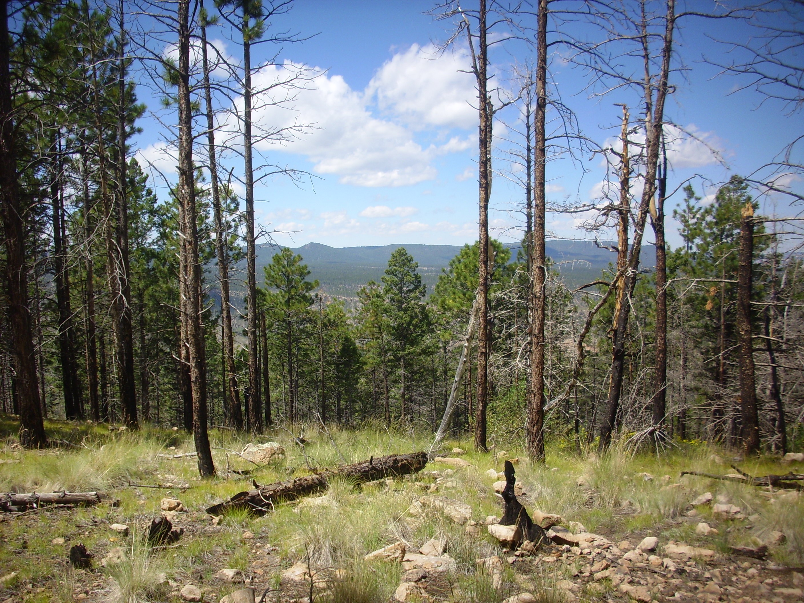
To the traveler approaching the Jemez from the east, the skyline is dominated by the Sierra de los Valles, a chain of mountains that forms the scenic backdrop for the city of Los Alamos. These extend from Sawyer Dome in the south to Caballo Mountain in the north. Across Santa Clara Canyon, the high terrain is known as the Tschicoma Highlands, and includes Tschicoma Mountain, Polvadera Peak, and Cerro Pelon, which appear to be aligned with the Sierra de los Valles. Tschicoma Mountain and Polvadera Peak are the highest and third highest peaks in the Jemez volcanic field.
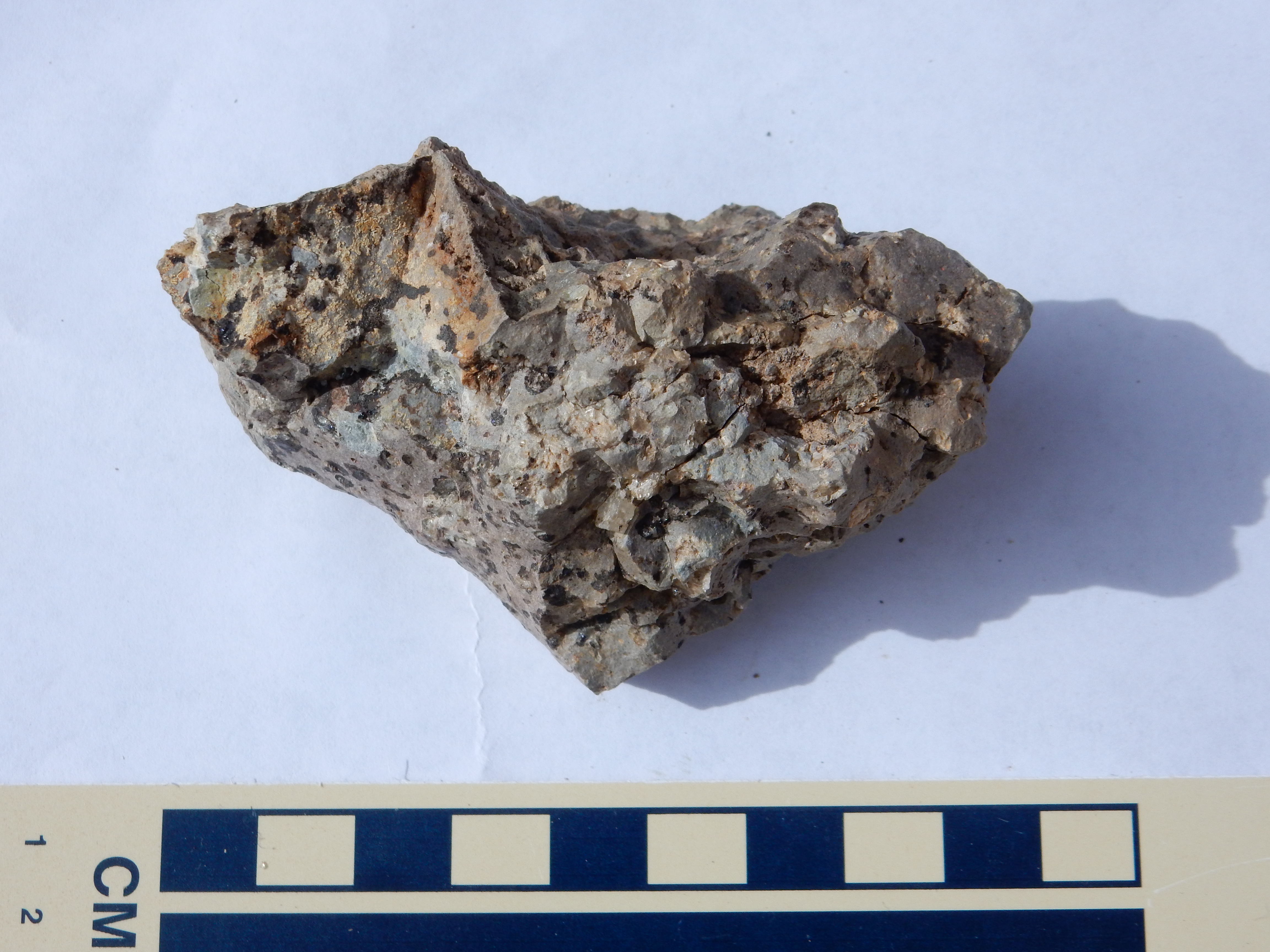
All of this terrain is underlain by porphyritic dacite of the Tschicoma Formation. This rock is quite distinctive. It's described as porphyritic because it consists of a very fine-grained rock, called the ground mass, in which much larger individual crystals, called phenocrysts, are embedded. The ground mass of Tschicoma porphyritic dacite is typically pinkish tan in color, but can vary all the way from bluish-gray to brick red. The phenocrysts are plagioclase feldspar and are always white or off white. In a few outcrops, there are phenocrysts of quartz visible as well, and the rock is then described as a rhyodacite. You can't mistake Tschicoma Formation samples for either Bandelier Tuff or Cerros del Rio basalt, the other two most common rocks in Los Alamos County.
The oldest Tschicoma Formation flows are nearly 7 million years old, but the eruption didn't really get going until about 5 million years ago. The eruptions were essentially over by 2.5 million years ago. The oldest substantial flows in the Los Alamos area are those of the Rendija Canyon Member of the Tschicoma Formation, which makes up most of the Sierra de los Valles west and northwest of Los Alamos. This was erupted in a relatively short period of time around 5 million years ago.
The early voluminous flows coincided with the shift of major displacement along the western margin of the Rio Grande Rift from the Cochiti Fault Zone to the Pajarito Fault Zone. The voluminous flows of the Tschicoma Formation likely erupted from fissures opened along faults now buried underneath the flows that were associated with this fault zone. The Pajarito Fault Zone forms part of the western boundary of a deep graben, the Velarde Graben, that reflects brittle rifting along a quite narrow zone within the broader Rio Grande Rift.
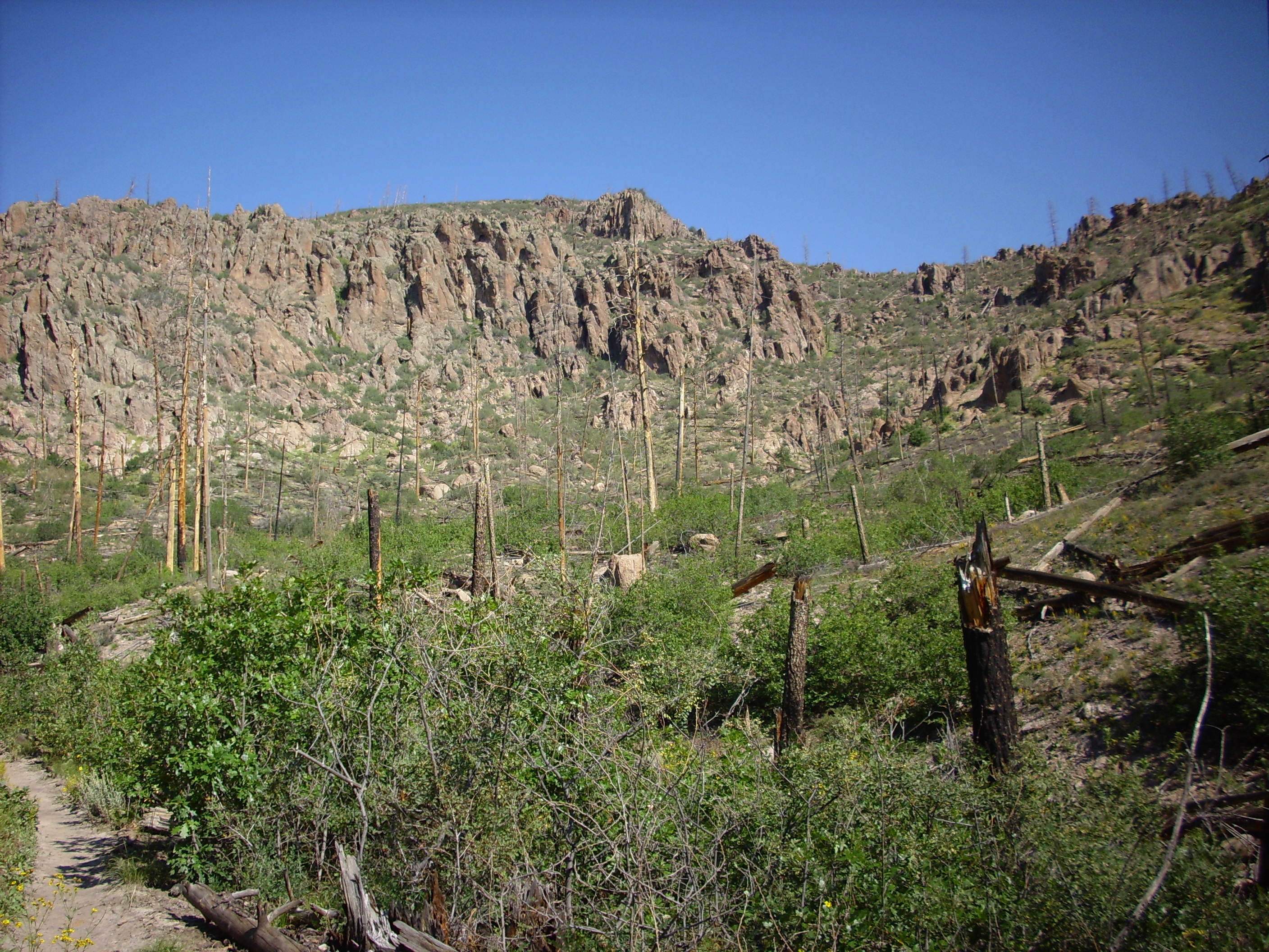
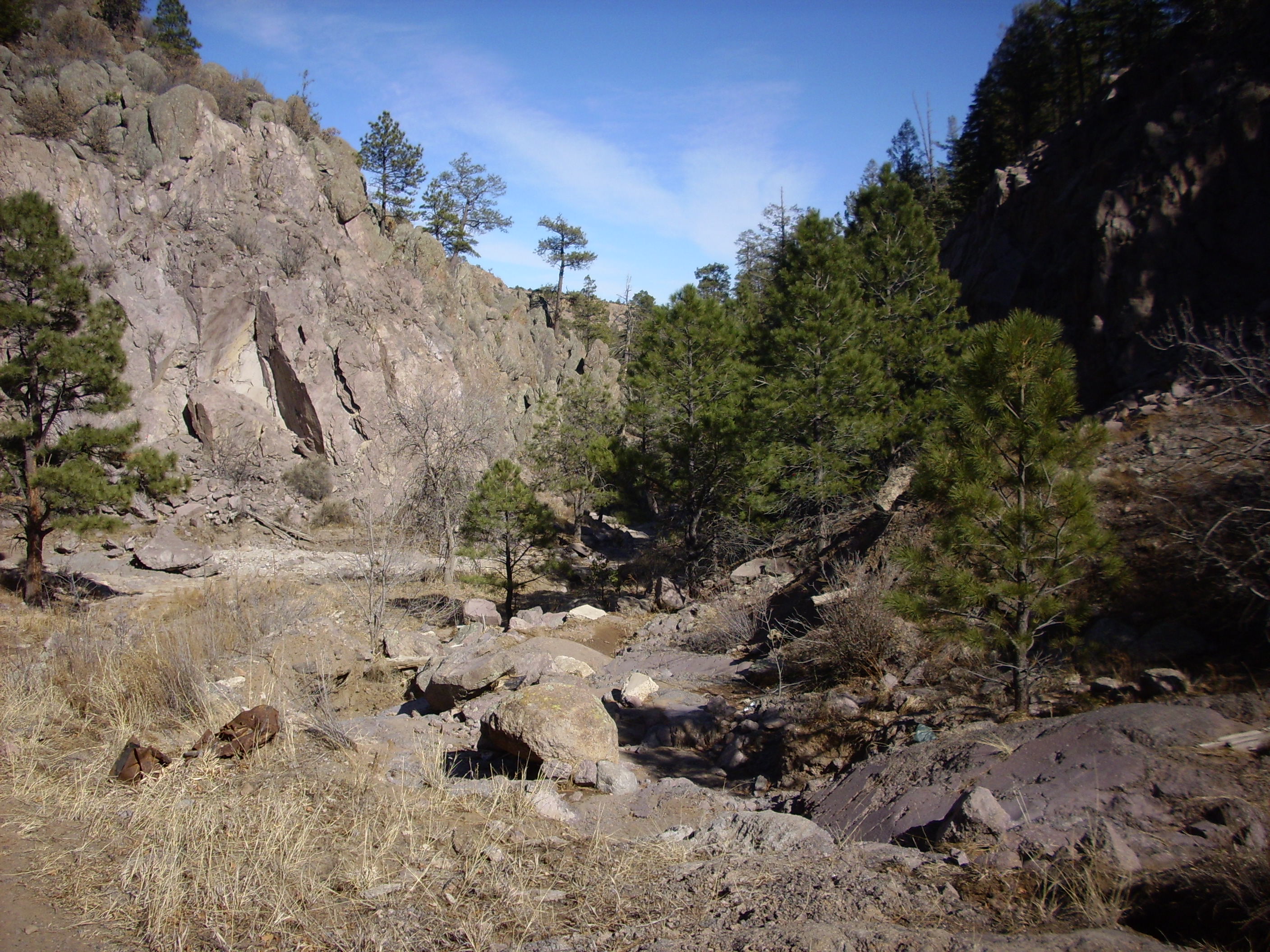
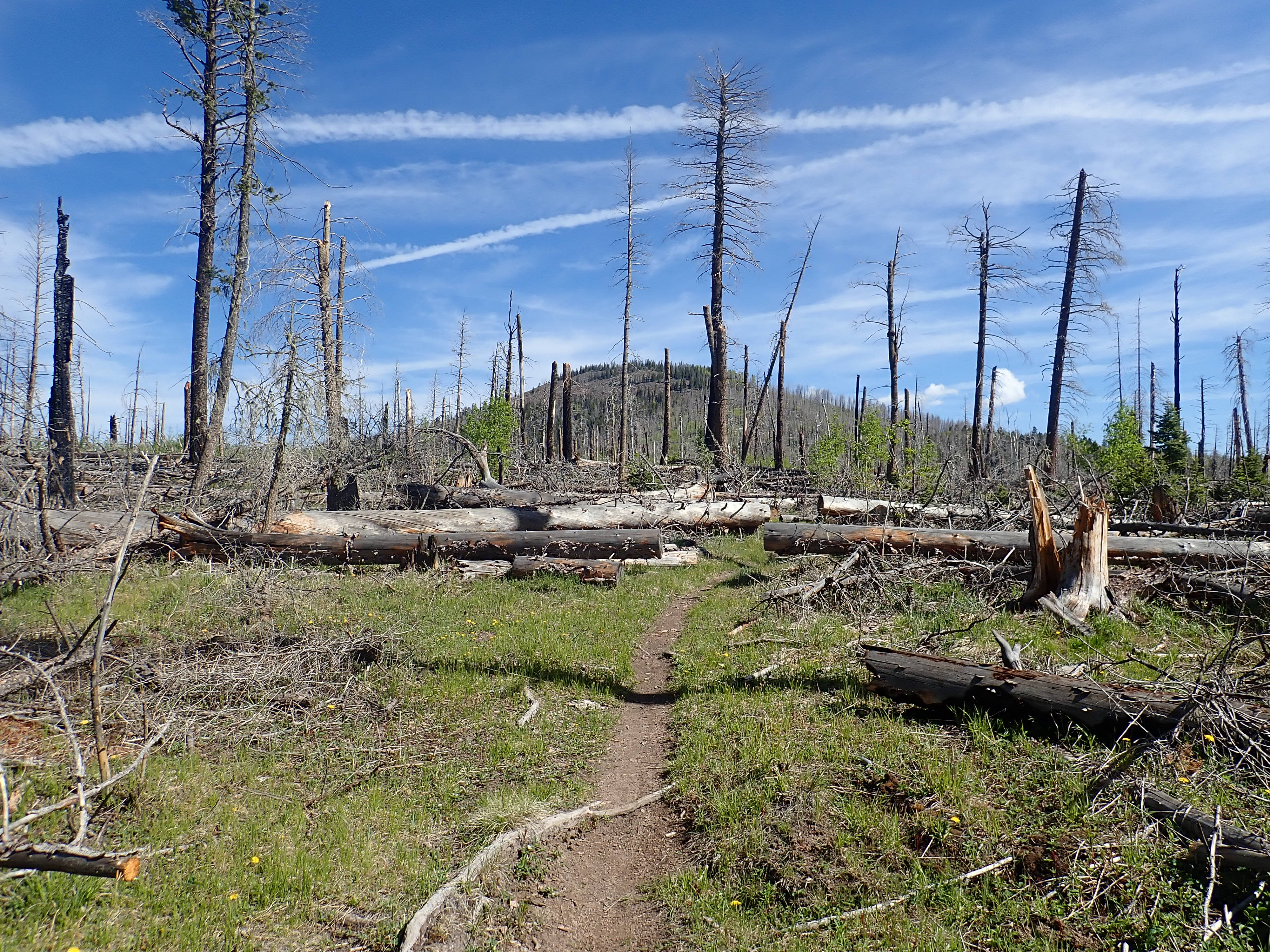
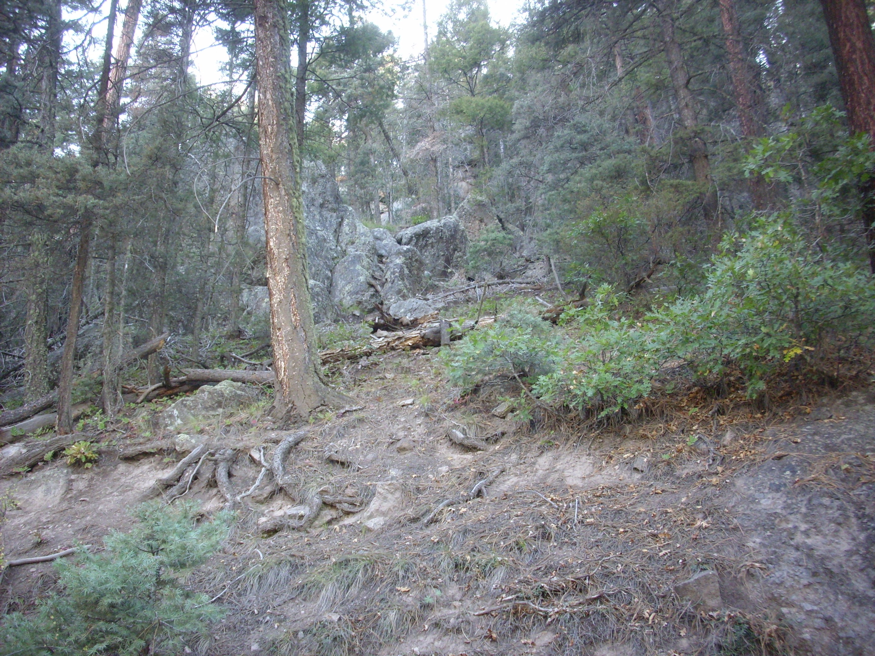
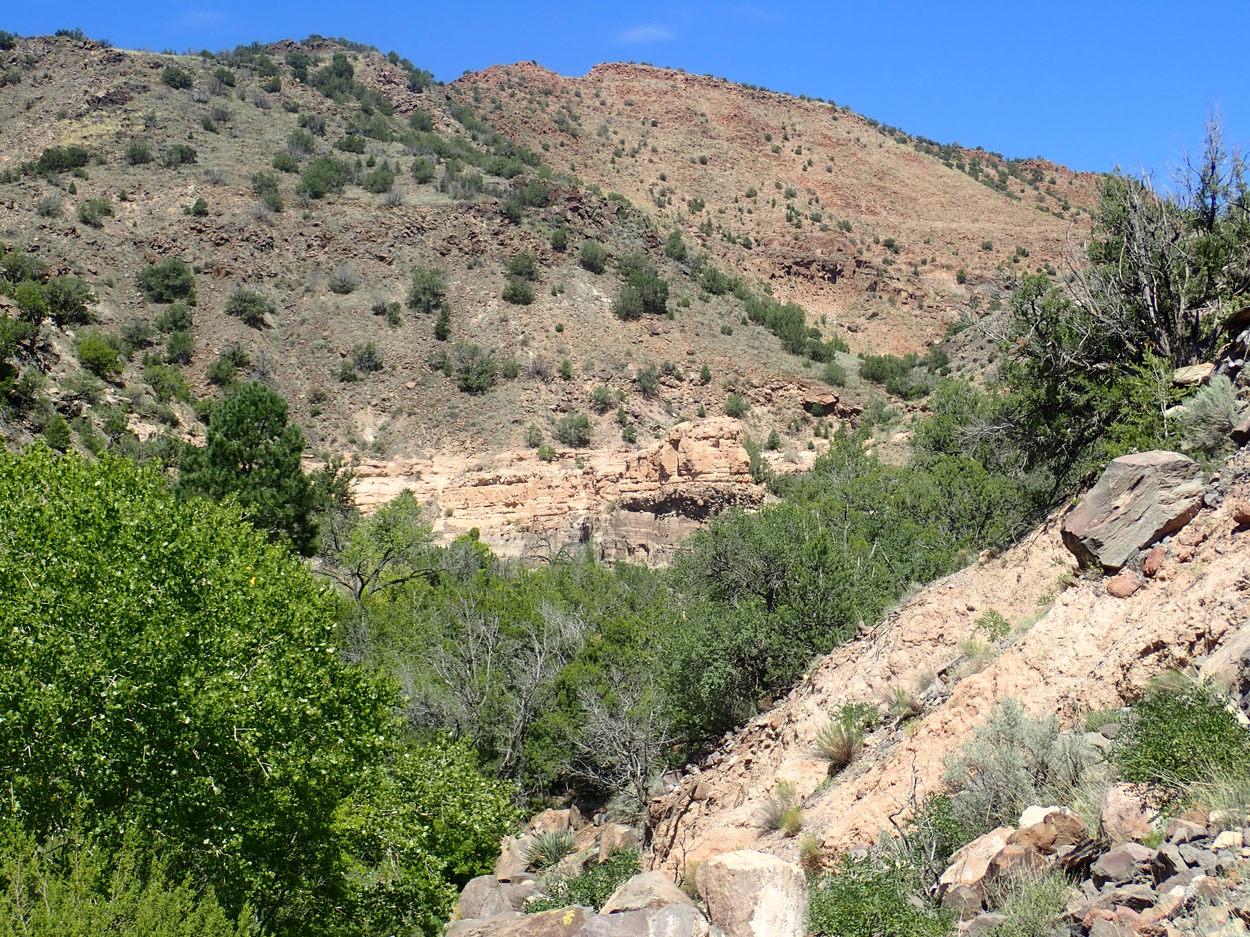
One of the best places to begin examining the Rendija Canyon
Member is along the
Mitchell Trail. One must take care not to be diverted
onto a utility road that ultimately leads nowhere, and one must
keep in mind that much of the lower part of the trail is badly
washed out in the aftermath of recent forest fires. With those
caveats, the trail is a wonderful hike.
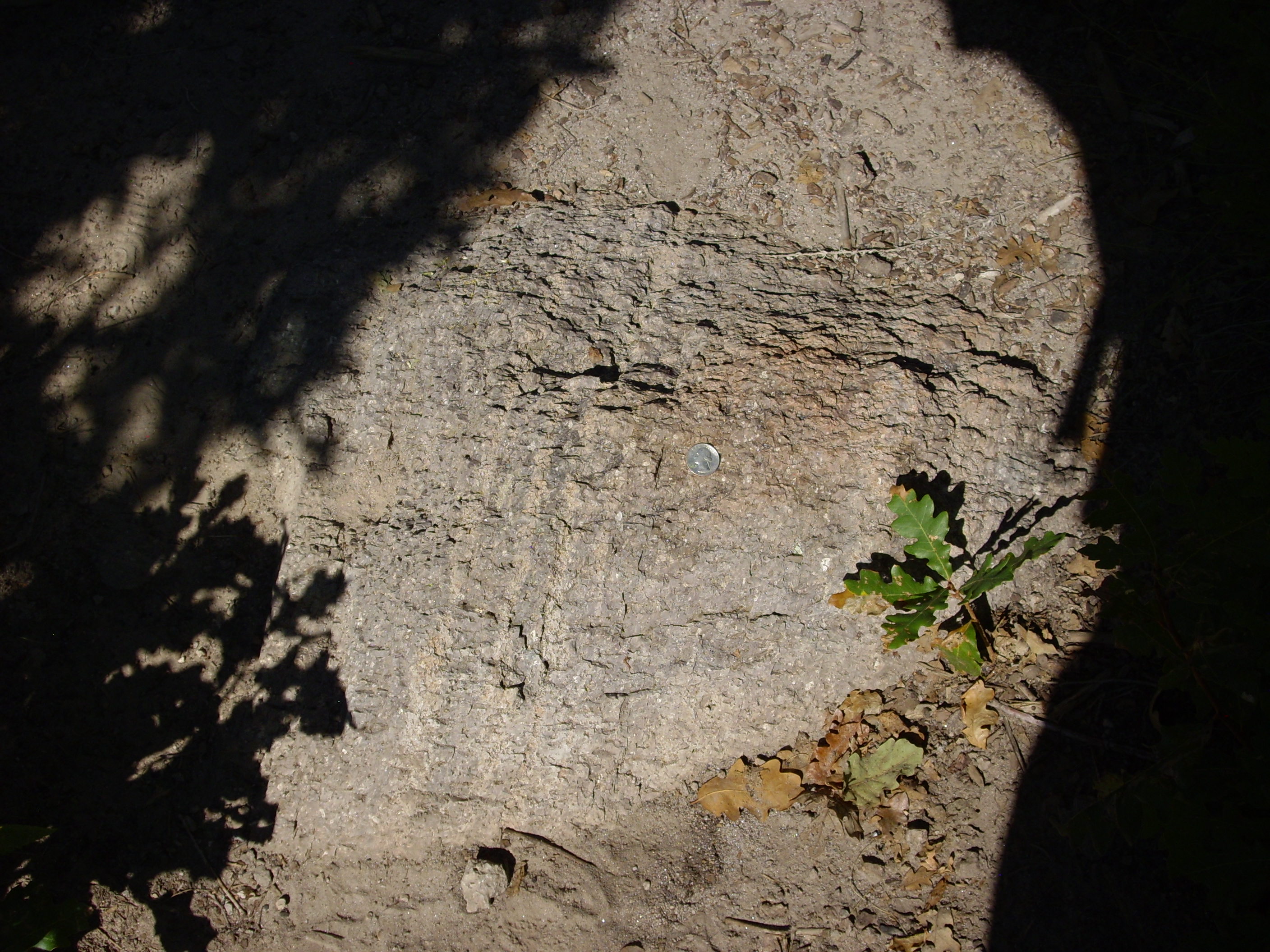
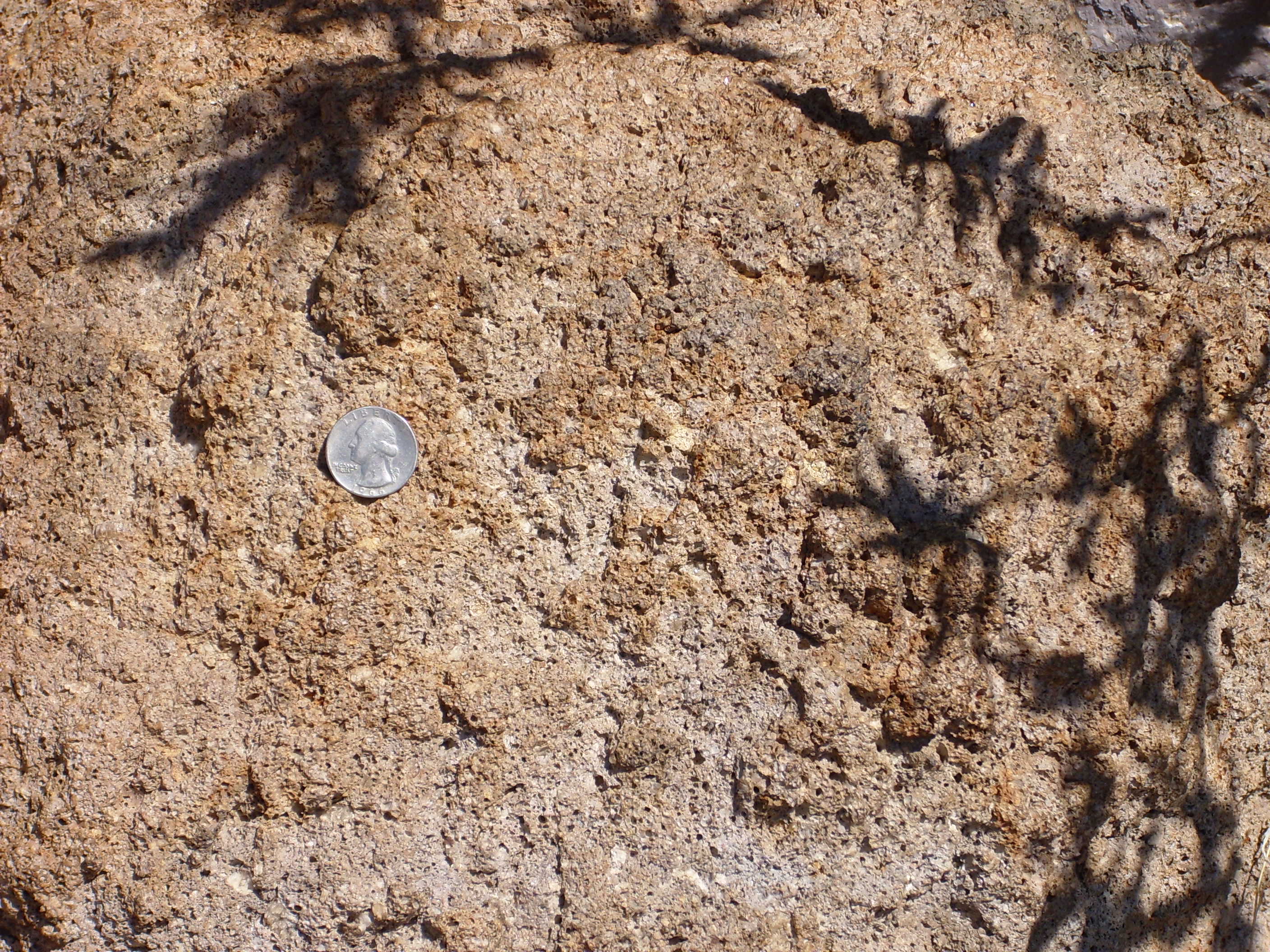
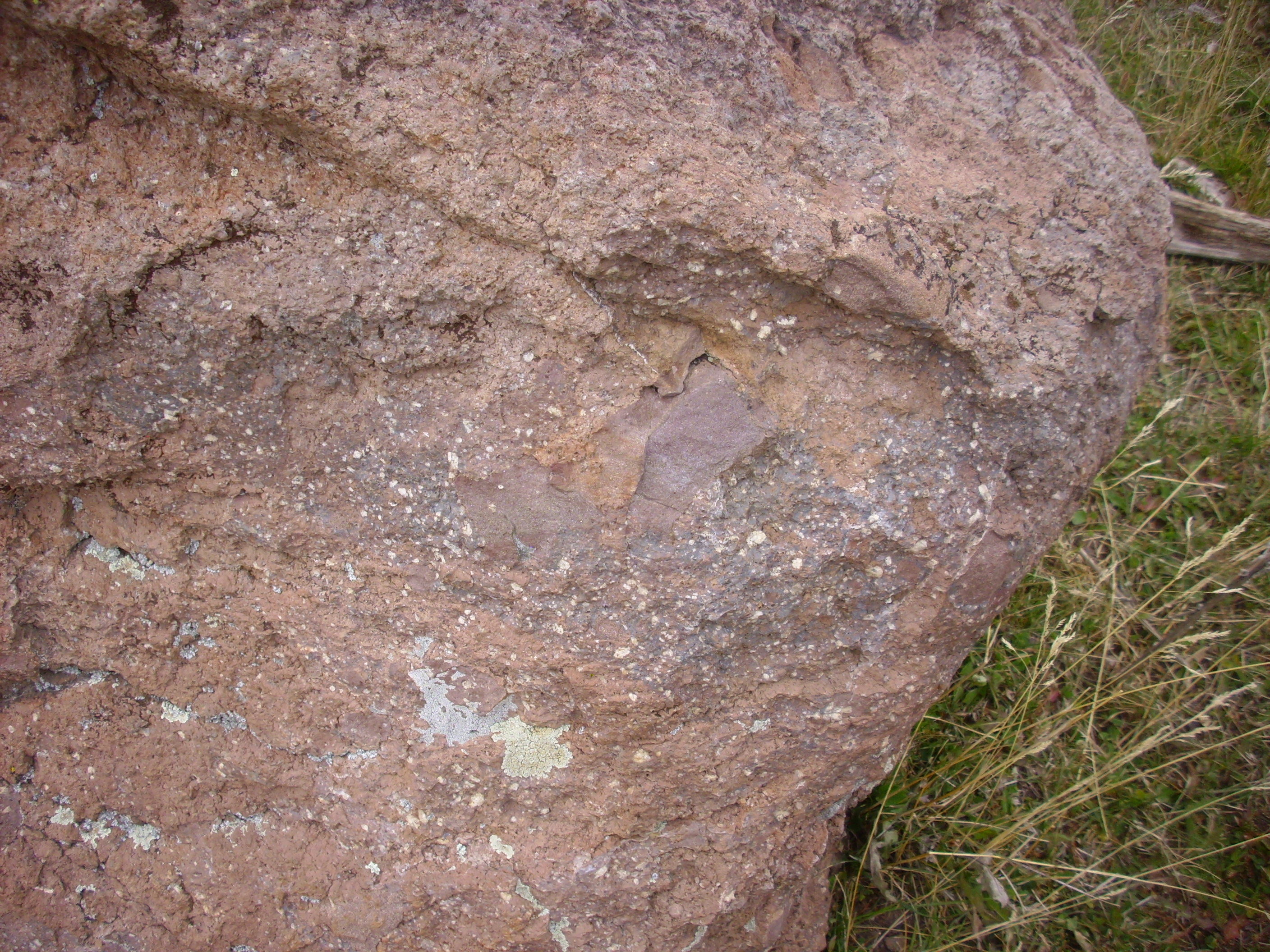
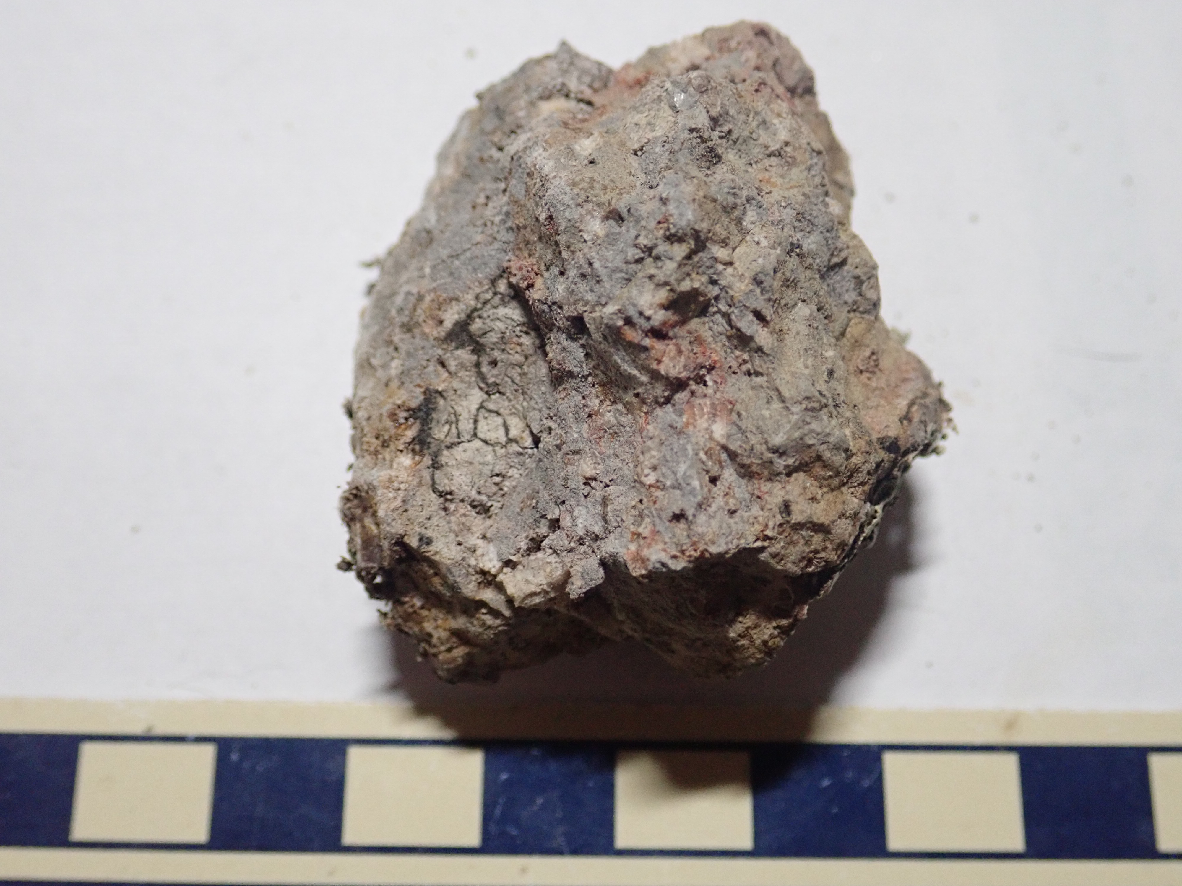
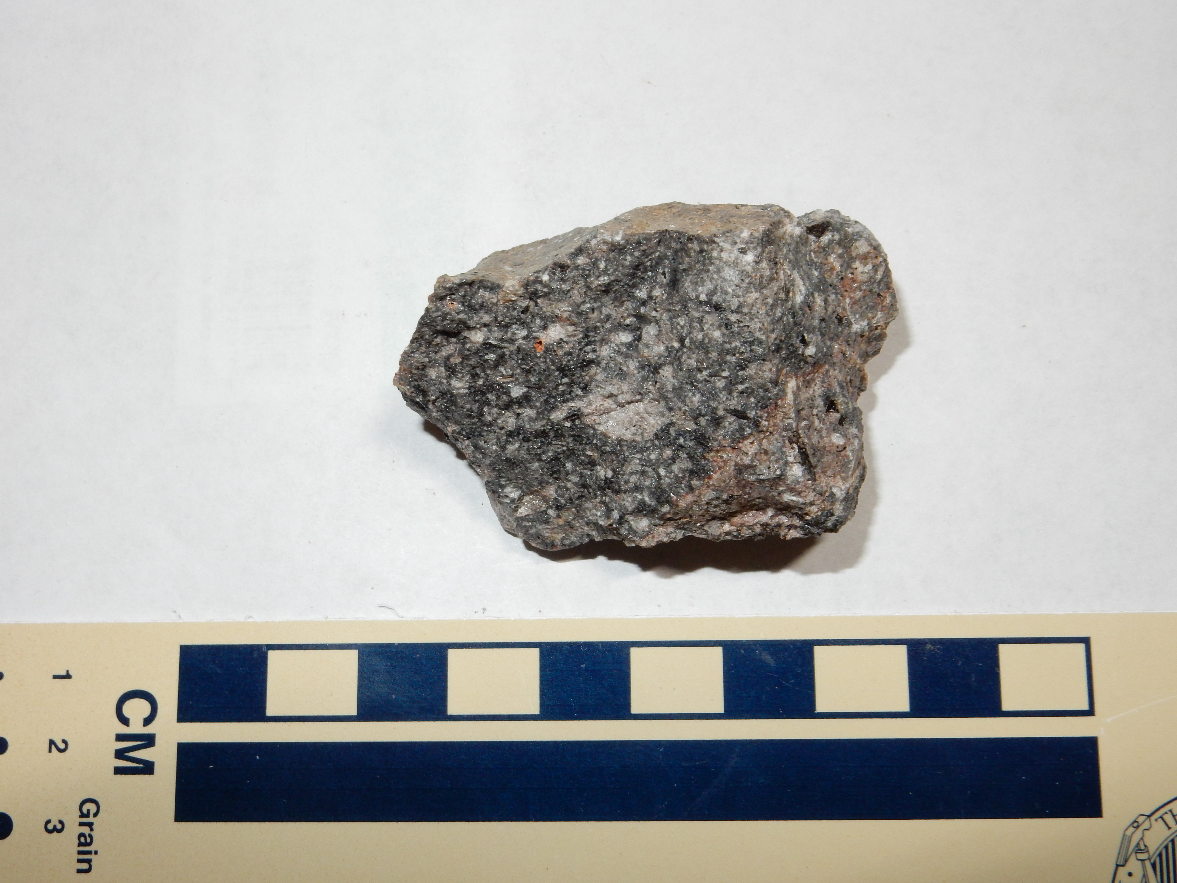
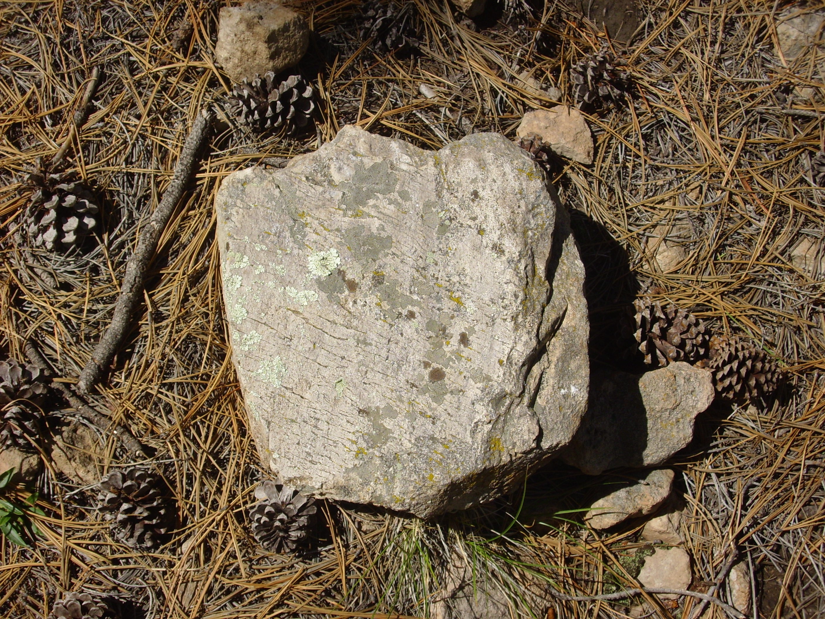
Poprphyritic rhyodacite boulder of the Rendija Canyon Member,
showing flow banding and plagioclase phenocrysts. Quarter provides
scale.

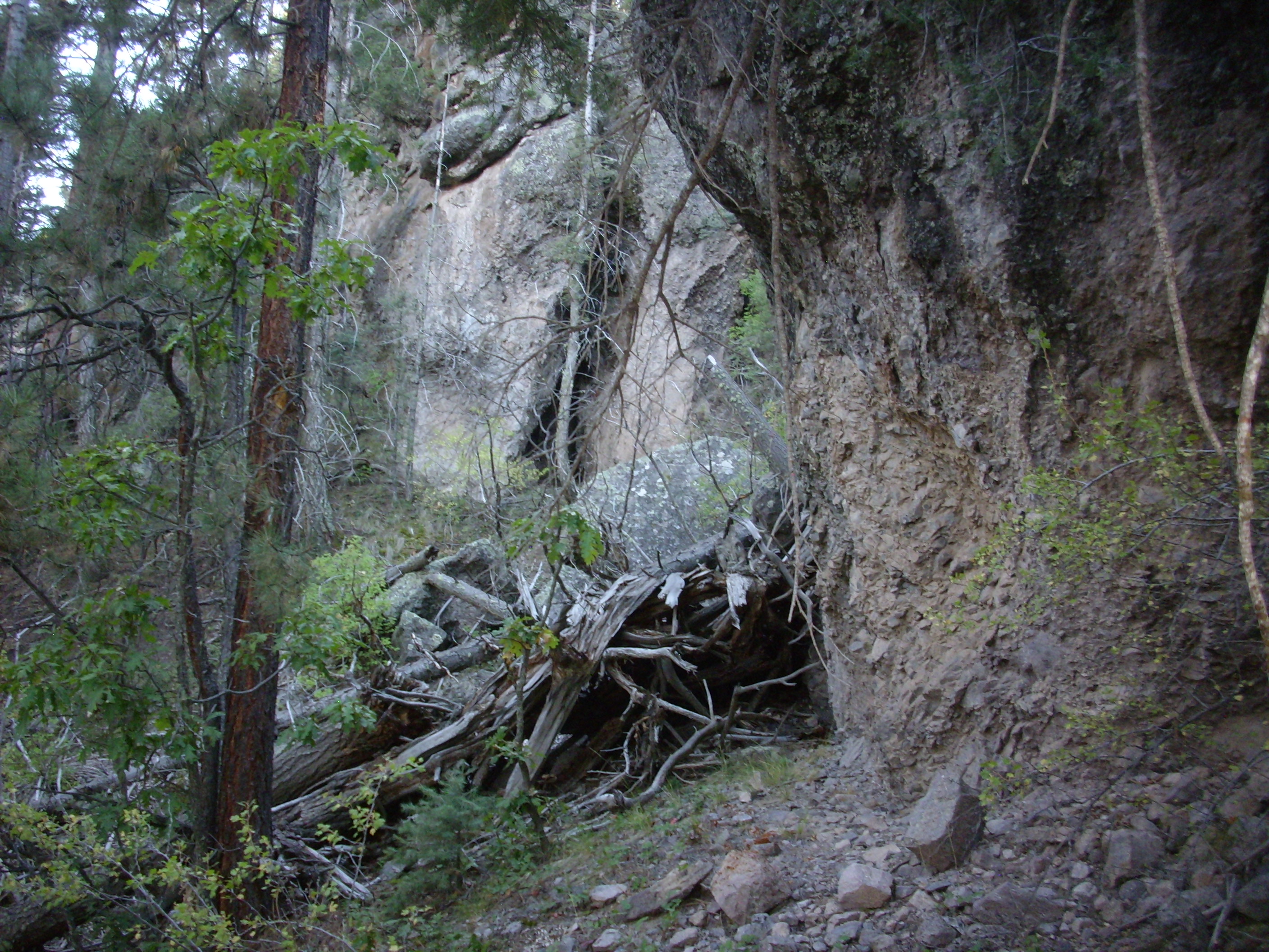
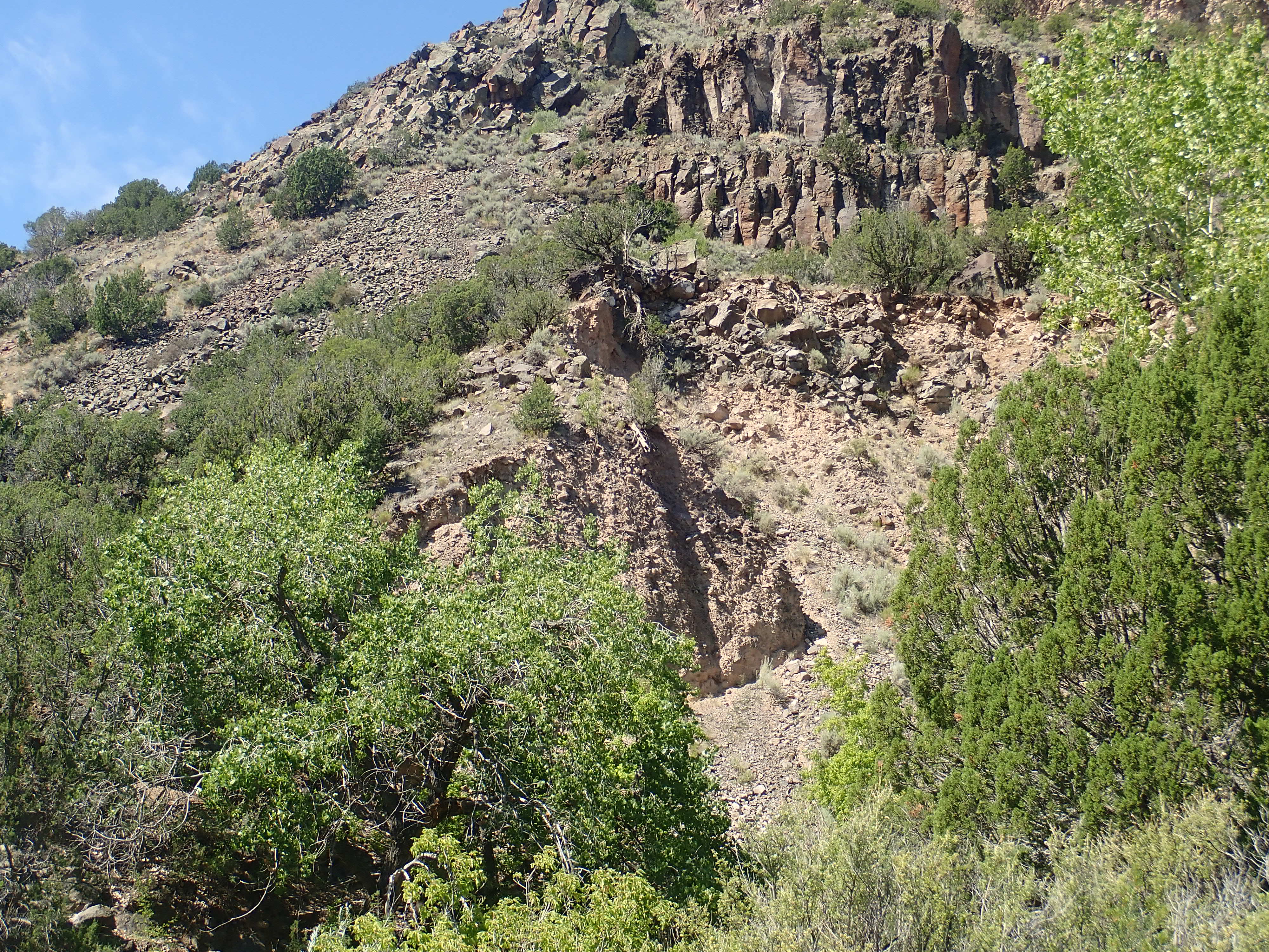
This is reached via a rather steep and rocky side trail best climbed with occasional three-point contact.
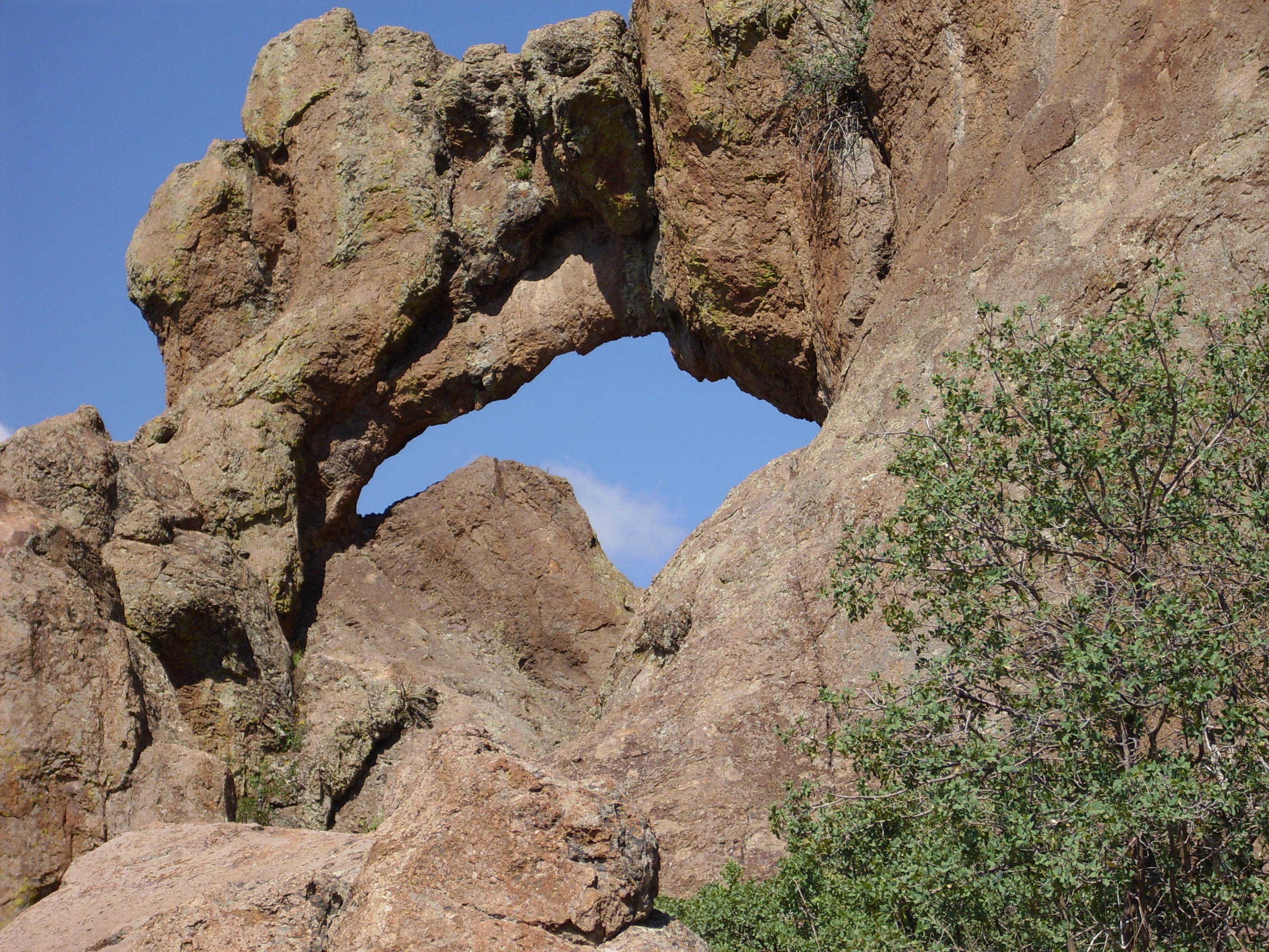
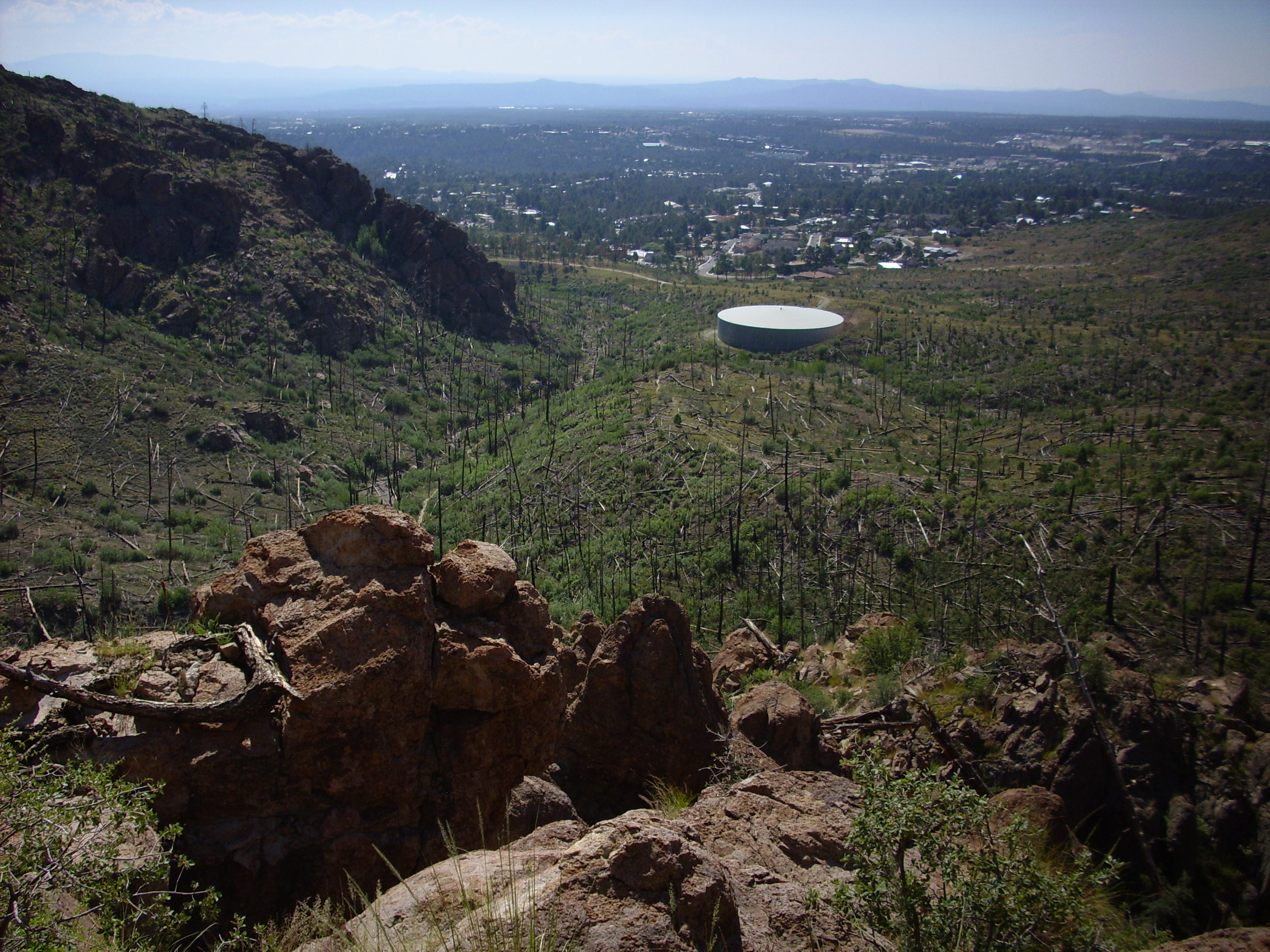
Looking southeast from the Guaje rock window towards the town
site. The Arizona
Street water tank is cut into a bank of welded rhyolite tuff
of the Tshirege Member, Bandelier Formation, which pooled in a
paleovalley in the Tshicoma Formation.
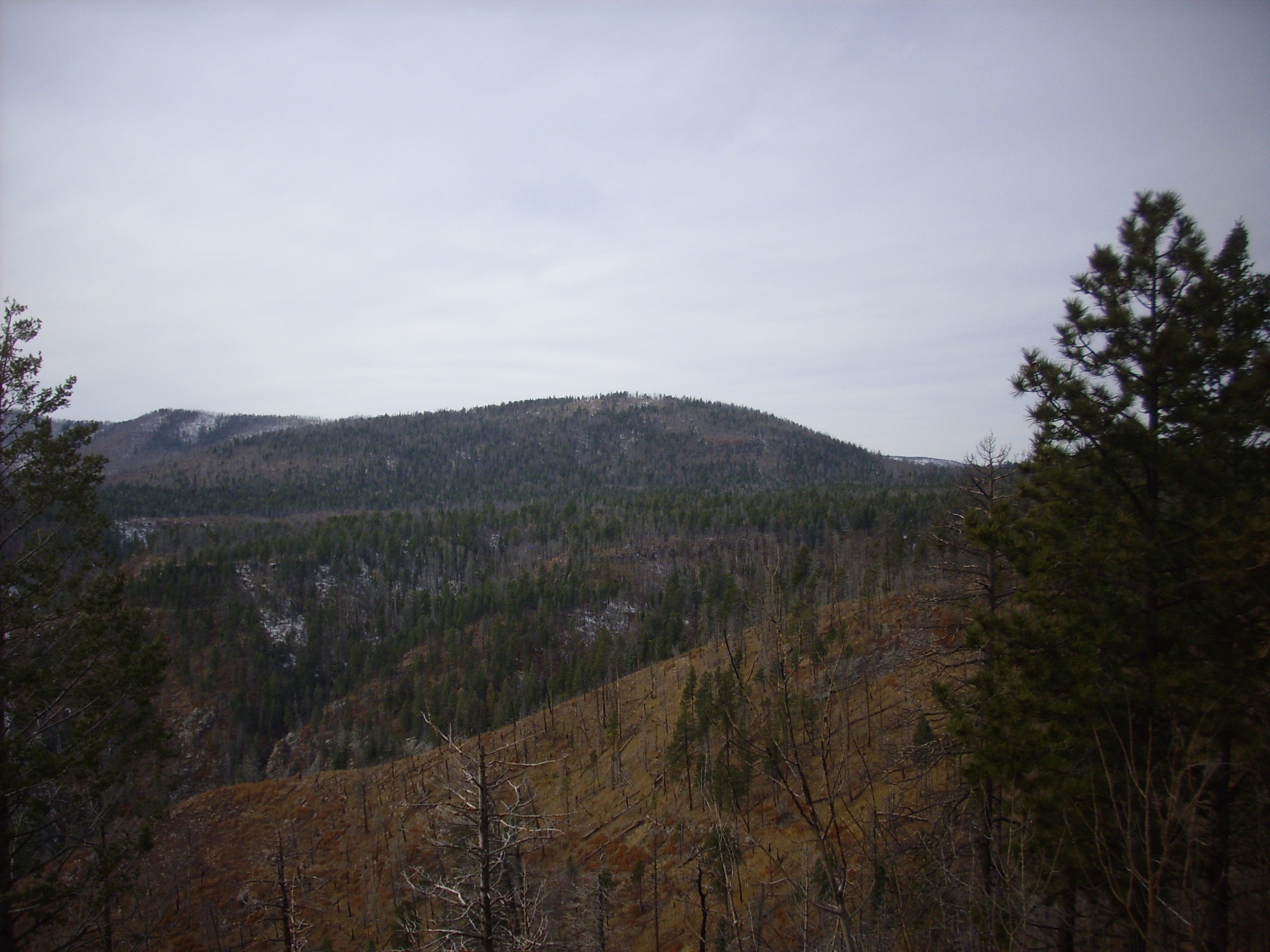
Looking south from the rock window towards Pajarito Mountain (which just pokes above the nearer ridges)
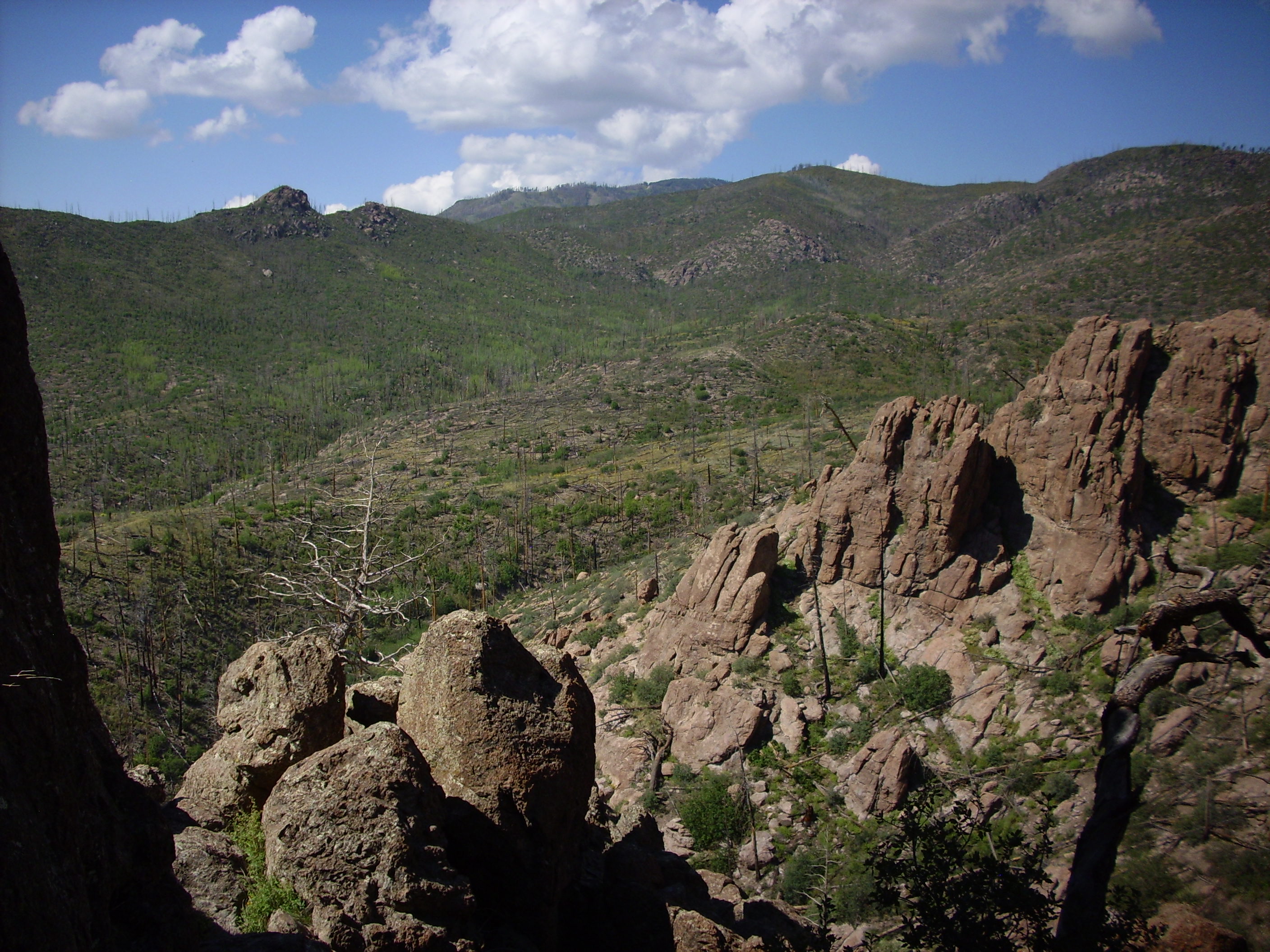
Looking west from the rock window towards Rendija
Mountain. Unless it's Quemazon Mountain. Both names are used
locally; neither is recognized by the U.S. Geological Survey.
The entire terrain in the last two photographs is underlain by
Tschicoma Formation.
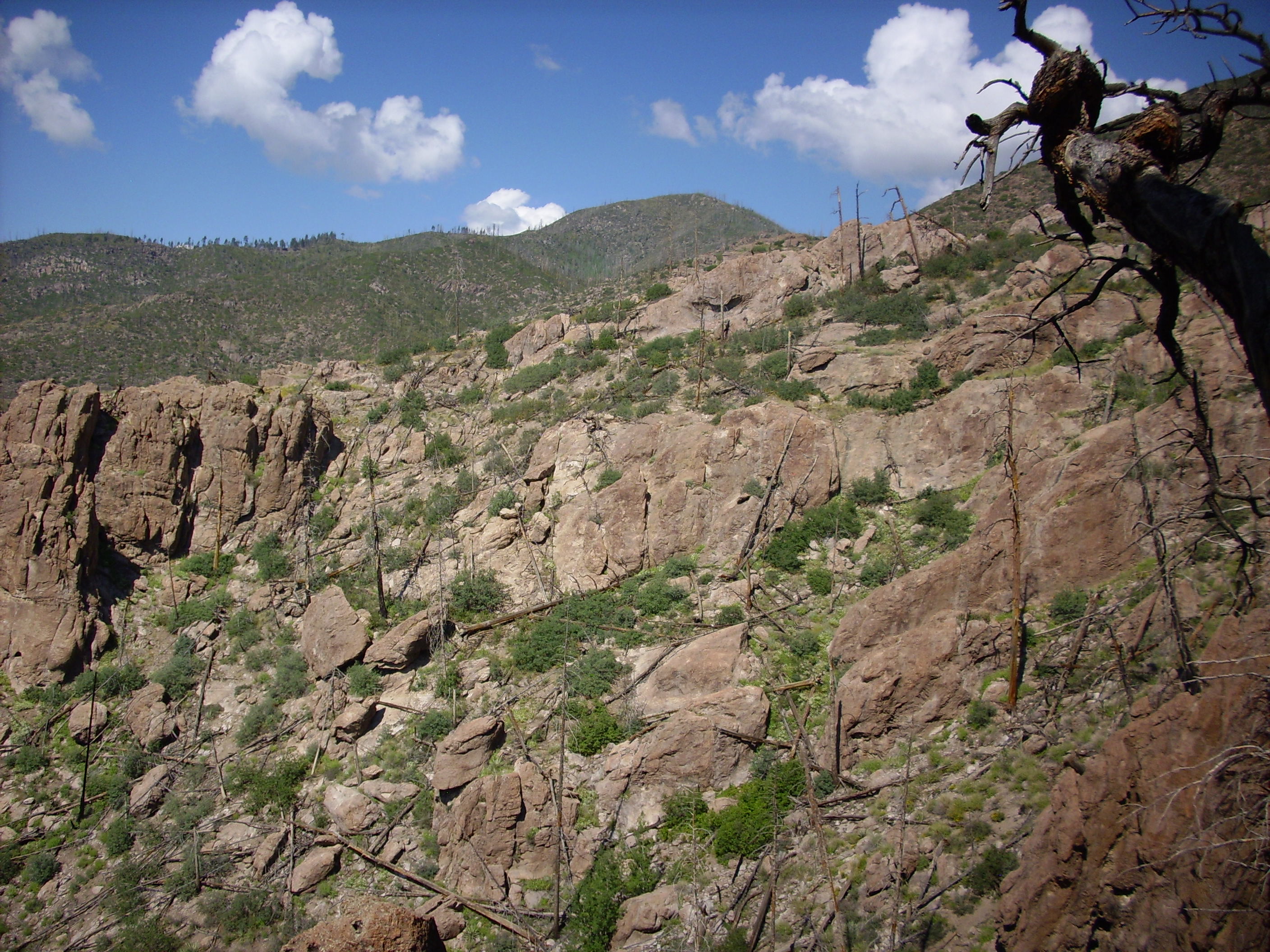
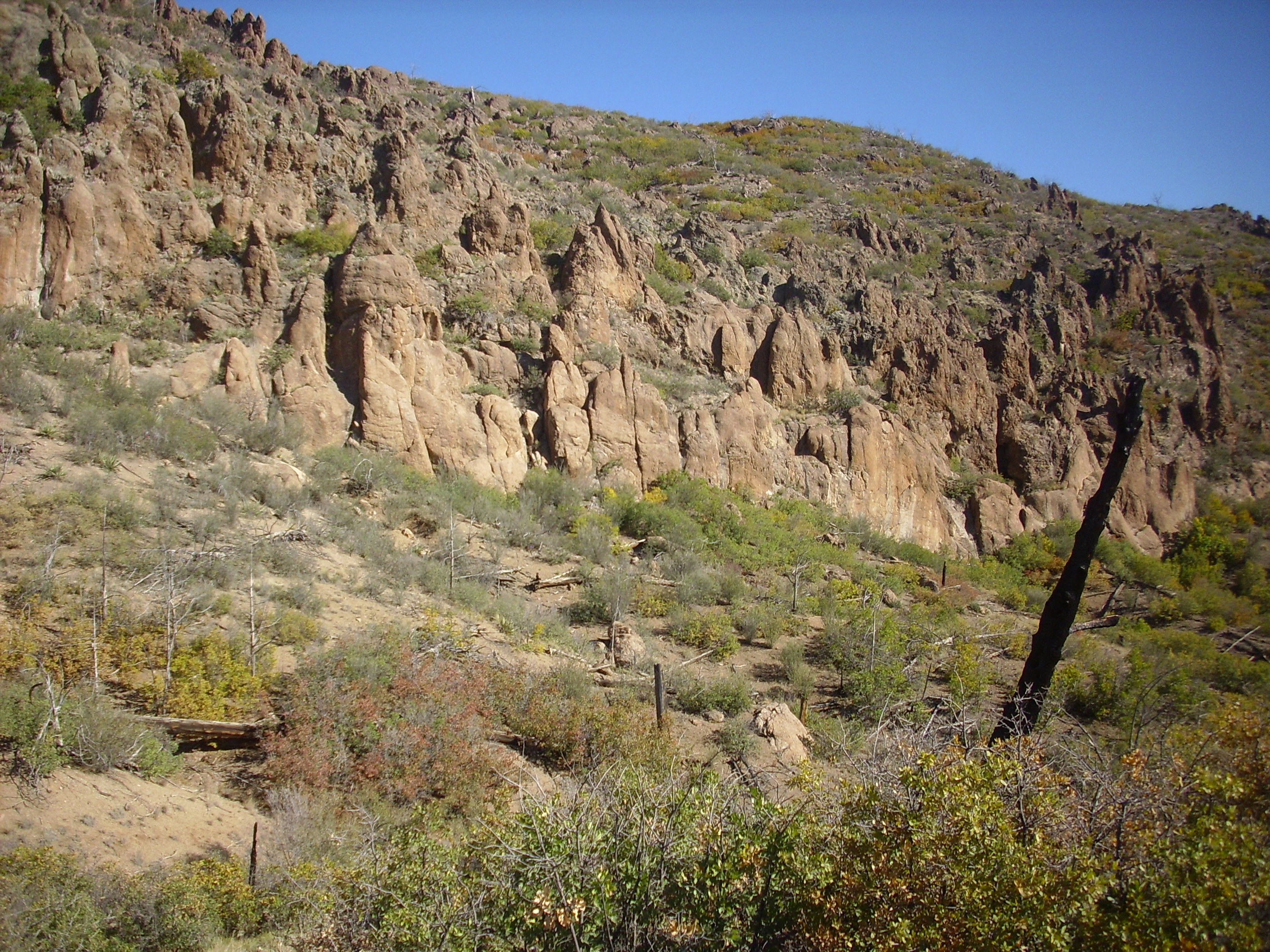
Guaje Ridge is a massive dacite flow from a single eruptive center located to its west. This was possibly Quemazon Mountain, or it may have been a vent even further west that foundered into the caldera when Valles Caldera was formed by the same eruptions that produced the Bandelier Tuff. The ridge is now moderately eroded, and in some places has been cut by faults, but the remaining high relief reflects the high viscosity of the original silica-rich lava.
Dacite cliffs showing flow banding:

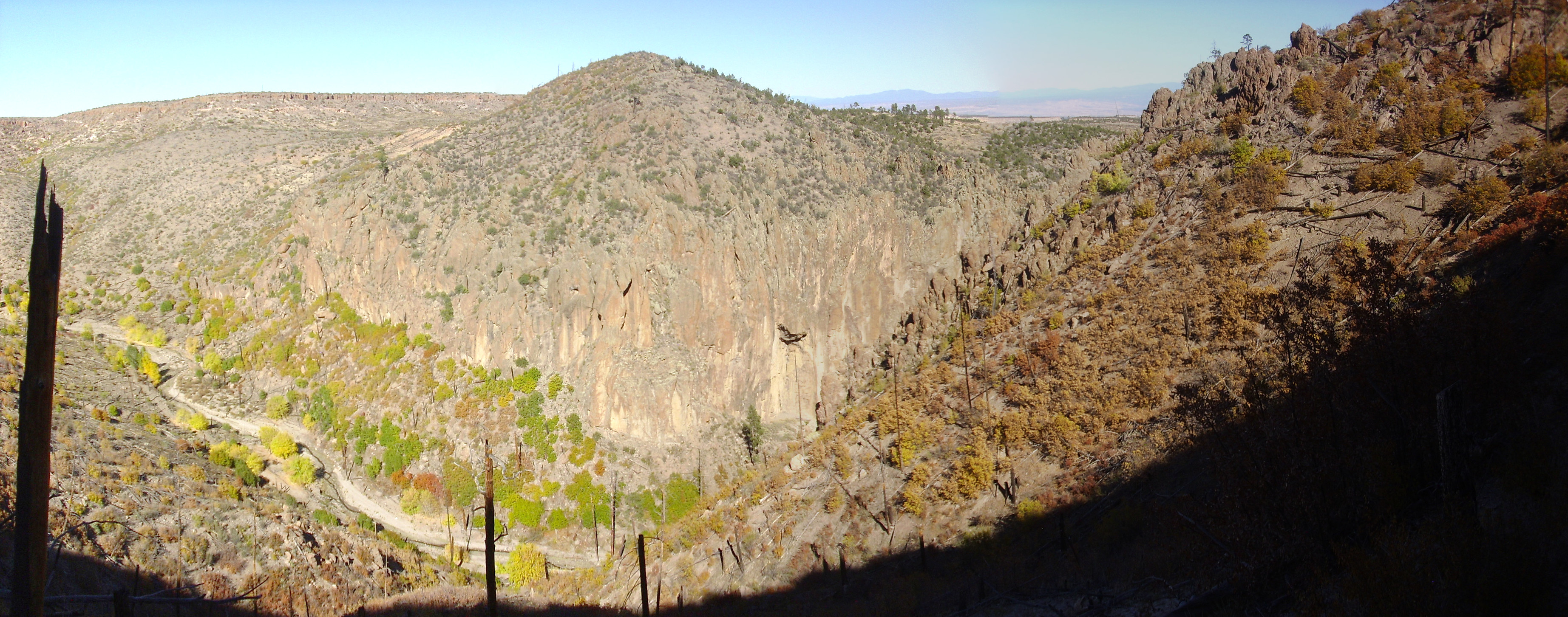
Guaje
Canyon looking east towards Round
Mesa in the far distance. Guaje Ridge is to the right.

Looking down the trail again. The hill to the upper right may be
a small dacite dome. For many years, it was known as "L.A.
Mountain", because there was a white painted logo for Los Alamos
High School on the east face of the dome. However, the dome is on
public land, and increased enforcement of environmental
regulations has kept the high school kids from repainting the logo
for some decades. It is now all but invisible.
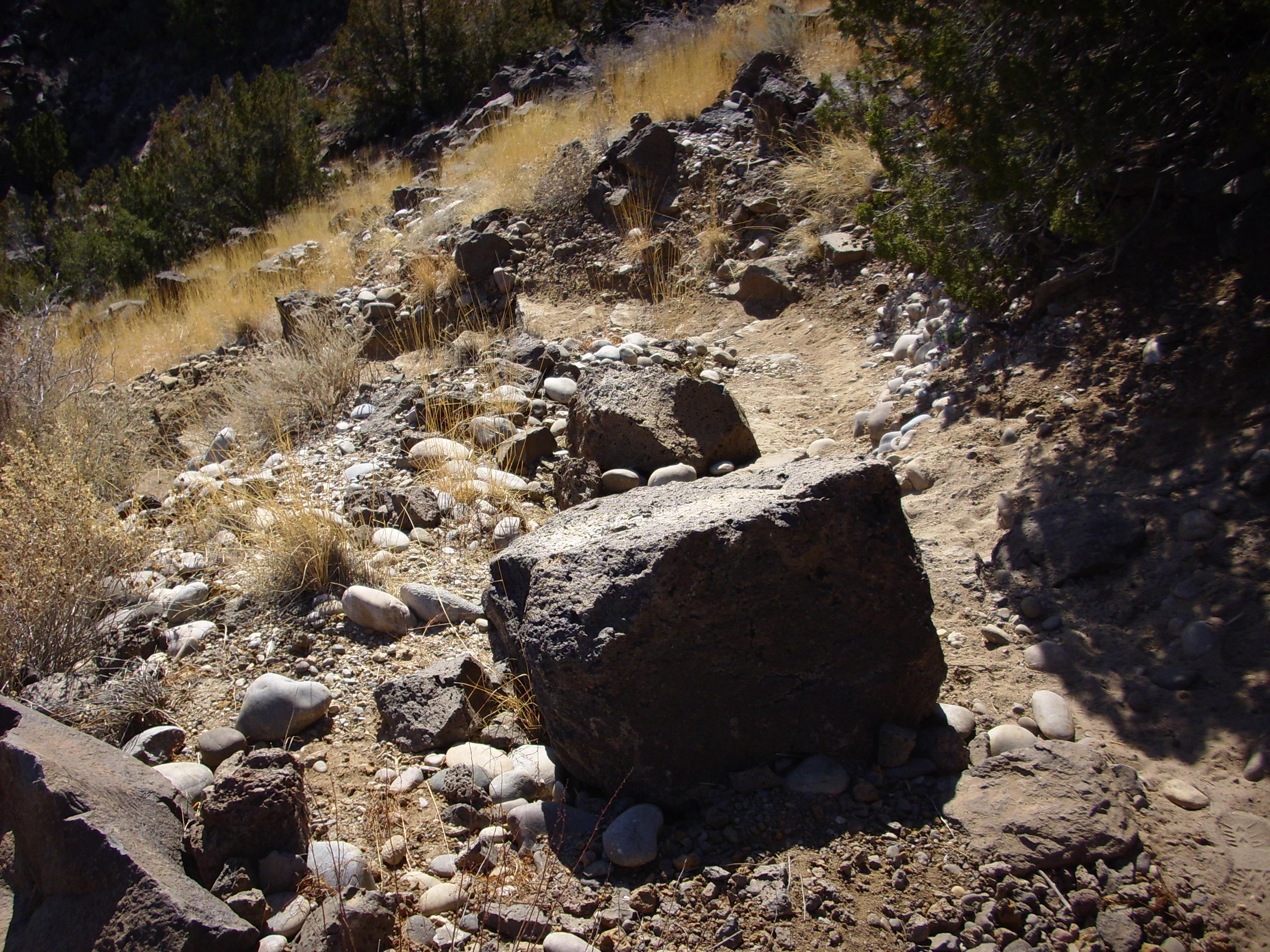
The next photograph shows a scoria outcrop near the top of Guaje
Ridge. This is lava that cooled while it was still full of gas
bubbles. Scoria is typically found near the surface of a lava
flow, and its presence here, near the top of Guaje Ridge, helps
establish that the ridge is in fact a large flow that has only
partially eroded.
Dacite outcropping with possible flow banding.
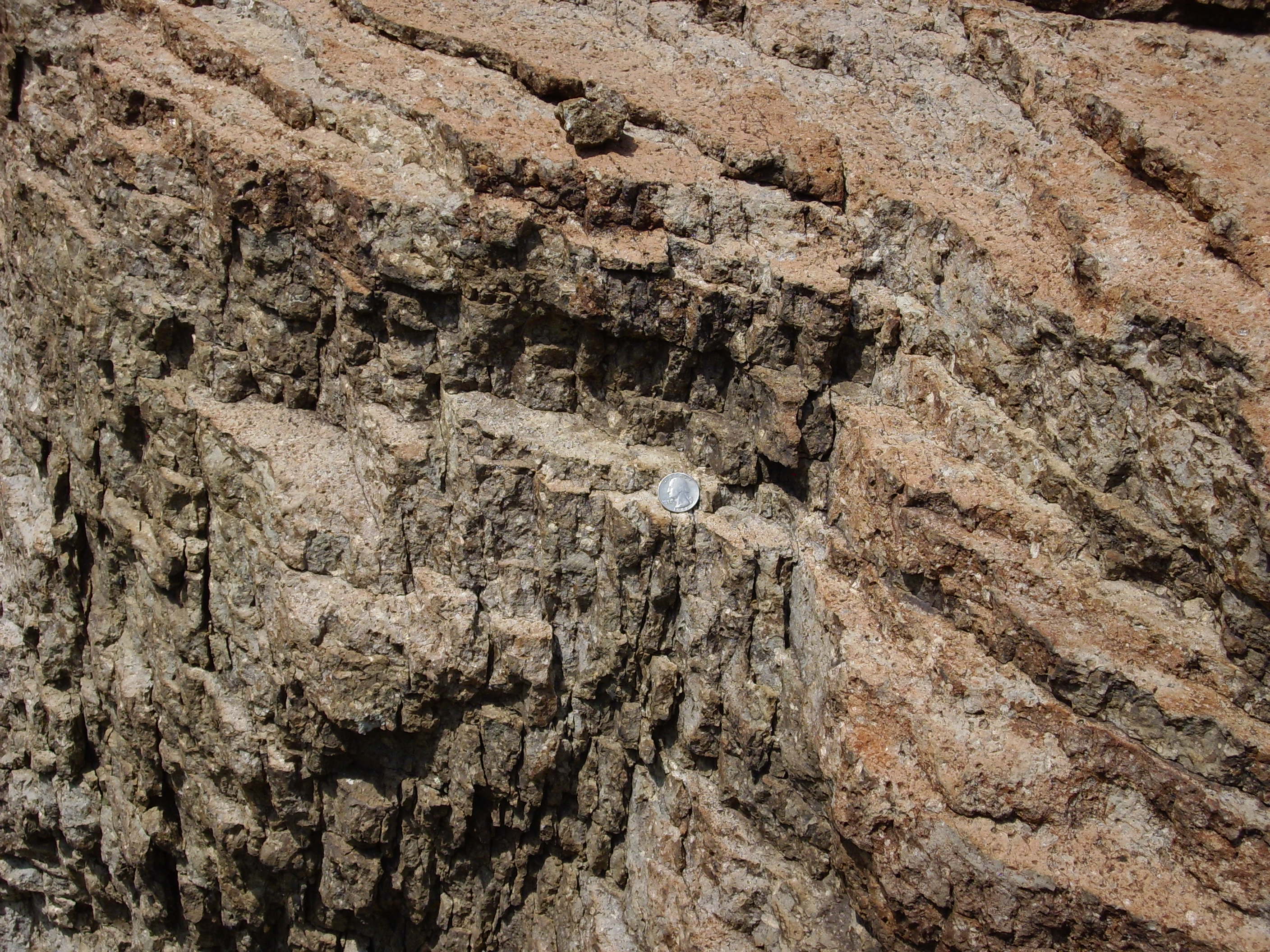
Flow banding in rhyodacite outcropping.
I've mentioned flow banding several times now. Flow banding is
the presence in a lava flow of thin layers of different
composition or texture. The boulder at the start of this section
showed what appears to be compositional differences between
layers; the photograph above shows what appears to be more of a
textural layering.
The causes of flow banding are debated by geologists. When I first read about the phenomenon, I assumed this was a manifestation of a more general phenomenon called shear banding, well-known in the field of continuum mechanics (in which I worked for some years.) Shear banding occurs when the deformation in a ductile material becomes localized into thin layers. This occurs because the deformed material loses strength, so that further deformation tends to occur in the regions that are already most deformed. I can imagine something similar happening in a viscous lava flow, where the presence of many phenocrysts could give the lava the right mechanical properties. For example, this outcrop of the Rendija Canyou Member in Cabra Canyon west of Guaje Mountain is likely the result of flow of very cool, nearly solidified magma.

Rendija Canyon slot. 35.9204376N
106.2853387W
However, shear banding does not seem to be satisfactory
explanation for all cases of flow banding. Some cases may simply
be manifestations of incomplete mixing of different compositions
of lava. If you have ever tried to mix pigment into white
paint, you have likely seen that the pigment initially forms thin
layers in the paint, and considerable stirring is required to
distribute the pigment throughout the paint. Something similar may
occur in some lava flows of mixed composition.
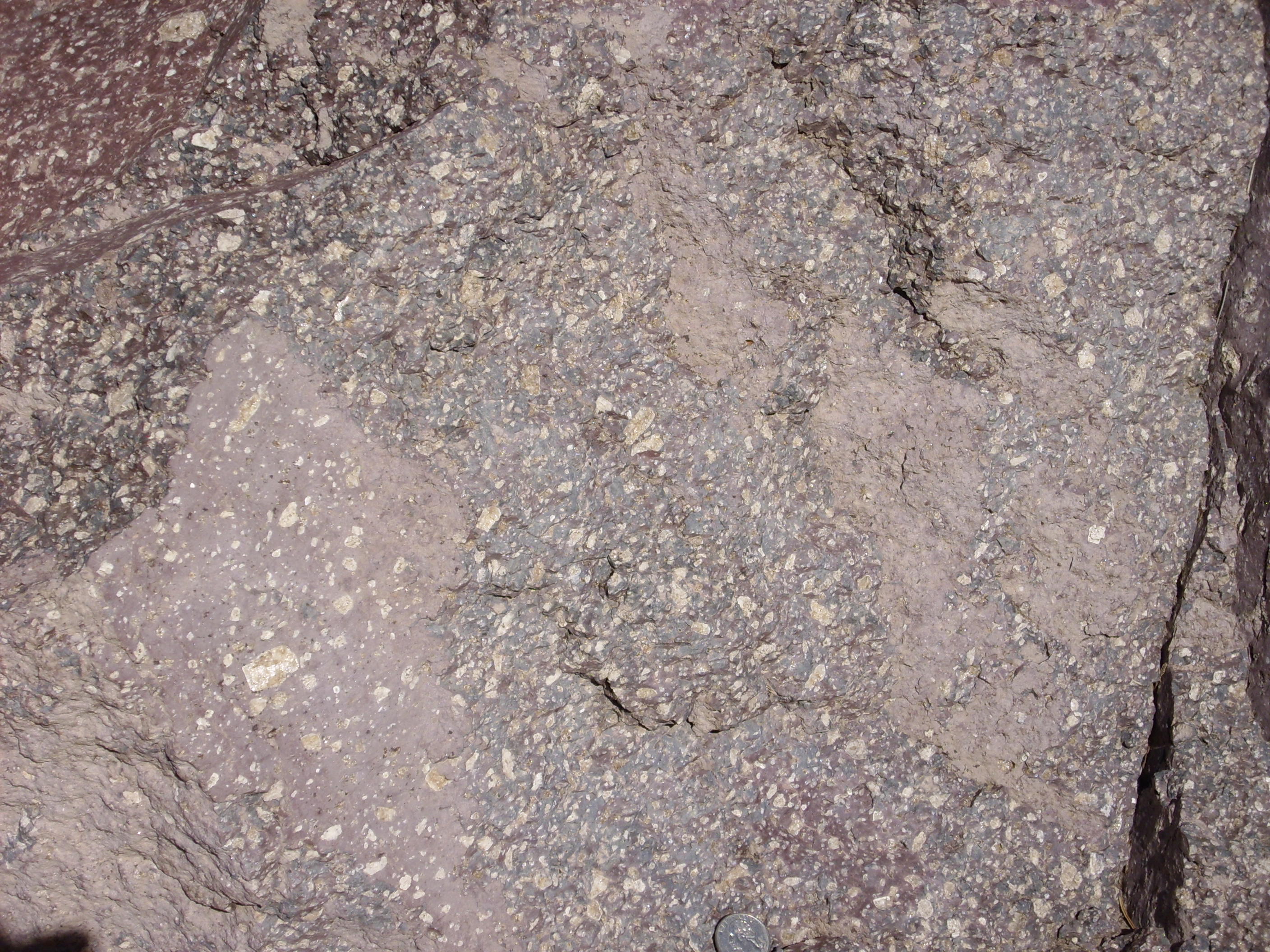
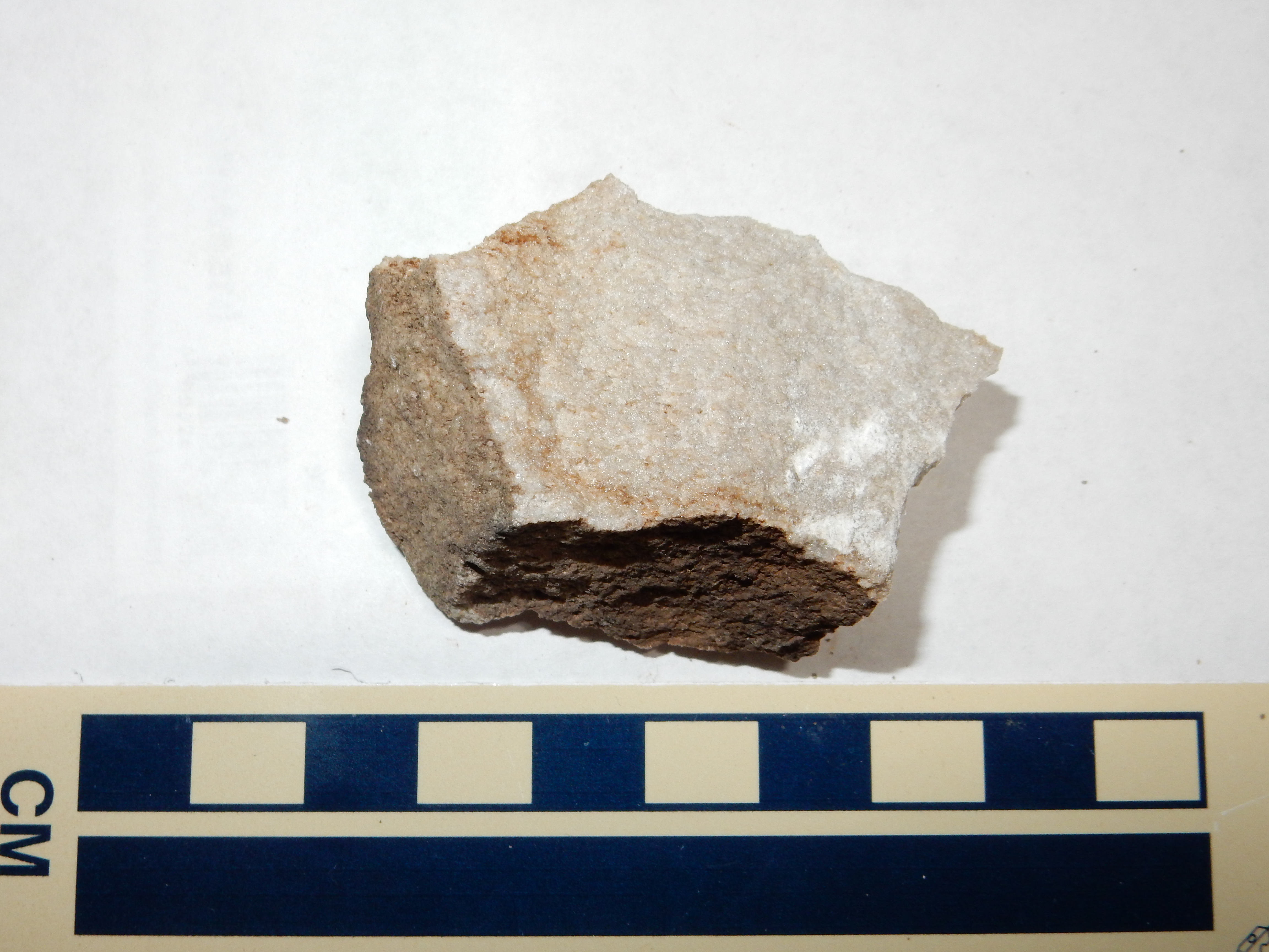
Let's return to the Tschicoma Formation by examining a sample of the Rendija Canyon dacite.
We see that the dacite consists of large light-colored
phenocrysts of plagioclase in an aphanitic matrix. This is very
typical of most flows of the Tschicoma Formation. There are also
quartz grains, making this a rhyodacite.
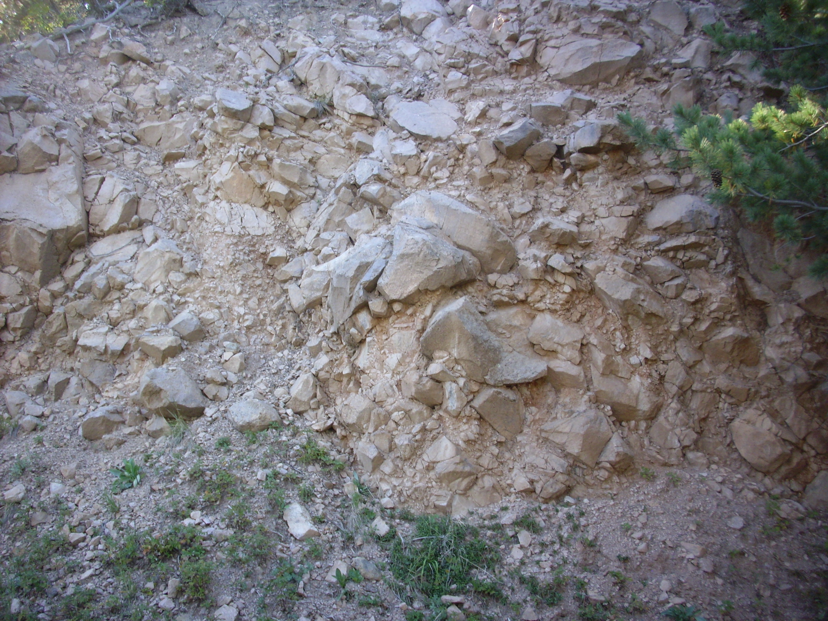
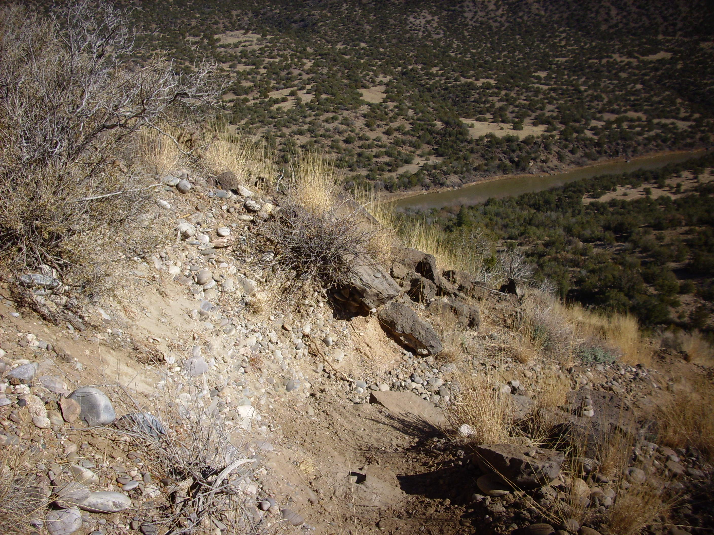
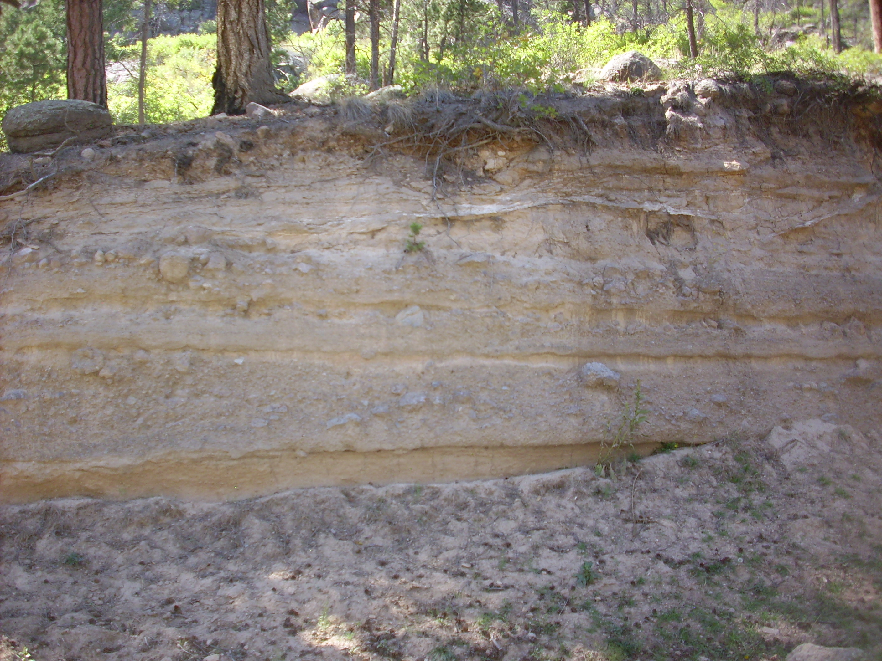
The area around the Mitchell Trail shows mostly exposures of
dacite close to the surface of the flow. The interior of the flow
is exposed in a slot
canyon just east of the Los Alamos cemetery at Guaje
Pines. This is part of Rendija Canyon, which opens out and
becomes quite substantial further to the east.
Both sides of the canyon are Tschicoma dacite, but the wall on the right (south) is topped by Bandelier Tuff while the wall on the left is bare. When it was first erupted, the Bandelier Tuff ponded against the older dacite to the left, and then the tuff preferentially eroded away at the point of contact to produce this canyon. Erosion continued cutting down into the dacite to expose the interior of the Guaje flow in this slot canyon..

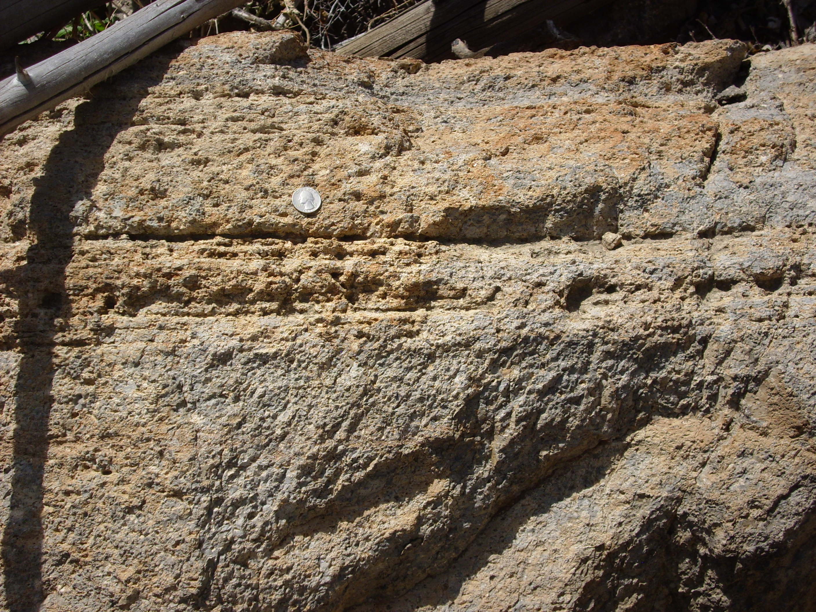
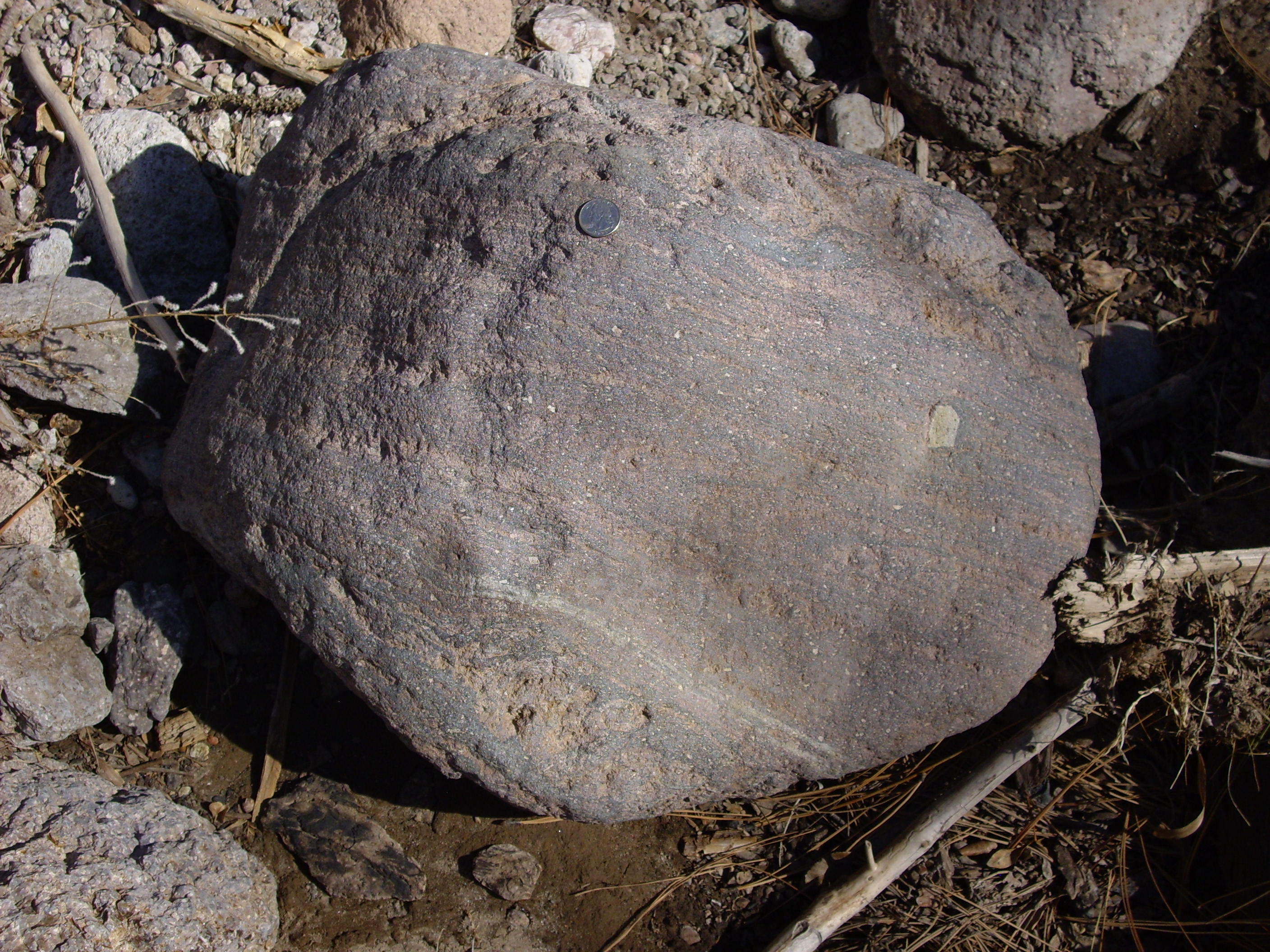
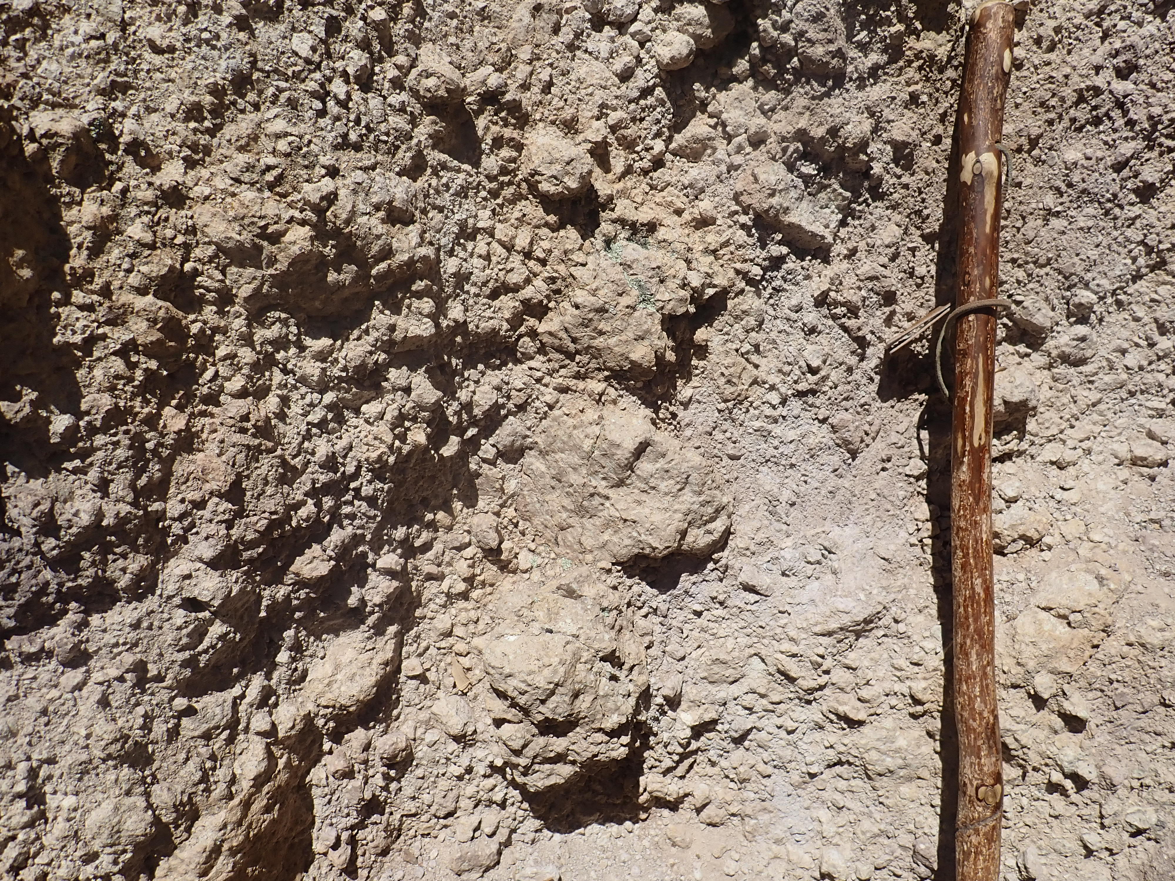
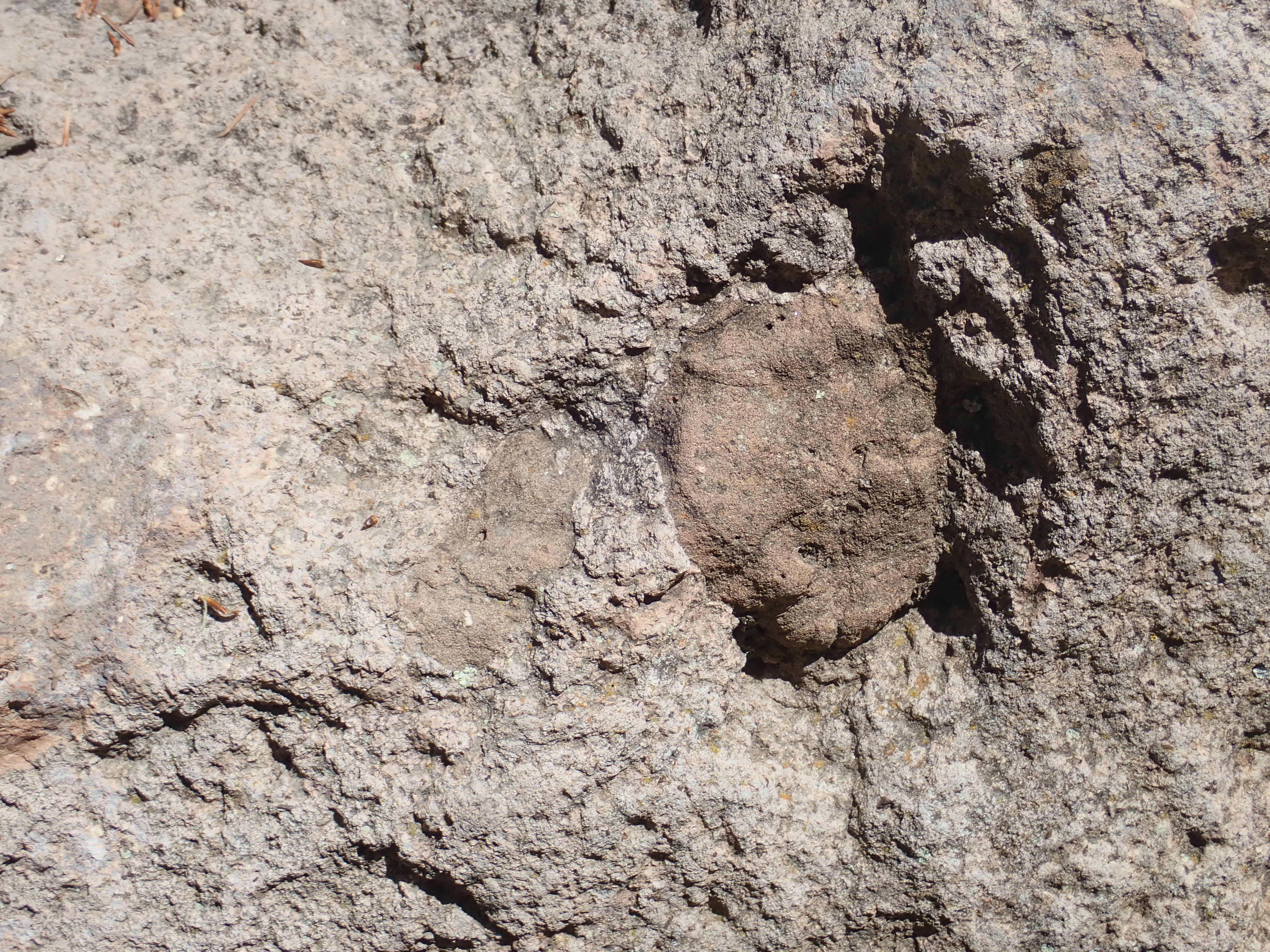
The canyon is floored with large clasts of Tshicoma dacite like this one, which is roughly two meters across. Here's a close up photograph:
There's a quarter at the bottom for scale. This lava would have erupted out of the source vent as a thick sludge full of these plagioclase crystals. In some cases, the lava was a bit more fluid, as with this boulder full of flow bands:
Halfway up the canyon wall, there is an extensive exposure of
fractured rock.
This is probably a block and ash flow, like those we saw around Cerro Balitas earlier in the book. Here is a close look at part of the beds.
Block and ash flow.
35.909407N
106.2979157W
There are several cooling cracks visible in the larger clasts
here.
The Rendija Canyon Member is the oldest member of the Tschicoma Formation present in any volume around Los Alamos, and this is evident from the topography of the formation, which is clearly more heavily eroded than other areas underlain by Tschicoma Formation. The younger domes and flows really do look like they are draped over the older eroded topography. However, with all formation ages, one must keep in mind that there is inherent uncertainty in the formation age of a few percent, and there is also genuine spread in ages -- most vents erupted more than once, often at intervals of tens of thousands of years.
It is perhaps no surprise that the Tschicoma Mountain Member of the Tschicoma Formation shows a broad age range, since Tschicoma Mountain is the highest point in the Jemez.
It would have taken repeated eruptions from a single vent to build up so high a peak. The oldest lavas from this vent have been dated to about 5.6 million years, just a little younger than the youngest Rendija Canyon dacite, but the bulk of the mountain was erupted between 3.9 and 3.3 million years ago. The northeast flank of the mountain is a single large flow, the Gallina Mesa Flow, dated to about 3.9 million years. Here's a sample:
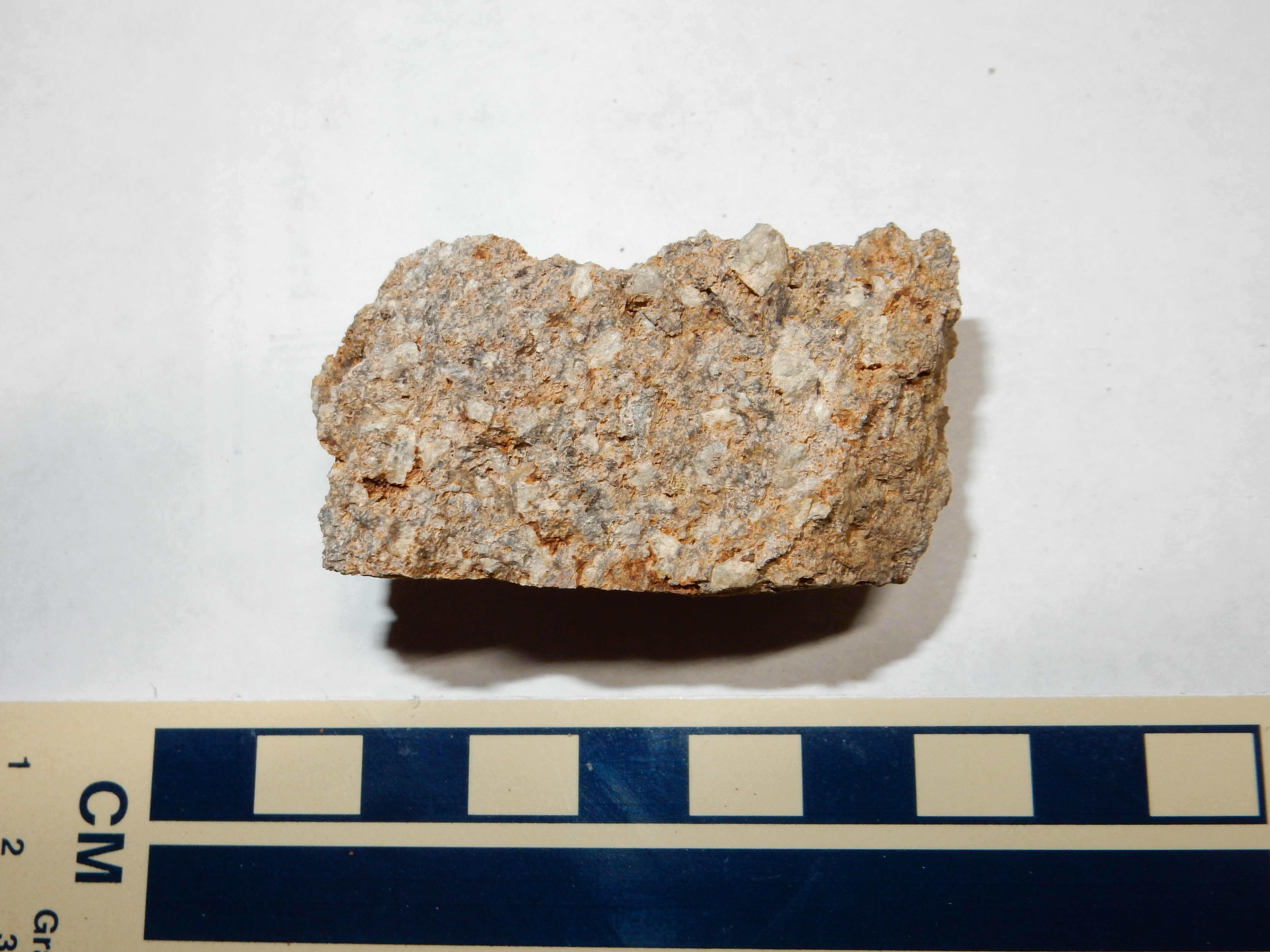
Gallina Mesa Unit, Tschicoma Mountain Member, Tschicoma
Formation
Dacite to the northwest of Tschicoma is notable for the presence
of mafic inclusions.
Tshicoma dacite with mafic inclusions. 36
01.783N 106 28.132W
This photograph shows two blobs of fine-grained darker rock (the mafic inclusions) surrounded by Tschicoma dacite, with its distinctive white plagioclase feldspar crystals. The mafic inclusions are evidence that the Tschicoma eruptions may have involve mixing of low-silica basalt magma from the mantle with high-silica melted crust. Similar inclusions are found near Pajarito Mountain.
Tshicoma dacite with mafic inclusions. 35.8962414N 106.3925109W
This looks almost like country rock entrained in the magma, but
this may be an effect of weathering.
The view south of Tschicoma Peak shows Santa Clara Canyon and the
north flank of Caballo Peak,
Caballo Peak is the ridge left of center. The city of Los Alamos
is visible over its shoulder. The deep valley below is Santa Clara
Valley. To the right are younger cliffs of Tsherige Member,
Bandelier Tuff, and domes of the Toledo Embayment, a semicircular
region seemingly carved out of the Tshicoma Highlands by later
geologic events.
Further north still are Polvadera Peak and Cerro Pelon. These are
prominent on the skyline south of El Alto Mesa.

Polvadera Peak and other Tschicoma domes
south of El Alto. 36
08.159N 106 20.590W
Polvadera Peak is the prominent peak near the center of the panorama. Cerro Pelon is in the foreground to its right. Like Tschicoma Peak, these domes are around 5 to 3 million years old.
Cerro Pelon is particularly striking on the topographic map, with
an obvious summit crater.
Cerro Pelon from the south. 36
06.584N 106 23.633W
Geologists have interpreted the dome on the right as a single flow coming out of the summit crater.
The next vents to open were in the area around Cerro
Rubio, where the dacite is between 4.2 and 3.6 million years
old.

Cerro Rubio is the peak on the skyline just left of center. One can climb the peak itself from the Guaje Trail.

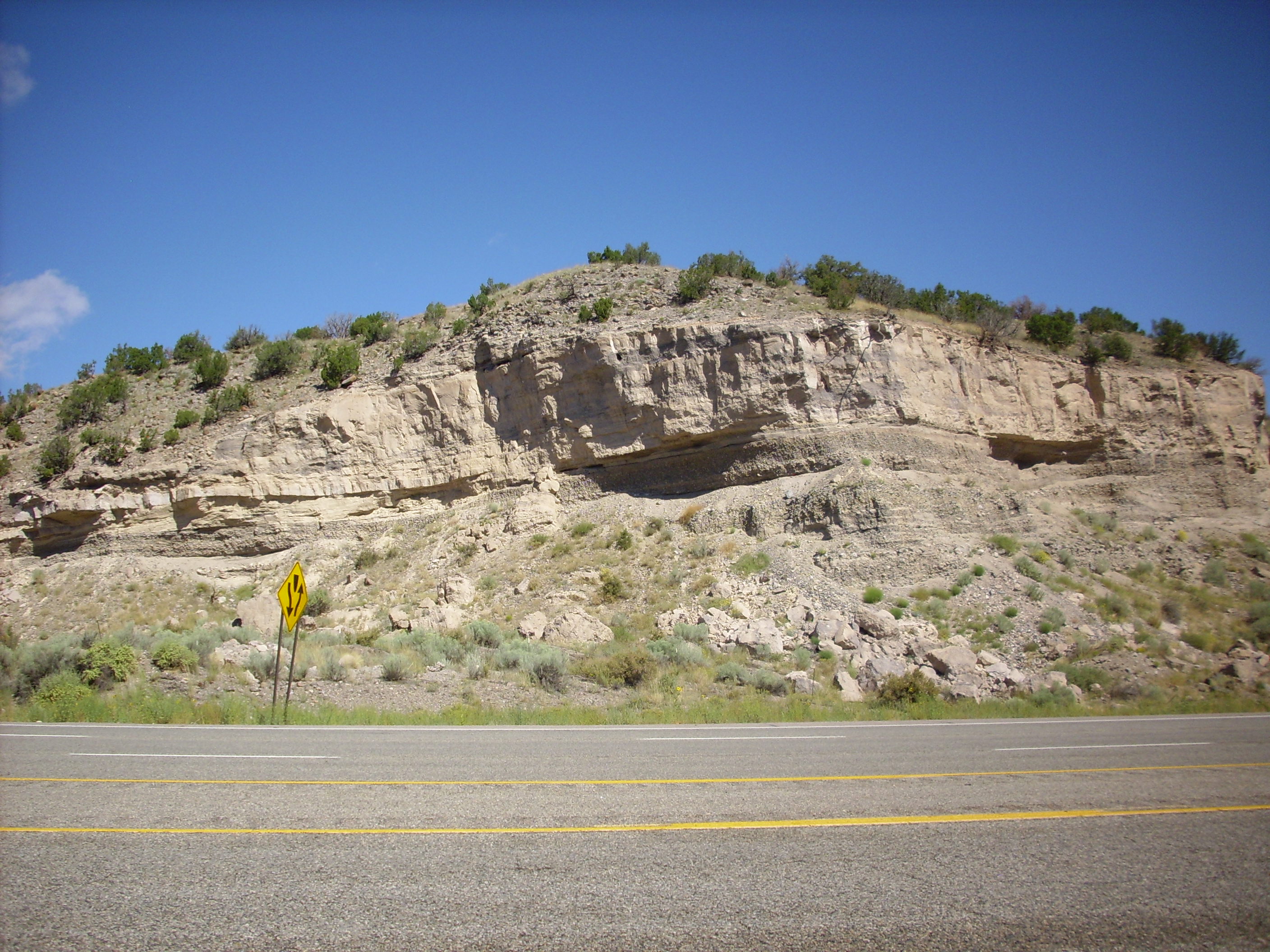
Another pair of vents opened around 3.7 million years ago.
Sawyer
Dome has been dated to 3.6 to 3.4 million years old, and
some of its flows are overlain by the massive Cerro Grande Member,
which has been dated to between 3.8 and 2.9 million years old. The
Cerro Grande dacite is particularly noted for containing visible
crystals of hornblende (a hornblende dacite). This is well exposed
in a
road cut along State Road 4:
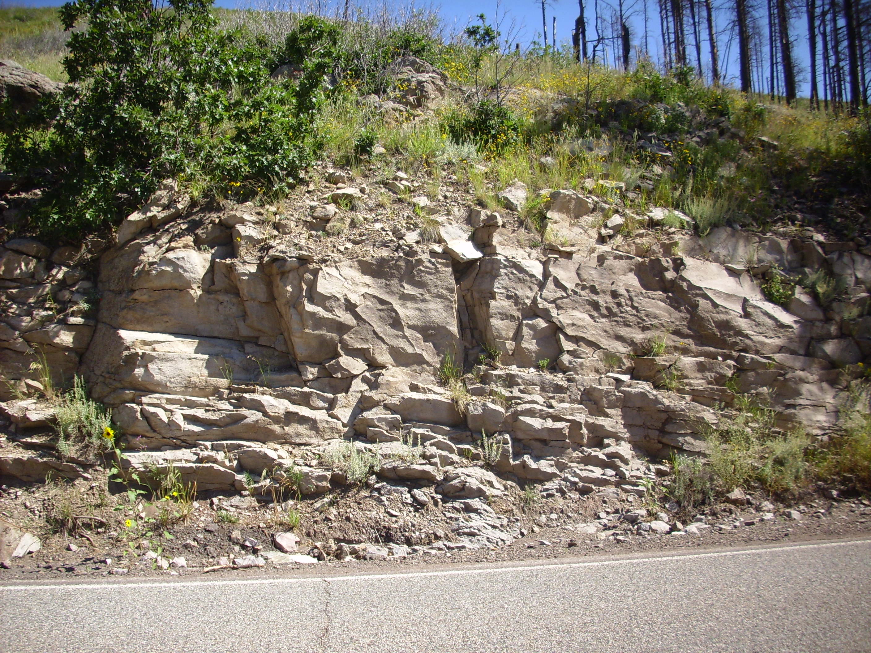
Much of the hornblende in this sample appears under the loupe to
have oxidized to hematite, but there are a few black crystals of
hornblende remaining.
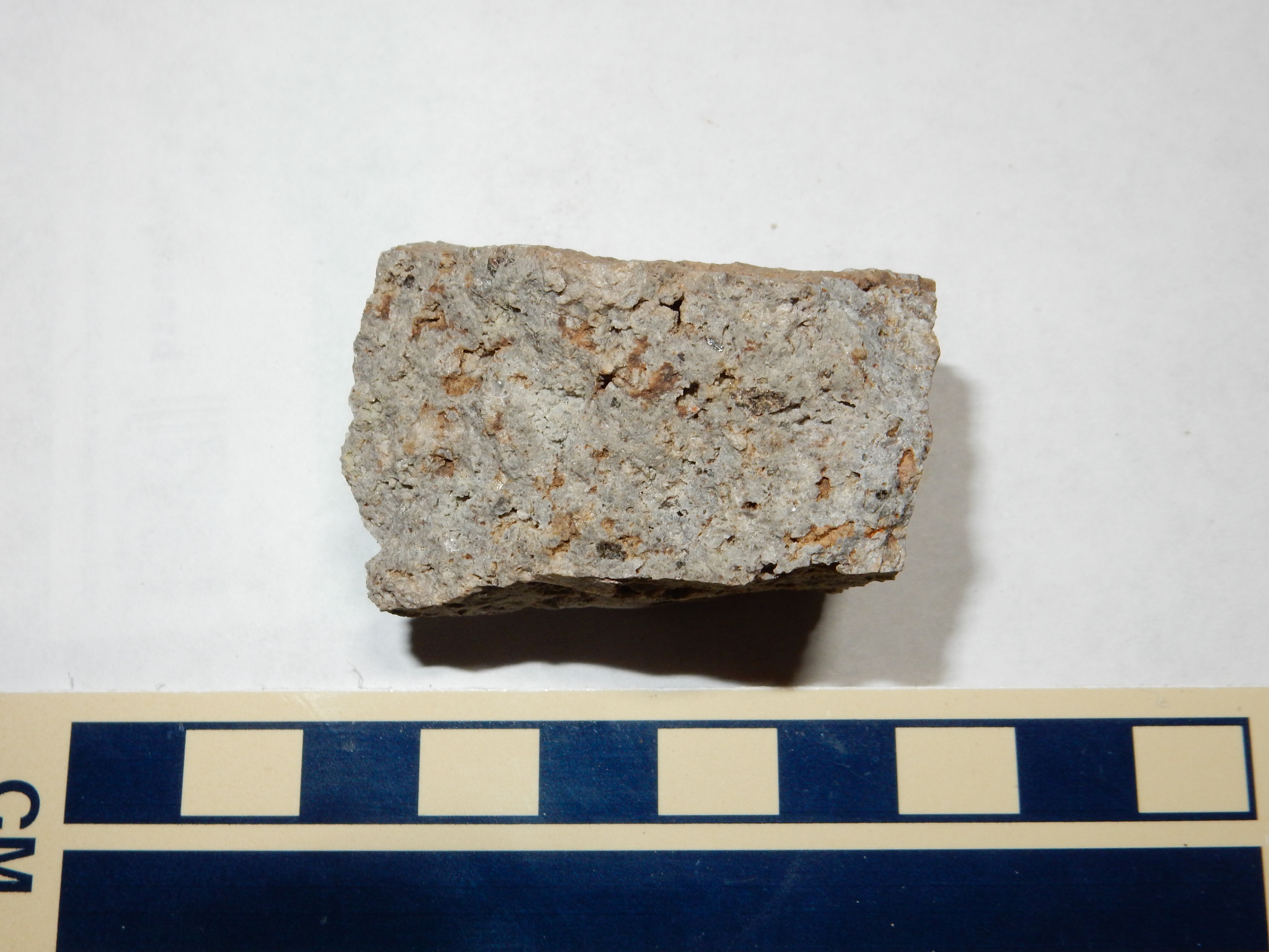
A final voluminous pulse of activity took place around 3 million years ago. One major vent formed Pajarito Mountain.


Pajarito Mountain dacite outcrop. 35.900745N 106.389462W
This is probably the most distinctive dacite I've sampled from the Tschicoma Formation. The feldspar phenocrysts are relatively small and numerous, and the ground mass is an almost bluish gray. The rock is also tough as nails, judging from what it took for me to break off a sample.
The north slopes of Pajarito Mountain are occupied by Pajarito
Mountain Ski Area, with 44 trails. The ski area is typically open
from mid-November to mid-March.
At almost the same time, another major vent opened to produce Caballo Mountain.
Caballo Mountain is relatively inaccessible and likely to remain so, though in principle one could hike in and out in a long day on one of the spurs of the Mitchell Trail. It could also be approached from Guaje Trail.
Finally, a small vent opened near
the head of Quemazon Canyon about 2.9 million years ago. The
resulting flow can be reached from the Guaje Trail for a sample.
The sample is somewhat weathered. The sold rock was virtually
impossible to break with a geologist's hammer.
There were likely additional vents further west that foundered
into the Toledo caldera 1.6 million years ago. Just how far west
the Tschicoma Formation eruptive centers extended is not known.
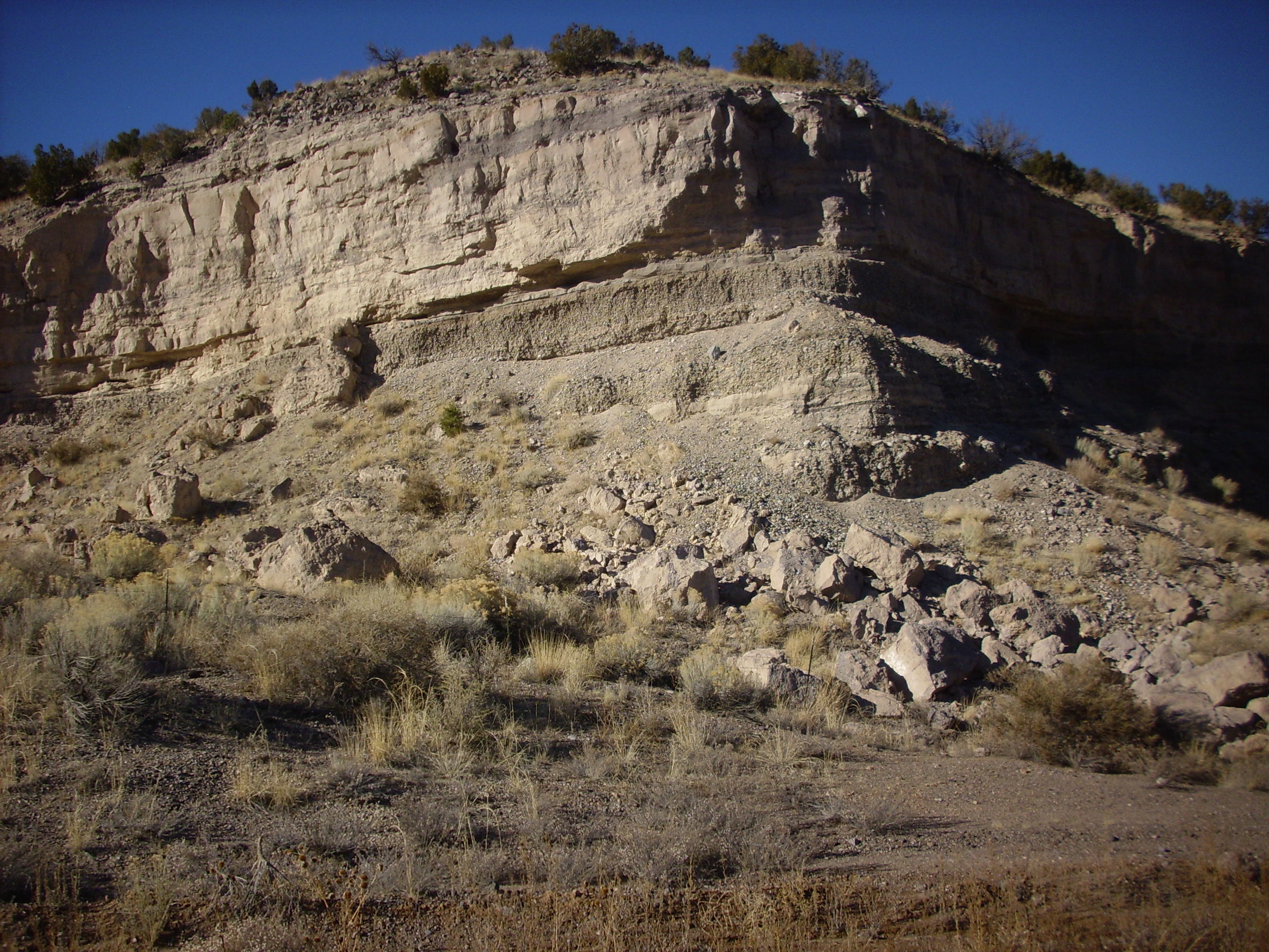
However, there is a prominent Tshicoma Formation flow in the west
rim of the caldera, located just above Forest Road 376.
Tshicoma Formation flow in caldera west
rim. 35
53.165N 106 40.114W
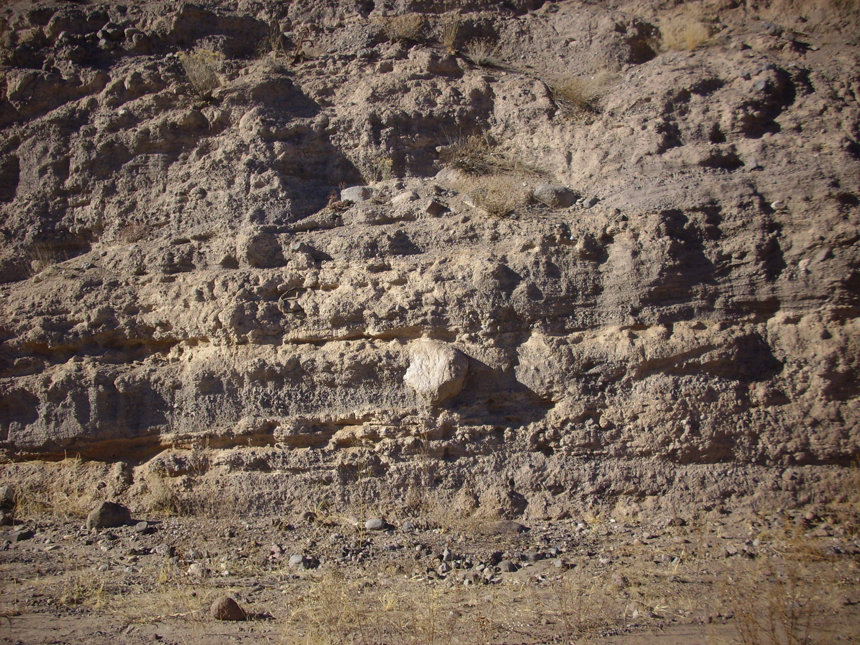
This consists of a massive flow body lying on a bed of basal breccia.
Massive core of Tschicoma flow in
caldera west rim
Basal breccia of Tshicoma flow in
caldera west rim
The breccia is quite solid, in spite of its appearance. It
represents fragments broken off the face of the very viscous
dacite flow as it advanced, which formed a carpet of broken rock
beneath the more massive core of the flow. Similar basal breccia
are visible in the multiple Tschicoma flows exposed in upper Los
Alamos Canyon.
The process of early solidified lava being broken up and incorporated into the remaining liquid lava to form breccia of this kind is called autobrecciation. The breccia and the massive core can be quite different in appearance, as is the case here. From the breccia at the base of the flow:
From the massive core of the flow:

The latter is quite striking, isn’t it? The larger white crystals are feldspar, while the smaller include quartz, and augite and biotite crystals are prominent under the loupe.
The base sample has a glassy appearance under the loupe,
suggesting more rapid cooling consistent with this being formed on
the face of the flow. There are also hints of microscopic glass
bubbles. However, the samples likely differ only in texture and
weathering, not in composition.
The youngest flows of the Tschicoma Formation erupted 2.5 million years ago. However, these are exposed nowhere at the surface. They are found instead in well cuttings from Los Alamos Canyon and from Los Alamos National Laboratory wells further south. These have been dubbed the "northern dacites" and "southern dacites", respectively, and they are distinct from other Tschicoma flows. These likely erupted from vents in the Diamond Drive Graben.
The Diamond Drive Graben is a shallow graben in which sits much
of the western part of the city of Los Alamos. It gets its name
because the axis of the graben lies along Diamond
Drive, one of the main roads in Los Alamos. Since the Rio
Grande Rift itself is a large graben, the Diamond Drive Graben is
a graben within a graben. One school of thought holds that the
Diamond Drive Graben was formed partially by subsidence into the
magma chamber from which the Tschicoma Formation was erupted.
Another school of thought holds that the Diamond Drive Graben is an example of a listric graben, formed along the hanging wall of a major listric fault. A listric fault is a fault whose dip decreases with depth, so that the fault has a curved shape. This diagram shows a listric fault with an associated listric graben:
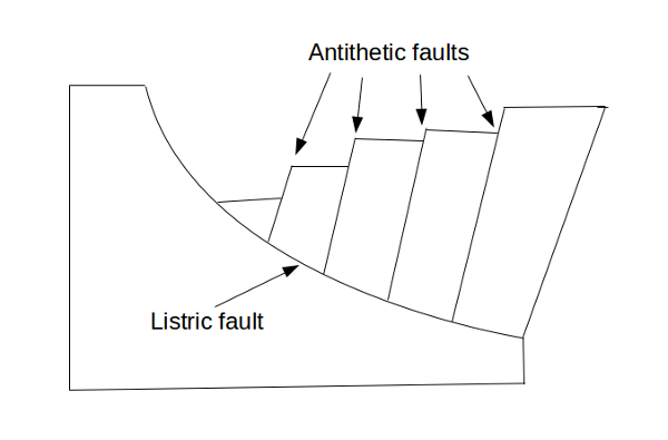
According to this interpretation, the Pajarito Fault would be the large listric fault underlying the Diamond Drive Graben. It is possible that both mechanisms contributed to the formation of the Diamond Drive Graben.
The western horst of the Diamond Drive Graben is then the
foothills of the Sierra de los Valles west of Los Alamos. We saw
part of the fault escarpment earlier.

Pajarito Escarpment north of hairpin at 35
49.991N 106 21.804W
The escarpment runs along the eastern foot of the Sierra de los Valles until it joins the Santa Clara Canyon Fault north of Los Alamos.
Faulting and deformation associated with the Diamond Drive Graben extends possibly as far east as the Rio Grande, but the eastern boundary of the graben is usually taken to be the prominent escarpment associated with the Rendija Canyon Fault. The fault escarpment is most striking just west of Los Alamos Middle School and to the east of Guaje Pines Cemetary.
Both the east and west horsts expose a large section of Tsherige Member, Bandelier Tuff. However, the rock on the west side is much more densely welded (being closer to the source vent), has weathered differently (being in a wetter zone), and so is much darker brown than the light pink tuff you see here. It's a horst of a different color.
The fault continues south and is well exposed in Pueblo Canyon.
Rendija Fault escarpment. Looking east from 35
53.327N 106 18.282W
The tall hill on the left is the fault escarpment. This becomes less prominent south of the canyon but is still visible.
Rendija Fault trace Looking south from 35.8890881N
106.3014552W
Further south, the fault splays in the area around Ashley
Pond and to the west. Ashley Pond is largely artificial now,
but it was a small natural pond in 1943 and an example of a sag
pond, formed in a depression formed between two fault
splays.
North of Los Alamos, some of the displacement along the Rendija
Canyon Fault is taken up by the Guaje Fault to the east. This
fault forms a low escarpment through the Barranca
Mesa subdivision just west of the elementary school, but it
is more obvious further north, on the west flank of Guaje
Mountain.

Guaje Mountain. Looking north from 35
54.828N 106 16.994W
The fault runs along the west side of the mountain and through
the notch on the left in the photograph. The flat western
face of the mountain is the fault escarpment.
West face of Guaje Mountain. Looking east from 35.9217876N
106.2839297W
Further north the fault seems to displace Guaje Canyon at the Guaje
Narrows, suggesting that there is a right lateral component
to the displacement along the fault.
West face of Guaje Mountain. Looking northeast from 35.9260376N
106.2821028W
The dry stream bed turns south along the face of the ridge, almost exactly along the fault trace, before turning back east through the narrows. This would make the Guaje Fault nearly unique among the faults of the Pajarito Plateau in having a significant lateral slip. However, a more likely interpretation is that the stream has changed course to preferentially erode through the shattered rock of the fault zone.
The Diamond Drive Graben is remarkably deep, with an estimated
1500 meters (5000') of sediments. Its faults appear to line up
with post-Lobato Formation faulting on Mesa Alta, suggesting the
original graben may extend far to the north.
High-silica volcanism is rubbly.
Because high-silica magma is both highly viscous and relatively
cool, it tends to solidify quickly on contact with air. This is
true to some extent of all lavas, of course, but a hot,
low-viscosity basaltic lava flow can travel for miles under a thin
crust of solid rock, through which the hot lava beneath is visible
through numerous cracks. High-silica lava flows only with the
greatest difficulty, and forms a very thick crust that breaks into
fairly large boulders with very little exposure of the underlying
lava. As a result, a high-silica flow resembles nothing so much as
a
creeping hill of hot boulders. This is described as block
lava by geologists, by contrast with pahoehoe and aa, which
are generally seen only in low-silica flows such as basalt.
When the flow fully solidifies, it is likely to consist of a core of fairly solid rock blanketed with much looser boulders and other debris. The loose blanket of debris is highly susceptible to erosion and can amount to a significant fraction of the total mass of the dome. Erosion quickly wears away the outer blanket, leaving a denuded dacite dome of solid rock surrounded by an apron of dacite clasts.
This apron does not normally last long, geologically speaking; it
is subject to further erosion that destroys the original clasts
and reduces the apron to fine sediments. However, just as dead
organisms sometimes are preserved by unusual geological
environments to produce fossils, so volcanic aprons sometimes are
preserved by unusual geological environments to produce beds of
very coarse conglomerate. These are known as fanglomerates
because they form from alluvial fans that make up the
apron around the volcanic center. We'll learn more about alluvial
fans later in the book.
The Diamond Drive Graben formed a natural trap for dacitic rubble from the Tschicoma Formation, and the preserved rubble is known as the Puye Formation. This is between about 5 and 2 million years in age, based on radiometric dating of an ash flow tuff within the formation at 2.53 million years old, and on the fact that no Peralta Tuff tephra (age 6.8 million years) is found in the formation. The Puye Formation is included in the upper Santa Fe Group, since it is sediments that filled part of the Rift, and it was deposited when the ancestral Rio Grande was already present. Remnants of dacitic rubble aprons are found elsewhere across the Jemez, but the remnants are small isolated outcrops everywhere but east of the Jemez.
The Puye Formation is a highly variable formation. In addition to fanglomerate beds, it includes tephra beds (volcanic ash or pumice), asjh flow tuffs, and mud flows. These not only form distinct layers, but vary considerably from place to place. Nevertheless, the formation as a whole has a distinctive ashen gray color that contrast sharply with the pink or tan of the underlying Chamita Formation and the light pink of the overlying Bandelier Tuff or very dark gray of the Cerros del Rio Basalt.
In some locations close to the Rio Grande, the Puye Formation
fanglomerate is underlain by a very coarse conglomerate of well
rounded clasts, the Totavi Lentil. This has generally been
regarded as a member of the Puye Formation, though its origin is
quite different. It is old river channel gravel associated with
the ancestral Rio Grande, and the clasts are mostly Precambrian
rock. Because of its different origin and distinctive character,
some recent papers have raised the Totavi Lentil to formation
status as the Totavi Formation. I will include it with the Puye
Formation here.
I'll begin my description of the Puye Formation at its furthest southern exposures, in White Rock Canyon, and work north. The Puye Formation is found only in isolated locations south of the main highway to Los Alamos, SR 502, suggesting that this was already higher terrain at the time of deposition. One such exposure is located at the mouth of Ancho Canyon, where it fills a paleocanyon in the underlying Vallito Member of the Chamita Formation.
Puye Formation in lower Ancho Canyon. Looking west from
35.774805N
106.2242357W
Similar exposures are scattered along the Rio Grande to the south, but are almost inaccessible at present. These are likely some of the oldest Puye beds, filling channels eroded in the top of the Santa Fe Group . At the mouth of Ancho Canyon, the lowest Puye Formation beds actually lie beneath the Totavi Lentil, which in most locations is the lowermost unit of the Puye Formation. As at other locations, the Totavi Lentil takes the form of beds of polished cobbles.
Totavi Lentil in lower Ancho Canyon. Looking southwest
from 35.773777N
106.2233857W
The Totavi Lentil is just below center in the photograph,
overlain by basalt colluvium and solid basalt flows.
There is a more accessible exposure along the Blue Dot Trail in White Rock Canyon. Here a small intermittent stream has eroded through the landslide deposits covering most of the canyon walls.
This outcropping is a very muddy sandstone that is moderately well indurated. This is likely an example of a mud flow.
A mud flow occurs when soil or other sediments rich in clay
become saturated with water, the sediments lose cohesion, and the
semi-liquid mass begin to move downhill under the force of
gravity. To be classified as a mud flow, the flow must contain at
least 50% clasts of clay or silt size and not more than 30% water.
If the water content exceeds 30%, the flow becomes a hyperconcentrated
flow, while flows containing more than 50% clasts of sand
size or larger are debris flows. A slump does not
lose cohesion, so that much of the structure of the rock and
sediments remains intact, while a fall involves relatively
small quantities of material moving relatively short distances.
All of these except floods are examples of mass wasting,
where rock and sediment moves downhill under the force of gravity.
I'll have more to say about other forms of mass wasting later in
the book.
Mud flows are most common in semiarid climates, where infrequent but heavy rainfall can quickly saturate the ground. However, they can occur in almost any climate. They are more common on the steep slopes of mountainous terrain, but can occur on more gently sloping ground that is especially rich in clay and absorbs a greater quantity of water. Mud flows associated with volcanic activity are especially notable and are known as lahars. A lahar can form from recently erupted ash that is exposed to rainfall or to runoff from glaciers or snowfields melted by volcanic activity. Lahars are thus typically rich in volcanic ash and can harden to rocklike consistency very quickly after coming to rest.
The eruptions that formed the Tschicoma Formation likely produced
quite a lot of ash, and many of the beds in the Puye Formation,
particularly close to the Sierra de los Valles, are preserved
lahars. The bed shown here is at the fringe of the Puye Formation
and probably should be interpreted as a conventional mud
flow, formed from sediments that have already been weathered
and possibly repeatedly reworked during their long journey from
the foothills of the mountains. Mud flows in the Puye Formation
are relatively localized, with a single flow rarely exceeding two
or three hundred meters in width.
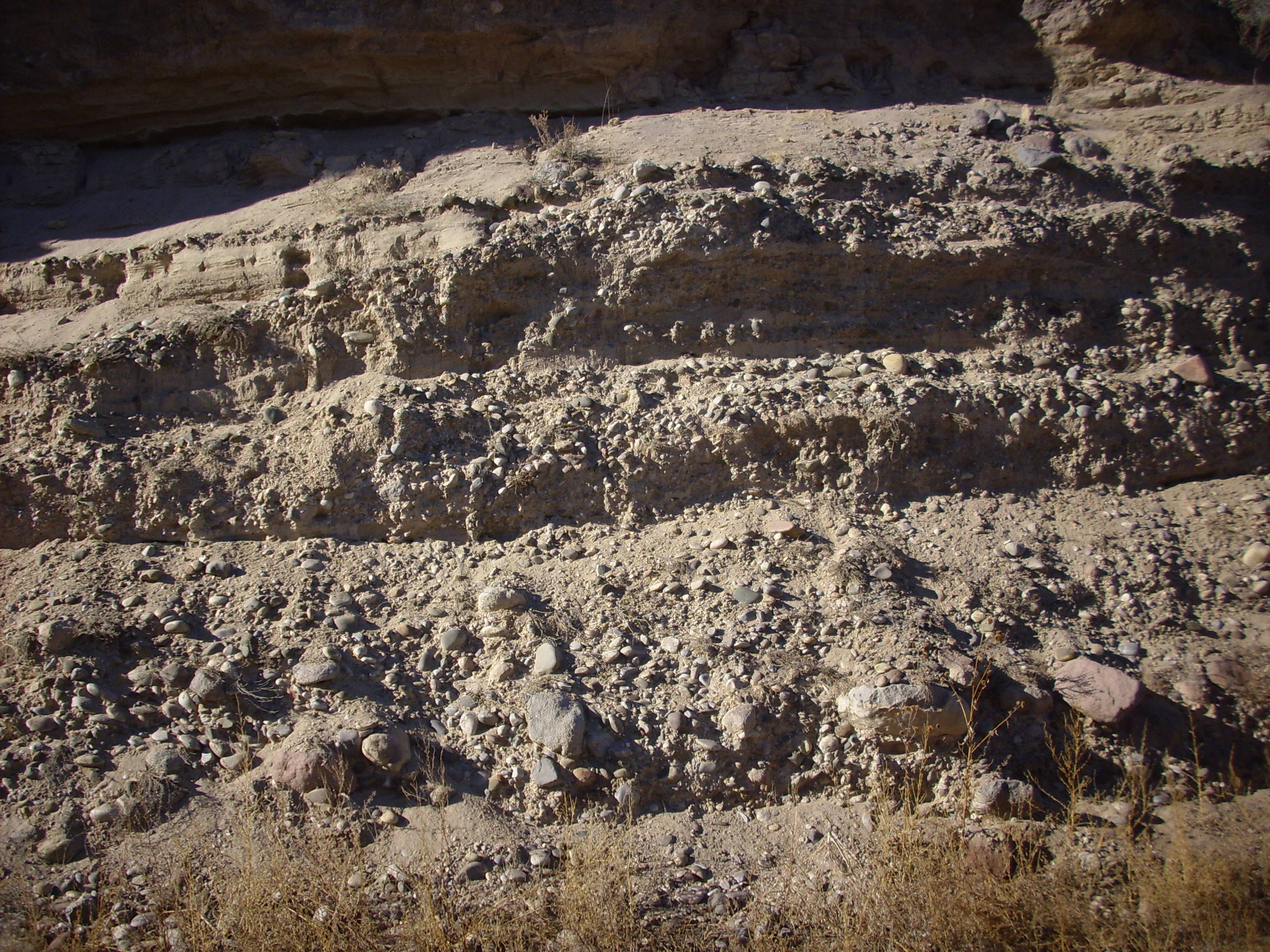
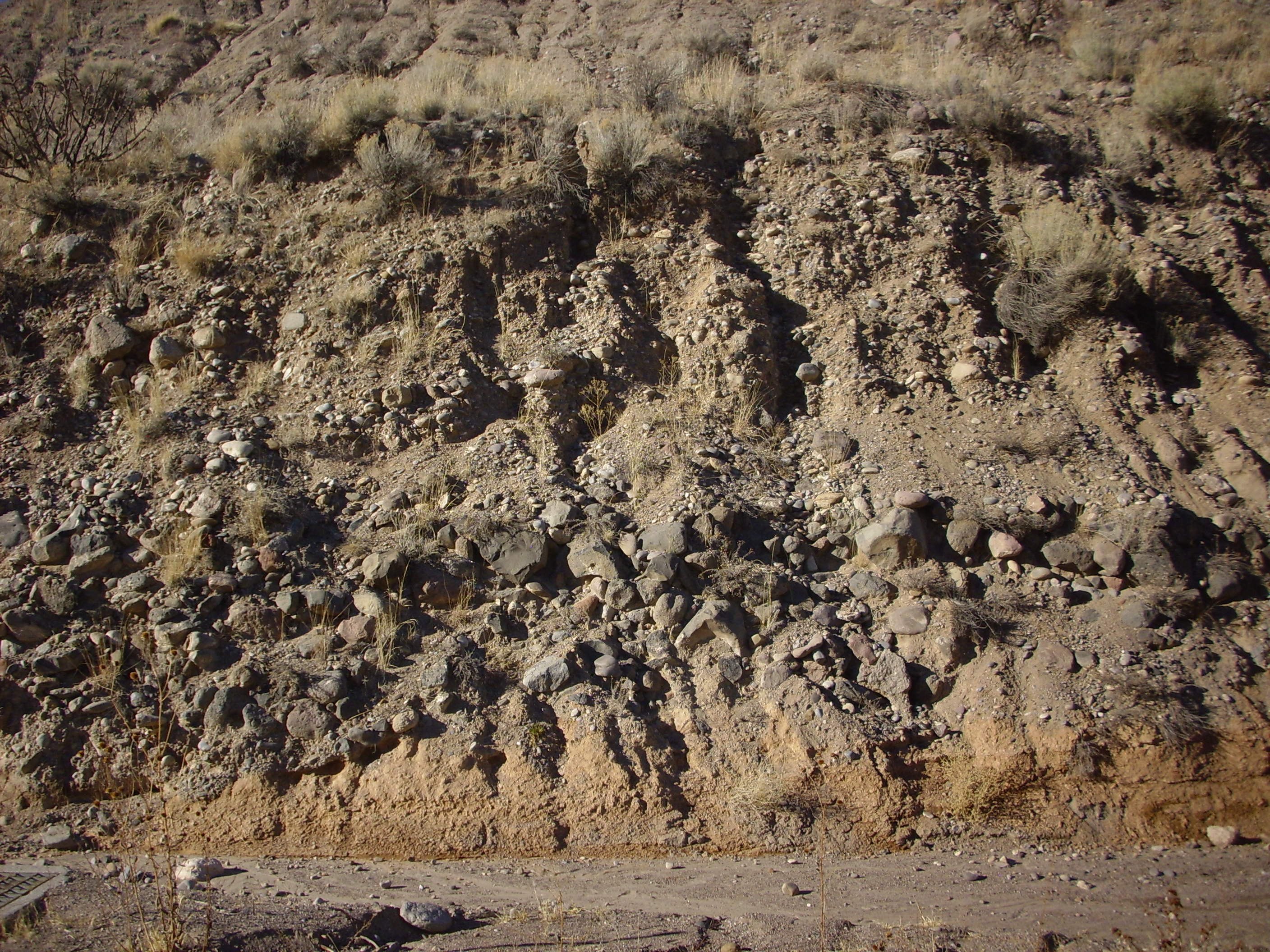
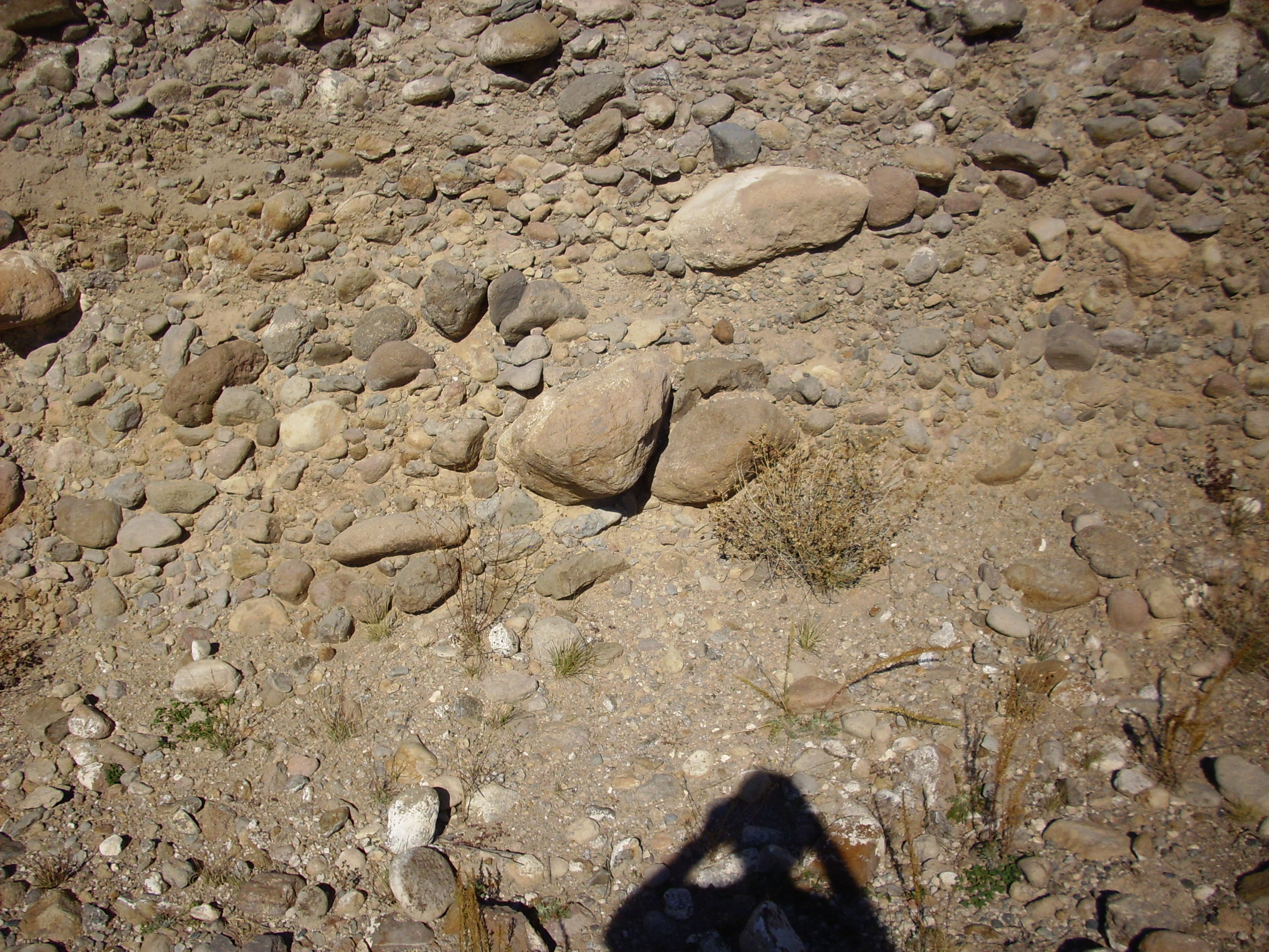
A short distance further down the Blue Dot Trail, one encounters very large rounded clasts.
These include quite a lot of quartzite and granitoid clasts, probably of Precambrian age. Though it does not show in this photograph, the clasts in the trail cutting show some signs of imbrication. In other words, the clasts overlap something like the shingles on a roof. This is an indication that the clasts were laid down in a strong river current, and indicates that this is an outcropping of the Totavi Lentil.
Further north, below the old Buckman Road north of Overlook Park in White Rock and beneath a layer of dark basalt, thicker exposures of Puye Formation are visible.

Puye Formation below old Buckman Road. 35.832N
106.181W
Still further north, there are excellent exposures of Puye
Formation in lower Pueblo Canyon along SR 502. The best are in the
area west and north of Totavi.
Here is a close up shot.
The thick gravel beds at center are the type section for the
Totavi Lentil, and were once quarried nearby
for road gravel for the Los Alamos area. They are composed of
well-rounded, moderately well-sorted clasts showing they were part
of a river bed. The gravel beds are overlain by a thick bed of
muddy clay and silt, relatively well cemented, that is probably a
lahar.
Much of the Puye Formation consists of beds made up mostly of
large clasts rather than clay and silt. These are classified as
debris flows.
The boulder in the center of this photograph is a little larger than a basketball. The layer it is embedded in may be a single debris flow. It is not unusual for larger clasts in a debris flow to work their way to the surface, as seems to be the case with the large boulder in the photograph, which lies towards the top of the layer in which it is embedded. As we will see shortly, some of the debris flows of the Puye Formation consist largely of very large clasts.
This also illustrates how debris flows are distinguished from
hyperconcentrated flows in the geologic record. In a debris flow,
large clasts remain suspended indefinitely or even work their way
to the top, so a debris flow tends to coarsen upwards. A
hyperconcentrated flow is not quite rich enough in debris for this
to happen. Large clasts move towards the bottom, so that a
hyperconcentrated flow tends to fine upwards.
Hyperconcentrated flows also tend to show sedimentary structures
associated with water escaping from the top of the flow. Debris
flows generally do not.
The next photograph illustrates of the power of flash floods during the monsoon season when the watershed is laid bare by fire and channels into a narrow canyon:
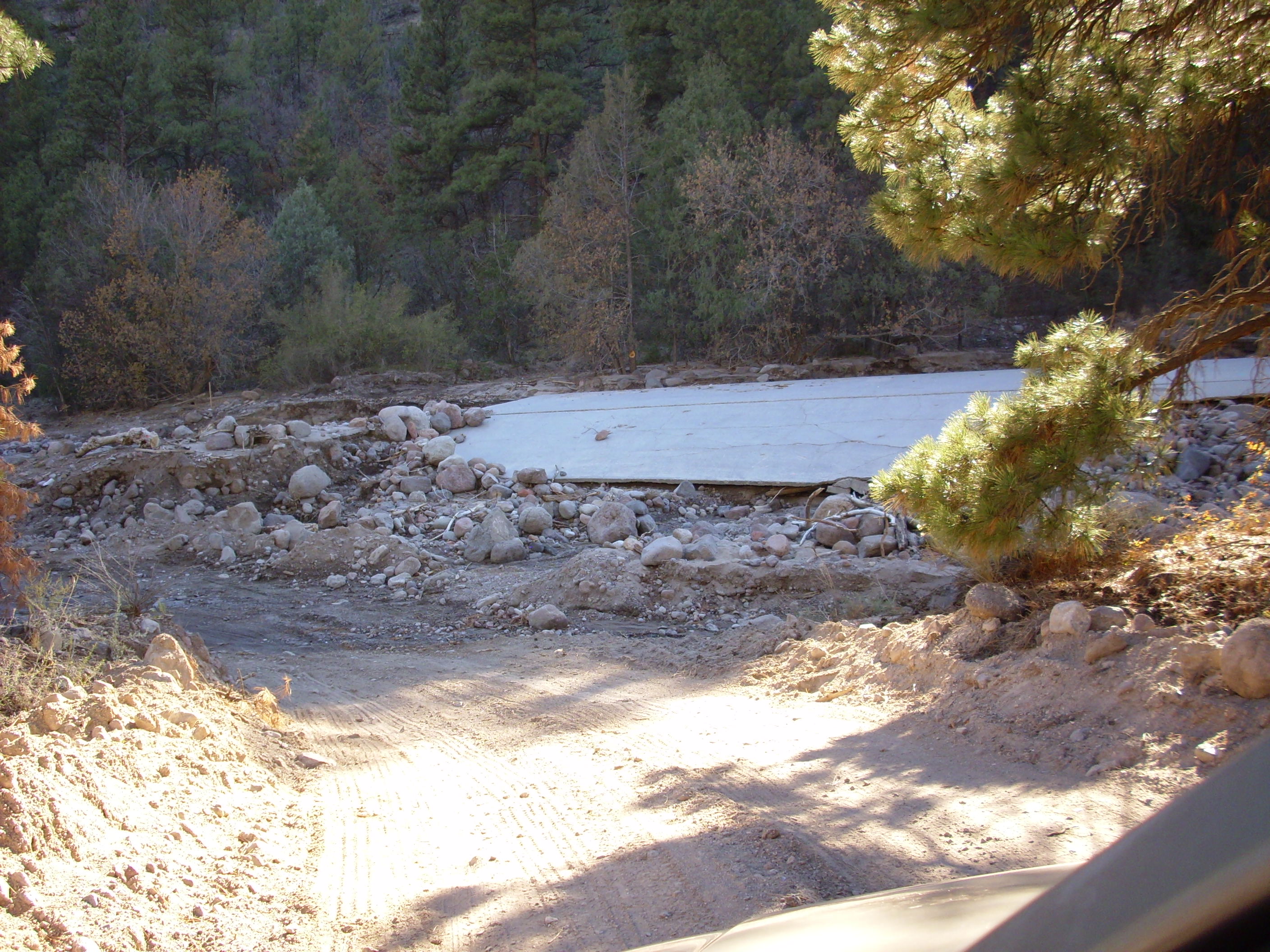
"Important safety tip. Thanks, Egon."
35.918N 106.234W
A flash flood destroyed this concrete culvert in Guaje Canyon,
leaving behind some very large clasts. Such floods resemble debris
flows, but with a higher water content, so that the moving water
rather than the weight of the clasts themselves is the principle
moving force. Flash floods often carry enough sediment, between 5%
and 70%, to be classified as a hyperconcentrated flow.
Thus, as the content of sediments increases, a watery flow goes
from ordinary fluvial flow with less than 5% sediments, to a
hyperconcentrated flow with 5% to 70% sediments, to a mudflow or
debris flow with more than 70% sediments.
This photograph is of beds of the Totavi Lentil near the base of
the type section.
You can see the rounded quartize clasts towards the bottom of the roadcut here. Another exposure is found further down the canyon.
Here the well-polished quartzite clasts characteristic of the
Totavi Lentil are underlain by a thin bed of what appear to be
basalt boulders, likely from the Lobato Formation. Under these are
reddish, poorly consolidated sandstones of the Chamita Formation,
Santa Fe Group. The basalt boulders appear to fill a shallow
channel eroded in the top of the Chamita Formation and may
represent an early debris flow. The top of the Chamita Formation
in this area is estimated at around 8.5 million years in age;
there is thus a gap in the geologic record of about 3.5 million
years between these beds and the overlying 5-million-year-old Puye
Formation beds.
At the mouth of Pueblo Canyon, west of the turnoff to Espanola, the Puye Formation becomes a thick cliff-forming unit.

Mud flows of the Puye Formation tend to form vertical cliffs like
those seen here. North of the road from Totavi to Espanola, the
Puye Formation forms the upper slopes of Battleship
Mountain.

The lower, pinkish part of the mesa is Chamita Formation, Santa
Fe Group. The upper portion, separated from the lower portion by a
light ash-rich bed, is Puye Formation. There is a small cap of the
Tshirege Member, Bandelier Tuff, at the very top of the mountain.
A north-trending fault lies roughly at the base of the west side
of the mountain (far side in this photograph) with the west side
thrown down. The presence of the fault is clear from this
photograph taken at high zoom from a point well to the east.
Battleship Mountain showing fault displacement. Looking
east from 35
52.933N 106 03.8704W
Battleship Mountain is right of center, visible against the Pajarito Plateau and with Tschicoma Peak in the background. If you click to see the full resolution image, you will see that the lowermost light bed of the Puye Formation is displaced upwards in Battleship Mountain relative to the Puye Formation in the hills behind Battleship Mountain. This fault is part of the easternmost side of the Diamond Drive Graben.
Further west, there are excellent exposures of the Puye Formation
in Rendija
Canyon.

In this photograph, you see various layers of clay, sand, and boulders from mud flows and debris flows. The boulder layer has individual clasts larger than a man's head.
The Puye Formation in this area includes an ash flow tuff bed
which has a radiometric age of 2.53 million years, corresponding
roughly to the peak of dacitic volcanism to the west.
Here is a sample from one of the finer-grained beds near this location.
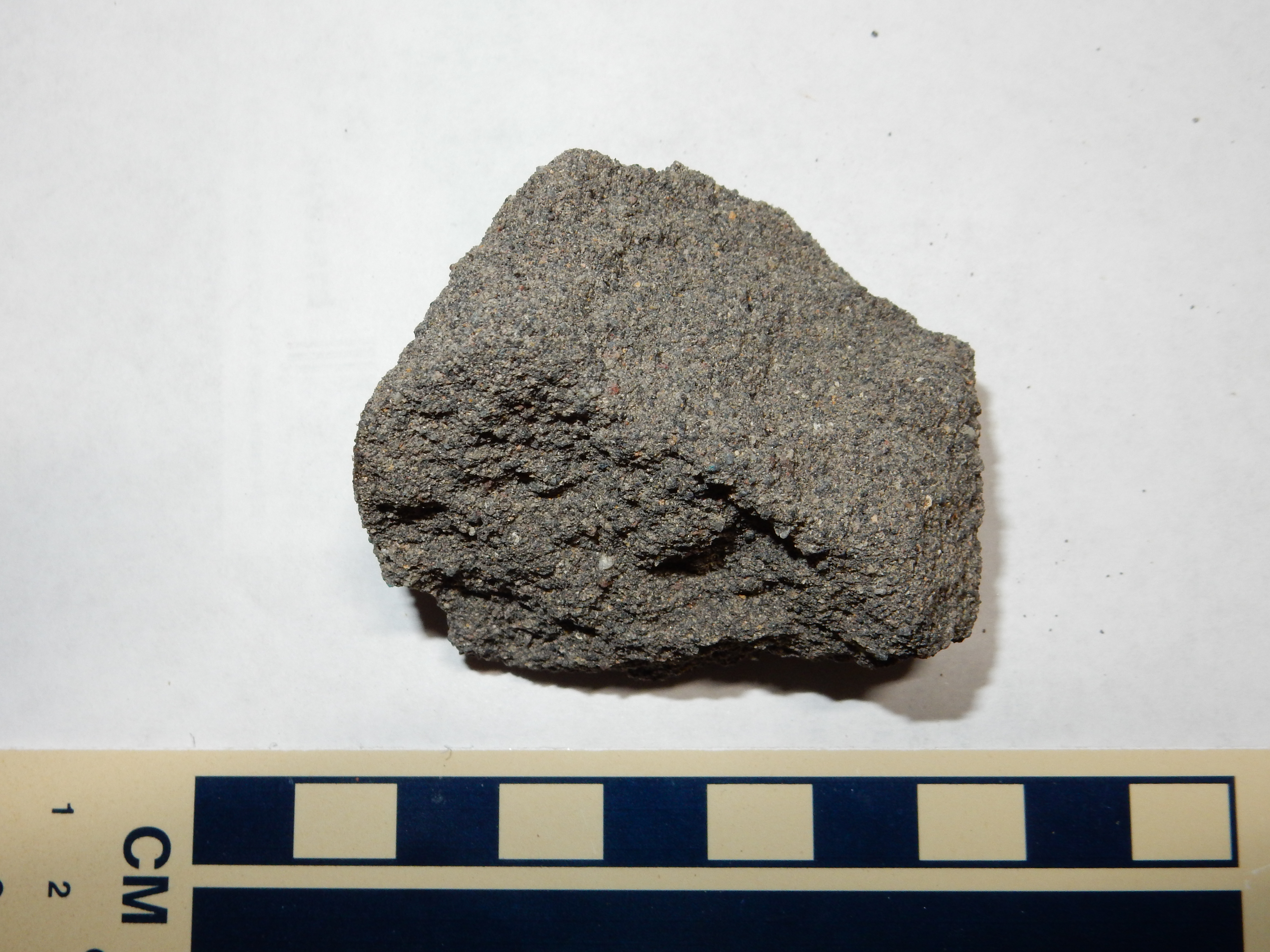
This is a moderately sorted sandstone composed almost entirely of
bits of volcanic rock, with just a few bits of quartz and
feldspar. There is relatively little matrix between the grains.
Such a rock is classified as a lithic arenite, and lithic
arenites are almost unique to regions of young volcanism. The rock
is only moderately well-consolidated; you can scratch off a few
grains with your fingers (it is friable.) It is an
excellent example of a tephra bed within the Puye Formation; in
this case, an ash bed (because the grains are less than 2mm in
size.)
There are some remarkable rock features in the Puye:
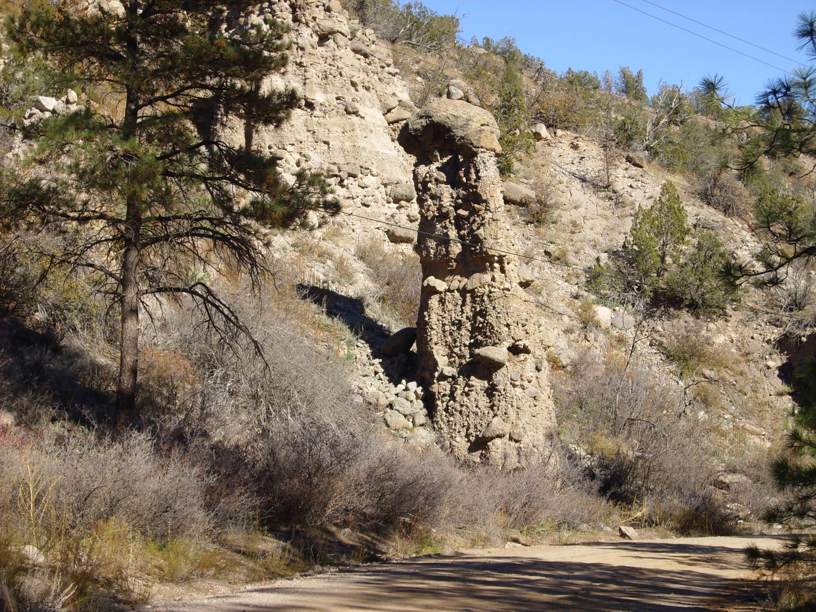

These kinds of rock structures are known as hoodoos and
found here and there throughout the area. The large boulder on top
is thought to have compacted the rocks underneath while
simultaneously protecting them from erosion, allowing a
surprisingly solid pillar to form. The existence of such
formations in this area has been regarded as proof of low seismic
risk, since these hoodoos are at least several thousand years old
and have not been toppled by any earthquake in that time, but
geologists now believe they are capable of withstanding quite
powerful earthquake motion.
The Puye Formation is also exposed in the walls of Guaje Canyon,
such as along the road cut here.
The next photograph shows how large some of the boulders can be.
My shadow provides scale. Further down the cliff, there's a
boulder three meters in diameter.
The beds become very thick further up Guaje Canyon, close to the source of the debris.
Puye Formation in Guaje Canyon. 35
54.921N 106 13.601W
Still further north, the Puye Formation is exposed along 31
Mile Road west of Espanola.

If this reminds you of the Cochiti Formation in the last chapter,
it's because this rock formed in a similar environment and from
similar source rock as the Cochiti Formation. Similar environments
produce similar rocks. However, the Cochiti Formation is, on
average, significantly older than the Puye Formation, and it
contains less gray ash in the ground mass and more tan sand, silt,
and clay.
At one point along the road, there is a prominent contact between the Puye Formation and the underlying Chamita Formation of the Santa Fe Group.

The Chamita Formation has the distinctive pink color of much of the Santa Fe Group. This contrasts with the distinctive grey color of the Puye Formation, which contains a large amount of volcanic ash. Here the extremely clean contact shows that the debris flow scoured clean the surface of the Chamita Formation.
Conditions along the east side of the Jemez were unusually good
for trapping debris flows and lahars off the Tschicoma Highlands,
but isolated deposits mapped as Puye Formation are also found in
the northern Jemez. Some of these are found on the northwestern
flank of the Tschicoma Highlands along Gallina Creek.
Puye Formation. Near 36.0347683N
106.3135258W
On El Alto, these take the form of long ridges that are likely erosional remants of more extensive beds.

Puye Formation on El Alto. 36 07.355N 106 21.815W
Note that I have not left the roadway for a better view. This
area is private land belonging to Pueblo de Abiquiu and visitors
are asked to stay on the road.
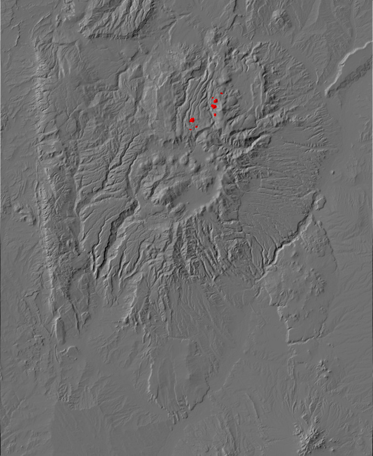
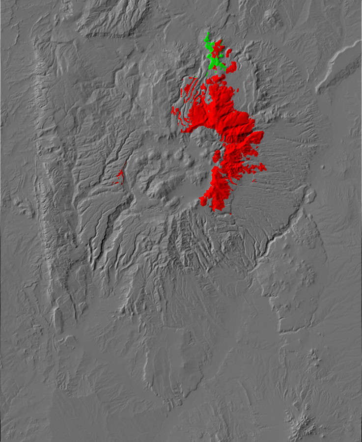
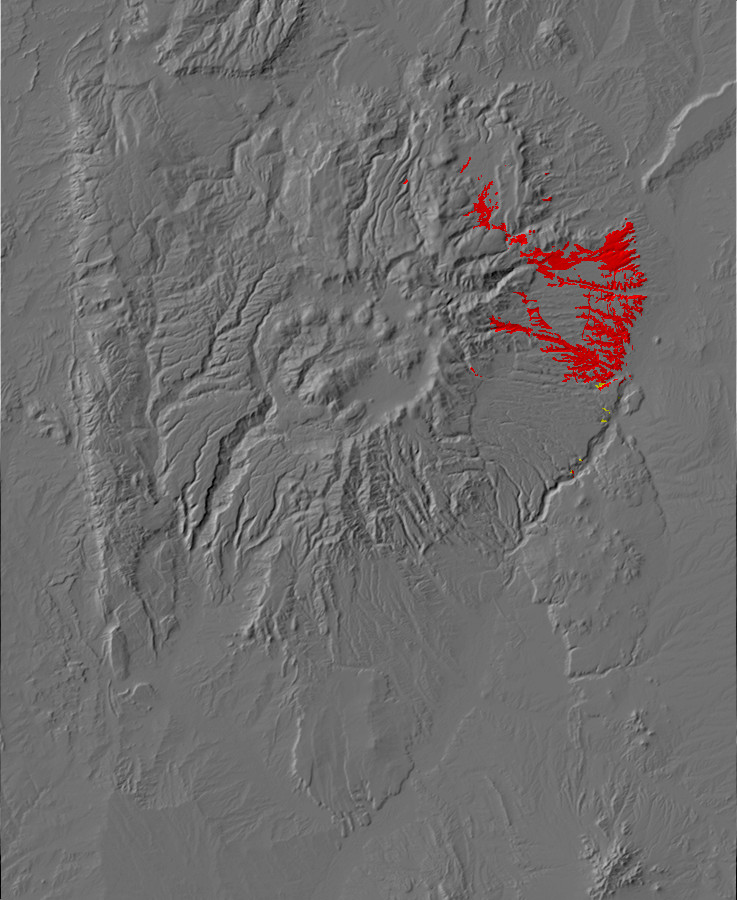
Relief map of the Jemez with El Rechuelos Rhyolite
outcroppings highlighted in red
The Tschicoma Highlands include a number of rhyolite domes erupted onto the Tschicoma Formation, and these have been assigned to the El Rechuelos Rhyolite. However, they are not necessarily a single petrological group, and they may not be distinct from surrounding formations.
The southwestern domes of the El Rechuelos Rhyolite have been dated at 7.5 million and 5.8 million years old. The former correlates with the Bearhead Rhyolite and many geologists believe this dome should be assigned to that formation. The second dome, and a pumice ring northeast of the other El Rechuelos domes, may be unusually silicic exposures of Tschicoma Formation. The remaining domes are about 2 million years old and have the strongest claim to being a distinct formation, with a chemistry that suggests they may have formed by differentiation of a primitive basalt, such as the El Alto basalt that I'll discuss in the next chapter.
The northern of the domes northwest of Polvadera Peak can be
reached by a pleasant hike from the forest road south of Cerro
Pelon.
El Rechuelos dome. 36 04.888N 106 25.149W
The dome is steep but one can hike to the summit area with
moderate effort. Here there are numerous clasts of the rhyolite.
Near the summit of El Rechuelos dome. 36
04.778N 106 25.392W
This one displays a barklike texture that probably represents a cooling surface.
The geologic map describes this as a pumiceous rhyolite, and it does have a different texture from the other rhyolite samples I’ve seen. Under a powerful loupe, it looks almost crystalline, or perhaps like a mass of tiny glass beads compressed together. I suspect the latter is actually quite close to the truth.
The view from the summit is exhilarating.
View from summit of El Rechuelos north
dome. 36
04.664N 106 25.411W
At left, the near orange mesas are Bandelier Tuff. Beyond, on the skyline, is La Grulla Plateau. The cluster of hills are dacite domes of the Four Hills complex, sitting on the basalt and andesite making up the plateau. El Alto and La Grulla Plateau channeled the pyroclastic flows of the Valles event, 1.2 million years ago, into the low ground between to form the Bandelier Tuff mesas. Cerro Pedernal, beloved of artist Georgia O’Keeffe, appears near the center of the panorama. The far skyline to the right is underlain by Mesozoic beds of the Colorado Plateau.
The El Rechuelos domes are rich in obsidian.
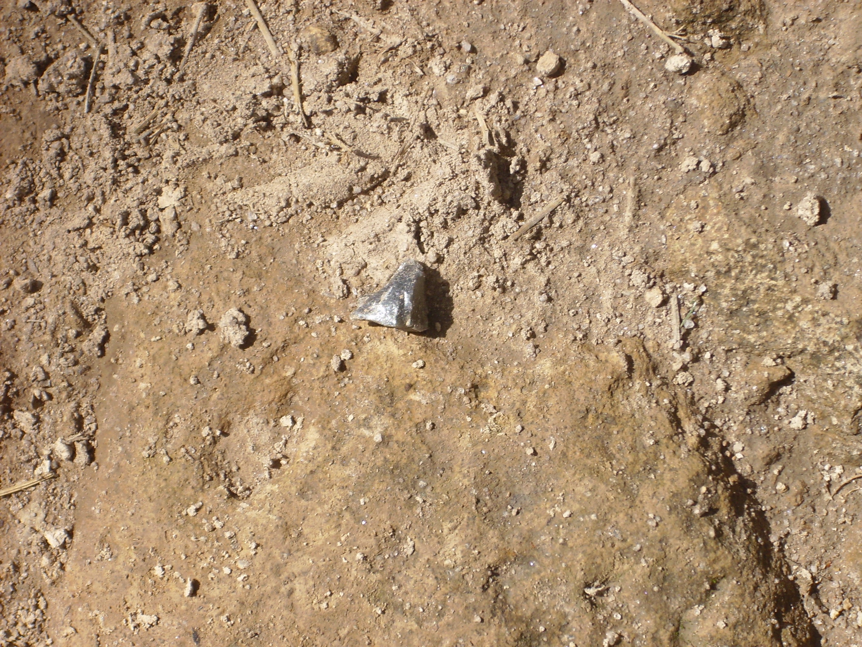
El Rechuelos obsidian. 36
06.112N 106 25.572W
Notice that this is relatively light-colored and translucent
obsidian. Most of the bits of obsidian I saw in the area were like
this, and I assume this is characteristic of El Rechuelos
obsidian. There is a fair amount of obsidian on El Alto, and it is
believed that it was scattered here by early man. The only obvious
natural source is the El Rechuelos domes, and it’s hard to see how
erosion could scatter the obsidian so far from the natural
drainages from these exposures. El Rechuelos obsidian seems to
have been particularly suited for toolmaking, because it is free
of phenocrysts or other inclusions.
Dacitic volcanism in the Jemez began petering out about 3 million
years ago. At about the same time, basalt began to be erupted
around the periphery of the Jemez where it overlaps the Rio Grande
Rift. This was a prelude to the most cataclysmic series of events
in the Jemez of which we have sure knowledge.
Next page: Basaltic volcanism
resumes
Copyright © 2015 Kent G. Budge. All rights reserved.