
The table of contents may be found here.
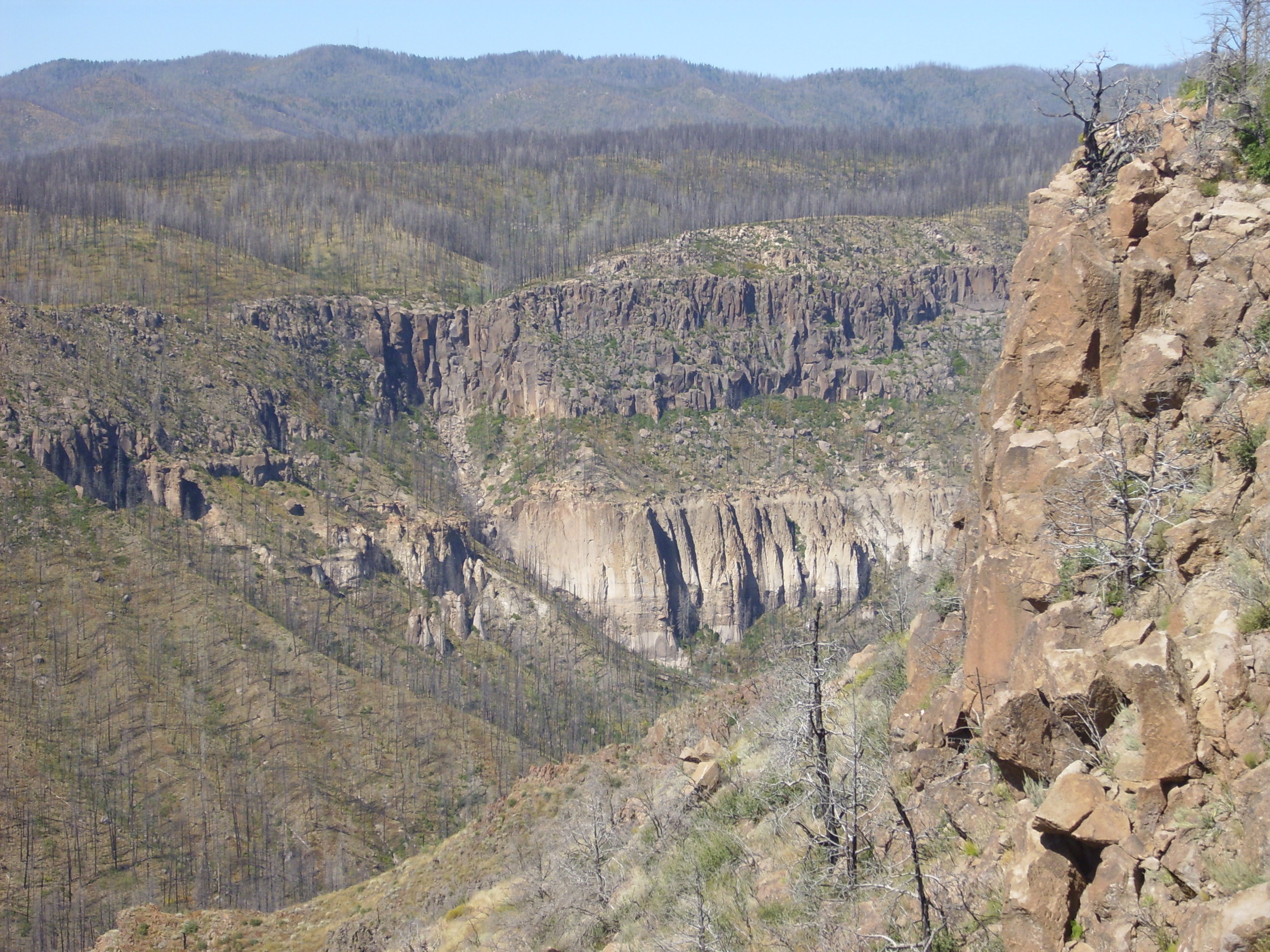
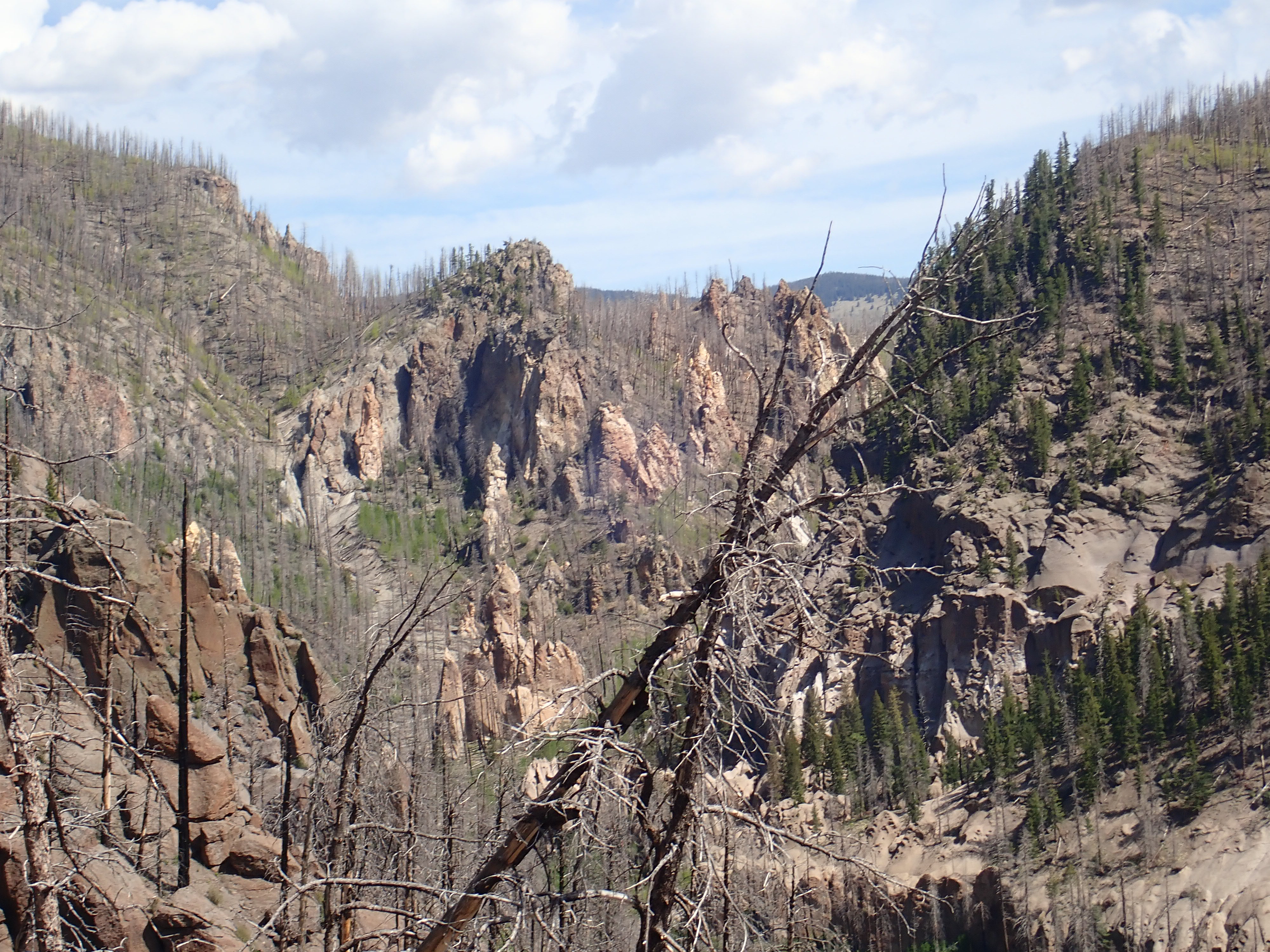
Pyroclastic flows at Mount Mayon. Such
flows occurred on a vastly greater scale in the Valles and
Toledo events.
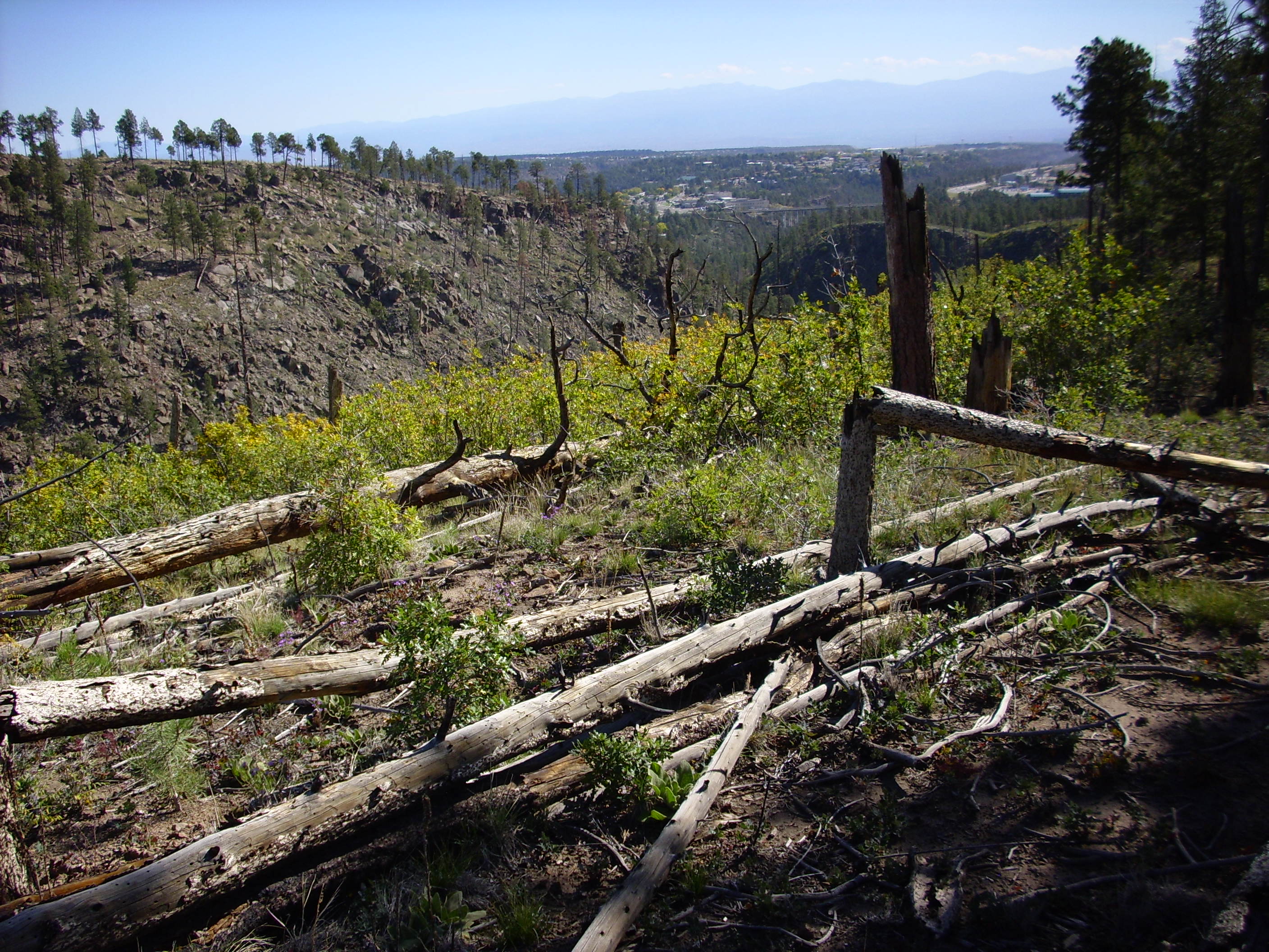
1.85 million years ago, northern New Mexico was beginning to take
the shape we see today. The Sierra Nacimiento and Sangre de Cristo
Mountains were in place and Sandia Crest was rising to the south.
The Rio Grande and Rio Chama flowed just a little to the west of
their modern courses, though White Rock Canyon was shallower and
narrower. Regional uplift had led to widespread erosion, producing
escarpments around La Grulla Plateau, El Alto, the Cerros del Rio,
and Santa Ana Mesa and turning the Espanola Basin into a badlands.
The climate had cooled as the elevation increased and as the Quaternary ice age settled in. Most likely it was cooler then than today: We are living in an interglacial, a relatively warm period between glaciations. The palm groves of the lower elevations were long gone, replaced by pinon scrub at lower elevations, ponderosa forests at higher elevations and spruce, aspen, and fir on the peaks. Many of the animals would seem familiar, but they included large mammals such as mammoths, mastodons, horses, camels, and saber-tooth tigers, which would disappear with the arrival of humans, who most likely hunted them to extinction. But that was still well in the future; Homo erectus had only just emerged as a distinct species, was just beginning to master the use of fire, and was still largely confined to Africa.
Some things were different. Between the fault escarpment at the
feet of the Sierra de los Valles and the White Rock basalt ridge
lay a shallow valley. Remnants of young dacite domes may have been
exposed in the valley bottom, and a large cinder cone dominated
the southern end of the valley. West of the Sierra de los Valles
was a series of north-trending ridges and valleys, ending to the
west at the broad valley of the ancestral Rio Guadaupe and Rio de
las Vacas in the lee of the Sierra Nacimiento.
This green land, unspoiled by man, was about to be devastated by
nature. Repeated injections of magma into the crust beneath the
Jemez, going back over twelve million years, had created an
enormous magma chamber; and this was now primed to explode.
In this chapter, we will look at the evolution of the
Jemez volcanic field into a supervolcano, and the
catastrophic eruptions that produced the Bandelier Tuff.
Within recent years, two enormous calderas, that of the Valles Mountains of New Mexico, probably the largest caldera in the world, and that of Aniakchak, in Alaska, have been attributed to explosion....
...we may remain skeptical of the explosion hypothesis for two reasons. In the canyons on the outer, eastern slopes of the [Valles] caldera the rhyolite tuffs are extremely poor in lithic ejecta and consist of compacted pumice and vitric tuff, apparently laid down by nuées ardentes. They closely resemble the sheets of welded tuff (ignimbrite) around the Aso caldera of Kyusyu. The volume of the caldera alone approximates 40 cubic miles; how much more old material disappeared is unknown, but unless most of this was dissolved in new magma or has been lost by engulfment, there should be an enormous accumulation of coarse lithic debris extending for miles in all sides of the caldera. No such accumulation seems to exist. Moreover, by analogy with other calderas, such as Krakatau, Santorin, and Crater Lake, it can hardly be doubted that he eruption of such vast quantities of pumice and vitric tuff as may be seen in the canyons surrounding the Valles depression would be followed by wholesale collapse.
— Howel Williams, 1941
We now know of much larger calderas than Valles, though they are
not nearly as obvious from surface topography. But Williams was
right in concluding that the Valles caldera is the result of
collapse into the underlying magma chamber. Williams had examined
calderas worldwide, including Krakatau, Santorini, and Crater
Lake; and he was familiar with the findings of Japanese and Dutch
geologists. None of these large calderas had enough shattered
country rock around them to account for more than a small fraction
of the volume of the calderas. Instead, they were surrounded by
welded tuffs obviously formed from freshly erupted magma. The
calderas could not be the products of colossal explosions. They
had to have formed through the collapse of large magma chambers
when their contents were erupted as pyroclastic flows.
In Chapter 7, we discussed the
various kinds of rock formations that can be produced by volcanic
ash generated from a high-silica magma. These included ash flow
tuffs, which are produced by pyroclastic flows.
High-silica magma that reaches the surface disintegrates into a mixture of hot gas and tiny shards of volcanic glass. If this mixture is not buoyant enough to rise into the atmosphere as an eruption column, then it flows across the surface as a pyroclastic flow. The pyroclastic flow is sometimes described as a nuée ardente (from the French for "glowing cloud"), since it glows bright red when seen at night. Pyroclastic flows can travel for many kilometers, destroying everything in their path, before settling to the surface and cooling to form an ash flow tuff.
Pyroclastic flows are relatively uncommon and very dangerous to observe, so many volcanologists have never seen one. However, they are common in the geological record, and many of these prehistoric pyroclastic flows completely dwarf anything witnessed in human history. These huge flows are almost always associated with calderas, huge depressions in the crust of the Earth formed when the roof of the magma chamber from the which the pyroclastic flows erupted collapsed. Volcanologists have taken to describing such volcanoes as supervolcanoes.
Supervolcanoes are not actually the largest known volcanic eruptions. That honor would go to flood basalt eruptions, in which vast quantities of basaltic magma are erupted through sets of fissures that can be hundreds of kilometers long, drowning areas of up to a million square kilometers in a sea of lava. However, flood basalts are even rarer than supervolcanoes, do not produce calderas, do not produce pyroclastic flows or vast quantities of ash, and in most cases a human could have outrun the advancing lava. (Though, since the most recent flood basalts on Earth erupted some millions of years ago in British Columbia, no human has ever witnessed a flood basalt.) Perhaps it is for these reasons that flood basalts have not captured the public imagination the way that supervolcanoes have, even though the largest flood basalts are far more destructive.
That no supervolcano has erupted in historic times is something
to be grateful for. Such an eruption would be a global
catastrophe. Apart from the devastation in the area immediately
around the volcano, significant amounts of ash would be deposited
for hundreds of kilometers downwind of the volcano, and the dust
and gas in the stratosphere could cause catastrophic global
cooling. The eruption of Tambora in 1815, the largest in human
history, killed over 70,000 persons and caused "The Year Without a
Summer", but Tambora produced only 160 km3 (38 cubic
miles) of ash and flows and a caldera not quite 6 km (4 miles)
across, versus 600 km3 (145 cubic miles) of ash and a
caldera 23 km (14 miles) across for the Valles caldera.
Most of what we know about the Valles caldera grew out of the
work of three United States Geological Survey geologists, C.S.
Ross, R.L. Smith, and R.A. Bailey. Ross had reconnoitered the
Jemez in the 1930s, and by 1941 had recognized that the center of
the mountains was a giant caldera. Smith and Bailey began their
work in the 1940s, and by 1961 Ross and Smith had recognized the
nature of ash flow tuffs. In 1961 the three geologists published a
landmark description of the Valles caldera, interpreting it as the
result of the collapse of a magma chamber from which the Bandelier
Tuff had been erupted. They described the resurgent dome formed
after the Valles event and the formation of ring fracture domes,
making the Valles caldera the type specimen of a resurgent
caldera.
Though geologists have never witnesses so large an eruption, they have examined the rock record from prehistoric eruptions. These include old calderas that have been deeply eroded to expose their plumbing. Geologists thus can extrapolate from smaller historic eruptions to understand how a supervolcanic eruption might behave.
By this point in our story, nearly two million years ago, the
Jemez had already been an area of continuing volcanic activity for
twelve million years. Repeated injections of magma into the crust
had heated and softened the country rock, and numerous pockets of
magma accumulated at depths of around 10 km (6 miles). These
gradually coalesced into a single large magma chamber full of
silica-rich magma.
Computer analysis of seismic waves passing beneath today's Jemez
Mountains yields a rough image of what the remains of the magma
chamber look like. The most recent and sophisticated analysis
shows a partially molten zone extending from 7 to 13 km (4 to 8
miles) beneath the center of the caldera and 12 to 14 km (7 to 9
miles) across. This zone is a network of molten rock, including
some sill-like bodies, in which liquid magma makes up at least 13%
of the total volume of the rock. More sills were detected at a
depth of around 20 km (12 miles), and the crust-mantle boundary is
located at a depth of 30 to 40 km (19 to 25 miles). There is some
indication that the crust is underplated by primitive basalt.
The most silica-rich fraction of the magma, together with considerable quantities of dissolved gases (primarily water and carbon dioxide), accumulated at the top of the chamber. Dissolved gases in such magma can make up as much as 5 to 6 percent of its composition by weight. Because its density was relatively low, this gas-charged magma had considerably buoyancy and exerted enormous pressure on the solid rock forming the roof of the the magma chamber. The stage was set for a devastating eruption.
One of the mysteries of giant calderas is called the room
problem. How did all that magma rising from the depths
shoulder aside enough country rock to make room for itself? At
great depth, the rock of the crust is hot enough to be ductile, so
that it could slowly deform to make room for the rising magma. The
upper crust is more brittle and is not so easily shoved aside.
One theory is that the magma didn't move at all; it formed in place, from melted country rock. This would explain why giant calderas erupt high-silica lava similar in composition to the crust. We know that there was substantial, prolonged heating of the crust in the Jemez. Perhaps the magma chamber formed and grew from repeated injection of very hot low-silica magma into its base. This is consistent with the observation that basalt flows were erupted in the early stages of the Jemez volcanic field and, later, around its periphery. The same pattern is seen at Yellowstone and other supervolcanoes. This would also explain why blobs of low-silica rock are often found in tuffs. However, as attractive as this theory is, it has some problems. The amount of heating required is enormous. The composition of the magma erupted from tuffs does not quite match that of the crust, even when mixing of some low-silica magma is taken into account. Chemical analysis of the magma of the Bandelier Tuff suggests that not more than 30% of the magma came from the crust. The remainder appears to have formed by differentiation of basalt magma from the mantle.
Another possibility is that the magma rose through stoping.
This is a process in which solid pieces of rock break off the roof
of the magma chamber. The denser rock sinks to the bottom of the
magma chamber, and the magma rises to take its place. There is
considerable evidence supporting this mechanism, coming
particularly from ancient calderas whose magma chambers have been
exposed by prolonged erosion. The seismic imaging results for the
Valles chamber suggest that relatively small fissures forming
above the rising magma, allowing it to flow up and then spread out
between beds in the country rock as large sills. This is simply a
variant of stoping, with entire beds separating and sinking into
the lower chamber as the upper chamber fills.
Very likely both repeated hot magma injection and stoping play a
role in the formation of a giant magma chamber.Whatever the
mechanism, the long history of volcanic activity in the Jemez,
extending over millions of years, would have provided plenty of
opportunity for a large magma chamber to form.
Since the catastrophic eruption of so large a magma chamber has never been witnessed, the details of how such an eruption takes place remain uncertain. Smaller eruptions, such as that of Tambora in 1815, took place from relatively small magma chambers containing intermediate-silica magma following a conventional eruption through a central vent. Geologists long assumed that giant supervolcano eruptions took place in a similar way, starting with an eruption from the central vent of a giant volcano. Some older books on the Valles volcanic field speculated that the Valles caldera was once the location of a very large volcanic peak of enormous height, perhaps as high as the highest peaks on earth today.
Geologist no longer think so. Drilling and seismic studies have shown that the floor of the Valles caldera consists of relatively flat beds of rock that collapsed into the magma chamber more or less like a piston moving in a cylinder. The terrain in the central Jemez could not have been much higher than the peaks around the rim we see today. Geologists are more inclined to think that the eruption began with the formation of a large circular fracture (a so-called ring fracture) around a giant plug of rock that began dropping into the magma chamber even as gas and ash erupted through the fracture. Such ring fractures are exposed in ancient calderas, and we have convincing evidence of the existence of a ring fracture within the Valles caldera, as we'll see in the next chapter.
Just what triggered the breakout is also not known with
certainty. However, there is considerable evidence that injection
of fresh magma immediately precedes breakout.
There would likely have been some warning signs, though there was no one in northern New Mexico to observe them. One of the surest signs of an impending eruption in modern volcanoes is an increase in sulfur oxide emissions. This might have preceded the supervolcano eruption by months or even years. Another warning sign would be inflation of the volcanic field, where the surface of the ground began to rise over the magma chamber. Inflation of Mauna Loa and Kilauea in Hawaii can be measured with great accuracy using inclinometers, and follows so regular a pattern that eruptions can be predicted with high confidence. Finally, when breakout is imminent, the rising magma begins fracturing rock above the magma chamber, and this produces a characteristic seismic signal called harmonic tremor. Viscous magma flows into a crack, increasing the stress on the crack tip until the crack abruptly advances further into the rock. The magma then slowly flows into the new crack space. This produces a surprisingly regular pattern of seismic impulses.
In the last chapter, we examined the mafic eruptions around the
perimeter of the Jemez volcano field that peaked not quite 3
million years ago. These eruptions showed that mafic magma was
continuing to rise from the mantle and heat the crust under the
Jemez. As a result, an enormous magma chamber was forming under
the heart of the Jemez. One imagines that this must have been
accompanied by considerable volcanic activity in the area.
However, the collapse of the caldera destroyed most of the
evidence of early activity above what would become the Toledo
caldera. We do have a few hints.
The time scale for this collapse is not known with certainty, but it could not have been long. There may be preliminary low-volume eruptions that weaken the roof of the chamber and set up the main eruption. These so-called leakage events may take placed up to hundreds of thousands of years before the main event. However, the main event itself cannot last more than a few weeks, based on the character of the ash and tuff that are emplaced by the eruption. These show that individual beds of ash and tuff could not have cooled very much between flows.
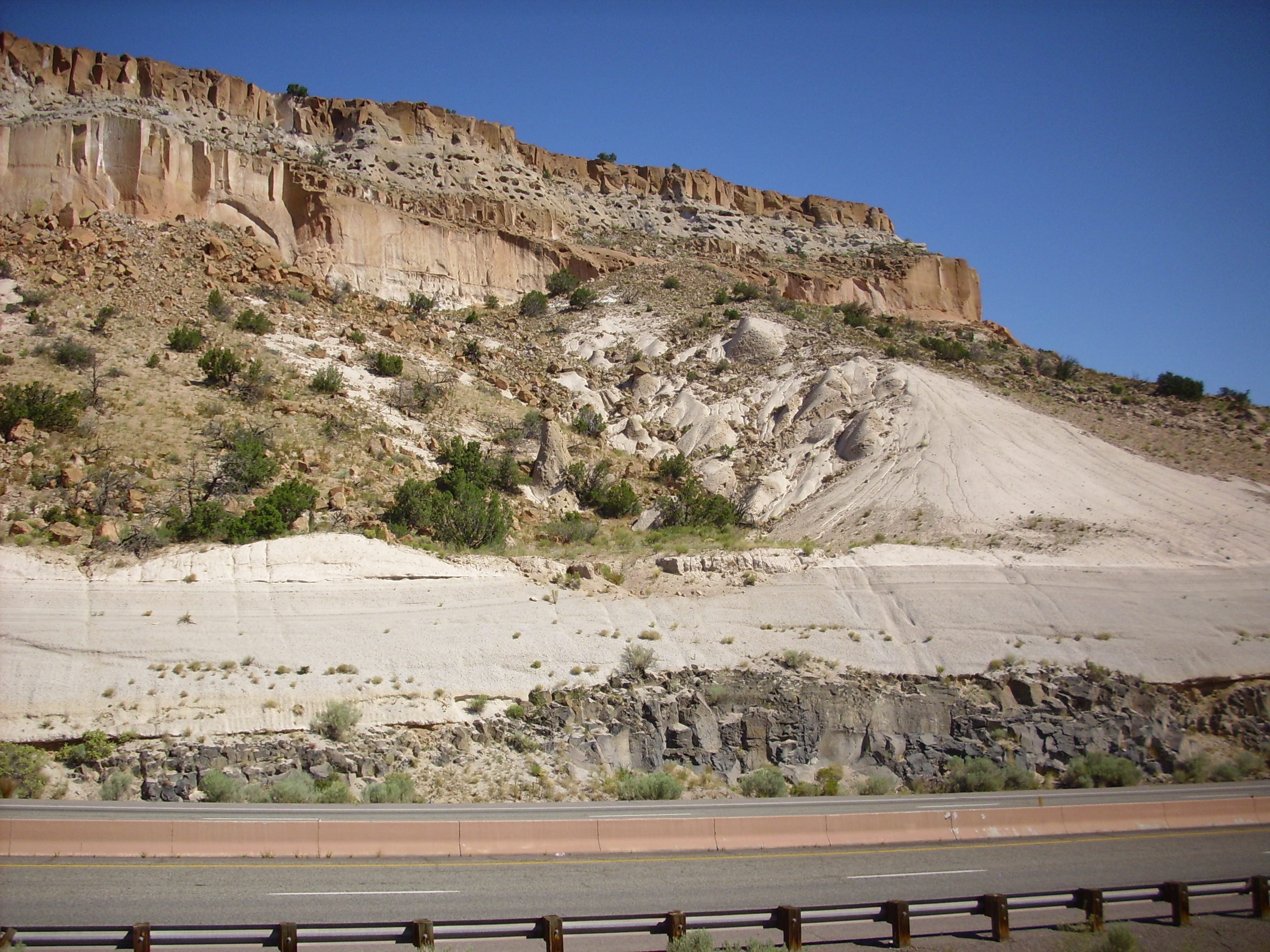
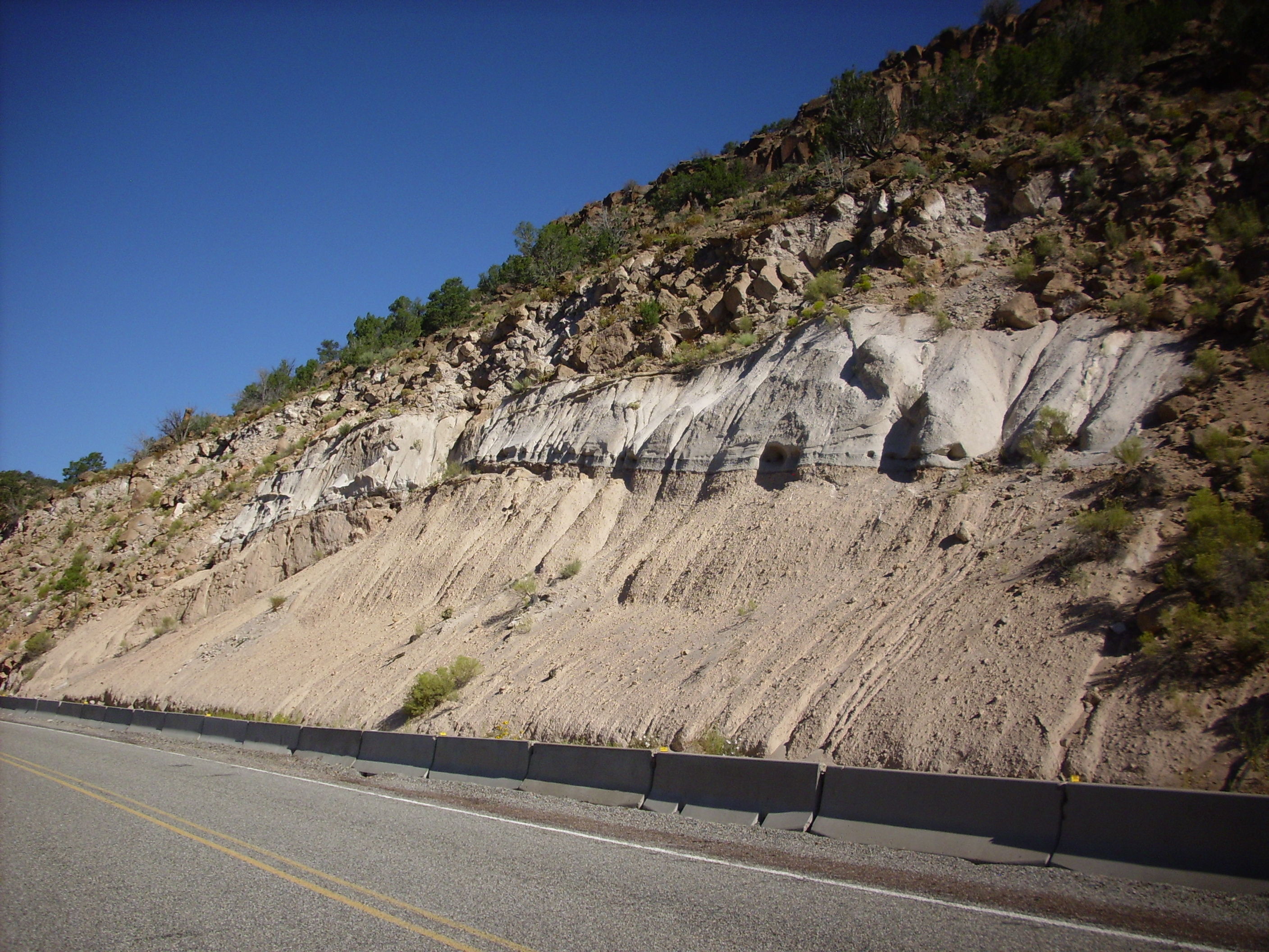
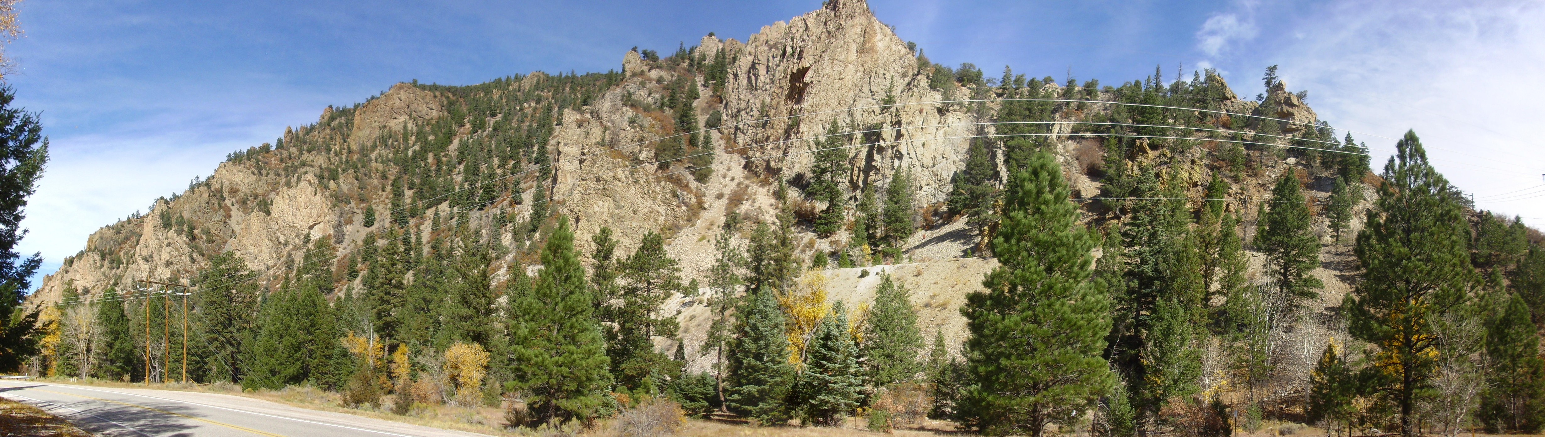
Geologists mapping the rocks in San Diego Canyon discovered a small tuff bed at the very base of the Bandelier Tuff. This was originally given the sensible name of the San Diego Canyon Ignimbrite, but because it is clearly related to the later Bandelier Tuff eruptions (and is not that much older, with a radiometric date of 1.85 million years) it has been reassigned to the La Cueva Member of the Bandelier Tuff. This tuff is found also in the walls of the caldera, in a few places underlying Redondo Peak, and as thin beds interbedded with part of the Puye Formation north of Los Alamos and in lower Alamo Canyon in Bandelier National Monument.
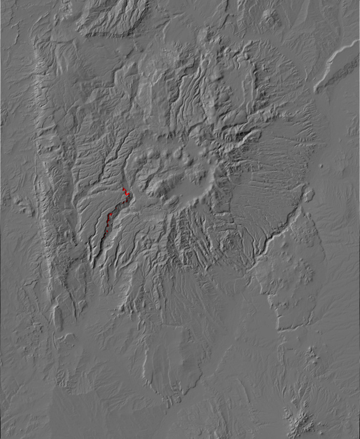
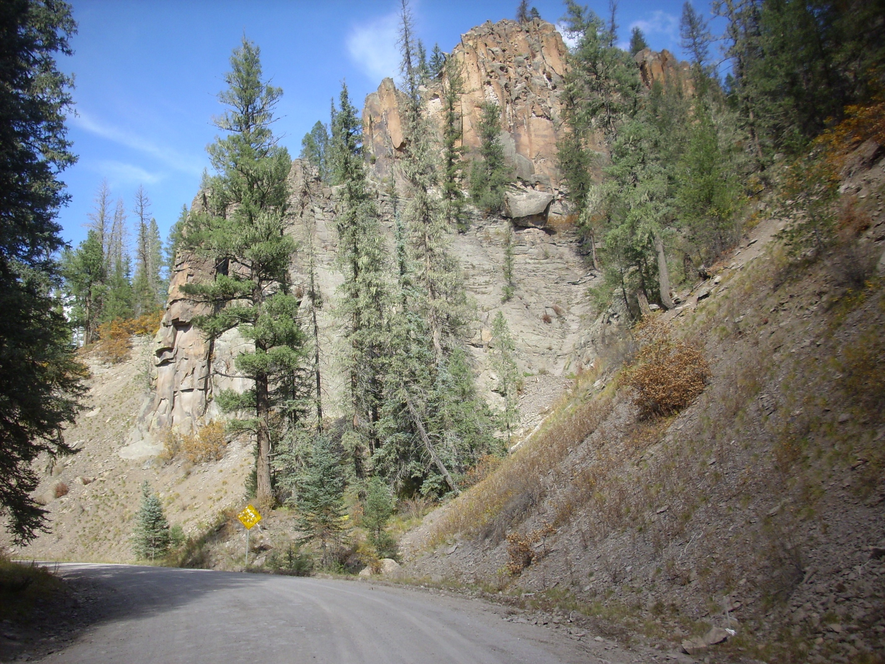
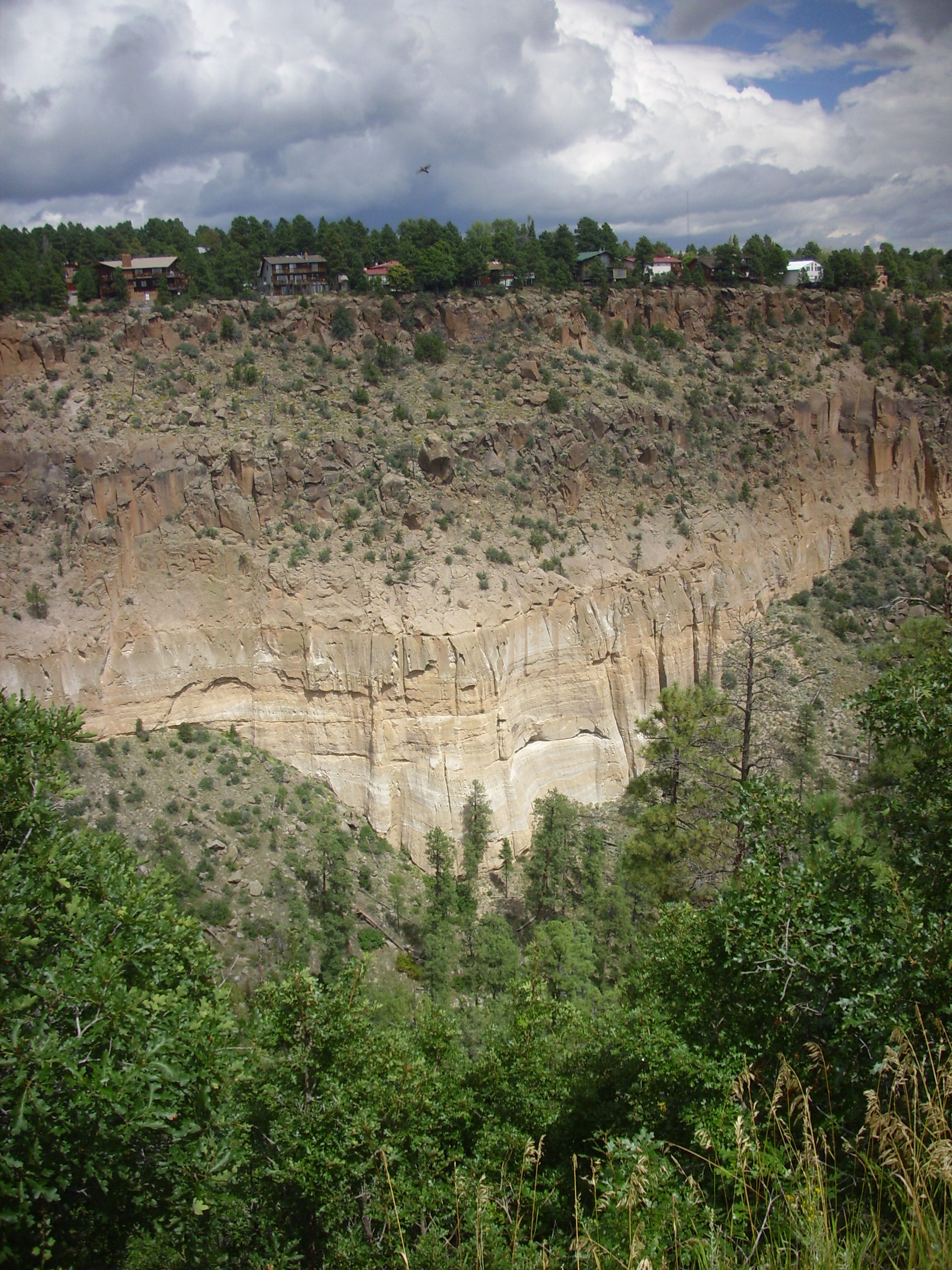
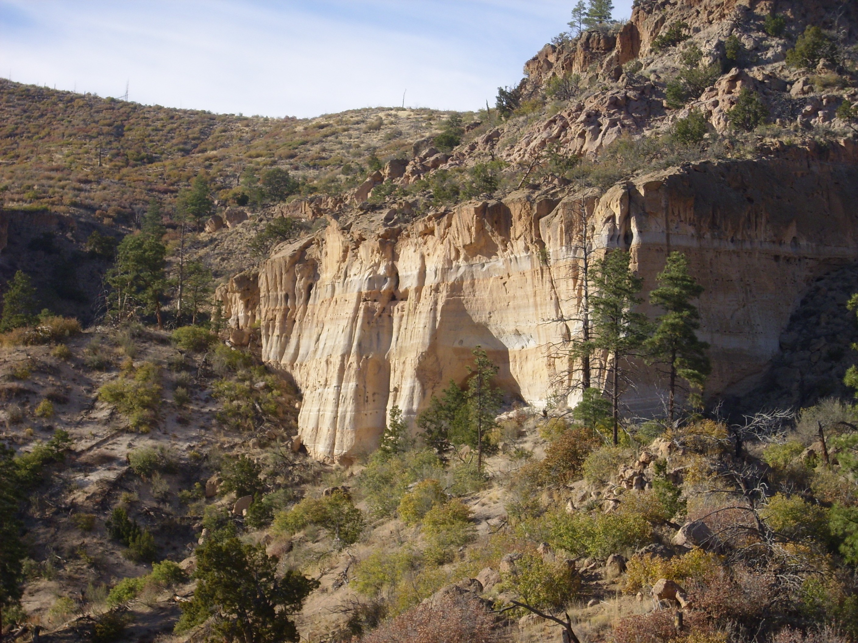
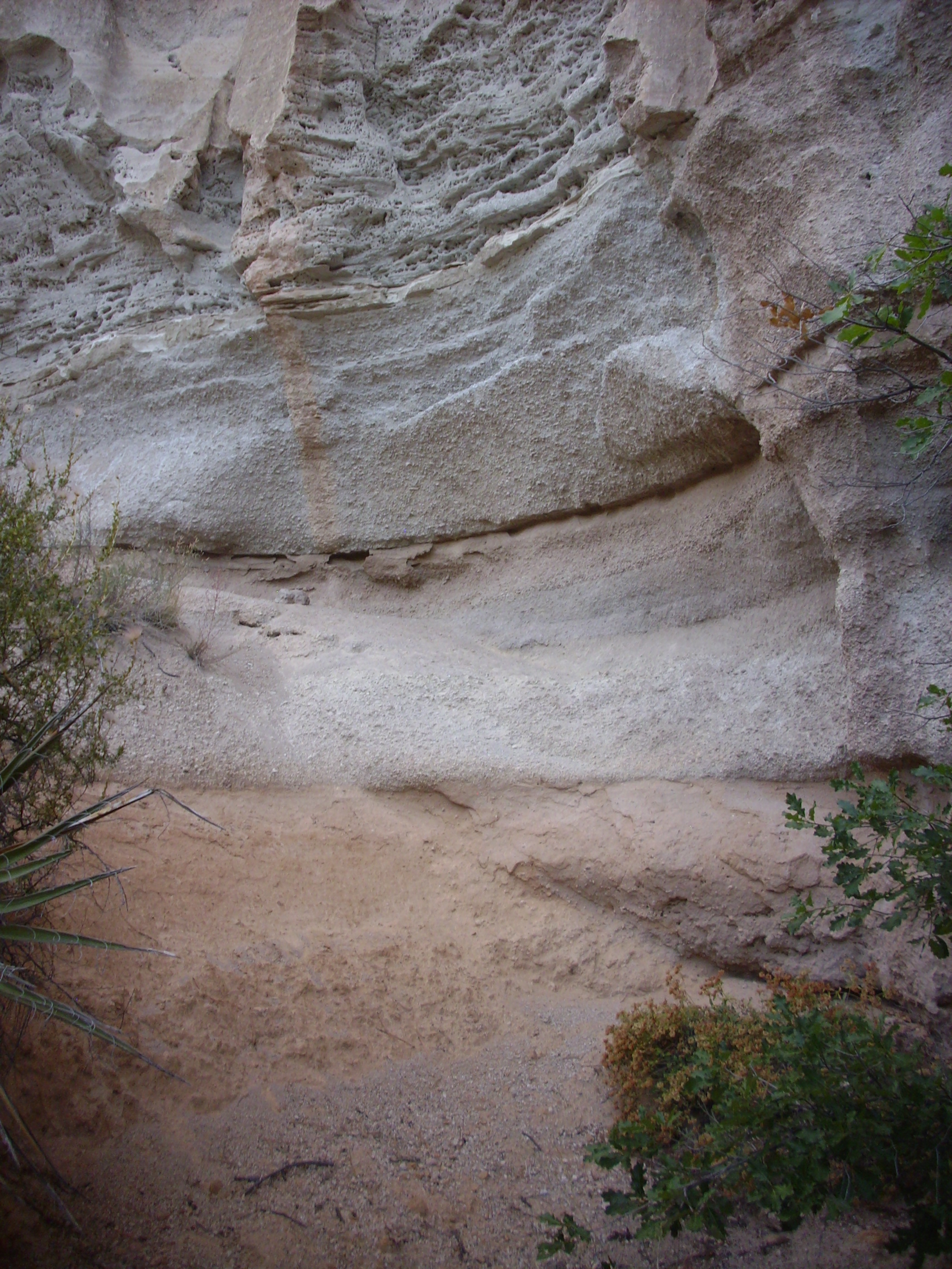
One readily visible exposure is in the east face of Virgin Mesa,
high above State Road 4 in Canon de San Diego.
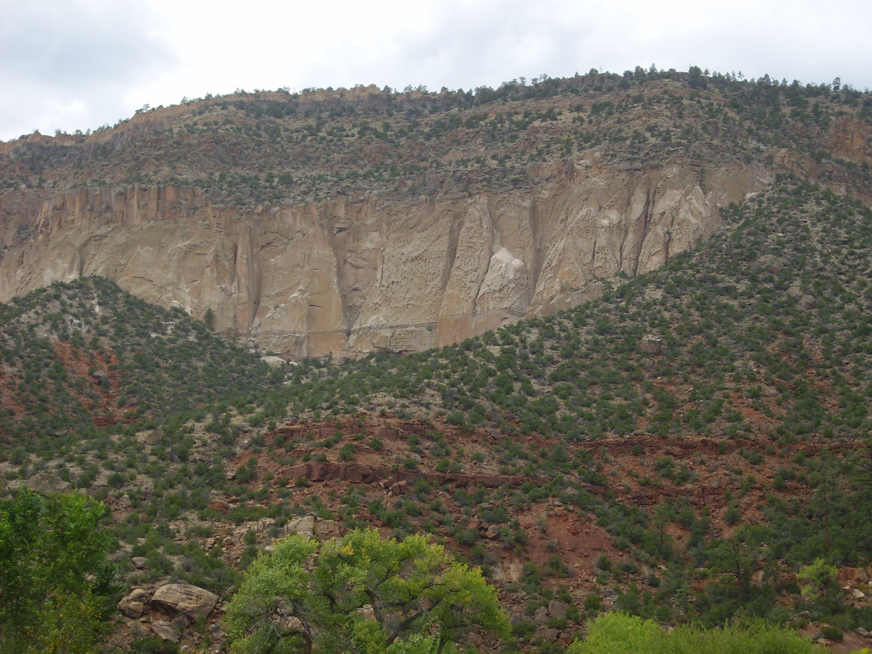
Bandelier Tuff in Virgin Mesa, showing
all three members. Looking northwest from 35
45.417N 106 42.194W
All three members of the Bandelier Tuff are visible here, resting on much older red beds of the Abo Formation. The La Cueva Member shows as a thin layer at the bottom of the cliffs, with a clearly visible notch separating it from the much thicker and nearly featureless beds of the Otowi Member. Above are multiple flows of the Tshirege Member.
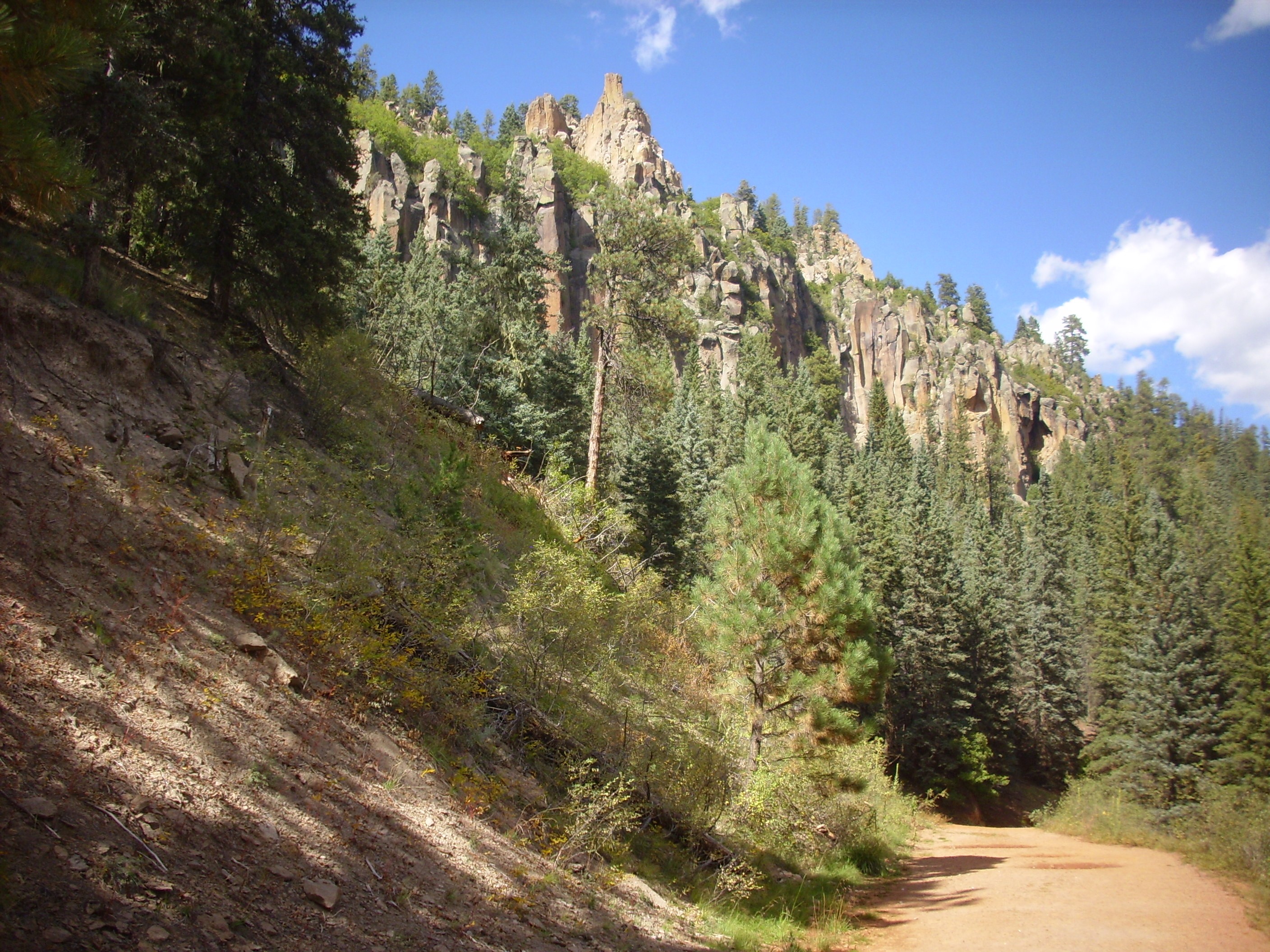
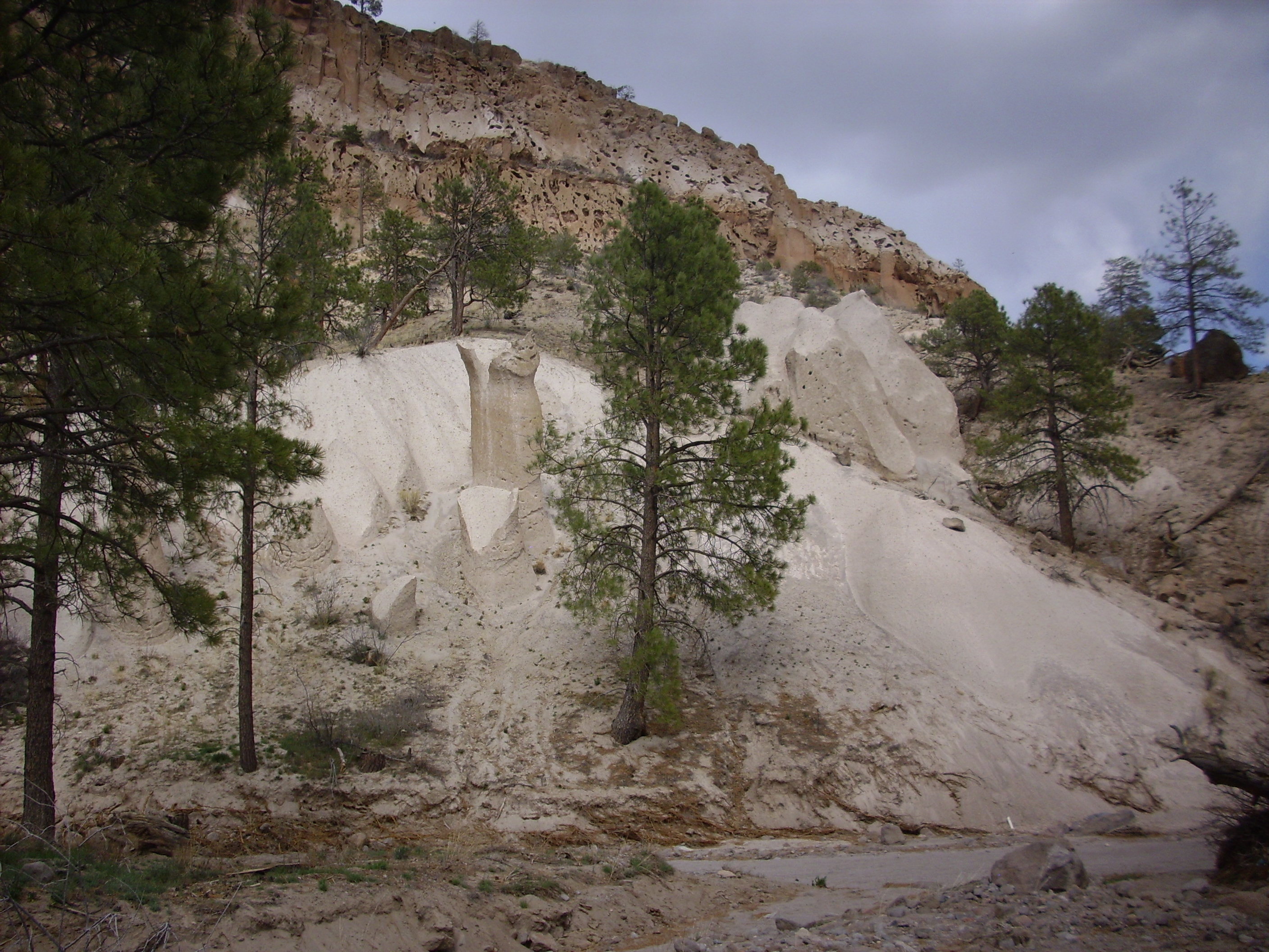
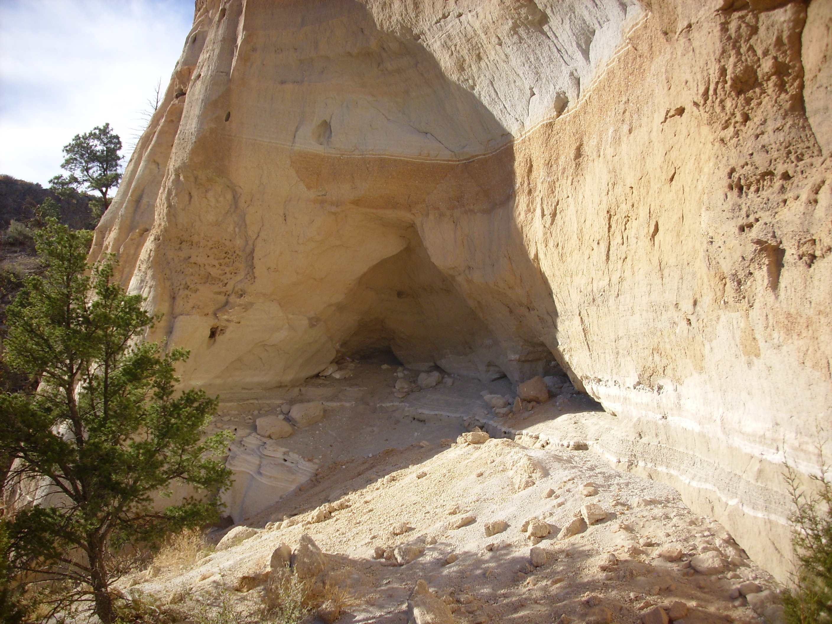
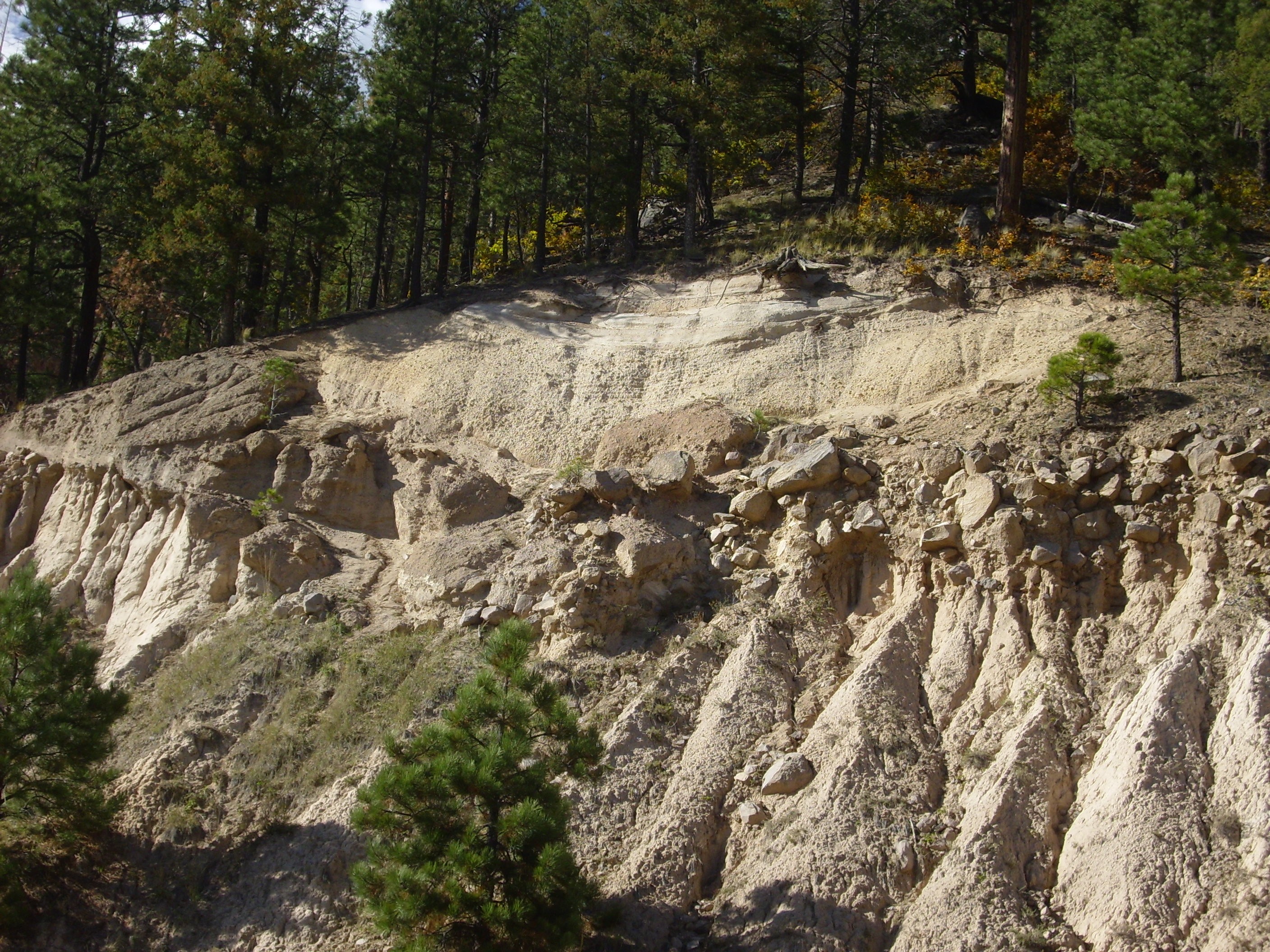
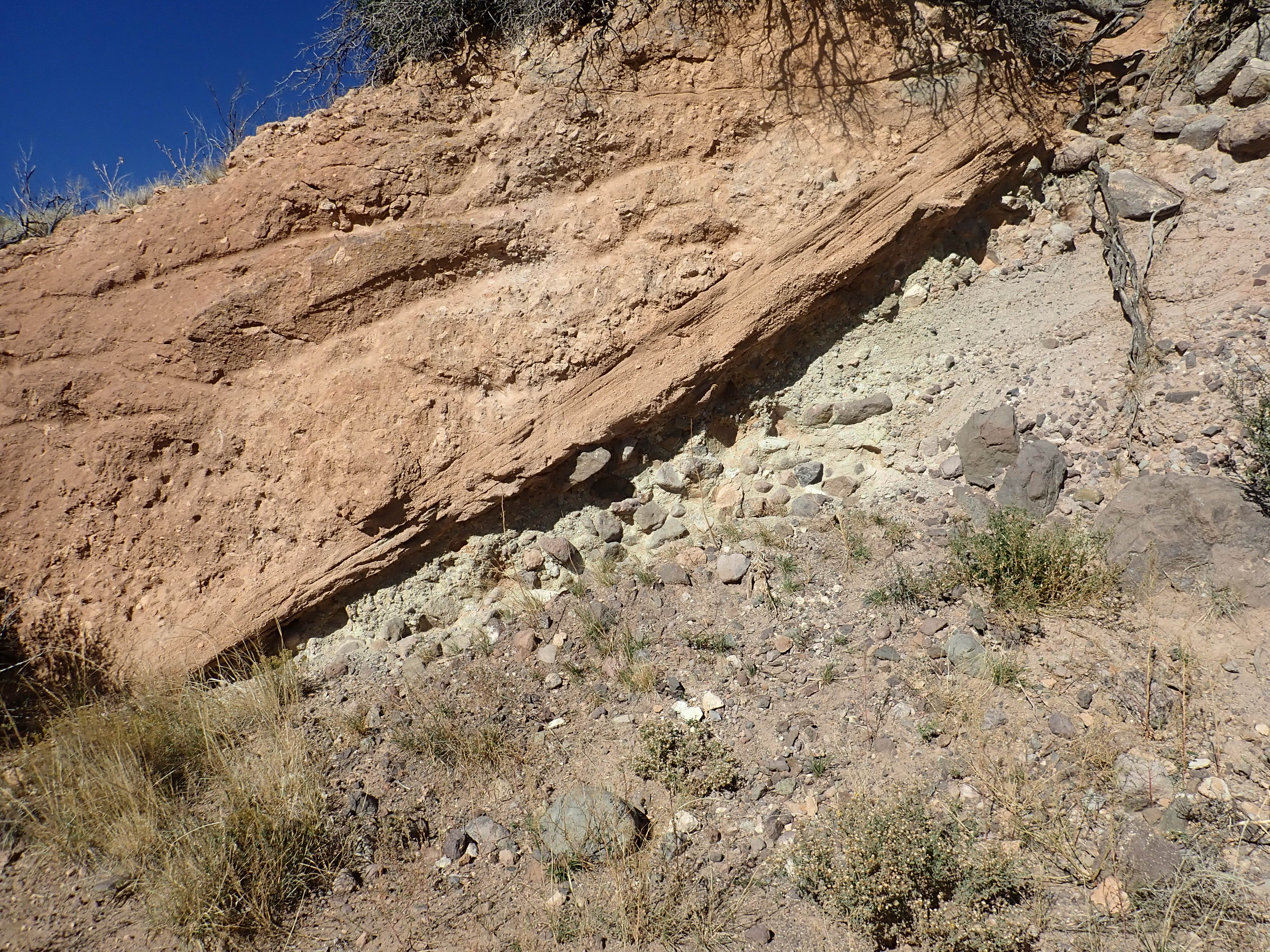
The best exposure for close examination of the La Cueva Member is
probably in the La Cueva area itself, in the caldera wall south of
the Obsidian Way subdivision. This has the informal name of
"Cathedral Canyon." It is an area of spectacular tent rocks eroded
out of the Otowi and La Cueva Members, with Tshirege Member
exposed in the cliffs overhead.
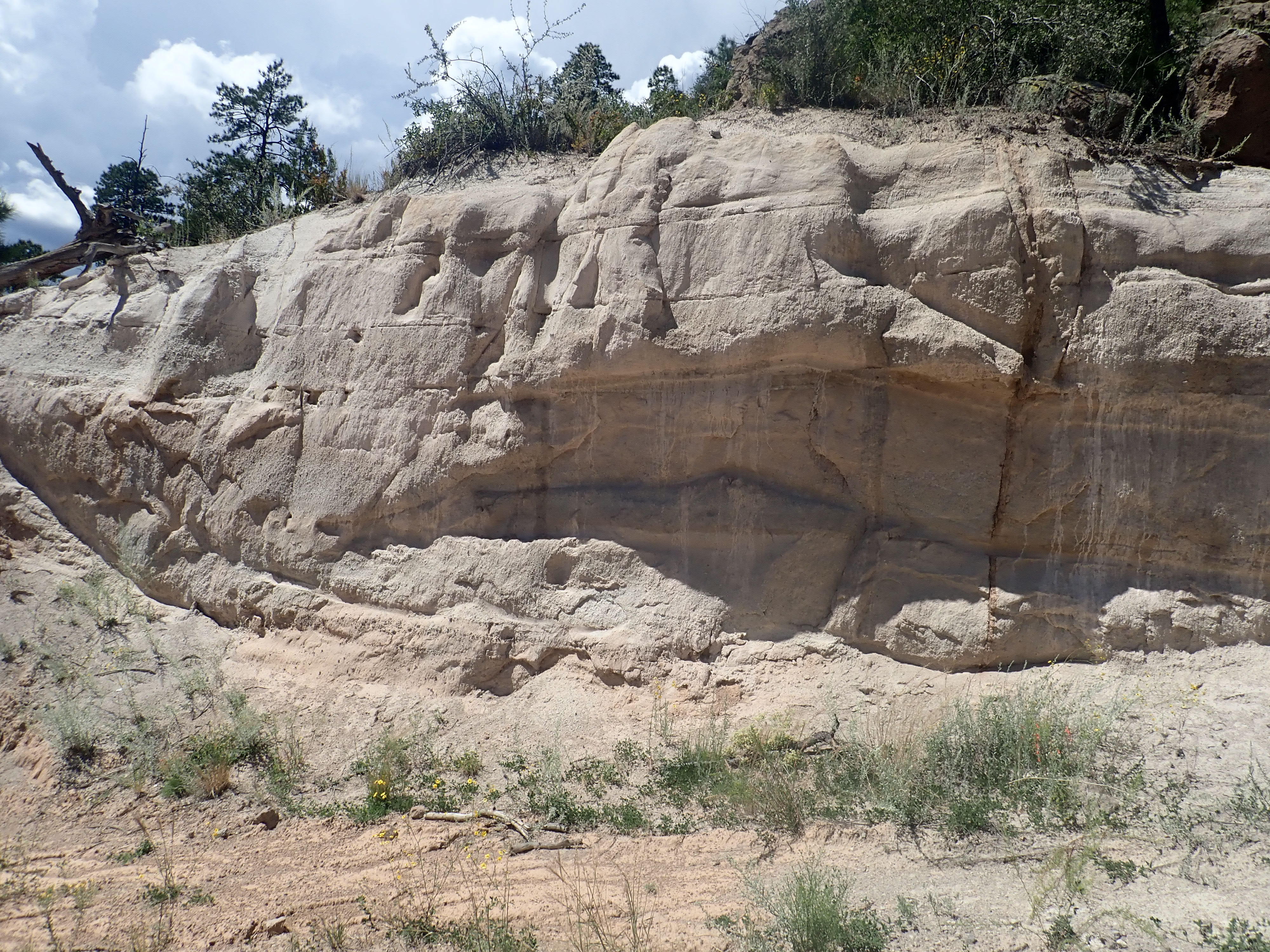
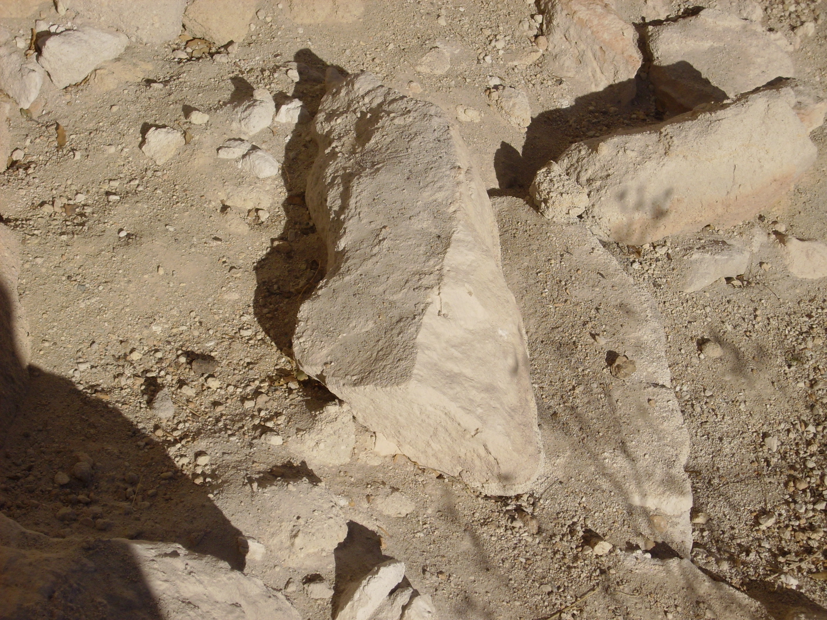
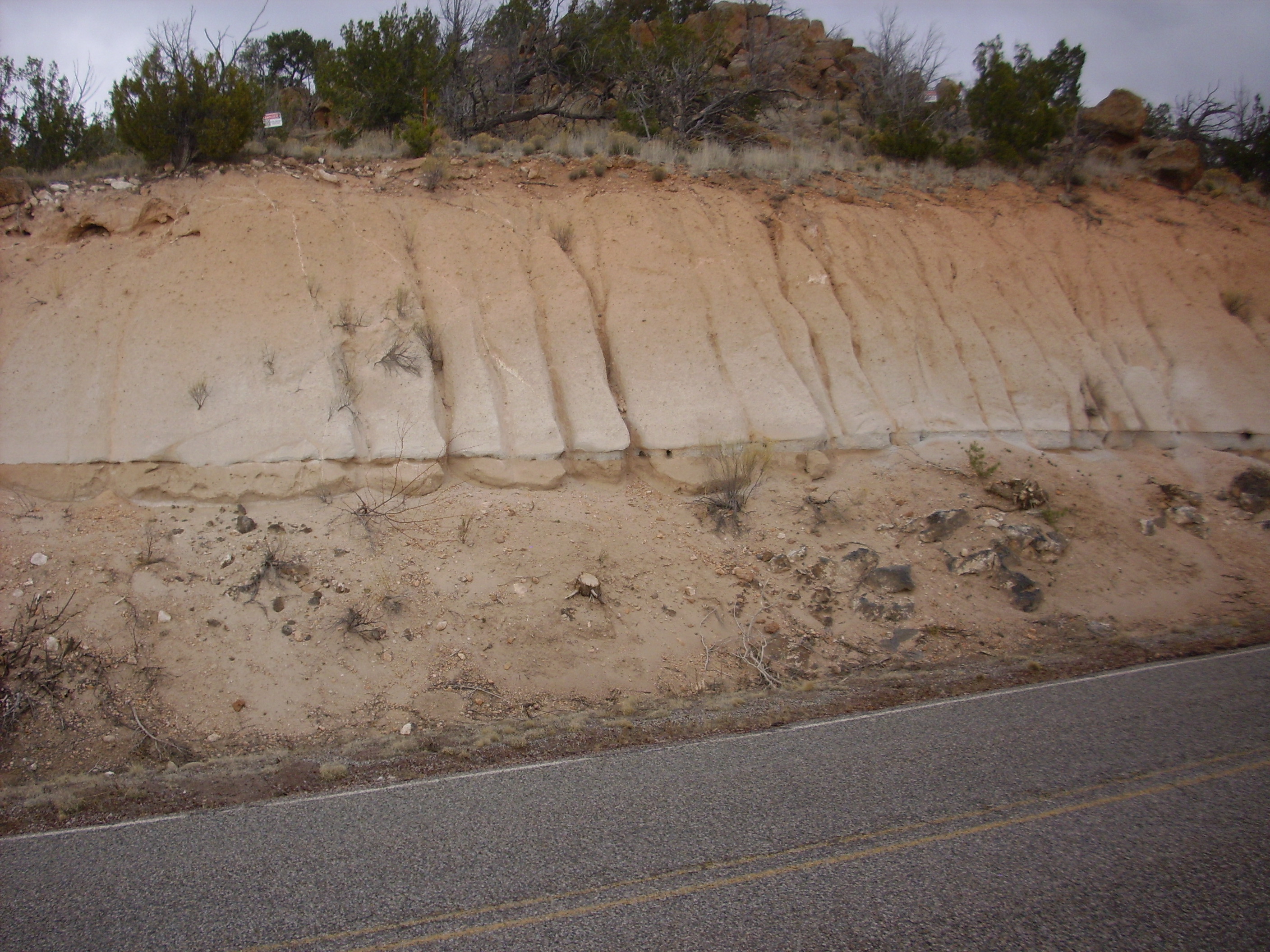
Here's a tent rock showing contacts between beds.
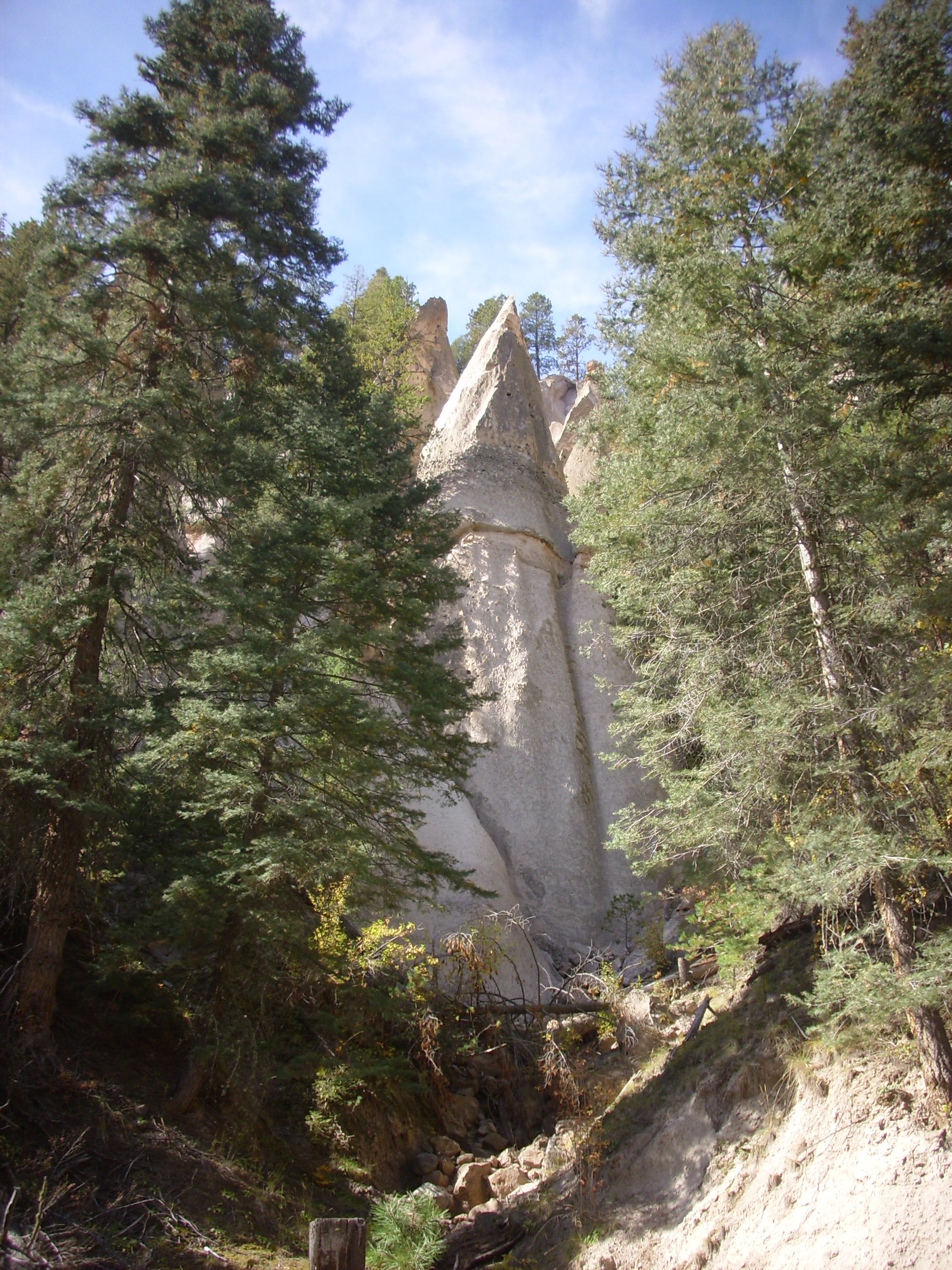
Contact. Looking south from 35
52.017N 106 39.543W
It's a little challenging to tell the various contacts in this
area apart. The geologic map does not have nearly the detail
necessary, and while I have a road log discussing this location,
it has a single photograph of only the uppermost Tshirege beds and
a crude diagram of this area as a whole. But I believe this is the
contact between the La Cueva Member below with the Otowi Member
above.
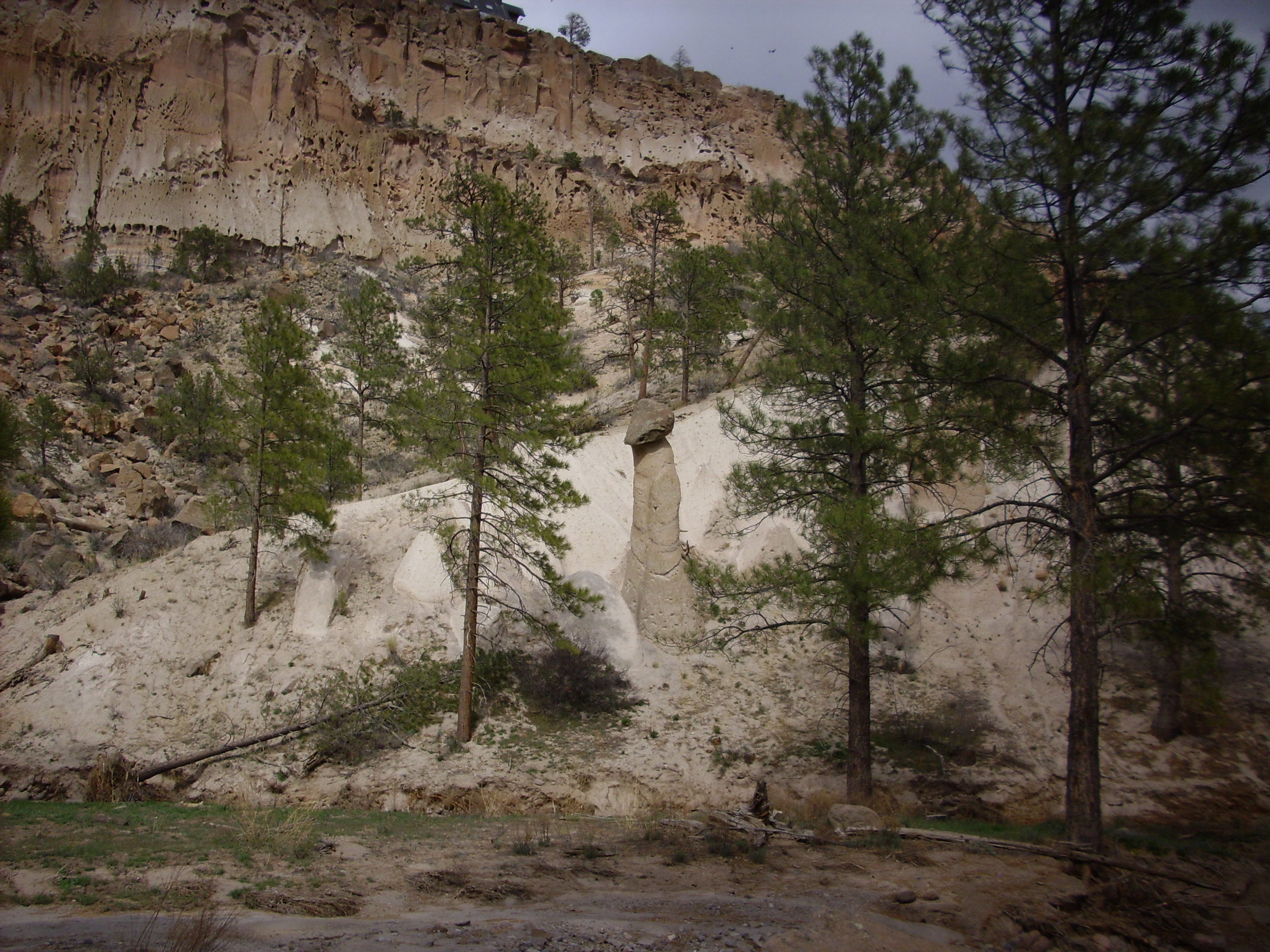
Here's an isolated tent rock with the beds showing clearly.
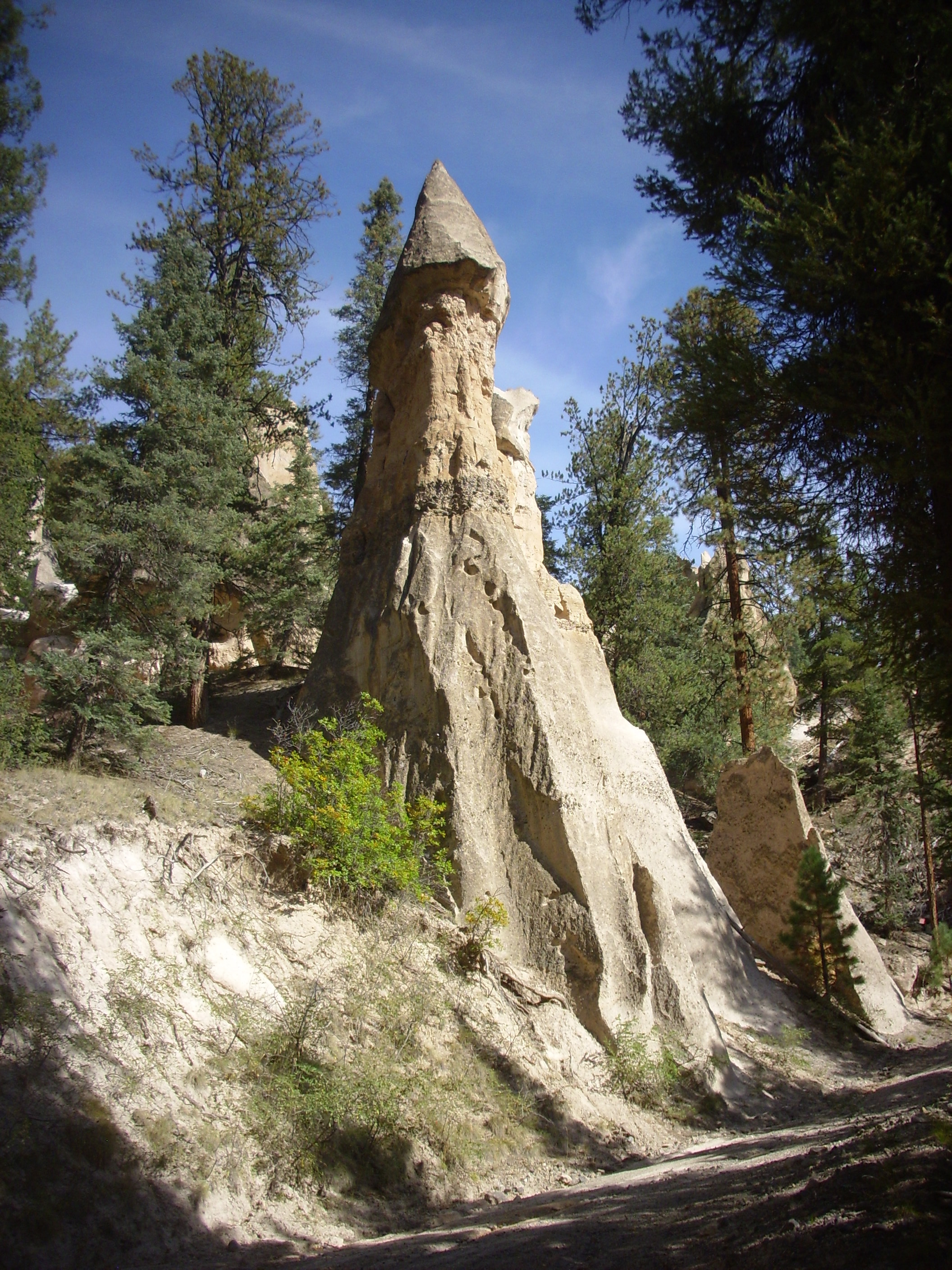
Contact. Looking north from 35
52.017N 106 39.543W
This one seems to more closely match my road log's diagram. If so, the bottom of the tent rock is the "A" bed of the La Cueva Member; the lithic-rich layer halfway up (the thin layer full of dark pebbles) marks the transition to the "B" bed of the La Cueva Member; and the cap at the very top is Otowi Member.
Here's a view of the formation from the other side.
Contact. Looking west from 35
52.029N 106 39.512W
The lithic-rich bed represents a lag breccia and is an indication that the source vents for the La Cueva Member could not have been far from this location. Lag breccias represent large clasts of country rock caught up in the eruption that are too heavy to be transported far from the vent.
The La Cueva event was clearly much less voluminous than the
eruptions that followed. It has been described by some geologists
as an early leakage of the magma chamber. Nevertheless, the
eruption was not minor. Drilling in the Redondo Creek area has
discovered buried beds of the La Cueva Member that are up to 400m
(1200') thick. This suggests that the source vents for the La
Cueva Member were located in the area between Redondo Creek and
the southwest caldera wall, and may even have formed a small
caldera in this area.
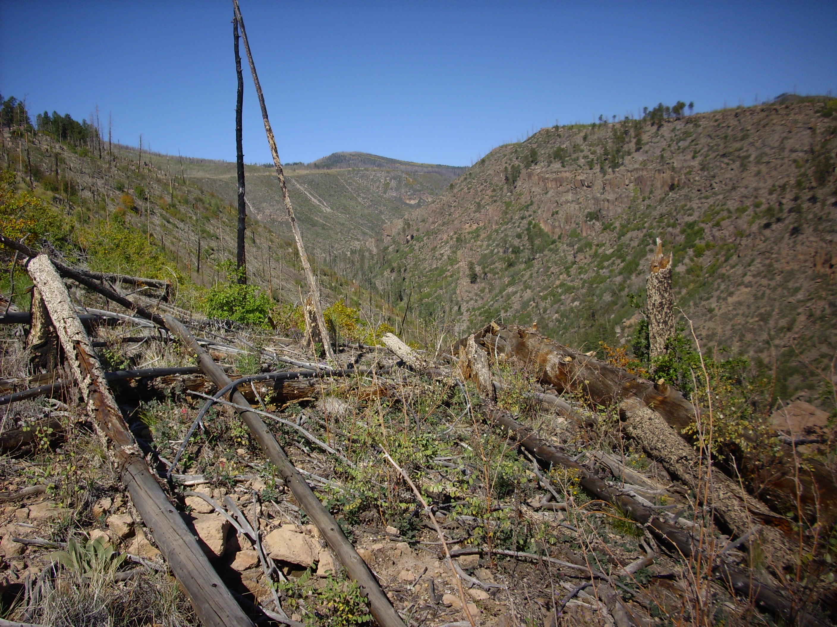
This preliminary eruption took place some 230,000 years prior to the first truly enormous caldera eruption.
About 1.62 million years ago, the first truly enormous eruption
burst out of the Jemez volcanic field. This eruption is known as
the Toledo event and it produced a caldera roughly coinciding with
the present Valles caldera. It also emplaced the Otowi Member of
the Bandelier Tuff, sometimes called the lower Bandelier Tuff in
older geologic writings.
The Otowi Member covers a vast area in all directions from the caldera, although there are areas where it was clearly channeled by existing high ground. For example, none is found on the La Grulla Plateau in the northern Jemez and little on El Alto in the northeastern Jemez, and it is sparse in the highlands of the southern Jemez. On the other hand, substantial flows of Otowi Member are found in the lower ground between the La Grulla Plateau and Mesa Alta and west of the La Grulla Plateau and in Cañon de San Diego. The bulk of the Otowi Member is found in the finger mesas of the Pajarito Plateau northeast to east of the Sierra de los Valles and the Jemez Plateau between the western topographic rim of the caldera and the Sierra Nacimiento Mountains. The latter are the most extensive and best preserved beds of the Otowi Formation.
One area that was not reached by the Toledo pyroclastic flows is
the village of White
Rock. Although there are thin flows of the later Tshirege
Member north, west, and south of the village, there are none
underlying the village itself, and no flows of the Otowi Formation
anywhere in the immediate area. The pre-Bandelier surface beneath
the Pajarito Plateau can be reconstructed in considerable detail,
thanks to numerous test wells drilled to evaluate contamination
from the early days of Los Alamos National Laboratory, and we now
know that there is a ridge of basalt of the Cerros del Rio
extending north from roughly the location of my house, on the west
side of White Rock, for about three kilometers (two miles). Prior
to the Toledo Event, there was a low valley west of this ridge,
dominated by a large cinder cone to the south, at the present
location of a
LANL technical site, and the Sierra de los Valles to the
west and north. The valley was underlain by beds of coarse
sediments, nowhere exposed today but dubbed the Chaquehui
Formation by LANL hydrologists. This could become an important
aquifer for Los Alamos in the future. This paleovalley corresponds
with a region of slightly lower surface gravity that suggests it
is a particularly deep part of the Rio Grande Rift.
On the Pajarito Plateau, the Otowi Member is typically found at the base of sheer mesas of the Bandelier Formation, capped with the more densely welded Tshirege Member. In the last chapter, we saw an excellent exposure in Pueblo Canyon on the main road to Los Alamos.
Bandelier Formation sitting on top of
Cerros del Rio Formation on State Road 502 west of Totavi. 35
52.099N 106 11.913W
The road cut here exposes the Otowi Member, which rests on three-million-year-old basalt of the Cerros del Rio Formation and is capped by cliffs of the Tshirege Member. There is a thin layer of paleosol between the Otowi Member and the Cerros del Rio basalt that has been interpreted as shallow lake sediments from Culebra Lake. The rounded slope right of center is ash flow tuff of the Otowi Member, while the gray, very level beds at the base of the Otowi Member are an air fall pumice, the Guaje Pumice.
The Toledo Event began when a large vent opened somewhere almost directly west of the present location of Los Alamos. A convective column of ash and pumice emerged from the vent and rose into the atmosphere. There must have been a stiff breeze blowing to the east, because the air fall pumice beds of the Guaje Pumice are thickest east of Los Alamos. This area includes the road cut along State Road 502, where the Guaje Pumice is several meters thick. North, west, and south of the caldera, the Guaje Pumice is very thin or is missing altogether.
Just how many vents were involved, and where they were located, remains controversial. The original picture was of a more or less central vent. Later, geologists began to lean towards the view that the initial vents were located at one or more points along the developing ring fracture. However, the isopach map for the Guaje Pumice, which shows the estimated thickness of the bed at various locations around the Jemez, strongly suggests the Guaje Pumice was erupted from a central vent or a few closely clustered vents. We cannot say for certain whether the vents were located near the center of what is now the caldera, or at the easternmost point of the ring fracture, or somewhere else along the same east-west line.
Thick beds of Guaje Pumice were deposited north of Guaje Canyon. Here the Copar Pumice Mine operated for many years, and there are still large beds exposed in the area.
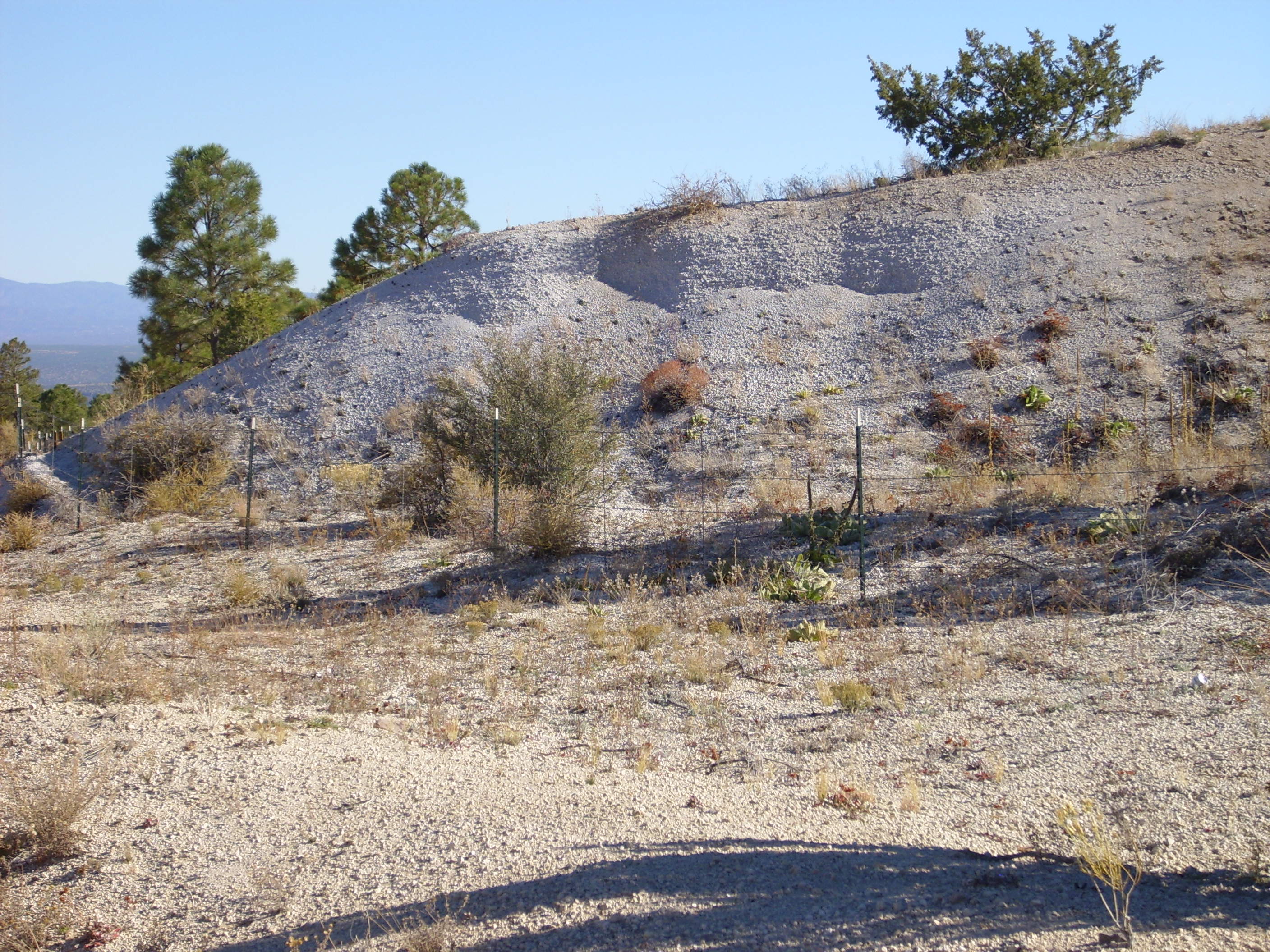
Guaje Pumice beds. Near 35.917N 106.225W
Another pumice pit is located just south of Thirtyone Mile Road.
Pumice pit in Guaje Pumice beds. Near 36.009N 106.203W
I took the photographs without much thought about land jurisdiction, but a pumice pit will certainly be a private holding and both the Copar mines are on tribal lands. I should not have been surprised that someone materialized to ask what I was photographing and why. The correct answer in such situations is the truthful one. Tourists out looking at geology are fairly nonthreatening, though one should always be respectful of privacy on non-public lands.
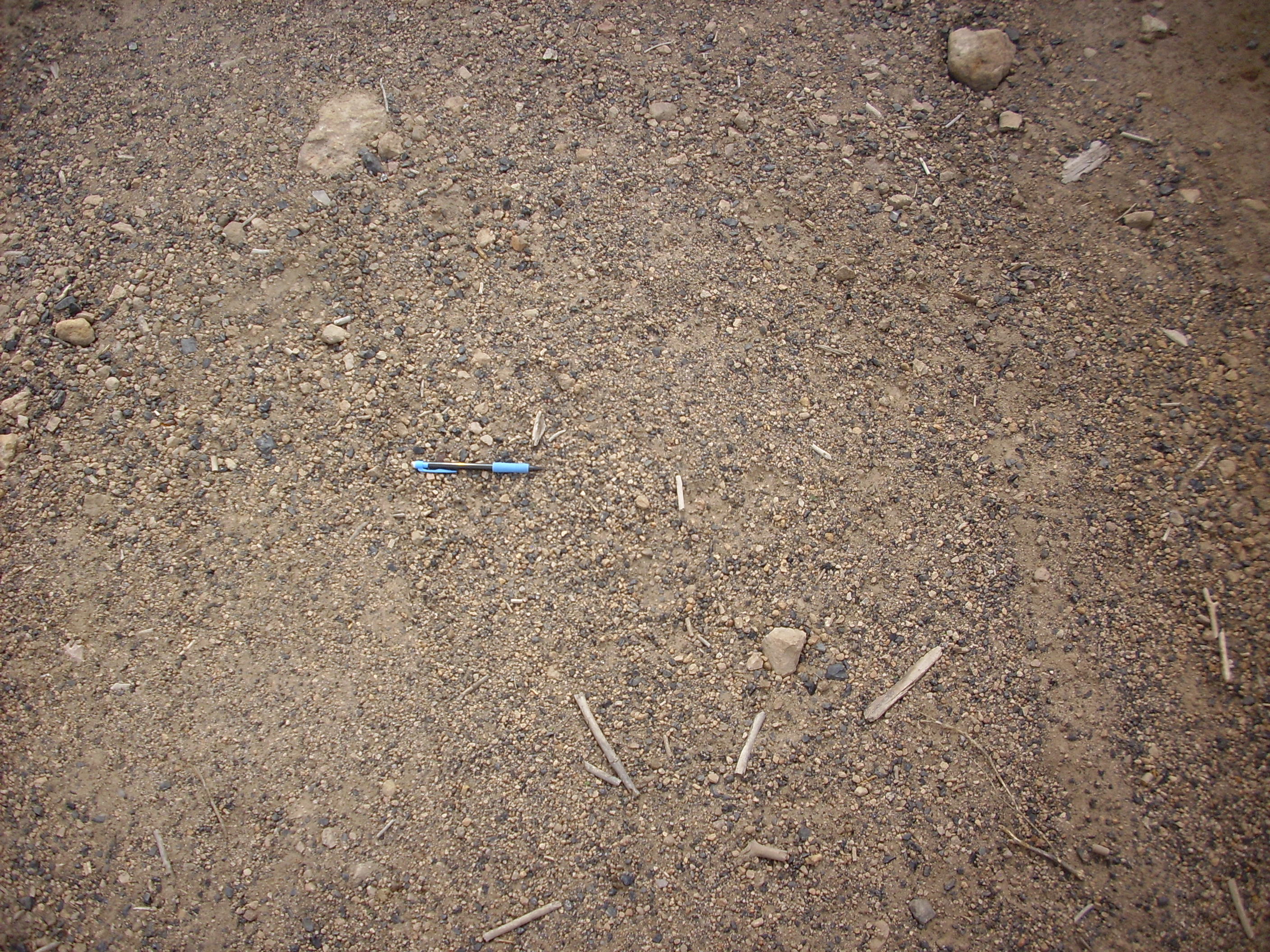
The large pumice beds on the west rim of White Rock Canyon at
Overlook Park are probably Guaje Pumice.

Though locally substantial, these beds cover only a very small area and so are not mapped on the geological map of the White Rock quadrangle. Here's a sample.
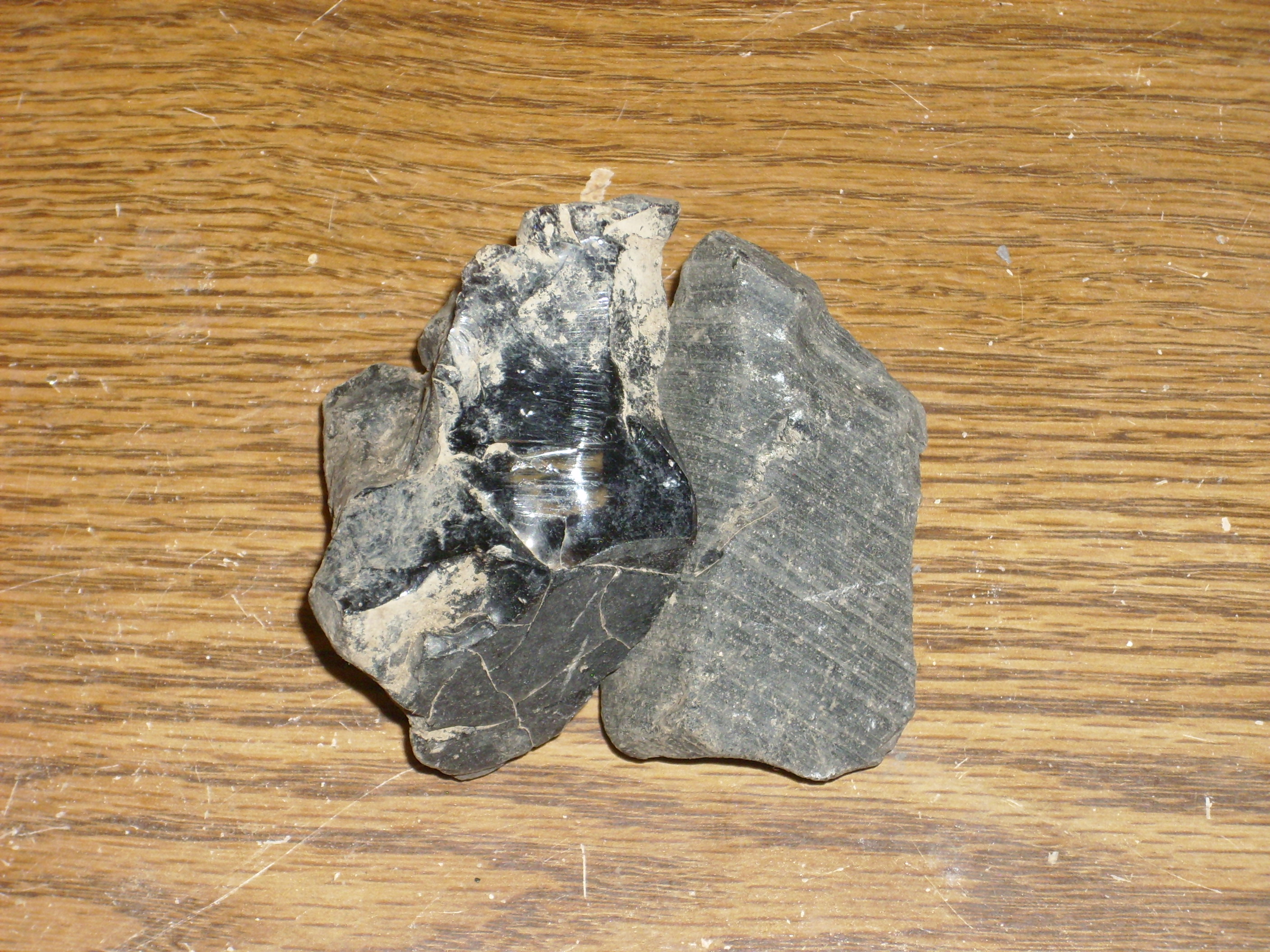
Close examination shows that the pumice has abundant phenocrysts
of quartz and feldspar, likely sanidine (alkali feldspar.) There
are no visible phenocrysts of biotite. This is characteristic of
the Bandelier Formation pumice beds and rules out the much younger
El Cajete Pumice, which has obvious biotite phenocrysts. The pure
white color is more characteristic of the Guaje Pumice than the
Tsankawi Pumice; the latter tends to be grayish in color.
The Guaje Pumice likely was deposited for great distances downwind. One deposit is located at Truchas, in the foothills of the Sangre de Cristo Mountains some 65 km (40 miles) downwind of the likely source vents. This is not the furthest identifiable airfall deposit of Guaje Pumice. In 1972, a team of geologists reported that an ash bed found at Mount Blanco, Texas, closely matched the Guaje Pumice in both chemical composition and radiometric age. This bed, which is 30 cm (1') thick, is nearly 500 km (300 mi) downwind of the source vents.
Some of the ash was carried far downriver by the Rio Grande,
producing the Bosquecito Ash beds in the upper Sierra Ladrones
Formation near Socorro.
The eruption column gradually eroded the sides of the vent, widening it and increasing the volume of the eruption. Additional vents likely opened as the roof of the magma chamber lost support and a ring fracture began to form. The eruption column abruptly collapsed, producing the first of the massive pyroclastic flows of the Otowi Member. Unlike the Guaje Pumice, the pyroclastic flows extended in all directions, which is unsurprising given that pyroclastic flows move at great speed. The breeze from the west was essentially irrelevant at this point.
In fact, the most impressive exposures of Otowi Member
ignimbrites are on the west side of the caldera. There seems to
have been no topographic barrier in this direction, and
pyroclastic flows moved freely across this area, producing great
thicknesses of moderately to highly welded tuff. The area is also
sheltered by the Sierra Nacimiento immediately to the west, which
may have reduced erosion rates and allowed more of the beds to be
preserved.
There is an impressive exposure of welded Otowi Member tuff north of Fenton Lake.
Otowi Member north of Fenton Lake. 35
52.905N 106 43.376W
The cliffs are mostly Otowi Member with a layer of Tshirege Member at the top. The Tshirege Member caps most of the mesas of the Jemez Plateau, but is generally less thick than the underlying Otowi Member. This is likely because the caldera rim left by the Toledo event formed a modest topographic barrier to the later eruption.
Similar impressive exposures are found along State Road 126, in Bear Canyon.
Otowi Member in Bear Canyon. 35
54.885N 106 42.841W
The prominent cliff at left is Otowi Member, with the Tshirege
Member forming the sloping ground above the cliffs.
Another impressive exposure is found in Calaveras Canyon.
Otowi Member in Calaveras Canyon. 35
56.249N 106 42.519W
The entire cliff here is Otowi Member, with no cap of Tshirege Member. It appears that a very thick sequence of surge beds makes up the lower half of the exposure.
Otowi Formation also dominates the west rim in San Antonio Canyon.
Otowi hoodoos in San Antonio Canyon. 35
56.234N 106 39.091W
The cliffs are Otowi Member, except for an isolated patch of Tshirege Member forming the high point of the rim.
In the Pajarito Plateau on the east side of the Jemez, the Otowi
Member is often difficult to distinguish from colluvium, since it
is usually present only under cliffs of more durable Tshirege
Member and it tends to weather to a gentle slope. However, there
are some good exposures in road cuts. For example, as State Road
502 approaches Los Alamos, it climbs the north side of Los Alamos
Mesa, where there is a fine exposure of the contact between the
Otowi and Tshirege Members. The road here is narrow with no really
safe places to pull over, so the visitor wishing to examine this
exposure is well advised to park on a
pullout on a side road just before SR 502 begins the climb,
then walk to the outcropping. Be very careful of traffic on this
busy and narrow road.

Otowi Member on State Road 502
ascending Los Alamos Mesa. 35
52.233N 106 13.390W
The walking stick provides scale. The ash flow tuff here is pinkish white ash with numerous small mafic clasts (probably country rock entrained in the flow) and numerous pumice clasts. The pumice clasts are completely undeformed, showing that this is an unwelded tuff.
The Otowi Member is often quite rich in lithic clasts, enough
that their cooling effect may have inhibited welding. The clasts
are mostly older volcanic rock of the Jemez, with much smaller
amounts of Paleozoic rock and traces of Precambrian rock. This
suggests that most of the erosion of the eruption events was at
quite shallow depths, giving them a funnel shape.
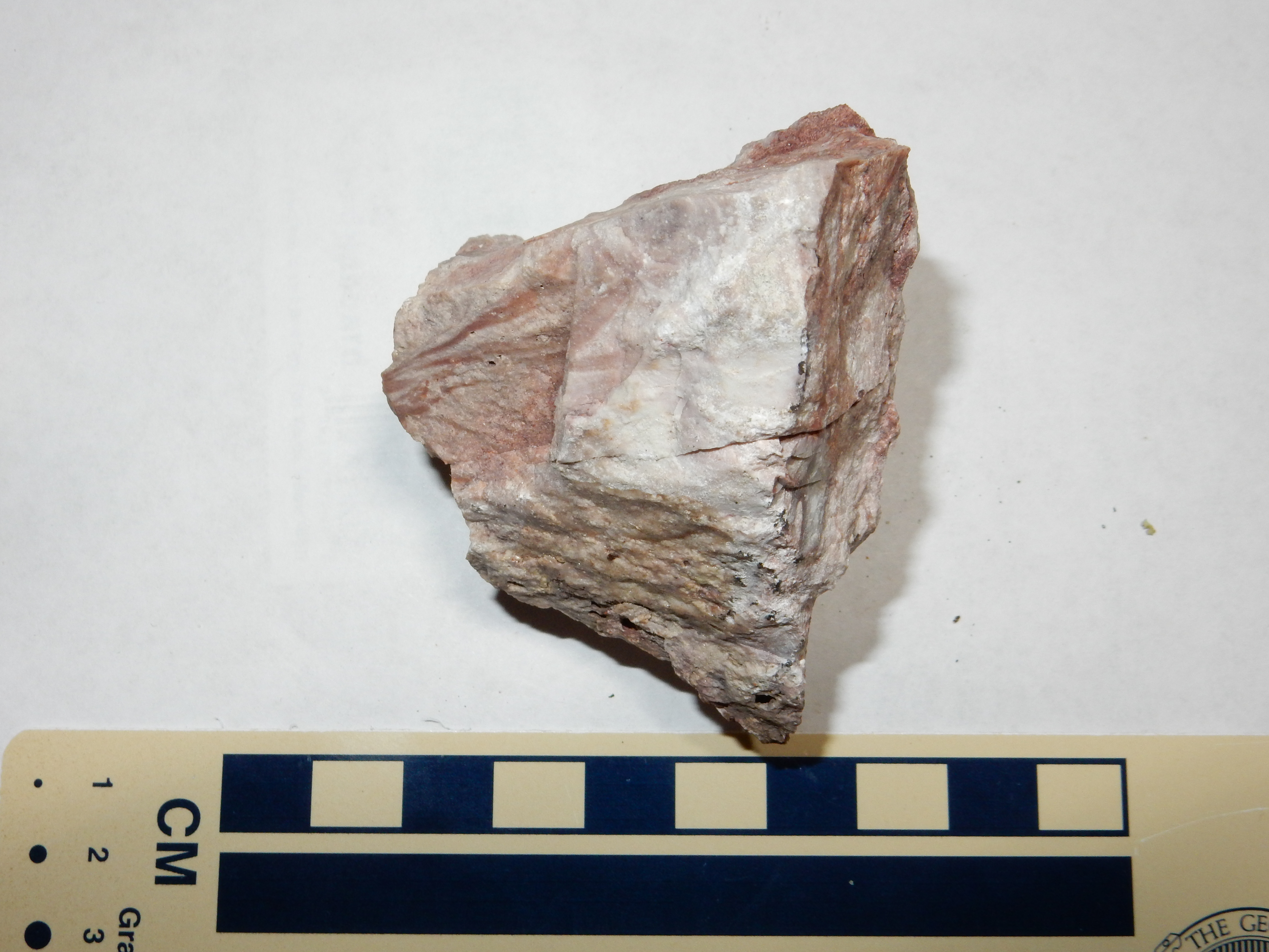
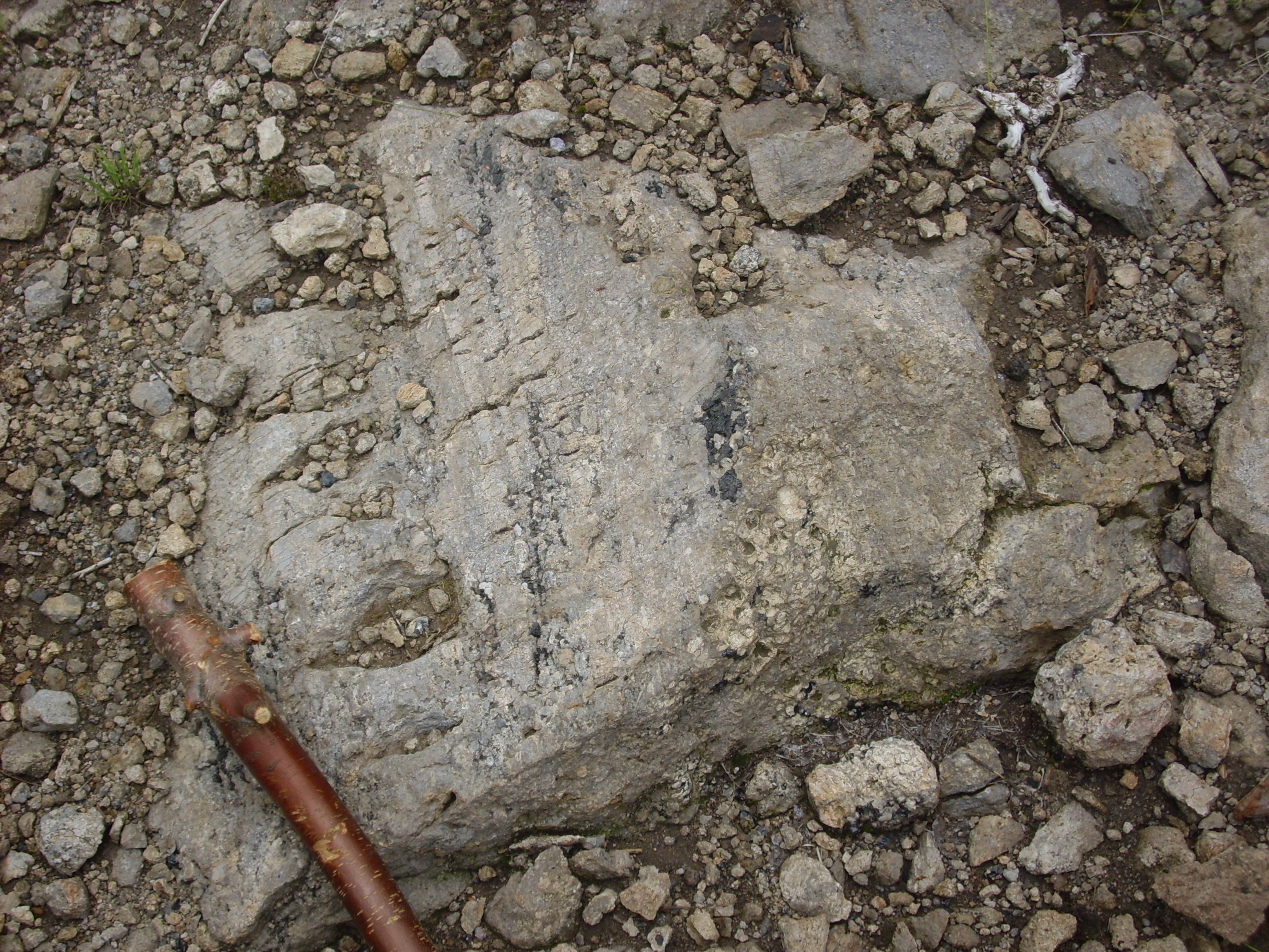
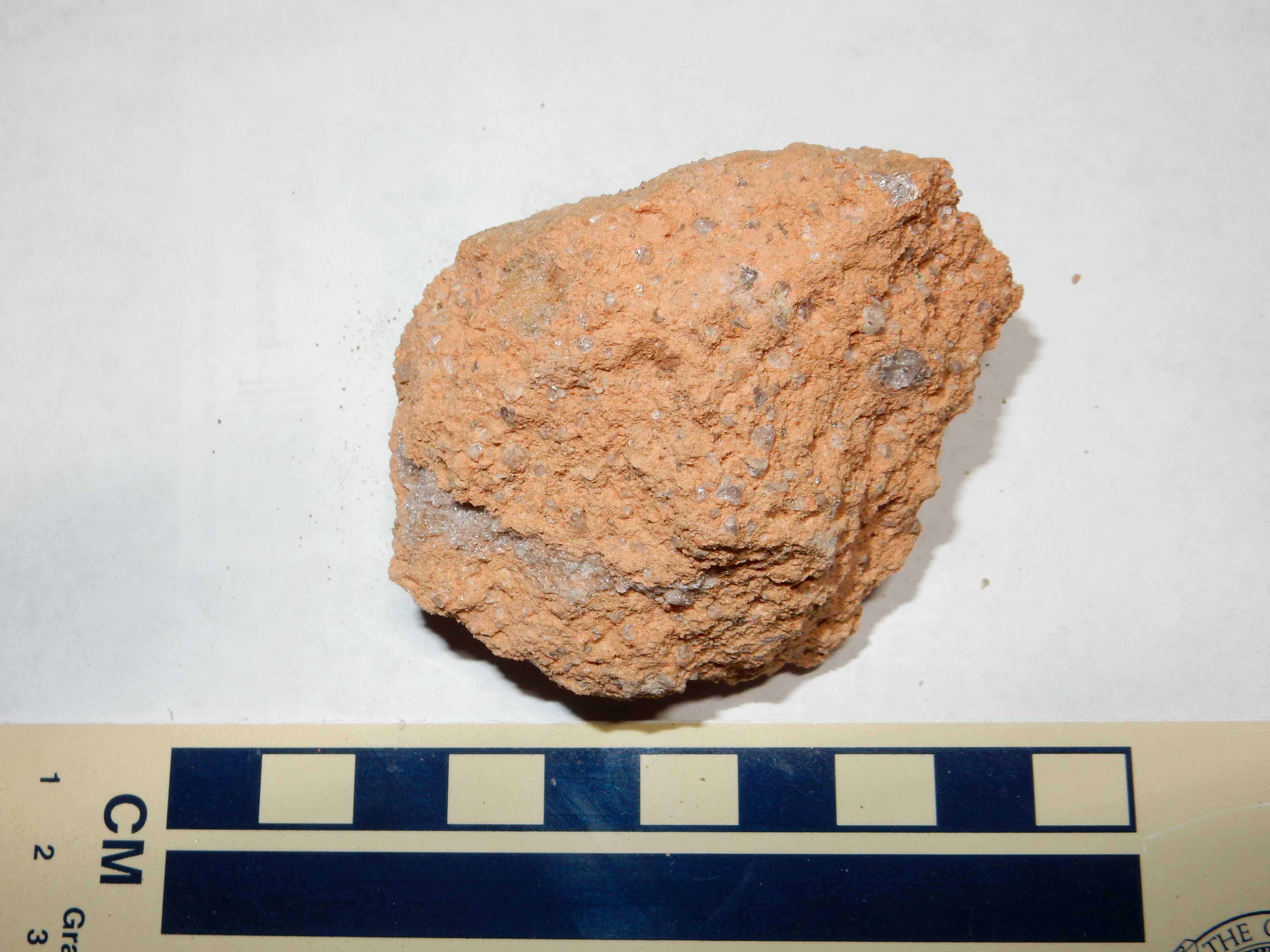
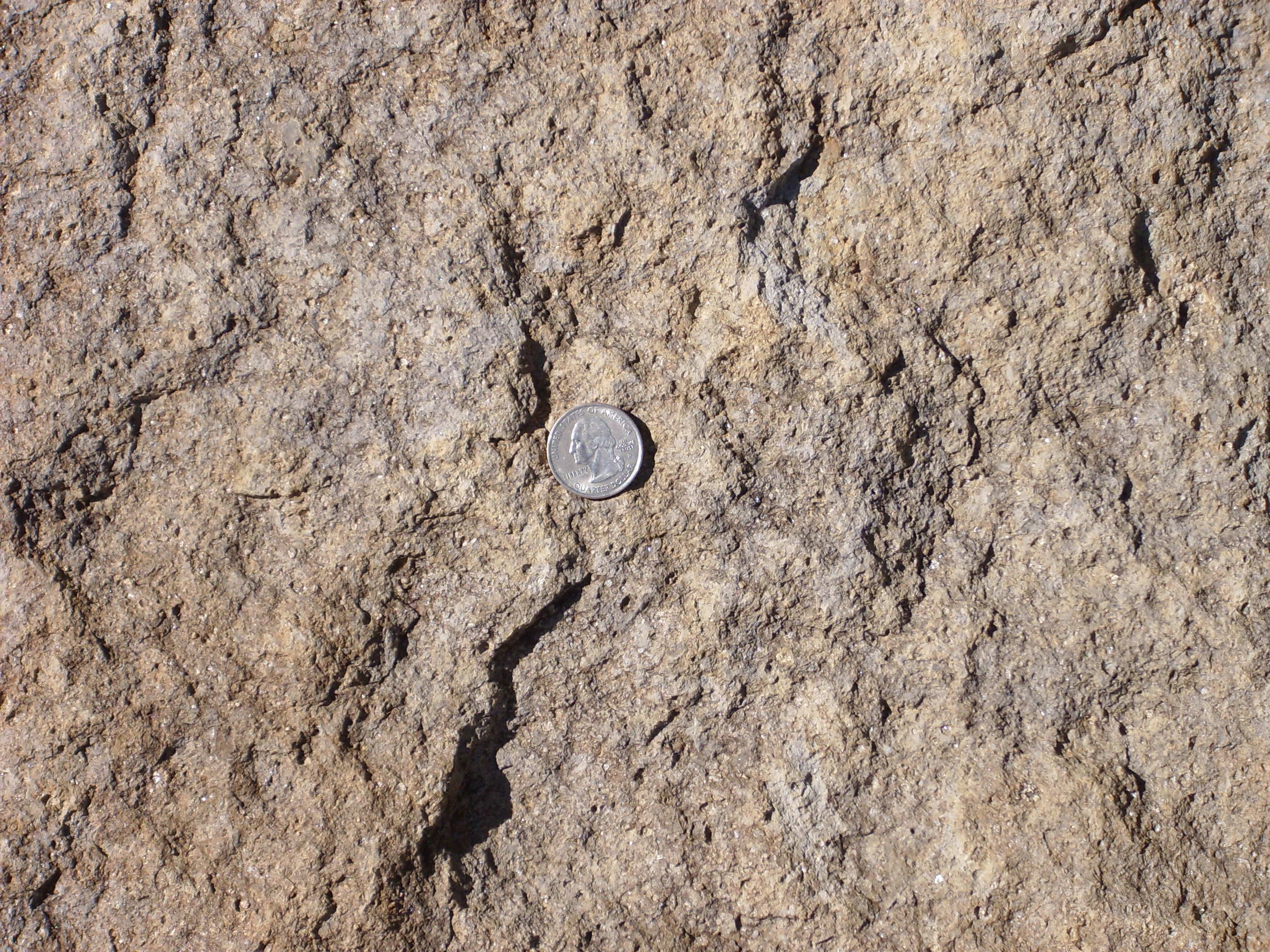
Here's a sample of Otowi Member up close. This comes from an outcropping along 31 Mile Road.
Sample of Otowi Member from Thirtyone
Mile Road
The sample contains abundant phenocrysts of quartz and sanidine
(alkali feldspar). The Otowi Tuff contains up to 30% of such
phenocrysts.
Another exposure of the Otowi Member and its contact with the
Tshirege Member is found in Ancho Canyon along State Road 4
between White Rock and Bandelier National Monument.
Road cut in Bandelier
Tuff. 35
47.322N 106 15.405W
The lower, pinker beds are Otowi Member, while the upper beds are
Tshirege Member. There is about a foot of pumice at the base of
the Tshirege Member. This is the Tsankawi Pumice, which we'll
revisit shortly.
As one hikes down the trail on the south side of Pueblo Canyon onto the talus slope, one sees that it is deeply mantled with soil.
Colluvium on south wall of Pueblo
Canyon. 35
52.890N 106 15.945W
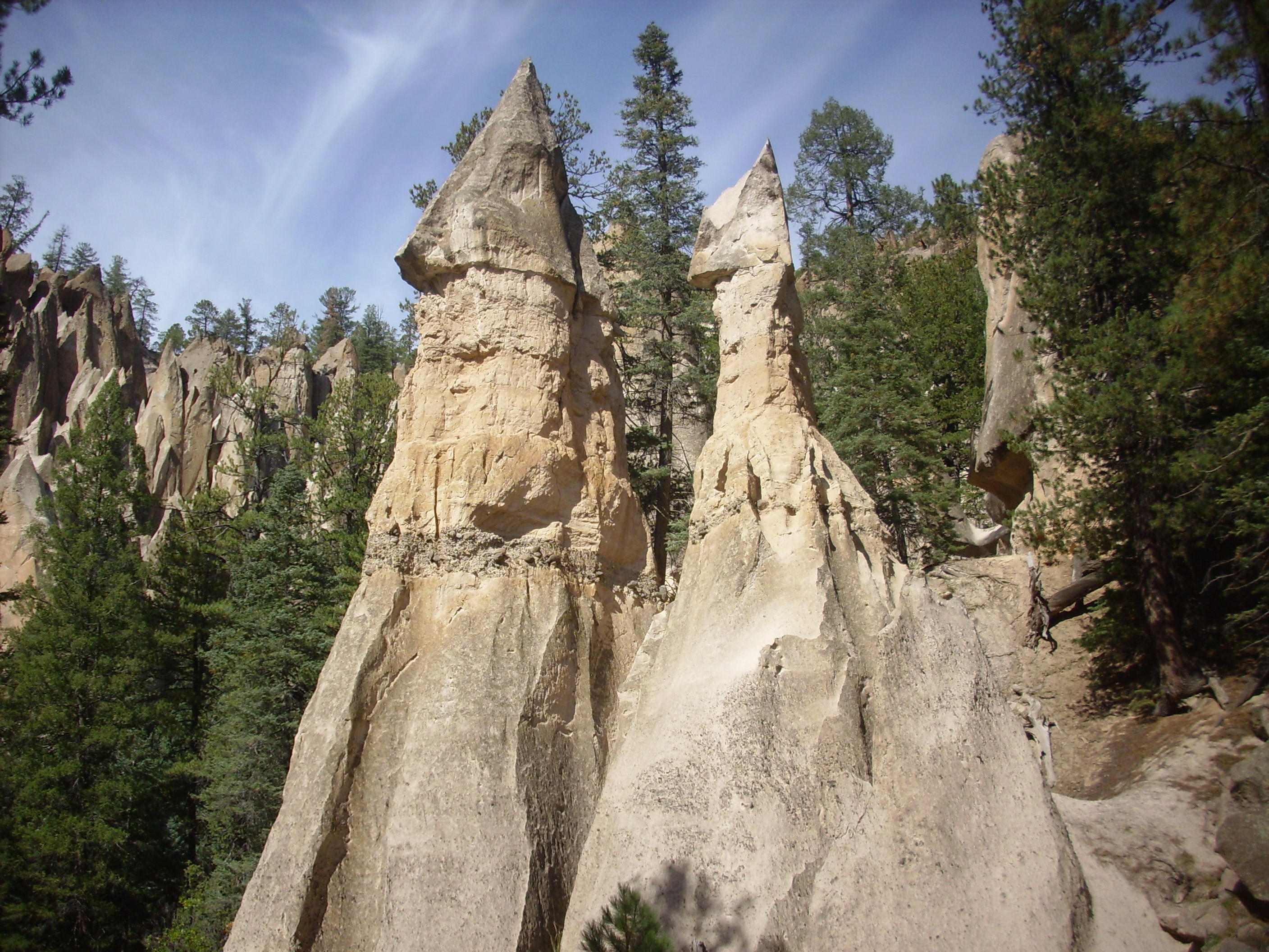
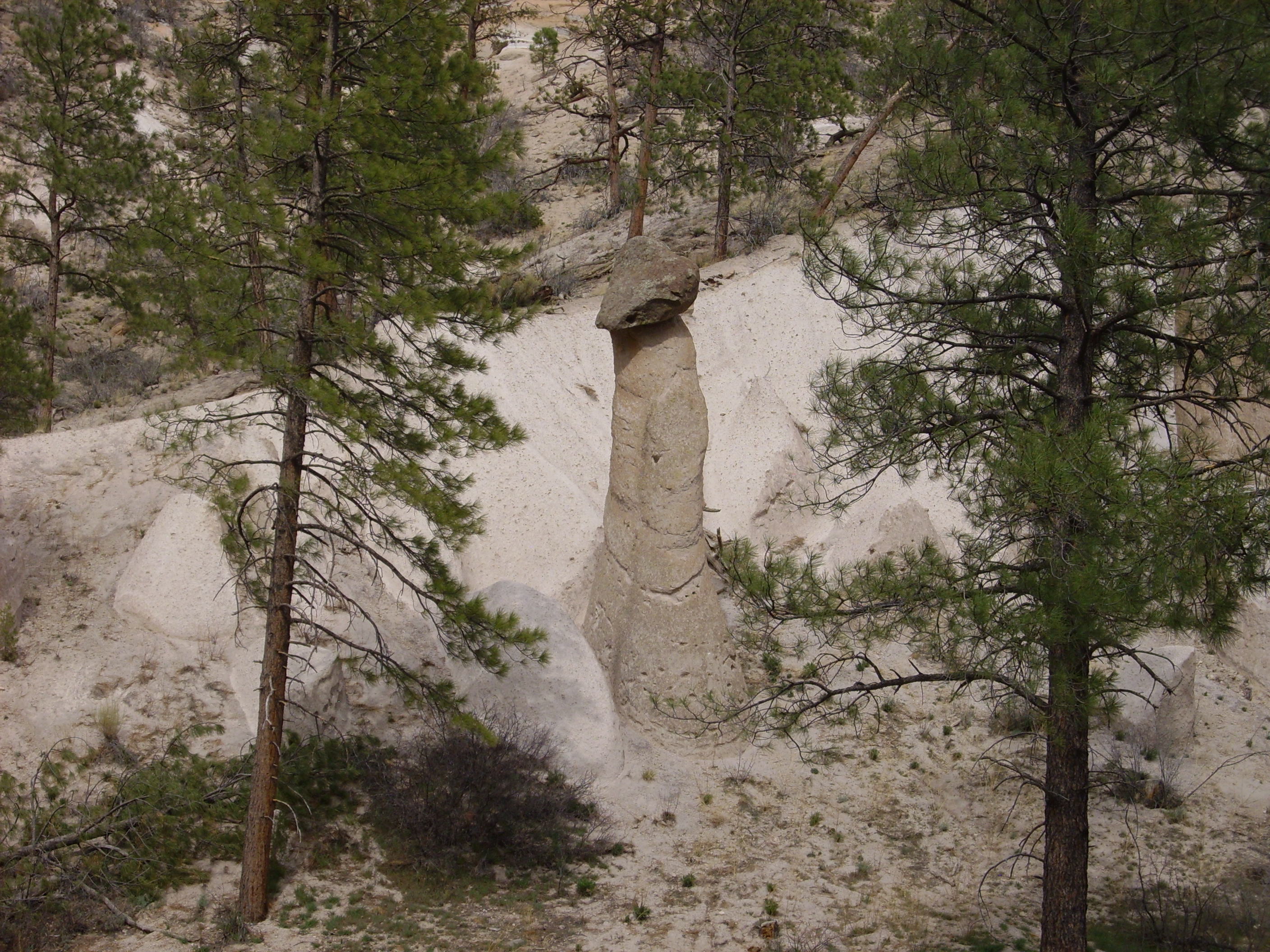
But one of the attractions of the canyon is the hoodoos and tent
rocks that are found typically at the base of the mesas. These are
eroded out of the Otowi Member.
Examination of the eroded bank of this slope shows that it's
clearly solid tuff, with few signs of bedding or any other
indications that this is reworked volcanic sediments rather than
an original pyroclastic flow.

To be sure, there are no signs of welding, but the Otowi Member of the Bandelier Tuff is generally not welded in the Los Alamos area.
Tent rocks seem to be a common feature of the Otowi Member. Other prominent outcroppings showing tent structure are found in Guaje Canyon below its confluence with Rendija Canyon
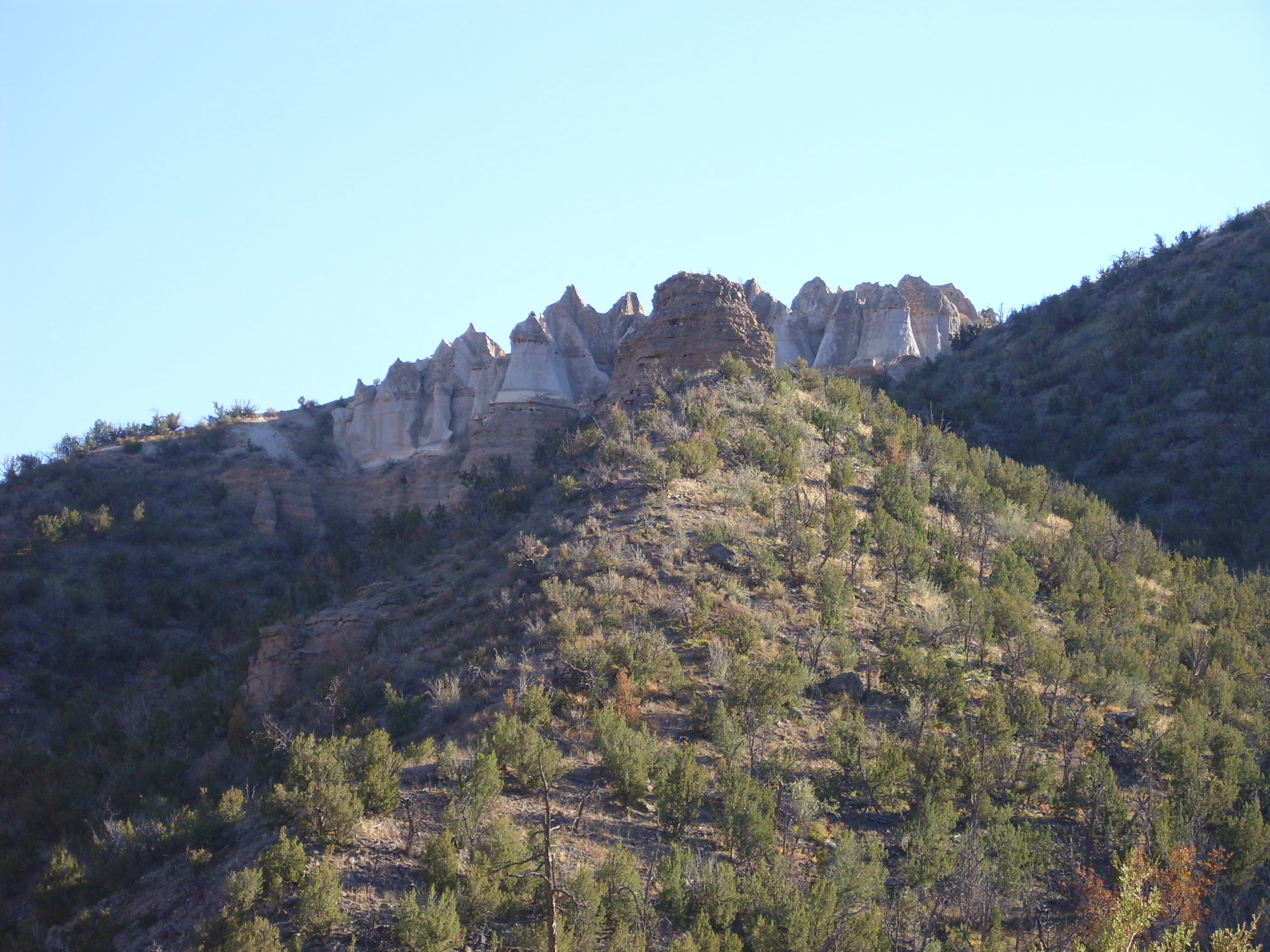
Hoodoos in Otowi Member, Bandelier Tuff. 35.904N
106.210W
in Canon de San Diego
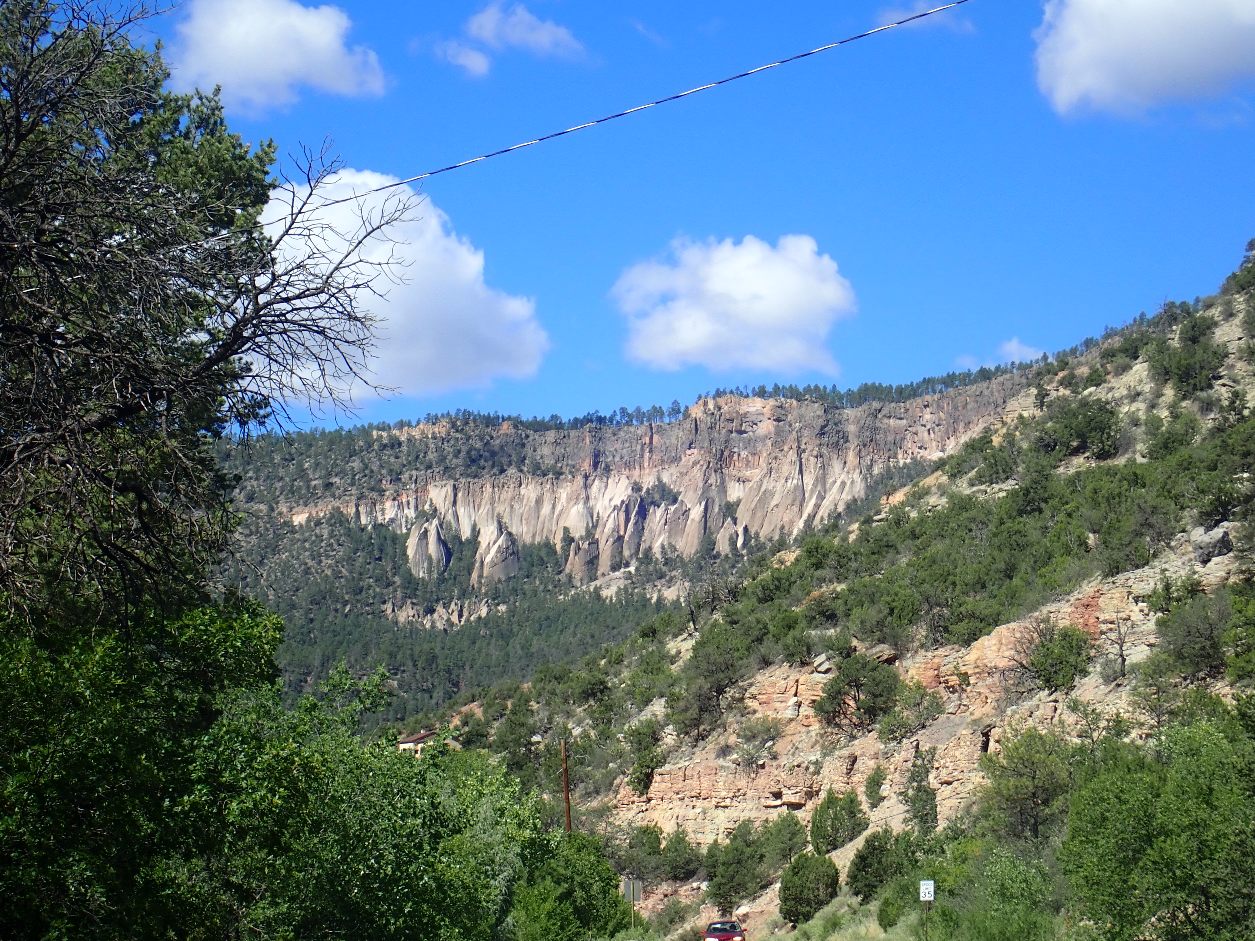
Tent rocks in Otowi Member, Bandelier Tuff. Looking
southwest from near 35
48.383N 106 40.872W
and in Valle de los Indios on the southwest caldera rim.
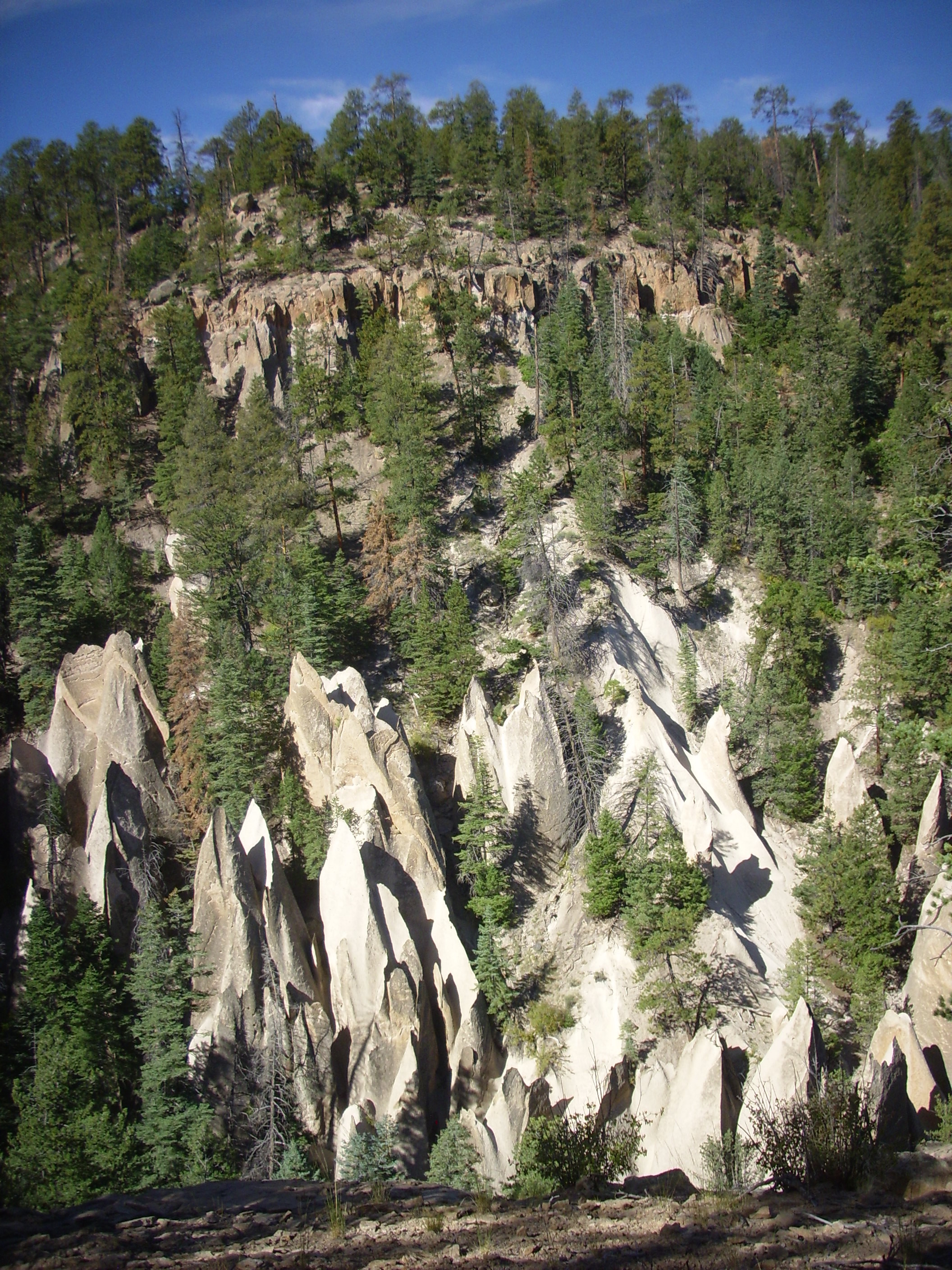
The entire thickness of the tuff beds in the last photograph,
including the skyline, is Otowi Member, with no overlying Tshirege
Member. The flows at top appear to be more welded than those
further down. This is no accident; the higher beds came from the
deeper and hotter portions of the magma chamber.
Some of the most distal surviving deposits of the Otowi Member are found to the southeast of the Jemez. These include deposits cut by the highway near the Cochiti golf course.
Otowi Member near Cochiti Golf Course. 35 39.727N 106 21.117W
The area between Aspen Ridge and the San Miguel Mountains was
relatively low ground before the Toledo Event, and the pyroclastic
flows of the Otowi Member are particularly thick and extensive
here. One tongue of the eruption made it across the Rio Grande,
where it was subsequently buried by the youngest dacite flows of
the Cerros del Rio about 1.3 million years ago.
As the magma chamber emptied, the roof of the magma chamber began to collapse. This led to deposition of ash flow tuff beds rich in lithic clasts close to the caldera. In the exposures closest to the ring fracture, there are beds of lag breccia associated with caldera collapse. Some of the best exposures showing these lag breccias are in upper Cochiti Canyon.
Lithic beds of Otowi Member. Looking nortthwest from 35
45.999N 106 25.150W
The ring fractures from the Toledo caldera and, later, the Valles
caldera are today deeply buried under younger sediments and flows.
However, there are other locations in the Southwest where erosion
has exposed the ring fractures of older calderas, and this allows
us to study their structure. One such ring fracture zone is
exposed in Red River Canyon west of Questa, New Mexico.
Rhyolite dike swarm marking ring
fracture zone of Questa caldera. 36
40.866N 105 30.985W
The jagged rocks along the cliff are rhyolite dikes marking the
ring fracture zone on the south side of the Questa caldera. These
run parallel to the highway for a considerable distance.
With the collapse of the magma chamber, the eruption drew to a
close. The steep rim of the newly-formed caldera was unstable and
soon collapsed onto the caldera floor. Erosion further wore down
the rim and deposited new beds of sediments in the caldera. Quite
likely one or more crater lakes formed. However, the traces of all
these events were obscured by the subsequent Valles eruption.
The Toledo event coincided roughly with the arrival of the first
mammoths in New Mexico. These large relatives of modern elephants
mostly disappeared at about the time humans arrived in North
America, which most paleontologists do not see as a coincidence.
The last mammoths are thought to have survived on Wrangel
Island in the Russian Arctic until about four thousand years
ago.
The Toledo event produced the first giant caldera in the Jemez
region. However, the subsequent Valles event obscured much of the
geological record of the Toledo event and the subsequent Toledo
Interval, and geologists must search for clues to the size and
location of this caldera. One reconstruction of the likely
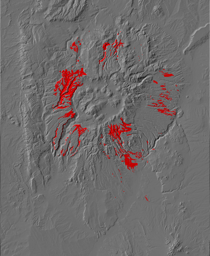
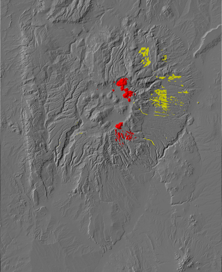
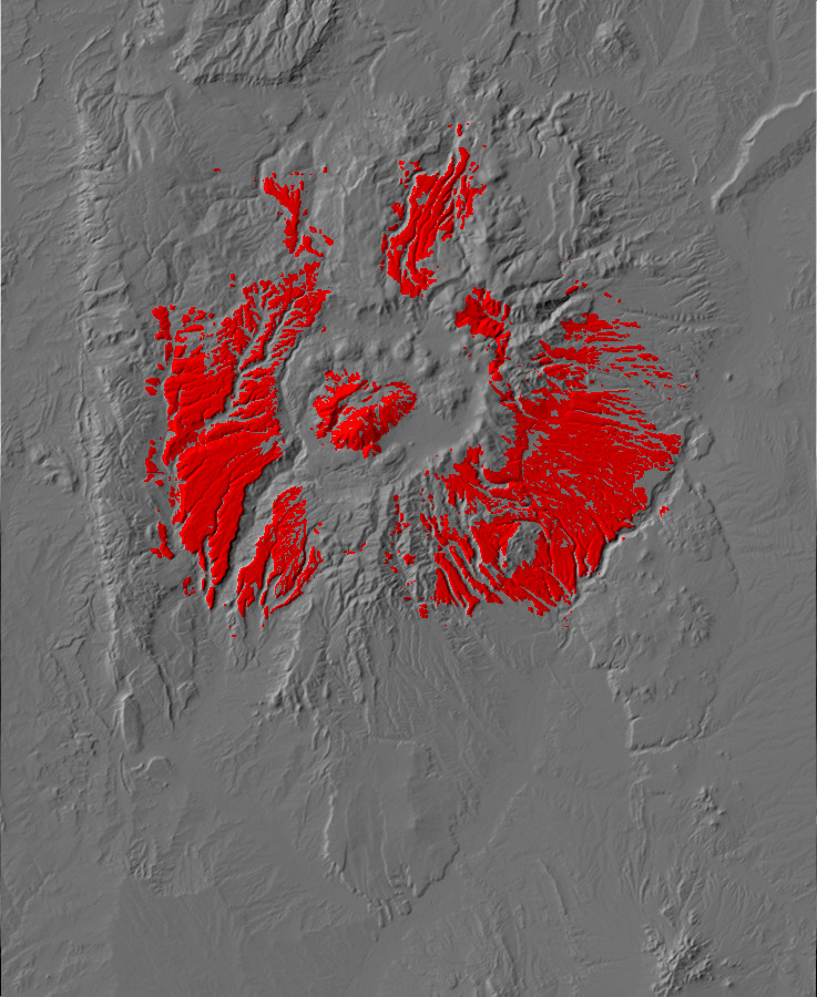
location of the Toledo ring fracture is shown below.
Reconstruction of Toledo ring fracture
(dashed red) with Toledo Embayment (dashed yellow) and Cerro
Toledo domes (circled in red.)
The red dotted line shows the likely location of the main Toledo
Event ring fracture, while the solid circles identify ring
fracture domes.
The formation of a caldera in a supervolcanic eruption leaves a considerable amount of high-silica lava still underground, with a natural route to the surface through the ring fracture along which the caldera floor collapsed. The remaining magma is likely to be lower in gas content than before the caldera eruption, and it tends to erupt effusively rather than explosively through the ring fracture. Such eruptions localize at a single point along the fracture where the path to the surface is the most clear. The result is that a rhyolite dome forms around a vent located on the ring fracture.
Once the energy of the eruption is spent, the vent is plugged with solidified rhyolite and overlain by the mass of the dome itself. This effectively seals the ring fracture in the immediate vicinity of the dome. If magma is still being injected into the old magma chamber, which seems to be a frequent occurrence with supervolcanoes, then the next eruption must come through a different part of the ring fracture. The result is that individual dome complexes will line the ring fracture almost like beads on a wire. We will see superb examples of this in the aftermath of the Valles event.
The ring domes produced by the Toledo event have been largely destroyed by the subsequent Valles event. However, some remnants of domes remain, and it is largely from these remnants that the location of the Toledo ring fracture has been inferred. In the previous photograph, the red circles show rhyolite domes or remnants of domes dating between the Toledo and Valles events, which have been assigned to the Cerro Toledo Formation. Those close to the ring fracture are interpreted as ring fracture domes. These are, starting from upper left, a small unnamed dome dating back 1.59 million years; the small Warm Springs dome dating back 1.26 million years; the Cerro Transquilar dome at the east margin of the Toledo Embayment, dating back 1.36 million years; the West and East Los Posos domes dating back 1.54 and 1,45 million years; and, to the south, the Rabbit Mountain dome (1.43 million years) and Paso del Norte (1.47 million years) domes. Rabbit Mountain is likely the southern remnant of a much larger dome, most of which foundered into the subsequent Valles caldera along with other Toledo ring fracture domes.
The identification of the small, unnamed dome furthest to the
northwest as a Toledo ring fracture dome is questionable. Its age
is nearly indistinguishable from that of the Toledo event itself,
and the most recent geologic map of the area maps it as Otowi
Member. The dome at Warm Springs is nearly the same age as the
Valles Event, but its location well outside the Valles ring
fracture supports its identification as a remnant of a Toledo ring
fracture dome. The domes in and near the Toledo embayment and the
Rabbit Mountain and Paso del Norte domes seem beyond question,
showing that Toledo caldera extended at least across the
eastern half of the present Valles caldera.
The Cerro Trasquilar dome is accessible by passenger vehicle with
a Valles Preserve back country permit.
Cerro Trasquilar. From near 35
58.310N 106 31.102W
This small dome is parked right in the middle of the moat, outside the ring of larger domes that mark the Valles ring fracture. Its age from radioisotope dating (1.36 million years) reveals that Cerro Trasquilar is a remnant of one of the domes that likely formed over the ring fracture of the earlier Toledo caldera. There is some disagreement over the naming here; geologists have generally referred to this small dome as Cerro Trasquilar and the much larger, younger dome complex to the south as Cerro Santa Rosa, but the Forest Service topographic map identifies the entire complex as Cerro Transquilar and the dome immediately to the south as Cerro Santa Rosa.
The dome is composed of rhyolite.

Cerro Trasquilar Rhyolite. 35.9663876N
106.491122W
Cerro Trasquilar Rhyolite. 35
58.310N 106 31.102W
On the east side of Cerro Trasquilar, the visitor reaches the end
of Pipeline Road, or at least of that part of Pipeline Road that a
back country permit gives one permission to drive. The road
continues on through the Sierra de los Valles to Los Alamos, a
drive I'd very much like to take someday. Here is a
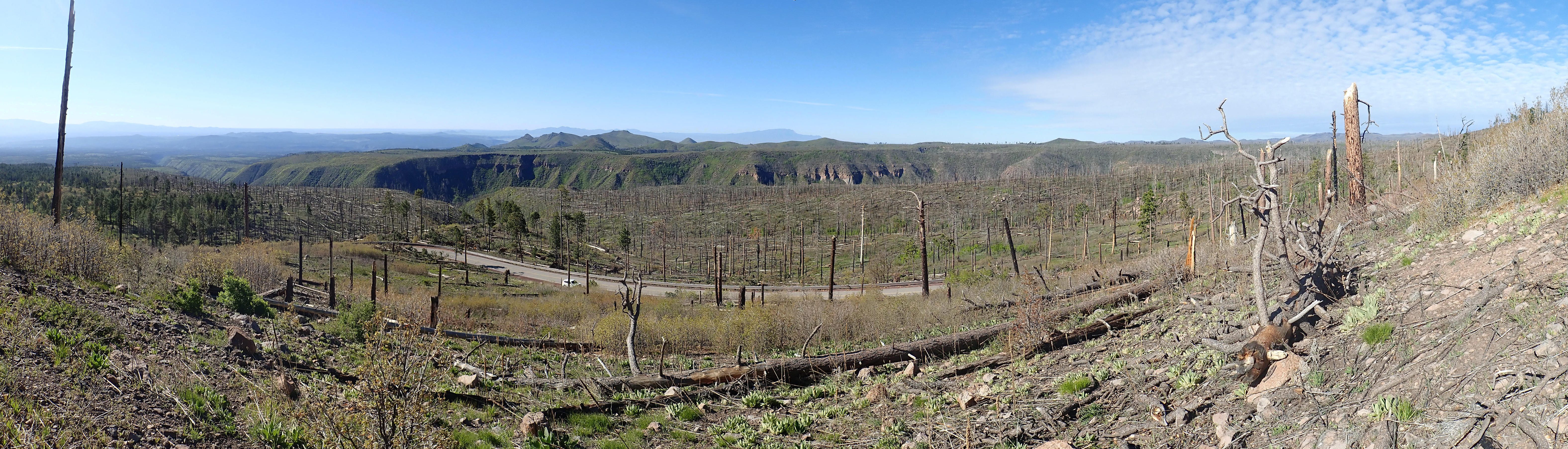
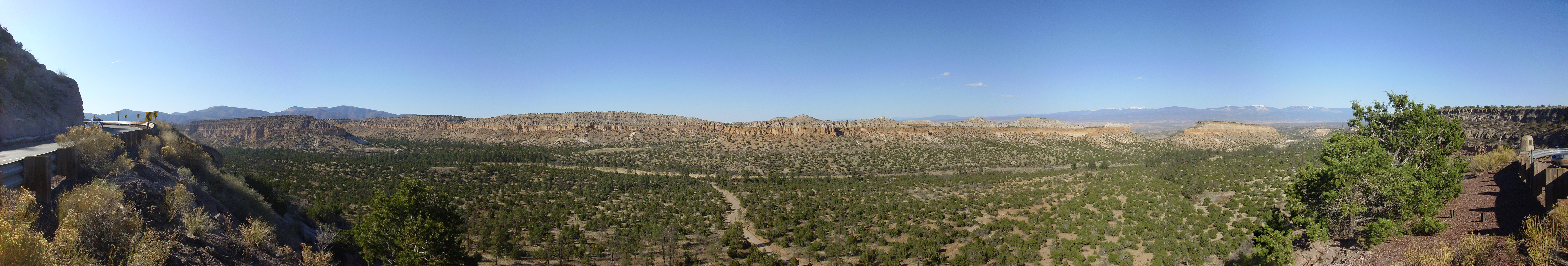
panorama:
Valle Toledo panorama. 35
57.461N 106 28.890W
The panorama starts at the soutwest, looking towards the Cerro
Santa Rosa complex. The dome known by area geologists as Santa
Rosa II is prominent to the right of the vehicle park, while the
Cerro Trasquilar dome is north of the access road, with the north
caldera wall beyond. The gentle slope in the foreground is an old
stream terrace.
Turkey Ridge forms the skyline dominating the center of the panorama. This dome complex is about 1.38 million years old and fills the mouth of the Toledo Embayment, an odd feature of the caldera whose interpretation geologists have not been able to fully agree on. It looks like a pocket in the northeastern topographic rim of the caldera that is full of rhyolite domes, all between 1.33 and 1.45 million years old, but it is not clear what would cause this. The two leading theories are that it is a structural feature, formed by deep faulting that connects the Redondo Graben to the Escondido Fault Zone north of Espanola; or that it is an extension of the Toledo caldera to the northeast. The two are not mutually incompatible. The notion that this is the remnants of the caldera from which the Otowi Member was erupted -- the Toledo caldera -- is no longer accepted, but a few geologists think it may be the caldera from which the La Cueva Member of the Bandelier Tuff was erupted.
The dome on the right, north of Pipeline Road as it continues east. is the nearest dome of Cerros de los Posos, age 1.54 million years, which is thought to be another remnant of the domes of the Toledo ring fracture. It is also composed of rhyolite.
West Posos rhyolite. 35.9438127N
106.4460444W
Some of the West Posos rhyolite is spectacularly vesicular.
West Posos vesicular rhyolite. 35.9400377N
106.4368801W
The Rabbit Mountain and Paso del Norte dome complex is the most
accessible of the Cerro Toledo dome complexes. Rabbit Mountain
forms much of the southeast rim of the caldera, its lower slopes
are crossed by State Road Four, and it is prominent on the skyline
as seen from the Valles Preserve headquarters.
This is looking southeast across the Valle Grande towards the caldera rim.
The Paso del Norte Dome is accessible from Forest
Road 36 south of State Road 4, from which one gets an
excellent view of the dome.
Del Norte dome. Looking southwest from. 35
49.603N 106 28.551W
The dome can be climbed by a short but strenuous hike from a pullout here. Be advised that there is no trail and the dome is steep and heavily overgrown with thorny shrubs. However, the top of the dome shows excellent exposures of Del Norte rhyolite and a view (through the trees) of nearby Rabbit Mountain.
Paso Del Norte dome summit. Looking northeast from. 35
49.236N 106 28.735W
Paso Del Norte dome and the southern flank of Rabbit Mountain are on National Forest land just south of the preserve, so I took a sample.
No individual crystals are visible even under the loupe;
the rock is completely aphanitic.
The Del Norte dome is well outside the actual south caldera rim.
Like Rabbit Mountain, it was part of a much larger dome to the
northwest that foundered into the Valles caldera, leaving a small
remnant overlying the precaldera rocks of the south rim.
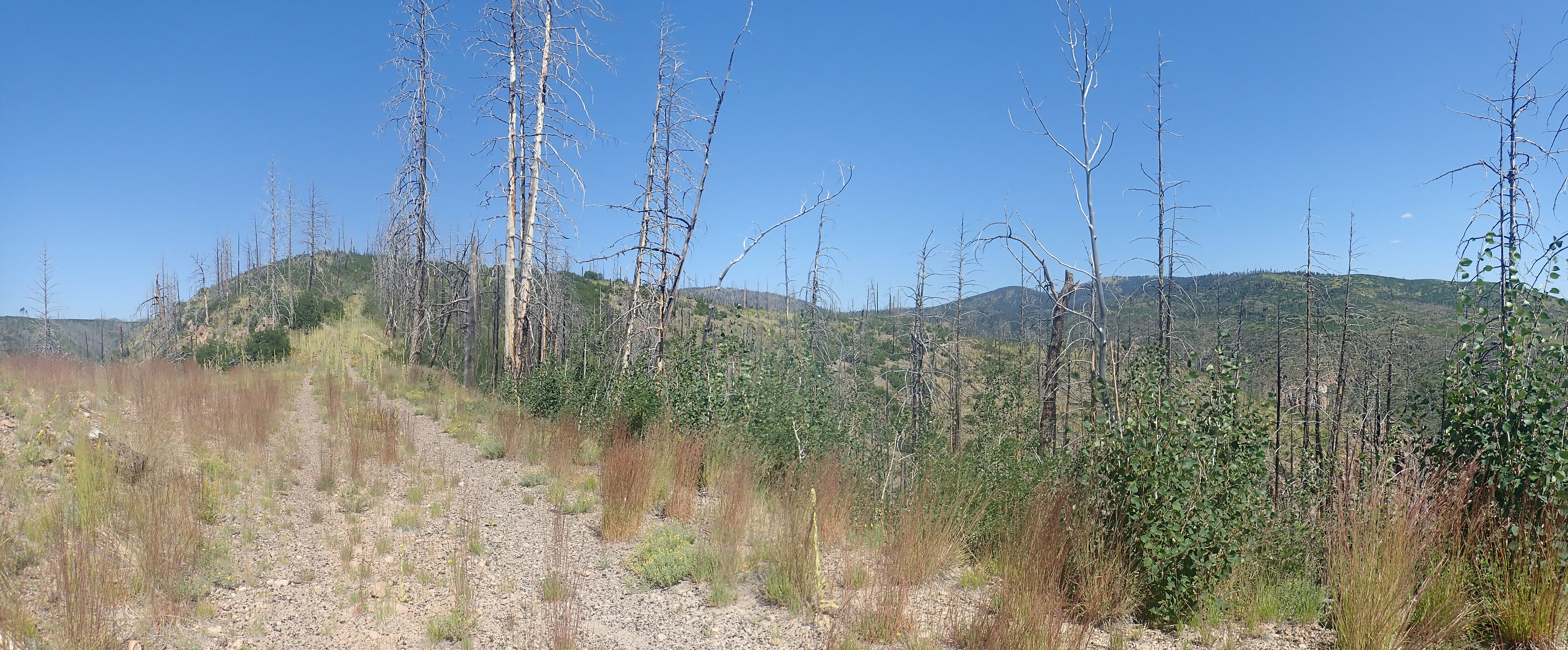
Rabbit Mountain is accessible via the Coyote Call Trail of the
Valles Preserve. The trailhead is a
small pullout from State Road 4. Visitors should be aware
that the parking is very limited here, though the trail requires
no use fee. The hike itself is not particularly difficult nor
lengthy except where downed trees force a detour. The latter seems
to be a common problem throughout the Valles preserve, a
consequence of recent forest fires in the area rather than any
lack of diligence on the part of the Preserve staff.
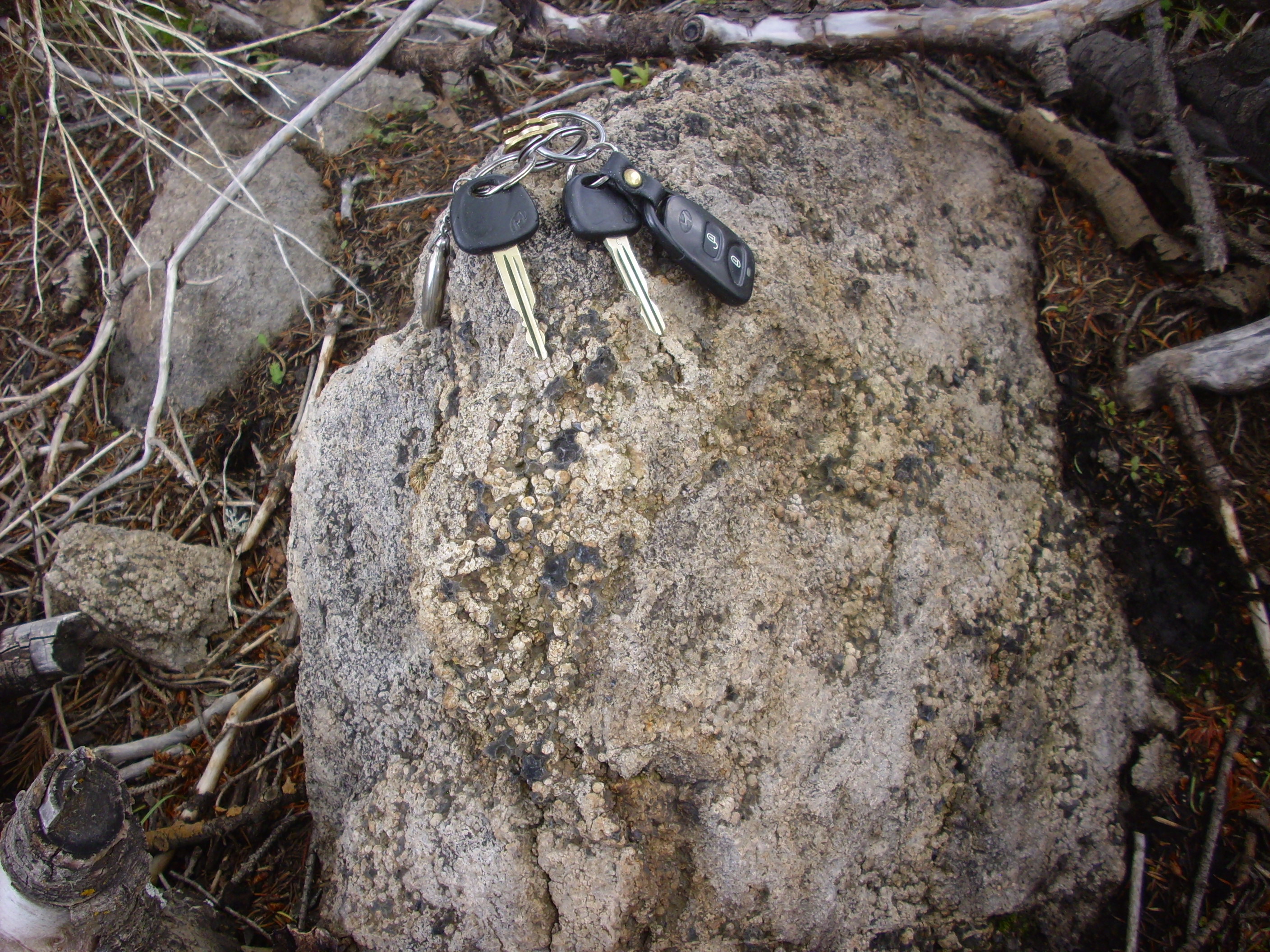
The rhyolite on the north flank of Rabbit Mountain is quite different in character from the rhyolite of the Paso del Norte dome. It is generally darker, with no hint of the purple discoloration, and one can understand why earlier geologists mapped the Paso del Norte dome as Bearhead Rhyolite until radioisotope dating showed it to be much younger (1.47 million years), only slightly older than the Rabbit Mountain rhyolite. I am struck by the peculiar surface texture of some of the rhyolite clasts:
Rabbit Mountain rhyolite. 35
50.578N 106 27.648W
The peculiar bark-like texture might be a weathering surface, but it seems more likely this is a cooling surface of a flow. Such textures are occasionally seen in basalt flows and are described as spiny pahoehoe. Here's a photograph from a very young basalt flow at Craters of the Moon National Monument in Idaho:
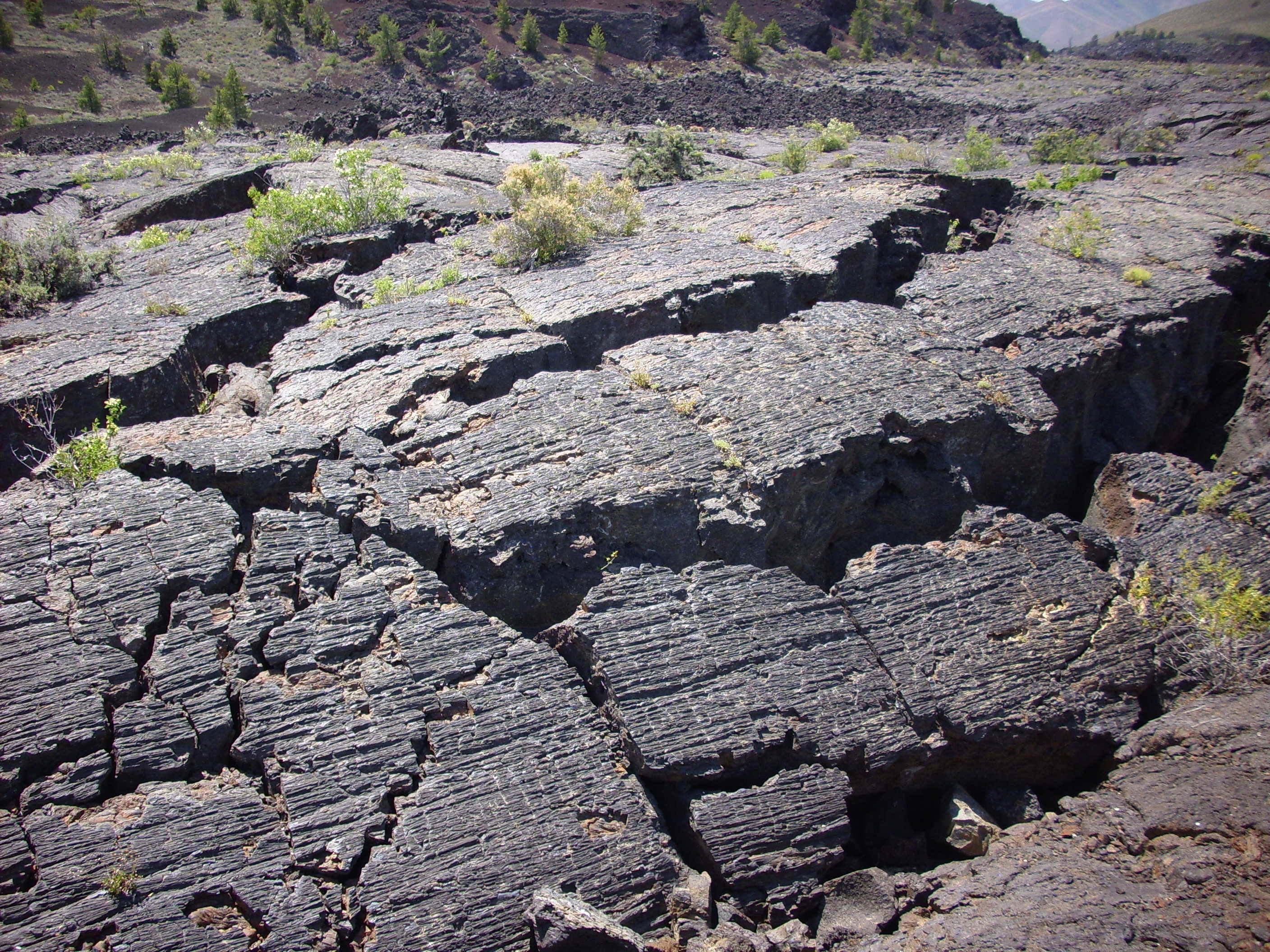
In both cases, these textures were probably produced here by stretching of the partially solidified surface.
Another feature of the mountain is occasional outcrops that show
a distinctive tan color and coarser texture, almost resembling a
sandstone. Examination under the loupe shows that this is
crystalline rock. There is no sampling here on the Preserve and a
large-scale photograph does not do the outcrop justice.
A distinctive feature of Rabbit Mountain is the presence of
significant quantities of obsidian in the rhyolite flows.
Rabbit Mountain rhyolite. 35
50.807N 106 27.190W
Obsidian is volcanic glass. It forms from magma that is cooled so rapidly that the atoms freeze into a tangled mess before they can arrange themselves into a regular crystal structure. Volcanic glass is relatively uncommon in subaerial mafic rocks, which because of their lower viscosity require very rapid chilling to form glass, but it is quite common in felsic rocks. In fact, some geologists believe that almost all extrusive felsic rocks start off as volcanic glass, which slowly devitrifies over geologic time as the atoms gradually work themselves into a regular crystalline arrangement. If this is true, then it is possible that the entire boulder here was once obsidian, which has now devitrified to the point where only a few thin layers of obsidian remain.
Weathering has released a considerable number of small obsidian nodules from the rhyolite at some locations along the trail.
Obsidian nodules in the trail. Click to enlarge. 35
50.765N 106 27.135W
It is not uncommon for obsidian to weather out of formations as small nodules, and these are sometimes called "Apache tears", based on a number of native American legends. It surprises me that obsidian would weather more slowly than devitrified rock, but it seems to be the case.
One piece of evidence for widespread devitrification of obsidian flows is the presence of spherulites.
Spherulites near northeast summit of Rabbit Mountain.
Click to enlarge. 35
50.771N 106 27.180W
Spherulites are characteristic of volcanic glasses, but one can see that a great many of the spherulites here have devitrified.
Rabbit Mountain was large enough to experience several episodes
of dome collapse. This produces a form of pyroclastic flow
described as a glowing avalanche. The steep face of the
dome becomes unstable as it is pushed out from within by fresh
magma entering the interior of the dome, and the face collapses in
a landslide. The magma beneath, depressurized by the removal of
the overlying rock, disintegrates into hot gas and volcanic ash.
This mingles with the larger clasts of the original landslide to
form the glowing avalanche, which can travel for miles. This is
similar to a block and ash flow, but with a smaller proportion of
ash, so that the flow is not as thoroughly cemented.
One such glowing avalanche deposit is found along the Dome Road south of Graduation Flats.
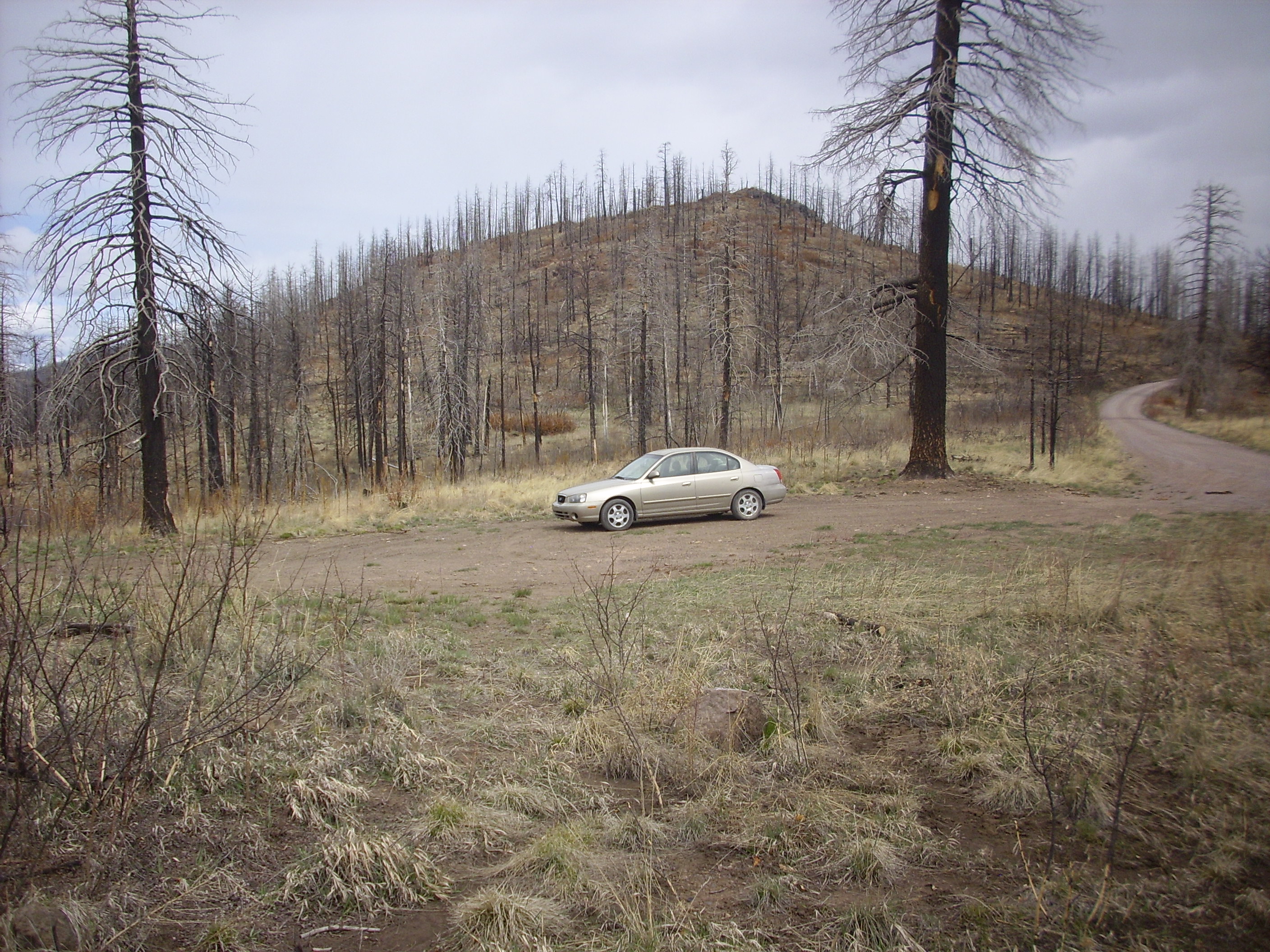
Pullout atop Rabbit Mountain debris flow. 35
47.537N 106 25.174W
The pullout and the area around it are underlain by glowing avalanche deposits from Rabbit Mountain, which is over five kilometers (three miles) to the northwest. Such avalanches occurred at least three times from the southeast flank of the dome, forming the surface on which my car is parked. (The dome in the background is an older dacite dome, which we visited several chapters back.) The ground surface shows numerous clasts of rhyolite and obsidian.
Rabbit Mountain debris flow. Pencil for scale. 35
47.537N 106 25.174W
Here are samples of a couple of larger obsidian fragments.
Obsidian of Rabbit Mountain debris flow. Pencil for
scale. 35
47.537N 106 25.174W
These chunks are about three inches long. The fragment on the
right shows flow banding. Both are weapons grade, suitable for
manufacturing arrowheads and other tools. There is abundant
archaeological evidence of widespread trade of Jemez obsidian
throughout the Southwest.
The flow is also exposed at Obsidian Ridge, a knife ridge separating Alamo Canyon from Frijoles Canyon. Here the overlying cap of Tshirege Member has been locally stripped away to expose the obsidian-rich debris flow.
Obsidian Ridge, Looking south from 35.8284973N
106.393654W
At center are prominent white cliffs of Bandelier Tuff; these are at the west end of Mesa del Rito. Right of the spur at center right is Sawyer Mesa. The ridge connecting the two is Obsidian Ridge. This can be reached via an easy hike from the wilderness boundary.
Obsidian Ridge, 35.8284973N
106.393654W
The knoll left of center is the cap of Tshirege Member on Sawyer
Mesa. The foreground road cross the knife ridge, which is
underlain by broken rhyolite and obsidian of the debris flow. This
is the toe of the flow, located a distance of six km (four miles)
from Rabbit Mountain.
A similar avalanche deposit is found south of Rabbit Mountain. This flow is thought to have come off the Del Norte dome.
Del Norte debris flow. 35
48.5785N 106 27.897W
This is almost entirely devitrified, with little or no obsidian.
Like Cerro Trasquilar, the Warm Springs dome is accessible by
passenger vehicle with a Valles Preserve back country permit.
There actually are warm springs here, with an old bath house
dating from the time when the Valles Caldera was owned privately
as a single large ranch. The bath house is decorated with cow
skulls; I assume as a warning to other cows.
Warm Springs. 35
58.328N 106 33.631W
The small hill west of the bathhouse is the dome. Its radioisotope age is just a hair more than the Tshirege Member of the Bandelier Tuff, 1.26 million years. It is interpreted as a dome on the Toledo ring fracture that was formed just prior to the Valles event. In the background is Cerro Seco, a Valles ring fracture dome.
Dome eruptions tend to produce pumice fall beds over a significant area downwind, and the Cerro Toledo domes laid down significant pumice beds on top of the Otowi Member of the Bandelier Tuff east of the Jemez. These have recently been formally assigned to the Pueblo Canyon Member of the Cerro Toledo Formation. One such series of beds is visible in the road cut of State Road 502 as it climbs the north side of Los Alamos Mesa, which we visited earlier. Let's take a look now at the Pueblo Canyon Member beds.

Pueblo
Canyon Member on State Road 502 ascending Los Alamos Mesa. 35
52.233N 106 13.390W
At bottom is the Otowi Member of the Bandelier Tuff. Above are a
pair of pumice beds of the Pueblo Canyon Member. Above these is
the basal Tsankawi Pumice and the lowest ash flow bed of the
Tshirege Member. Similar beds are particularly well exposed in
Pueblo Canyon north of Los Alamos Airport.

Bandelier Tuff in Pueblo Canyon. 35
53.182N 106 16.262W
The top three layers of the mesa (North Mesa) are units of the
Tshirege Member, Bandelier Formation. The topmost is partially
obscured by houses and trees on the canyon rim. The second layer
plunges into the canyon, and the third layer reaches to the
sloping ground at the canyon bottom in most places. These are
three flow units, erupted far enough part in time that each had
cooled slightly before the next was erupted on top of it.
At the center of this photograph, you see a narrow banded layer
with just a little of an eroded formation showing beneath it.
(Click on the photograph to see an enlarged version.) The
uppermost part of this banded layer is the Tsankawi Pumice, while
the lower portion is the Pueblo Canyon Member. The boundary
between the two is difficult to pin down at this distance.
So what we're seeing is tall, resistant mesas of Tshirege Member
sitting on top of low, gently eroded ridges of Otowi Member. This
is an excellent example of inverted topography. The
Tshirege Member settled preferentially in river channels and other
low points in the existing erosional surface of the Otowi Member.
Subsequent erosion preferentially eroded the Otowi Member, leaving
the more durable Tshirege Member as finger mesas coinciding with
the ancient river channels. Thus, the topography has been
inverted: What was the high points of the old surface are now the
canyons, and what was the low points are now the tall finger
mesas.
Going back to the photo of the north wall of Pueblo Canyon, one
can easily imagine the gentler slope showing the outline of the
Otowi topography, with a paleochannel near the center of the photo
which became partially filled with Cerro Toledo tephra. The
sediments might well have been unusually wet. The deposit of
Tshirege Member, Bandelier Tuff, on top would have vaporized the
water, account for what look like vapor phase pipes in the
Tshirege Member above the paleochannel. Vapor phase refers to all
the fluids that percolate through the pores of a rock bed, but
particularly when the fluids are very hot. Deposition of minerals
from the vapor phase can indurate the rock, and if the vapor phase
is mostly moving upwards along narrow channels, the result is
cylinders of particularly hard rock. We'll see an even more
striking example later in this chapter.
Here's another shot of the base of the Tshirege Member, where the Guaje Pumice and Pueblo Canyon Member have been deeply eroded.

Further up Pueblo Canyon, the Pueblo Canyon Member becomes still more prominent.
Pueblo Canyon Member in Pueblo Canyon. Looking north from 35.886623N 106.2972867W
The Pueblo Canyon Member fills the notch in the talus slope.
The most accessible exposure of Pueblo Canyon Member sediments is found south of the Los Alamos Golf Course, along a utility gravel road.
Pueblo Canyon Member in Pueblo Canyon. 35.890000N 106.3035585W
These are sediment-rich beds showing indications of deformation
from the nearby Rendija Fault. There may also be a disconformity
halfway up the beds, most obvious at left, though it is possible
this is bulldozer marks from construction of the gravel road.
The Cerro Toledo Interval is particularly thick in the area around Rendija Canyon and to its north. The area is underlain by hills rich with Cerro Toledo Interval pumice.

Soil rich in Cerro Toledo interval pumice. 35 54.766N 106 17.006W
There is a fine exposure of the Cerro Toledo Interval in the
canyon wall at the end of an unnamed spur of Cabra Canyon.
Cerro Toledo interval exposure in Cabra Canyon. 35 55.177N 106 17.664W
The uppermost half of the mesa is Tshirege Member, Bandelier Tuff, with a base of light-colored Tsankawi Pumice. Below this is a mixture of pumice, tuff, fluvial sediment, and paleosoil beds of the Cerro Toledo Interval. These appear to have accumulated in a paleovalley in the underlying Puye Formation; there is no Otowi Member of the Bandelier Tuff mapped anywhere in this area.
The next photograph show the east face of this exposure.

Cerro Toledo interval exposure in Cabra
Canyon. Near 35
55.157N 106 17.563W
There are a great variety of deposits here: a pumice-rich bed at bottom, followed by thin alternating ash-rich and pumice-rich beds likely reworked by streams, then a thicker pumice bed that is obviously eroded along its contact with a thick paleosol, then another pumice-rich bed at the very top of the photograph above the thick paleosol. Here's a closer view of the base of the paleosol.

Cerro Toledo interval exposure in Cabra Canyon. Near 35 55.157N 106 17.563W
There is a mixture of pumice and clasts of Tschicoma Formation dacite at the base of the paleosol, which strongly resembles the alluvium in modern drainage channels in this area. This transitions to a thick clay-rich bed with fewer clasts.
On the south side of the exposure, there is a cave eroded deeply into the paleosol layer.
Cerro Toledo interval exposure in Cabra Canyon. Near 35 55.157N 106 17.563W
The paleosol layer is particular susceptible to erosion, being very poorly cemented. It is likely that the caves seen in the cliffs in Pueblo Canyon in the photograph I showed earlier are in this paleosol layer.
This area is littered with fragments of rock from the cliff face.
These include large clasts of paleosol
Cerro Toledo interval clay in Cabra Canyon. Near 35 55.157N 106 17.563W
and pumice:

Cerro Toledo interval pumice in Cabra Canyon. Near 35 55.157N 106 17.563W
Note the reddish color on the freshly fractured surface. This has the appearance of hematite cement rather than clay, and it may represent mafic minerals in the pumice that have been oxidized.
A particularly well bedded pumice deposit is located further north along Cabra Canyon.
Cerro Toledo interval pumice in Cabra Canyon. Near 35.9177296N 106.2833866W
Finally, some purely sedimentary beds are assigned to the Cerro Toledo Interval. These include this gravel bed on 30 Mile Road, northwest of Espanola, that was deposited on top of Otowi Member.
Cerro Toledo interval gravel bed. 36 01.121N 106 13.867W
One can also see the contact between the Otowi Member and the
Tshirege Member in the southwest caldera wall south of La Cueva.
We saw exposures of the La Cueva Member in this area earlier in
this chapter.

Contact. Looking south from 35
52.029N 106 39.512W
The tan band is Cerro Toledo interval sediments, while the bed of
pumice is the Tsankawi Pumice that marks the lowest part of the
Tshirege Member. Here the Cerro Toledo beds are assigned to the
Virgin Mesa Member. They are distinguished from the Pueblo Canyon
Member by the absence of Cerro Toledo pumice and the presence of
Permian rock clasts. The Virgin Mesa Member is mapped in the
southern and western part of the Jemez whereas the Pueblo Canyon
Member is located to the east.
The satellite photograph near the start of this section shows a number of Cerro Toledo Formation domes northeast of the caldera that almost fill a large embayment in the older rocks of the Tschicoma Highlands and La Grulla Plateau. The largest of these is Cerro Toledo itself.
The northern portion of the embayment can be seen from the west slope of Tschicoma Peak.
Northern rim area of Cerro Toledo Embayment. Looking
west from
We are looking down the north rim of the Toledo Embayment just
left of center in the panorama. To its left on the skyline is La
Garita on the north caldera rim, and in the nearer distance is
Cerro Toledo. The very flat mountain on the distant skyline is San
Pedro Mountain. To its right comes the La Grulla Plateau, Cerro
Pedernal, and Polvadera Peak.
The earliest interpretation of the Toledo Embayment is that it
was the caldera from which the Otowi Member of the Bandelier
Formation was erupted, and this led to this event being named the
Toledo Event. However, as the previous reconstruction shows,
geologists now believe the main Toledo caldera was located nearly
in the same location as the subsequent Valles caldera.
Based on stratigraphy, the Toledo Embayment must have formed
between 2.3 and 1.5 million years ago. One interpretation is that
it formed slightly after the Toledo Event during eruption of Cerro
Toledo Formation domes. Another interpretation is that it formed
as part of the Toledo Event as a kind of offshoot of the main
magma chamber along Rio Grande Rift faults. A few geologists have
revived a version of the original interpretation, suggesting that
the Toledo Embayment was the source area for the La Cueva Member
of the Bandelier Tuff.
The latter interpretation gains support from gravity modeling of the caldera. Gravitational modeling begins with taking very precise measurements of the gravitational field at as many points as practical within the caldera. The structure of the caldera is then modeled on a computer, assuming one density for the basement rock, a somewhat lower density for old sedimentary beds, and a still lower density for Bandelier tuff and Valles rhyolite, which fill the interior of the caldera. The deep structure of the caldera is inferred by adjusting the depth of the various rock layers to match the gravity measurements.
In 1996, geologist D.A.G. Nowell carried out this procedure using gravity measurements published by another geologist, R.L. Segar, in 1974. The most interesting part of the model is the depth of the basement rocks relative to sea level, which presumably formed a more or less level surface before the caldera formed.
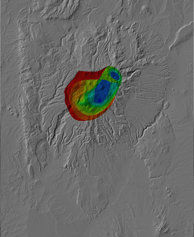
Relief map of the Jemez with inferred depth of basement
relative to sea level shown in color contours.
There are two striking aspects of this plot. First, the basement
under the Valles caldera did not sink evenly; the depth of
basement is much greater on the east side. I'll have more to say
about this later in this chapter. The other striking feature is
the indication that the Toledo Embayment coincides with a low spot
in the underlying basement rocks.
The interpretation of the Toledo Embayment as a small caldera from which the Culebra Member erupted is intriguing but has not attracted much support from most geologists. The most popular interpretation is still that it is an offshoot of the Toledo caldera that formed during or shortly after the Toledo Event.
A final possible clue is the presence of tuff plugs in the Toledo
Embayment that intrude the older domes but appear to be overlain
by Bandelier Tuff, which they do not closely resemble except in
age.
Toledo rhyolite tuff and plug. 35.938813N
106.3886205W
These plugs appear to fill the vents through which they erupted,
and the eastern one, shown here, includes solid rhyolite at its
base. Their radiometric age is actually slightly less than
the Tshirege Member, but field relationships suggest they are
slightly older. Further study of these plugs may shed light on the
nature of the Toledo Embayment or on the earliest stages of the
Valles Event.
While returning from the Colorado Plateau to Santa Fe with the
Macomb Expedition, John Newberry took time to ride into the Valle
Grande, becoming the first trained geologist to enter the Valles
caldera. He noted that it contained a number of small
mountain ranges separated by fertile valleys, identified the rock
in the cores of the ranges as granite, and remarked on the
"immense sheets and masses of trap" surrounding the area. These
"give an aspect to the scenery and a character to the geology
somewhat different from most of the mountain ranges visited on the
present expedition." The identification of the rock as granite was
not far off; the Bandelier Tuff and Valles Rhyolite are extrusive
counterparts of intrusive granite.
Newberry's report was the first of a long series of geologic
reports on the Valles caldera that have continued to the present
day, making the Valles event one of the most carefully studied in
the entire geologic record. By 1910, W. Lindgren and his
colleagues could write that the Jemez were a deeply eroded
volcanic cone that had stood 3400 meters (11,200') high and 24 km
(15 miles) in diameter, surrounded by a apron of rhyolite that was
16 km (10 miles) wide and 150 to 240 meters (500 to 800 feet)
thick. They concluded that this had erupted from a vent somewhere
in the vicinity of Redondo Peak.
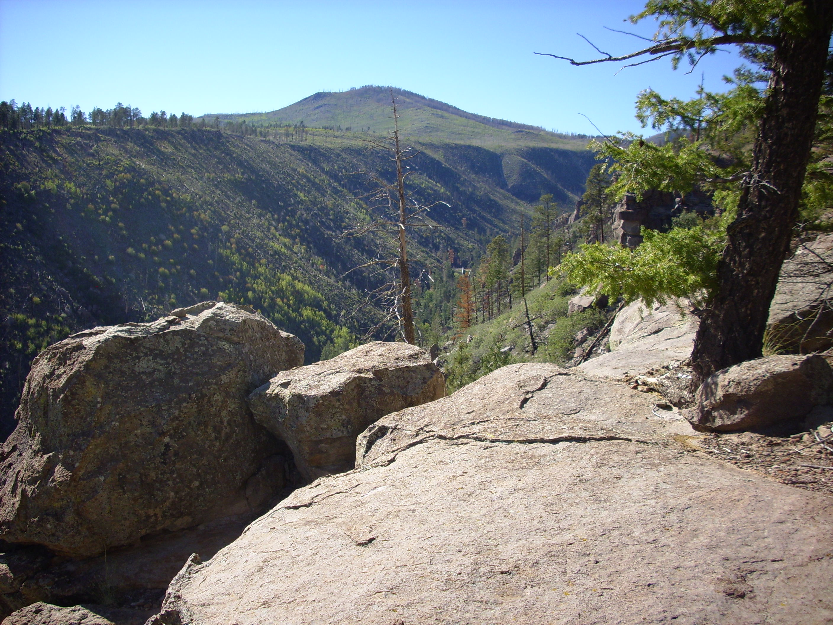
By 1.25 million years ago, what is now the Pajarito Plateau was a surface of relatively gentle relief. The White Rock basalt ridge still stood out, but the northern part of the valley to its west was filled with Otowi Member ash flows and the southern part was quite shallow. Stream valleys were typically 15 to 30 meters (50' to 100') deep, compared with over 300m (1000') for canyons today. Geologists have identified four such valleys in the Otowi surface. Because the Otowi Member is unwelded on this side of the Jemez, there were no towering cliffs on the rims of canyons.
The Jemez volcanic field as we know it today was largely shaped by the Valles Event 1.25 million years ago. This massive eruption produced the Tshirege Member of the Bandelier Formation, which is the iconic geological formation of the Los Alamos area.
Like the Toledo Event, the Valles Event emptied a magma chamber in which large quantities of gas-rich, high-silica magma had accumulated. This magma chamber likely nearly coincided with the Toledo magma chamber. As with the Toledo event, the Valles eruption was preceded by increased emissions of sulfur oxides, inflation of the volcanic field as magma rose beneath it, and, immediately before the eruption, seismic signals such as harmonic tremor. But the earliest precursor may have been the eruption of the Warm Springs dome, which we visited earlier. Eruption of this dome took place along the old Toledo ring fracture only a few thousand years before the Valles event.
The Valles Event resembled the Toledo Event, but with some significant differences. Not least of these is that much more of the Valles Event is preserved in the geological record.
Much like the Toledo Event, the Valles Event opened with the eruption of a convective column through one or more vents. However, while the Guaje Pumice is strongly concentrated directly east of the caldera center, the Tsankawi Pumice is spread more evenly around the caldera. It is thickest to the northwest, which suggests there was a mild breeze blowing from the southeast, but tells us little about the source vent locations. These are thought to have been near the center of the caldera. The eruptive column penetrated the jet stream, which carried ash as far north as western Canada.
A moderately thick bed of Tsankawi Pumice is exposed along State Road 126 on the way to Fenton Lake.
Tshirege Member along SR 126 to
Fenton Lake. 35
53.078N 106 40.963W
At bottom and at left is the Ojo Caliente Member of the Tesuque
Formation. The darker patch of rock at top left is Otowi Member,
Bandelier Tuff, as are most of the boulders in the middle layer.
Atop this is a bed of Tsankawi Pumice, and above that are surge
beds of the Tshirege Member.
A thin bed of Tsankawi Pumice can be found at the base of the Tshirege Member southwest of the village of White Rock.
Tshirege Member on paleosoil above
Cerros del Rio basalt. 35
48.649N 106 13.640W
The Tsankawi Pumice forms a very thin bed on the right side of
the photograph and pinches out on the left. This location is
almost directly southeast of the caldera, the direction from which
the wind was presumably blowing during most of the eruption. Thus,
the pumice fall was very scanty here. We've already seen similar
thin beds in Ancho Canyon and on
the north side of Los Alamos
Mesa.
One of the better exposures of the Tsankawi Pumice east of the caldera is in Rendija Canyon, northwest of the sportsmen's club.
Tshirege Member in Rendija Canyon. 35 54.655N 106 16.990W
The pink bed at bottom is Toledo Interval sediments. Above is the
Tsankawi Pumice, which consists of two beds separated by a very
thin fine ash layer (mostly eroded at this location to form a
pronounced notch.) Above are surge beds, which we'll discuss
presently. The Tsankawi Pumice beds are subtly present in
the exposure along Los Alamos
Mesa as well, where the upper bed is quite thin and the ash
layer separating it from the lower bed is no more than a slight
notch.
The Tsankawi Pumice can be distinguished from other pumices of
the Jemez area by a grayish color and the presence of needles of
hornblende.
After the initial stage of the eruption, in which the convective column deposited air-fall pumice and ash over a wide area, the eruption column collapsed to produce pyroclastic flows. Column collapse occurs when the eruptive column no longer entrains enough air to remain buoyant, but exactly what triggers this transition is uncertain. Perhaps the volume of the eruption increases to the point where enough air can no longer be entrained.
When the column collapses, a dense mixture of hot gases and ash flows out across the landscape as pyroclastic flows. These move steadily across the ground with little turbulence (laminar flow). They are often preceded by pyroclastic surges, which contain less ash and are much more turbulent, and these can deposit thin beds of fine ash that have such features as crossbedding. The previous photograph shows surge beds immediately above the Tsankawi Pumice, which is a frequent but not universal occurrence in the Tshirege Member.
A road cut on Dome Road shortly before it descends the Pajarito
Escarpment shows the contact between the Tshirege Member and the
underlying volcaniclastic beds of the Paliza Canyon Formation.
Contact in road cut. 35
42.800N 106 23.406W
There are surge beds in the Tshirege Member along the contact, and also near ground level to the left. The Tshirege Member is here a particularly vivid red, which may also be an indication of hydrothermal alteration.
Tshirege Member. Just north of 35
42.800N 106 23.406W
There are numerous bore holes here and in an outcrop on the other
side of the road, suggesting this rock has attracted attention
from geologists. I don't have any dates marked on my map for this
area, though a nearby andesite outcrop is dated to 9.33 million
years.
And next to the bore holes are some hash marks scratched crudely in the rock. Either this is some kind of Secret Geologist Language, or some non-geologist is less than overawed by the activities of scientists.
Pyroclastic surges were followed by pyroclastic flows. These
produced the bulk of the Tshirege Member of the Bandelier Tuff.
There are spectacular exposures of the Tshirege Member throughout
the Jemez area, but perhaps none are better known than those
visible from the Clinton P. Anderson Scenic Overlook on the south
rim of Pueblo Canyon.
Clinton P. Anderson Scenic Overlook. 35
52.391N 106 14.006W
The finger mesas visible here are all Tshirege Member resting on a base of Otowi Member, with the Otowi Member partially mantled with colluvium. Geologists have identified at least five separate units in the Tshirege Member, and some of these are clearly visible here. We'll discuss these units presently.
Before doing so, we'll take a tour around the Jemez of the Bandelier Tuff. The finger mesas east of Los Alamos continue west to the foothills of the Sierra de los Valles and underlie the entire Los Alamos town site. Geology around Los Alamos largely consists of climbing down into canyons to see what is below the Bandelier Tuff or climbing hills and mountains to see what is sticking up above the Bandelier Tuff. The entire terrain in the next photograph, except for the distant Sangre de Cristo Mountains, is Tshirege Member. At this location, close to the Sierra de los Valles forming the caldera's east rim, the Tshirege Member tends to be densely welded and darker in color than further from the caldera.
Los Alamos Canyon and Omega Bridge. 35
52.689N 106 20.615W
Tshirege Member near Camp May Road. 35
52.689N 106 20.615W Public
domain
Looking up Los Alamos Canyon from Camp May Road, we see that the Tshirege Member extends quite high up the Sierra de los Valles.
Tshirege Member in upper Los Alamos Canyon. 35
52.689N 106 20.615W
The canyon rim in the distance, above and left of center and left of the small peak, is the upper surface of the Tshirege Member. East of where this photograph was taken (behind the camera), the Tshirege Member is thrown down a substantial distance by the Pajarito Fault Zone. In the foreground, across the canyon, Tshirege Member sits directly on the Pajarito Mountain Member of the Tshichoma Formation, with no Otowi Member mapped bertween the two. Apparently any Otowi Member that was deposited in this area had eroded away in the 400,000 years between the two events.
Here's the view from the opposite (north) side of Los Alamos
Canyon at a different time of day. Los Alamos Reservoir is just
visible at the canyon bottom in the distance.
Tshirege Member in upper Los Alamos Canyon. Near
35 52.801N 106 20.292W
The section of Los Alamos Canyon between Los Alamos Reservoir and Omega Bridge is crossed by numerous strands of the Pajarito Fault Zone. Looking across the canyon to the north, one sees here two likely strands of the fault, showing as gullies with a slight displacement in the Tshirege beds.
Faults in Tshirege Member in Los Alamos Canyon. 35
52.689N 106 20.615W
The displacement here is not particularly great.
The finger mesas of the Pajarito Plateau also extend southeast to the White Rock area and Bandelier National Monument. In fact, the Tshirege Member takes its name from Tshirege ruins, an archaeological site of the Ancestral Puebloans located just northwest of the village. Prominent cliffs of Tshirege Member form the entire skyline north of White Rock.
Tshirege Member north of White Rock. Looking north
from 35
49.452N 106 11.072W
The cliffs here are the furthest eastern extent of the Tshirege
Member in this area. Here the mesas are thinner than to the north,
since they are underlain by the White Rock ridge of the Cerros del
Rio basalt.
Throughout the Pajarito Plateau, the Tshirege Member was erupted
onto a surface of relatively gentle relief, underlain in most
locations by low hills of the Otowi Member.
The furthest southeastern extent of the Bandelier Tuff is an outcropping filling an ancient meander of the Rio Grande that cuts into in the Cerros del Rio on the east side of White Rock Canyon. This outcropping may be responsible for the name of the canyon.
Tongue of Bandelier Tuff perched in
paleocanyon on the east side of White Rock Canyon. 35
47.214N 106 11.356W
Here's the same outcropping seen from near the mouth of Potrillo
Canyon, nearly to its west. We saw this in the last chapter.
The Bandelier Tuff rests on basalt of the Cerros del Rio
throughout the White Rock and Bandelier area. For example, there
is the outcrop southwest of White Rock we saw earlier.

Tshirege Member resting directly on Cerrros del Rio Basalt just west of White Rock. 35.811N 106.227W
This shows Tshirege Member, Bandelier Tuff, sitting on top of Cerros del Rio basalt. This is appears to be a high point of the Cerros del Rio surface. On the other side of the road, the basalt is exposed in the canyon wall descending into Potrillo canyon. There is no Otowi Tuff in this area; if it was ever deposited, it was completely eroded away before the Valles event.
Further south, near Powerline Point, the beds tell an interesting story.
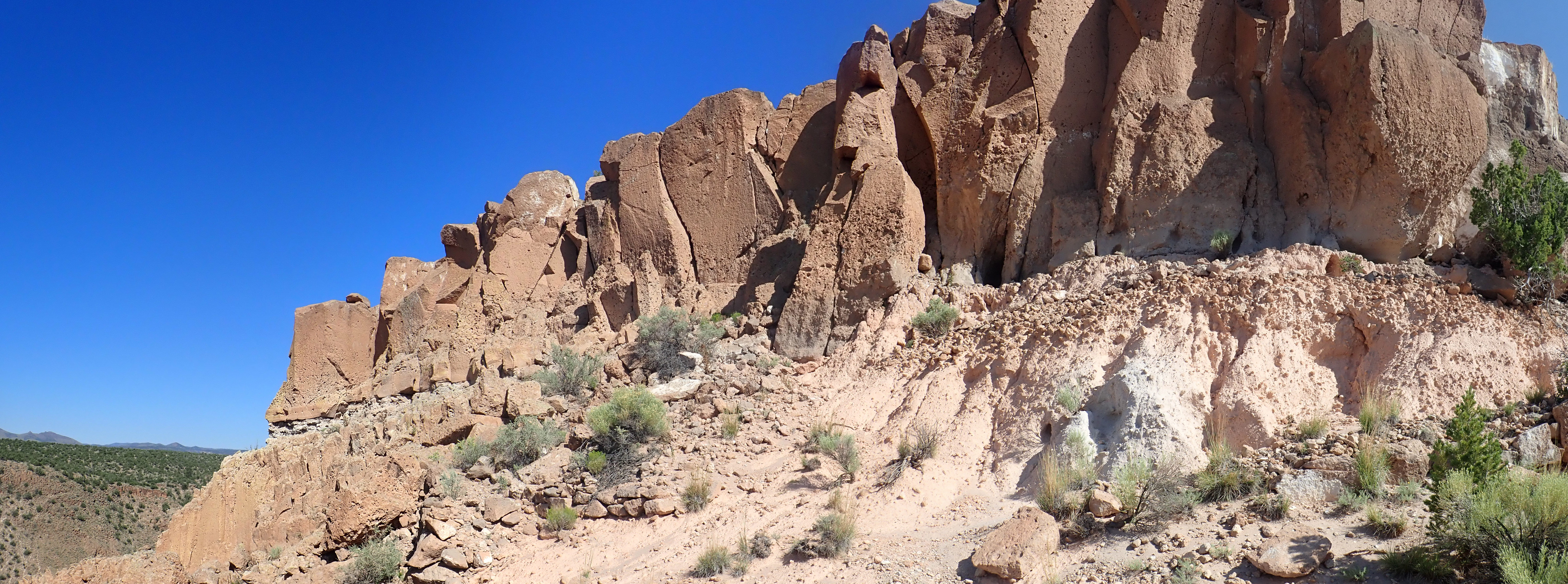
Notice how there is very coarse pumice underneath a gap in the Tshirege Member. Some of this pumice was entrained by the Tshirege Member pyroclastic flow, showing that it was already present on the surface 1.25 million years ago. My interpretation is this: The ancestral Rio Grande, or one of its tributaries, passed to the west of this location (left in the photograph). The beds at lower right in the photograph lap onto basalt flows of the Cerros del Rio. Thus, this area was likely part of the east rim of the ancestral White Rock Canyon, rather than west of the canyon as it is today. Pumice accumulated on the rim. It’s impossible to be sure without laboratory analysis, but this is likely similar to the pumice near Overlook Park, which is thought to be part of a lake bar from when White Rock Canyon was blocked by flows of the Otowi Member and a lake formed to the north. The blockage was eroded through and the lake receded prior to the Valles Event. Pyroclastic flows of the Valles Event filled the ancestral White Rock Canyon with Tshirege Member to the rim (the lower section to the left), there was a pause, and then a second pulse overtopped the rim, entraining big chunks of pumice from the old lake bar on the rim top, at right.
In the last chapter, we saw Bandelier Tuff filling ancient meanders of the ancestral Rio Grande in present-day Water Canyon and lower Frijoles Canyon. As we move soutwest from White Rock, the canyons become progressively deeper and the finger mesas thicker, reaching their maximum thickness in Bandelier National Monument. The eastern exposures, around the monument headquarters, resemble those further north and east. The exposures to the west become progressively darker and more uniform, as in the northern rim of Capulin Canyon.
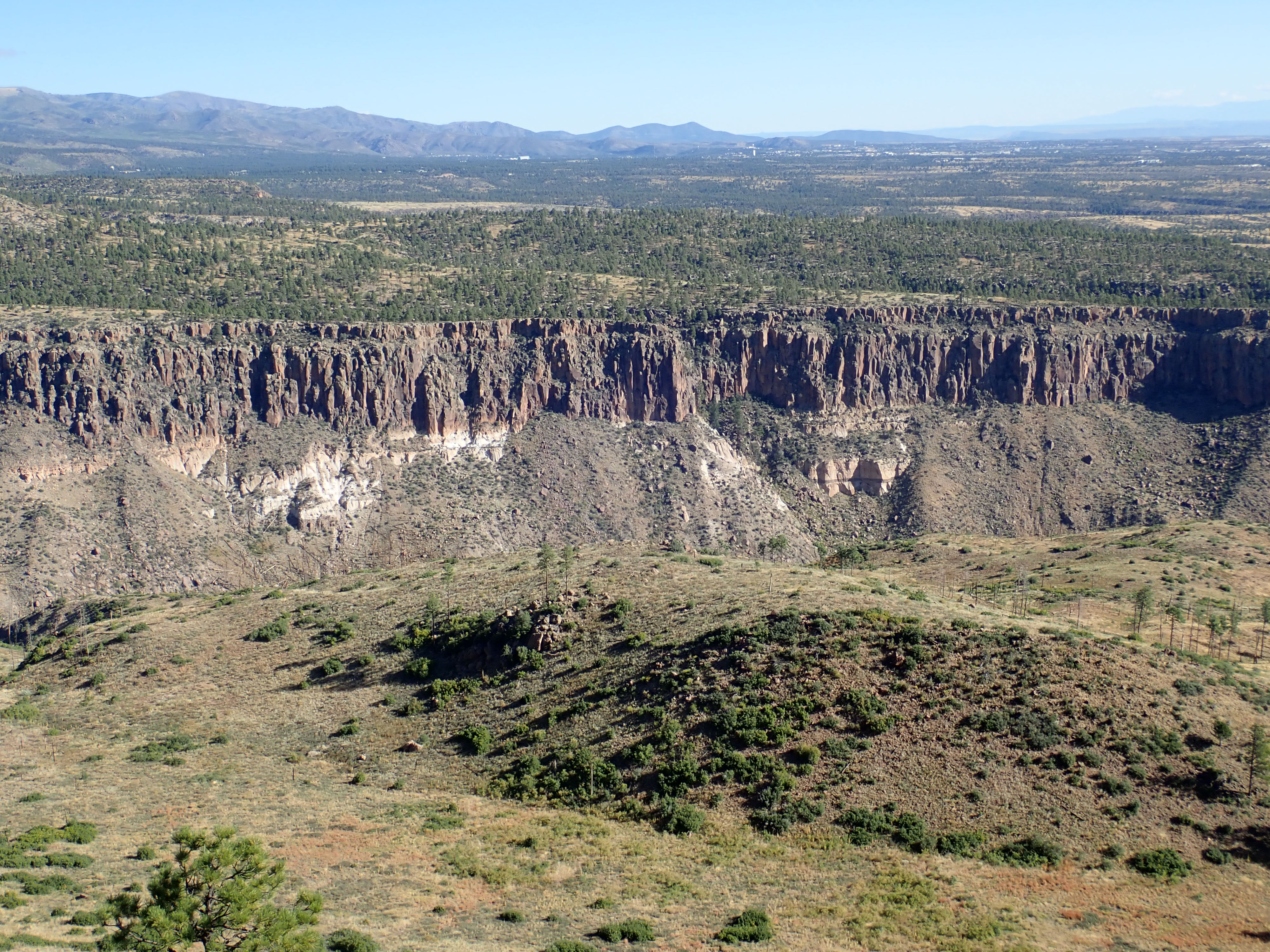
The Tshirege Member contrasts strongly with the underlying Otowi
Member. Note that there appears to be a lag breccia bed in the
Otowi Member, right of center (partially in shadow), similar to
the one we saw earlier in Cochiti Canyon.
The Tshirege Member thins out again around the San Miguel
Mountains, which form a kind of island in the surrounding Tshirege
Member surface. West of the San Miguel Mountains, in the southeast
Jemez, the Bandelier Tuff sits on volcaniclastic beds of the
Paliza Canyon Formation.
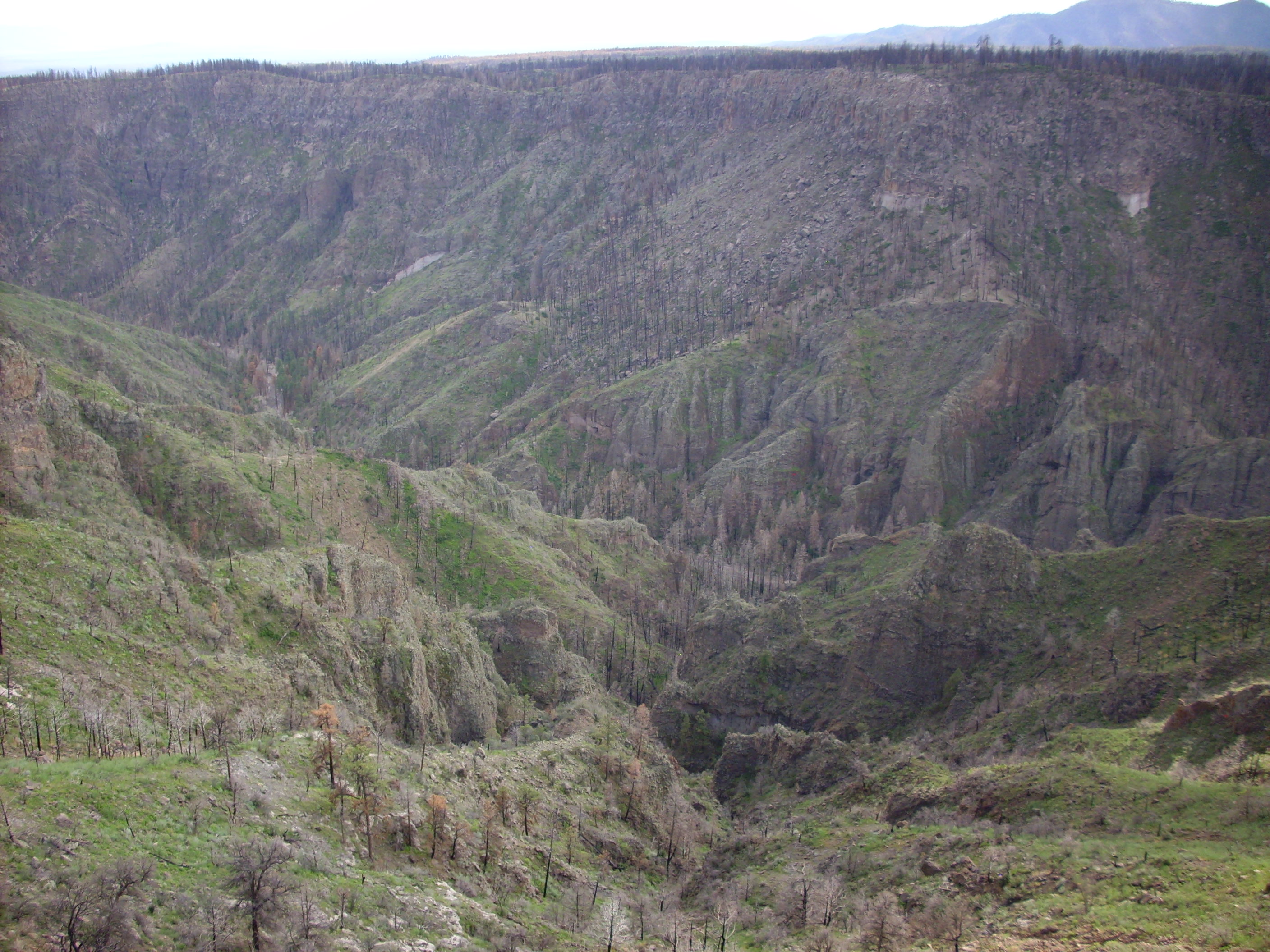
Paliza Canyon Formation volcaniclastics under Bandelier
Tuff. 35
46.001N 106 25.159W
In this photograph, the Tshirege Member is at top, with Otowi
Member exposed as white patches at two locations partway down the
can yon. Below this is a jumble of heavily-eroded block and ash
flows and lahars of the Paliza Canyon Formation.
The contact between Tshirege Member and Otowi Member is particularly dramatic on the east side of Cochiti Canyon.
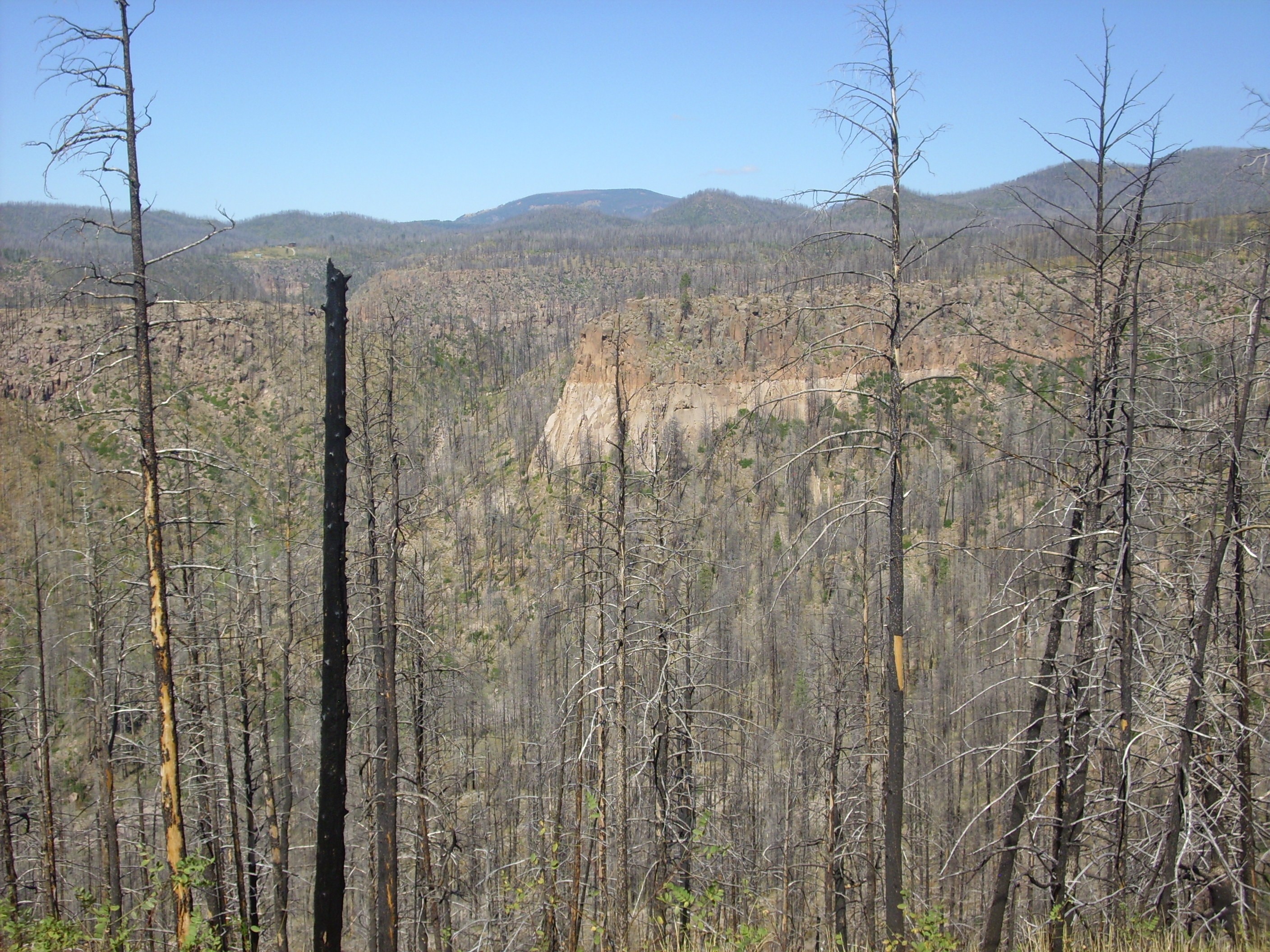
Bandelier Tuff showing contact between Tshirege and
Otowi Members.
Looking northwest from 35
46.738N 106 25.297W
The Keres highlands to the west acted as a topographical barrier to the Bandelier pyroclastic flows. The Tshirege Member lapped up against Aspen Ridge, so that the whole area between Aspen Ridge and the San Miguel Mountains became a relatively level surface of Tshirege Member. This has since been cut by deep canyons and displaced by faults.
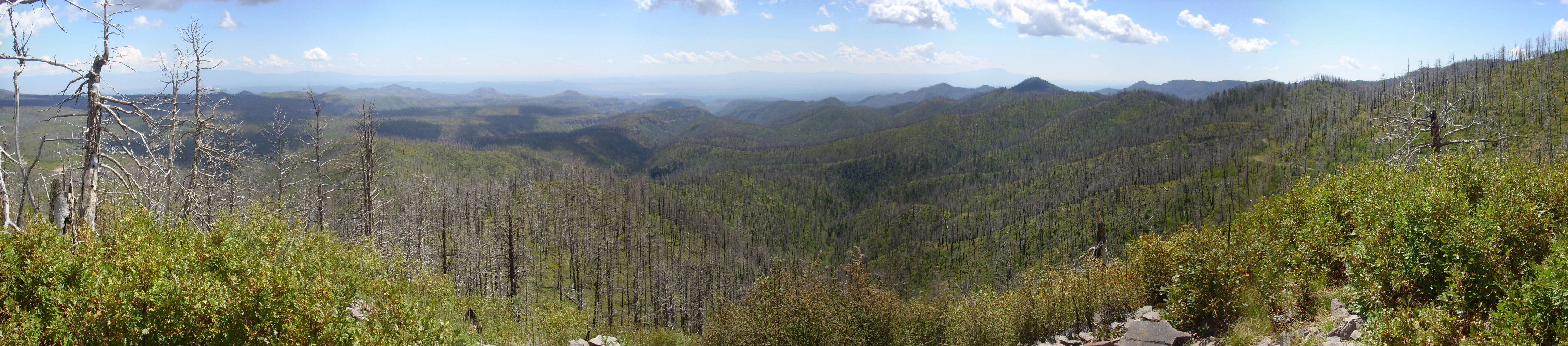
Panorama from a knoll on the east side
of Aspen Ridge. 35
47.888N 106 30.012W
The panorama begins to the east, where we see the San Miguel Mountains in the distance. The middle distance is a maze of mesas of Bandelier Tuff. Near the center of the panorama, to the right of distant Cochiti Reservoir, we look almost directly down Bland Canyon. To the right is the southern part of Aspen Ridge.
Though the Keres Highlands generally formed an effective barrier against the pyroclastic flows, there are isolated outcrops of Tshirege Member along Peralta Canyon and of Otowi Member in the lower canyon.
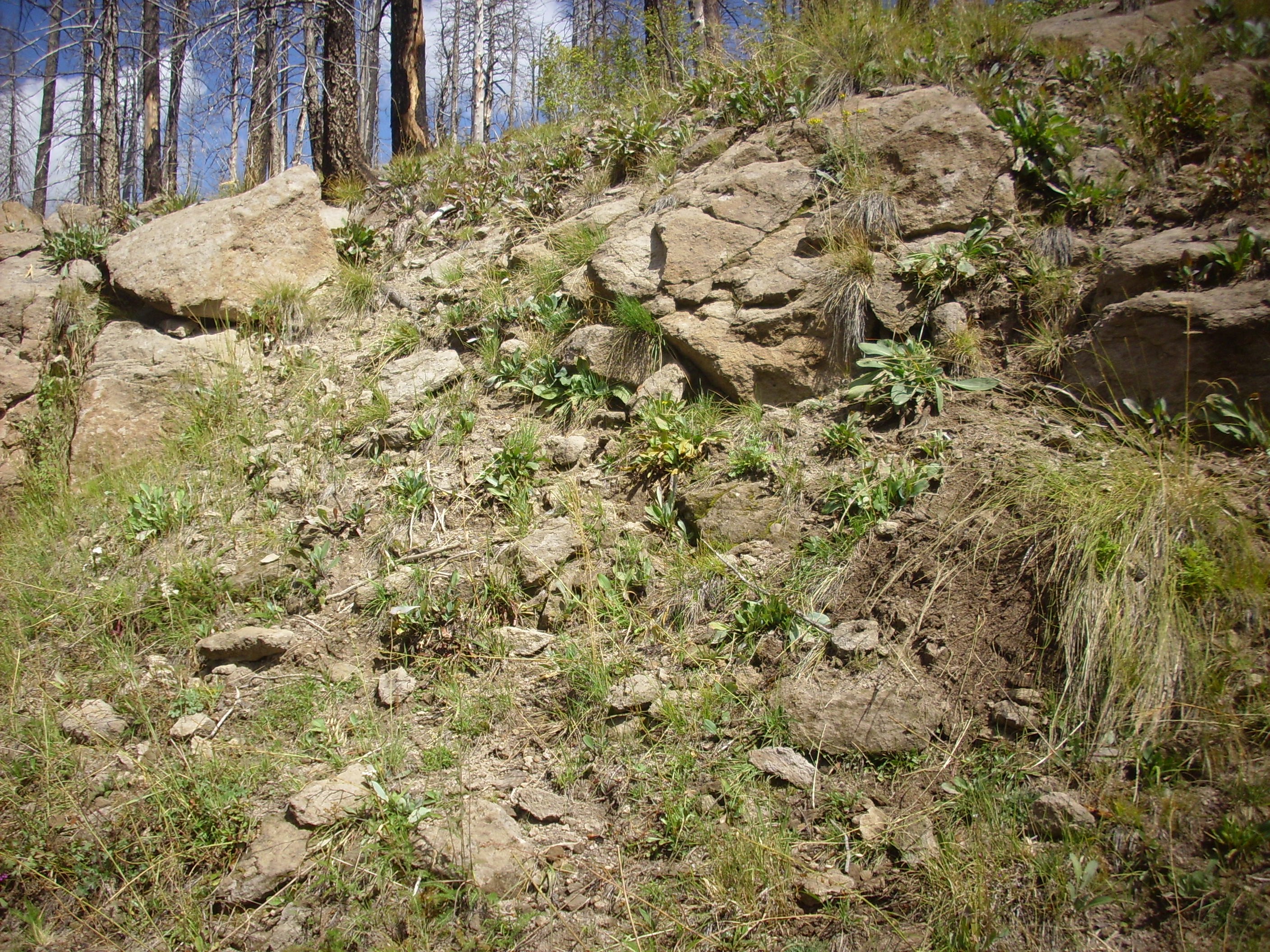
Tshirege Member in upper Peralta Canyon.
35
48.113N 106 30.943W
The presence of these beds shows that Peralta Canyon already existed when the Toledo caldera collapsed 1.62 million years ago. The canyon bottom was filled with Otowi Member, which subsequently mostly eroded away, and then the canyon bottom was filled again with Tshirege Member when the Valles caldera collapsed 1.25 million years ago, which has also mostly eroded away.
Beds of Bandelier Tuff again reappear west of Cerro del Pino. These extend south to Borrego Mesa and west to Canon de San Diego in the southwest Jemez. Here the Bandelier Tuff lies directly on Permian red beds that must have already been exposed at the surface 1.65 million years ago. These contacts are sometimes quite dramatic.
The southwesternmost exposure of Tshirege Member is a knob atop
Mesita Blanca.
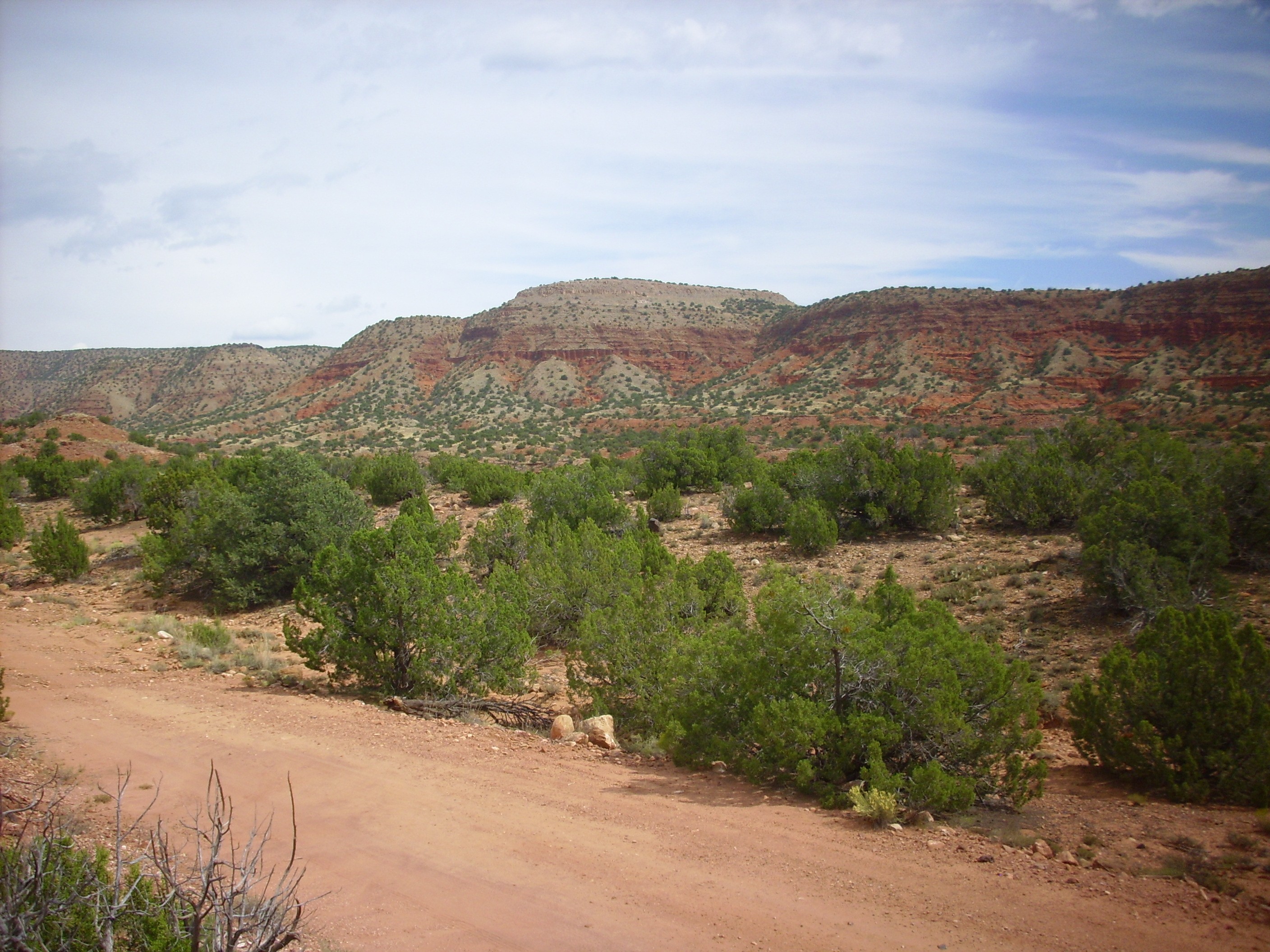
Mesita Blanca. Looking northeast from near
35 39.435N 106 43.701W
This rests on Triassic beds that in turn are underlain by a
sequence of Permian formations. If the Tshirege Member flows
reached any further south, the flows have since been eroded
completely away.
Here is a case where the Permian red beds of the Yeso Group and
the Glorieta Sandstone are cut by a sizable fault, which has been
filled in by Bandelier Tuff. The upper beds of the Bandelier Tuff
are not displaced by this fault, showing that it has not been
active in at least 1.6 million years.
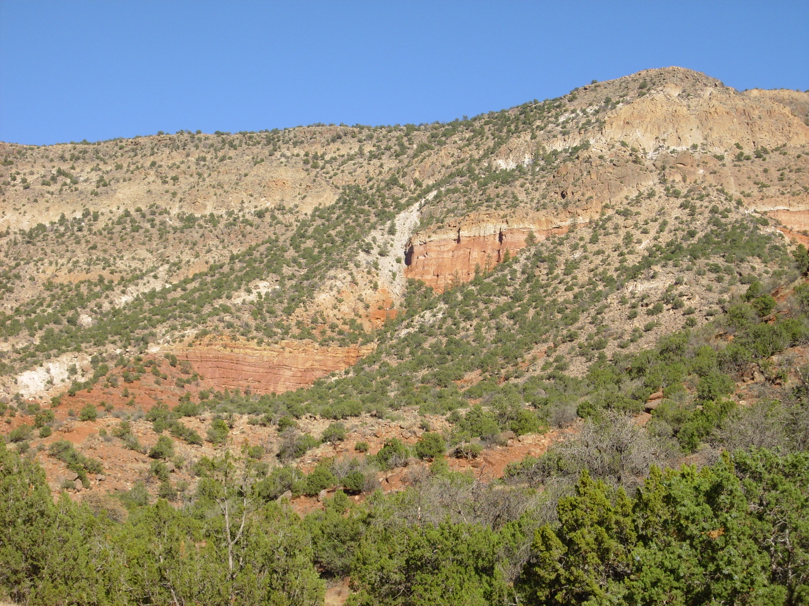
Fault in Permian red beds buried by Bandelier Tuff.
Looking east from near 35
43.073N 106 43.152W
A little up the canyon, one can see hills of Yeso Group that were
engulfed by the Bandelier Tuff, forming a dramatic discontinuity.

Permian hills engulfed by Bandelier Tuff. Looking
northeast from near 35
43.073N 106 43.152W
Nearby is an impressive paleocanyon.
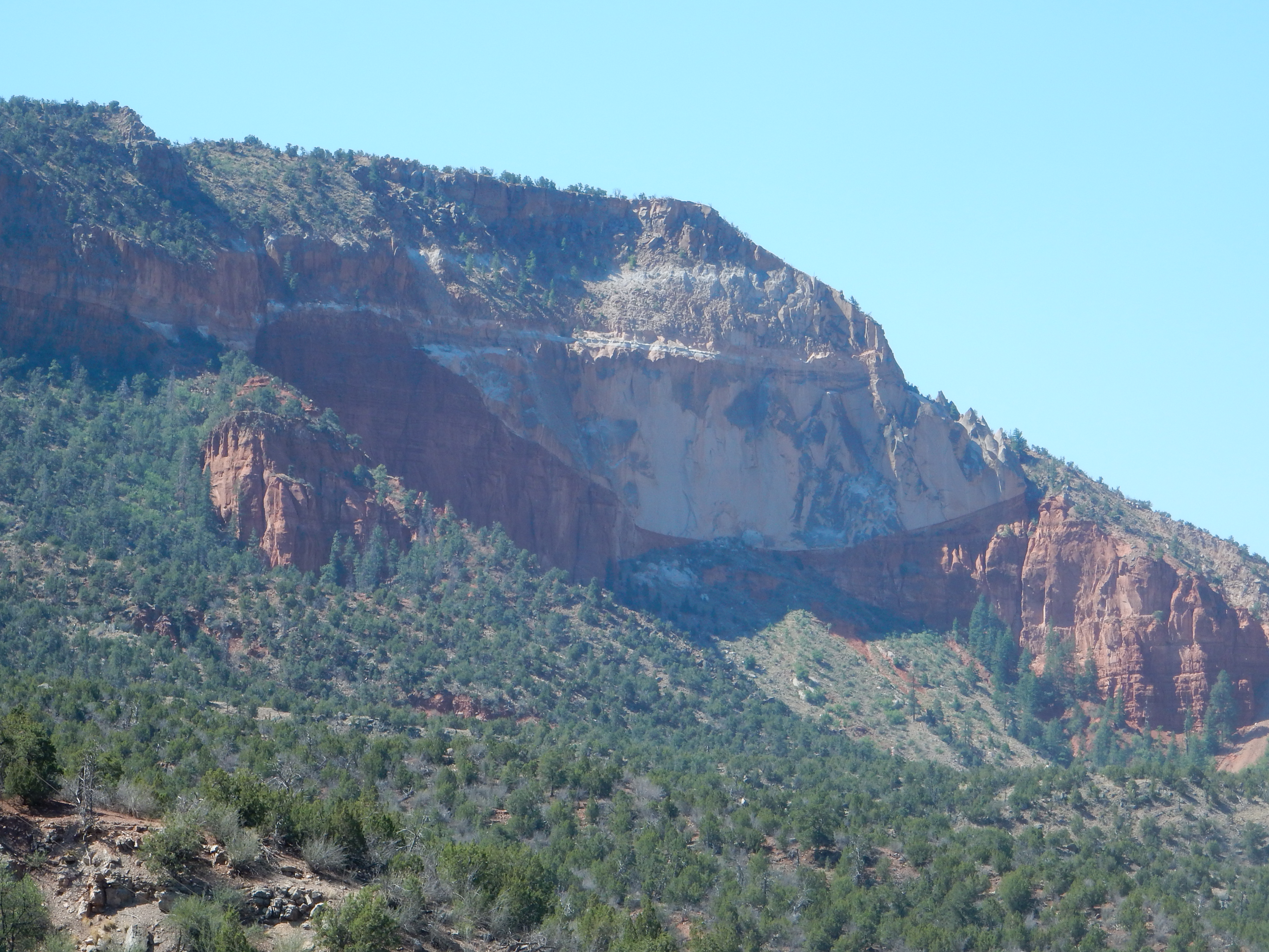
Paleocanyon filled by Bandelier Tuff. Looking
south from near 35
46.676N 106 41.406W
Here the Otowi Member and Tshirege Member are fairly easily
distinguished from each other. The Otowi Member filled the shallow
canyon in the Yeso Group and was then overlain by Tshirege Member.
The contact between Abo Formation and Bandelier Tuff is seen
along the west side of Mesa de Guadalupe.
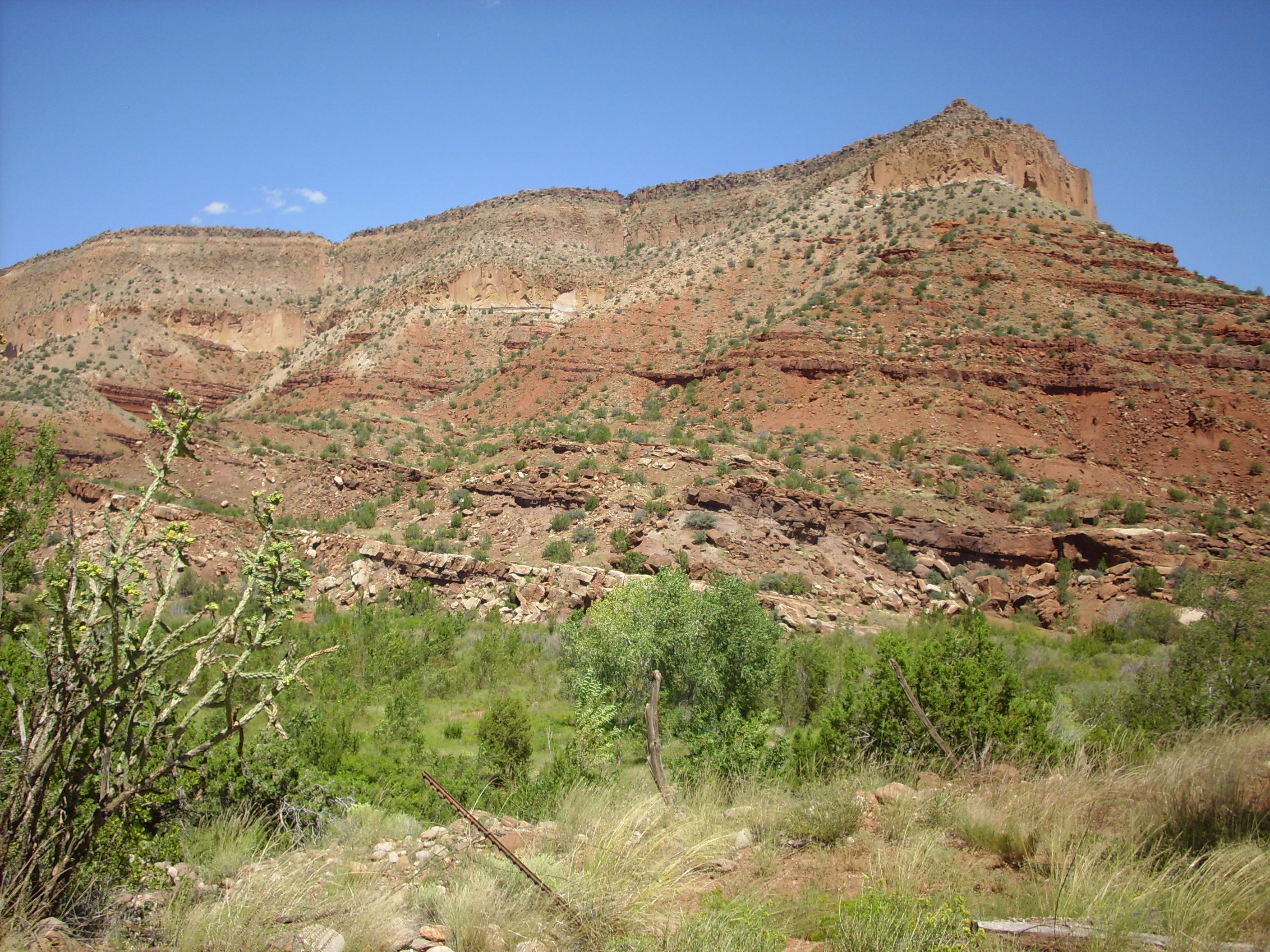
Mesa de Guadalupe. 35
41.718N 106 44.783W
Between the caldera and the Sierra Nacimiento is the Jemez Plateau, where the Otowi Member is best preserved.
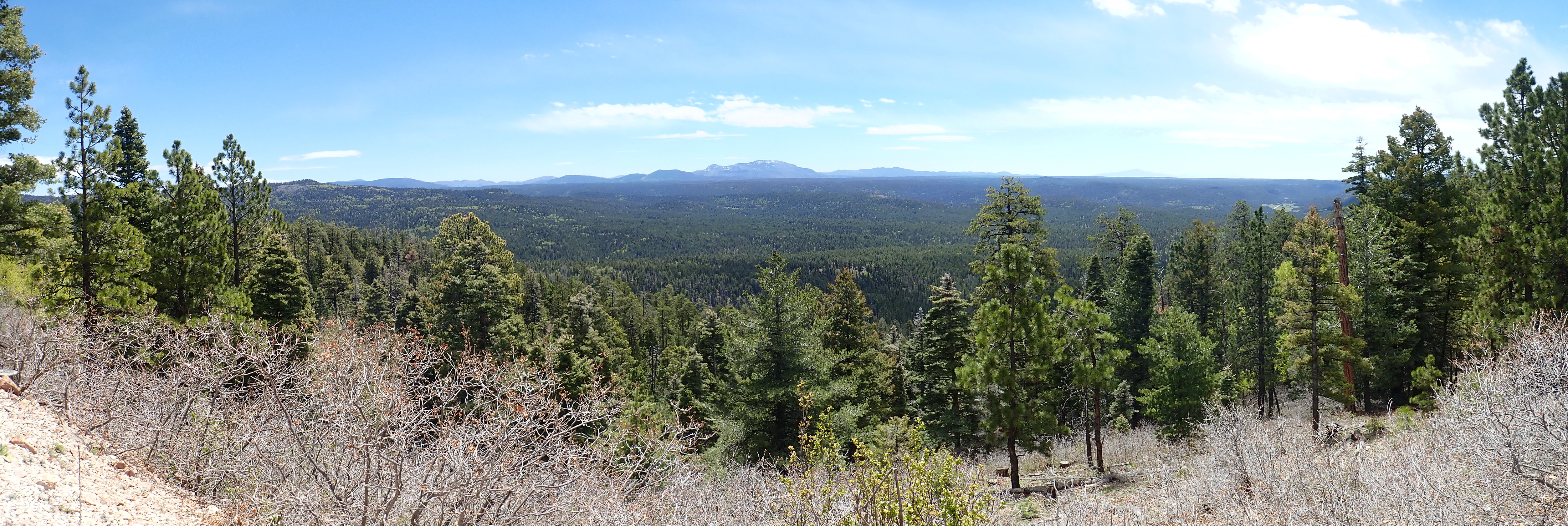
Jemez Plateau, with the heart of the caldera on the
skyline. Lookingn southeast from 36.0162173N
106.797647W
Redondo Peak is located at the center of the panorama, with the
south rim to its right and the ring fracture domes (which we'll
discuss in the next chapter) to its left.
The Tshirege Member caps most of the mesas of the Jemez Plateau
west of the Caldera.

State Road 126 cut into Tshirege mesa top. 35
57.505N 106 42.768W
In the northwest Jemez, the Bandelier pyroclastic flows were channeled into the low ground between the Sierra Nacimiento Mountains to the west and the La Grulla Plateau to the east, forming Mesa Pinabetosa:
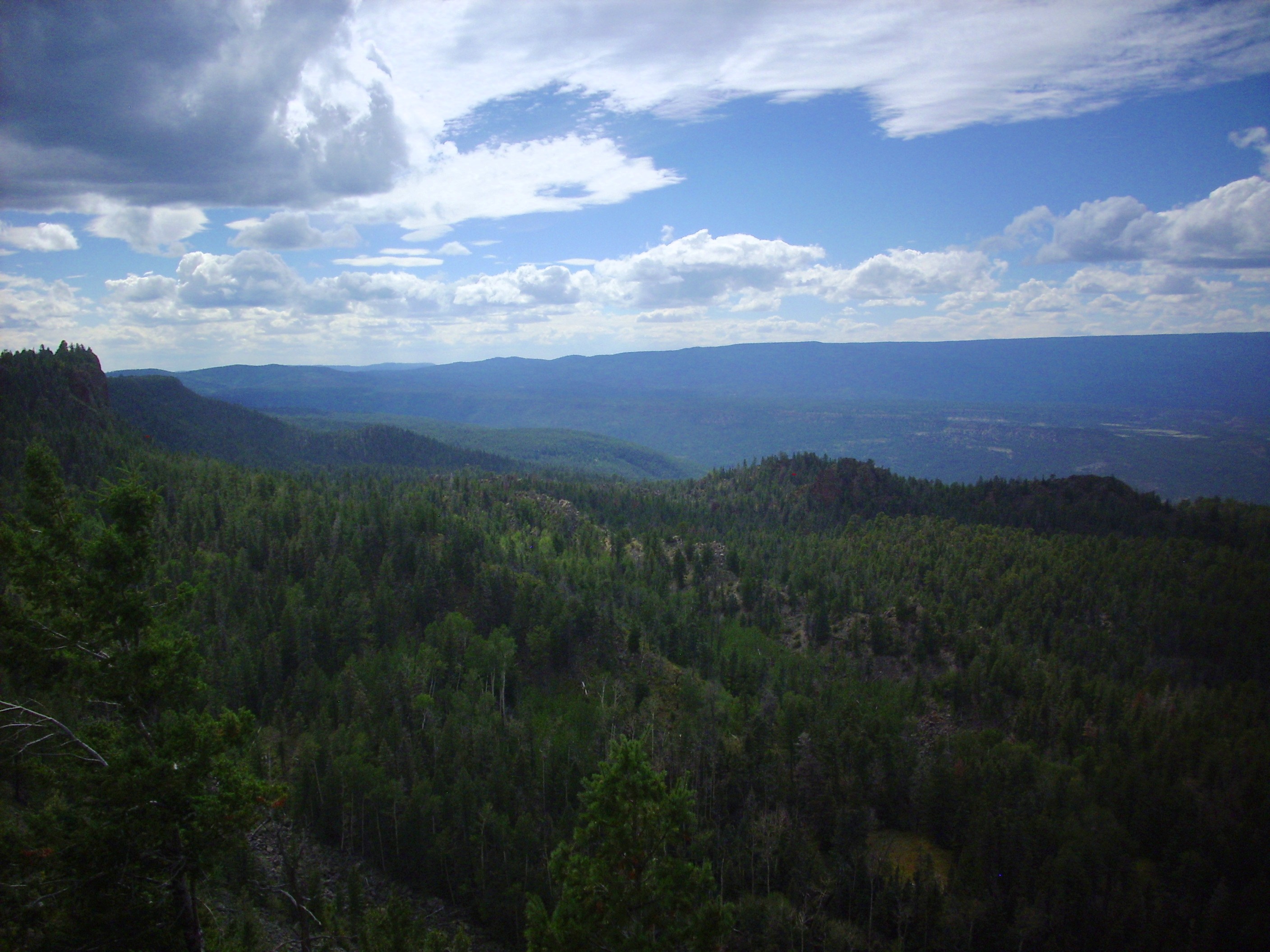
Mesa Pinabetosa. Looking southwest from near 36
7.650N 106 33.133W
The mesa is somewhat obscured by haze, but is the low ridge below the skyline. As in the southwest Jemez, the Bandelier Tuff here sits directly on Permian redbeds. The northernmost outcrop of Bandelier Tuff caps Loma Coyote.
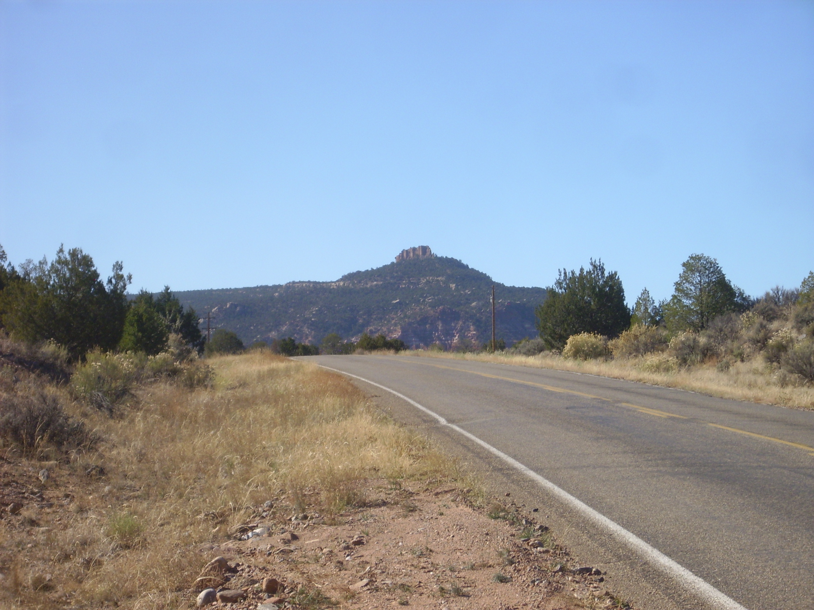
Loma Coyote. Looking southwest from 36.1764043N
106.604722W
The Bandelier flows were channeled through the low ground between the La Grulla Plateau and the Tschicoma highlands in the northeast Jemez. Exposures of Tshirege Member begin a short distance below the caldera rim
Proximal Tshirege Member. 36
00.695N 106 29.442W
and fill the area between the two high plateaus.
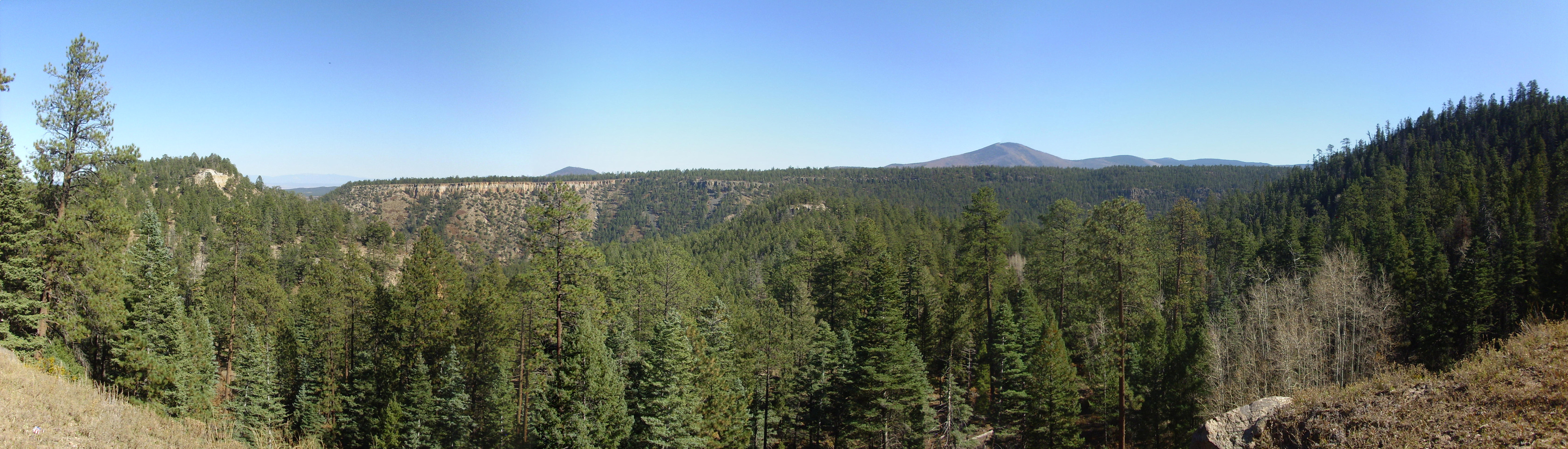
Polvadera panorama. Looking southeast from 36
06.874N 106 30.570W
The mesa across Canones Canyon is Mesa del Medio. To the left one sees the mesa underlain by Santa Fe Group with a cap of Bandelier Tuff. To the right this gives way to basalt flows of the La Grulla volcanic center. Polvadera Peak is right of center and Cerro Pelon is the smaller peak just left of center. Both are dacite domes of the Tschicoma Formation.
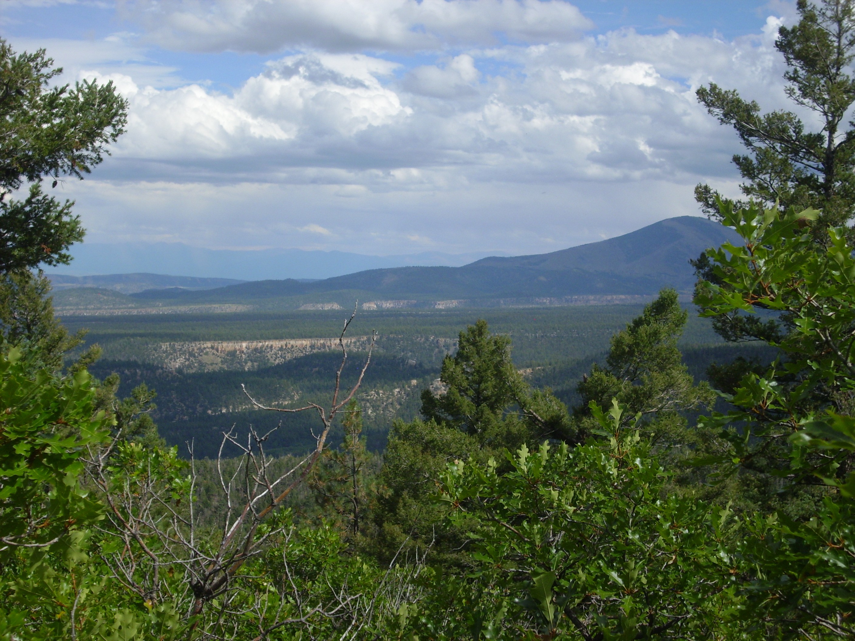
Bandelier Tuff below Polvadera Peak. Looking east from
near 36
7.883N 106 32.745W
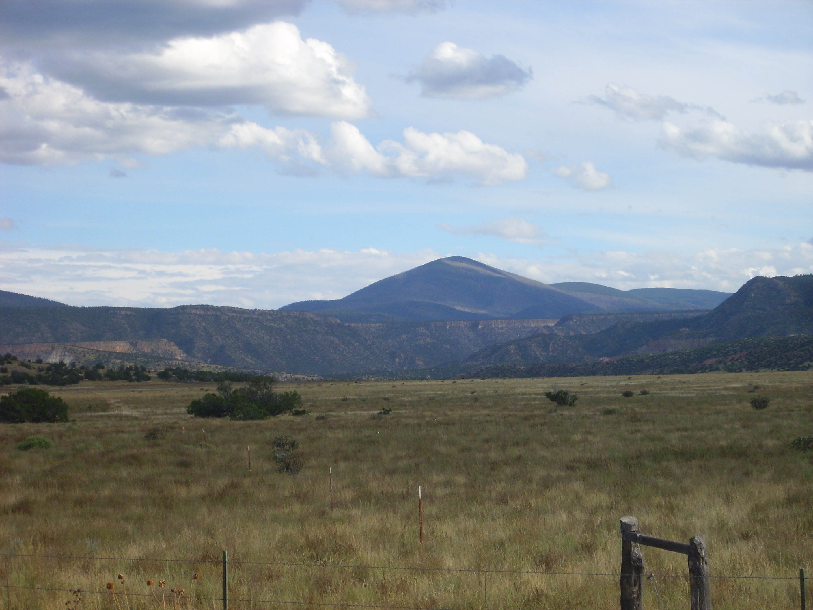
Bandelier Tuff below Polvadera Peak. Looking SSE from 36
13.931N 106 28.821W
The Tshicoma Highlands blocked the Tshirege flows from reaching most of El Alto, but a flow lapped onto the edge of the mesa on its west side.
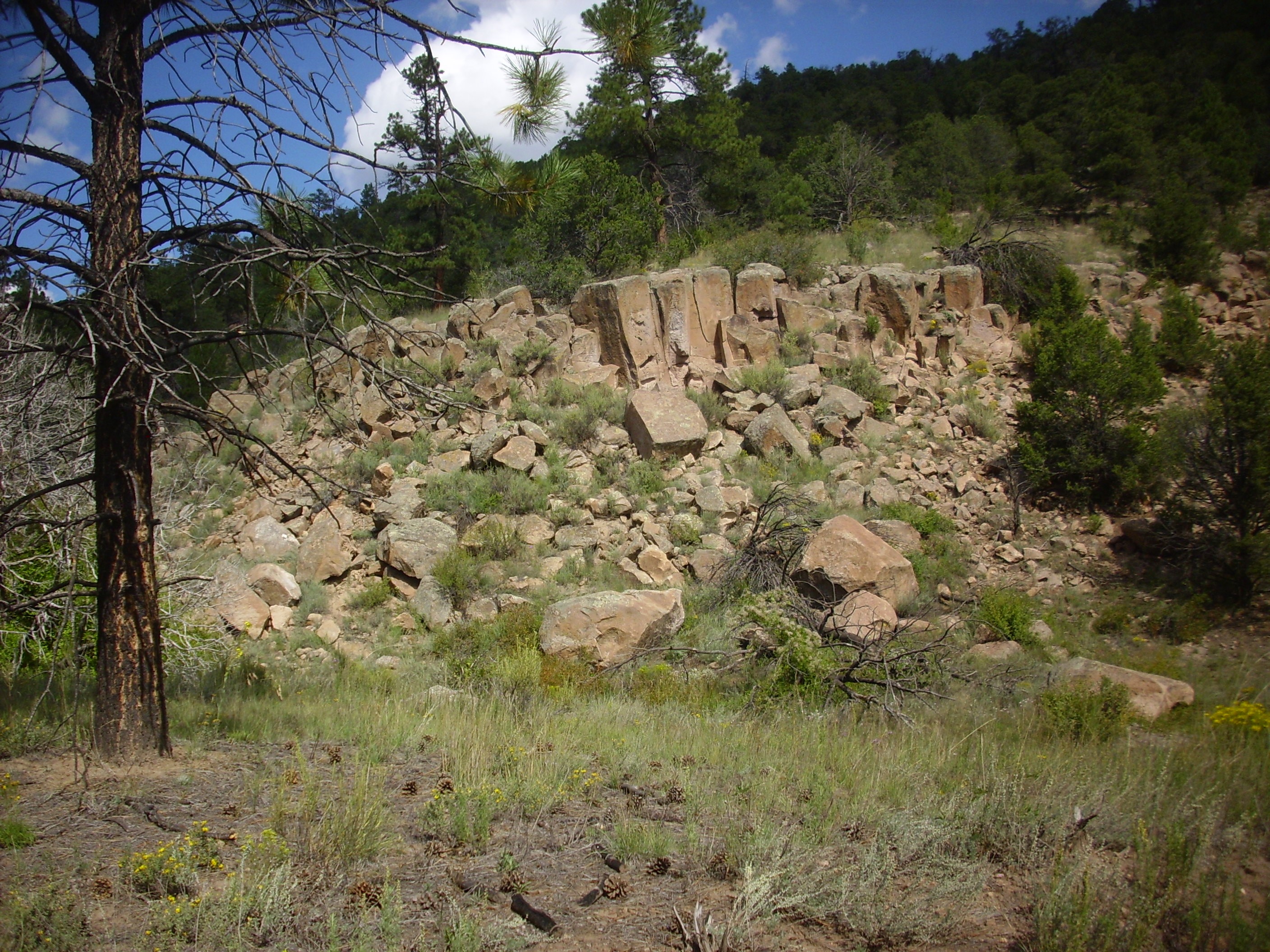
Tshirege Member flow on west edge of El
Alto. 36
06.560N 10625.029W
Tshirege Member filled much of the lower terrain in the Toledo Embayment, but it is not found again outside the caldera until we reach the north rim of Santa Clara Canyon. Here we find a few small beds of Tshirege Member, including Penasco Blanco.
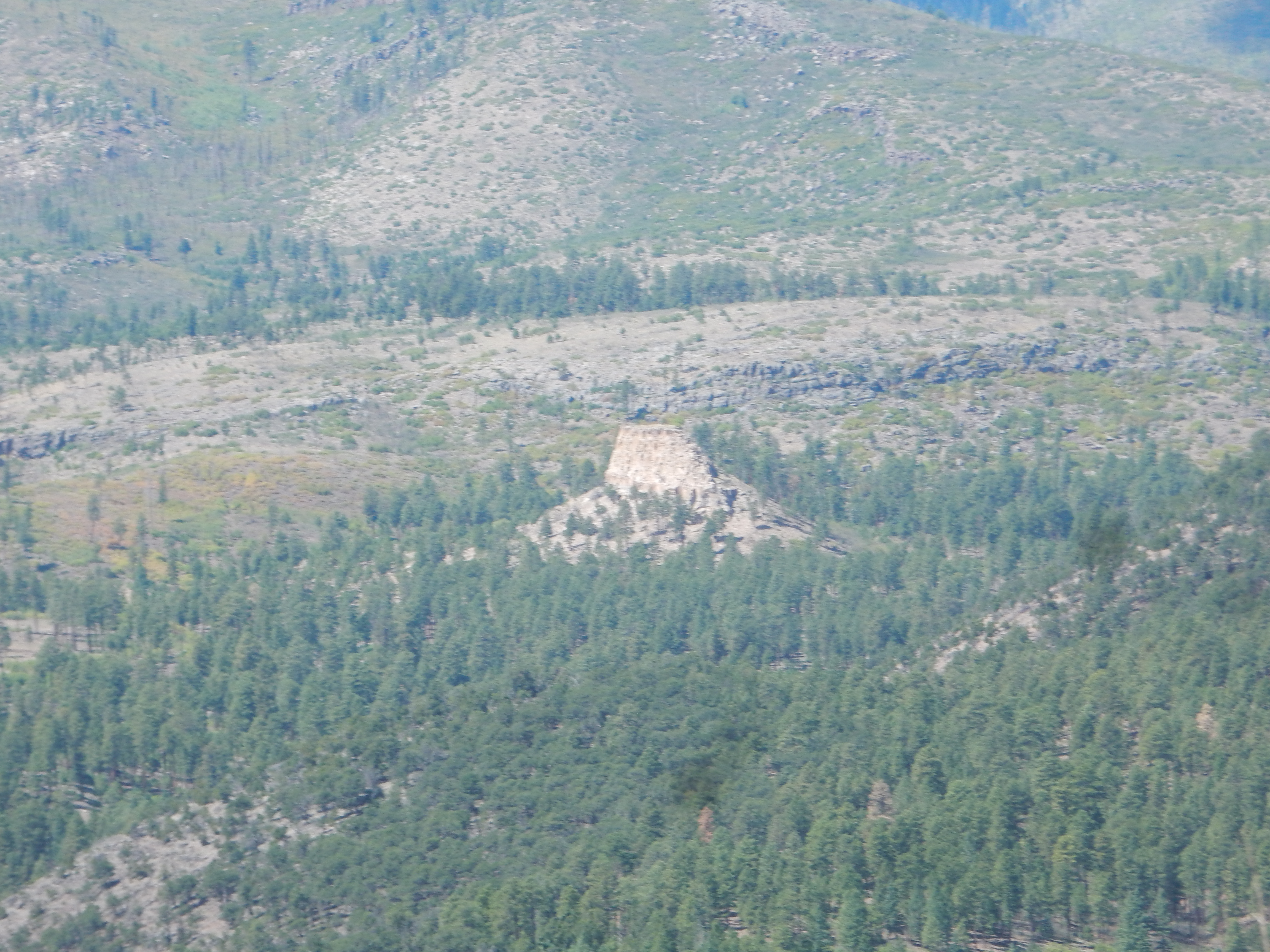
We are then back in the finger mesas of the Pajarito Plateau.
We finish up with the intracaldera tuffs, deposited within the caldera itself. These underlie Redondo Peak and some of the hilly terrain to its north. This tuff tends to be crystal-rich and densely welded, as in this outcrop on the north side of Valle Jaramillo.
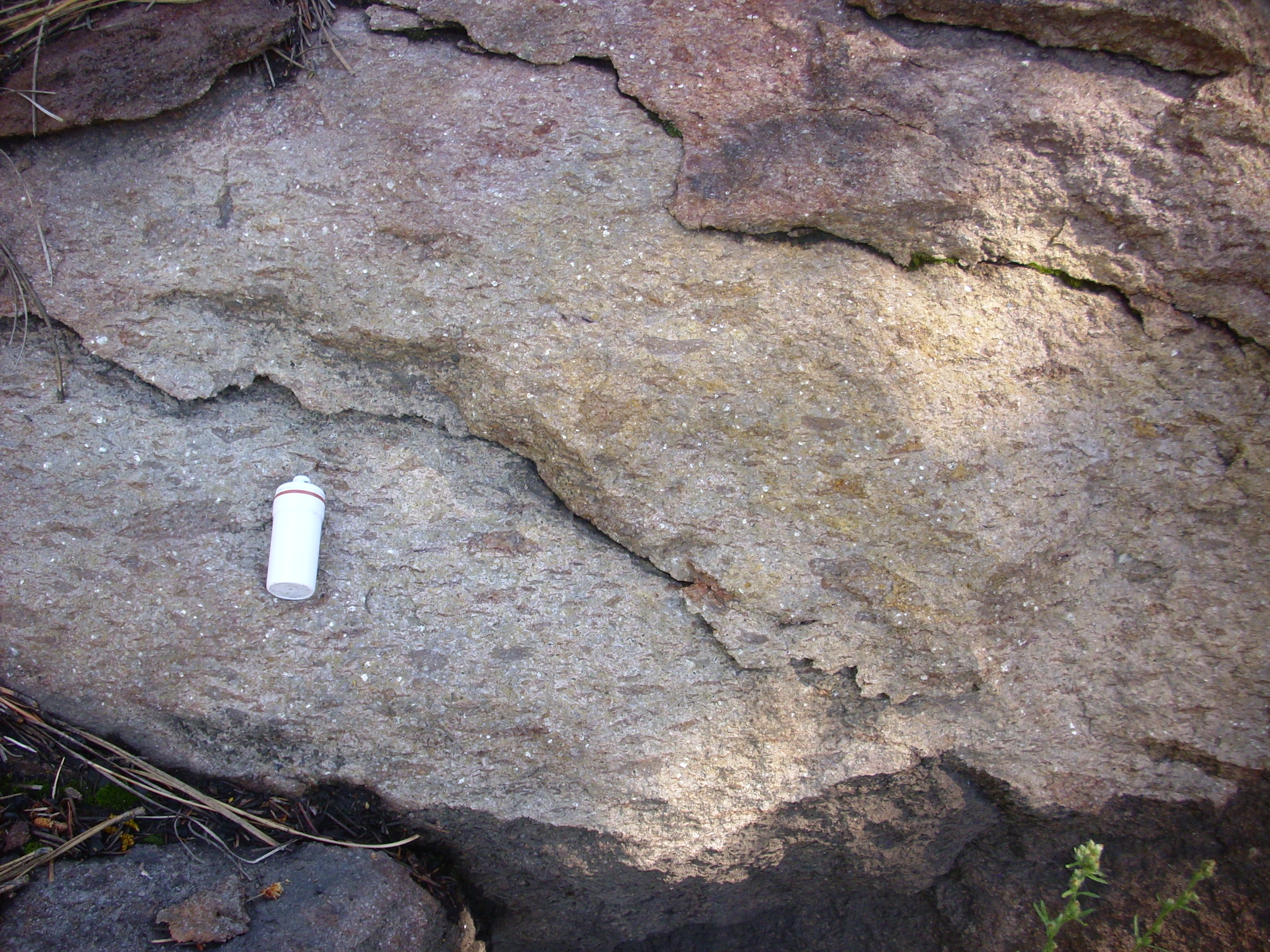
Intracaldera tuff near Valle Jaramillo.
35
54.857N 106 30.554W
The white specks are crystals, probably of high-temperature alkali feldspar (sanidine). The dark patches were probably pumice caught up in the flow. Notice that these have been squashed flat, so that they are systematically elongated in the horizontal direction. These are called fiamme and are characteristic of a welded tuff, which is formed from ash so hot that the individual particles are soft and weld together after settling out on the ground.
As we saw in San Diego Canyon, the Otowi Member is a relatively
homogeneous unit. Though it probably erupted in several pulses,
these were close enough together that there was no time for
individual flows to cool significantly before being buried under
the next flow. The Otowi Member is therefore described as a simple
cooling unit, with the entire thickness of the member
sharing a common cooling history.
The Tshirege Member was erupted in at least five separate pulses, with enough time between pulses for each bed to cool slightly before the next was deposited. The interval between pulses was nonetheless brief enough that only a small amount of cooling took place. The Tshirege Member is thus described as a compound cooling unit. Each simple cooling unit within a compound cooling unit characteristically has a more densely welded core, with less welded upper and lower surfaces. This is because both surfaces cool faster and have less time to weld, the lower because it is in contact with the slightly cooled surface of the previous flow. Boundaries between cooling units in a compound cooling unit are sometimes marked by a vapor gap, but this is not always present, and flows can sometimes be difficult to distinguish with certainty.
The best nomenclature for the various units of the Tshirege
Member is still being worked out by geologists. One scheme was
developed by geologist M.A. Rogers in 1995. Rogers' scheme
emphasized lithological differences between beds that could be
easily mapped throughout the Jemez Mountains. Rogers' units are
not necessarily individual cooling units or flows. At about the
same time, a different scheme was developed at by Broxton and
Reneau. Their scheme is applicable mainly on the Pajarito Plateau
and tries to divide the Tshirege Member into actual cooling units.
Rogers assigned letters to her lithological units, beginning with
A for the bottom unit and continuing to F for the uppermost unit.
Broxton and Reneau used numbers instead, with their Qbt 1
corresponds roughly to Rogers' Units A and B, 2 to C, 3 to D, and
4 to E and F. However, since the Tshirege Member is quite variable
across the Jemez and the two schemes were devised for different
purposes using different criteria, the correspondence is not
exact. This is particularly true away from the Pajarito Plateau.
In both schemes, a unit may consist of one or more flows; for
example, the A unit is thought to be a single flow, while the C
unit may consist of three flows so closely spaced in time that
they cooled as a unit.
The lowermost units of both schemes are also the units that
extend furthest from the caldera. The A and B beds are found
almost everywhere on the Pajarito Plateau, while the C and D beds
do not extend quite as far and the E and F beds are found only
relatively close to the caldera.
Broxton and Rogers subsequently published a joint paper comparing the two systems of nomenclature and presenting revised estimates of where the actual cooling unit boundaries are. This paper provided three reference sections, the first of which is an eastern spur of Los Alamos Mesa:

Lithostratigraphic units in Tshirege Member. Looking
west from near 35.873N
106.238W
This illustrates the lowest beds of the Tsherige Member, resting on a moderately thick section of Pueblo Canyon Member, Cerro Toledo Formation. Unit A is identical with Qbt 1g, and consists of glassy tuff. This is separated from the lower part of unit B by a distinct notch or ledge that can be traced across almost the entire Pajarito Plateau and which is known as the vapor phase notch.
The lower part of unit B corresponds to Qbt 1vc in the Broxton and Reneau scheme. This is devitrified tuff (the "v" standing for vapor-phase crystallization) that tends to show prominent columnar cooling joints ("c"). Above this is the Qbt 1vu unit, which is highly variable. Here you see it forming a slight ledge halfway up the unit. The entire A and B section (Qbt 1) is interpreted as a single cooling unit, possibly of multiple flows erupted very closely together in time.
The rim of this mesa is the C unit, corresponding to Qbt 2. This
is interpreted as a second multiple flow cooling unit.
The next reference section, which shows an additional cooling
unit, is the south face of Kwage Mesa.

LIthostratographic units in Tshirege Member. Looking
north from near
35.8783693N
106.2555967W
Here the Pueblo Canyon Member of the Cerro Toledo Formation is almost entirely covered by debris. But the full thickness of hte A, B, C, and D units is exposed. The D unit, corresponding to the lower part of the Qbt 3 unit, is part of a third cooling unit.
The third reference section is in upper Water Canyon. The beds here are more difficult to distinguish; my best estimate is:
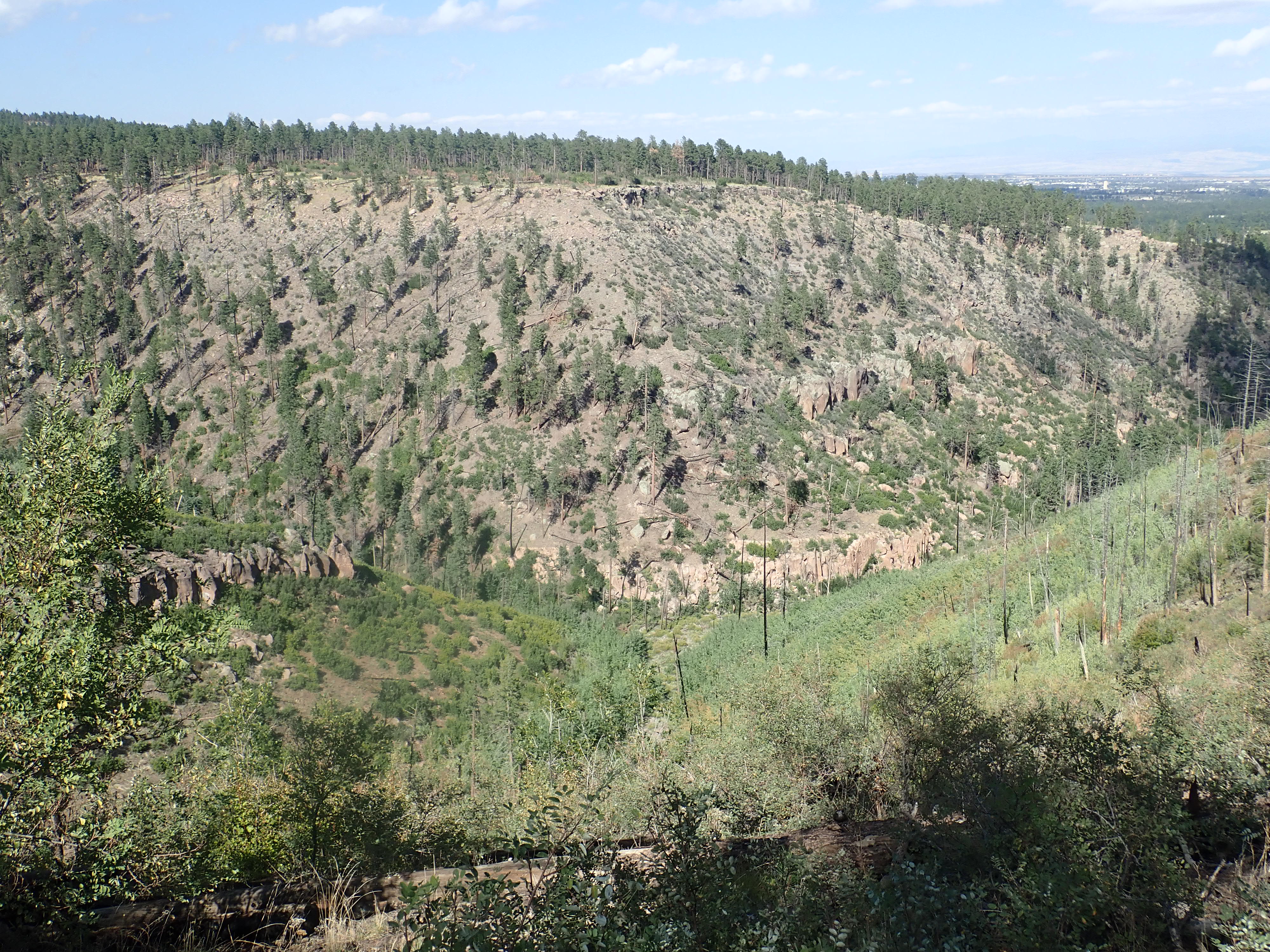
LIthostratographic units in Tshirege Member. Looking
northeast from near
35.8365113N
106.3705357W
The E and F units complete the last two cooling units. These are
found only in the westernmost part of the Pajarito Plateau. The E
bed has a distinctly darker color than the other beds, including
the overlying F bed.
We'll begin a closer examination of these beds at the fringes of
the plateau and work our way towards the caldera.
The unit boundaries dividing the A, B, and C units can be
examined at close range at Tsankawi Mesa. The more prominent is
the vapor phase notch between the A and B units, which forms a
very distinct notch or shelf in this area. It is visible near the
top of the mesa in the following photograph.
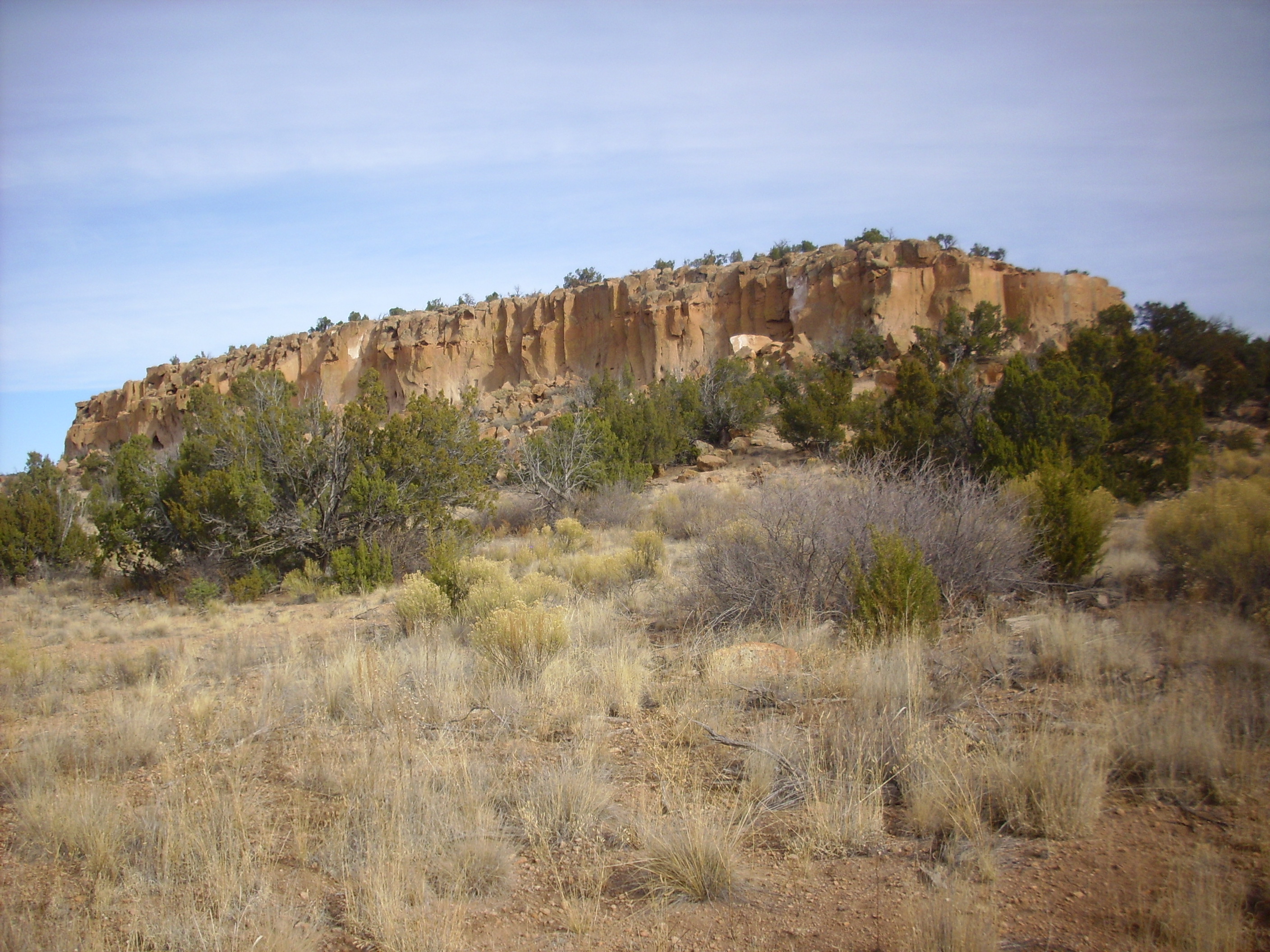
Tsankawi Mesa. 35
51.608N 106 13.542W
Rogers interpreted the vapor phase notch as a flow boundary.
However, Broxton and Reneau interpreted it as a devitrification
front. They could find no change in the chemistry of the
minerals across this boundary, nor any change in the size and
content of lithic and pumice clasts. However, the A/Qbt 1g unit is
composed of tuff in which the glassy shards of the ash and pumice
are unaltered, while the glass shards in the B/Qbt 1v have been
devitrified. The devitrification is thought to have been triggered
by hot vapors rising into the upper part of the flow shortly after
it was deposited, The transition between the two is remarkably
sharp.
The lower part of the B/Qbt 1v unit is relatively resistant and
often shows columnar cooling joints. This transitions higher in
this unit to soft tuff that generally forms slopes where it has
not been eroded away, as it has on the west end of Tsankawi Mesa.
Tsankawi Mesa is the location of Tsankawi ruins, which are
administered by Bandelier National Monument. The Park Service
maintains a trail to the mesa top, which comes to a ladder that
takes one to the upper surface of the A unit.
Upper surface of A unit. 35
51.640N 106 13.320W
This surface extends along much of the south face of the mesa, providing a natural footpath. The next photograph looks back along this natural terrace towards Pajarito Mountain.

Ledge formed on surface of A unit. 35
51.649N 106 13.300W
This photograph shows how the surface merges seamlessly into the
vapor notch on the steep side of the mesa.
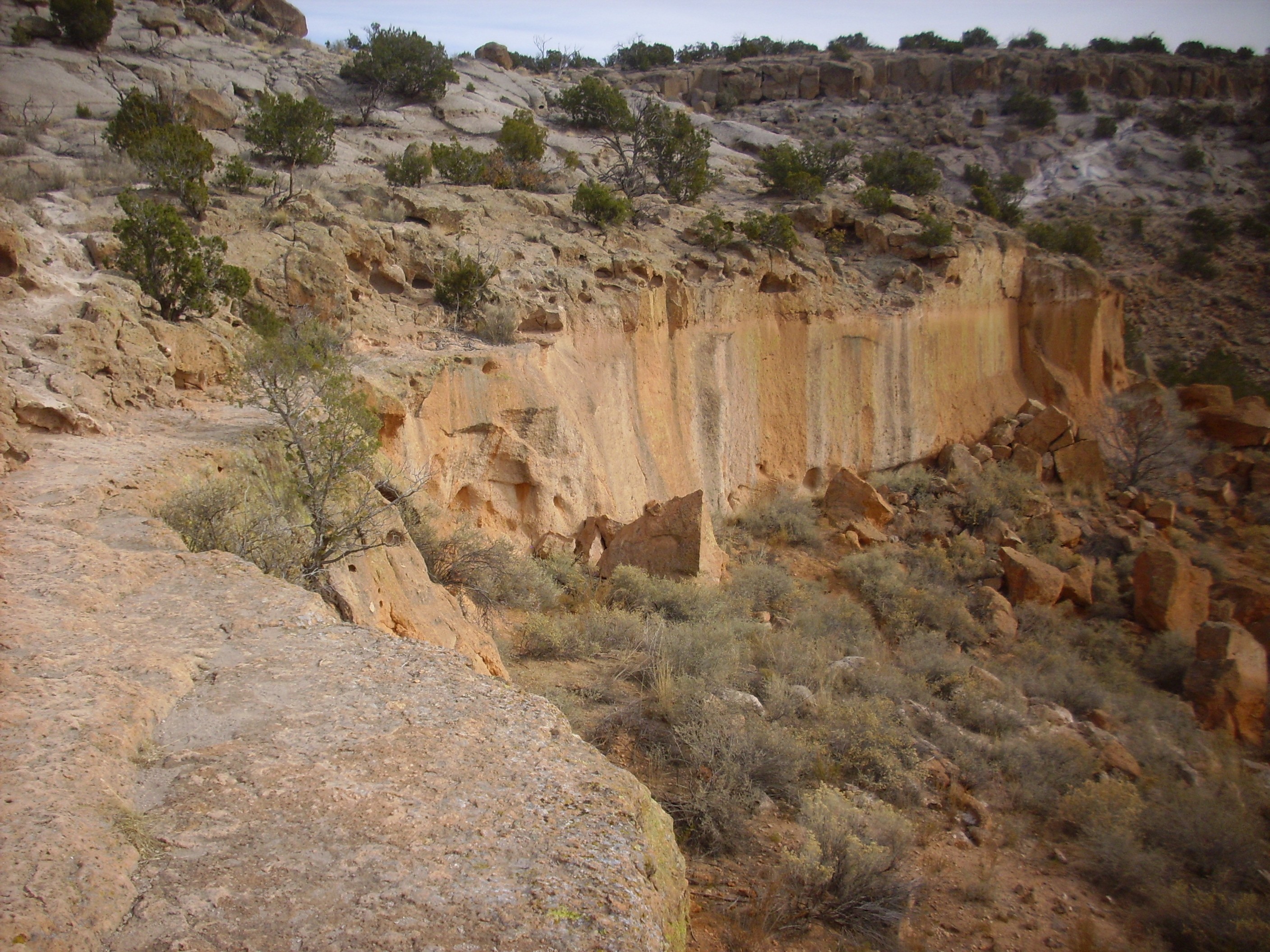
Boundary between A and B
units. 35
51.659N 106 13.247N
South of Tsankawi Mesas, this boundary can be seen as a ledge on
the nearby mesas.

Mesas south of Tsankawi showing unit
boundary. Looking southwest from 35
51.663N 106 13.125N
This vapor notch is prominent in the cliffs north of White Rock
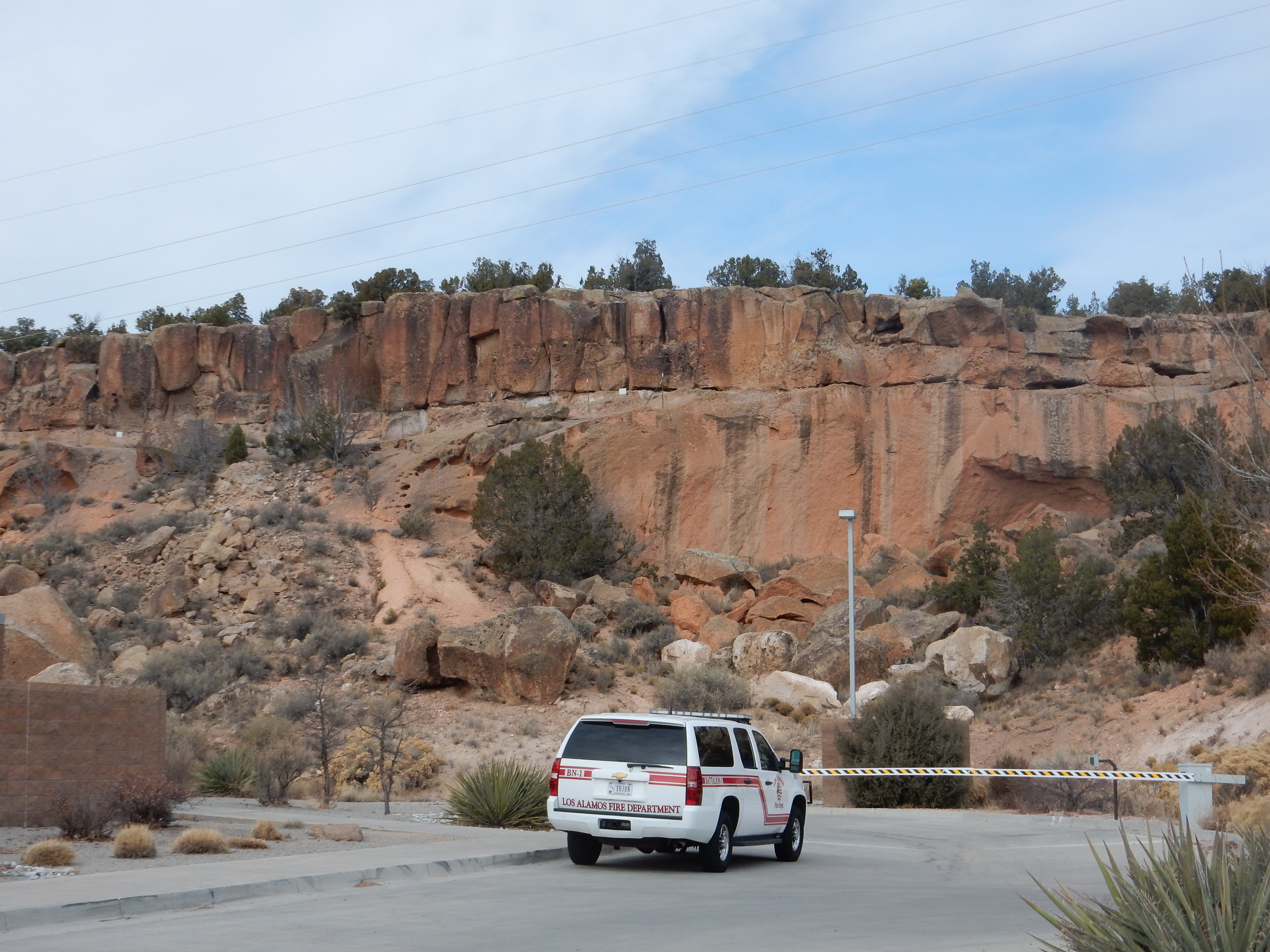
Here everything above the lower B unit (Qtb 1vc) has been eroded
away, if it was ever deposited. The notch can be traced to Water
Canyon south of White Rock.
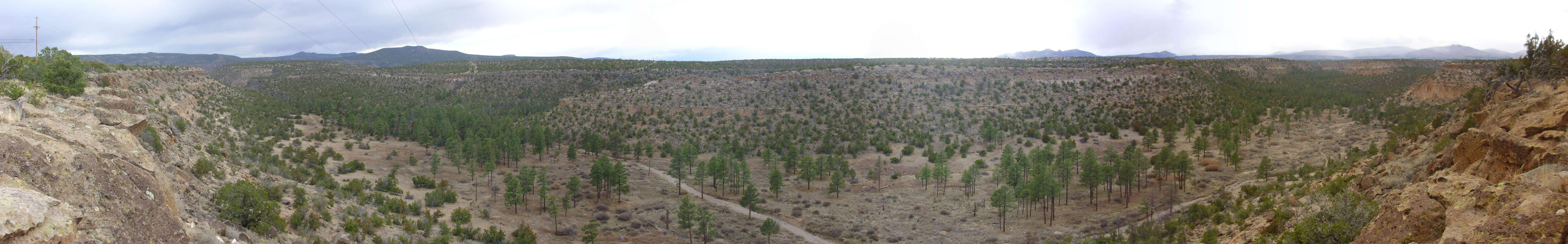
Water Canyon. 35 48.167N 106 14.041W
The boundary is most pronounced along the south face of the
canyon at the center of the panorama.
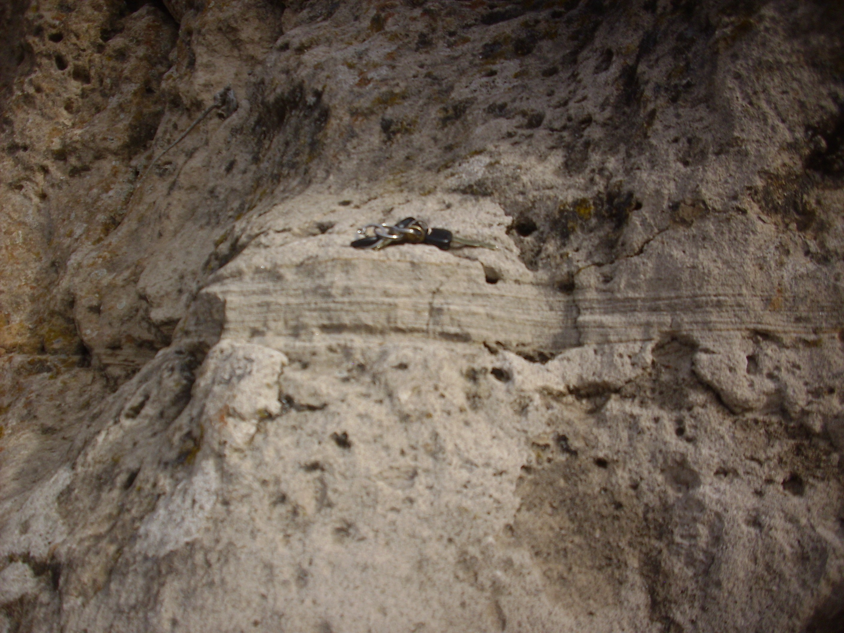
Surge beds at bottom of unit C on
Tsankawi Mesa. 35
51.662N 106 13.001W
This has been described in several geologic papers as a "sandy parting." Because this is relatively unresistant to erosion, it is more common for the boundary to be marked by a notch.
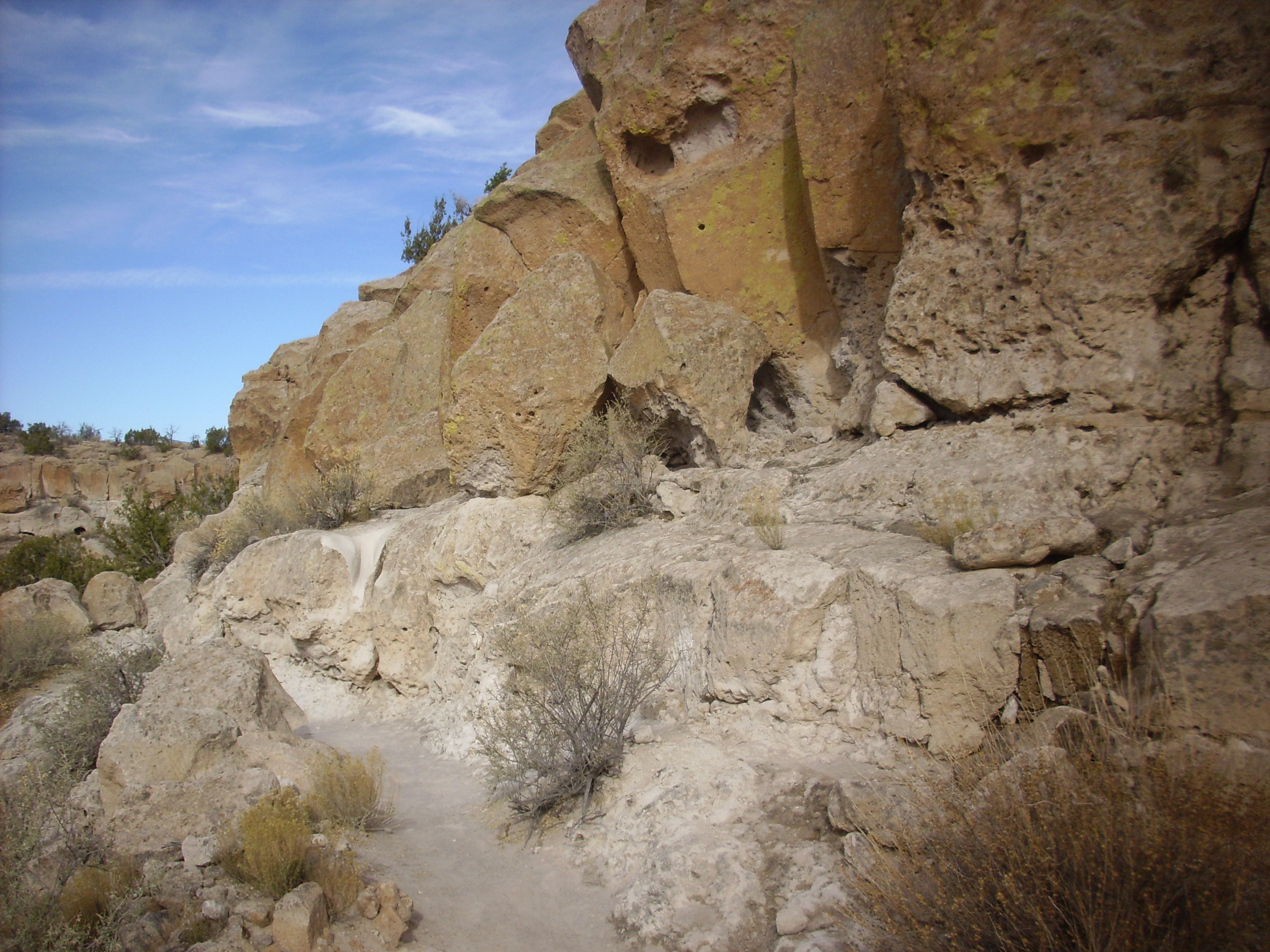
Notch at bottom of unit C on Tsankawi
Mesa. 35
51.662N 106 13.001W
Here’s a nice shot from just a little further down the trail.
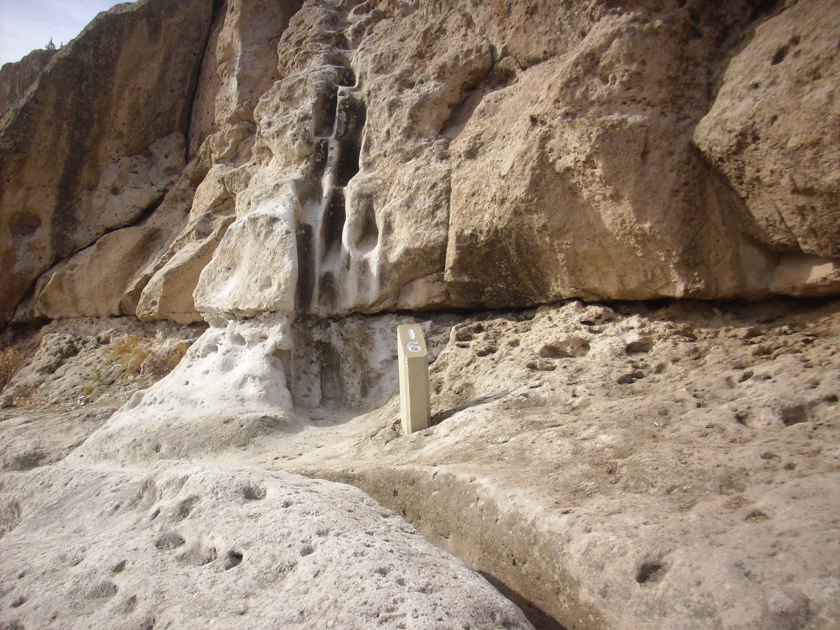
Notch at bottom of unit C on Tsankawi
Mesa. 35
51.671N 106 12.838W
The notch between units is clearly visible. However, this notch
is not a universal feature across the Pajarito Plateau.
These units are also prominent further south, in Ancho Canyon,
where we also see some of the overlying units.

The ledge atop Unit A/Qbt 1g is very distinct. The resistant
lower bed of Unit B/Qbt 1vc is particularly clear at left, and
above is the softer upper portion of unit B/Qbt 1vu. On top are
the resistant beds of Unit C/Qbt 2, which seems to form a double
layer here. This suggests two pulses that cooled together.
Unit D/Qbt 3 seems to consist of multiple thin flows that are particularly rich in lithic clasts. There is a remnant of this unit on the south rim of Water Canyon.
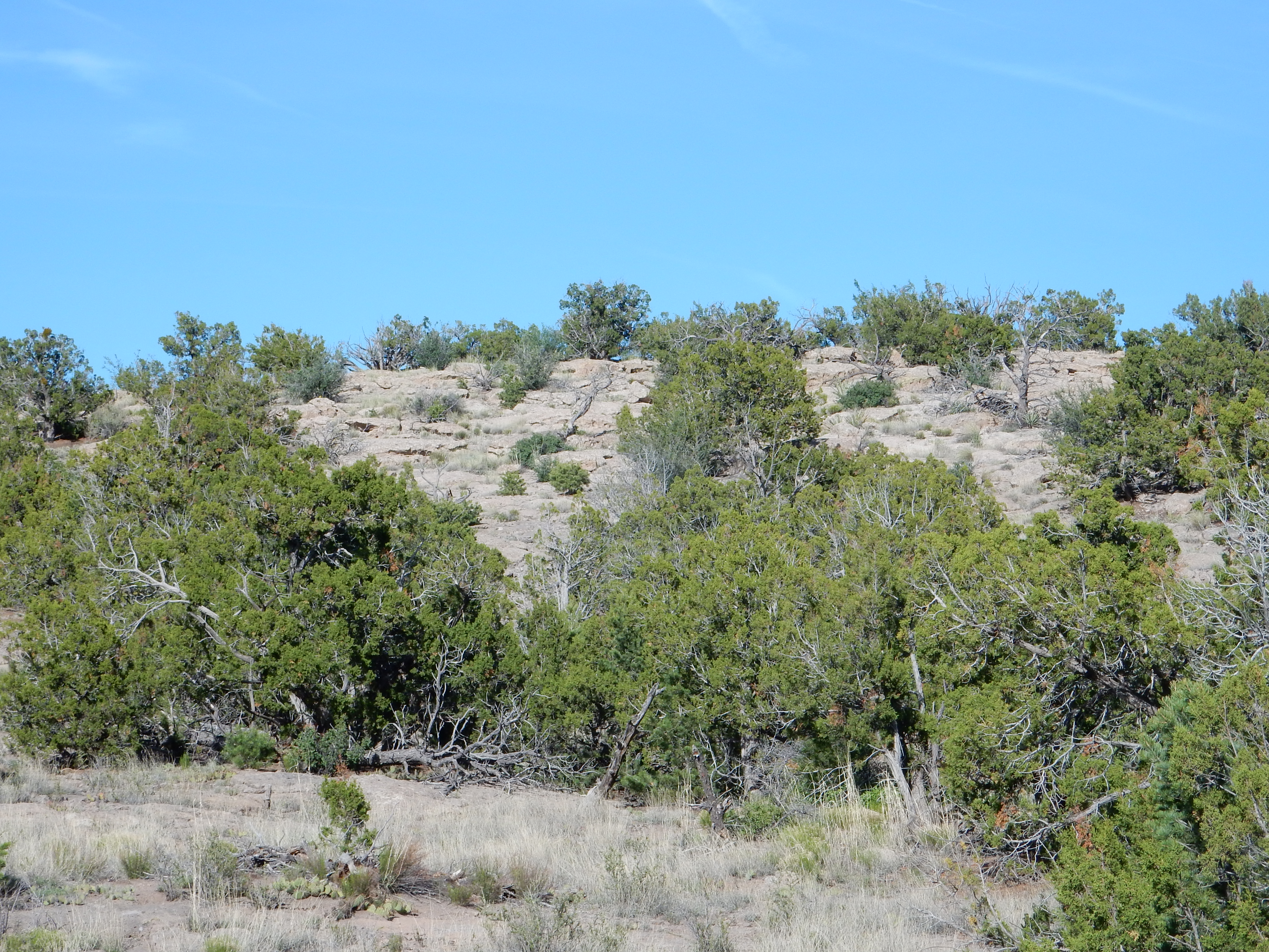
Lithic clasts weathered out of the tuff litter the surface of the tuff.
This unit probably marks the actual collapse of the caldera.
The south side of Los Alamos Mesa is accessible via a trail from near the Clinton P. Anderson Overlook, and it cuts across some of these unit boundaries.
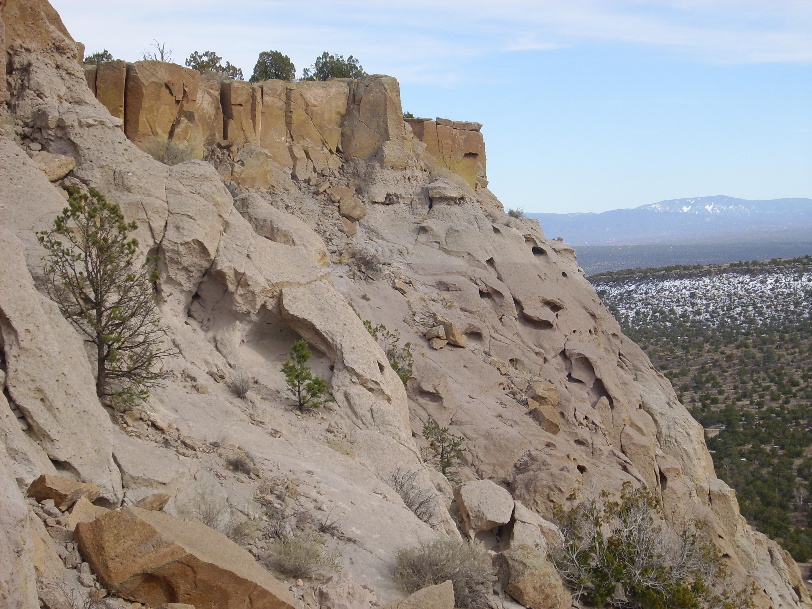
South side of Los Alamos Mesa. 35.871N
106.234W
The densely welded tuff at the top of the mesa is the C unit. Immediately beneath this unit is the B unit, which is characterized by a high content of pumice in its upper beds. This produces a characteristic spongy texture.
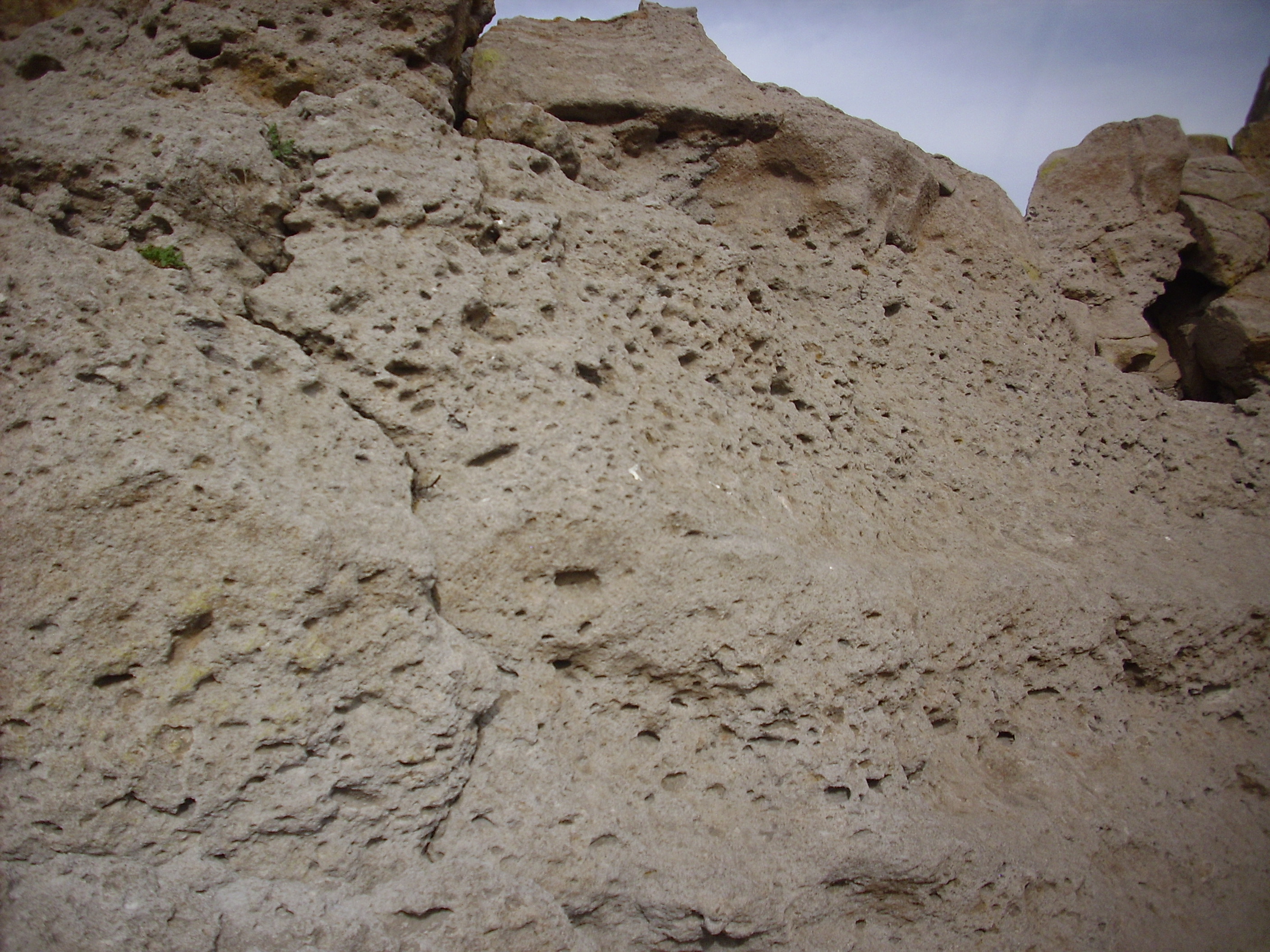
South side of Los Alamos Mesa. Near 35.871N
106.234W
Each pit marks where a pumice clast was present when the tuff was
laid down. The clasts exposed on the surface were subsequently
preferentially eroded to produce the pits, which often contain
remnants of the original pumice clast. Such zones rich in pumice
beds typically mark the upper portion of a flow, while the lower
portion of a flow tends to be enriched in lithic fragments and in
crystals of quartz and sanidine.
The pumice content drops further down, but not abruptly. However,
there is a very abrupt if subtle change in the color of the tuff,
which becomes more pink. This can be inspected closely from the
trail.
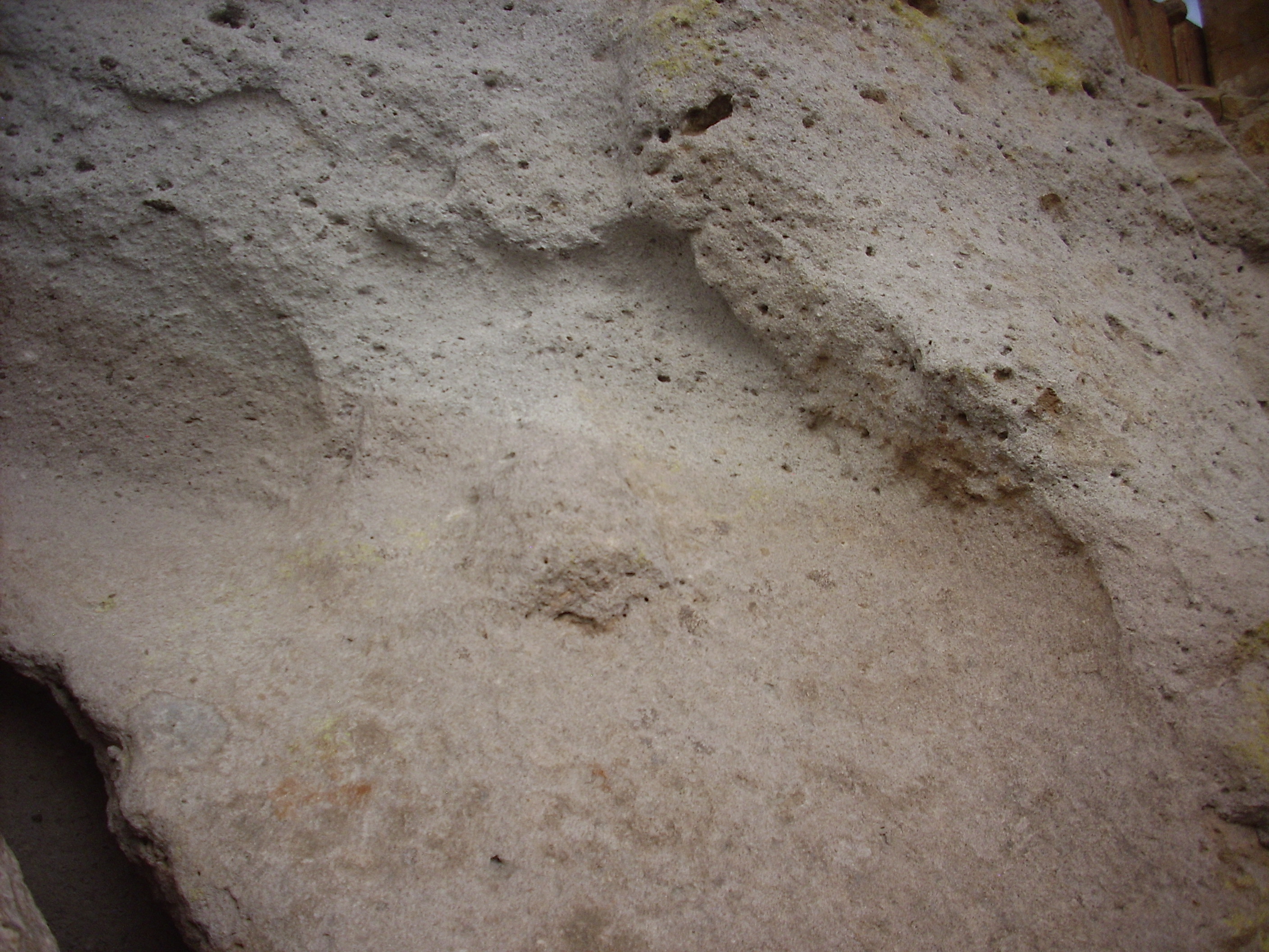
Abrupt color change, possibly marking flow boundary.
Near 35.871N
106.234W\
This is also exposed on the upper surface of the mesa at a low saddle.
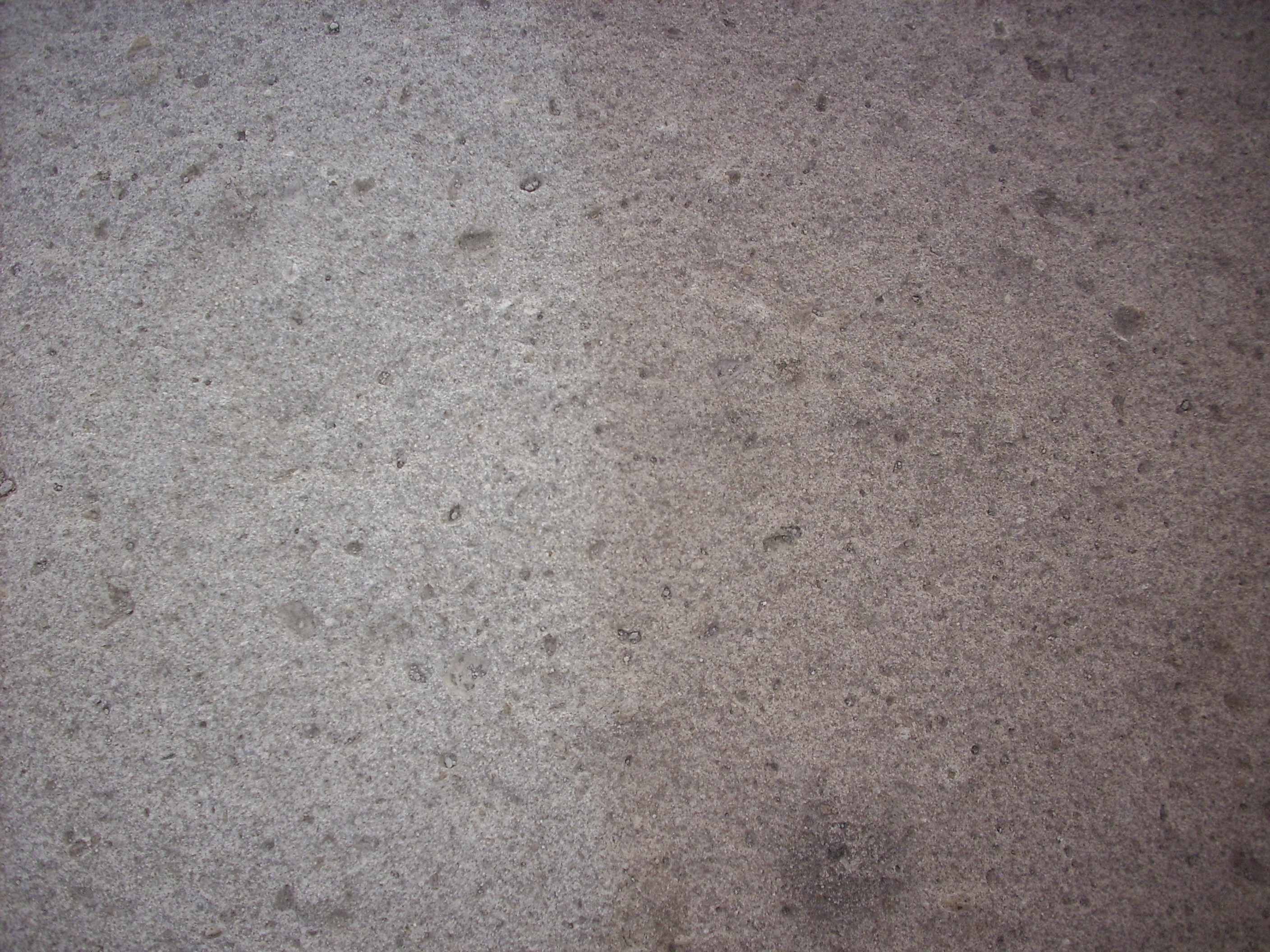
Abrupt color change, possibly marking flow boundary.
Near 35.871N
106.234W
This ledge in upper Pueblo Canyon probably corresponds to the C-D
unit boundary.
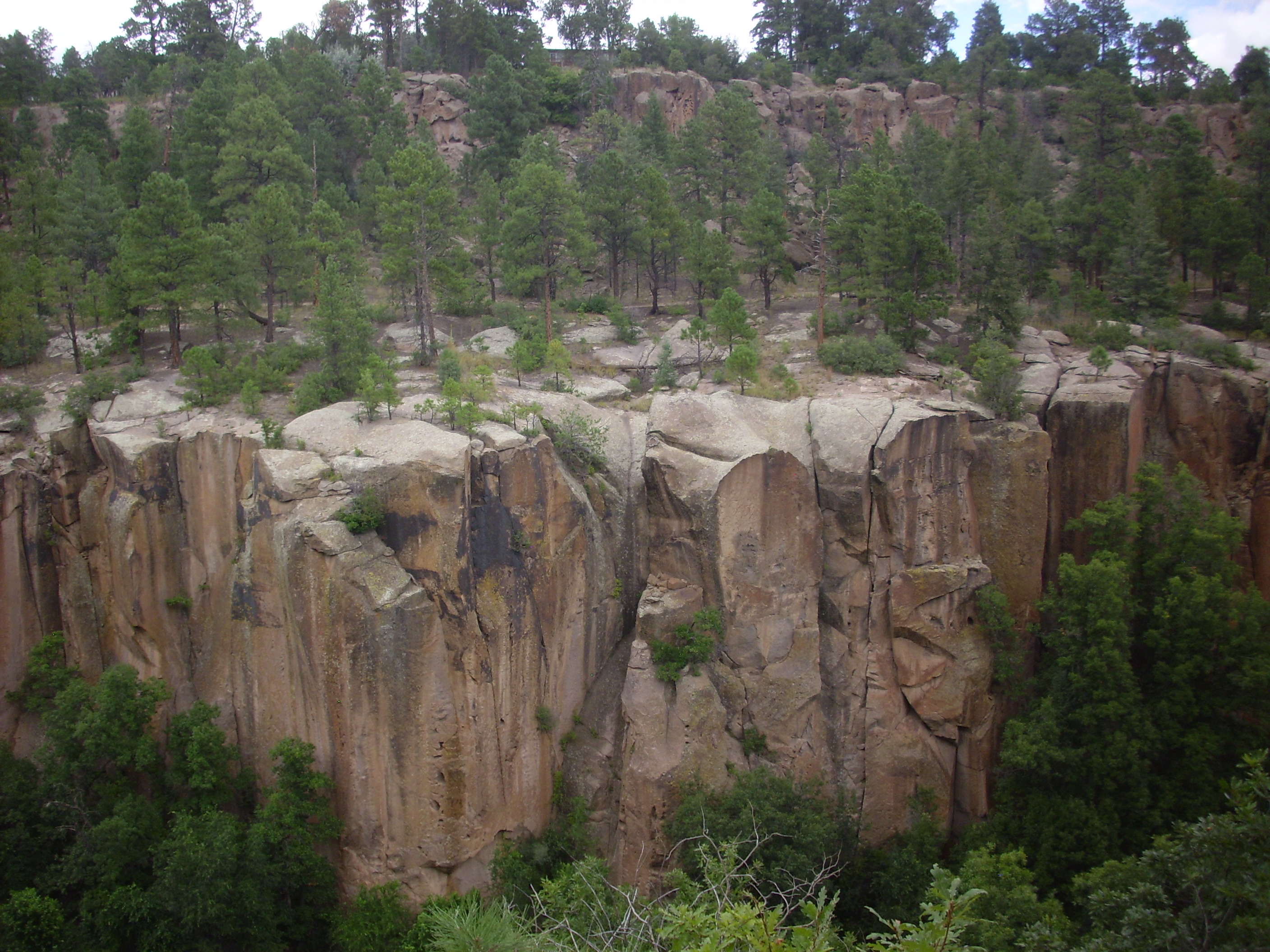
Flow unit ledge in Tshirege Member, Bandelier Tuff. 35.892N
106.316W
Units D, E, and F are visible in upper Los Alamos Canyon. We saw
this photograph earlier.
Faults in Tshirege Member in Los Alamos Canyon. 35
52.689N 106 20.615W
Unit F is the upper rim of the canyon. Unit E forms the slopes beneath, and the cliffs are Unit D.
The uppermost units (E and F) show occasional surge beds that
suggest these units are composed of multiple flows.
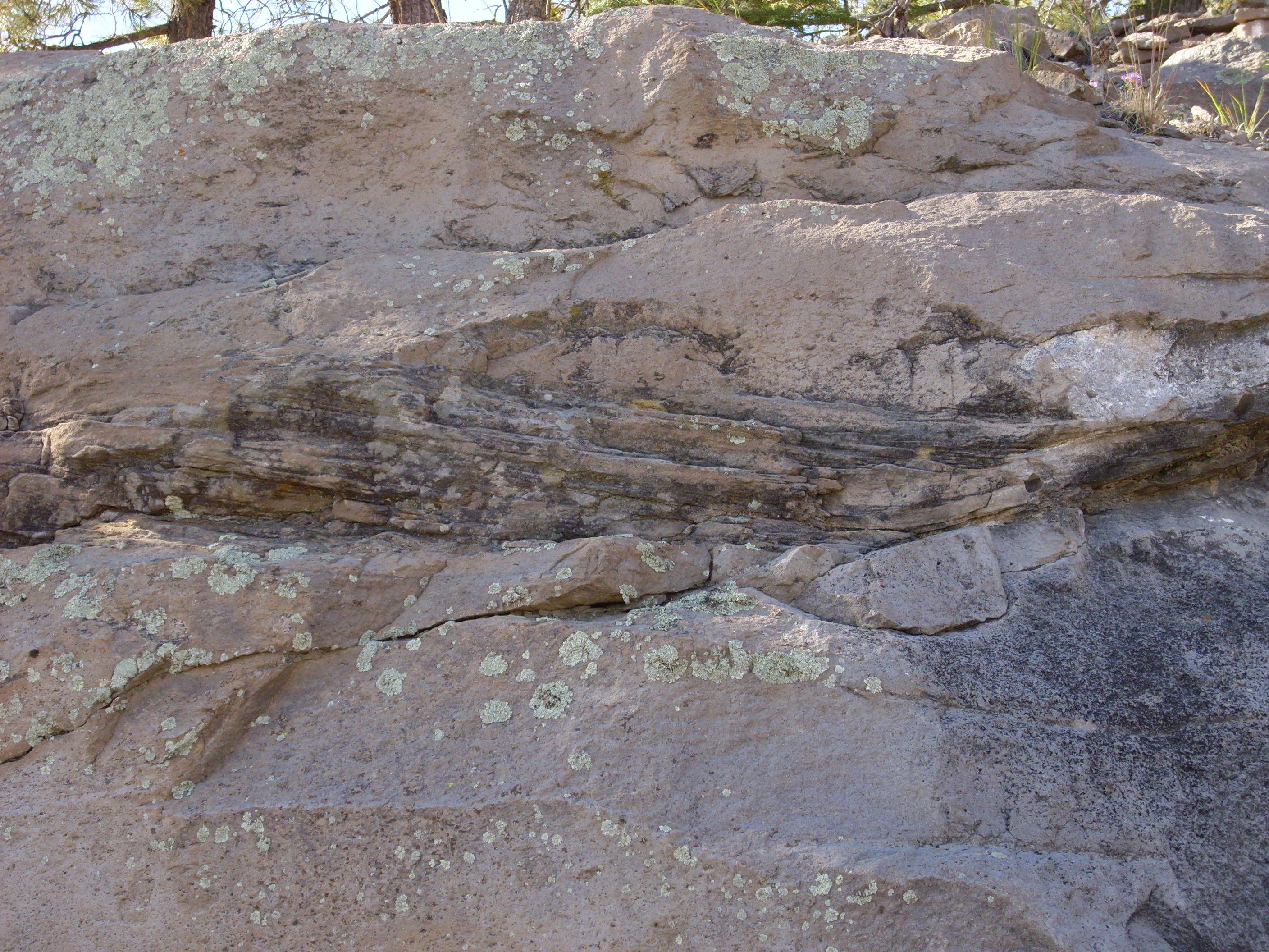
Surge beds in Tshirege Member along Camp May Road. Near
35
52.689N 106 20.615W
Tuffs often have a distinctive chemical signature that identifies
them as the product of a single batch of lava. Thus, the Peralta
Tuff discussed earlier in the book is significantly poorer in iron
and richer in calcium than the Bandelier Tuff, and the Tshirege
Member is significantly richer in iron than the Otowi Member.
However, there are systematic differences in composition even
within the Tshirege Member. Chemical analysis shows that the first
flows erupted during the supereruption were less rich in mafic
minerals than those erupted later in the supereruption. This compositional
zoning is interpreted as the gradual emptying of a magma
chamber that is richer in mafic minerals towards its bottom than
its top. The high-silica magma in the chamber was strongly
differentiated, and the heavier mafic minerals had crystallized
and begun to settle to the bottom. (With a magma as viscous as
rhyolite magma, the settling process can be extremely slow.) The
later flows also tend to be more densely welded than earlier
flows, indicating that the lower part of the magma chamber was
also hotter. While the Tsankawi Pumice erupted at a
temperature of about 700 C, the topmost E and F units erupted at a
temperature of about 850 C, and had a silica content of about 73%
versus 77% for the earlier magmas. This is nearly a dacitic
composition.
The compositional zoning is not obvious to the casual observer in the more distant parts of the Valles outflow sheet, but it becomes more obvious near the caldera where the differences are more extreme. For example, some of the exposures of the Tshirege Member just west of the caldera rim are quite dark in color.
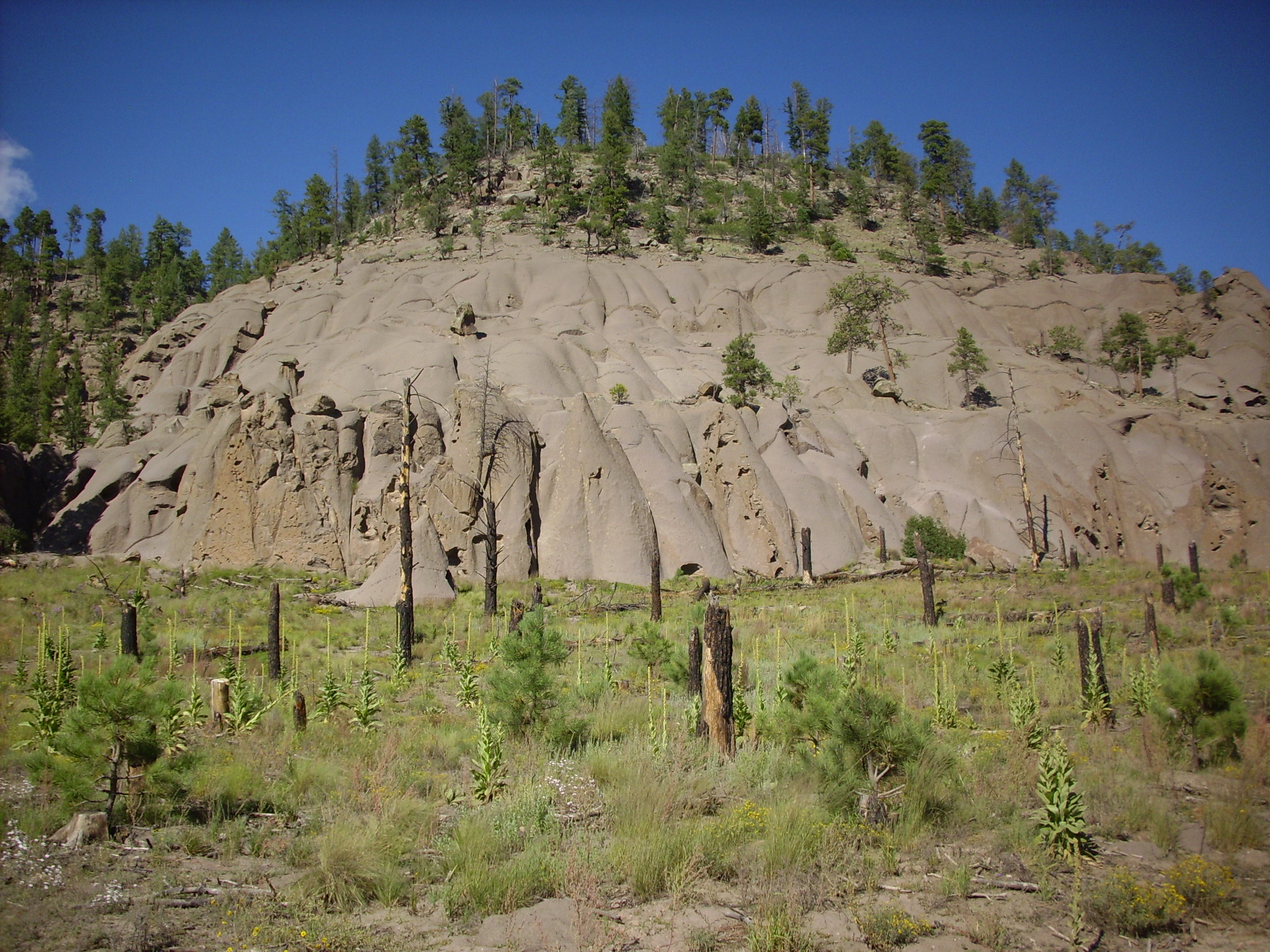
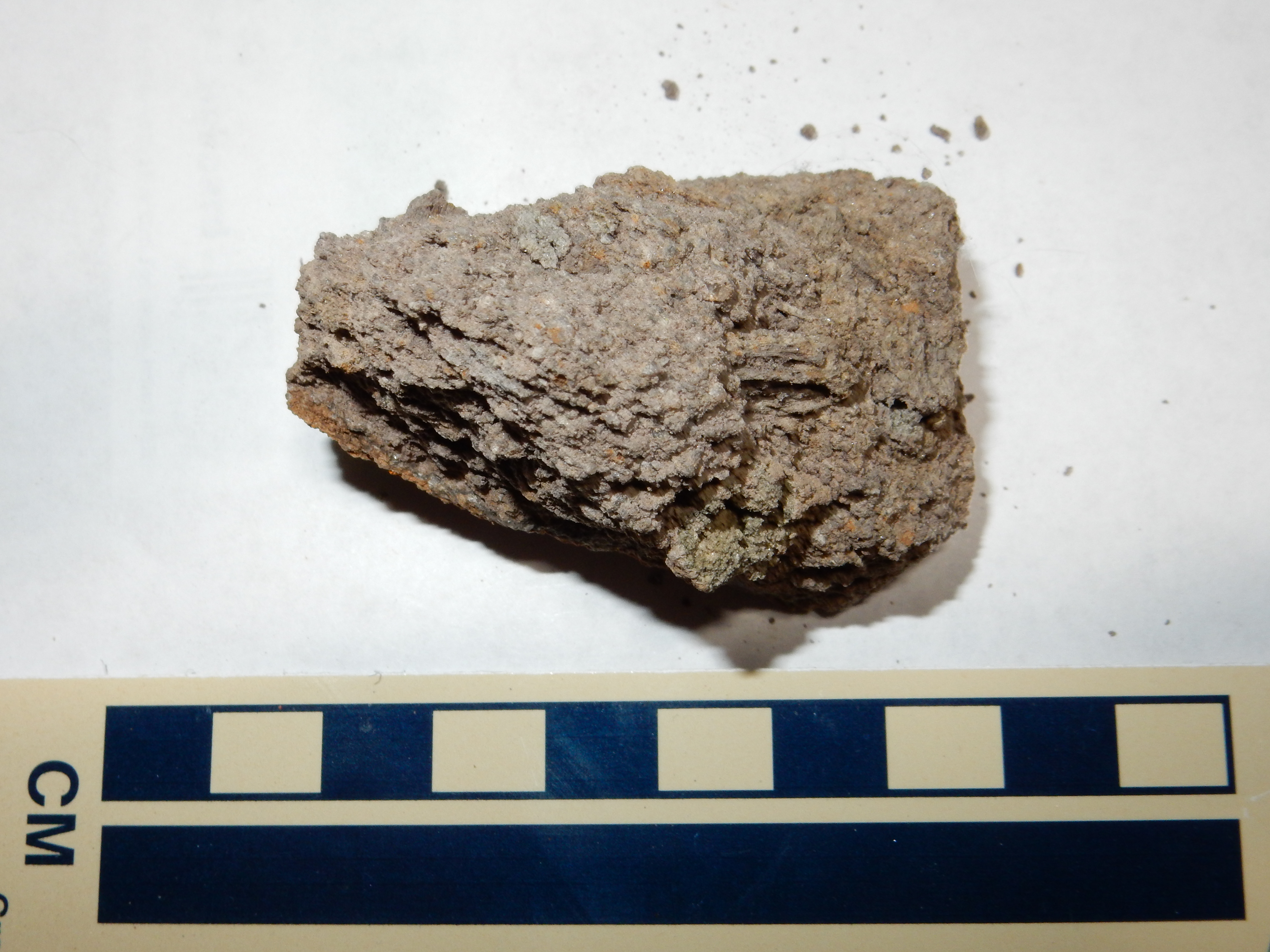
Mafic tuff along Forest Service Road 376 in the Jemez
Plateau. 35
52.121N 106 41.964W
These likely correspond to unit E/Qbt3.
Likewise, the exposures of the Tshirege Member along State Road 4
where it reaches the top of the Pajarito Escarpment shows some
extremely dark and densely welded tuff. This is probably also part
of unit E/Qbt 3.
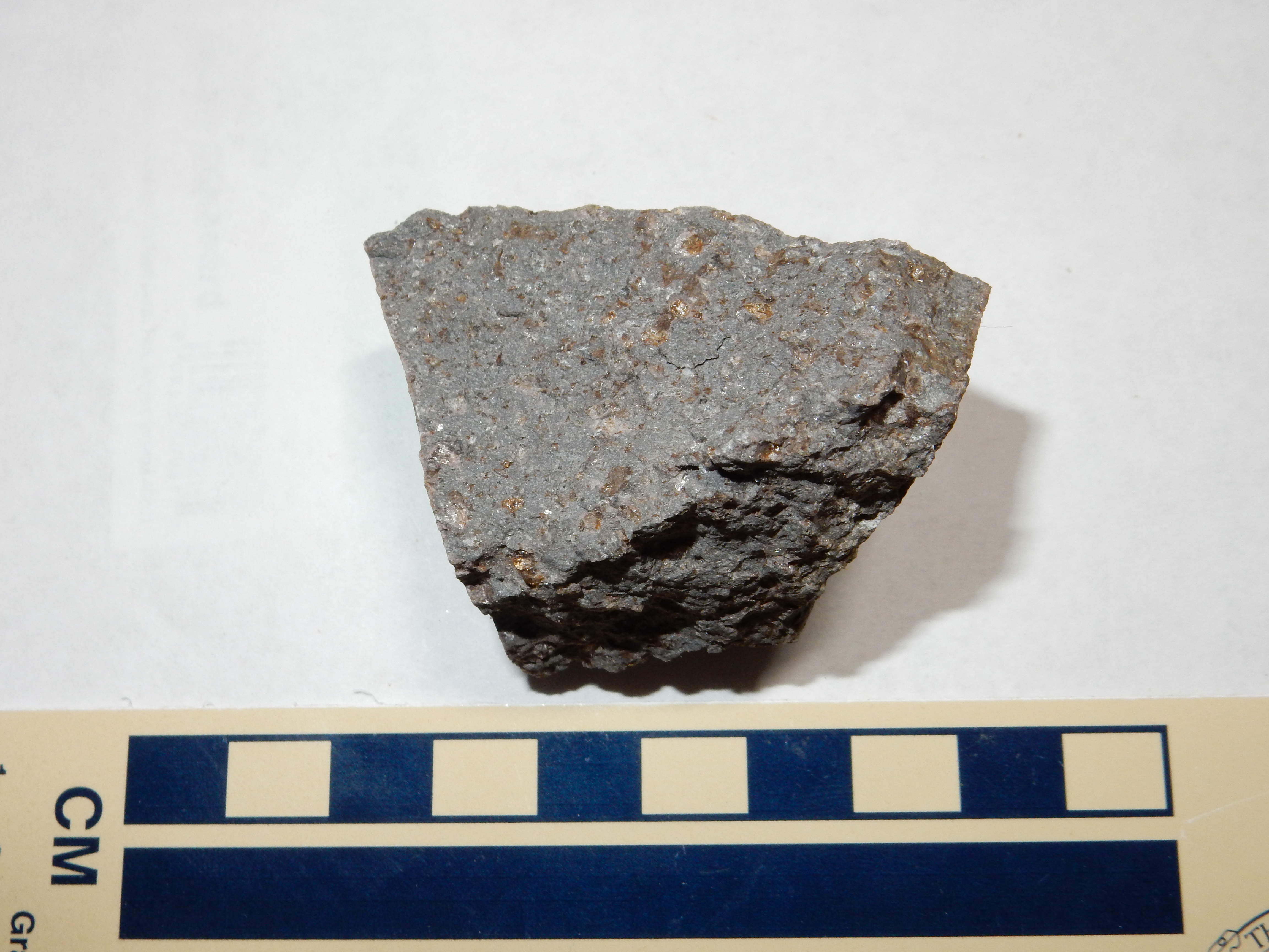
Highly mafic Tshirege Member from near eastern caldera
rim. 35.833N
106.364W
Besides the dark color, suggesting high mafic content, the rock
is much harder and noticeably denser than most samples of Tshirege
Member. It is also particularly rich in crystals of quartz,
feldspar, and biotite. These likely had settled towards the bottom
of the magma chamber before the eruption.
The Tshirege Member is generally more densely welded than the Otowi Member, and it seems to be much less prone to forming tent rocks. However, there are some impressive vapor phase pipes in lower San Juan Canyon.
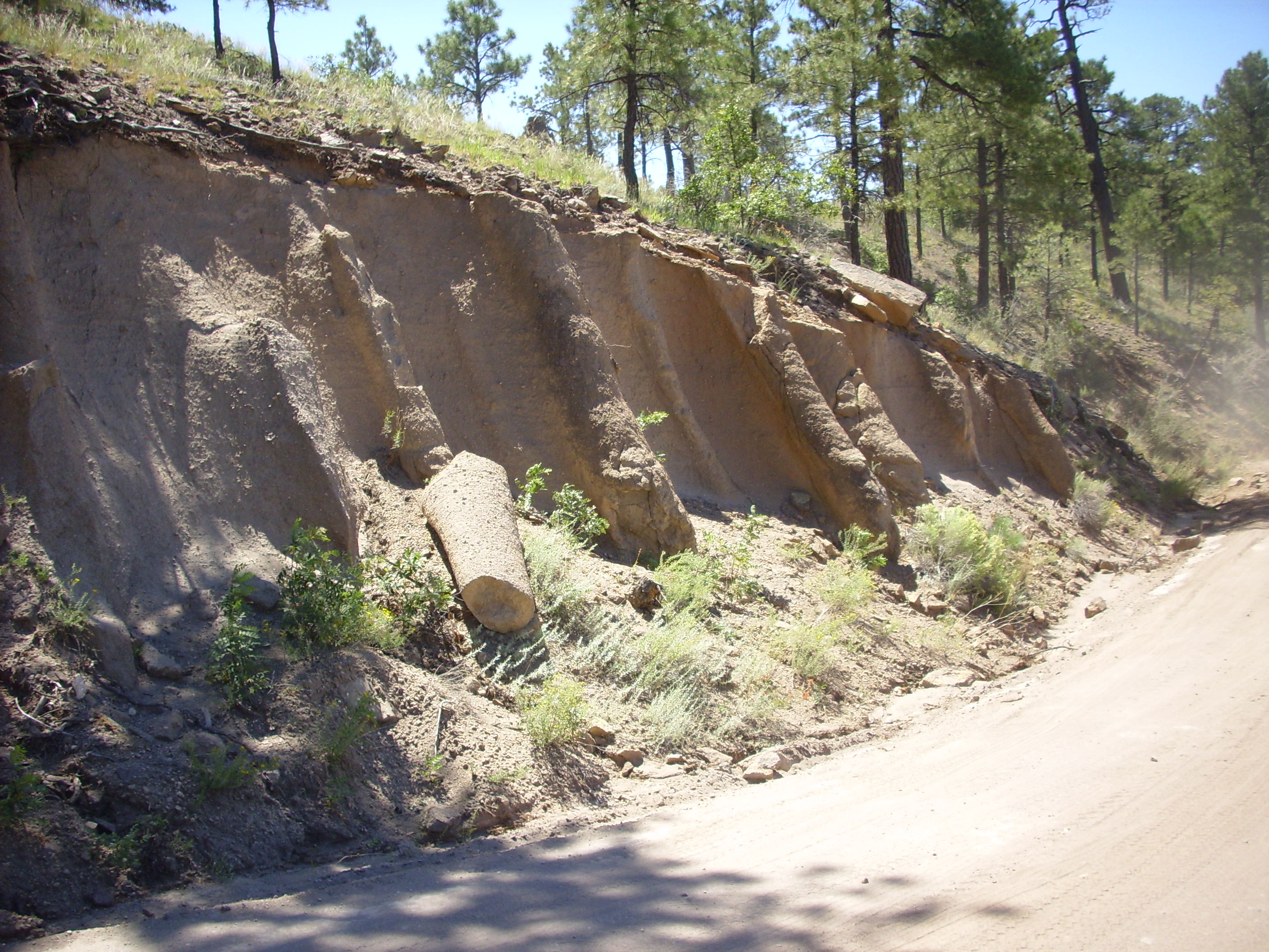
Vapor phase pipes in the Bandelier Tuff. 35.727N
106.622W
These are formed where rising vapors within the fresh pyroclastic
flow followed particular paths and hardened the tuff in a
cylindrical shell around each path. The pipes are hard on the
surface and softer within.
The Valles Caldera at the heart of the Jemez Mountains is a
splendid example of a giant caldera.Though not the largest caldera
known, it is relatively young, exceptionally well-preserved, and
show most of the characteristic features of a giant caldera.
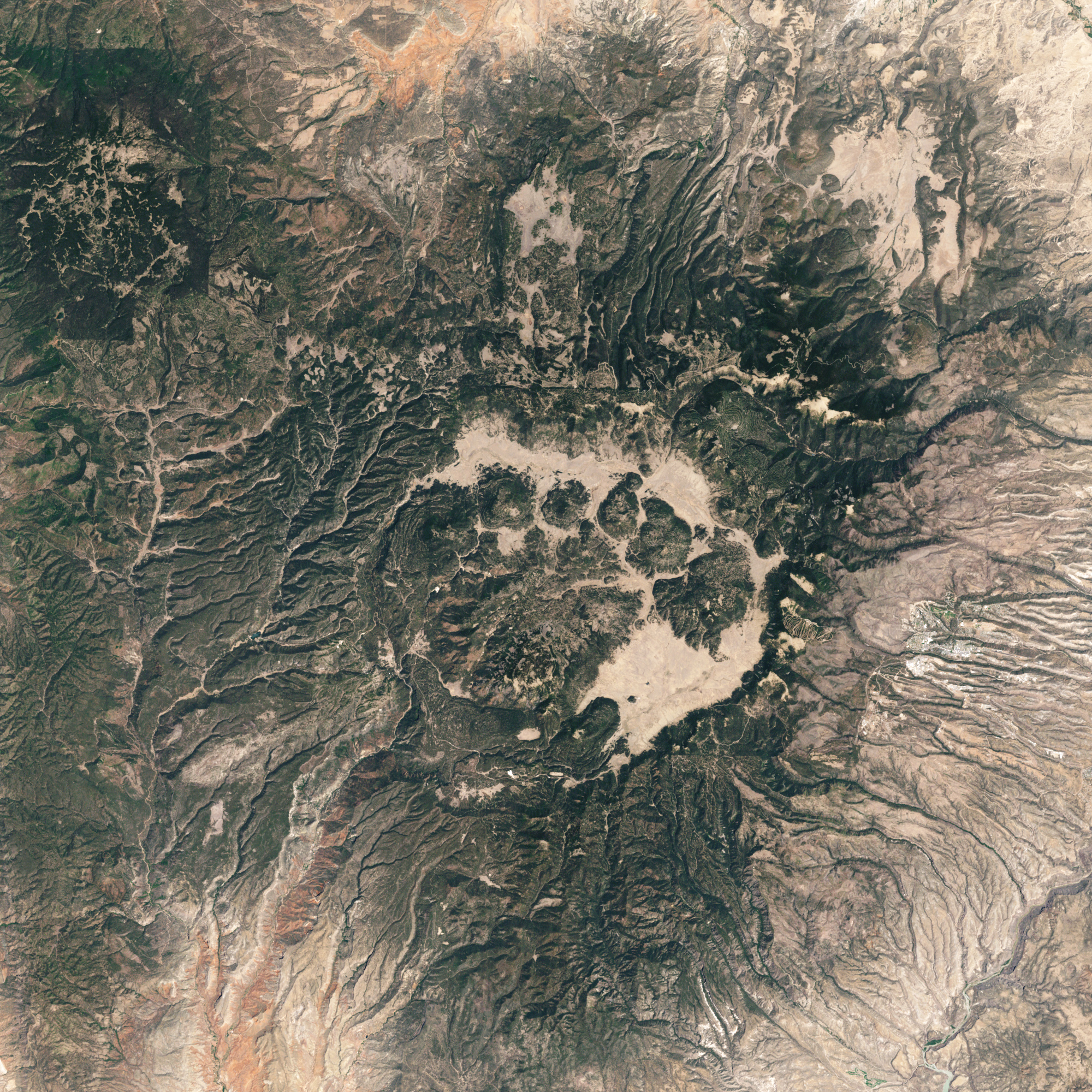
This satellite photograph shows the Valles Caldera as it is
today. The caldera measures about 12 miles (19 km) across and was
formed by the Tshirege event. This emptied a magma chamber with a
volume of 75 cubic miles (300 km3). The caldera
has a number of mountains within it, which many writers have
likened to a bear claw. The pad is the large area in the center,
the toes are the smaller mountains north and northeast of the pad,
and the thumb is South Mountain. We'll learn about the
significance of these mountains in the next chapter.
The topographic rim of the caldera is highlighted below.
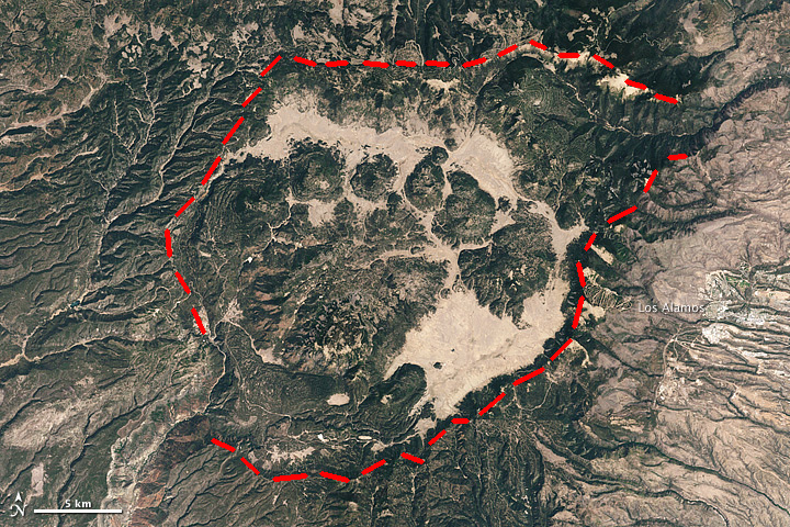
Topograhic rim of Valles Caldera
The topographic rim is poorly defined to the northeast and southwest. In the southwest, the rim has been heavily eroded by the Jemez River in San Diego Canyon. In the northeast, erosion in upper Santa Clara Canyon has combined with subsidence in the Toledo Embayment to obscure the exact caldera rim.
Here is a map of precaldera rocks around the caldera.
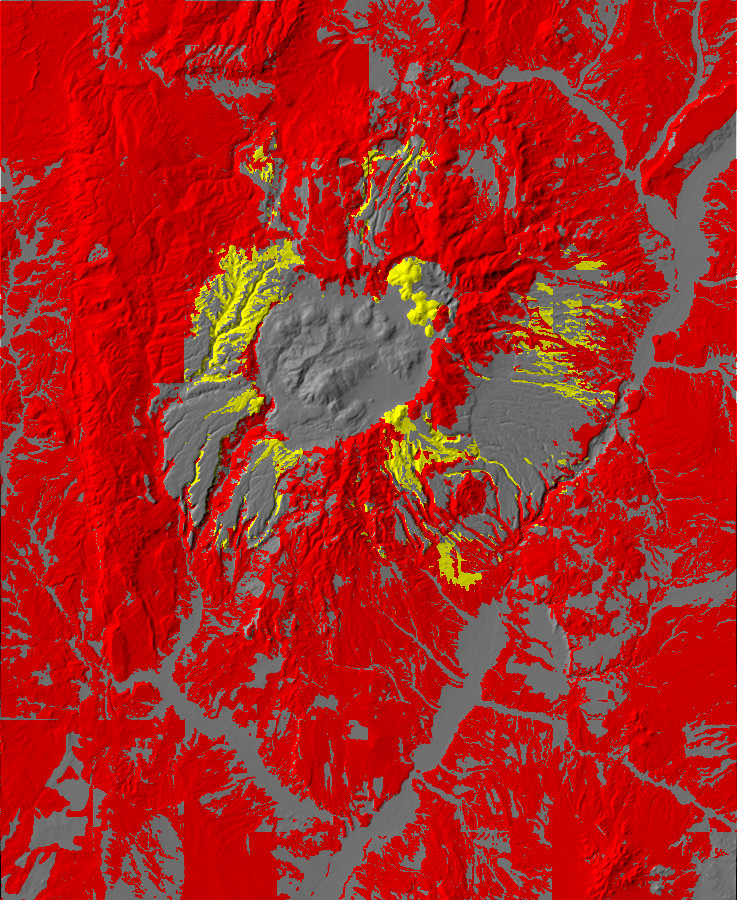
Relief map of the Jemez with pre-Toledo exposures
highlighted in red and Toledo Interval exposures highlighted
in yellow.
Red areas are rocks older than the Toledo event. The exposures
around the rim of the Valles caldera show the maximum possible
extent of the Toledo caldera. Yellow areas are exposures older
than the Valles event but no older than the Toledo event. These
mark the maximum possible extent of the Valles caldera. The two
are nearly identical except in the Toledo embayment.
Let's take a tour now of the caldera rim as it exists today. We'll begin with the eastern caldera rim.
The light area making up the southeast portion of the caldera in the satellite photos is the Valle Grande. It is easily accessible from State Road 4, from which the visitor sees this panorama.
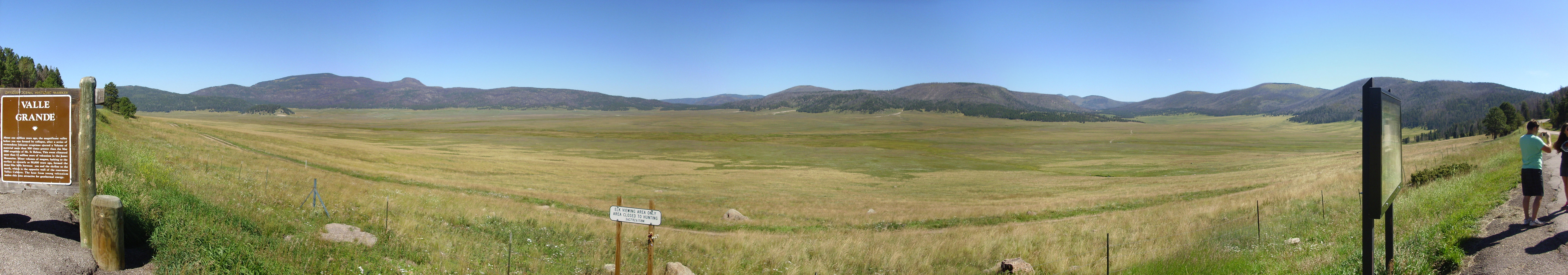
Valle Grande. 35
51.096N 106 27.305W
Valle Grande was probably the deepest part of the caldera when it first formed. Earlier I showed a reconstruction of the basement beneath the caldera, which show that the floor of the caldera dropped considerably further on its east side than on the west, almost like a trap door hinged to the west. On the west side of the caldera, the floor dropped about 1500 meters (5000'), while the floor dropped about 4600m (15000') on the east side. The entire caldera floor was deeply blanketed by the Bandelier Tuff, which tended to level out the visible surface.
The right side of the panorama shows the eastern rim of the
caldera, from the Toledo Embayment to Cerro Grande. This is the
Sierra de los Valles, which also forms the western skyline of the
city of Los Alamos. .
Switching our viewpoint now to the north side of the Valle Grande, we show the southeastern rim of the caldera.

Caldera southeast rim from Cerro Pinon.
35
53.333N 106 29.760W
At left in the middle distance is Cerro del Medio, a ring fracture dome. Beyond and to the right is Cerro Grande in the southeast caldera rim. Just right of center is Sawyer Dome, the southernmost major dome of the Tschicoma Formation. Between Cerro Grande and Sawyer Dome is a low point in the rim through which State Road 4 enters the caldera, and through which pyroclastic flows of the Valles event flooded the Bandelier area and surroundings. Rabbit Mountain is the irregular mass to the right of Sawyer Dome, while relatively low hills form the rim between Rabbit Mountain and Conchas Peak at far right. South Mountain obscures the south rim west of Conchas Peak.
Here's this stretch of the rim viewed from the south, outside the
caldera.

Panorama from east side of Aspen Ridge.
35
47.888N 106 30.012W
The panorama begins to the west. Aspen Ridge extends across the
left side of the panorama, turning east to form the south rim of
the caldera. Conchas Peak is on the skyline at left. Redondo Peak
forms the skyline behind the eastward leg of Aspen Ridge, and
Cerros del Abrigo and Cerro del Medio are visible to the right of
Redondo Peak, with the north caldera wall behind. Rabbit Mountain
dominates the left center of the panorama, just left of the clump
of foreground trees.

South rim of Valles caldera. Looking west southwest from near 35 49.953N 106 29.237W
The north end of Aspen Ridge dominates the left side of the panorama. This continues south into the Keres Highlands. At right, in the distance, are Las Conchas, with the pointy peak, and Los Griegos to its right. Los Griegos is the highest point on the caldera south rim. Here's a closer view from a little further west.
Las Conchas and
Los Griegos. Looking west southwest from near 35 49.478N 106 29.994W
The rim continues west through the Valle de los Indios. This is the largest private enclave in the southern Jemez, with numerous homes and cabins in a pleasant valley making up the south moat.
South rim in Valle de los Indios. Looking south from near 35 48.543N 106 35.270W
Los Griegos is at left in this panorama. The rim is relatively low to its west. Looking to the southwest:
South rim in Valle de los Indios. Looking south from near 35 48.529N 106 35.416W
Here is the view from State Road Four, cleared by recent forest fires.
Caldera southwest rim. Looking southwest from near 35.8152673N 106.574416,723W
The rim continues west towards the cliffs south of Battleship Rock, which are visible to the right in the panorama. Here's a closer view. We've seen this photograph before.

Caldera rim in Valles de los Indios.. 35 49.133N 106 36.846W
At right is the confluence of East Fork, Jemez River, with Cañon de San Diego. The canyon has cut a great cap in the caldera rim here, and we pick up the rim again further west near La Cueva.
West caldera rim near La Cueva. 35
52.396N 106 38.644W
Notice that the west rim is as low as any part of the rim we have seen so far. This reflects the trapdoor geometry of the caldera.
Further north, the rim forms the west side of the narrow San Antonio Canyon.
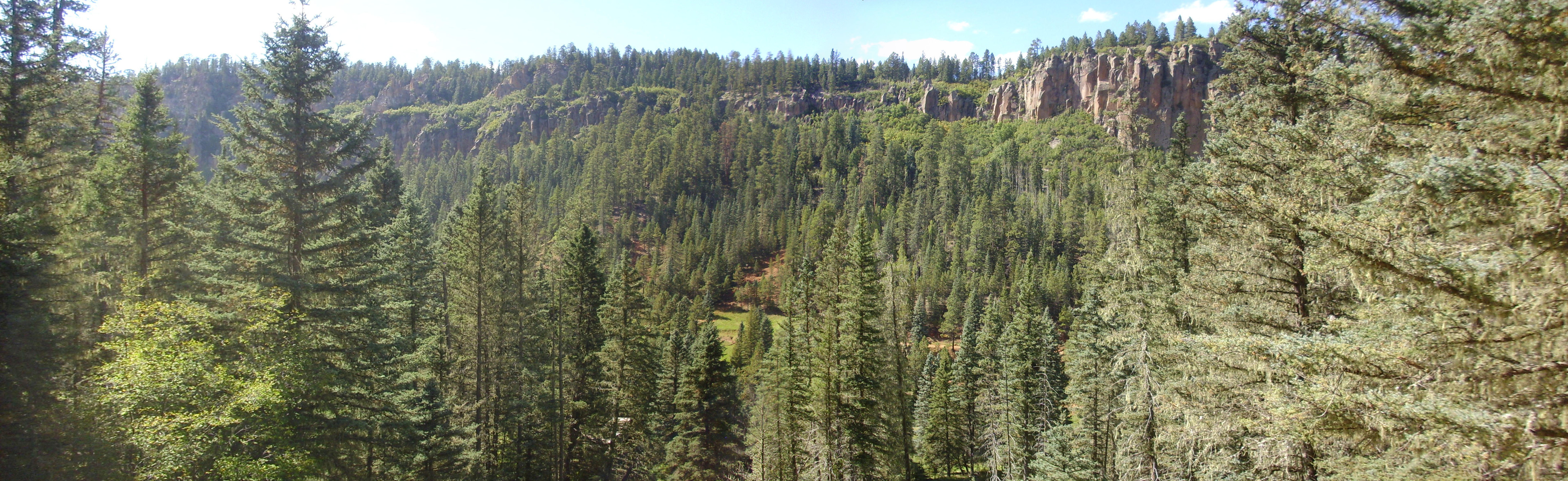
Caldera rim across from San Antonio
Springs. 35
56.387N 106 38.741W
Here Paleozoic rocks of the Abo Formation are present at the base of the rim, which is capped mostly with Otowi Member with a few isolated patches of Tshirege Member.
Looking further up canyon.
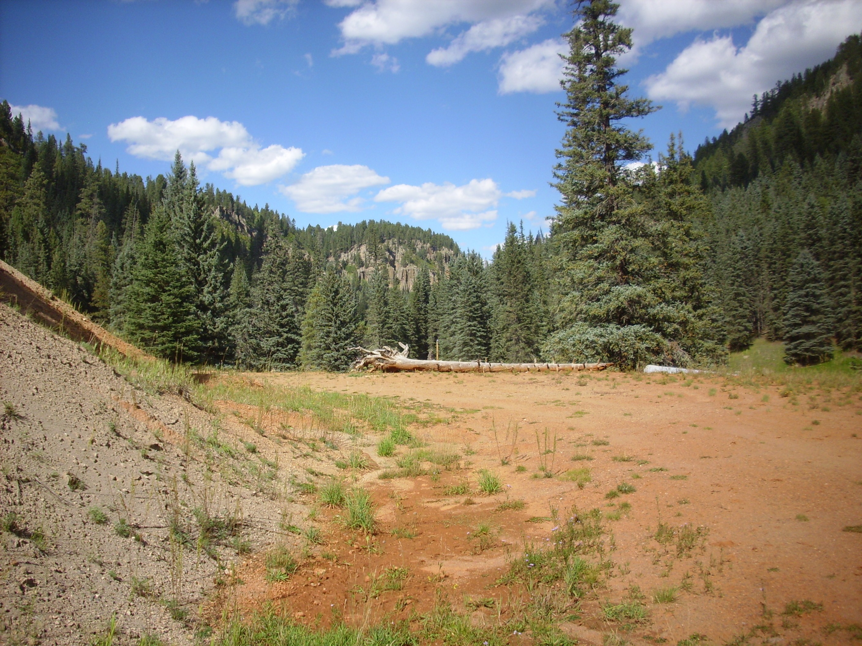
Upper San Antonio Canyon. 35 56.524N 106 38.782W
Or from the rim:

Upper San Antonio Canyon. Near 35.9463436N 106.6457751W
Seeing the canyon from the other end, looking south.
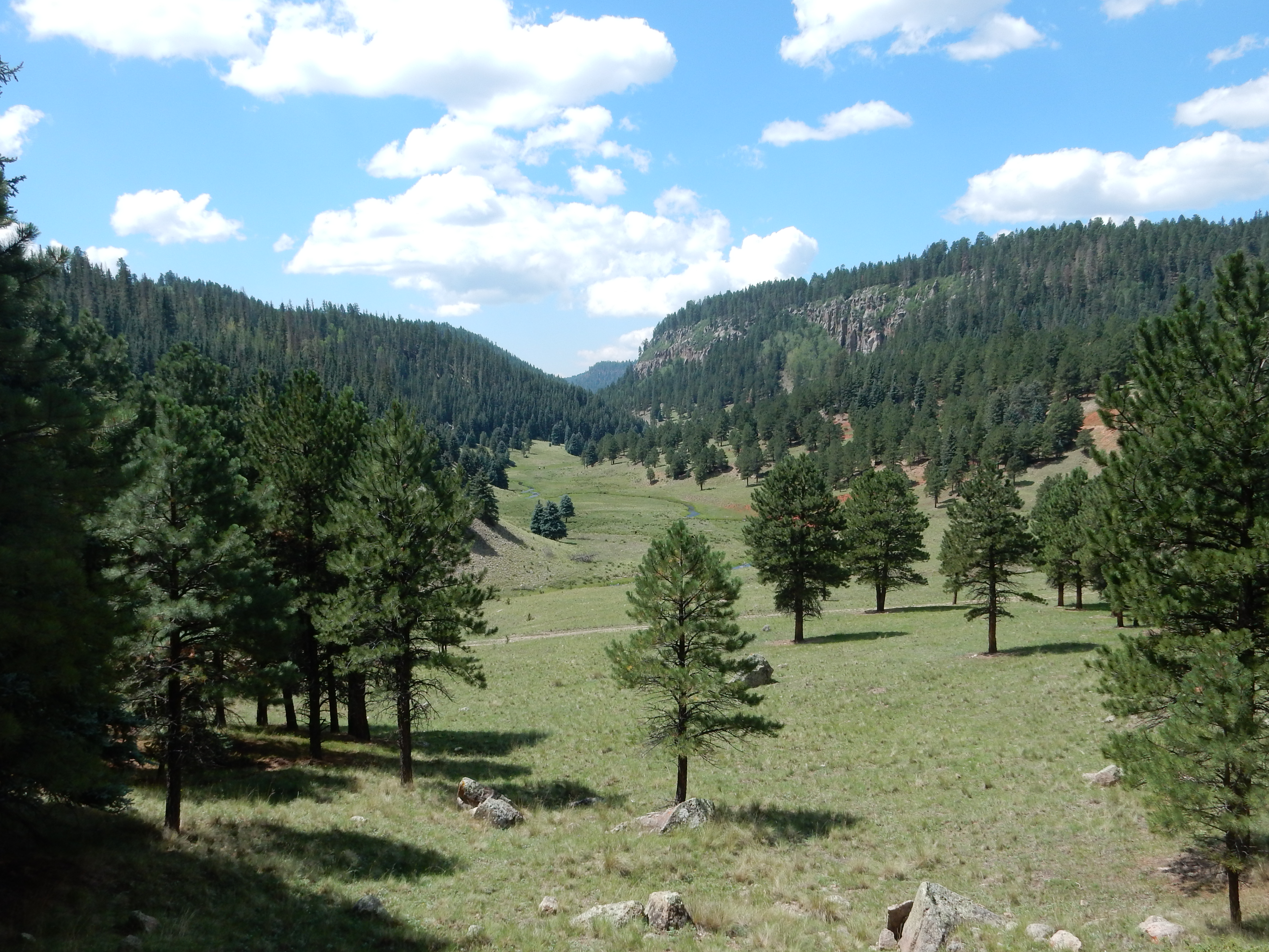
Upper San Antonio Canyon. 35.9618663N 106.6302157w
We pick up the rim again in westernmost Valle San Antonio. Here the rim is lower than any other point outside Cañon de San Diego.
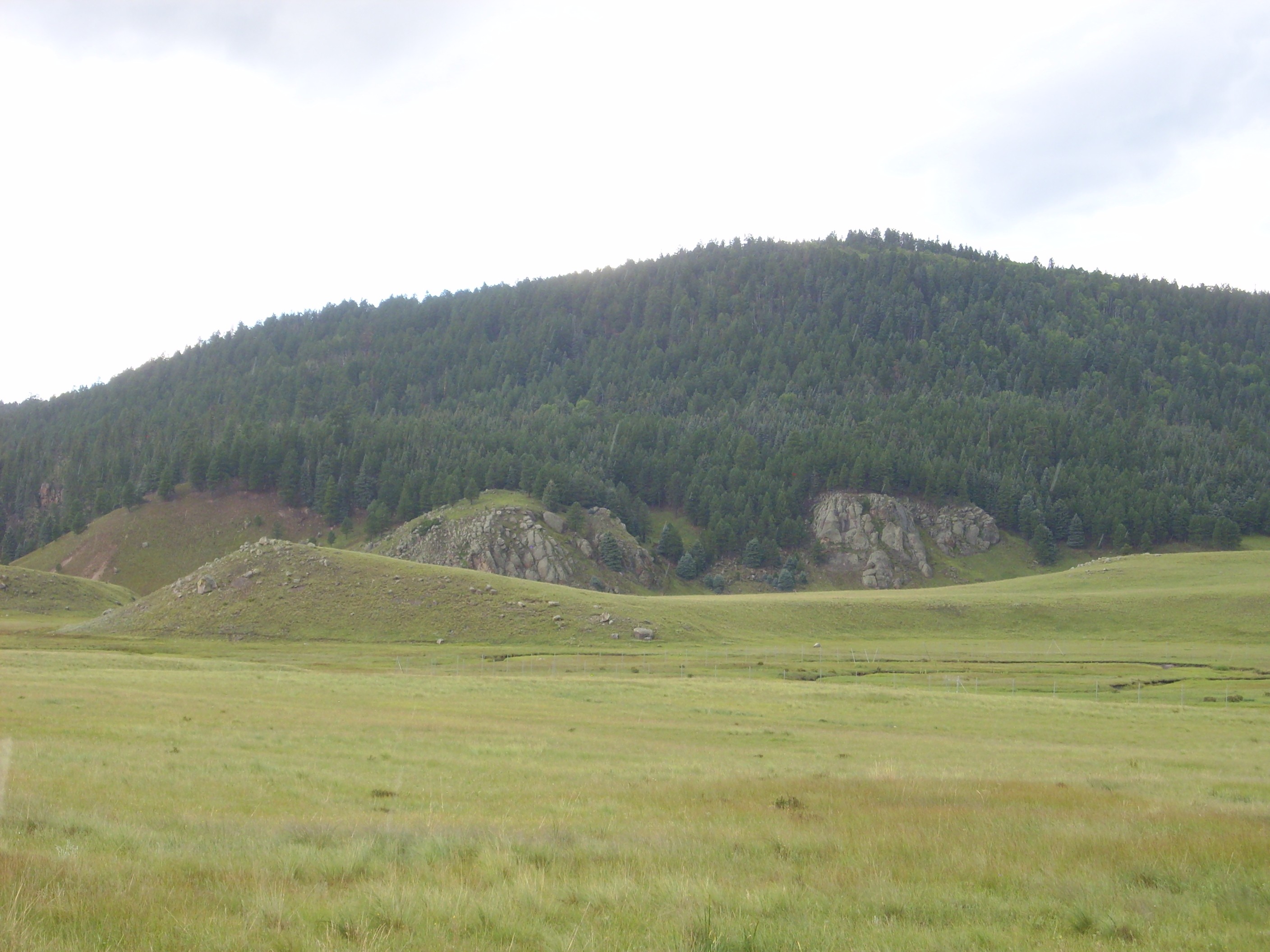
Northwest caldera rim. 35
58.369N 106 35.744W
The hill in the foreground (steeper to the left) and the two
rugged outcrops behind them are giant slabs of Paliza Canyon
Formation andesite that originally sat on the caldera rim behind
them, but which broke off and slid onto the caldera floor
immediately after caldera collapse.
Some densely welded Otowi Member at the base of the low rim:
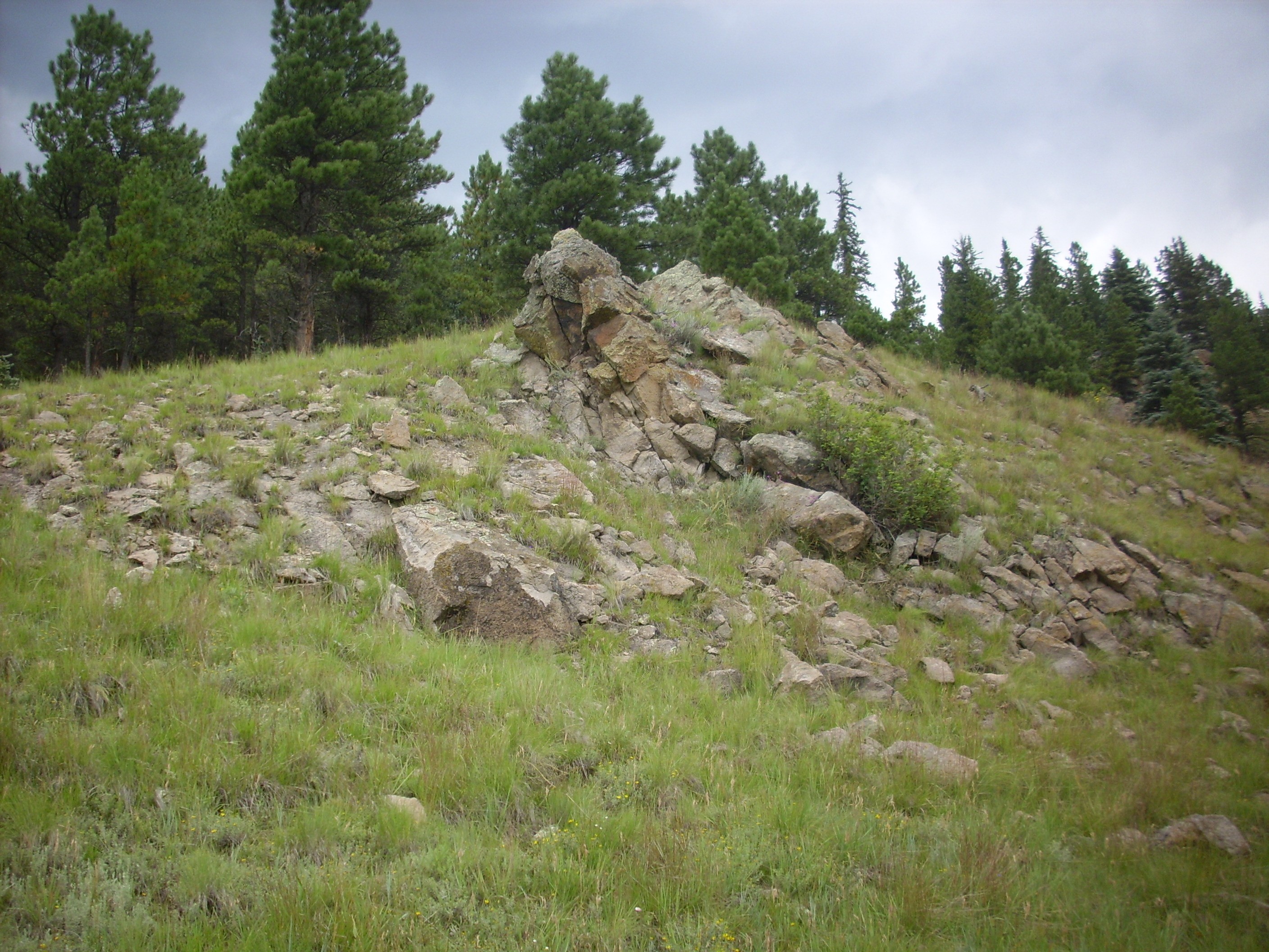
The remainder of the north rim is covered by this panorama from Warm Springs dome.
Warm Springs. 35 58.298N 106 33.728W
From this point, one can see almost the entire length of the northern moat of the caldera. The panorama begins looking down the north moat to the west, and at center is the point on the caldera wall directly north of Warm Springs. The lower cliffs exposed in the rim are Paliza Canyon Formation andesites while the top of the rim is La Grulla formation andesite. Cerro de la Garita, the high point of the north rim, is to the right. The right end of the panorama looks down Pipeline Road and the north moat towards the Toledo Embayment.
We get a better view of the northwest rim and Toledo Embayment from a point further west.
Valle Toledo. 35 57.461N 106 28.890W
In the middle distance at left is the northernmost part of the
Cerro Santa Rosa complex and at right is Cerro Trasquilar, as
known to geologists. (The Forest Service topographic map reverses
these, confusingly.) Between in the distance is Cerro de la
Garita. To the right of Cerro Trasquilar is more of the northeast
rim, an area underlain by Santa Fe Group sediments intruded by
both Paliza Canyon Formation and Bearhead Rhyolite. The right side
of the panorama is dominated by Turkey Ridge, which lies across
the mouth of the Toledo Embayment, while the dome at far right is
Cerros de los Posos West, interpreted as a ring dome of the Toledo
caldera.
The moat nearly pinches out southeast of Valle Toledo. Here the low obsidian flows of Cerro del Medio reach nearly to the caldera rim.
Northeast caldera rim. 35.9358373N 106.4474247W
At left is Cerros de los Posos West. To its right is Shell
Mountain, then Cerro Rubio just left of center. The flat mountain
right of center is Cerros de los Posos East, then comes a small
peak that is unofficially known locally as Quemazon Peak or
Rendija Peak. The second broad mountain right of center is
likewise unnamed, while the sharper peak at extreme right is
Pajarito Mountain.
The moat opens up somewhat further south, becoming Valle de los
Posos.
Valle de los Posos. 35.9392879N 106.4336567W
East Posos, an unnamed mountain, and Pajarito Mountain are at at left. Cerro Grande is just visible over the ridge in the middle distance, left of center. The ridge is part of Cerro del Medio, which dominates the middle distance at center and center right of the panorama. At far right is Cerros del Abrigo.
The east rim includes a bench of densely welded Bandelier Tuff.
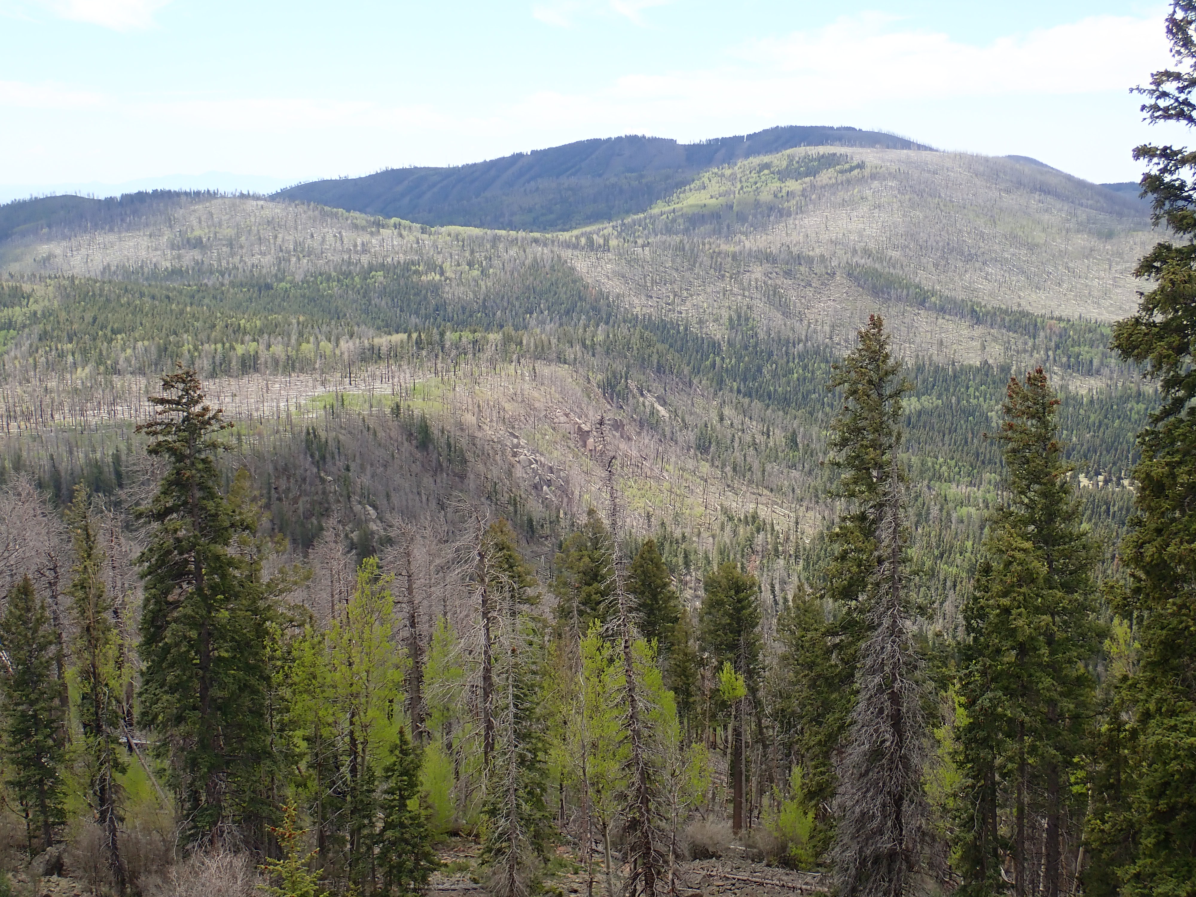
East caldera rim seen from the north. 35.943458N 106.4007479W
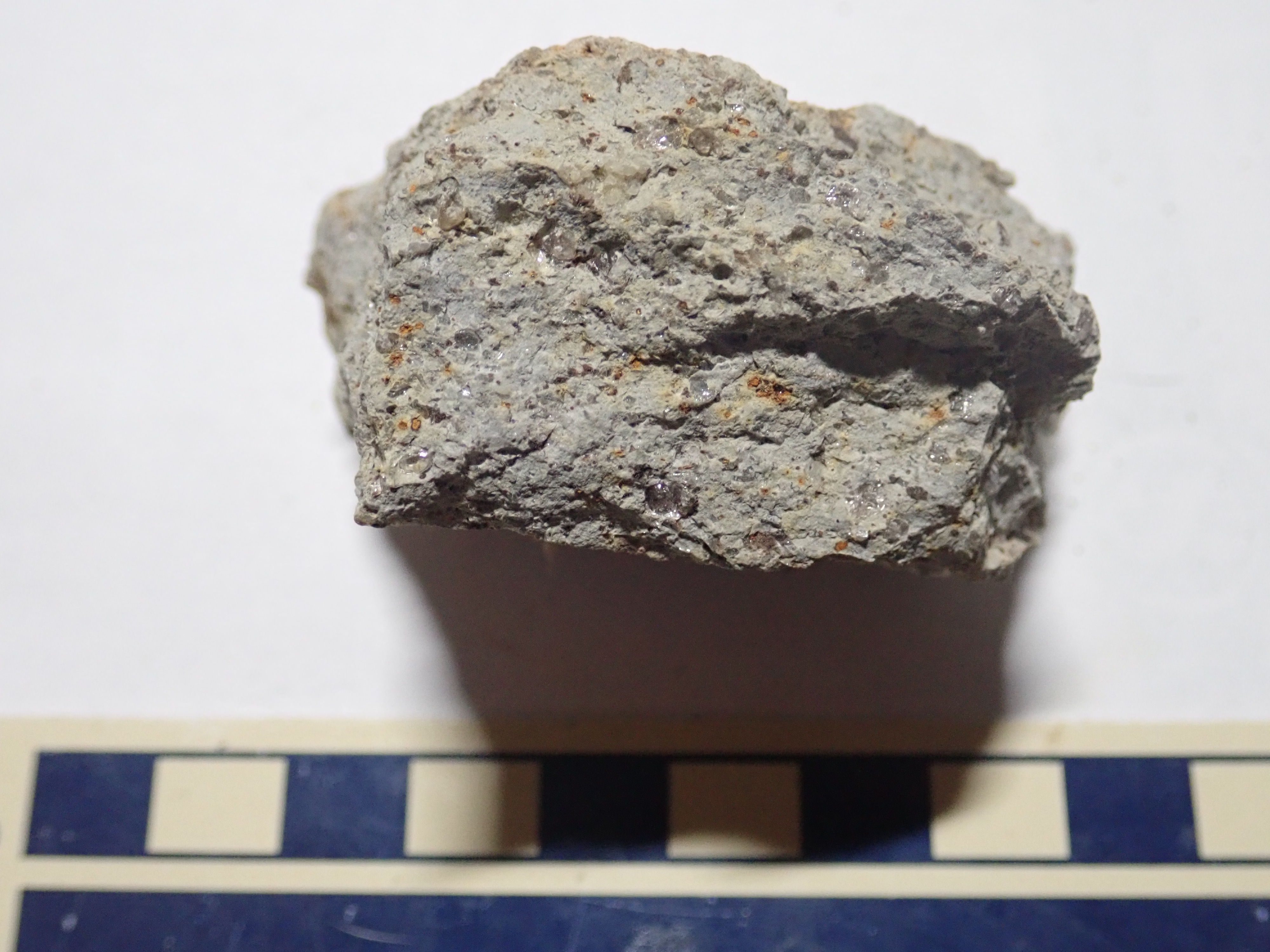
Densely welded Tshirege Member on east caldera rim. 35.934223N 106.397691W
This was likely some of the last tuff erupted from the caldera,
and this is reflected in its darker color, abundant iron minerals
(now oxidized to red), and high degree of welding. There are
nonetheless quartz and sanidine phenocrysts in the sample.
The Bandelier Tuff clearly had time to solidify before the caldera rim collapsed this far east.
The peaks here are all visible in the first photograph of this
section, and so we have completed our tour of the caldera rim.
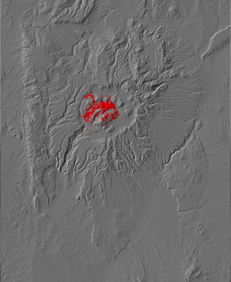
Relief map of the Jemez with caldera fill outcroppings
highlighted in red.
The topographic rim does not mark the actual ring fracture where the roof of the magma chamber collapsed. The steep walls left by collapse along the ring fracture were unstable, and subsequent landslides moved the rim outwards while burying the ring fracture. These early landslides are partially buried by later sediments, but in a few places, particularly around Redondo Peak, the original caldera fill is exposed. Some of the best exposures are in the Redondo Graben, where megabreccias show where entire beds of older rock slid back into the caldera.
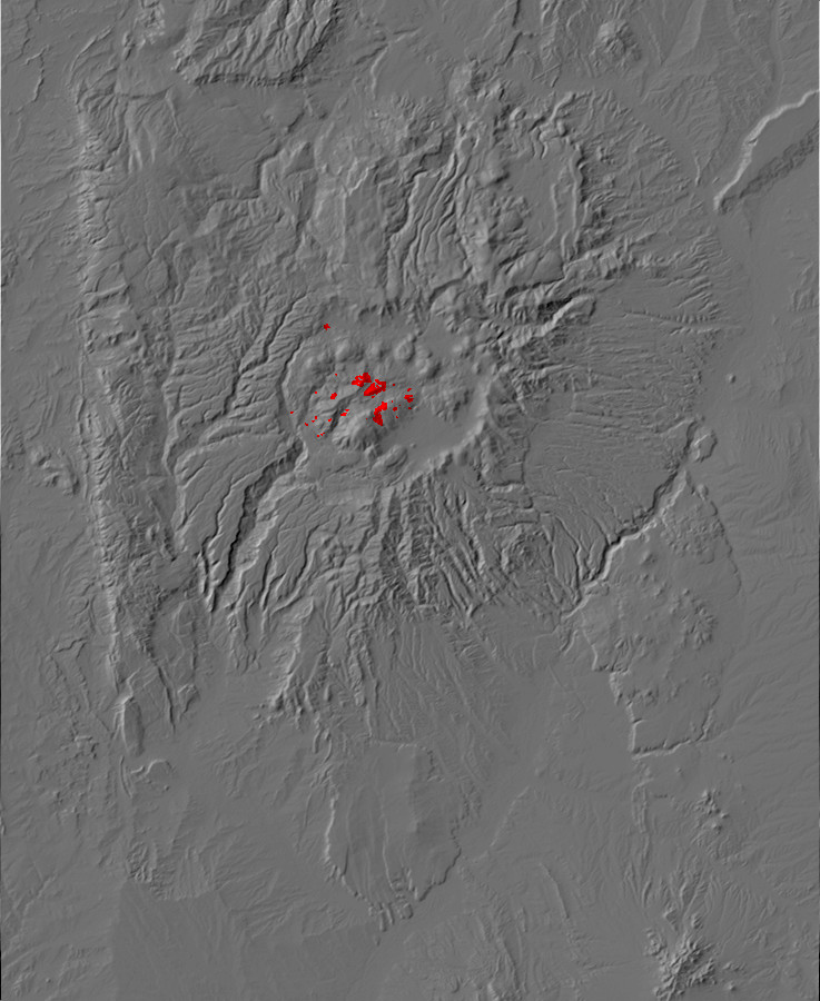
Relief map of the Jemez with megabreccia outcroppings
highlighted in red.
The most accessible of the megabreccia blocks is located north of State Road 4 on the east side of Sulfur Creek.
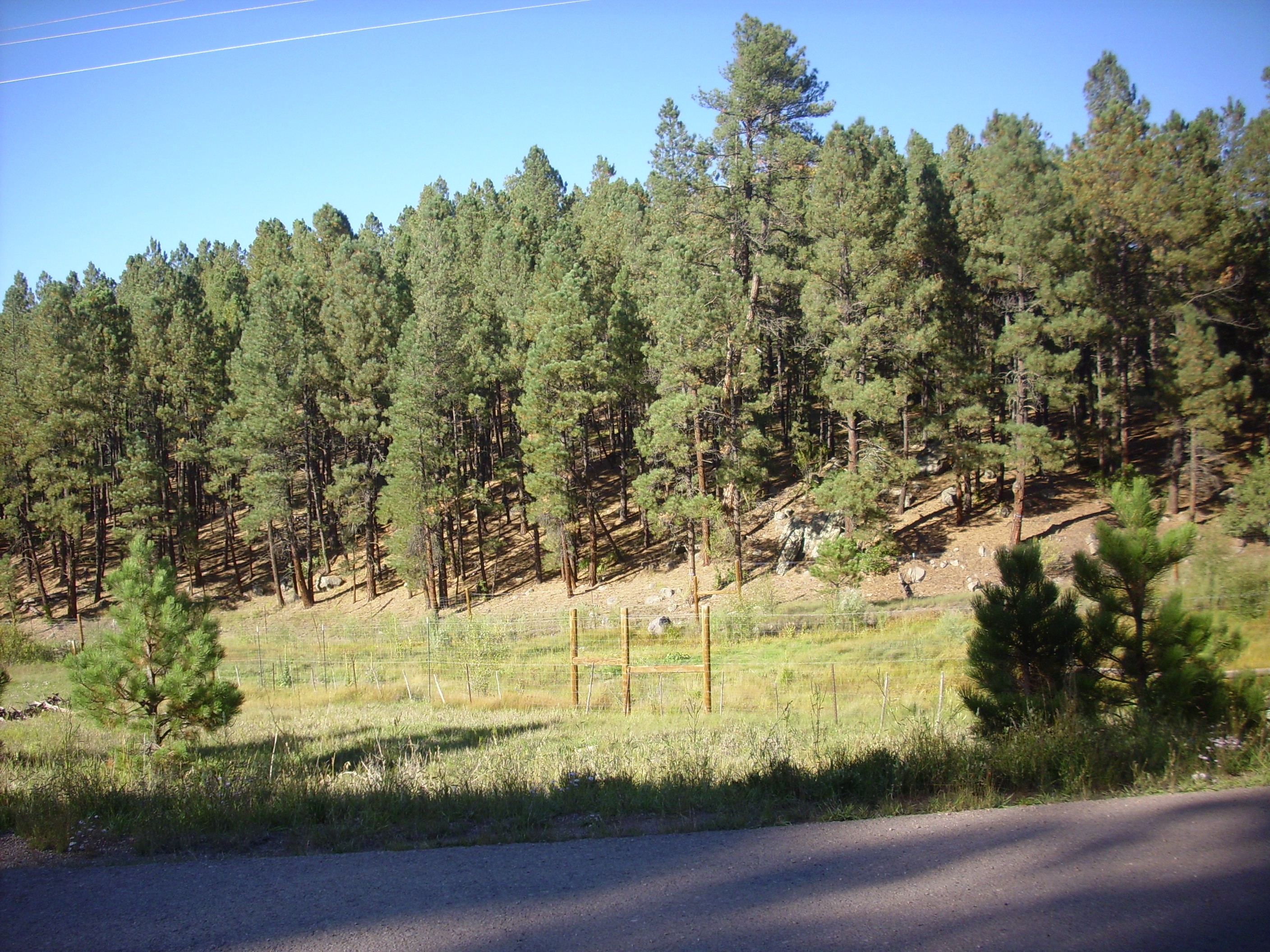
Megabreccia slab at Sulfur Creek. 35
52.516N 106 37.807
This low ridge is essentially a single large slab of Paliza Canyon Formation lava that broke off the caldera rim as the caldera collapsed, sliding down onto the caldera floor where we see it today.
A somewhat more spectacular megabreccia is exposed below the
northwest caldera wall, at the west end of Valle San Antonio.
Caldera collapse landslide. Looking west from 35
58.357N 106 35.644W
We saw this photograph earlier.
Some of the largest megabreccia blocks are located near the
center of the caldera, on what is now the northern slopes of
Redondo Peak and Redondo Border. The megabreccia blocks form part
of the ridges bounding Valle Jaramillo.
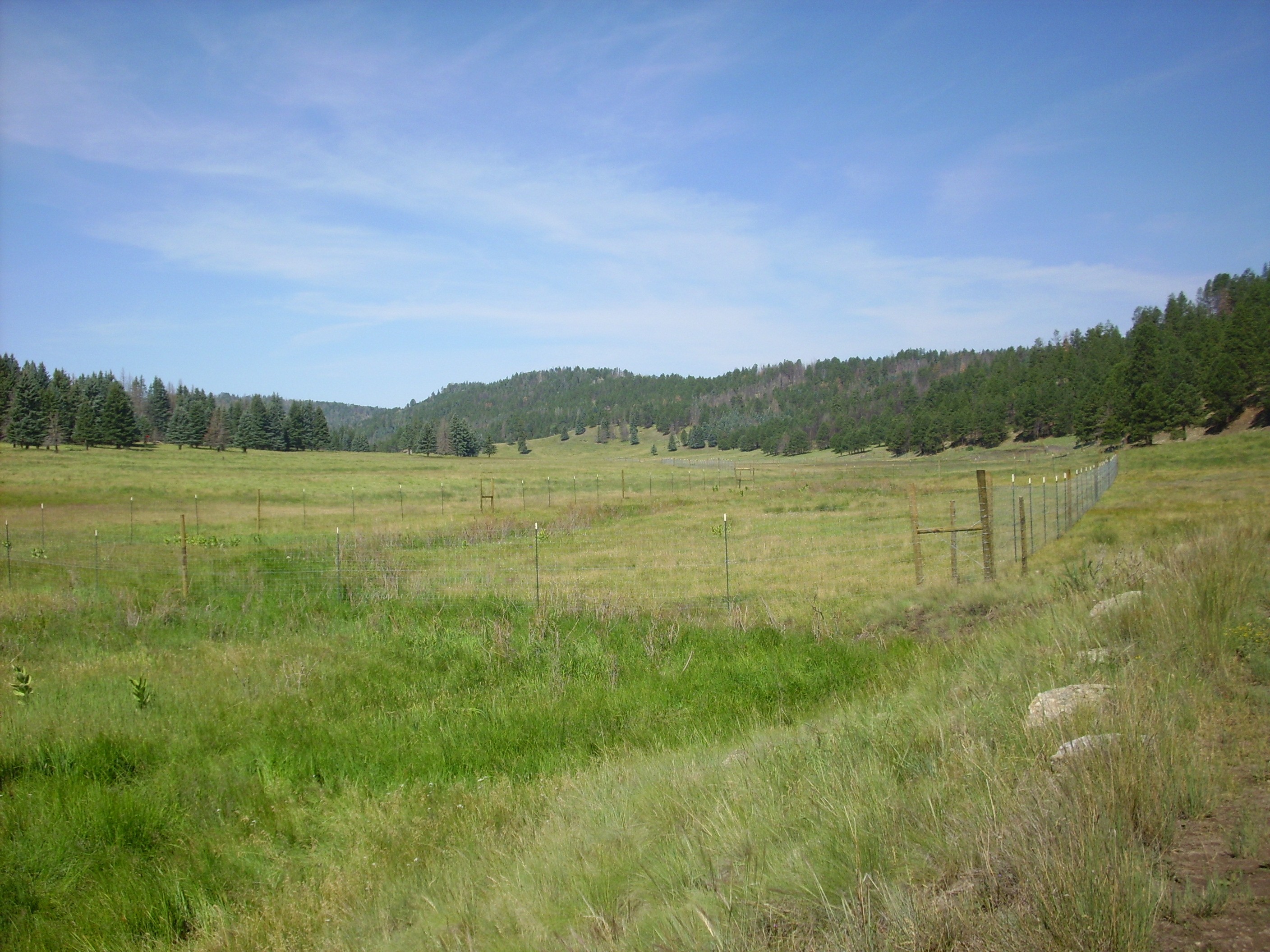
Megabreccia along Valle Jaramillo. 35
54.628N 106 33.035W
The ridge on the skyline is a chunk of andesite from the caldera wall that slid down, more or less intact, into the center of the caldera almost immediately after it formed.
A spur from the ridge is underlain by a relatively small block of
megabreccia, only a couple of hundred feet across.
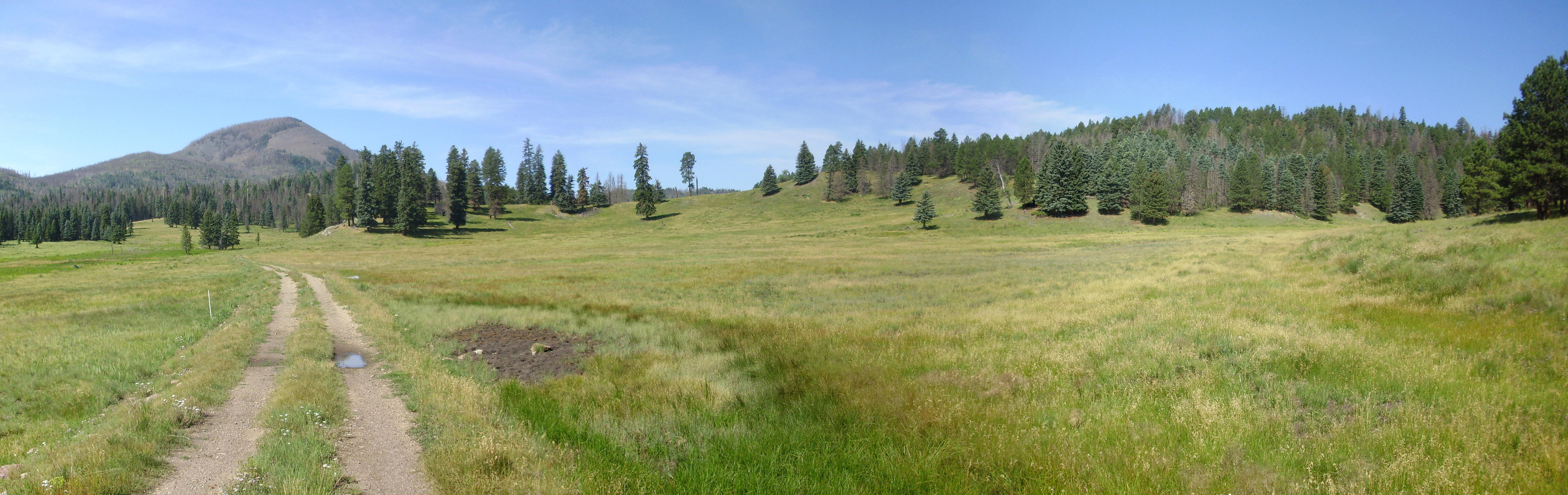
Megabreccia spur. 35
54.664N 106 32.069W
The geologic map shows the entire ridge as megabreccia, but it looks like this broke into two blocks, with a smaller block at left and a much larger block at right.
The road cut exposes part of the megabreccia
block.
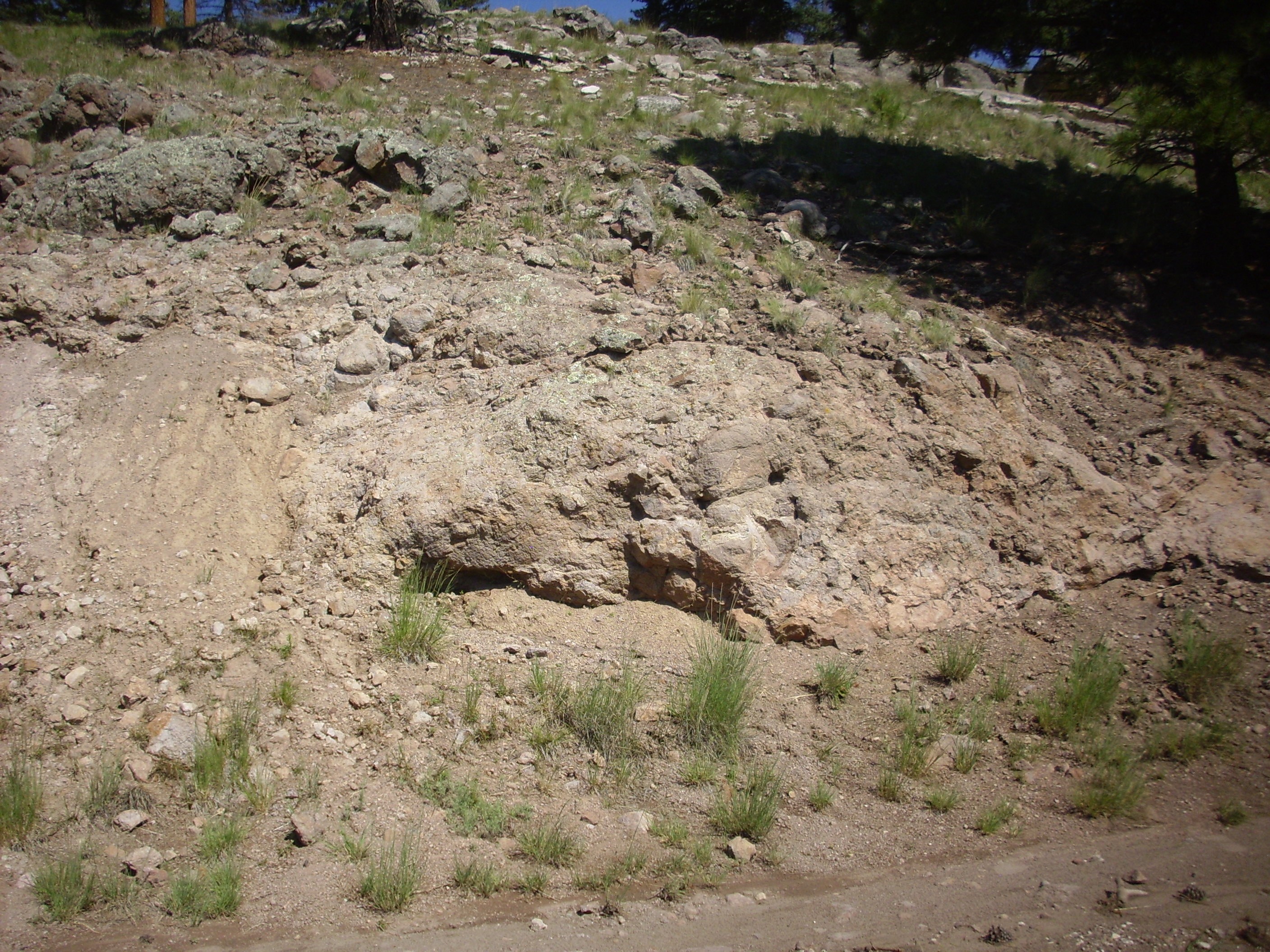
Megabreccia in road cut. 35
54.582N 106 32.056W
This rock is definitely andesite, though with some signs of hydrothermal alteration. It’s also a more or less solid block. This is just the toe end of a very large block of andesite.
Here is the main ridge, seen from the south:
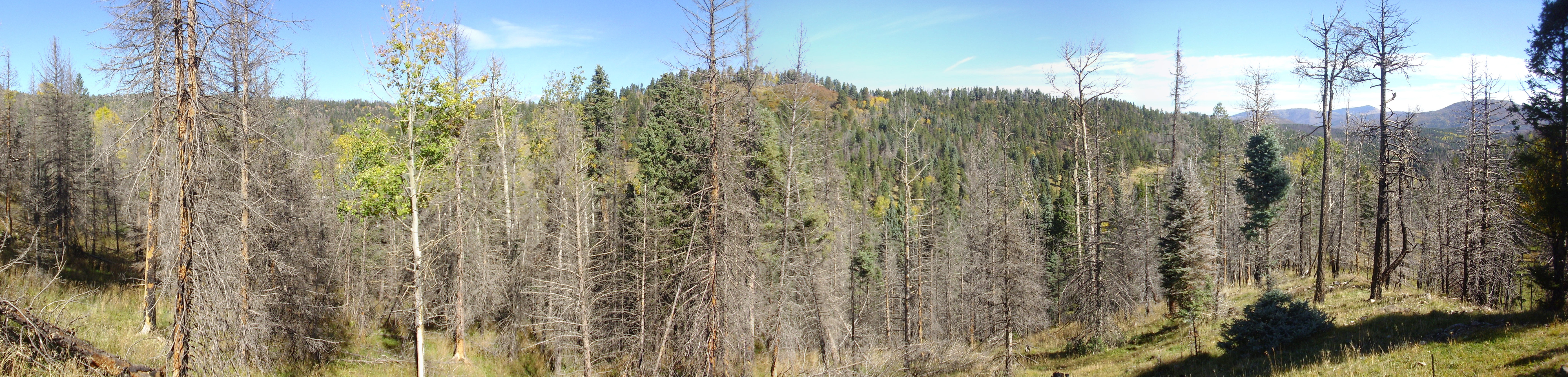
Megabreccia ridge north of Valle
Jaramillo. 35
54.285N 106 33.057W
Although the foreground trees obscure some of the view, you can see just how large the megabreccia block is. Though now faulted in several places, the original block was over 1.6 km (1 mile) in length.
There is no doubt the block is composed of the kind of andesites typical of the Paliza Canyon Formation.

Paliza Canyon Formation andesite from megabreccia block. 35 54.447N 106 33.432W
These boulders were weathered off the andesite megabreccia block.
This block is one of the two largest megabreccia blocks in the caldera. The other is located just east of Redondito.

Redondito with megabreccia block to its
east (left). 35
54.093N 106 33.048W
The knob at far left is composed of Tschicoma Formation dacite.
Another large megabreccia block is found on the northern end of Redondo Border.
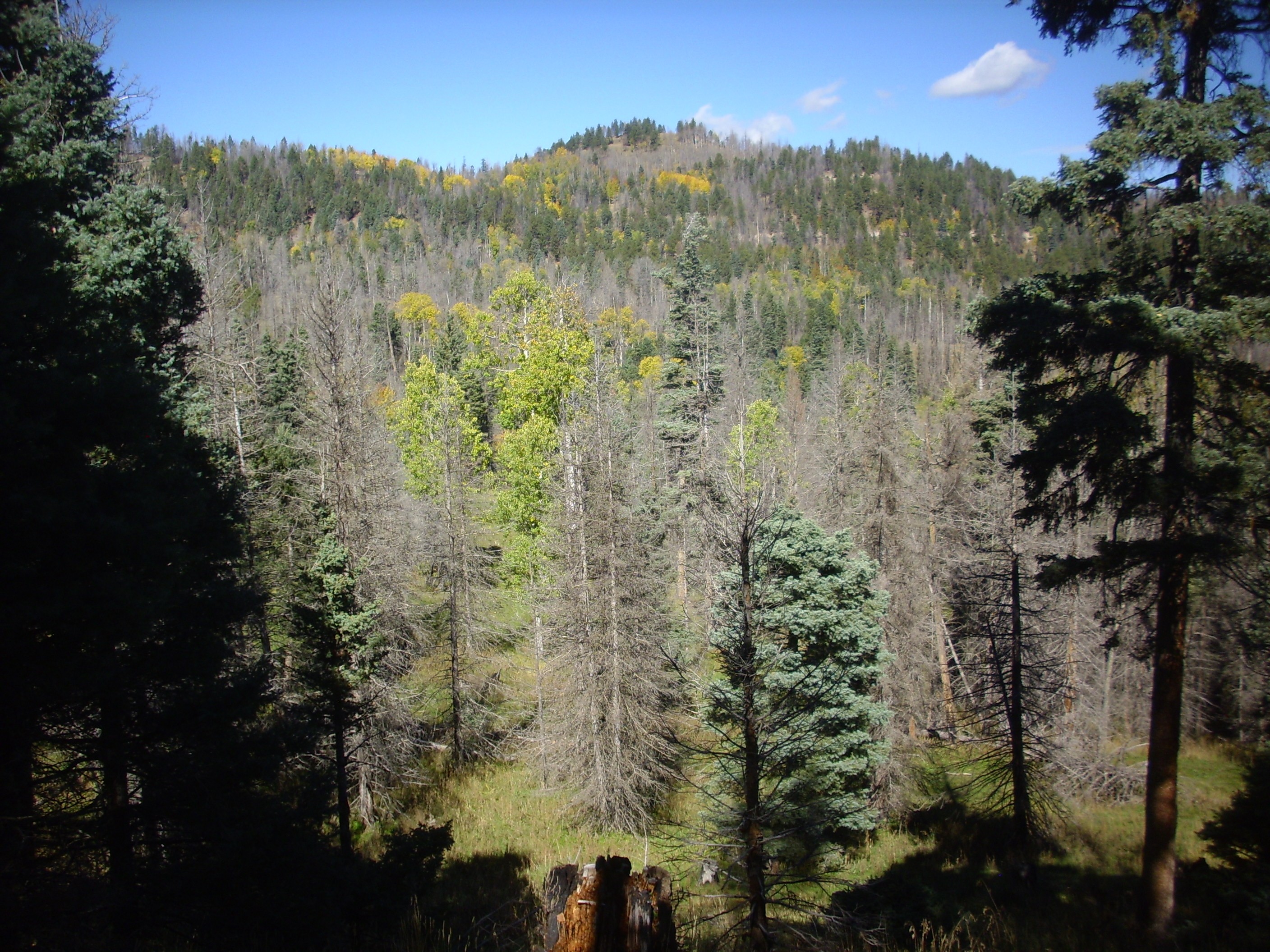
Northern part of Redondo Border. 35
54.447N 106 33.432W
The knob at top is a megabreccia block of Paliza Canyon Formation
tuff and andesite.
The presence of large and seemingly intact exposures of
precaldera rock in the center of the caldera contributed to the
early perception that there was once a very large central volcano
where the caldera is now located. The precaldera rock was
interpreted as the summit of this foundered volcano, poking
through the surrounding beds of Bandelier Tuff and postcaldera
sediments. However, drilling, careful mapping, and other
geophysical data have conclusively shown that these are rootless
beds of rock originally from the caldera rim.
Along with massive intact slabs of caldera rim, considerable
amounts of shattered rock slid back onto the caldera floor
immediately after it formed. The still-jagged caldera rim then
experienced rapid erosion which often took the form of debris
flows, like those we've already seen in the Puye Formation.
One such debris flow is found in lower Water Canyon west of San Antonio Campground, north of La Cueva.

Debris flow at mouth of Water Canyon. 35
53.206N 106 38.695W
The debris flow here takes the form of very large boulders of every composition from Abo sandstone to Tschicoma dacite. These form a jumble at the canyon mouth.
Lag deposit on debris flow at mouth of Water Canyon. 35
53.200N 106 38.608W
This is likely an example of lag deposit, where the larger clasts eroded out of an unsorted bed are left behind when the finer clasts are washed away.
Debris flows underlie much of the terrain north of Redondo Peak.
Since these formed later, as Redondo Peak was pushed up, we'll
take a look at them later in the book.
The eruption of the Tshirege Member and the collapse of the
Valles Caldera were not the end of volcanism in the Jemez. In the
next chapter, we'll see how volcanism resumed almost immediately
after the Valles event and has continued from time to time ever
since.
Next page: Resurgence &c
Copyright © 2015 Kent G. Budge. All rights reserved.
